Camelback Mountain Phoenix Hike Guide
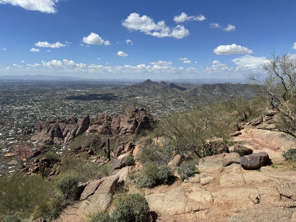
Camelback Mountain is likely the most popular hike in the Phoenix area with a few different routes to the summit: Echo Canyon and Cholla trails. This guide will focus on the Echo Canyon approach. This hike is extremely popular and involves a bit of scrambling towards the start of the trail. I would HIGHLY recommend hiking this during the Winter, Spring and Fall; avoiding the hot Summer months. Although not dangerous for the experienced hiker, there are almost daily accidents on Camelback Mountain so please be careful on your hike. Camelback Mountain is the highest in the Phoenix area.
Camelback Mountain Hike Guide
Camelback Mountain Rating: ★★★★ (4/5 Stars)
Distance: 2.5 Miles RT
Elevation Start: 1,400ft
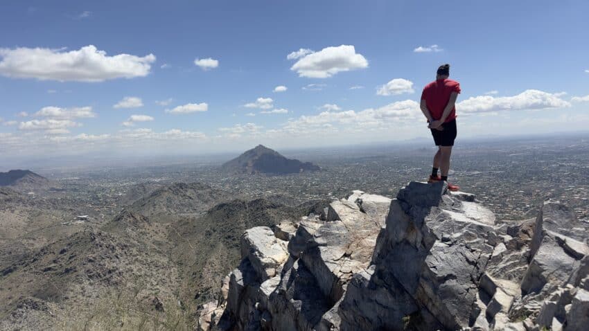
High Point: 2,704ft
Total Elevation Gain: 1,300ft
Estimated Time to Complete: 2-3 Hours RT
Difficulty: Moderate What does this mean?
Class: Class 2- What does this mean?
Season: Year Round – Would not recommend hiking during Summer months due to high heat. In fact, there are closures from 11am – 5pm when excessive heat warnings are in place.
Directions to Camelback Mountain
Trailhead: Echo Canyon
Getting Here: There are quite literally an infinite amount of ways to navigate to the Echo Canyon trailhead based on your starting location. However, for general purposes the hike starts about 20 minutes from downtown Phoenix in a residential area.
Parking: Camelback Mountain has a massive parking area that will, almost always, be full of other cars. The trail starts after the upper parking lot so if you are looking to minimize walking, try finding a spot there first. But, you do know you are about to hike, right? The upper parking area has a bathroom and a water fountain as well. When the lot is full or not able to be accessed due to an accident, there will be a guard and/or sign at the roundabout indicating so.
Fee: None – as of 2024
Summary
Dogs: Unfortunately, dogs are not allowed on this trail.
Camping: Camping is not an option for Camelback Mountain, the entire area is surrounded by houses. If you are looking to camp, your best bet is to head outside of the Phoenix area West or North.
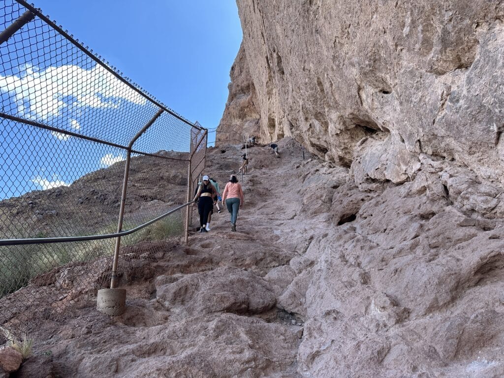
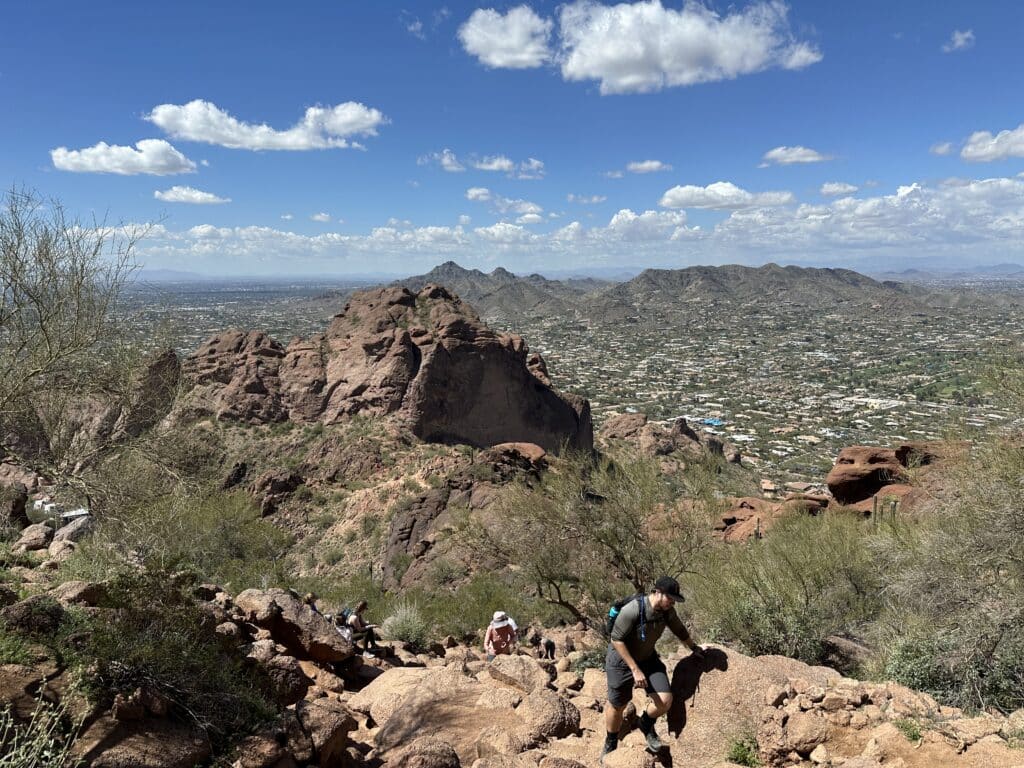
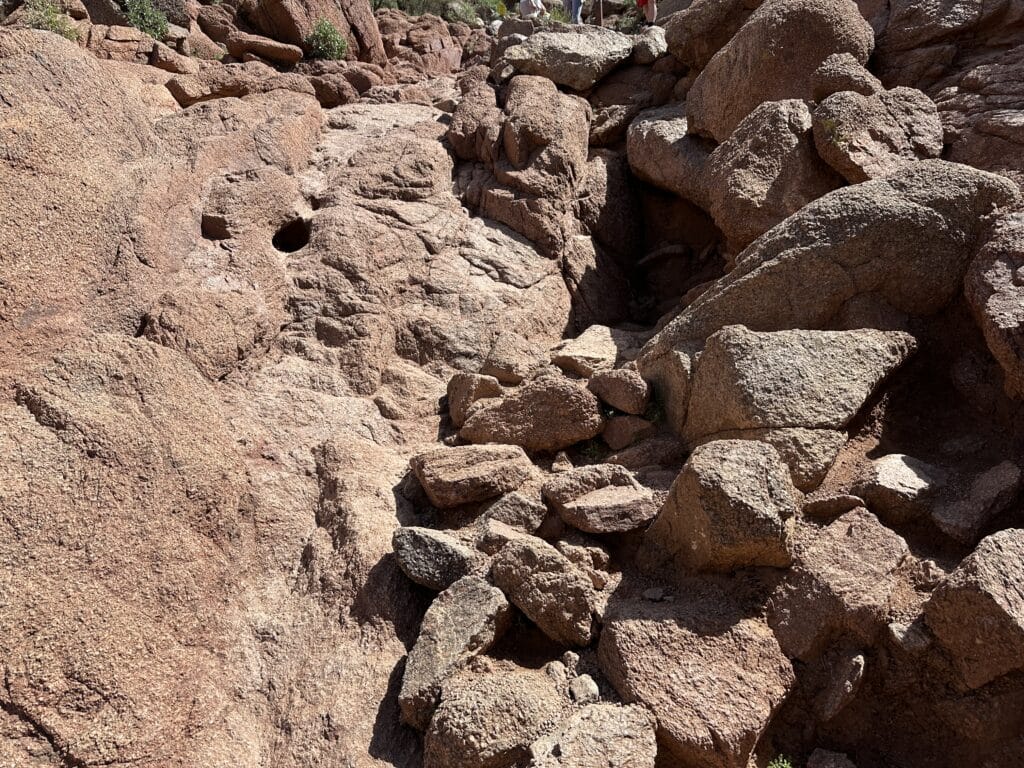
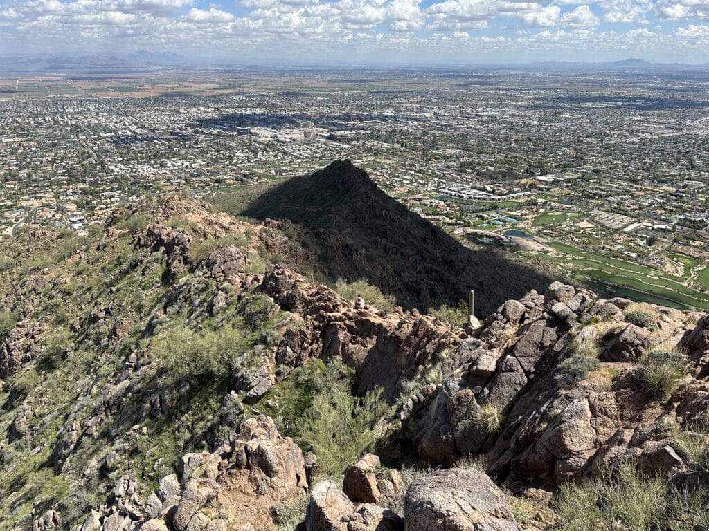
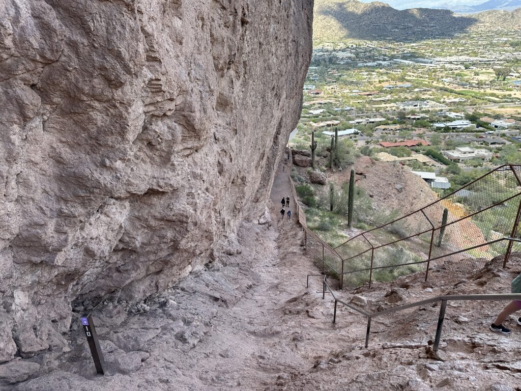
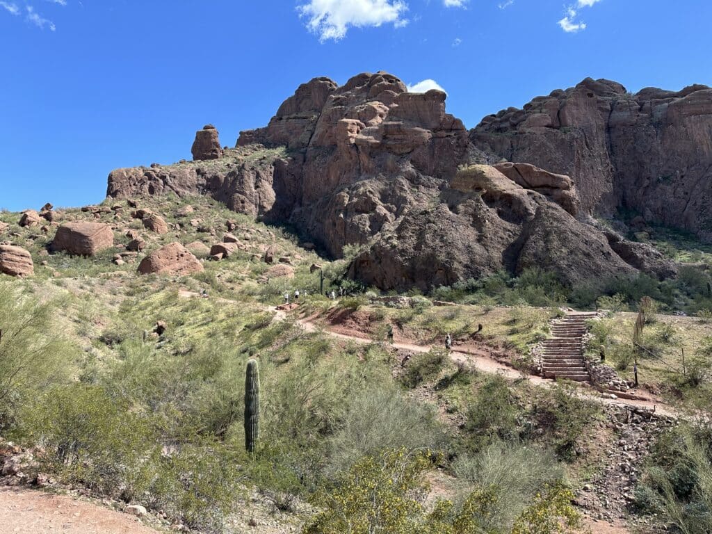
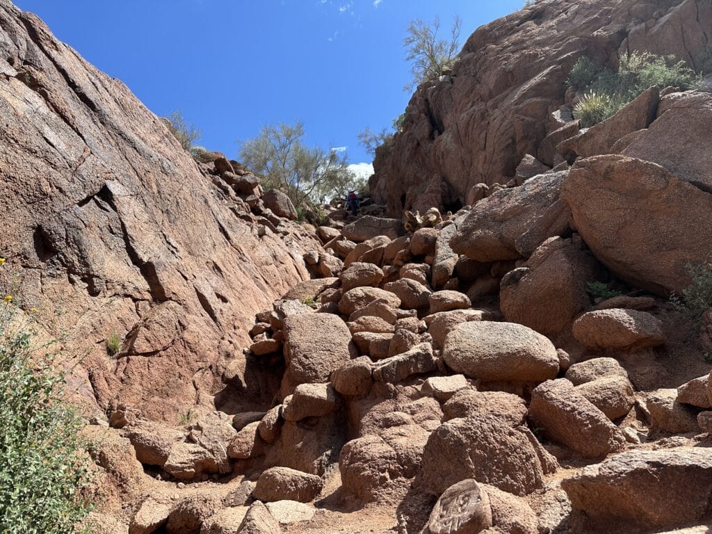
Hike Xfactor(s): If you are reading this, you have probably done a bit of research on Camelback Mountain via the Echo Canyon trail and are aware of the handrails towards the start of the hike. From a technical standpoint, this is the hardest part of the trail for a few reasons: 1. It is Class 2 (reference what that means above) and 2. If the trail is very crowded, there will likely be lines that form here. The rock in this area is fairly easy to grip on if you decide to forgo the handrail but I would NOT recommend this for anyone without lots of experience scrambling. A fall here could be deadly.
Hike Tip(s): Oh boy, where to begin. Let’s keep it simple with three:
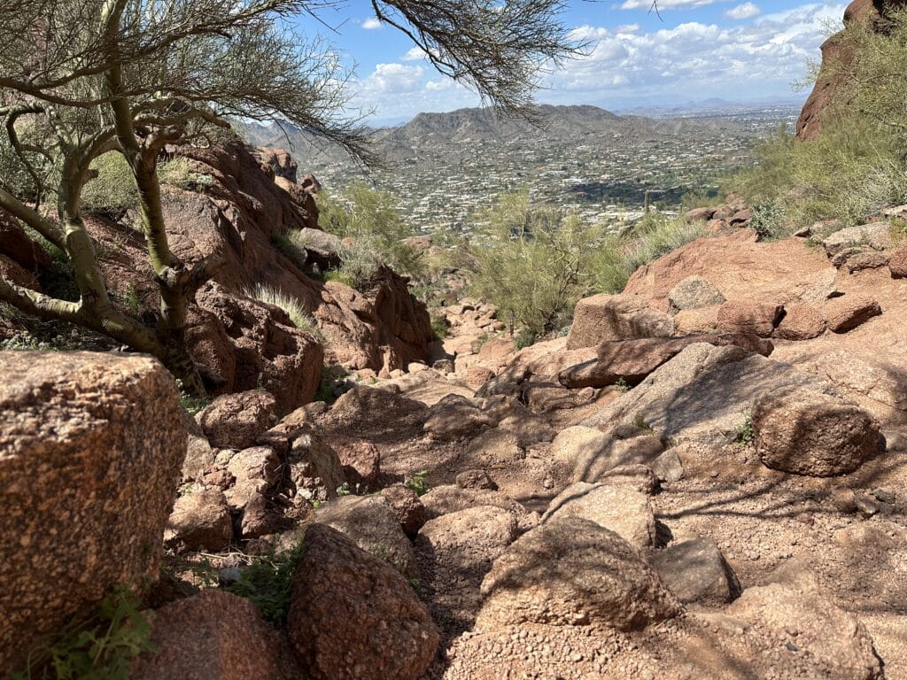
- Camelback Mountain has a ton of elevation gain for the amount of miles it is, be prepared for a very steep hike. Allow ample time, bring lots of water, food etc.
- Avoid this hike during the middle of the day, regardless of time of year. It will be hot, crowded and very slow going.
- Watch your footing and follow all trail signs. On my run down, I saw a woman do a summersault and luckily she walked away with just a few scratches on her face. However, it could have been A LOT worse. She just took a bad step and started to roll. Additionally, there are several spots where getting off the trail could be fairly easy.
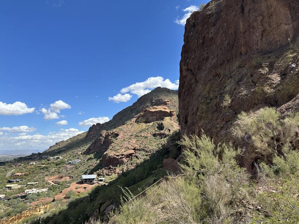
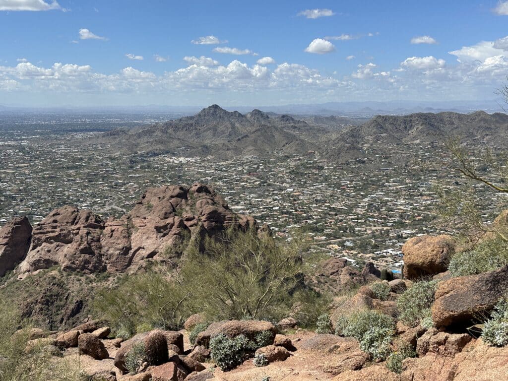
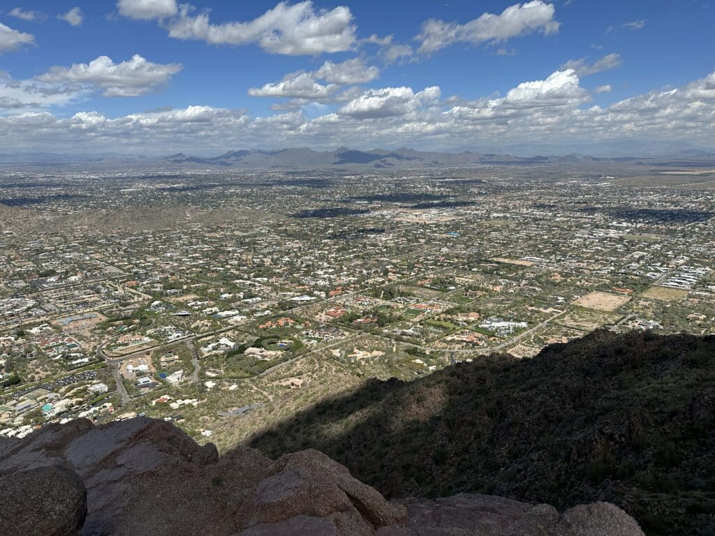
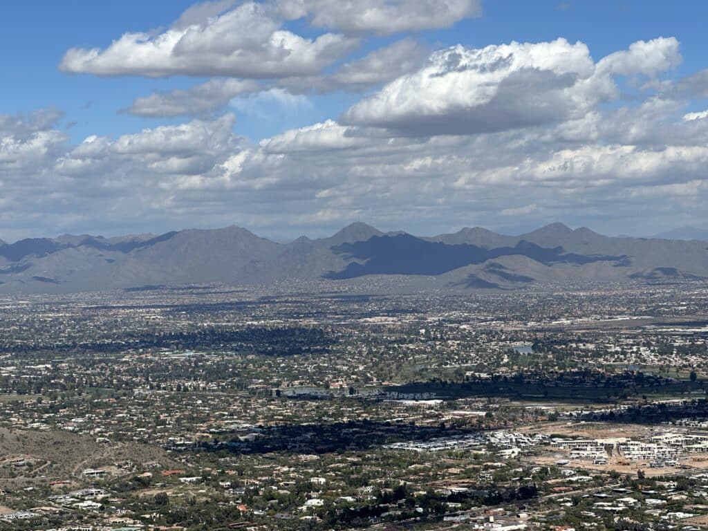
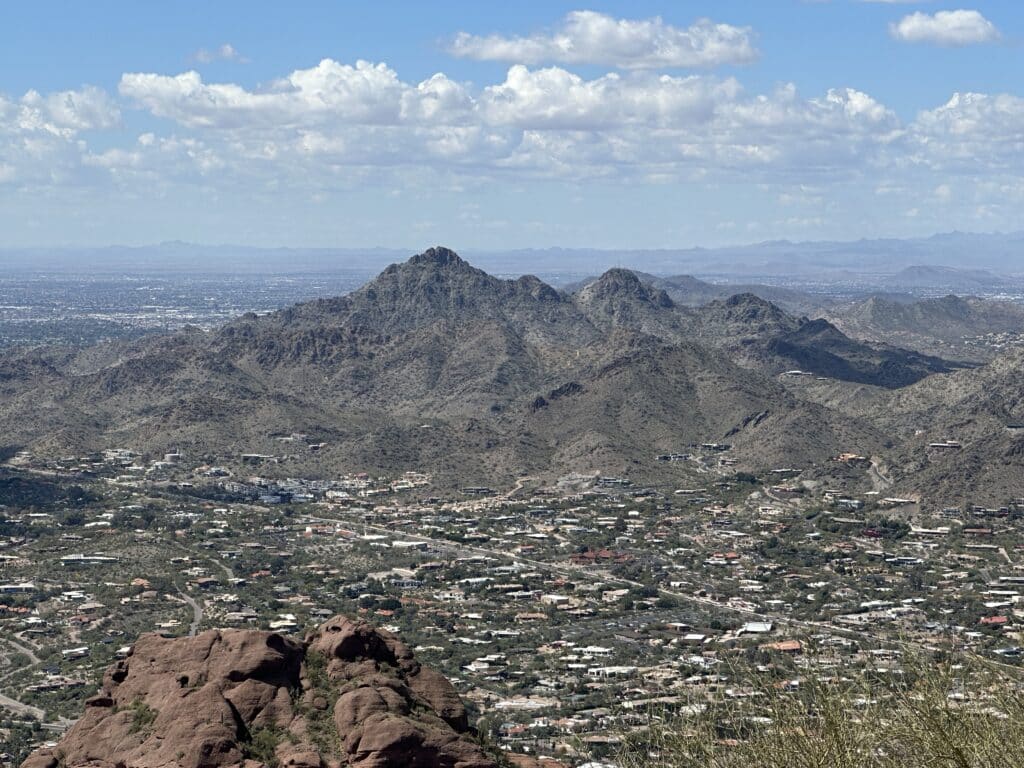
Best Views: The views from the top of Camelback Mountain are fantastic and there are also several viewpoints on the way to the top as well.
Make it a Loop: The best way to extend this hike would be to add on the Cholla trail for an additional 2.5 miles or so of trail. If you want another good hike in the area, be sure to check out Piestewa Peak.
Camelback Mountain Hike Route
Gear Needed
- Men’s Trail Runners
- Women’s Trail Runners
- La Sportiva Trango Hiking Boots (Men’s)
- La Sportiva Trango Hiking Boots (Women’s)
- Backpack (Summer)
- Food & Water
- Protection from the Sun
- Optional: Garmin inReach
- Optional: Hiking Poles – 120CM
- Optional: Headlamp
- Optional: Garmin Fenix Watch
- Optional: GoPro, Joby Tripod, Selfie Stick, GoPro 360
- *Links included in this description might be affiliate links. If you purchase a product or service with the links that I provide I may receive a small commission. There is no additional charge to you.