
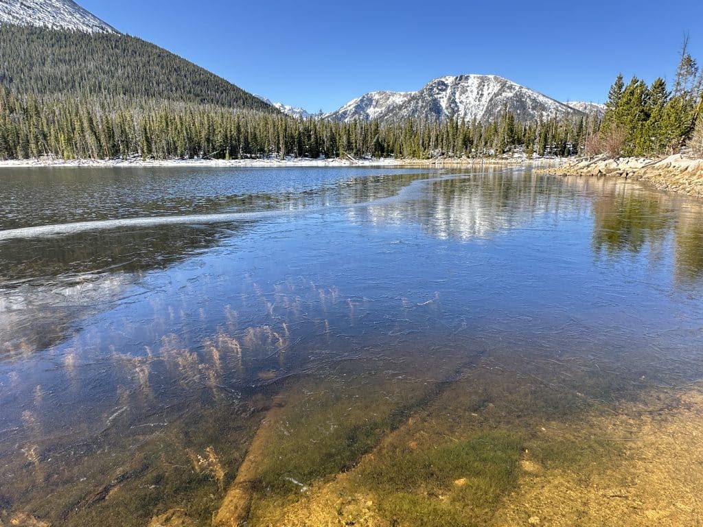
Lost Lake Colorado Hike Guide
Lost Lake is one of many of the namesake located in Colorado but this guide will focus on the one located just outside of Silverthorne, Colorado on the East side of the Gore Range. This hike is accessed via the Brush Creek trail and is a great spot to hike or trail run during the late Spring, Summer and Fall months. Unlike many others in the area, Lost Lake does not typically see super heavy trail use due to its somewhat tricky access.
Lost Lake Quick Facts
Lost Lake Rating: ★★★★ (4/5 Stars)
Distance: 7.25 Miles Total
Elevation Start: 9,023ft
High Point: 10,143ft
Total Elevation Gain: 1,300ft
Estimated Time to Complete: 2-4 Hours
Difficulty: Easy to Moderate What does this mean?
Class: Class 1 – What does this mean?
Season: June – October: You could hike this in early November and December depending on snowfall.
Directions to Lost Lake
Trailhead: Brush Creek
Getting Here: From I-70 take Exit 205, Silverthorne/Dillon, and travel north on HWY 9. Travel north on HWY 9 for approximately 16.8 miles. Just after mile marker 118 turn left onto County Road 30 toward the town of Heeney. Follow County Road 30 for approximately 0.5 miles and turn right into the parking area at the old Grandview Cemetery on the right side of the road. Park here if you do not have high clearance 4WD. If you do have high clearance 4×4 or AWD, continue on Brush Creek Road (FDR 1695) for 2.3 miles until you reach the trailhead. Generally speaking, you need to stay on the main road until the last .3 miles where you will bear left to reach the trailhead.
Parking: There is a tiny parking area at the trailhead with no restrooms.
Permits/Fee: No fee required.
Summary
Dogs: Lost Lake is a dog friendly trail but does enter a Wilderness area so dogs should be kept on the leash.
Camping: There are some spots to camp along the road to the trailhead, mostly towards the end of the road after you have left private property behind. On the hike itself, you could find a spot to camp but be sure to follow general backcountry camping rules.
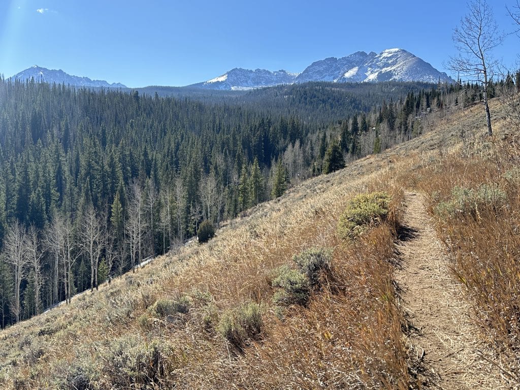
Make it a Loop: This hike is most commonly done as a loop following the Brush Creek trail to the Gore Range trail to the Lost Lake trail. I would recommend running this route clockwise as the terrain is a little more forgiving on the way down vs up. However, from a hiking perspective, it really does not matter.
Trail X Factors: Lack of Foot Traffic
There are so many great hikes up in Summit County of Colorado but they all tend to have one thing in common: lots of crowds and limited parking due to the high number of hikers. However, Lost Lake does not face this issue in my experience. The main reason for this, in my estimation, is the rougher road leading to the start of the hike + the limited season as to when the road is open (Summer and Fall). There are hundreds of lakes in the Gore Range but the lack of other hikers makes this one stand out.
Hike Tip(s): Lost Lake is a good spot to trail run as the elevation gain is manageable and the trail itself is fairly runnable from start to finish.
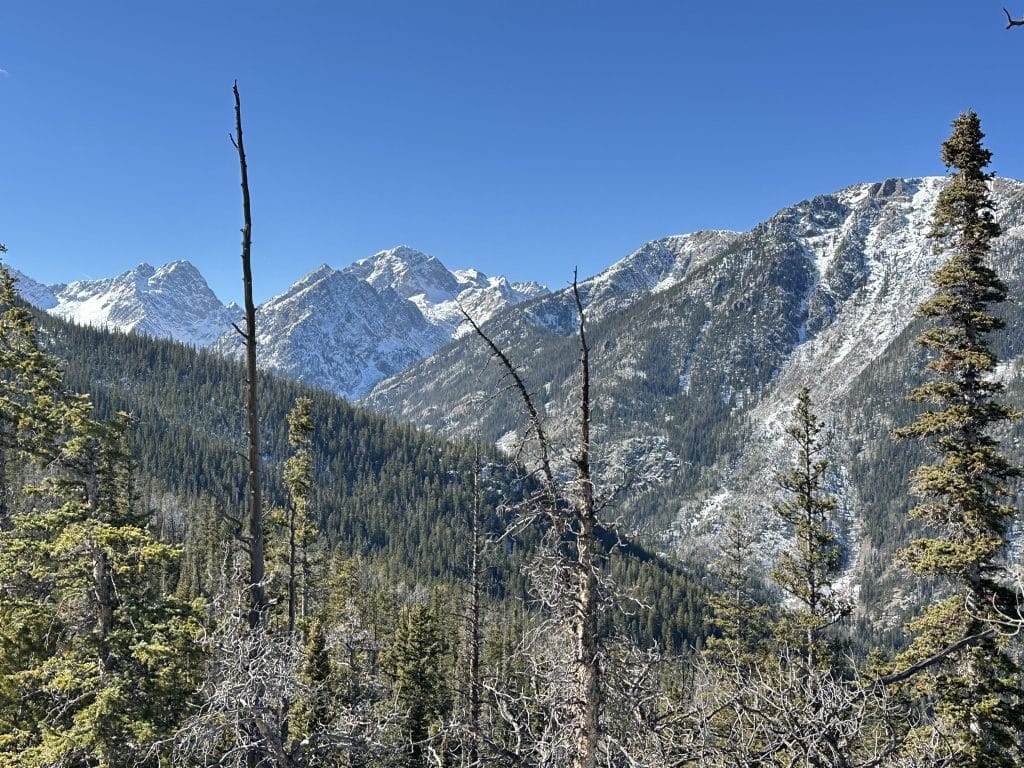
Best Views: The lake itself easily has the best views but there are some great spots to catch views of the Gore Range on the North side of the loop as well.
Gear Needed
- Men’s Trail Runners
- La Sportiva Cyklon
- La Sportiva Trango Hiking Boots (Men’s)
- Backpack (Winter)
- Backpack (Summer)
- Sunglasses
- Base Layers
- T Shirt
- Mid Layer
- Rain Jacket / Shell
- Pants
- Shorts
- Socks
- Food & Water
- Optional: Water Filter
- Optional: Garmin inReach
- Optional: Hiking Poles – 120CM
- Optional: Headlamp
- Optional: Garmin Fenix Watch
- Optional: GoPro, Joby Tripod, Selfie Stick, GoPro 360, Drone, Insta360
- *Links included in this description might be affiliate links. If you purchase a product or service with the links that I provide I may receive a small commission. There is no additional charge to you.