Rim to River to Rim Grand Canyon Trail Guide
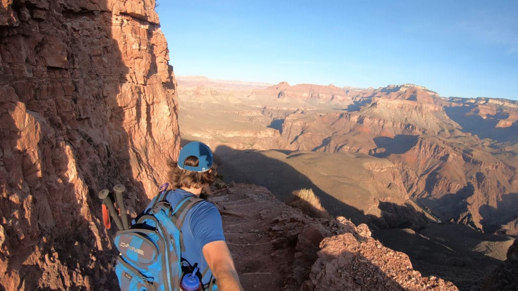
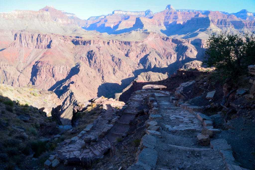
The rim to river to rim Grand Canyon hike is the most strenuous hike you can complete on the southern portion of the Grand Canyon. Similar to the rim to rim hike (where you hike from south to north rim) this trek involves thousands of feet of descending and ascending in the hot desert sun. A fit and experienced hiker can complete this loop in one day but most hikers will turn this into a two day outing. The hike starts at either the Bright Angel or South Kaibab trailhead and works down to the Colorado River before hiking along the river and then back up the other side.
Rim to River to Rim Grand Canyon Quick Facts
Virtual Trail Guide: Grand Canyon South Rim to Rim
Rim to River to Rim Grand Canyon Rating: ★★★★★ (5/5 Stars)
Distance: 17.5 Miles, 20.5 Miles with Plateau Point +2.5 Miles if walking back to visitor center.
Elevation Start: 7,200ft
Lowest Point: 2,245ft
Total Elevation Gain: 5,000ft
Estimated Time to Complete: 8-12+ Hours RT
Difficulty: Difficult to Strenuous Difficulty System Explained
Class: Class 1 What does this mean?
Season: Year Round: Best time to hike is October – April when heat is lower.
Weather: Check the Weather Forecast
Directions to Rim to River to Rim Grand Canyon Hike
Trailhead: South Kaibab or Bright Angel
Getting Here: To start this hike you need to first enter the south or eastern entrance of the Grand Canyon National Park. I would highly recommend a South Kaibab Trail start.
Fees: Visit this page for the most updated fees for the Grand Canyon National Park.
Parking: My recommendation for parking would be to be dropped off at either the South Kaibab or Bright Angel trailhead. Both have ample parking, especially at the hour you need to start this hike. If you are by yourself or do not have the option to be picked up/dropped off, park at the Visitor’s center and take the orange bus to the South Kaibab trailhead. At the Bright Angel trailhead there is typically a bus that will bring you back to the visitor’s center.
Summary
Camping: Car or parking lot camping is prohibited in the Grand Canyon National Park. You can read more about camping in the park here. If you are looking for dispersed camping nearby, I recommend County Road 305 which is about 20 minutes south of the entrance station. There are a variety of free camping options here that are accessible by most cars.
Dogs: Grand Canyon National Park prohibits dogs on all trails in the park including the south rim to rim hike.
Make it a Loop: The rim to river to rim Grand Canyon hike is almost a loop. Instead it forms a sort of “c”. You will need to either walk back to the start, park in the middle or take buses to complete the loop of this hike. I speak about that more above.
Trail X Factors: Elevation & Temperature
This hike is very odd. Unlike a normal hike where you start off climbing and then end your day descending, the Grand Canyon south rim to rim trail does the exact opposite. There is a high likelihood that you will fly down the trail to the Colorado River and wonder what the big deal is on the difficulty rating. At the river, your legs need to switch gears and almost immediately start climbing 5,000ft up back towards the rim.
If you were like me, you would think temperature would not be a big deal the lower you descended into the canyon. This could not be less true. Typically, temperatures on the top of the Grand Canyon will be 25-30 degrees cooler than the bottom. When I hiked the high on the top was 75ish Fahrenheit with temperatures in the 105 range at the bottom. You do not want this to catch you off guard. Bring PLENTY of water and be sure to start early to avoid those hot afternoon hours.
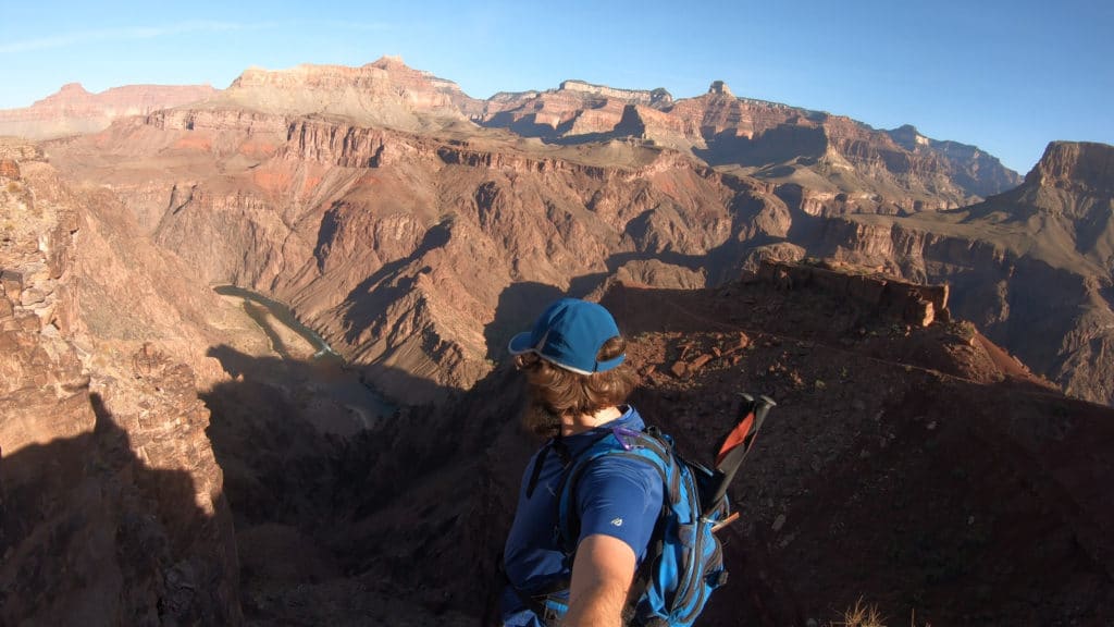
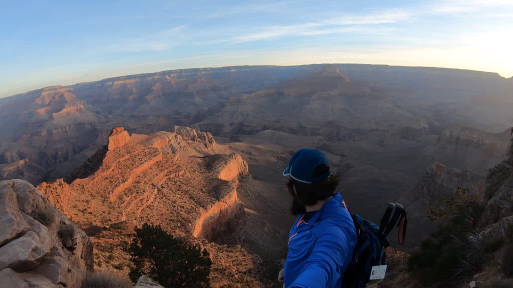
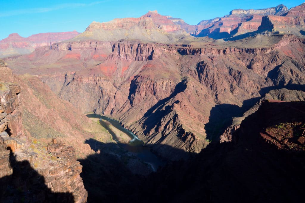
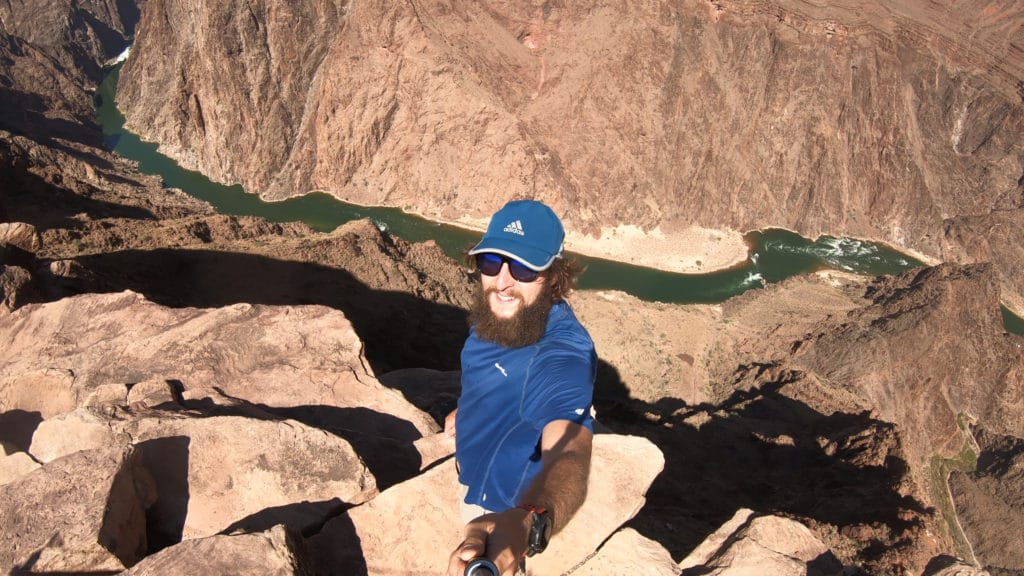
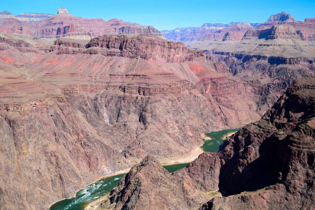
Hike Tip(s): Your legs and mind will probably kill me for saying this, but I would HIGHLY recommend adding Plateau Point to the Grand Canyon south rim to rim hike. It will add an additional 3 miles of hiking and minimal elevation gain but will provide you with, in my opinion, the best views on this entire hike. The overlook is simply breathtaking and worth every single extra step.
When deciding which way to hike this loop, keep in mind that the Bright Angel trail is the only section of this hike that has drinkable water. Due to this, I would strongly recommend descending via the South Kaibab trail and then ascending via the Bright Angel trail.
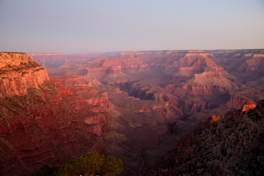
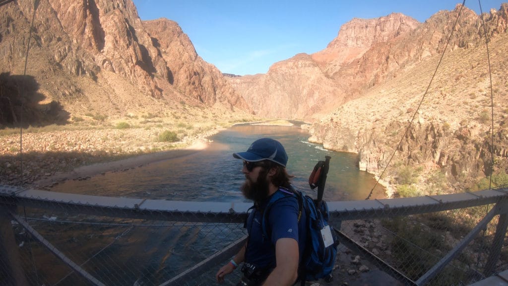
Best Views: This hike really has insane views from start to finish. My favorite spot was Plateau Point hands down. The unique aerial view of the canyon and Colorado River just blew my mind. If I had to pick a least favorite spot, it would be the Bright Angel portion of the trail.
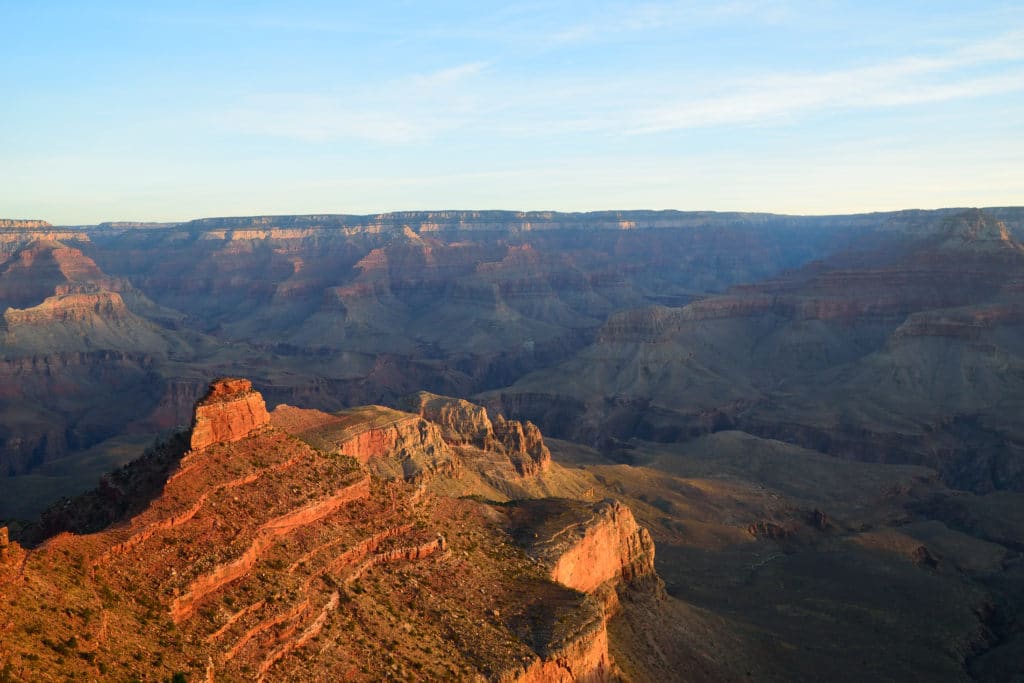
Rim to River to Rim Grand Canyon Route
South Kaibab Start + Plateau Point + Bright Angel End + Walk Back to Parking Lot
Gear Needed
- Backpack
- Hiking Shoes or Hiking Boots
- Protection from the Sun
- LOTS of water (at least 2-3 Liters)
- Optional: GPS or navigational device
- Optional: Hiking Poles
- *Links included in this description might be affiliate links. If you purchase a product or service with the links that I provide I may receive a small commission. There is no additional charge to you.
My Trip Rim to River to Rim Grand Canyon: October 2020
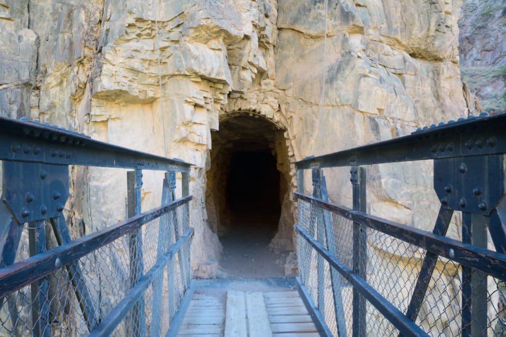
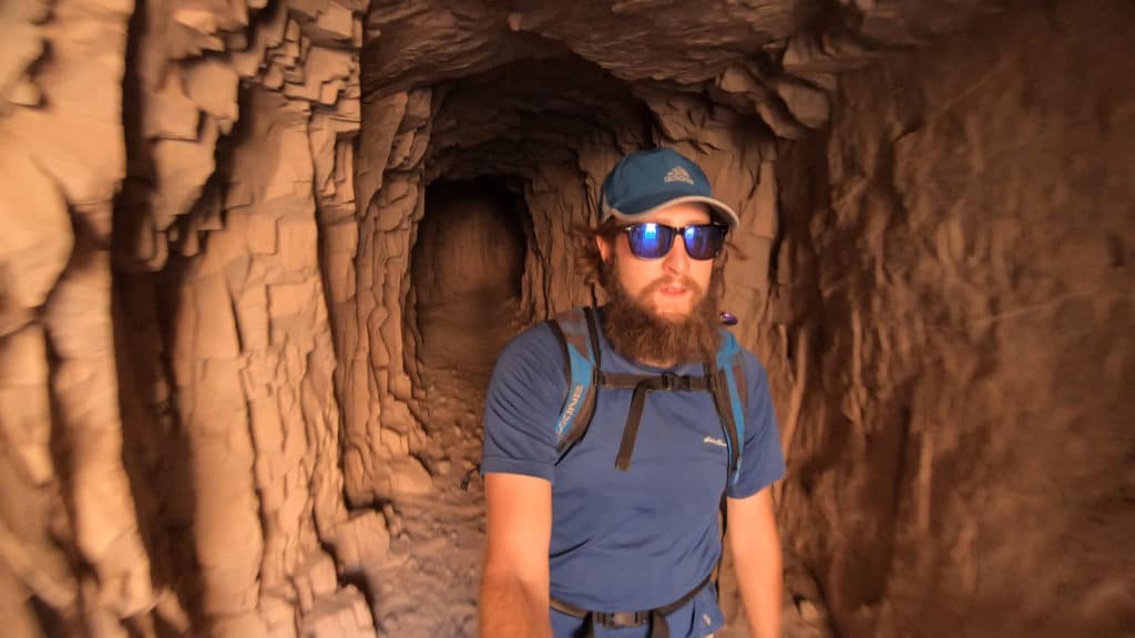
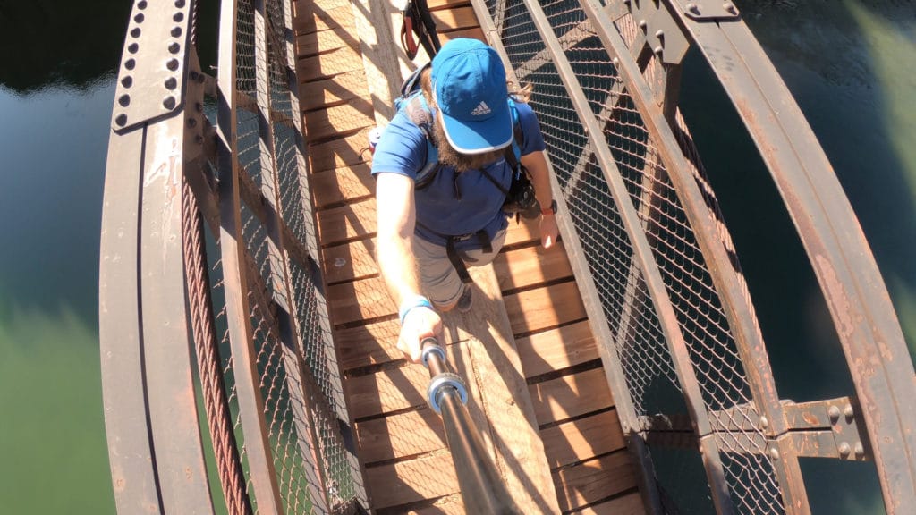
My first trip to the Grand Canyon was with Jackie after I finished my first Ironman. My legs were jelly so we decided to just hike a bit of the Bright Angel trail. I knew that I had to hike here again when I was feeling more well rested. 2020 was a bizarre year that gave me LOTS of free time so after weeks of planning I headed down the Grand Canyon again to hike the south rim to rim hike. I started at the South Kaibab trail and hiked down to Phantom Ranch and back up the Bright Angel trail.
This hike was so unique, very beautiful and surprisingly not super crowded besides the start and finish. I was about 15 miles into the day but knew that I had to add on Plateau Point and boy was I glad I did. The views here were some of the best the entire day.
All in all, I ended up hiking about 24 miles since I had to walk along the rim back to my car. My legs were sore but my memory was full of amazing sights and an experience I will never forget.
Grand Canyon Rim to River to Rim Virtual Trail Guide
Questions or comments about the hike through the Grand Canyon? Leave a comment below or follow me on Instagram!
One thought on “Rim to River to Rim Grand Canyon Trail Guide”