Mount Whiteface via Blueberry Ledges Hike Guide
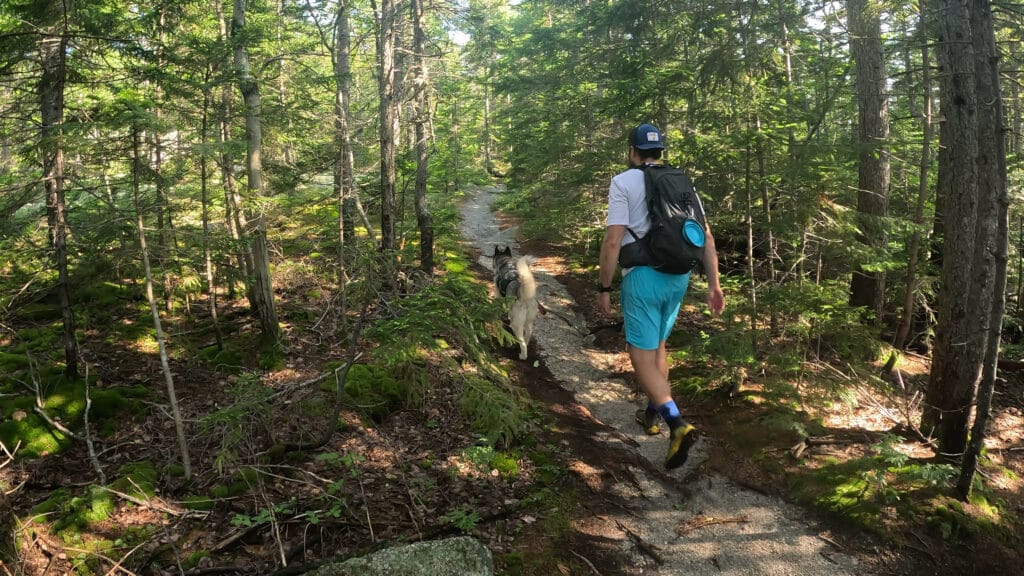
Mount Whiteface via Blueberry ledges trail is a hike located in the White Mountains of New Hampshire, near Waterville. The Blueberry ledges trail is part of the “terrifying 25,” a list of 25 hikes in New Hampshire that are the most technically difficult and challenging. Mount Whiteface is not a 4,000ft mountain but is still a popular hike due to the scrambling required to get to the partially bald summit. This is a great hike for those looking to scramble and have great views on the summit while avoiding some of the crowds on its more popular neighbors to the North.
Mount Whiteface Blueberry Ledges Quick Facts
Virtual Trail Guide: Mount Whiteface via Blueberry Ledges
Mount Whiteface via Blueberry Ledges Rating: ★★★★ (4/5 Stars)
Distance: 7.5 Miles RT
Elevation Start: 1,151ft
High Point: 3,994ft
Total Elevation Gain: 2,850ft
Estimated Time to Complete: 3-5 Hours RT
Difficulty: Moderate What does this mean?
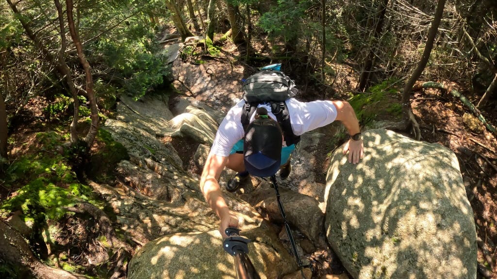
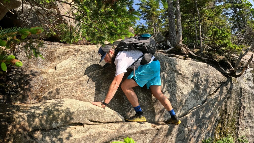
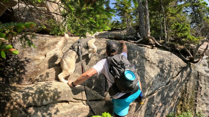
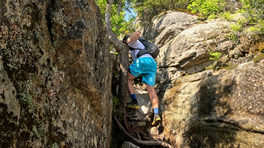
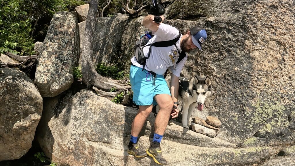
Class: Class 3 – What does this mean? Mostly class 1 with a handful of small sections of high class 2/low Class 3.
Season: Year Round – Though most people will want to tackle this between June and October.
Directions to Mount Whiteface via Blueberry Ledges
Trailhead: Ferncroft
Getting Here: There are a variety of ways to get to the Ferncroft trailhead depending on your starting point but be advised that you probably won’t have cell service near the TH. I would recommend downloading the area to your phone or start your navigation and then switch your phone to airplane mode. The hike itself DOES NOT start at the parking area and requires you to leave the lot, take a left and then follow signs to start Mount Whiteface via the Blueberry Ledges trail.
Parking: There is a large parking lot that can fit between 20-30 cars with a portapotty as well.
Fee: There are no fees for this hike.
Summary
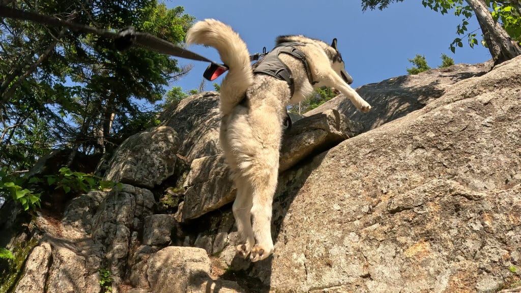
Dogs: This hike, for most dogs, is probably not dog friendly. However, if you watch the virtual guide -it’s pretty obvious that Aria (our dog) had a blast on this hike. I would say that if your dog is taller or easier to carry and in both cases, athletic and used to hiking/scrambling – they will likely be okay on this hike. If you are unsure, I would highly recommend watching the virtual guide where I show some of the more difficult moves. If you will need to assist your dog, it would likely be on the way down when some of the jumps can be tricky. This entire hike is in a Wilderness Area so dogs should be kept on the leash.
Camping: In general, this is not a GREAT spot to camp, but for those looking to find a spot, your best bet would be to continue on past the summit of Mt Whiteface on the Rollins trail towards Camp Rich primitive campsite where there are 8 first come, first serve, campsites.
Make it a Loop: The most popular way to extend a Mount Whiteface via Blueberry Ledges trail would be to add on Mount Passaconaway. Read more about that loop here.
Trail X Factors: Bugs
Who doesn’t love bugs? If you hike in the White Mountains of New Hampshire you are probably used to each season of bugs but since the base of this hike can get quite muddy and wet – have some bug spray and apply it liberally, you will thank me later.
Hike Tips: Although the summit does have good views, I would recommend stopping at the several viewpoints you pass on the way to and from the summit. They offer great views, a cool spot to grab some snacks or hydrate or escape the crowds.
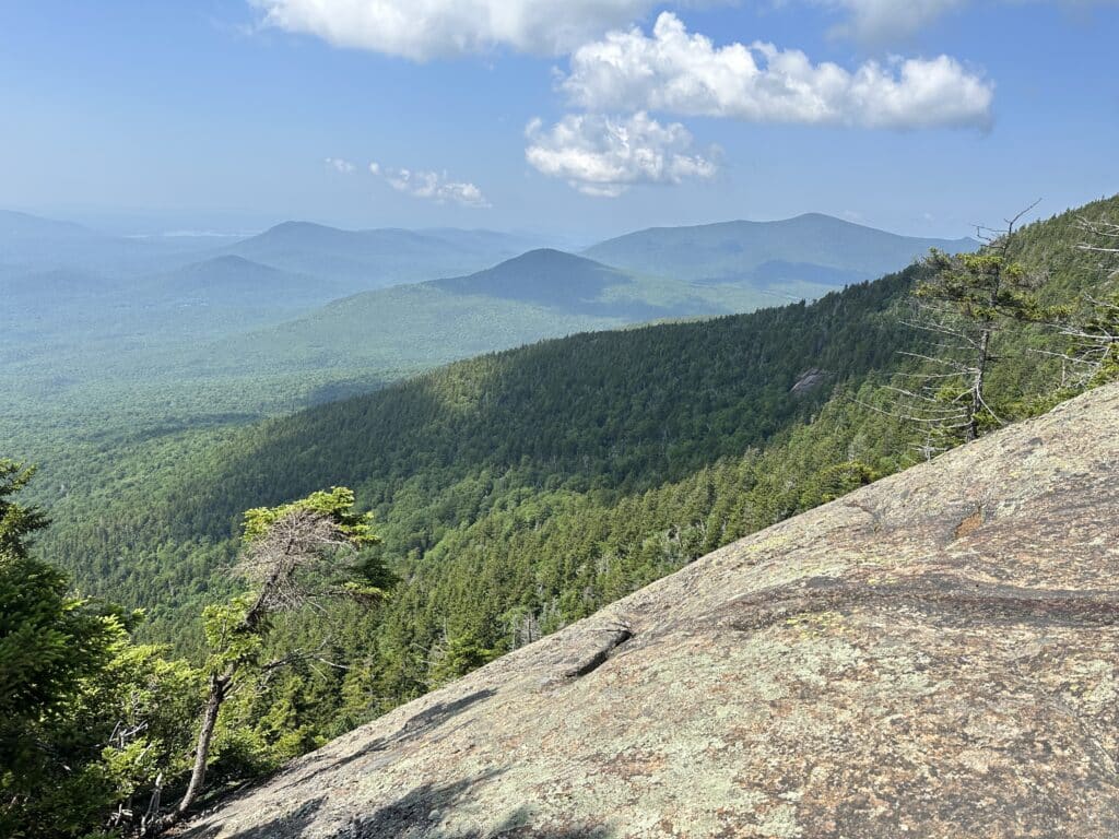
Best Views: Like many hikes in the White Mountains Mount Whiteface via Blueberry Ledge trail is below treeline for about 9/10 of the hike with no views to speak of. Stop at the Blueberry Ledge to soak in a fantastic aerial display of green that coats the valley floor below you. From the ledges just below the summit you have your best look at the mountains to the East and North. The summit has 180 degree views as well on a clear day.

Mount Whiteface via Blueberry Ledge Trail Route
Gear Needed
- Men’s Trail Runners
- Women’s Trail Runners
- La Sportiva Trango Hiking Boots (Men’s)
- La Sportiva Trango Hiking Boots (Women’s)
- Backpack (Winter)
- Backpack (Summer)
- Food & Water
- Bug Spray
- Optional: Garmin inReach
- Optional: Hiking Poles – 120CM
- Optional: Headlamp
- Optional: Garmin Fenix Watch
- Optional: GoPro, Joby Tripod, GoPro 360
- Optional: Drone
- *Links included in this description might be affiliate links. If you purchase a product or service with the links that I provide I may receive a small commission. There is no additional charge to you.
Mount Whiteface via Blueberry Ledge Trail Pictures