Pawnee Buttes Colorado Hike Guide
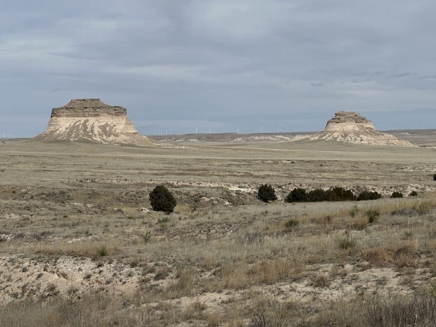
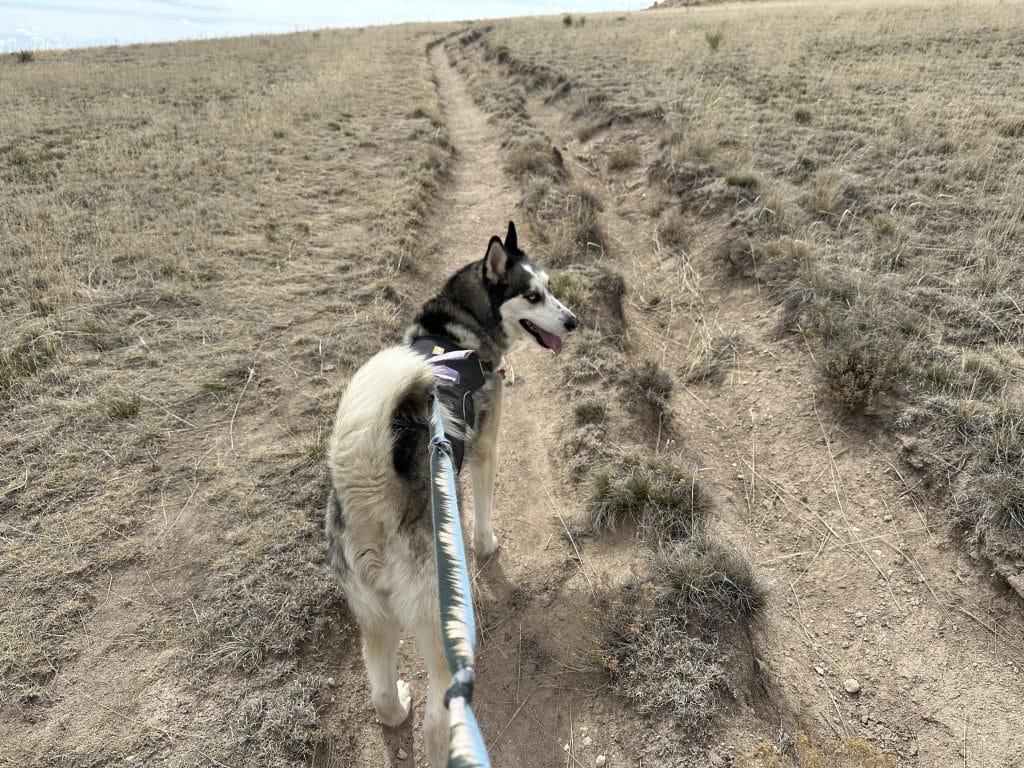
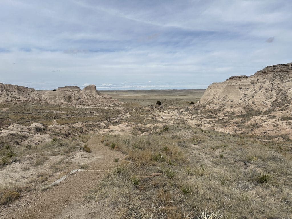
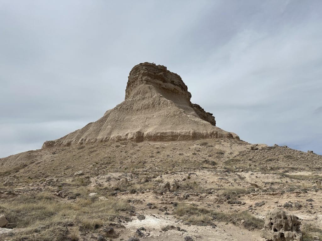
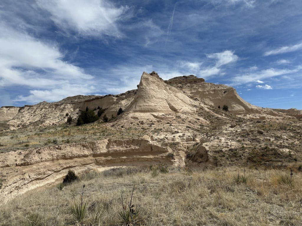
Pawnee Buttes is a relatively unknown Colorado hike located about 13 miles south of the Wyoming border in the Northeast part of the state. The pair of 300ft Buttes break up the monotonous Prairie land that surrounds the area. The hike to the base of these two Buttes can be done year round and is great for hikers of all skill levels. There is a seasonal closure on one of the trails due to Raptor nesting but this does not prevent access from the other route.
Pawnee Buttes Colorado Hike Guide
Pawnee Buttes Rating: ★★ (2/5 Stars)
Distance: 4-5 Miles RT
Elevation Start: 5,135ft
High Point: 5,316ft
Total Elevation Gain: 540ft
Estimated Time to Complete: 1-2 Hours RT
Difficulty: Easy What does this mean?
Class: Class 1 – What does this mean?
Season: Year-round. One of the trails is closed March 1st – June 30th for Raptor nesting. However, you can still reach the Buttes during this time period from another trail.
Directions to Pawnee Buttes Colorado
Trailhead: Pawnee Buttes
Getting Here: The trailhead is located about 60 miles Northeast from Greeley, Colorado. There are a few variations on how to get there, but ultimately you will take a series of dirt Colorado County Roads to CO113 where you will find the trailhead which is well signed. The roads to the TH can vary in condition, but generally speaking, should not require high clearance or 4×4 to reach this hike.
Parking: The parking area can fit about 10-20 cars and I don’t anticipate crowds ever being a problem for the hike to Pawnee Buttes. There is a non plumbing bathroom at the TH and a small pavilion if you’d like some reprieve from the sun.
Fee: None
Summary
Dogs: This is a dog friendly trail but be sure to check the temperature before heading out during the summer months. There is absolutely no shade on this hike.
Camping: There are a handful of spots along the way to the TH where you can car camp. Generally speaking though, camping in this area is not great.
Hike Xfactor(s): Let’s call a spade a spade for me personally, this hike was just really boring. I know that beauty is in the eye of the beholder but for the amount of driving it took to reach this spot, I just would not repeat it. Hankering for a hike during the winter? Cool, Pawnee Buttes can check that box for you. Otherwise, this is really not a destination worthy hike, for me personally.
Hike Tip(s): Bring lots of water and protection from the sun, especially during the summer months. There is absolutely no shade on this hike. Additionally, I would avoid this trail on a very windy day.
Best Views: There is a small viewpoint detour about .3 miles into the hike that offers the best aerial view of the two Buttes.
Make it a Loop: It is possible to make this hike a sort of loop but it does require all of the trails to be open. One of the trails is closed from March 1st – June 30th due to raptor (not the dinosaur) nesting. View a map of the area, including closures, here.
Pawnee Buttes Colorado Hike Route
Gear Needed
- Men’s Trail Runners
- Women’s Trail Runners
- La Sportiva Trango Hiking Boots (Men’s)
- La Sportiva Trango Hiking Boots (Women’s)
- Backpack (Winter)
- Backpack (Summer)
- Food & Water
- Optional: Garmin inReach
- Optional: Hiking Poles – 120CM
- Optional: Headlamp
- Optional: Garmin Fenix Watch
- Optional: GoPro, Joby Tripod, Selfie Stick, GoPro 360
- *Links included in this description might be affiliate links. If you purchase a product or service with the links that I provide I may receive a small commission. There is no additional charge to you.