Rifle Falls State Park Hiking Trail Guide
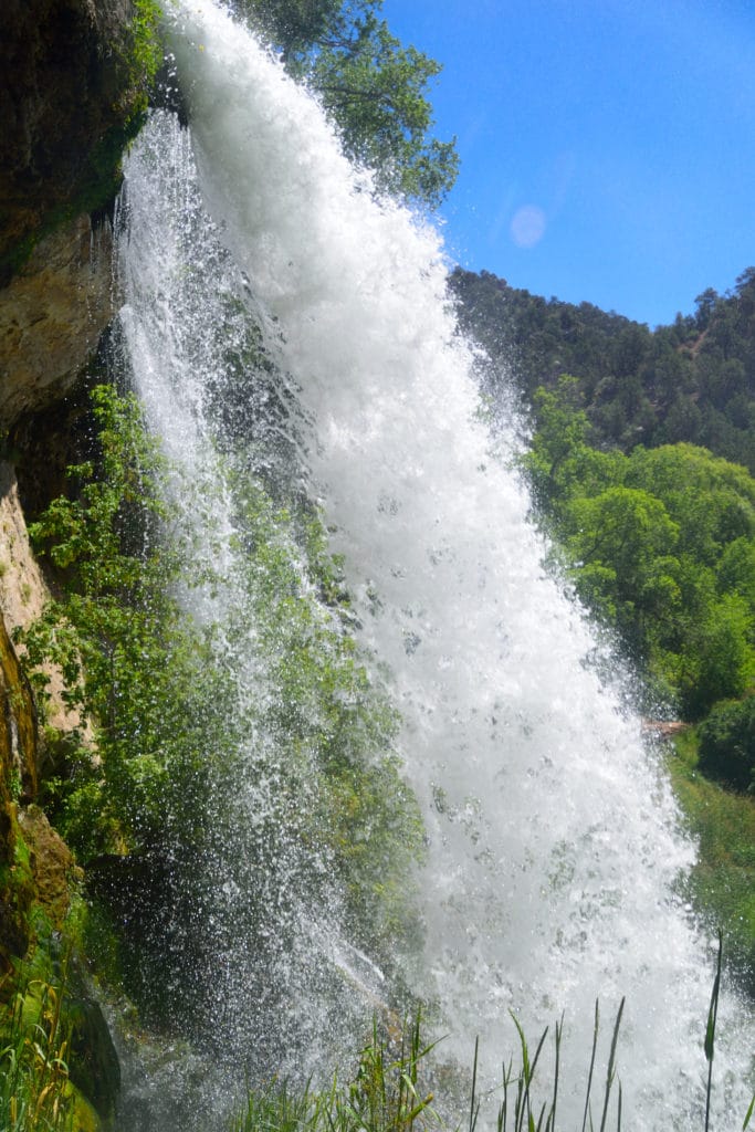
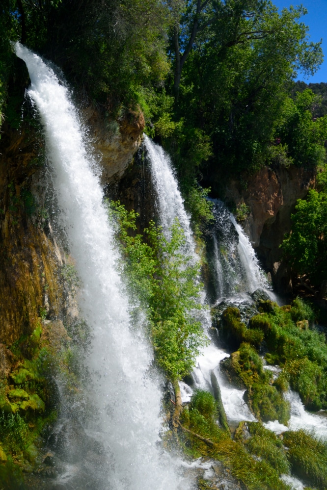
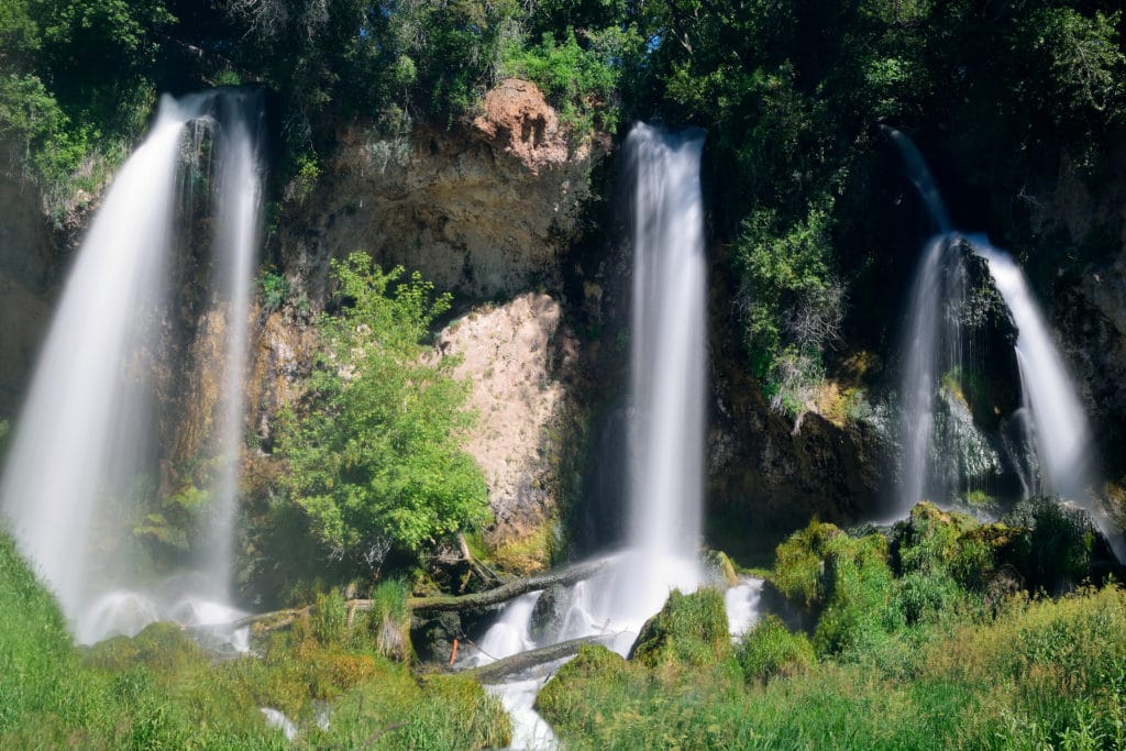
Rifle Falls State Park is the smallest State Park in the state of Colorado. However, its 48 acres contain Rifle Falls which once were once used to provide power for the town of Rifle. Today, it’s a great spot to bring the family to enjoy a short hike and take in the beautiful waterfalls. The State Park is open year round and is a great spot for a short hike with the entire family – even bring the dog!
Rifle Falls State Park Quick Facts
Rifle Falls State Park Rating: ★★★★ (4/5 Stars)
Distance: Various, most trails under 2 miles RT- view park map here
Elevation Start: 6,450 ft
Highest Point: 6,630 ft
Total Elevation Gain: 330 ft
Estimated Time to Complete: 1-2 Hours RT for most trails
Difficulty: Walk in the Park What does this mean?
Class: Class 1
Season: Year Round – Falls are typically flowing the hardest May – July
Directions to Rifle Falls State Park
Trailhead: Rifle Falls State Park
Getting Here: From Glenwood Springs: Take I70 west for 11 miles and exit the highway at 105 (New Castle). Continue to Colorado Road 226 and stay on this for 7.3 miles. Once you reach the junction with Colorado 325, take a right and continue for 2.7 miles until you reach the park entrance on your right.
From Rifle (coming from the west): Take Colorado 13 to Colorado 325 and continue on this for 9.6 miles until you reach the park’s entrance on your right.
You can enter Rifle Falls State Park into your favorite navigational device.
Fees: $8 to enter the park, view more about camping fees here
Parking: The state park has two main lots that can collectively fit about 30 cars. The lot closer to the falls themselves can only fit about 12-15 cars and will fill up quickly on most weekends. However, due to the relatively short nature of this hike, the turnover is quick. If that lot is full, there is another one near the park entrance that involves a 5-10 minute walk to get back to the falls lot. Both parking areas have non-plumbing bathrooms.
Summary
Camping: Rifle Falls State Park does have a variety of tent and RV camping spots that are available throughout the year. I would recommend making a reservation in advance, you can read more about camping in Rifle Falls State Park here.
Dogs: The hikes in Rifle Falls State Park are dog friendly. Due to the busy nature of this trail and the narrow trail itself, I would recommend keeping your dog on a leash. It’s great that your dog is friendly, but you don’t know what other dogs on the trail are like. As always, please pick up after your dog on this hike.
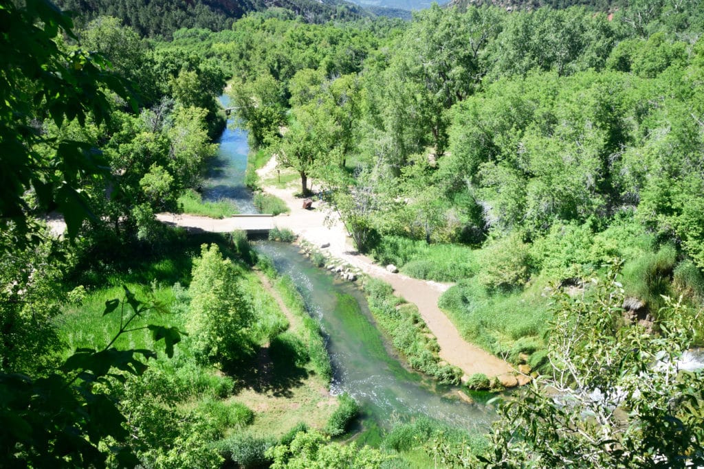
Make it a Loop: The Coyote Trail (far and away the most popular in the park) is a loop that takes you around the waterfalls and along some caves. If you are looking for other trails that offer far more seclusion, I would recommend checking out the other two trails: Squirrel and Bobcat.
Trail X Factors: Time of Year You Visit
Although Rifle Falls does flow year round, like most waterfalls in Colorado, the flow is the strongest during the spring months due to snow melt. Visit the park during the spring to view the falls at their strongest.
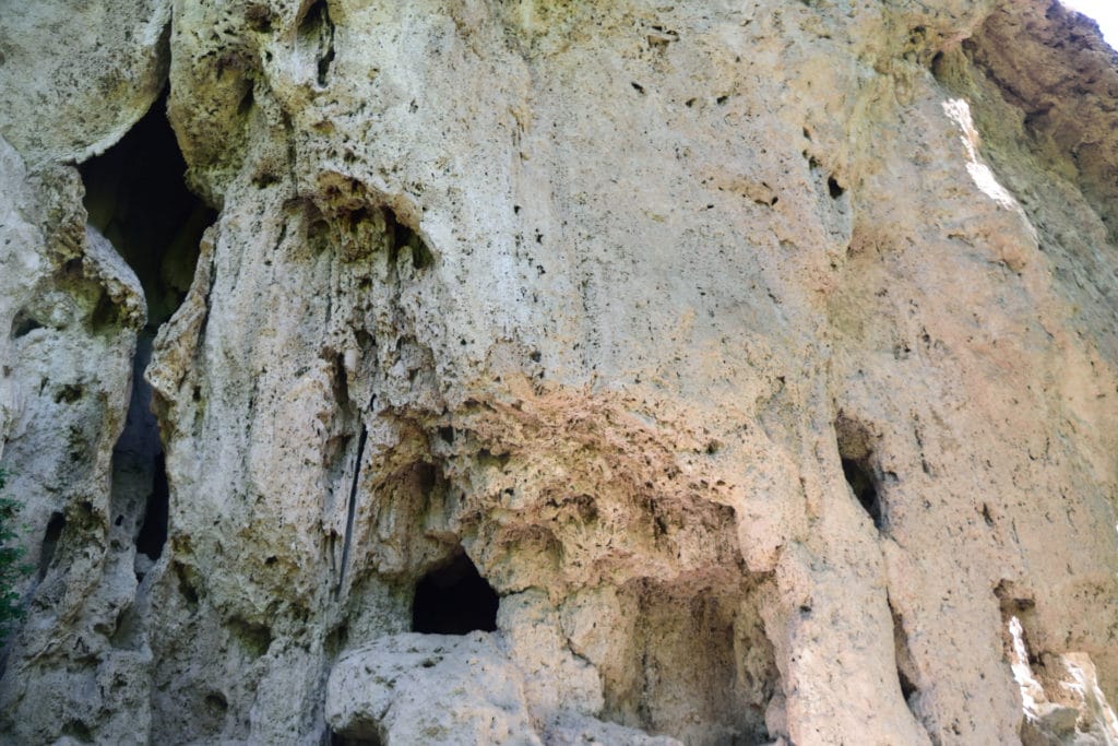
Hike Tip(s): If you want to have a trail to yourself within the park, you should visit on a weekday or early/later in the day. Venture outside of the Coyote Trail to explore other areas of the park with far less people. Don’t forget to bring a flashlight to explore the caves that surround the waterfalls. Looking to fish? The streams the feed the falls are directly downstream from the Rifle Fish Hatchery.
Best Views: The park offers great views around almost the entire Coyote Trail. Outside of this trail, there are a few more peaceful spots but I feel this trail does offer the best pure views in terms of nature. If you like photography, be sure to bring your tripod, wipes and filters to take some long exposure shots of the waterfalls.
Rifle Falls State Park Hike Route
Shows Coyote Trail & Squirrel Trail
Gear Needed
- Men’s Trail Runners
- Women’s Trail Runners
- La Sportiva Trango Hiking Boots (Men’s)
- La Sportiva Trango Hiking Booths (Women’s)
- Backpack
- Food & Water
- Optional: Garmin inReach
- Optional: Hiking Poles
- Optional: Headlamp
- Optional: Garmin Fenix Watch
- Optional: Camera and Lens
- Optional: GoPro, Joby Tripod
- *Links included in this description might be affiliate links. If you purchase a product or service with the links that I provide I may receive a small commission. There is no additional charge to you.
Our Trip to Rifle Falls State Park July 2019
Our trip to Rifle Falls State Park was relatively uneventful, but enjoy some photos from the park below. Questions or comments about the hiking? Leave a comment below or follow me on Instagram!