Clinton Peak Colorado 13er Centennial Hike Guide
Clinton Peak is a centennial and 13er located in the Front Range of Colorado. This mountain is ranked as the 80th highest peak in Colorado at 13,857ft. This hike is accessible year round and provides a great winter/spring ski/snowboard descent. If you don’t plan on taking the fun way down, Clinton Peak is a class 2 hike with generally loose trail conditions starting from Wheeler Lake and continuing to the summit.
Clinton Peak Quick Facts
Virtual Trail Guide: Clinton Peak Hike with Snowboard Descent
Clinton Peak Rating: ★★★(3/5 Stars)
Distance: 9 Miles From Winter Closure/4 Miles From Wheeler Lake (Upper TH)
Elevation Start: 10,922 Winter Closure / 12,168 Wheeler Lake (Upper TH)
Highest Point: 13,857ft
Total Elevation Gain: 2,800ft Winter Closure / 1,800ft Wheeler Lake (Upper TH)
Estimated Time to Complete: 5-7 Hours RT
Difficulty: Moderate What does this mean?
Snow Climb Grade: Easy- 30-35 degrees max
Class: Class 2 What does this mean?
Season: Year Round – Skiing/Boarding Lines Usually last until early June
Avalanche Forecast: This route and area is avalanche prone, check conditions here.
Directions to Clinton Peak
Trailhead: Montgomery Reservoir
Getting Here: About a mile south of Hoosier Pass take the County Road (CR) 4 west. Stay straight on this road for about a mile then continue right on the higher road to reach the reservoir. In the winter and spring this will be the end of the road for you. In the summer, low clearance cars can continue another .3 miles or so. VERY high clearance 4×4 cars with a very experienced off-road driver can continue another 2.5 miles up to Wheeler Lake. I would not recommend this option for anyone without a lift kit on their car, this road is extremely rough.
Fees: There is no fee for this hike.
Parking: The parking situation for this hike is going to entirely depend on the snow conditions and when you visit. In the best case scenario there are several spots to park 5-10 cars at the reservoir itself. If the summer road is open you can continue another .3 miles to the summer TH that can fit another 5-10 cars. Neither area has a bathroom. If you do drive up to Wheeler Lake, expect extremely limited parking options.
Summary
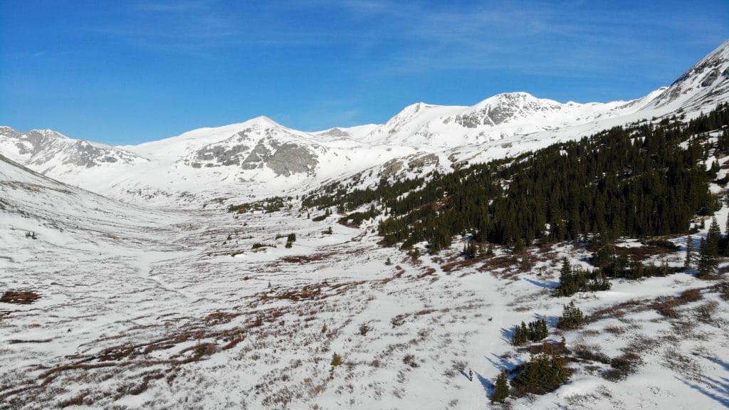
Camping: Camping for Clinton Peak is surprisingly good if you are willing to hike in a bit. There are several flat camping areas along the 4×4 road all the way up to Wheeler Lake. Of course, you do need dry conditions to take advantage of these options. Car camping is not an option for this one.
Dogs: Clinton Peak is dog friendly hike during all times of year. If you visit during the winter or spring, I would say that an off leash dog will be much safer and overall more enjoyable hiking companion.
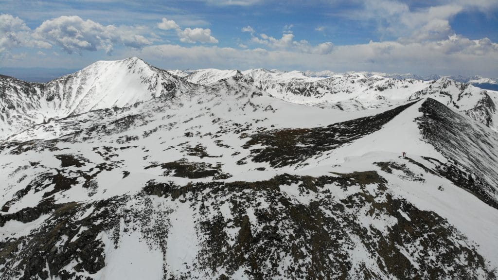
Make it a Loop: Clinton Peak is an out and back hike, however you can make this route a lollipop loop by adding neighboring Mcnamee and Traver peaks. To complete this loop, first summit Clinton Peak then head west on the ridgeline to Mcnamee and continue south towards Traver. Once you finish Traver you can head down the east slopes back to your starting area.
X Factors: Puddles & Loose Trail
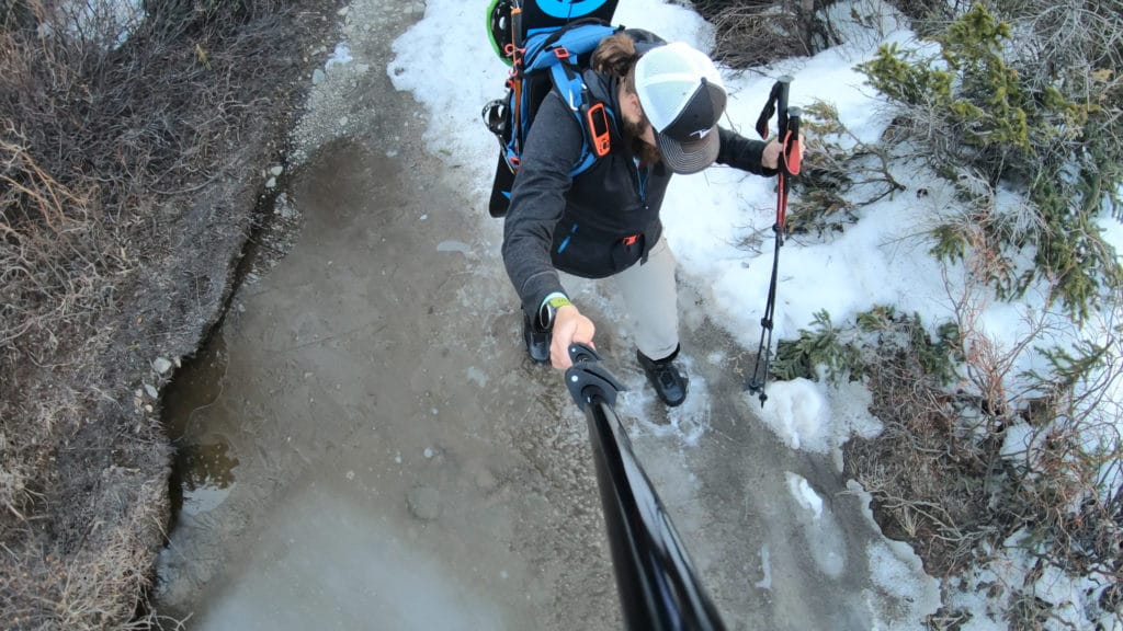
Regardless of whether you are hiking or snowboarding/skiing Clinton Peak – you will probably encounter some deep puddles on the 4×4 road up to Wheeler Lake. This area is just plain wet. There is loads of snowmelt from the mountains above and it does not do a good job of draining. Postholing/falling into water will most likely be how you start or end your hike. Waterproof boots are nice but so is being able to navigate the many social trails around these spots. If you are boarding/skiing – don’t expect a straight ride from the summit to your car. You will most likely have to walk out 1.5 miles or so.
If coming here when the snow is gone, there is a lack of a solid trail from Wheeler Lake to the summit of Clinton. Expect loose conditions and very slow going in certain sections.
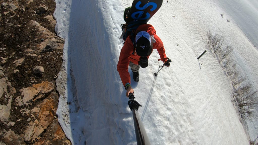
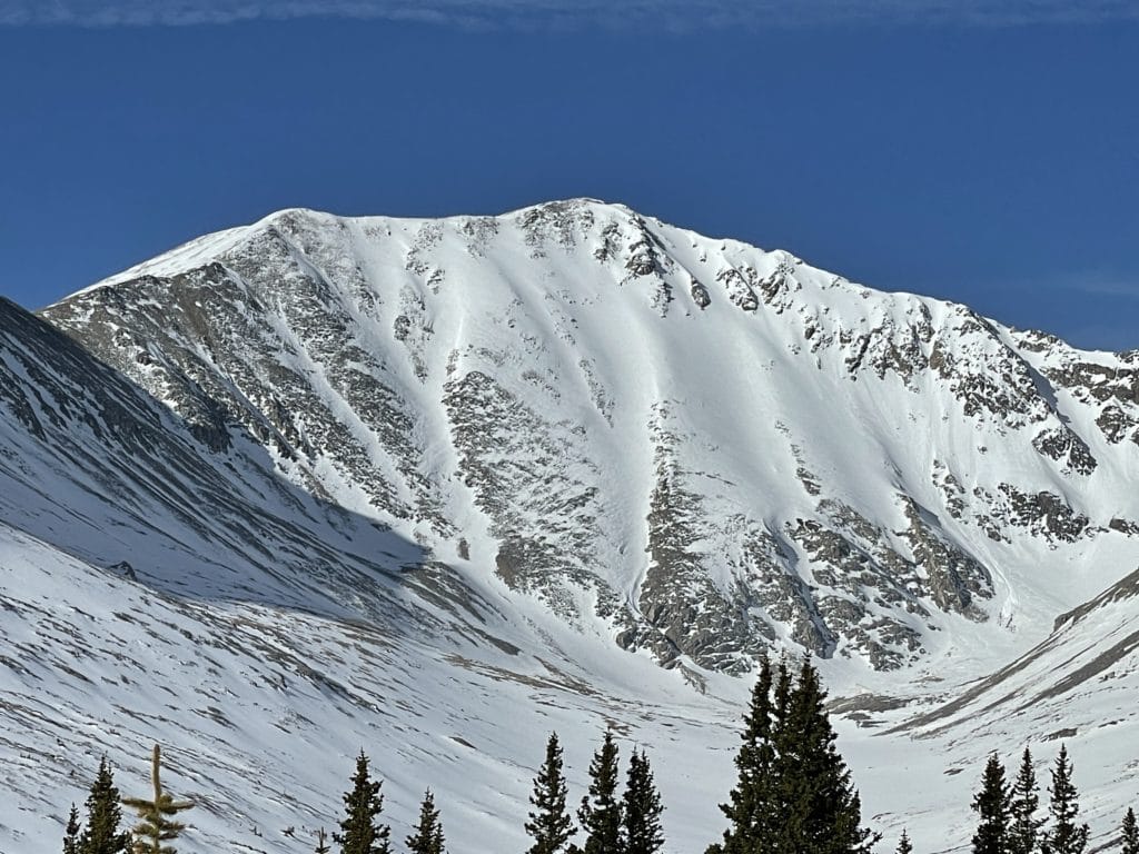
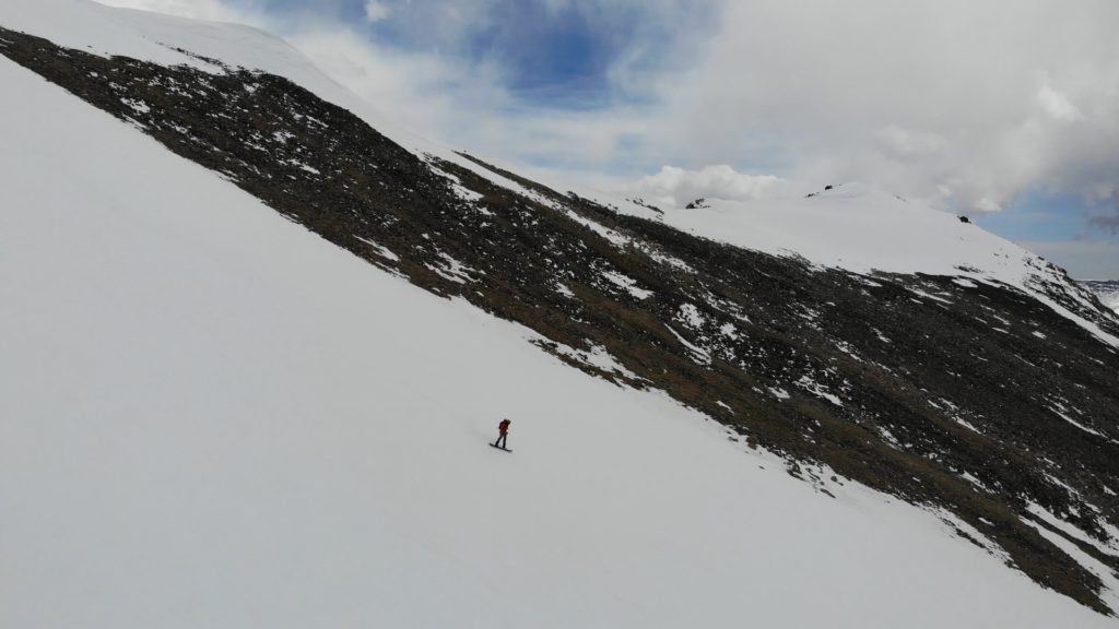
Hike Tip(s): I would highly recommend hiking Clinton Peak in the winter or spring before all the snow is gone. Even though this might make your hiking a bit more slow going, this route from what I can tell, is not enjoyable when it’s dry. The grade of this hike makes it a nice intro snow climb and great opportunity to practice with a mountain axe/crampons. In addition, the snow covering the slopes of the mountain will make for a much more easy going hike. Be sure to check avalanche conditions if you do plan on hiking with snow, the final slopes are prone to slide.
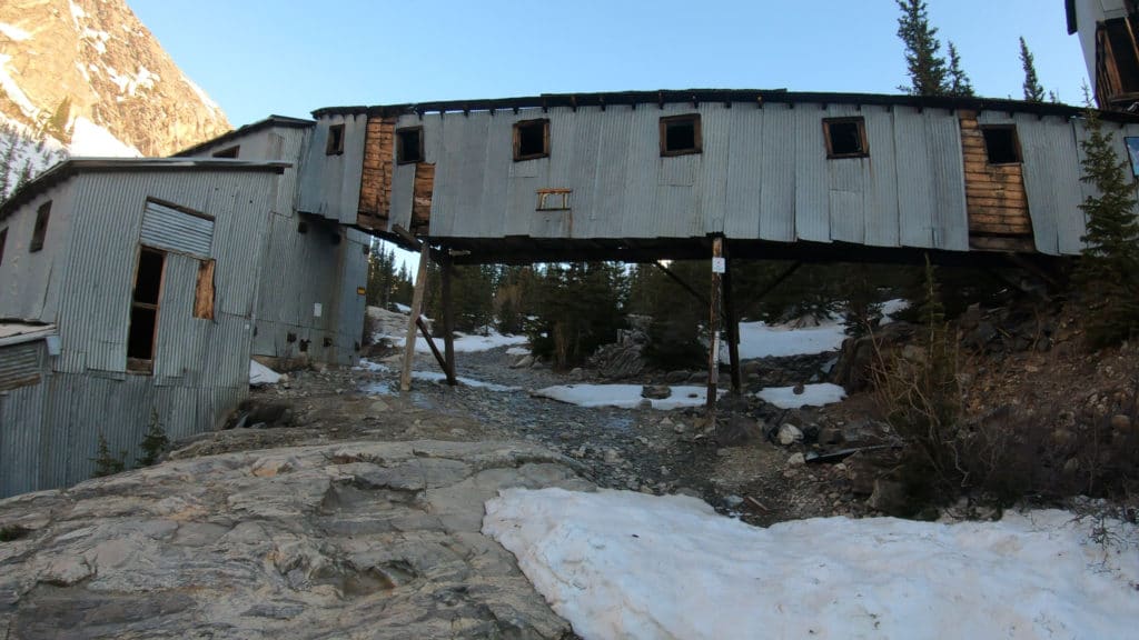
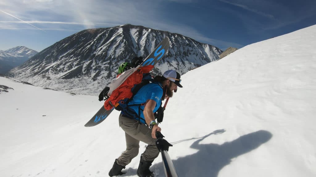
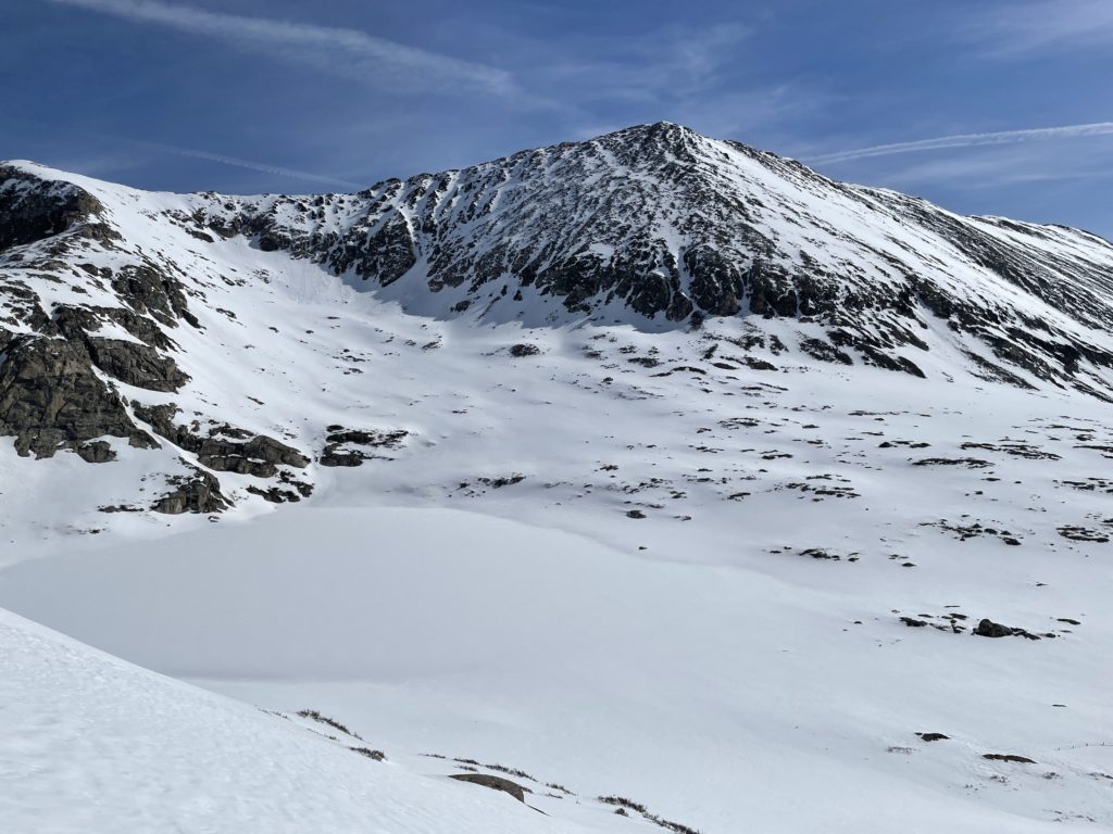
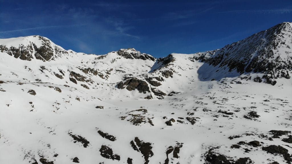
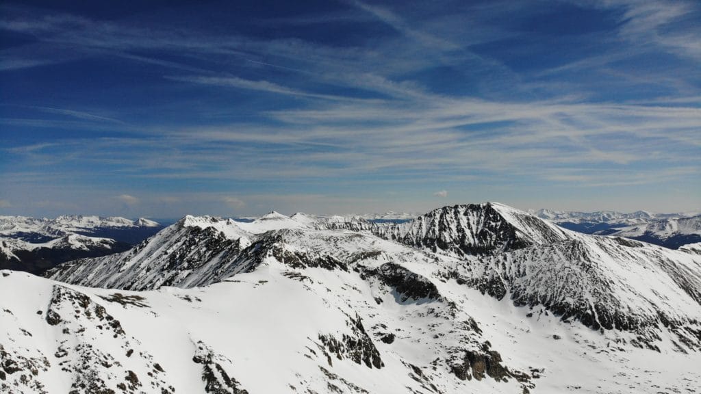
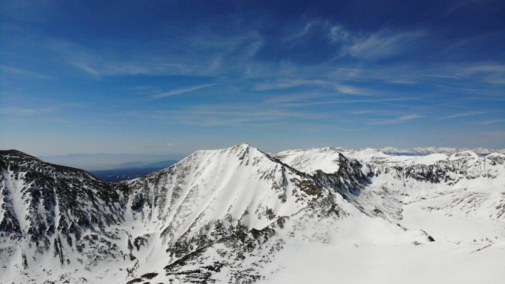
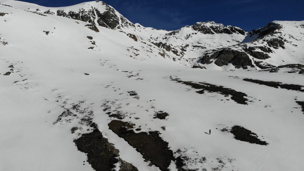
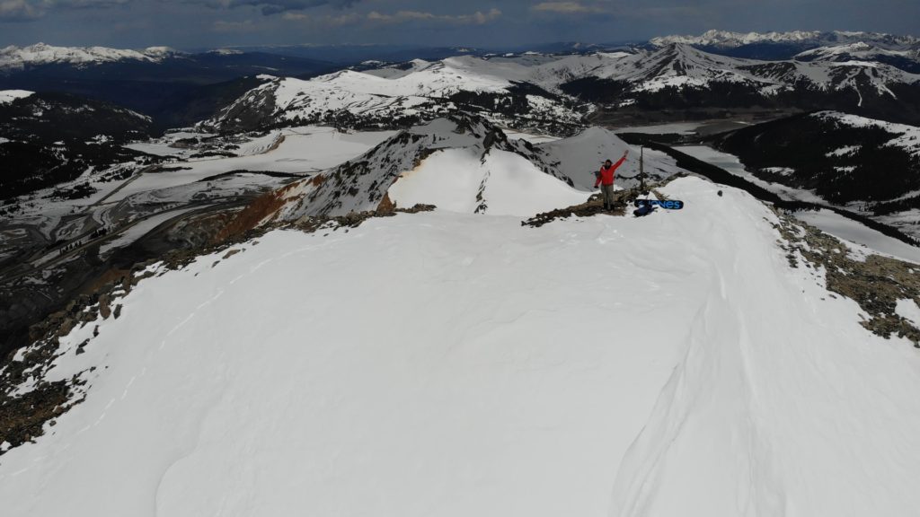
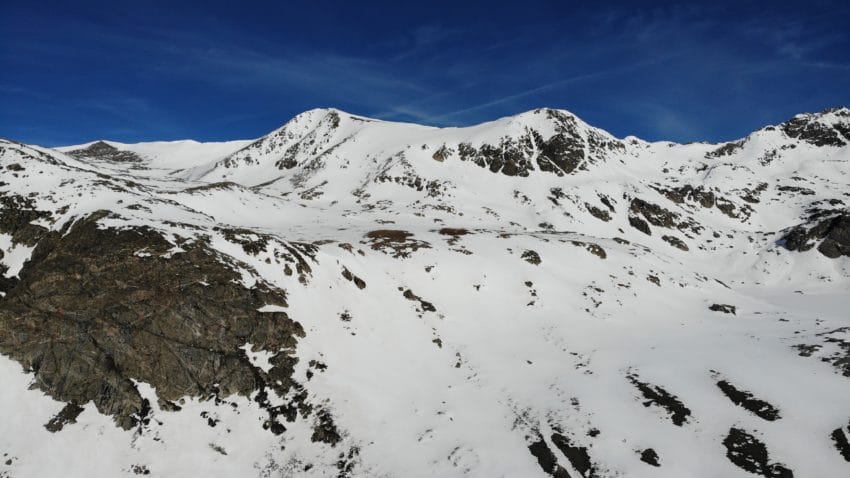
Best Views: I really enjoyed the views on the way up to Clinton Peak. You get a cool perspective of the Decalibron including the north couloir of Mt Democrat. After this point, the views behind Wheeler Lake and the lake itself are great. From the summit of Clinton Peak you have the unique opportunity to look directly down into an active mine.
Clinton Peak Hike Route
Gear Needed
- Dakine Poacher Winter Backpack
- Hiking/SkiPoles
- Headlamp
- Climbing Helmet
- Mountain Axe
- Crampons
- Crampon Bag
- La Sportiva Mountaineering Boots
- Microspikes
- Gaiters
- Optional: Avalanche Gear: Beacon, Probe, Shovel
- Optional: Snowshoes
- Optional: Skis or Splitboard
- Optional: Goggles
- Optional: Garmin inReach
- Optional: Garmin Fenix Watch
- Optional: Camera and Lens
- Optional: GoPro, Joby Tripod
- *Links included in this description might be affiliate links. If you purchase a product or service with the links that I provide I may receive a small commission. There is no additional charge to you.
My Trip to Clinton Peak: May 2021
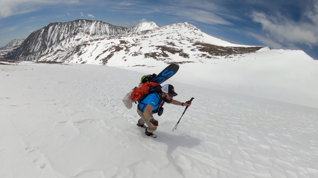
2021 proved to be the year when I became addicted to snow climbs and snowboard descents. I was hungry to get out on the splitboard again and noticed a perfect option to check off a centennial and use the snowboard: Clinton Peak.
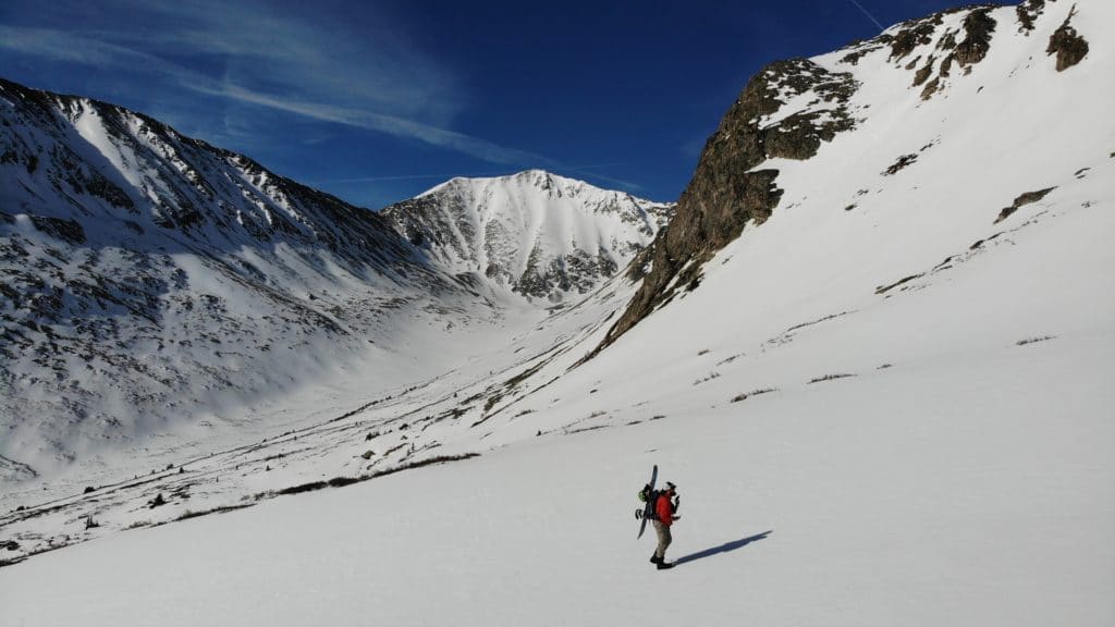
I arrived to the TH a little late, 6:30AM but quickly hit the road up towards Wheeler Lake. The freeze overnight was fairly good but not good enough to freeze over the large puddles that covered the rough 4×4 road. Each foot deep 5-6+foot wide puddle proved to be tricky to navigate around. By the time I was up towards the basin the sun was blasting the snow, softening it up at an alarming rate. I was a bit concerned that I would run out of time to safely ascend Clinton’s final south slopes which are prone to wet slides.
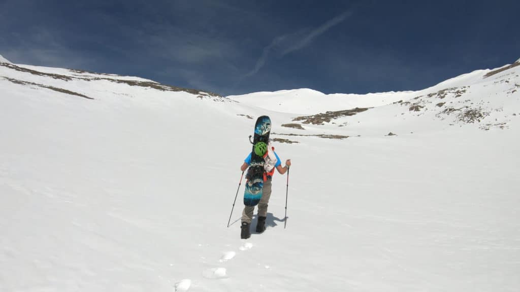
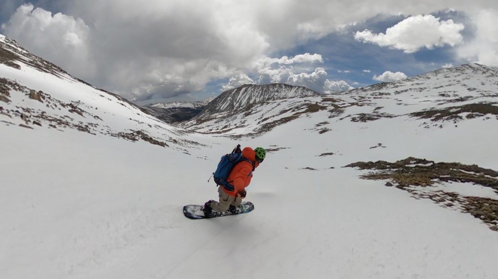
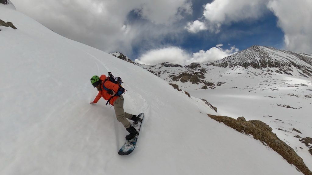
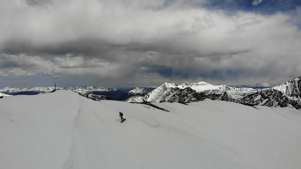
As I hiked by Wheeler Lake, I took a more direct line than the summer route would have which was nice as this saved me a bunch of time. When I reached the upper basin and final slopes it was clear that the snow up here still had plenty of time to soften up. I arrived at the summit of Clinton Peak by myself at 11AM and soaked in the beautiful views. For the second weekend in a row, angry clouds cut my summit time short. I transitioned to the splitboard and quickly started my descent. The initial turns were beautiful – near perfect snow and I was able to snowboard directly off the summit.
After boarding all the way past Wheeler Lake and towards the lower valley my trip abruptly ended and the 2 miles of postholing began. This part was not super fun. Oh well, it was getting later in the season after all and a summit to car boarding descent was getting harder and harder to find. I am glad I hiked Clinton Peak in the snow, I felt this mountain would be very boring and much more tricky to hike without it.