Matterhorn to Wetterhorn Traverse Trail Guide
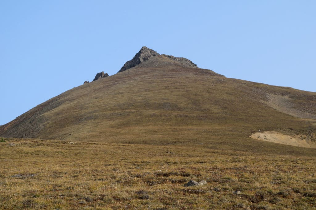
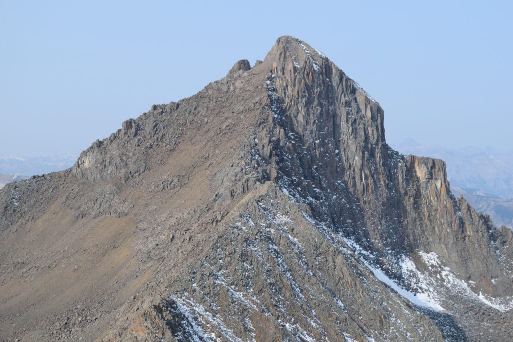
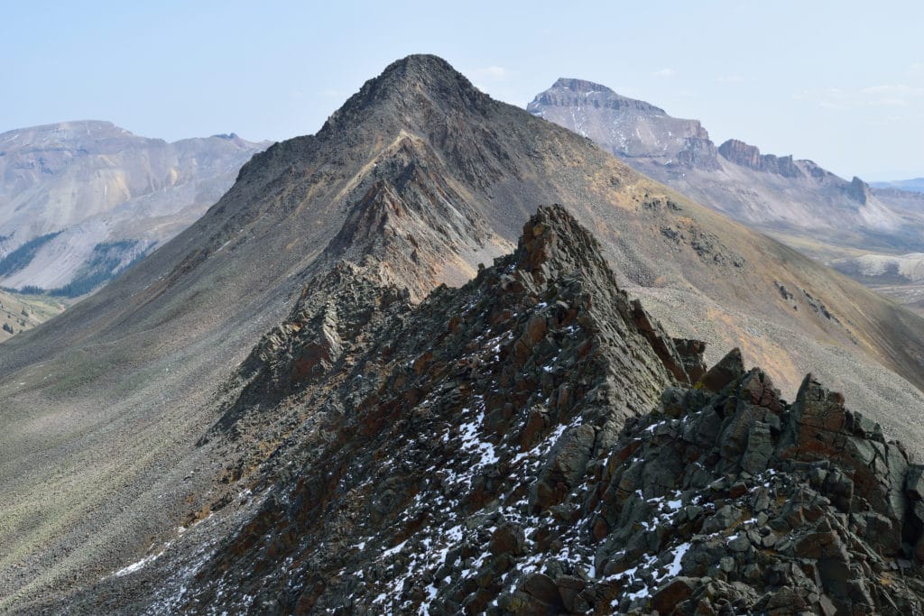
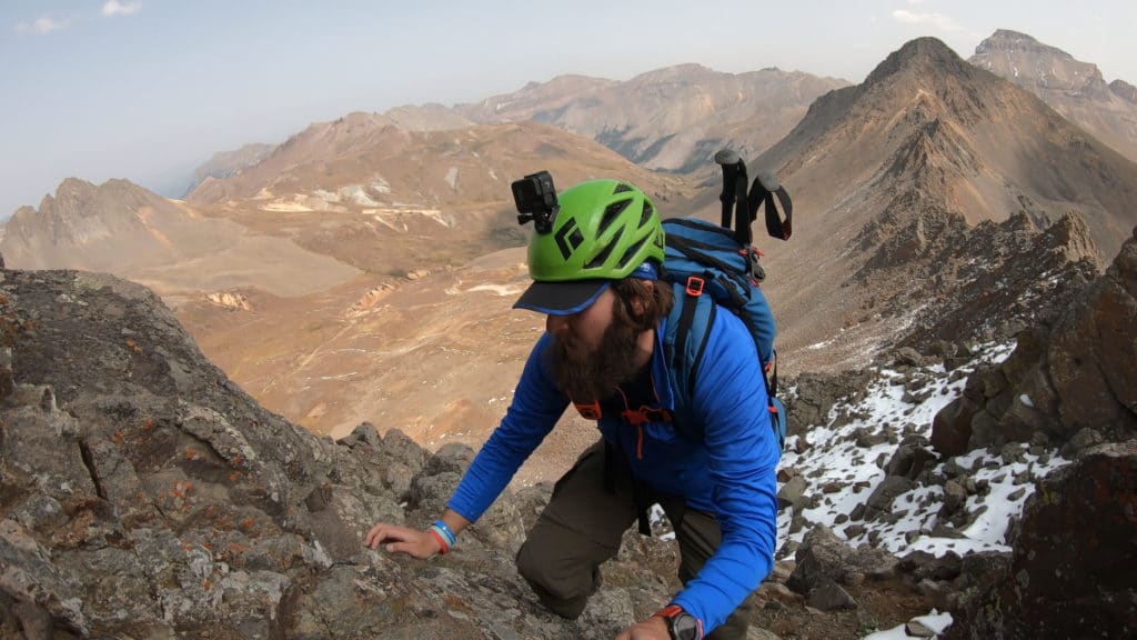
The Matterhorn to Wetthorn Traverse is one of the most challenging non-technical ridge traverses in Colorado. Matterhorn Peak, a bicentennial peak, is frequently hiked and so is neighboring 14er Wetterhorn but the traverse together is rarely tackled. This hike starts up mellow 13er Matterhorn Peak which has only a small section of high class 2 or low class 3 hiking. The traverse itself consists of some of the worst rock quality I have ever experienced. There are about 5 towers on this ridge, 2 of which feel as though they could completely fall over on you. The ridge ranges from class 2 to class 4+ and involves A LOT of route finding. Once you have hiked the mile long ridge you end your hike with a short scramble up Class 3 Wetterhorn and down its standard route. This hike is only recommended for solo hikers or small parties with ample experience route finding, dealing with loose rock and navigating through class 3+ terrain.
Matterhorn to Wetterhorn Traverse Quick Facts
Virtual Trail Guide: Matterhorn to Wetterhorn Traverse
Matterhorn to Wetterhorn Traverse Rating: ★★★ (3/5 Stars)
Distance: 10.75 Miles RT
Elevation Start: 10,394ft (4×4 split), 11,000ft (4×4 TH)
Highest Point: 14,015ft Wetterhorn, 13,590ft Matterhorn
Total Elevation Gain: 4,400ft
Estimated Time to Complete: 10-12+ Hours RT
Difficulty: Difficult to Strenuous Difficulty System Explained
Class: Class 3+ What does this mean?
Season: Late June – Late November – Expect snow outside of this period
Weather: Check the Weather Forecast
Directions to Matterhorn to Wetterhorn Traverse
Trailhead: Matterhorn Creek TH
Getting Here: From Lake City, its about 11 miles to the Matterhorn Creek trailhead. From the center of town, turn onto 2nd avenue. Take a left at the end of the road (Bluff St/CO Rd 20). From here, the road turns into dirt but is passable for most vehicles. It can be rough in spots, but it does not turn into 4WD/AWD until about 9 miles into the road. As you drive, keep an eye on your odometer or the small green mile signs on the right side of the road. After 9 miles, the road does close seasonally (December – May). From here, take a right onto North Henson Creek Road. The road is more rough from here until the lower TH, but is still passable for most vehicles with careful/experienced driving. Continue another 2.5 miles or so, where you will reach the Matterhorn Creek trailhead sign. If you want to continue to the proper trailhead, take a right up the rough 4WD road for another .7 miles. While it is possible to take a passenger car up, I would not recommend it unless it’s a weekday and you have lots of experience with rough roads and a high tolerance to scrape your vehicle. You can enter “Matterhorn Creek Trailhead” into your favorite navigational device.
Fees: There is no fee to hike the Matterhorn to Wetterhorn traverse.
Parking: Wetterhorn Creek trailhead can fit about 5-10 cars and has no restrooms. If you park at the 4×4 split, there are plenty of pull offs that can again fit 5-6 cars. If you park below this point before North Henson Creek there is a much larger area to park.
Summary
Camping: Surprisingly, for how remote Wetterhorn Peak & Matterhorn Peak are, they do not have the best camping options. During your drive to the trailhead, there are scattered camping spots along the first 9 miles and a handful more once you turn onto North Henson Creek road which is your best bet to camp in my opinion. Near the trailhead (upper or lower) there are really not that many decent options to camp. While this area is pretty remote for hikers, you will be competing with 500 people from Texas who are in town using their off road vehicles.
Dogs: This hike is absolutely not dog friendly. Matterhorn Peak is dog friendly on its own and an experienced mountain dog with good climbing skills could make an attempt on the standard route of Wetterhorn Peak.
Make it a Loop: This hike forms a lollipop loop which starts and ends on the standard Wetterhorn Peak trail. If you wanted more hiking you could easily add on neighboring Uncompahgre Peak.
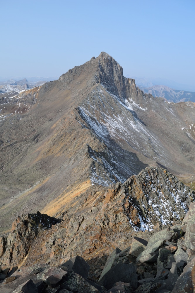
Trail X Factors: The Rock & Route Finding
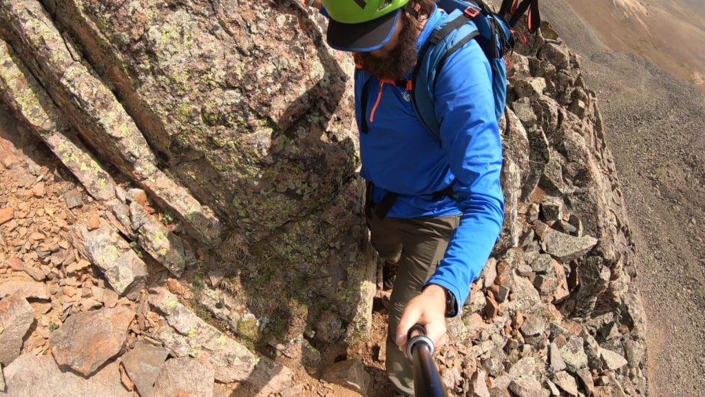
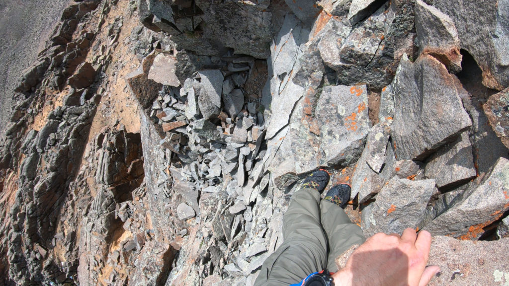
There is no easy way to put this, the rock quality on the Matterhorn to Wetterhorn traverse is just straight garbage. I think I said in the virtual trail guide that the rock quality goes from, “oh my god I am going to die” to “wow this seems okay” very frequently. The rock quality is just consistently extremely loose. It’s scary, you should never fully trust it and need to test EVERY SINGLE HOLD AND FOOT PLACEMENT. The rock does get slightly better as you get closer to Wetterhorn.
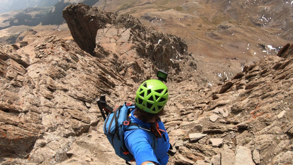
Like most ridge traverses, route finding is a huge part of this hike. To summarize this hike, descend straight down from Matterhorn, avoid the first tower and take the ridge to the 2nd and 3rd towers. These two are by far the worst and require quite a bit of downclimbing on the south (left) side of the ridge. Once you regain the ridge after traversing these two you will generally stay on the ridge itself for 95% of the remaining hike. However, there are a number of spots that require scouting and careful route finding. I would say bring a partner to help with this but they might just kick a rock down onto you and kill you…
Hike Tip(s): When hiking the Matterhorn to Wetterhorn traverse give yourself plenty of time and do your research beforehand. A clear weather day is a must on this. There are plenty of bailout points on the southern portion of the ridge but they involve descending several hundred vertical feet of extremely loose rock. I would avoid this unless your life is in danger.
Be sure to study this route and know the challenges you will face along the way. Read this guide, watch the virtual one and study topographical maps. There are no cairns, no signs and most likely will be no one else on the ridge to follow.
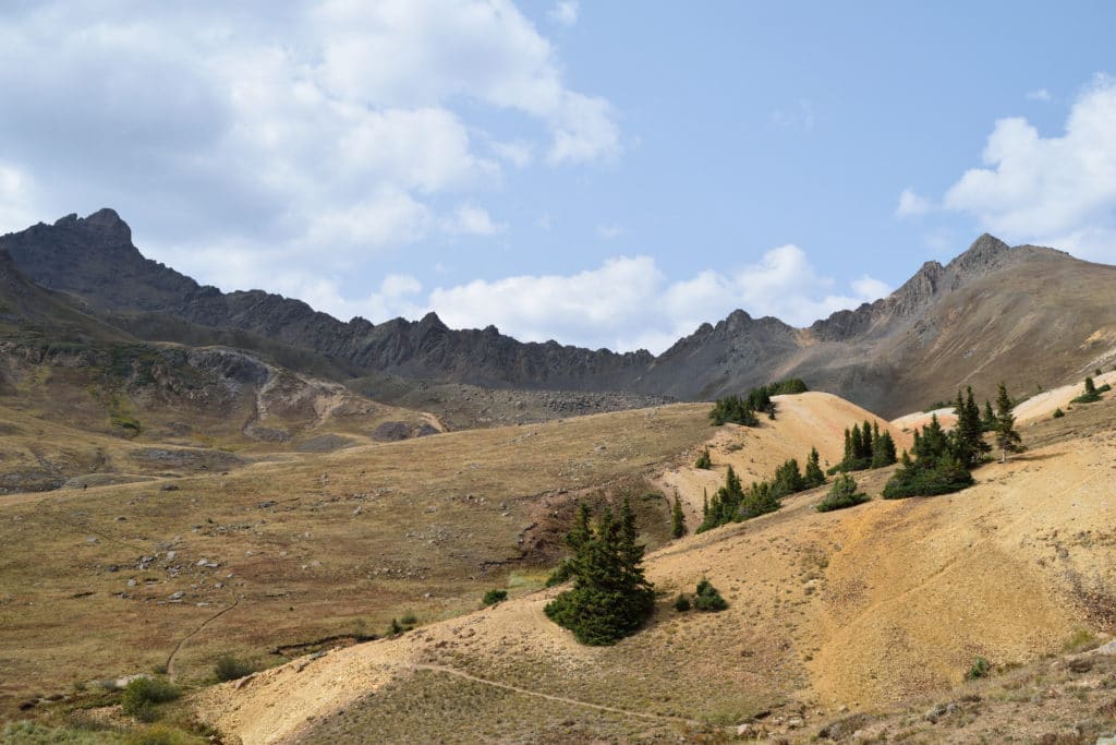
Best Views: This hike really has great views from start to finish. My personal favorite however were when I was looking at the standard trail on Wetterhorn knowing that the traverse was behind me.
Matterhorn to Wetterhorn Hike Route
Gear Needed
- 14er Packing List
- Hiking Boots or Trail Runners
- Backpack
- Protection from Sun – almost entire hike is above tree line
- Helmet
- Optional: Map of area or GPS – I use the Garmin inReach
- Optional: Hiking Poles
- Optional: Headlamp
- Optional: Camera
- *Links included in this description might be affiliate links. If you purchase a product or service with the links that I provide I may receive a small commission. There is no additional charge to you.
My Trip to the Matterhorn to Wetterhorn Traverse: September 2020
My summer of checking off bucket list hikes in Colorado continued with the Wetterhorn to Matterhorn traverse. I spotted this line a couple of years back when I hiked Wetterhorn for the first time and knew that I had to make an attempt on it one day. I did my best to research this hike but only found two reputable trip reports on it. Needless to say they were both a great help on what to expect and I studied them like the back of my hand.
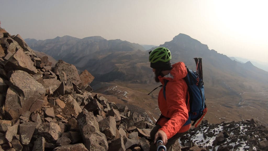
I arrived at the trailhead, camped out and began hiking early the next morning. The hike up Matterhorn was very straightforward and easy. The traverse itself was insane. I can’t ever remember thinking of bailing on a hike because I was fearful. This is the situation that I faced on this hike. Not because of the technical grade of hiking or climbing but because the mountain was literally falling apart. I sent rocks from the size of dinner plates to large plasma tvs tumbling down the mountain. There were times when I was not able to stop moving out of fear for getting caught by a sliding pile of rocks. I got cliffed out a number of times and was growing increasingly frustrated.
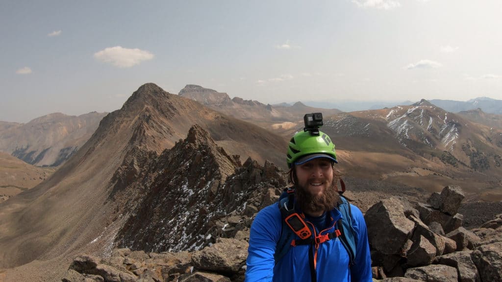
Eventually I found my way back to the ridge and with hours and hours of careful scouting and class 3+ hiking was able to summit Wetterhorn Peak and complete the traverse. I was so grateful to be on the summit with this gnarly traverse behind me. I can safely say that this one will not be a repeat for me and feel lucky to get out relatively unscathed.
Matterhorn to Wetterhorn Traverse Virtual Trail Guide
Questions or comments about this hike? Leave a comment below or follow me on Instagram!