Mt Sneffels Southwest Ridge 14er Trail Guide
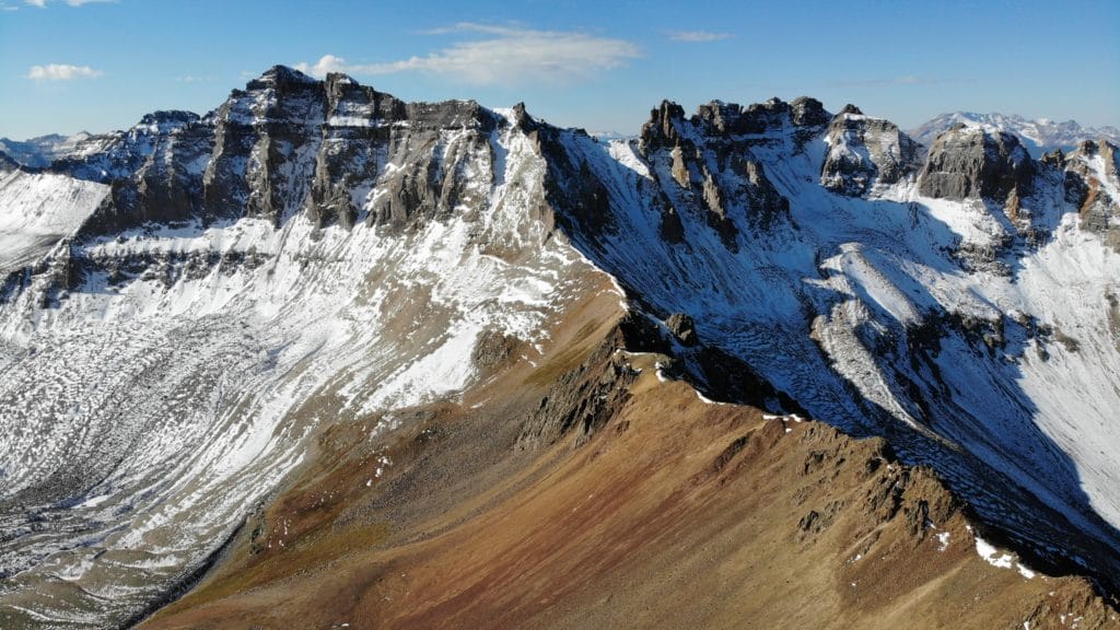
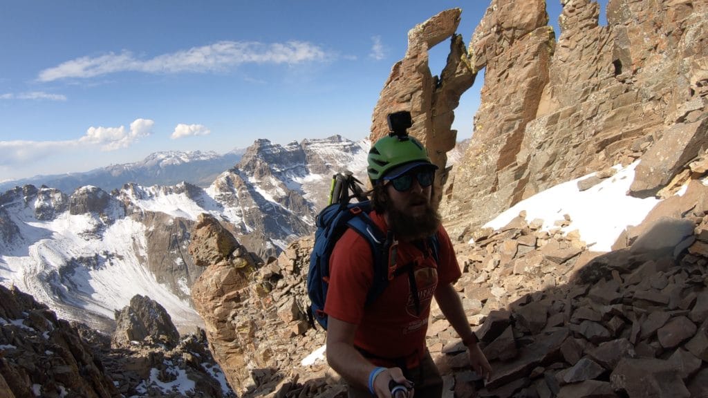
Mt Sneffels via the Southwest ridge is an alternative ridge scramble to one of the most prominent mountains in Colorado. Located just outside of Ouray, Colorado Mt Sneffels is an extremely popular hike and the southwest ridge provides an excellent alternative to ascend this 14er. The ridge consists of some route finding and excellent class 3 hiking with medium exposure. In addition to the better trail conditions, the southwest ridge provides far superior views of neighboring Blue Lakes as well. In my opinion, this should be the only way to ascend this mountain.
Mt Sneffels Southwest Ridge Quick Facts
Virtual Trail Guide: Mt Sneffels via Southwest Ridge
Mt Sneffels via Southwest Rating: ★★★★★ (5/5 Stars)
Distance: Various Depending on Starting Point & Decent Route – Between 3-8 Miles RT (3 Miles 4×4 TH, 6.5 from Upper TH, 8.25 from Road Split) – add minor distance for addition of Wrights Lake.
Elevation Start: 10,787ft (Road Split), 11,335ft (Upper TH), 12,464ft (4×4 TH)
Highest Point: 14,150ft
Total Elevation Gain: Various (1,750 – 3,400) depending on starting point
Estimated Time to Complete: 5-7 Hours RT
Difficulty: Moderate to Difficult Difficulty System Explained
Class: Class 3 What does this mean?
Season: Late June- Early November – Expect snow outside of this period
Weather: Check the Weather Forecast
Directions Mt Sneffels Southwest Ridge
Trailhead: Yankee Boy Basin
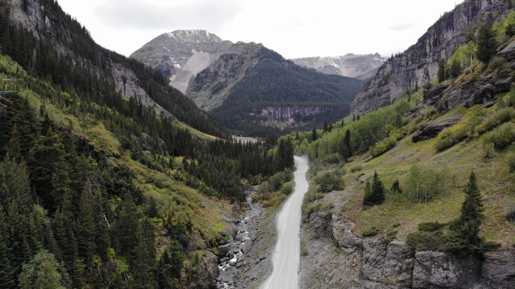
Getting Here: First step is to get to Ouray, Colorado. Drive through the town and turn right onto County Road 361 toward Yankee Boy Basin. Pay attention to your odometer from here on out. The name of the game at this point is stay right. The dirt road is usually in fairly good condition for about 6.5 miles, but there are sections of very narrow road with steep drop offs.
-At 4.6 miles, stay right CR26
-At 5.9 miles, stay right towards Imogene Pass
-6.7 miles, you will reach your first potential parking area. This is about .7 miles from the lower trailhead and a good place to stop if you have a lower clearance car. If you are confident with your car’s clearance, continue right here.
-7.5 miles you will reach the lower trailhead which has the only non plumbing bathroom along this route. If you don’t have a 4WD car, this is a good area to stop. I will say that you can probably go to the 8.2 mile mark without 4WD or high clearance, but there are not great areas to turn around or park.
-7.5 miles (100 yards past lower TH)- continue right
-8.0 miles: Stay right
-8.2 miles: If you do not have high clearance or 4WD, continue at your own risk
-9.2 miles: Upper Trailhead. This area has room to fit about 5ish cars. There is no bathroom of any kind up here.
Fees: There is no fee to hike Mt Sneffels.
Parking: The parking situation is entirely dictated by your car, the road conditions and your driving ability. Parking in all areas is free and the only bathrooms are at the first campground and the lower trailhead. As of October 2020, the road was in pretty rough once you take a right at 6.7 miles. There was a 40-50 yard section here that was tough for even lower clearance 4WD vehicles to get through. Unless the road improves, I imagine this first split will become the new standard parking area. The split can fit about 5-10 cars. The lower trailhead lot can fit about 20 cars comfortably and past that point there are a handful of 1-2 car pull offs until you reach the upper trailhead that can fit about 5-10 cars.
Summary
Mt Sneffels Camping: Surprisingly for a mountain so remote, Mt Sneffels does not offer the best camping situation. Once you are on CR 26, there are a very limited number of “permitted (technically illegal)” camping spots outside of the initial campground. Much of the land leading up to the Mt Sneffels trailhead/hiking area is private mining land, which takes away a lot of the usual spots to camp. If you want to camp along the road, there are some spots on the right hand right near the 6.5 mile mark, otherwise you will need to go up the lower trailhead. Once past the lower trailhead, camping is again prohibited. If you want to backcountry camp, that could be an option as well but not in Yankee Boy Basin itself, camping there is illegal. Please note: this area gets extremely heavy usage during the summer, do not make new campgrounds, stay on existing roads and leave no trace. Yankee Boy Basin is one of Colorado’s most beautiful areas, lets keep it that way.
Dogs: I would not recommend bringing your dog up Mt Sneffels, especially via the southwest slopes.
Make it a Loop: You can easily make this a lollipop loop by descending or ascending via the standard south slopes route. The south slopes are less technical but also have TERRIBLY loose trail conditions. Going down this route will save you some mileage though.
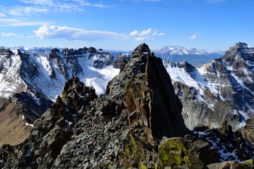
Trail X Factors: Views & Trail Conditions
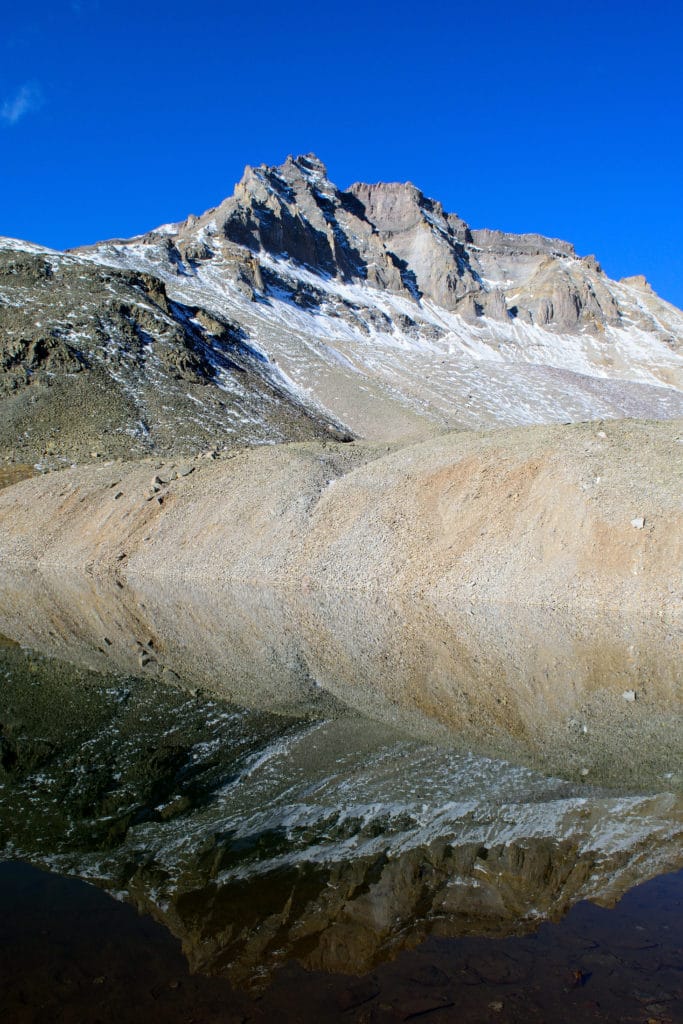
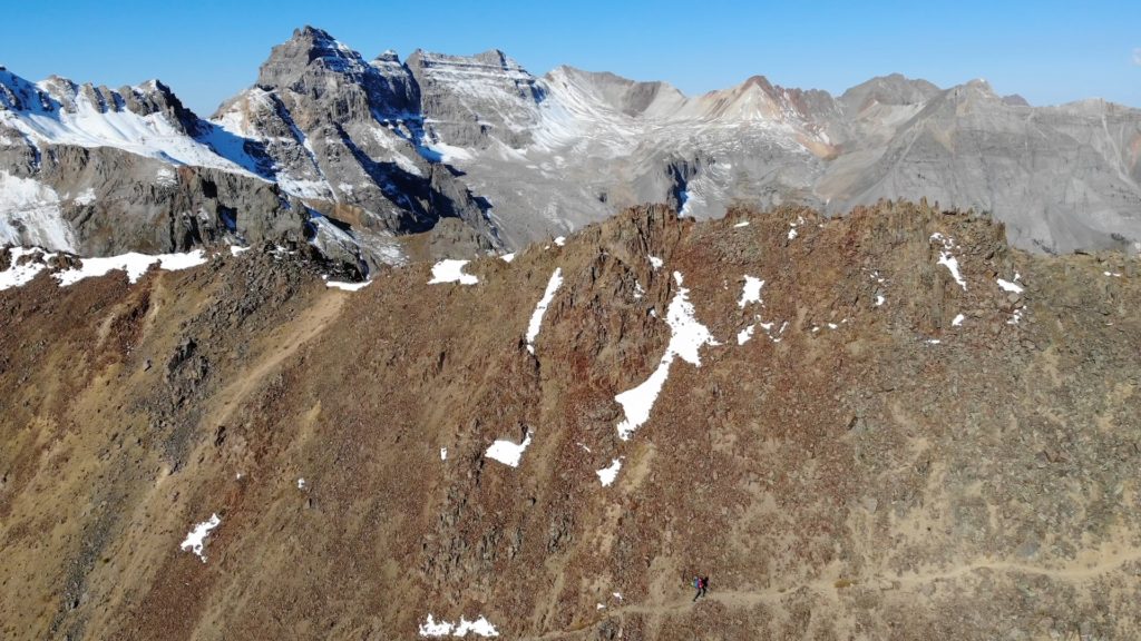
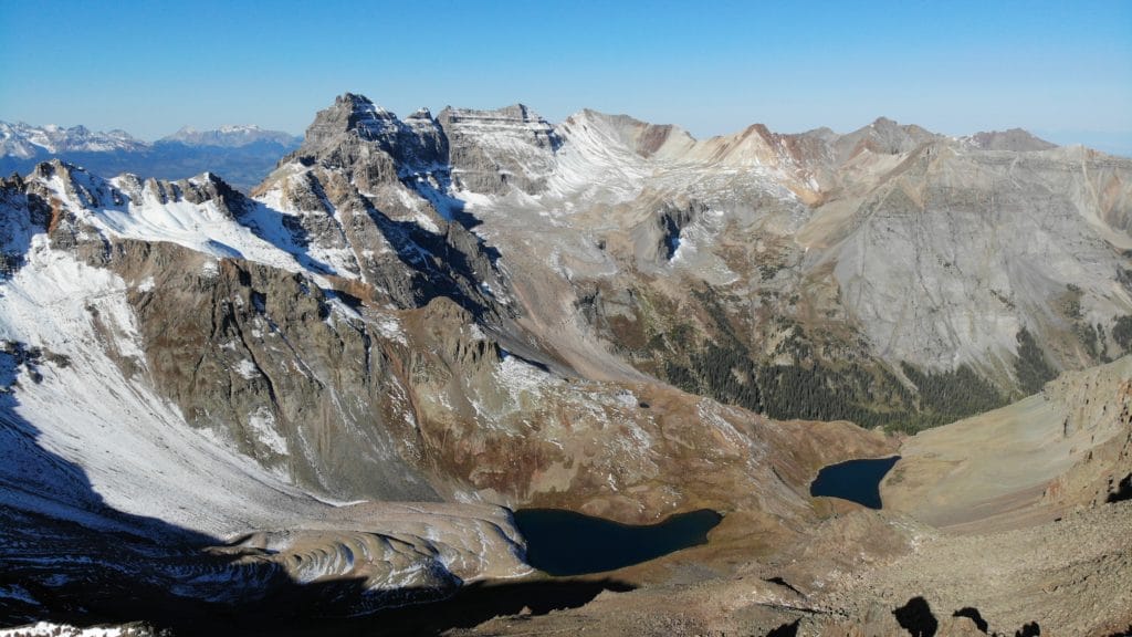
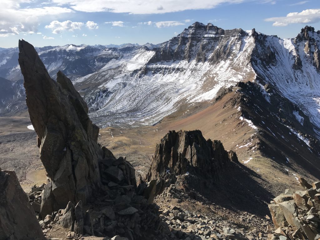
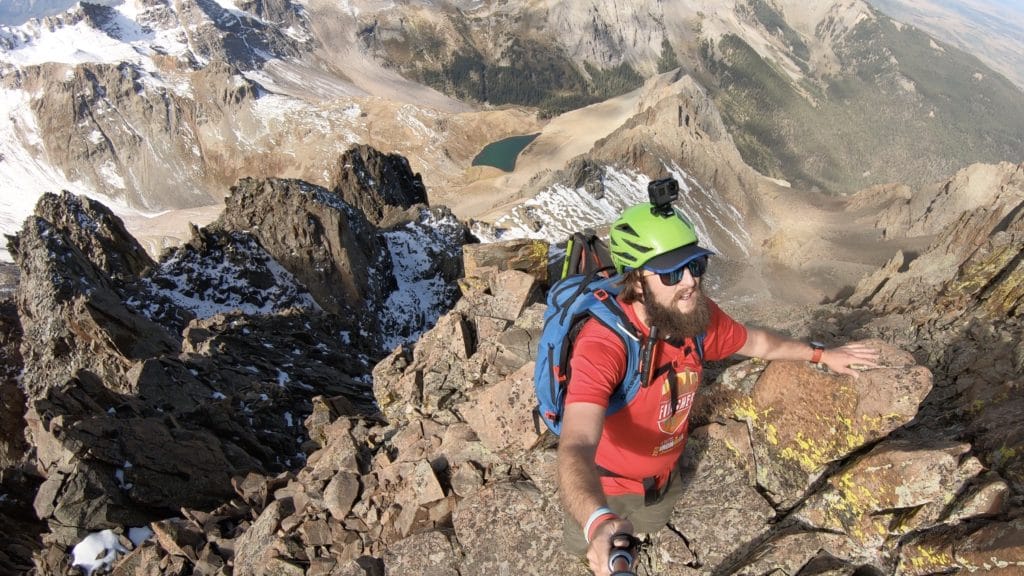
Look, this entire area is BEAUTIFUL but I think that the views on the southwest ridge are far superior than the standard one. Blue Lakes Pass itself is a worthy hike and this is just a stopping point on your way up to Mt Sneffels. From the pass you get amazing views of the blue lakes and the San Juans and Telluride to the south.
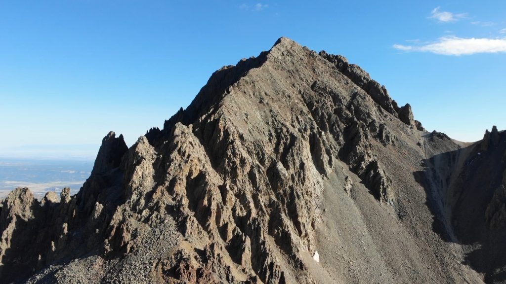
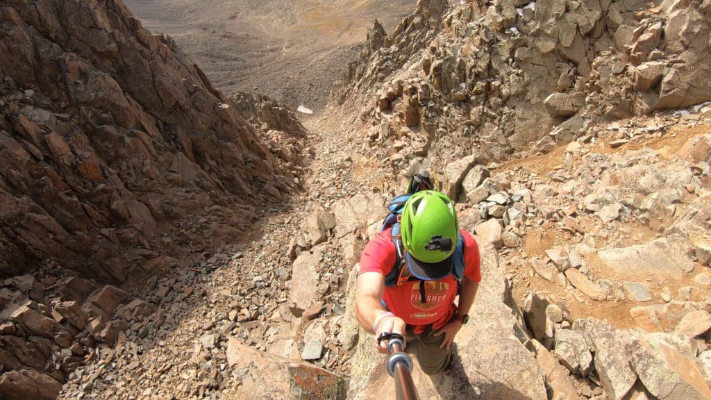
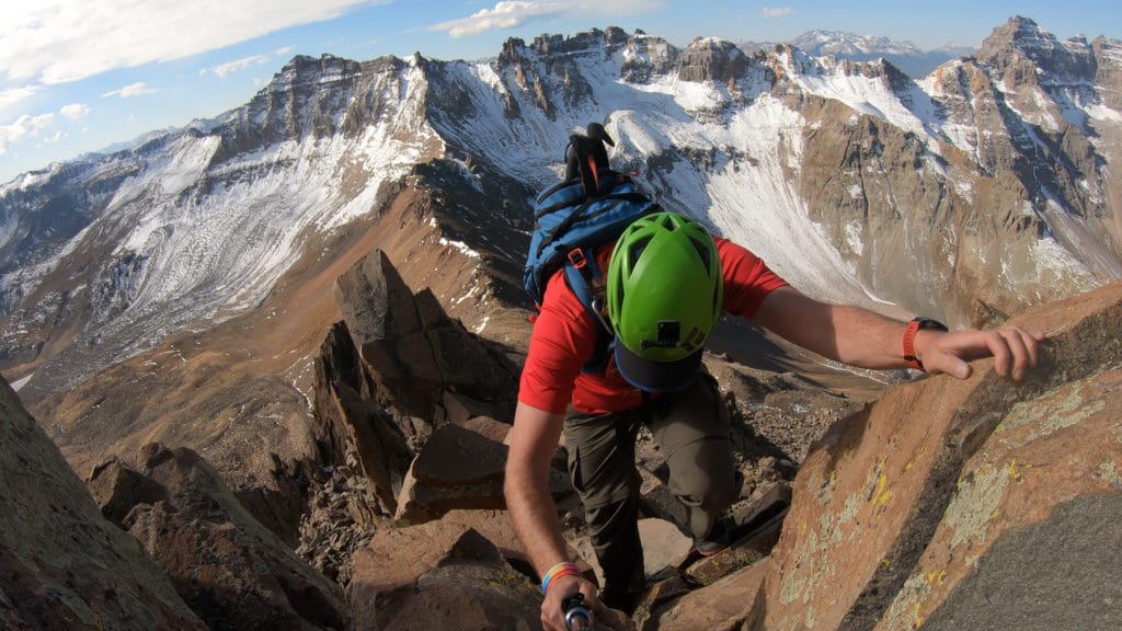
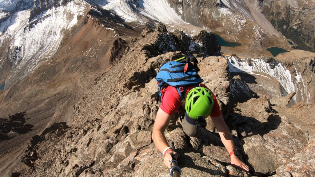
If you read my previous trip report up the south slopes of Sneffels, you know that the trail conditions are far from ideal. The southwest ridge is not perfect but in general trail conditions are FAR superior. Far less loose rock and dirt with a ton of class 2 and 3 scrambling on solid rock.
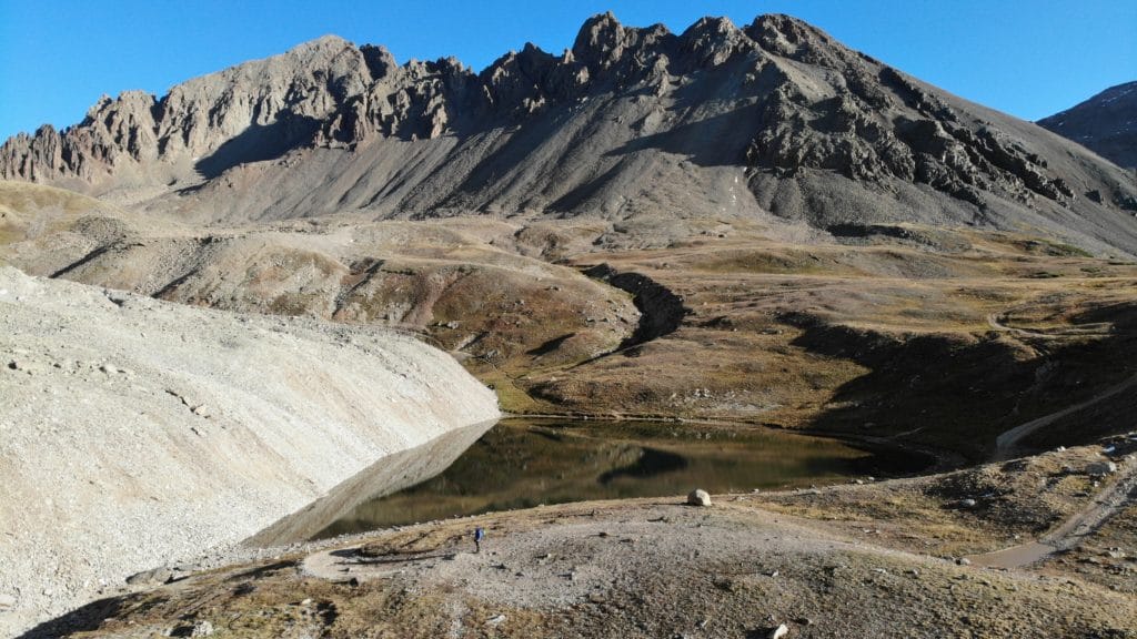
Hike Tip(s): If you are hiking in from the lower TH or road split, instead of hiking up the 4×4 road to the upper trailhead, I would highly recommend a side trip to Wrights Lake. Sure, you can see this lake from above, but it’s a great way to see this beautiful spot up close with almost no additional extra hiking. From the lake it’s an easy connection to the Blue Lakes Pass trail.
Best Views: Anytime you are hiking in the San Juans, the views are going to be beautiful. The geography here is very different from the rest of the state and of course, most peaks are very secluded from humans. While hiking Mt Sneffels, you will have outstanding ridgeline views, lots of wildflowers in the summer and of course the opportunity to view three blue lakes from the pass and hike up to the summit. The top of Mt Sneffels provides views down into Montrose and over into Telluride as well. Even though it was a short hike, I really enjoyed the many photo opportunities that Mt Sneffels had to offer and is one of the most beautiful hikes up a 14er.
Mt Sneffels Southwest Ridge Hike Route
Up Southwest Ridge, down South Slopes
Gear Needed
- 14er Day Hike Packing List
- Backpack
- Hiking Shoes or Hiking Boots
- Protection from the Sun
- Helmet
- Optional: GPS or navigational device
- Optional: Hiking Poles – especially helpful if descending south slopes
- Optional: Headlamp
- *Links included in this description might be affiliate links. If you purchase a product or service with the links that I provide I may receive a small commission. There is no additional charge to you.
My Trip to Mt Sneffels Southwest Ridge: October 2020
Dry hiking season was coming to an end and I wanted to head down south one last time before the snow moved in. I had previously hiked Mt Sneffels but I have had so many requests to hike up the Southwest Ridge I just had to check it out. To be honest, I forgot how beautiful the area was and I could not stop soaking in the views on the hike up from the road split. I decided to add on Wrights Lake and head up to Blue Lakes Pass from there. The pass itself was stunning. A fresh coating on snow covered the neighboring peaks but left my route up Sneffels bone dry.
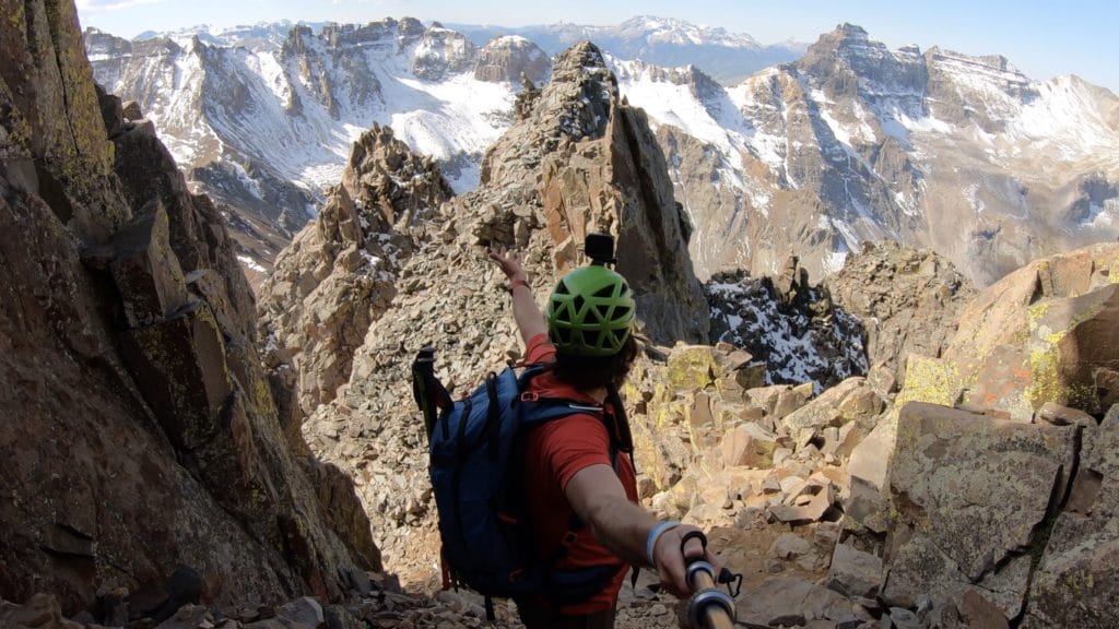
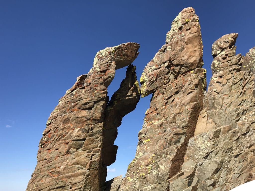
The southwest ridge was a fun mix of class 2 and class 3 hiking with mostly solid trail conditions. I was able to see the famous “Kissing Camels” and have some exciting scrambling with higher exposure towards the top of the ridge. I was lucky enough to have summit to myself for several minutes, soaking in the stunning views in every single direction. I descended the standard south slopes and was back to the car in no time. Given the choice, I would not even hesitate to re-hike Mt Sneffels via the Southwest ridge vs the standard route. What a beautiful hike!

Mt Sneffels via Southwest Ridge Virtual Trail Guide
Questions or comments about the hike up to Mt Sneffels via the Southwest Ridge? Leave a comment below or follow me on Instagram!
6 thoughts on “Mt Sneffels Southwest Ridge 14er Trail Guide”
Hi there!! Great info and photos! I’m planning to do Sneffels from the blue lakes. Camping overnight at the lower lake then summiting in the morn via SW ridge. Can you tell me how the descent is on the SW ridge? Do you know if it’s common for people to descend this route?(especially if coming from Blue Lakes) I’d like to save on mileage and pain by avoiding the gully descent down the scree and then having to go back up to the pass.
Hi Mariah,
I would say the SW is fine to descend and a lot of people do it. There is one move that I show in the video at 8:56 or so that might be a little tricky, but nothing crazy. Honestly, I think its probably easier to just descend the ridge vs having to regain the pass.
Thank you that’s good to hear! I haven’t been able to find much mention of descending the ridge. Most comments on the descent seem to be about the south slope gully.
I’ll check out the video. Thanks again!
I was wondering the same thing! Headed there in a few weeks! I went down the coulior last year and it was almost infuriating with all the slippery rock and dirt. I vowed never again!
The .com .gpx does not go to Wright Lake and I would love to add that on. I cant figure out how to download your Garmin track, however. Do you happen to have a .gpx file of your route listed somewhere? Apologies if Ive missed it.
Having some issues with those on the site at the moment, shoot me an email and I can get it over to you.