
Bandelier National Monument Guide
Bandelier National Monument was created to protect the ancestral and traditional lands of over 23 tribes who once inhabited the area. Located about an hour Northwest of Santa Fe this New Mexico National Monument is a great place to hike, trail run and backpack while checking out some pretty unique history of the region. This monument is accessible year round.
Bandelier National Monument Quick Facts
Bandelier National Monument Rating: ★★★★ (4/5 Stars)
Virtual Trail Guide: Bandelier National Monument Big Loop
Distance: The park has over 70 miles of trails. The most popular though can be done in under 5 miles. These included the Pueblo Loop, Alcove House and Falls Trails. View a full map of the park’s hiking here.
Elevation Start: 6,067t (Park Headquarters)
High Point: 10,190ft (Cerro Grande Peak – most of you will not go there)
Total Elevation Gain: Various, most trails, even the long loops will be under 2,500ft
Estimated Time to Complete: The most popular trails will take you 1-2 hours to complete.
Difficulty: Walk in the Park to Moderate Depending on Trails Taken What does this mean?
Class: Class 1 – What does this mean?
Season: Year Round – Most popular times to visit are around the Thanksgiving Holiday. However, this monument is great to visit during the Winter months.
Crowds: Low to Moderate
Directions to Bandelier National Monument
Trailhead: Los Alamos Visitor Center
Getting Here: Bandelier National Monument is located about an hour from Santa Fe. Access to the monument does not require a special vehicle and is all on paved roads.
Parking: While listening to a Park Ranger, I overhead there are about 110 spots to park in the Monument. On its busiest days, these lots will fill up. They recommend visiting during the evening or early morning for the best chance to secure a spot during peak seasons.
Permits/Fee: A National Park’s Pass or One Day Entry Fee is required.
Summary
Dogs: Like all National Parks and National Monuments, dogs are “allowed” but basically can’t leave the parking lot. They should also NOT be left unattended in your car.
Camping: Although I did not camp in Bandelier the camping scene here is fairly good. You can view all options, including backcountry camping here.
Make it a Loop: There are loads of options to hike in the Monument as mentioned above but the most common trails are The Falls and Pueblo Loop. Although these two do not form an actual loop – you can create a larger lollipop loop by combining them both.
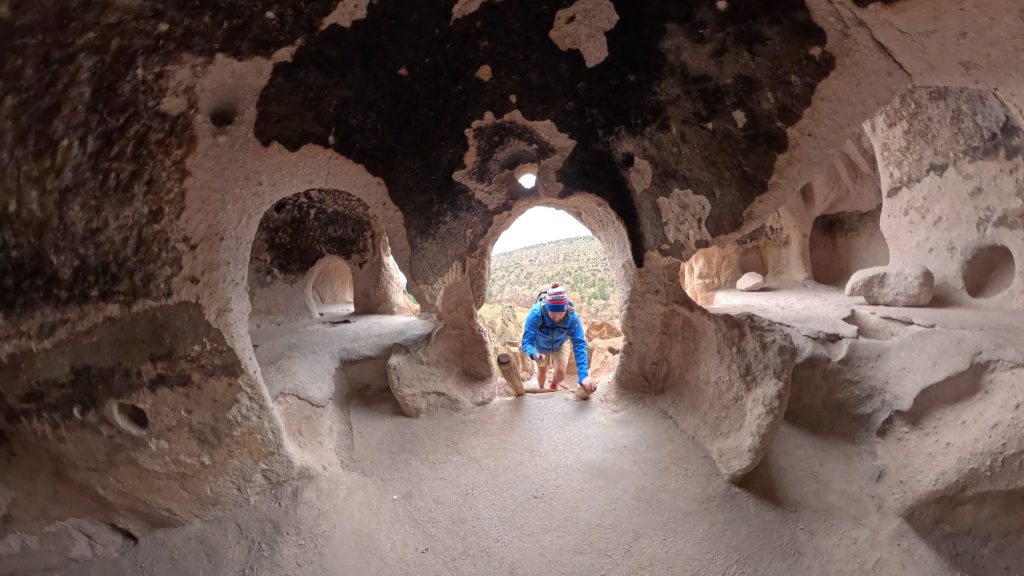
Trail X Factors: Cavates
If you are reading this blog, chances are you want to check out the cavates in the Monument. These are mini cave-like dwellings the tribes of the area used to inhabit hundreds of years ago. They all require a little (or larger series of) climbing via ladders to access. These ladders are generally open year round but can close, temporarily, due to ice and poor conditions.
Hike Tip(s): When visiting the Monument, BE SURE to add on nearby Tsankawi which is located outside of the main Monument area but a must visit if you are in the area. Read more about that side quest here.
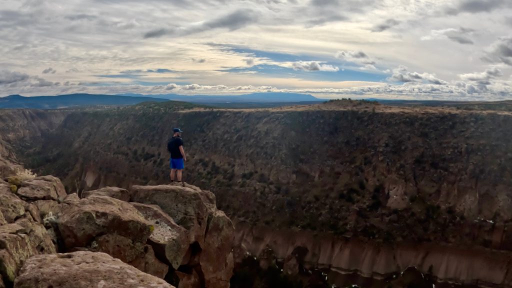
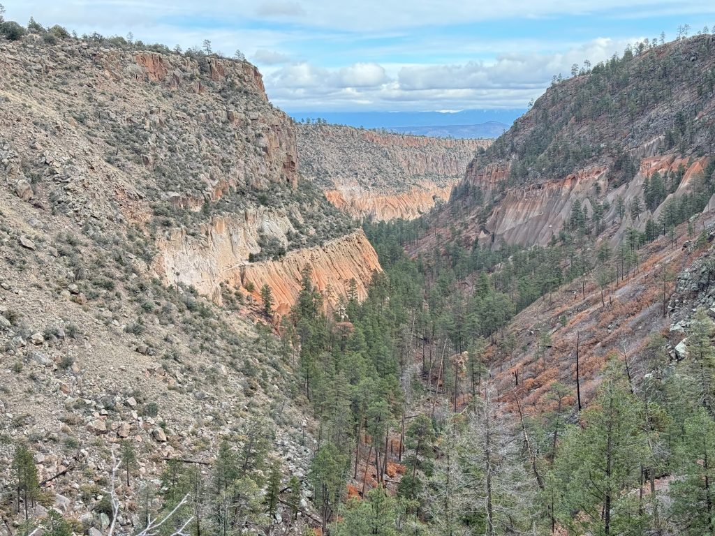
Best Views: Although it requires a much larger loop – I do recommend checking out the multiple canyons in the park. They offer fantastic views of the nearby mountains and provide a break from all of the people near the Pueblo Trail.
Gear Needed
- Men’s Trail Runners
- La Sportiva Cyklon
- La Sportiva Trango Hiking Boots (Men’s)
- Backpack (Winter)
- Backpack (Summer)
- Sunglasses
- Base Layers
- T Shirt
- Mid Layer
- Rain Jacket / Shell
- Pants
- Shorts
- Socks
- Food & Water
- Optional: Water Filter
- Optional: Garmin inReach
- Optional: Hiking Poles – 120CM
- Optional: Headlamp
- Optional: Garmin Fenix Watch
- Optional: GoPro, Joby Tripod, Selfie Stick, GoPro Max 2 , Drone, Insta360
- *Links included in this description might be affiliate links. If you purchase a product or service with the links that I provide I may receive a small commission. There is no additional charge to you.
Bandelier National Monument Loop
I ended up running about a 19 mile loop that visited the Yapashi Pueblo, Alamo Canyon and Frijoles Canyon in addition to the Pueblo Loop.