High Lonesome Loop Hike Guide
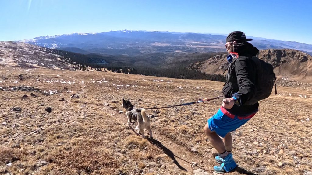
The High Lonesome loop is a 15 mile trail that runs through the Indian Peaks Wilderness of Northern Colorado. This loop is popular with hikers, backpackers and trail runners and passes several high alpine lakes along the way. This trail provides access to popular spots like: King Lake, Bob & Betty Lakes, and Devils Thumb lake while topping out along the Continental Divide. Its a Colorado classic and one of the best in the Indian Peaks Wilderness.
High Lonesome Loop Quick Facts
High Lonesome Loop Rating: ★★★★ (4/5 Stars)
Virtual Trail Guide: High Lonesome Loop
Distance: 14.5 – 15.5 Miles
Elevation Start: 9,058ft
High Point: 12,131ft
Total Elevation Gain: 3,300ft (Although my watch showed much more)
Estimated Time to Complete: 4-8 Hours to Multiple Days (Backpacking)
Difficulty: Moderate to Difficult What does this mean?
Class: Class 1– What does this mean?
Season: June – October (Expect snow outside of this window)
Crowds: Moderate to High (Depending on point of trail and time of year)
Directions to High Lonesome Loop
Trailhead: Hessie Trailhead
Getting Here: The Hessie Trailhead is located on the immensely popular Fourth of July road located just outside of Nederland, Colorado. To get to the High Lonesome Loop, navigate to the accessible trailhead below. If you have a higher clearance vehicle + the ability to drive on rough roads, continue another .5 miles at the fork in the road to the standard trailhead. Note: there are not many areas to turn around on Hessie Road (the last .5 miles) so proceed with caution.
Parking: There are two main areas to park at the Hessie Trailhead: at the 4×4 trailhead (room for about 4-6 vehicles) or along the Fourth of July Road. Parking along the road is the first spot to fill up and will on almost all weekends and some busy weekdays. DO NOT park outside of the signed areas, you will get a ticket and make access harder for future hikers. The 4×4 trailhead along Hessie Road is not maintained but is, in most years, doable for a high clearance 4×4 or AWD car. There are two big rocks at the start of the road that are tricky to navigate without scraping but after that the road is not too bad (if you are used to driving rough mountain roads).
Shuttle: If both parking areas are full or you just do not want to deal with parking, there is a free shuttle that runs seasonally from the Nederland High School. Typically the shuttle runs from mid May to late October and more information can be found here.
Permits/Fee: No fee required.
Summary
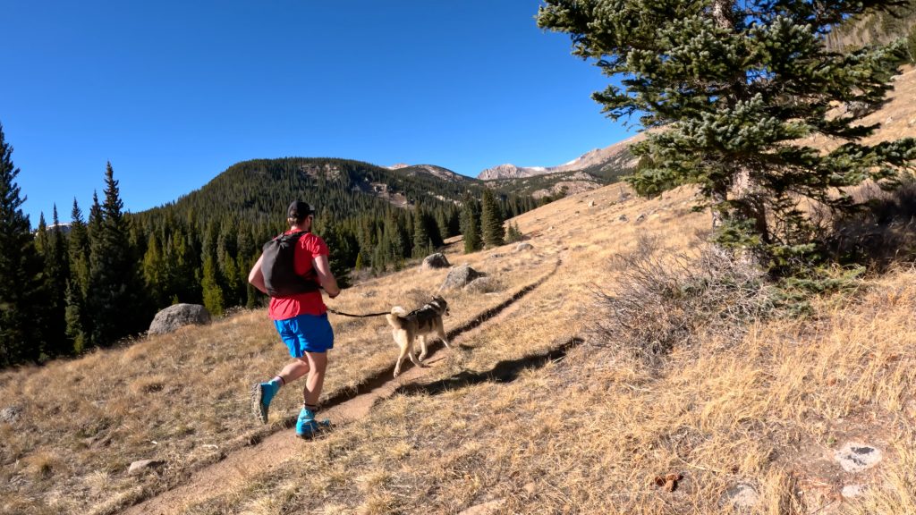
Dogs: The high lonesome loop is absolutely dog friendly and has plenty of sources of water, almost year around, to pump and refill H2O for both you and your pup.
Camping: This loop has a variety of places to camp along the hike itself. Please visit this page to reserve your camping permit ($11 as of 2025) and learn more about the process for camping along this loop. Generally speaking, the most popular spots to camp would be at Jasper Lake, Devils Thumb Lake and King Lake. A popular side quest would be to add on Bob and Betty Lakes which I detail more about below.
Make it a Loop: The high lonesome loop is exactly that with endless options to extend your hike. The most common would be: adding Woodland Lane and Skyscraper reservoir, Diamond Lake and Bob and Betty Lakes. All of these options would add several miles to this loop but are all accessed along the same standard trail.
Hike Tip(s): Water, Wind & Bugs
Even in November, it’s fairly easy to find running water along this loop. Save yourself some weight and travel light and pump/refill when you need to.
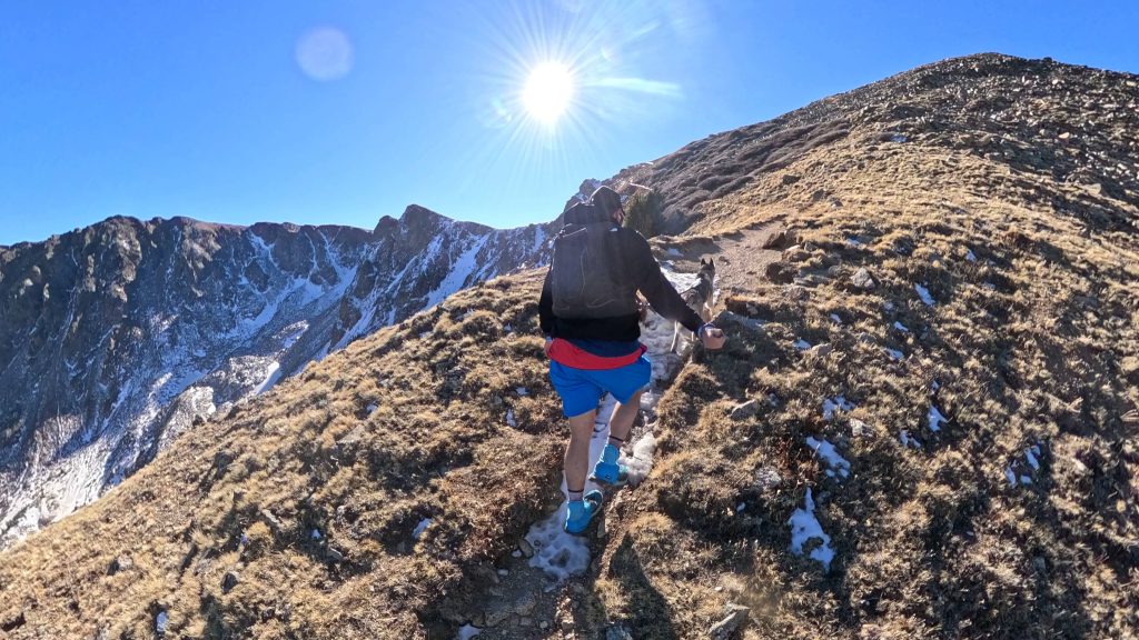
In terms of weather, you will want a good day for this loop but always expect to have higher winds than forecasted. For some reason, in this part of the state, in particular along the Continental Divide itself, the winds can be absolutely awful even when not forecasted.
If you are traveling during the late Spring and Summer months (June – August) you will want to have bugspray for this one. There are lots of sources for water in this area which = lots of sources for mosquitoes.
Trail X Factors: Trail Junctions
Any time you hike, trail run or backpack it’s a pretty ideal idea to have a map of where you are going. However, for some hikes and runs you could get away without one. Due to the number of trails the high lonesome loop passes, you will want to make sure you have a map downloaded to your phone or a printed copy on you. Going the wrong way at some of these trail intersections could add miles to your day or even worse, bring you to a completely different end destination.
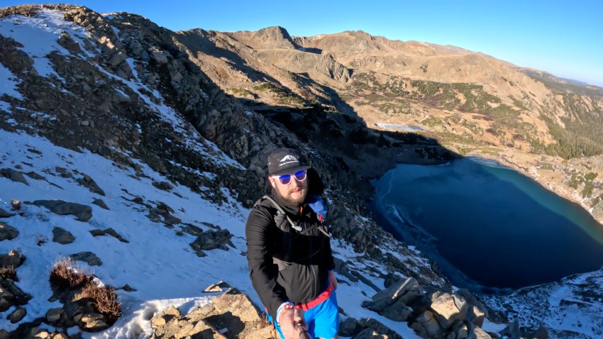
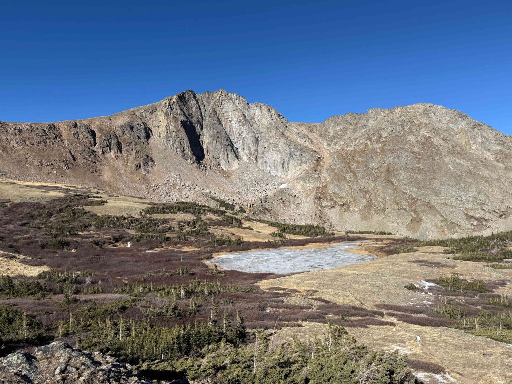
Best Views: I need to preface this statement with: I have only run this loop once and it was in shoulder season. For those not familiar, it’s when almost everything in the high alpine is dead or dying and so natural beauty, at least on the ground, is not exactly thriving. However, my favorite views were right before the Continental Divide and at King Lake. Although we did not see any, wildlife is also extremely common to see in this area. This hike is absolutely beautiful for almost the entire loop, shoulder season or not.
Gear Needed
- Sunglasses
- Running Vest
- Running Vest (Larger)
- Sun Hoodie
- T Shirt
- Jacket
- Running Shorts
- Hoka Mafate 5
- Hoka Speedgoat
- Hoka Challenger 7
- Running Nutrition
- Water Filter
- Water Soft Flask
- Watch
- Heart Rate Monitor
- Hiking Poles – 120CM
- Optional: GoPro, Joby Tripod, Selfie Stick, GoPro Max 2, Drone, Insta360 *Links included in this description might be affiliate links. If you purchase a product or service with the links that I provide I may receive a small commission. There is no additional charge to you.