Carrauntoohil Ireland’s Highest Mountain Hike Guide
Carrauntoohil is Ireland’s highest mountain at 1,038 meters or 3,407ft. While many hike this mountain from the popular Devil’s Ladder route, a great alternative option is to hike this mountain from Caher Mountain, Ireland’s 3rd highest peak. A hike up Carrauntoohil is challenging due to the tough terrain and unpredictable weather. This hike is only recommended for experienced hikers on a day with great weather. However, if you are able to hike Ireland’s highest peak on a clear day, the views are absolutely stunning.
Carrauntoohil Ireland Quick Facts
Virtual Trail Guide: Carrauntoohil & Caher Mountain
Carrauntoohil Rating: ★★★★★ (5/5 Stars)
Distance: 8 Miles/12.8KM RT (Including Caher Mountain)
Elevation Start: 453ft (138m)
Summits: 1,000m/3,300ft (Caher Mountain), 1,038m/3,407ft (Carrauntoohil Peak)
Total Elevation Gain: 1,214m/3,985ft
Estimated Time to Complete: 5-8 Hours RT
Difficulty: Moderate to Difficult What does this mean?
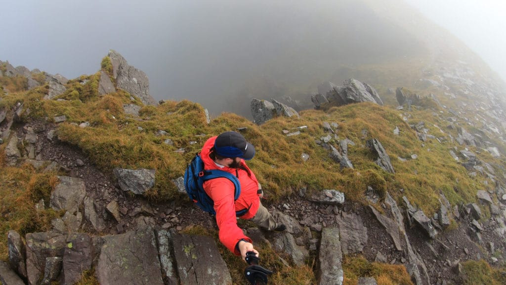
Class: Class 2 – Easy to find Class 3 on this ridge as well – What does this mean?
Season: May– October – Expect snow outside of this period
Directions to Carrauntoohil
Trailhead: Hydro Road Carpark
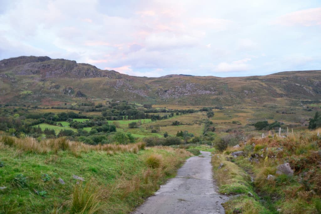
Getting Here: From Kilarney, there are a few ways to get to the TH. It’s best to just enter Hydro Road Carpark into your favorite navigation app. The roads are all paved but do get quite narrow as you get close to the parking area.
Parking: The Hydro Road Carpark has room for about 20 cars with no restrooms at the TH.
Fee: As of 2021, there is no fee for this hike.
Summary
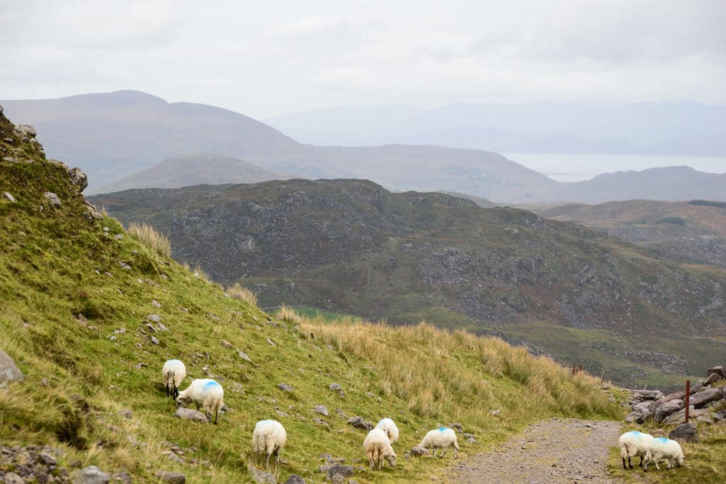
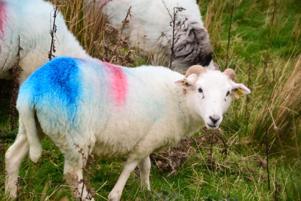
Dogs: Dogs are not allowed on this hike since this is private farming land with sheep all over the mountainside.
Camping: Since the majority of this hike is on private land, there are no good camping options in the area. Your best bet to stay close to this hike is finding somewhere in nearby Killarney.
Make it a Loop: On this day, I did hike this as an out and back hike. However, you can add Carrauntoohil to a lollipop loop by adding the Coomloughra Horseshoe. If you add this ridge, expect more class 3 scrambling, heavy exposure in areas and a lot more challenging terrain. I would highly recommend this route on a clear, dry day which unfortunately I did not have on my hike.
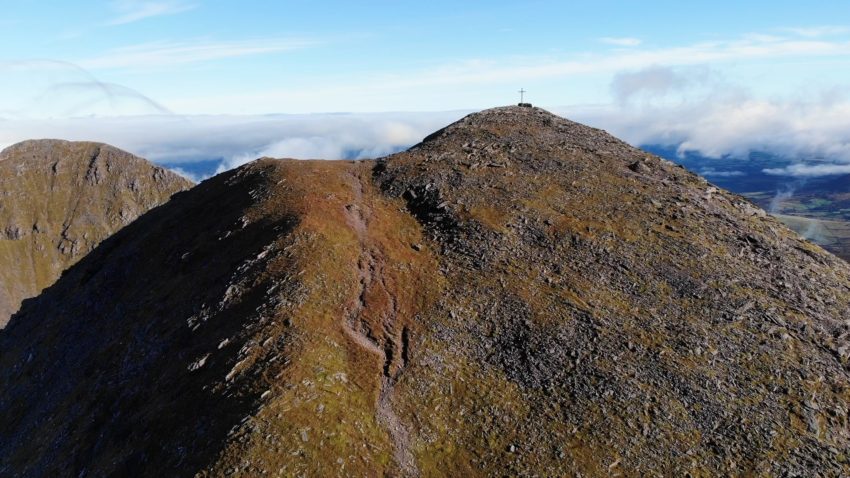
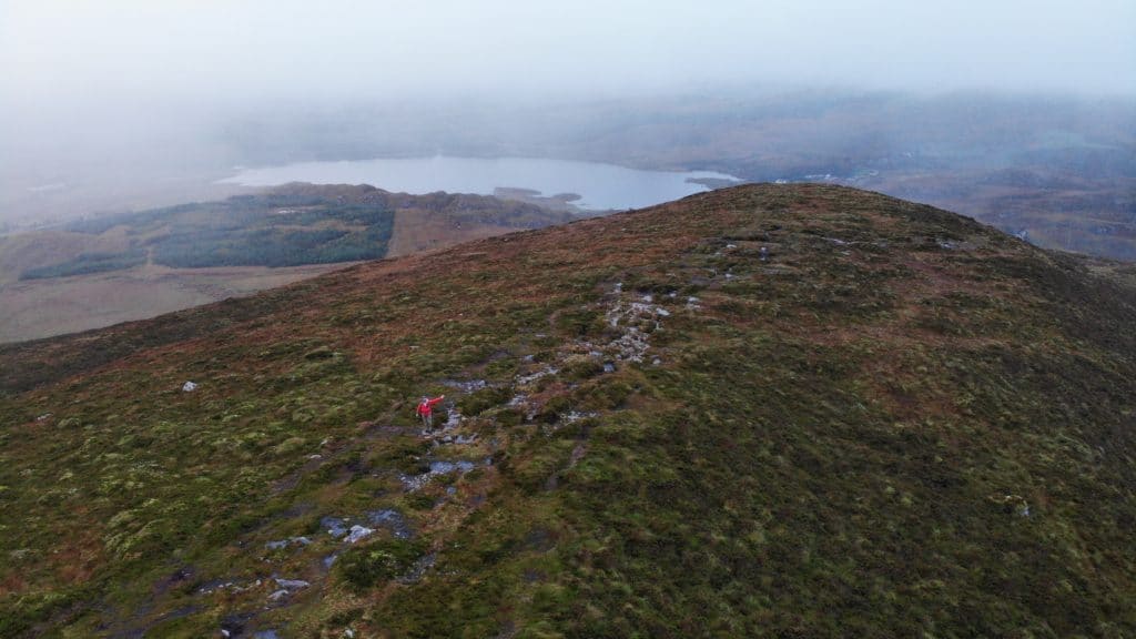
Carrauntoohil & Caher Mountain Hike Route
Trail X Factors: Weather
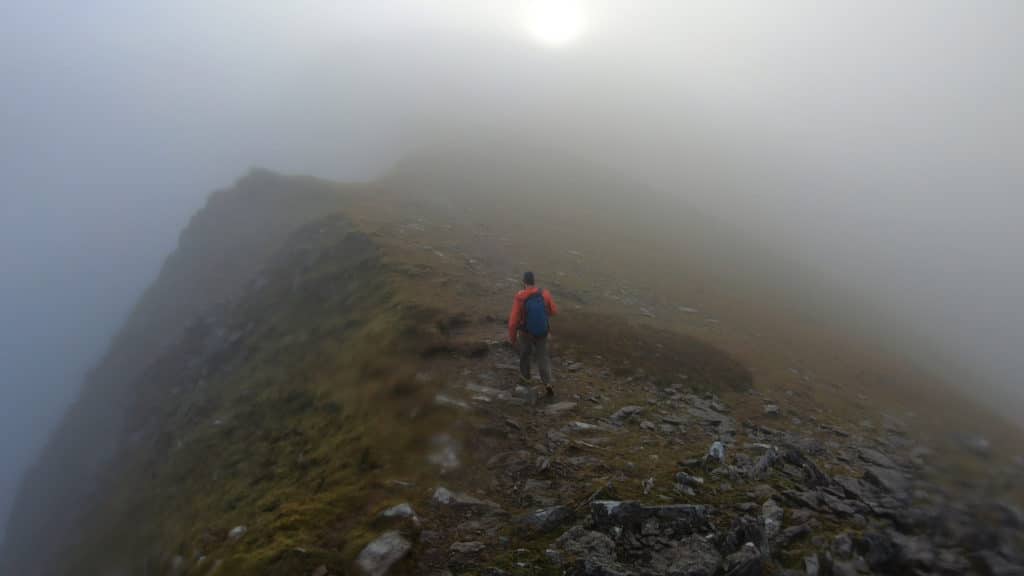
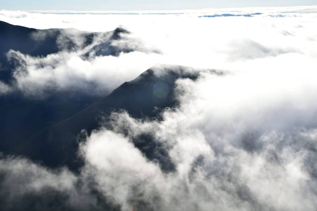
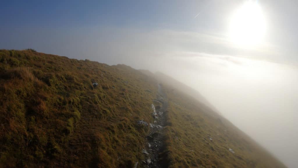
When hiking any mountain, it’s important to research and keep an eye on the weather. However, when hiking Carrauntoohil Peak, I think it’s a bit of a different animal. I made two attempts on this peak, the first day I arrived to Lough Gouragh and it was almost like the mountain was yelling at me. Winds over 50MPH, rain hissing down from the sky and the mountain shrouded in clouds. Needless to say, I didn’t go any further. On my second attempt, I spent hours hiking in the clouds, misting rain covering me. As if from a movie script, I was about 200 yards from the summit and all of a sudden, the clouds cleared and I was greeted with STUNNING views of the entire area. My point in all of this is that the weather here changes RAPIDLY and is extremely unpredictable. Pick a day where winds are low along with rain chances for your best bet at a successful summit.
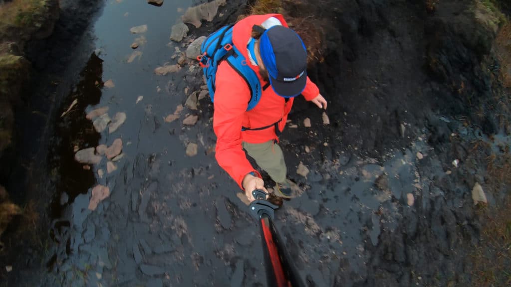
Hike Tip(s): Hiking in Ireland, your mind most likely goes to rain and wet conditions. While this hike does have a lot of rocky terrain, it starts off in a muddy, boggy mess. Even with the best trail finding, you are bound to step at least ankle deep into mud and water. Unless you like hiking in soggy shoes or boots the entire day, I would highly recommend waterproof boots with a high rise to them. If you have extra sensitivity to wet feet, bring some extra socks too. These bogs are only 100-200 meters long but they can ruin your day very quickly.
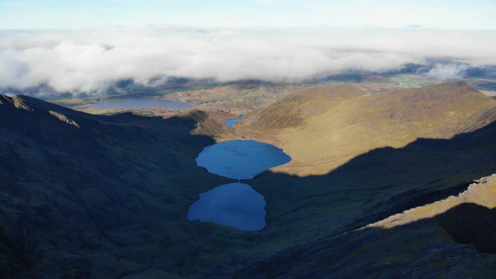
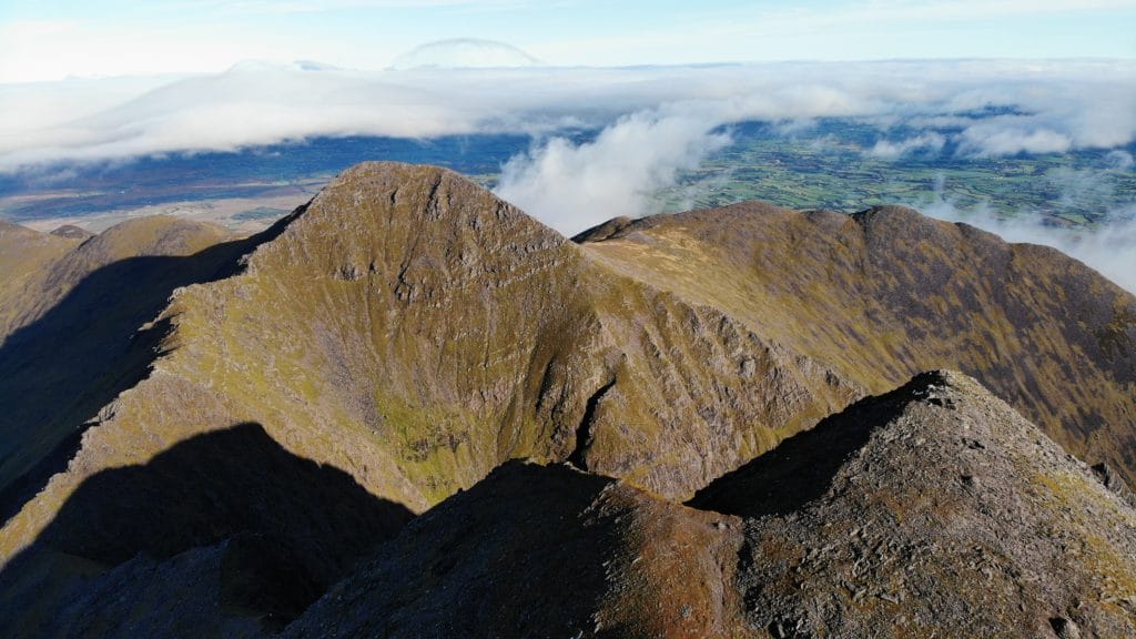
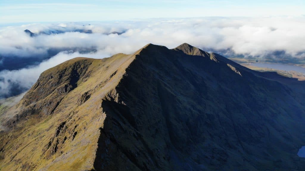
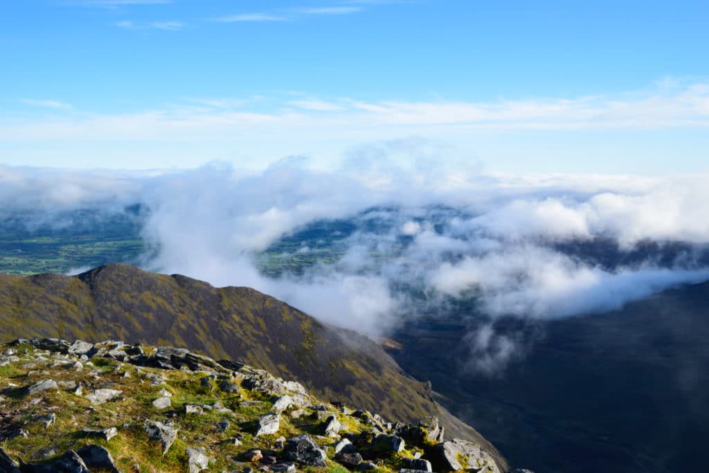
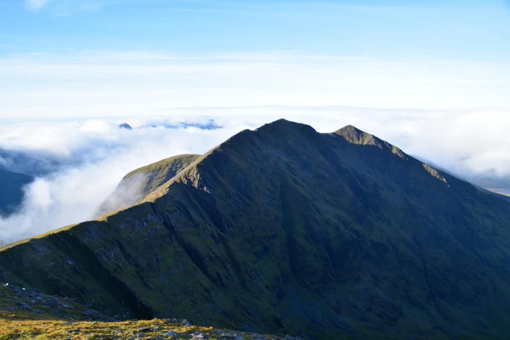
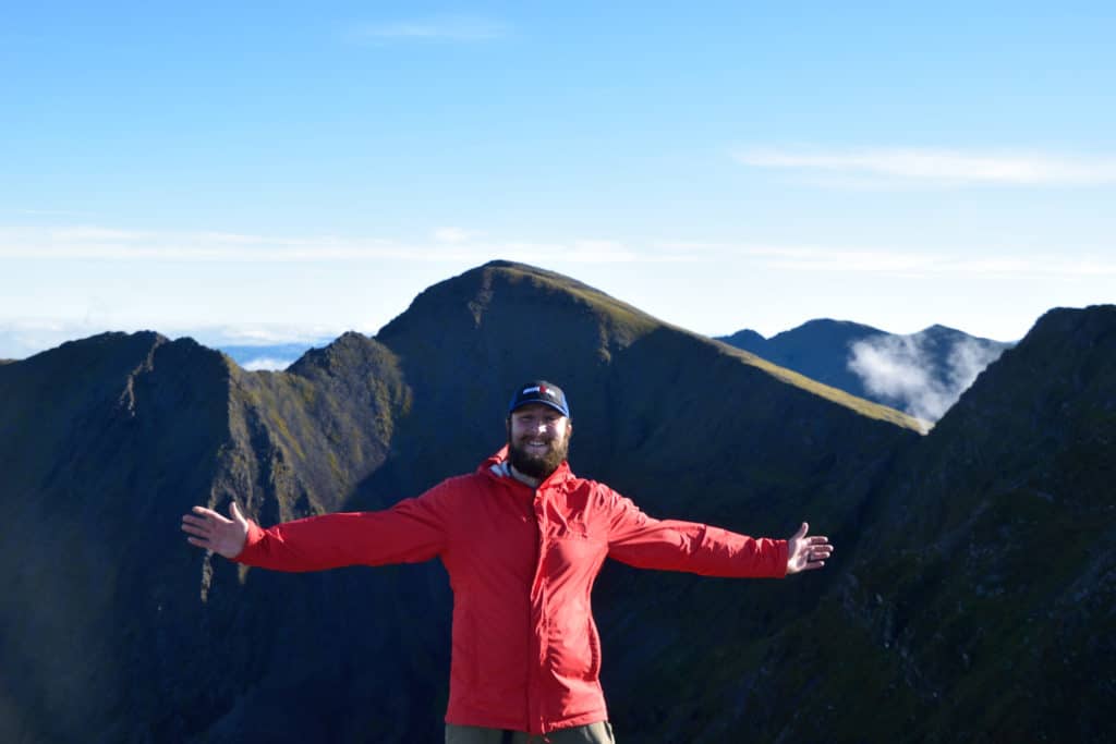
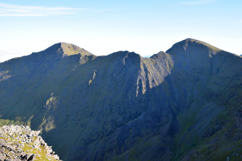
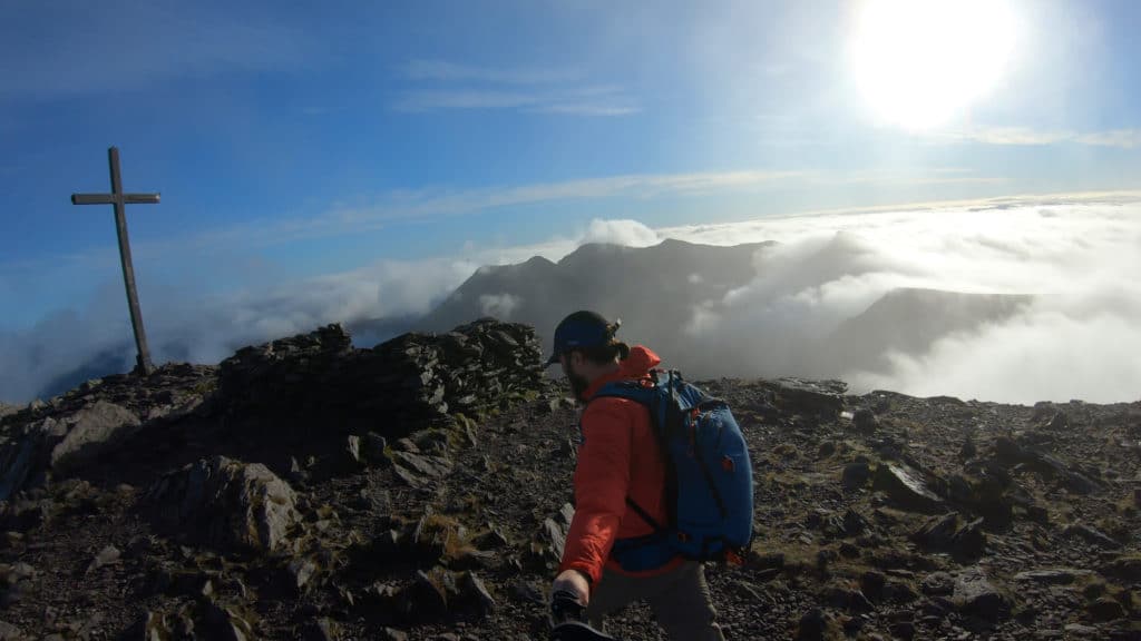
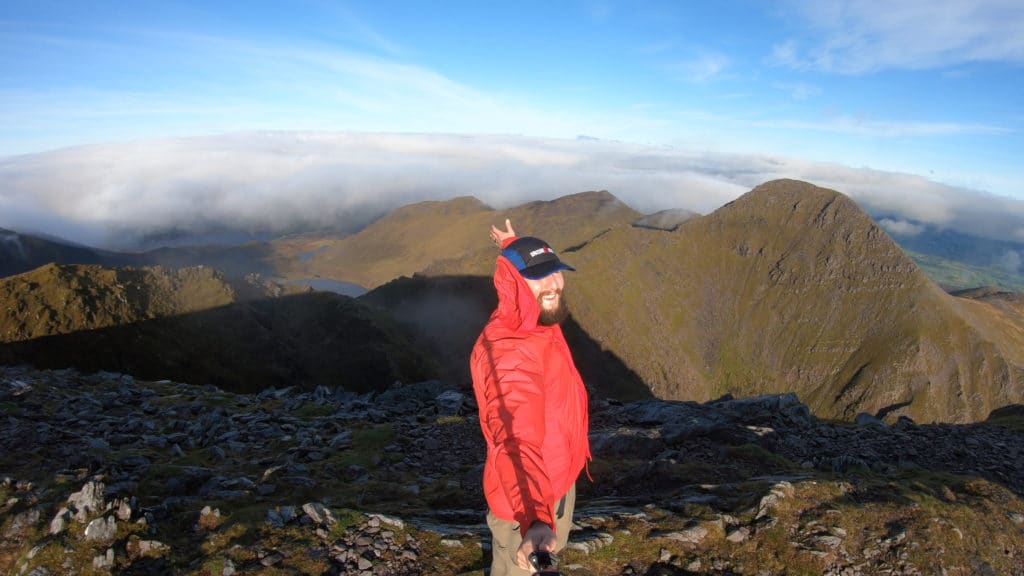
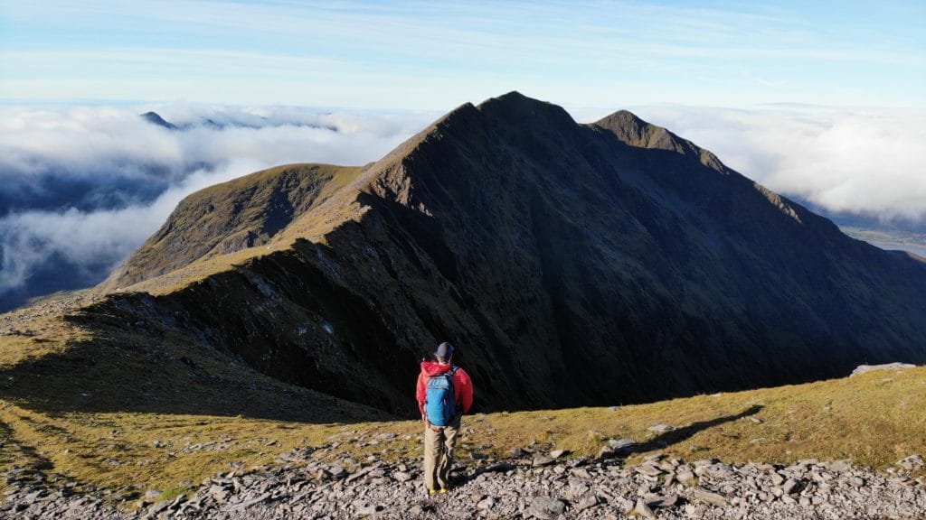
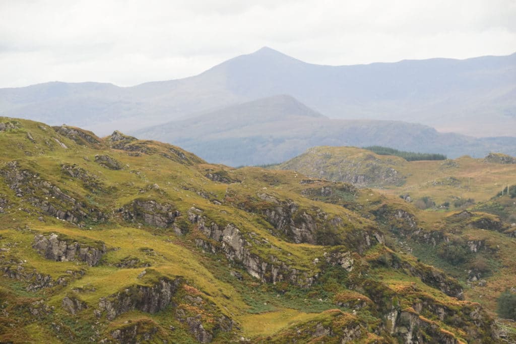
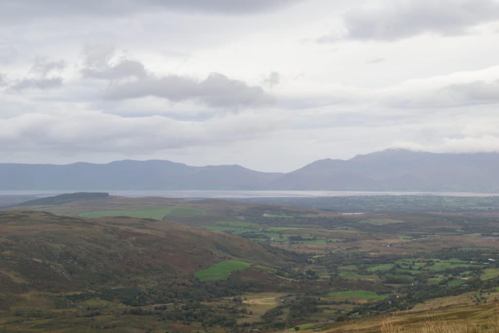
Best Views: If you are lucky enough to have a clear day, the views on Carrauntoohil are absolutely stunning from start to finish. Once on Caher Mountain, you are granted 360 degree views of southwest Ireland/Kerry and to be honest, its very hard to put in words how beautiful this can be. Inverted clouds, neighboring mountains and Loughs everywhere around you. I have seen many beautiful parts of the world and the views up here rival the best of them.
Gear Needed
- 14er Day Hike Packing List
- Men’s Trail Runners – Waterproof/Goretex is a must for the first part of this hike
- Women’s Trail Runnersers – Waterproof/Goretex is a must for the first part of this hike
- La Sportiva Trango Hiking Boots (Men’s)
- La Sportiva Trango Hiking Booths (Women’s)
- Backpack
- Rain Jacket
- Food & Water
- Optional: Waterproof/resistant hiking pants
- Optional: Extra pair of socks
- Optional: Climbing Helmet
- Optional: Garmin inReach
- Optional: Hiking Poles
- Optional: Headlamp
- Optional: Garmin Fenix Watch
- Optional: Camera and Lens
- Optional: GoPro, Joby Tripod
- *Links included in this description might be affiliate links. If you purchase a product or service with the links that I provide I may receive a small commission. There is no additional charge to you.
My Trip to the Carrauntoohil & Caher Mountain: October 2021
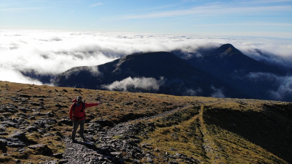
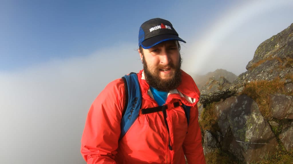
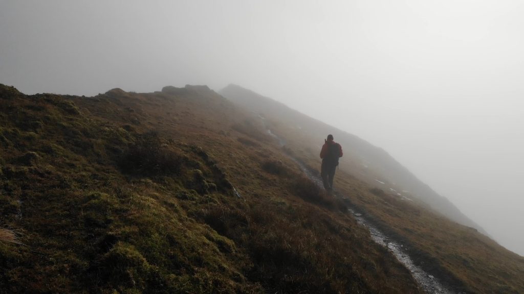
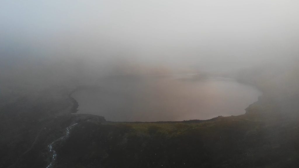
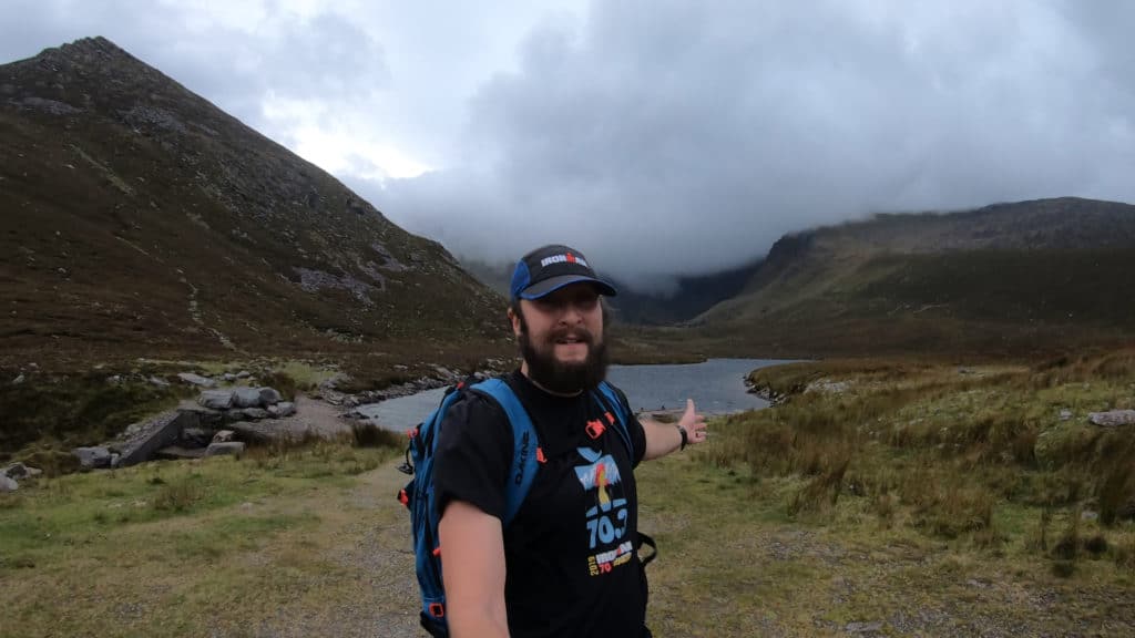
Persistence is the key to any trip in the mountains and my first time in Ireland was no different. On the first day of hiking Ireland’s highest mountain, I hiked in about 1.5 miles and realized, today is not my day. The weather was nasty and the mountain was telling me in its own way, not today buddy! 24 hours later, I found myself back in the same spot and marginally better weather. It was a cloudy day and fog covered Carrauntoohil and Caher Mountain; zero visibility. I decided that I would keep hiking until I felt unsafe and take it from there.
I made my way through the messy bogs that cover the bottom of Caher, stepping in mud multiple times, soaking my previously dry feet. As I worked up to the saddle, passing all the grazing sheep and started climbing the ground dried out a bit, but visibility did not improve at all. Eventually, I found myself near the summit of Caher Mountain, Ireland’s third highest mountain and the views were….non-existent. I was bummed out, but wanted to keep hiking because the winds were minimal and I knew the weather was supposed to be clear today. I hoped the forecast would come true.
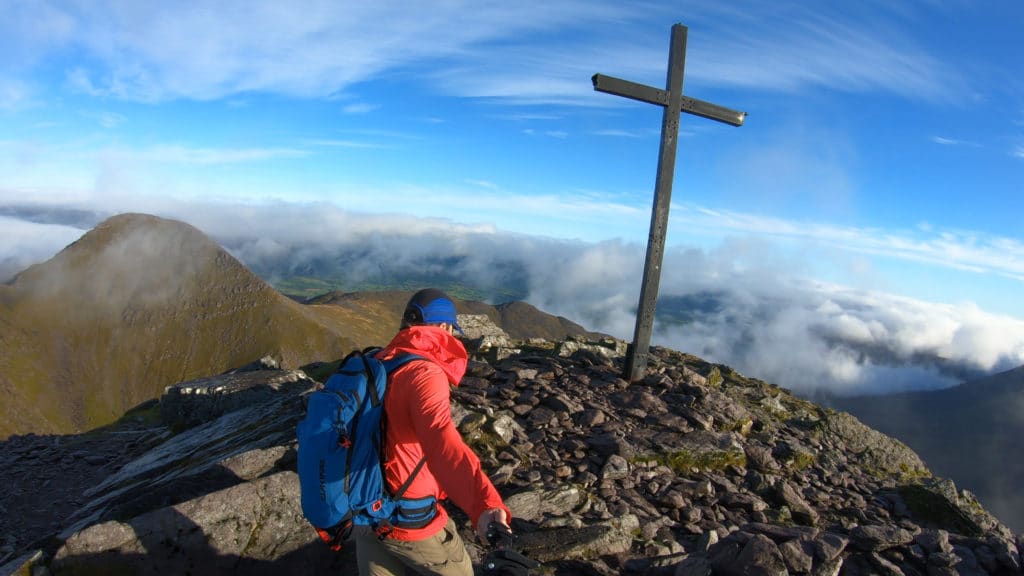
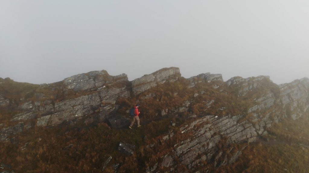
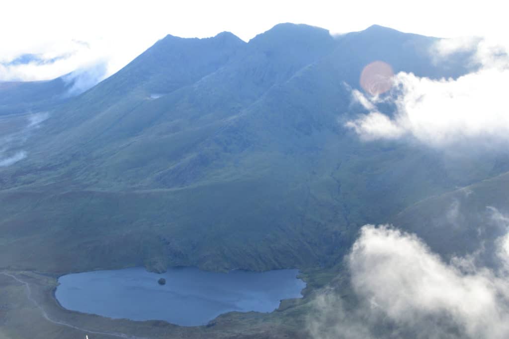
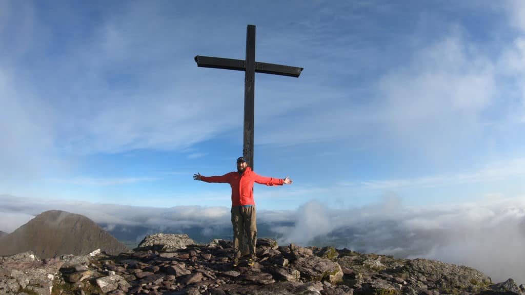
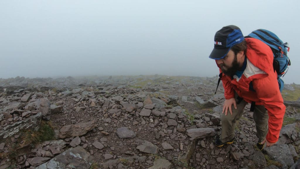
As I worked over to Carrauntoohil, the fog was insane. There were bits of the hike where I could only see about 100 yards in front of me. To say that the views sucked would be an understatement. As I kept hiking, the terrain got more rugged and even had bits of scrambling along the ridgeline. Based on my mileage/distance hiked, I knew that I was near the summit. As I was filming, suddenly, I saw bits of blue sky. Minutes later, the clouds had literally parted and I had stunning views of inverted clouds spilling over neighboring mountains, the beautiful lakes below and the mountains around me. It was almost like a miracle from mother nature. I kept hiking and found myself on the summit of Ireland’s highest mountain just minutes later. The views were absolutely breathtaking. I felt so lucky and was so grateful to literally have the clouds parted for me.
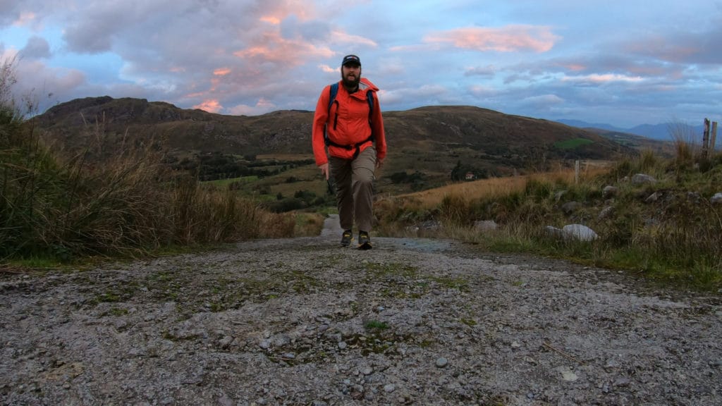
The winds picked up immensely which made my time on the summit short, but I would never forget this day. The hike back to the car was full of me soaking in the beautiful views and taking my time on my last full day in Ireland. Although the Devil’s Ladder route gets all the love, I would highly recommend a hike up Carrauntoohil from Caher Mountain. I would easily revisit this spot to try another route up this beautiful mountain in Ireland.
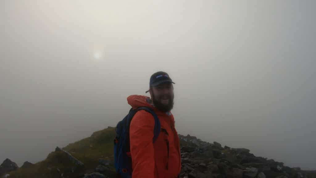
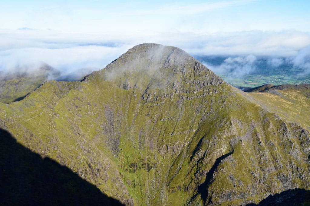
Summit of Caher