La Plata Peak 14er Spring Hike Guide
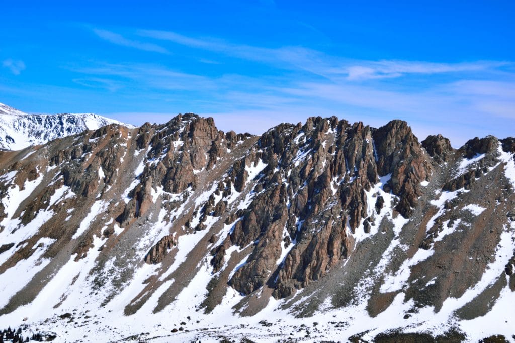
La Plata Peak is a 14er located near Leadville, Colorado. The trail starts near Route 82 (Independence Pass) and is composed mostly of packed dirt and loose rock. Although the hike is under 5 miles to the summit, there is over 4,000 feet of elevation gain during that time period. I would not consider La Plata to be a “beginner” 14er to try, but it certainly not in the harder group either. La Plata Peak can be hiked year round with a variety of different route variations to choose from depending on the season and now levels.
La Plata Peak Quick Facts
Virtual Trail Guide: La Plata Peak
La Plata Peak Trail Rating: ★★★★ (⅘ Stars)
Distance: 9.74 Miles RT (Northwest Ridge Route)
Elevation Start: 10,124 ft
Summit : 14,336 ft
Total Elevation Gain: 4,800 ft
Estimated Time to Complete: 7-9 Hours RT
Difficulty: Moderate – Difficult What does this mean?
Class: Class 2 – What does this mean?
Season: June – October (If you hike outside this period, please consider the winter route)
Directions to La Plata Peak
Trailhead: La Plata Gulch trailhead
Getting Here: Unlike many mountains in the area, the La Plata Peak trailhead can be accessed year-round. From the north, drive past Leadville on US 24 south until you reach US 82 towards Twin Lakes. Take US 82 for about 14.5 miles until you reach the small parking area on the left. If you Google this route during winter months you will see the road says “closed” but you will have no problem getting to the trailhead. You can enter “La Plata Gulch Trailhead” into your favorite navigational device.
Gear Needed
- 14er Day Hike Packing List
- La Sportiva Trango Hiking Boots (Men’s)
- La Sportiva Trango Hiking Booths (Women’s)
- La Sportiva Mountaineering Boots
- Backpack
- Food & Water
- Microspikes – only in snow conditions
- Gaiters– only in snow conditions
- Mountain Axe– only in snow conditions
- Optional: Ski or Snowboard- only in snow conditions
- Optional: Crampons– only in snow conditions
- Optional: Crampon Bag– only in snow conditions
- Optional: Garmin inReach
- Optional: Hiking Poles
- Optional: Headlamp
- Optional: Garmin Fenix Watch
- Optional: Avalanche Gear: Beacon, Probe, Shovel– only in snow conditions
- Optional: Snowshoes– only in snow conditions
- Optional: Camera and Lens
- Optional: GoPro, Joby Tripod
- *Links included in this description might be affiliate links. If you purchase a product or service with the links that I provide I may receive a small commission. There is no additional charge to you.
My Trip to La Plata Peak: April 2017
Working with mother nature is unpredictable. I feel as though I have started many hike summaries with this sentence. My original plan on a late April weekend in 2017, was to hike Mt Massive. I knew there was still a lot of snow, but was hoping the dry spell we had been experiencing would have melted a lot of from lower elevations. I left the Front Range around midnight and after a quick photo-stop, arrived to Mt Massive around 2:30AM. I drove several miles towards the trailhead until I realized the snow still covered much of the seasonal road (Halfmoon Creek). I hit a complete snow roadblock around 1.5 miles from the TH. Given this hike was over 14 miles without this extra walk, I decided to pursue other options. I knew La Plata Peak was close and accessible during the winter, so decided to head there instead.
When I arrived to the La Plata Gulch trailhead, there were 5-6 other cars of splitboarders getting ready for the long trek to the summit. After a failed drive to the other trailhead, I was ready to go as soon as I pulled into the parking area. I filmed a quick hike review segment, popped on my new backpack, turned on my headlamp and hit the trail. My headlamp died about 5 minutes later. Great start to the day. I crossed the two bodies of water that are near the start of the trail up to La Plata Peak and was joined shortly thereafter by the large group of splitboarders who had started a couple of minutes after me. We made our way through the darkness, following the well traveled trail. Eventually, we reached the same creek we had crossed earlier which snaked its way up through the valley. Lucky for all of us, there was enough snow covering the creek which allowed us to hike right up it, instead of working around it. Traveling up the creek was slow going and was the first time during the day I decided to pop on my snowshoes. During our travels up the creek, the split boarders eventually distanced themselves from me and I was left again in darkness and silence.
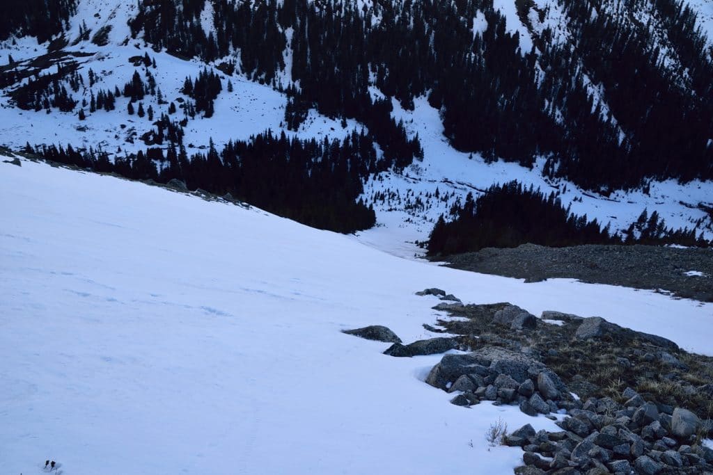
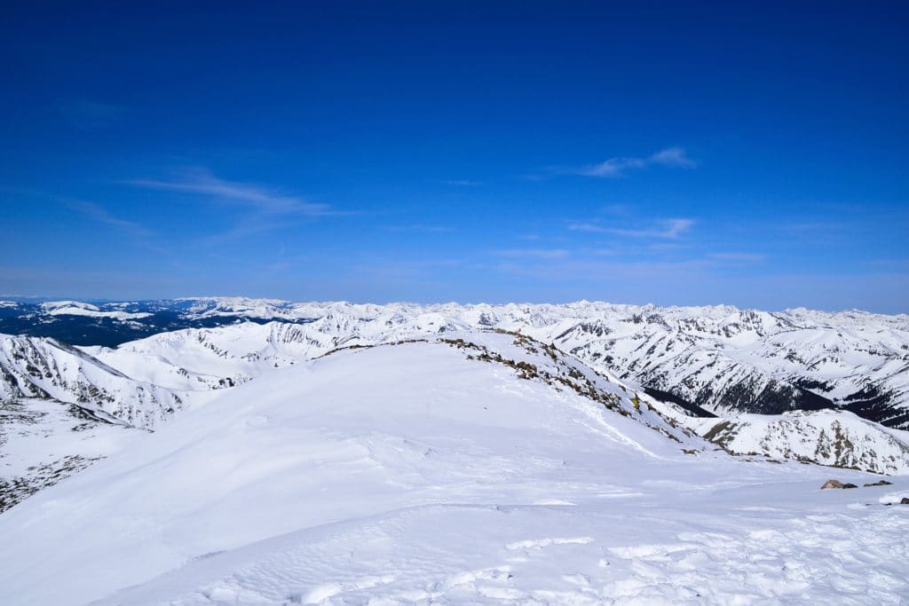
When I reached the top of the creek and entered into a valley to the west of La Plata Peak, the sun was starting to rise. At this point, I did my best to follow the trail, but with the large base layer of snow, it was hard at times. I slowly crunched my way through the crusty snow, through the woods and ascended up the side of the ridge towards La Plata Peak. I spotted the group I was following earlier in the distance and knew I was going the right way. At this point the it was about 6:30AM and the sun was just starting its long journey across the sky. I spotted the switchback of the summer trail in the distance and headed towards it. It was nice to see the trail again because I had been hiking off it for about a half hour. I continued through another large field and eventually reached the northwest ridge of La Plata Peak. I could see the summit in the distance, but based on my watch GPS, knew I still had over a mile to go.
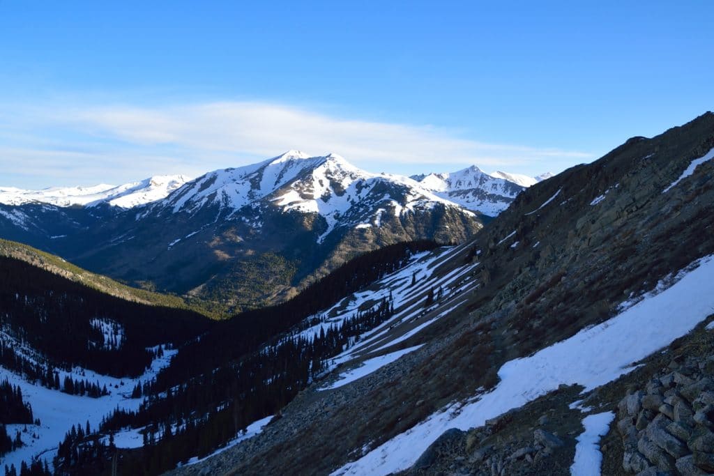
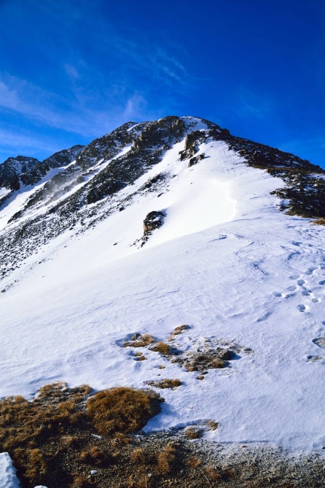
My first plan along the ridge was to follow the splitboarders’ path. I did this for about a ¼ mile until I reached a wind blown area of the ridge. I then popped off my snowshoes and stored them under a rock so I could save some weight up to the summit. I popped on my microspikes and continued up towards the top. The wind started to pick up at this point and the thousands of feet of elevation gain, sleepless night, and empty stomach were all starting to catch up with me. After another 20 minutes of hiking through the snow, I realized that I was going a direction that with my current set-up (no snowshoes) was much harder than it needed to be (that’s what she said). I looked about 20 yards to my right and saw an exposed trail with absolutely no snow. I wanted to punch myself for how stupid of a decision I had made. I worked over to the summer trail and continued to follow this up to the summit which I reached about 25 minutes later.
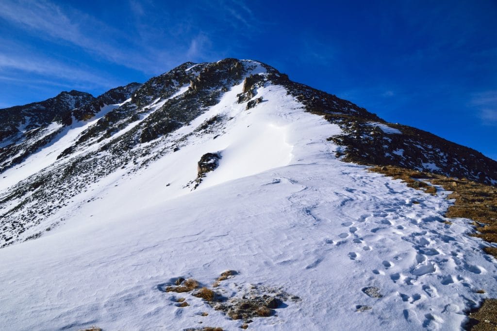
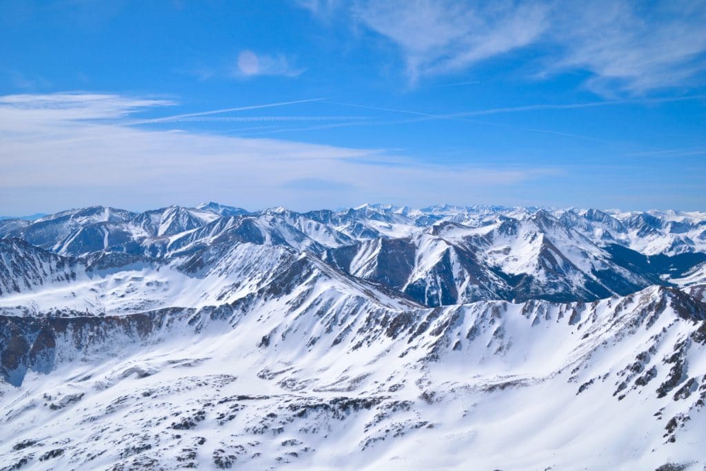
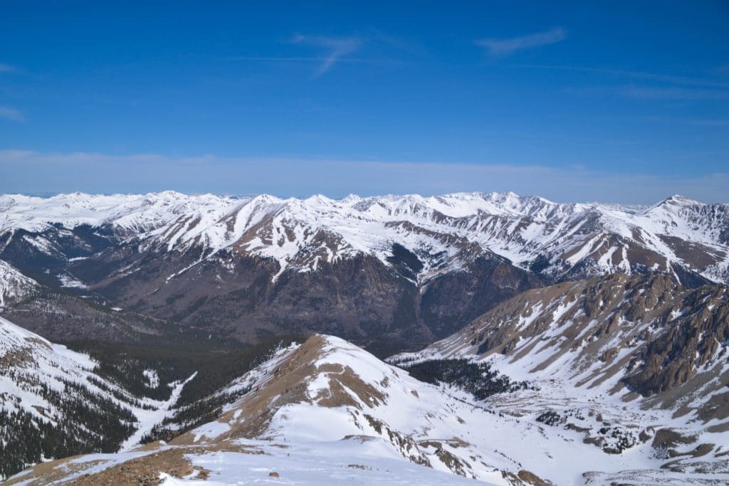
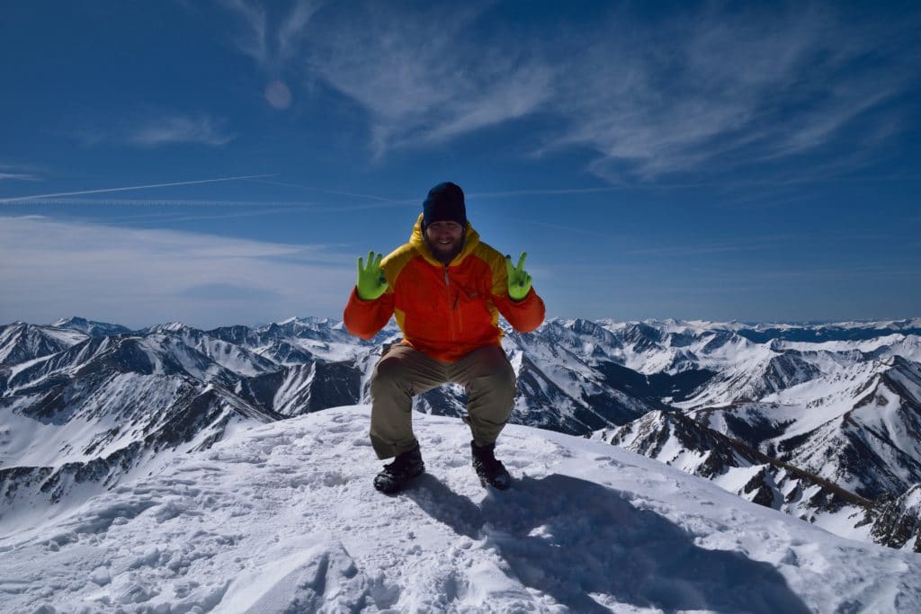
The summit of La Plata Peak was beautiful. You could see snow covered mountains in all directions and besides the three splitboarders who had yet to descend, I had the top all to myself. I re hydrated, snapped some pictures, chatted with the other guys up there and actually enjoyed myself. This was 14er number 24 for me and I was thrilled to have crossed this one off so early in the season. After about 15 or 20 minutes, I started down on the trail back towards the car. I knew that if I basked in the morning sun too long, I would be making my trip down much harder in the soft spring snow.
The descent from the summit was pretty uneventful until I was off the ridge and back on the steep slopes I had crossed earlier in the morning. I noticed several signs of snow slides and small wet avalanches which made me very cautious. I still had on my microspikes at this time and found that my once solid grip on the snow, was now extremely unreliable. The steep couloirs, which were fun to marvel at a few hours before, were now one missed step away from a long slide down the mountain. I cautiously crossed these and slowly worked down and away from the snow slides that were closer to the summer trail. Even if this route took me longer, I wanted nothing to do with an avalanche. After way too much time, I was finally back at the snow covered creek and started hoping that the snow had not warmed up the snow too much. The last thing I needed was to take a dip into the icy cold mountain water.
I slowly “snowshoed” down the gully and was only about ¾ of a mile from the parking lot. I was mentally exhausted at this point and let my brain fatigue get the best of me. I somehow lost the trail and instead of turning around right away, thought I could just freelance my way back to the car. Big ass mistake. I nearly ended up in someone’s yard, found the stream but was still several hundred yards away from the bridge, took off my snowshoes to post-hole (sink randomly when stepping in the soft snow) and overall made that last ¾ mile turn into over a mile of wandering around. It was so stupid because I was honestly, at the most, only about 3-4 hundred yards away from the trail. I could see my path from the morning hike on my GPS but somehow could not locate the trail. After about 15 minutes of just hanging out in the woods, I FINALLY reconnected with the trail and half jogged to the parking area. I was dead and just wanted to go home and sleep.
Spring hiking is always a gamble but I was thrilled with the gear (snowshoes, microspikes, ski poles, and mountain axe) I had brought with me and my ability to adapt to the negative circumstances. I am sure La Plata Peak is a fine mountain, but after my long morning on the mountain, I have absolutely no desire to go back.