Colorado Trail Segment 4 Hike Trail Guide
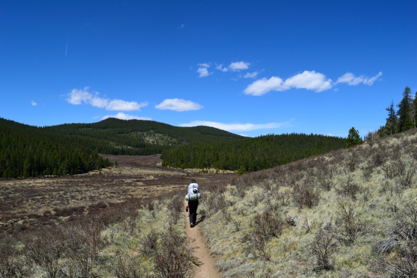
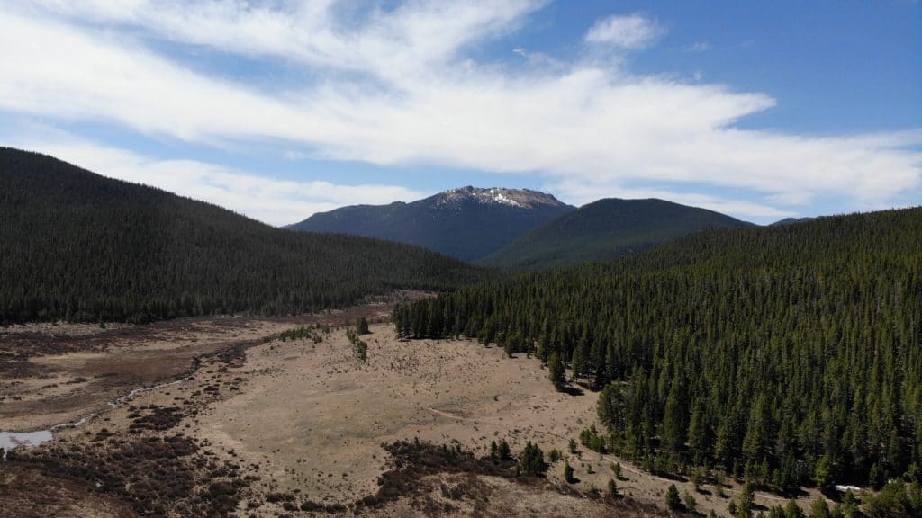
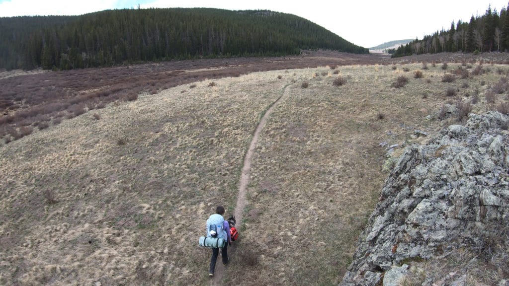
Colorado Trail Segment 4 is by far the most pretty of the first 4 segments while working through 16.6 miles of hiking and 3,330 feet of elevation gain. The segment starts off with a large climb on miles 3-7, works through a beautiful 5 mile field with endless views and ends in a valley where Segment 5 starts.
Colorado Trail Segment 4 Quick Facts
Virtual Trail Guide: Colorado Trail Segment 4
Colorado Trail Segment 4 Rating: ★★★ (⅗ Stars)
Distance: 16.6 Miles (One Way)
Elevation Start: 8,279ft
Highest Point: 10,929ft
Total Elevation Gain: 3,271ft
Estimated Time to Complete: 6-8 Hours One Way
Difficulty: Moderate Difficulty System Explained
Class: Class 1 What does this mean?
Season: Early May – Early December (Expect snow outside of this period)
Weather: Check the Weather Forecast
Directions to Colorado Trail Segment 4
Trailhead: Rolling Creek/Long Gulch
Getting Here: Start Trailhead (Rolling Creek): From Bailey on US285, take a sharp left on Park County Road 68. Continue on this road for 5 miles until you reach a fork and continue right. After another 2 miles you will reach another fork and stay right again. After another mile, you will reach the Rolling Creek TH on your right. Although you will see other cars do it, you really should park at the lower TH. The roads leading to Rolling Creek TH start off on rough pavement and turn to dirt, but should be accessible in all vehicles.
End Trailhead (Long Gulch): Take 285 to Kenosha Pass and drive for 3.2 miles to reach Lost Park Road on your left. Follow this road for 11 miles and bear left (or park at the lower TH) for another .1 miles to reach the small parking area. The trail starts up the gully and shortly after intersects with the CT. Besides the last .1 miles, Long Gulch TH should be accessible to all vehicles but does travel on dirt roads.
Fees: There is no fee to hike segment 4 of the Colorado Trail.
Parking: Both Rolling Creek and Long Gulch Trailheads have small parking areas that can fit 10-20 cars at the most. Rolling Creek typically is much more busy than Long Gulch, but both see decent amounts of traffic. Neither TH has a restroom.
Summary
Camping: While hiking Colorado Trail segment 4, you will have plenty of options to camp along the way. The most beautiful spots in my opinion are along the field from mile 9-14 but you really can’t go wrong while hiking this segment. In the stretch of hiking miles 3-7, camping spots will be harder to find.
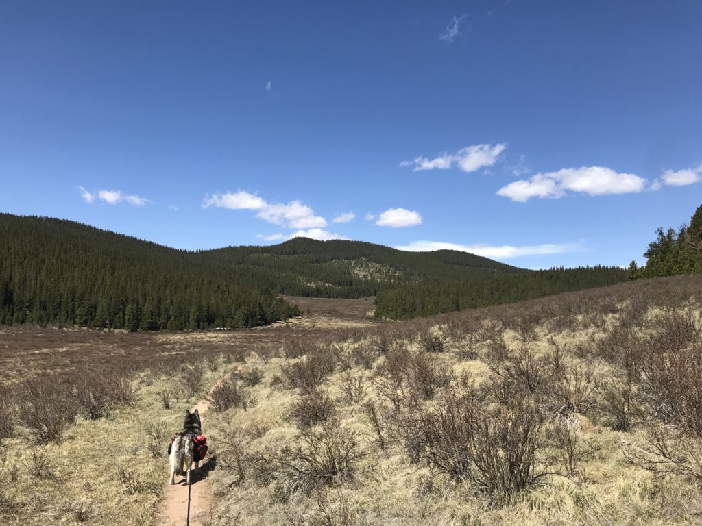
Dogs: Segment 4 of the Colorado Trail is dog friendly, but be sure to bring LOTS of water for your pup if you plan on hiking during summer months or on a hot day. The field section of the hike is basically entirely exposed to the sun which can lead to thirsty pups. As always, please pick up after your dog and pack out all of their poop.
Access to Water: Overall, this segment has decent access to water. The first 5 or so miles are a bit sparse with only a few seasonal sources of water. However, after that you will hike through several consistent sources at mile: 4.7,8.7 and mile 9-14 and 16.6. Water really should not be an issue for any segment or through hikers on this segment.
Make it a Loop: Colorado Trail Segment 4 is an out and back hike.
Trail X Factors: Climbing & Sun Exposure
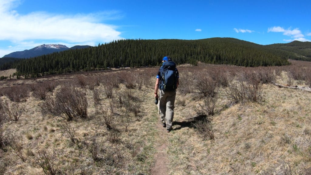
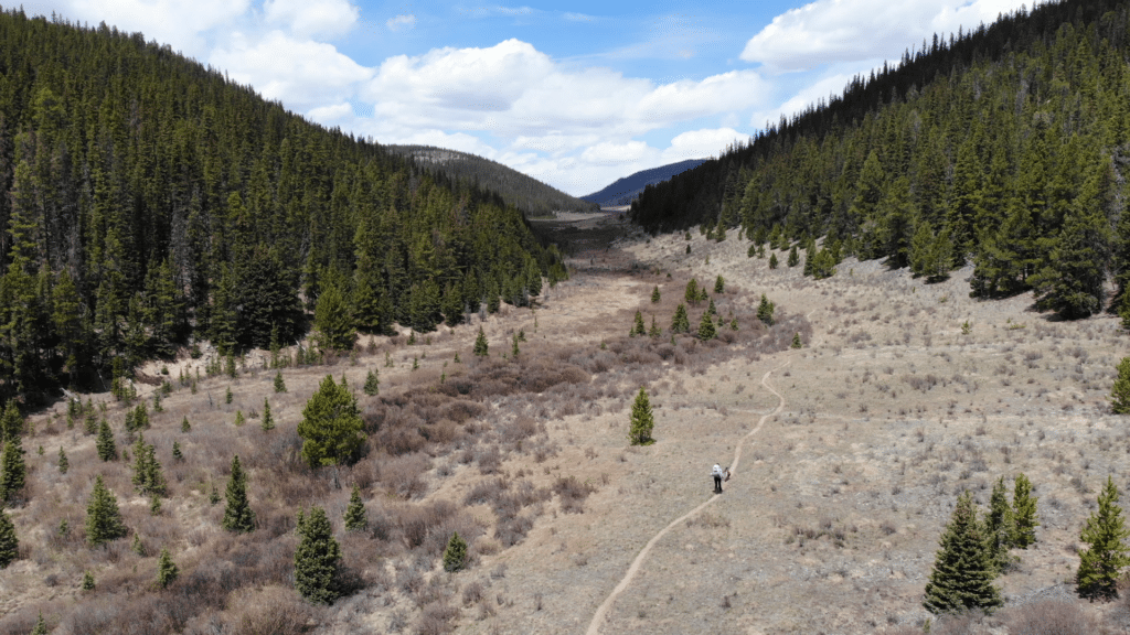
If you are not used to the elevation in Colorado, you will get used to it very fast on Colorado Trail Segment 4. After a flat start near the Rolling Creek TH, the trail picks up about 1,300ft of elevation through miles 3-7. In addition, this is the first time on the trail where your elevation is north of 10,000ft. Although the initial climb in taxing, the remainder of the hike is much more mellow with its elevation gain.
After entering the large meadow at mile 8.5, your exposure to the sun is very high for the next 5 miles. At 10,000ft you will burn quicker than you are used to and become dehydrated quicker on hot summer days. Luckily, there is a creek about 50-200 yards away from the trail at all times during this stretch of hiking.
Mick’s Tips: If you plan on segmenting or through hiking the Colorado Trail, it’s best to wait to tackle segment 4 until late May unless you want to deal with pockets of snow. Large portions of the trail (especially the start and finish) will melt out quickly, but there are several north facing pockets in the trees that will hang on for a while after that. Beware that a large portion of this segment (miles 1.9-8.2) is in the Lost Creek Wilderness which prohibits bikes and motorized vehicles from using the trail.
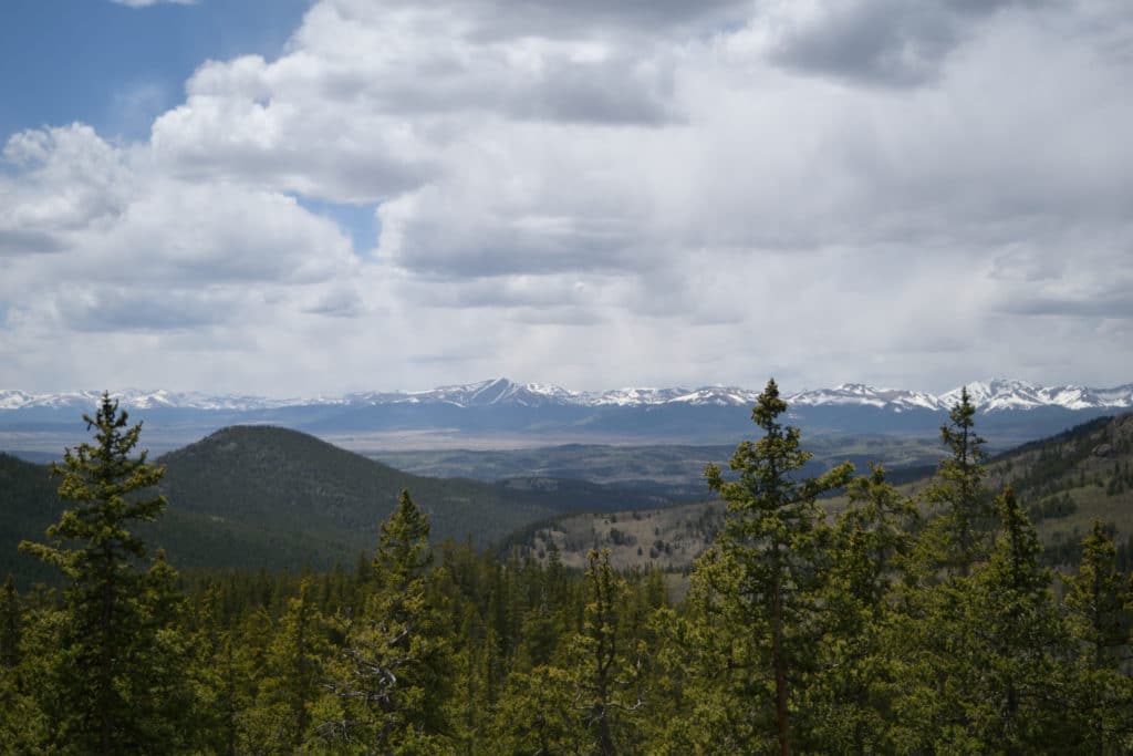
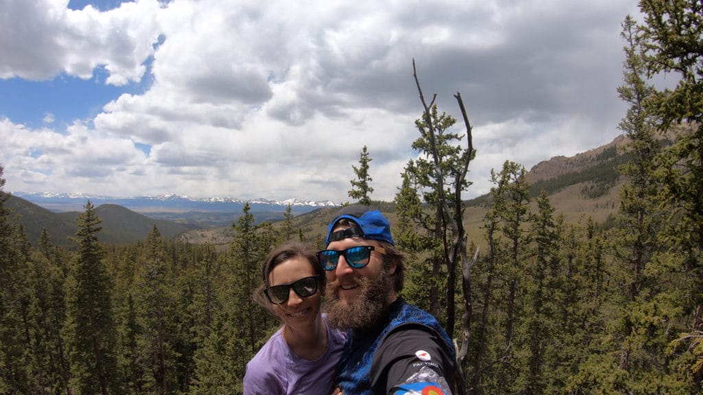
Best Views: In my opinion, Segment 4 offers the best views on the first four segments of the Colorado Trail. Although the hiking starts off with pine forests when you end up in the large meadow, views span in all directions and never end. After leaving the large field on the descent to Long Gulch trailhead, there is a very nice rock outcropping that provides beautiful views of the Sawatch Mountains in the distance. This might have been my favorite spot on the hike.
Colorado Trail Segment 4 Hike Route
Gear Needed
- Osprey Atmos 65 Backpack
- Hiking Shoes
- OR Hiking Boots
- Garmin inReach
- Water Filter OR UV Pen
- Headlamp
- Optional: Tent
- Optional: Sleeping Pad
- Optional: Sleeping Bag
- Optional: Cook Kit
- Optional: Hiking Poles
Jackie’s Gear:
Juno’s Gear
Colorado Trail Books:
- Full Version
- Pocket Guide
- *Links included in this description might be affiliate links. If you purchase a product or service with the links that I provide I may receive a small commission. There is no additional charge to you.
Our Trip to Colorado Trail Segment 4: May 2020
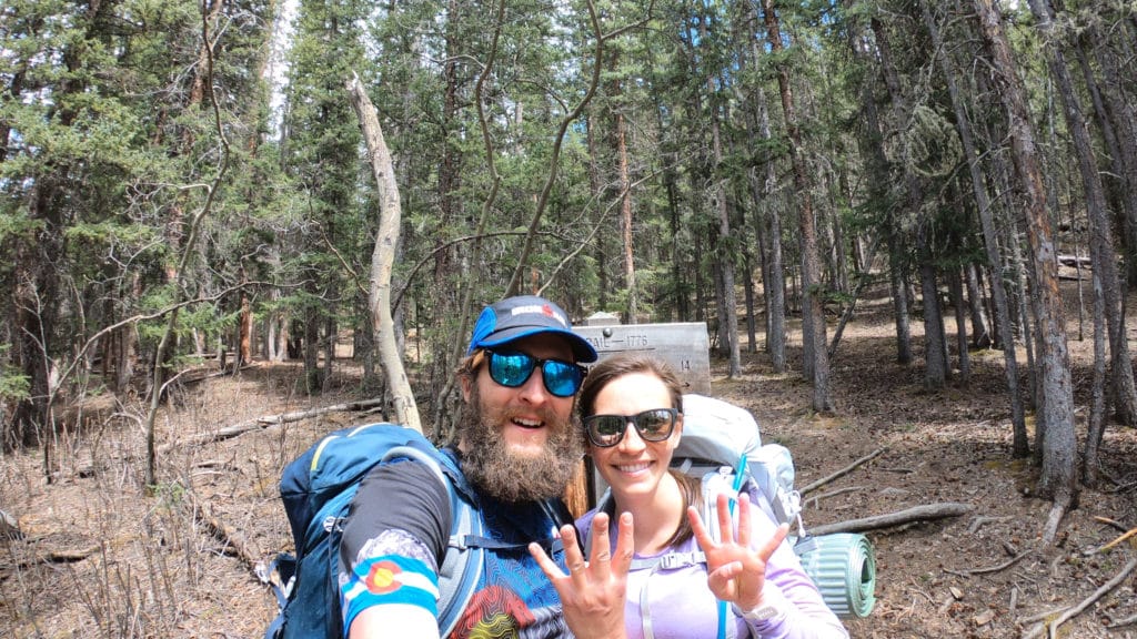
After tackling the first three segments of the Colorado Trail in 2019, Jackie and I were itching to continue our segment hiking of the CT in 2020. May brought us warmer than usual weather and allowed for the snow to melt out a bit early. Juno, Jackie and I hit the trail on Saturday morning with the plan to hike Segments 4&5 over two days. This segment was our favorite of the CT so far, until we hiked segment 5…

Colorado Trail Segment 4 Virtual Trail Guide
Questions or comments about our hike along Colorado Trail Segment 4? Leave a comment below or follow me on Instagram!