
Decalibron 14ers: Democrat, Cameron, Lincoln & Bross Hike Guide
The Decalibron is a popular hike located outside of Alma, Colorado – the highest incorporated town in the United States. The Decalibron features four 14ers: Mt Democrat, Mt Cameron, Mt Lincoln and Mt Bross. Mt Democrat is usually hiked first and then is paired with neighboring Mt Cameron, Mt Lincoln and Mt Bross to make a loop that summits four “14ers” also known as the Decalibron. This hike is a bucket list item for many and is a very tough day on the mountain because of the high elevation, steep gain and exposed terrain. This is not the hike you want to be on if a storm rolls in. Please note that the summit of Mt Bross is private property and land owners do not want you on the summit. Please stay on the bypass trail when hiking Mt Bross. *Please note that as of July 2023 access to the summit is now RE-opened but requires a waiver to be signed electronically at the TH.
Decalibron Hike Quick Facts
Virtual Trail Guide: Mt Democrat, Mt Cameron, Mt Lincoln, Mt Bross
Mt Democrat, Mt Cameron, Mt Lincoln & Mt Bross Rating: ★★★ (3/5 Stars)
Distance: 7.25 miles RT (from upper TH), 9.25 from winter closure
Elevation Start: 12,000 ft
Summit: Mt Democrat: 14,154 ft, Mt Cameron: 14,248, Mt Lincoln: 14,293, Mt Bross: 14,178
Estimated Time to Complete: 6-8 Hours RT
Difficulty: Moderate What does this mean?
Season: June – October (expect snow outside of this period and/or a longer hike since road is closed)
Directions to the Decalibron Hike
Getting Here: Kite Lake Trailhead
Take US CO-9 into Alma. Once you are in the small community of Alma, look for a sign indicating Kite Lake/Road 8. Take this road about 5.5 miles until you reach Kite Lake. The dirt road can have variable conditions and the last ½ -¼ mile can be very tricky to navigate without a high clearance vehicle.
Fee: Although the fee has changed over time, as of 2022 – the fee is $5 (cash or check) to park at the Kite Lake trailhead. Hint: pay at the first one to avoid any backtracking.
Parking: Parking for the Decalibron can get very tricky, especially on busy weekends. There is a small lot at the start of the trail and room for plenty of additional parking along the road. I would highly recommend getting to the TH early so that you can secure a good spot. There are non-plumbing restrooms at the TH.
Summary
Dogs: Dogs are allowed on this hike, but it would not be my first choice for bringing along your hiking companion. Why? The hike up to Mt Cameron is extremely rocky (not great for unseasoned dog paws) and the hike down from Mt Bross is extremely steep and the trail is in poor condition. It was hard for me to keep my footing, I could not imagine trying to hold a dog on a leash at the same time. There are also no water sources along the way (past Kite Lake). Having said all of this, this is certainly not impossible for a dog to hike, so if you have confidence in your dog’s abilities, bring them along. Dogs are expected to be kept on a leash.
Camping: There are about 5-10 camping spots along Kite Lake that generally fill up pretty quickly. If those spots fill up, you can technically camp near your car, just be careful because much of the land surrounding the area is private.
Make it a Loop: This trail is a loop, whoo! If you are looking for another hike in the area, check out Mt Buckskin.
Mountain X Factors: Mt Bross
Without a doubt, the biggest X Factor on the Decalibron is Mt Bross itself. The summit is on private land so you are not allowed to summit Mt Bross. Having said that, hundreds of people a year summit this popular mountain but are trespassing by doing so. Its an extremely murky issue because of the multiple parties who own the land on Mt Bross. According to the Colorado 14ers Initative, the main reason for not opening the summit is the inability to get in touch with all of the land owners. If you decide to summit Mt Bross, know that you are technically trespassing on private land. You can watch a much longer discussion with the land owners about this issue here.
Outside of the murky summit issue, Mt Bross has absolutely terrible trail conditions from the summit back to Kite Lake. I forgot how poor they were but after recently hiking the Decalibron again, I vowed to never hike down Mt Bross again until the trail is better.
Mick’s Tip: If you are looking to add Mt Democrat, Mt Cameron, Mt Lincoln and Mt Bross to your “to do” list, be sure to pace yourself accordingly on the initial ascent from Kite Lake to the ridge. This hike gives you almost no warmup and with an elevation start over 11,000ft, your lungs are going to be huffing and puffing right off the bat. In addition to pacing yourself, be sure to have good weather for the Decalibron hike. There is absolutely not retreat or shelter from any bad weather that comes in once you make the initial climb.
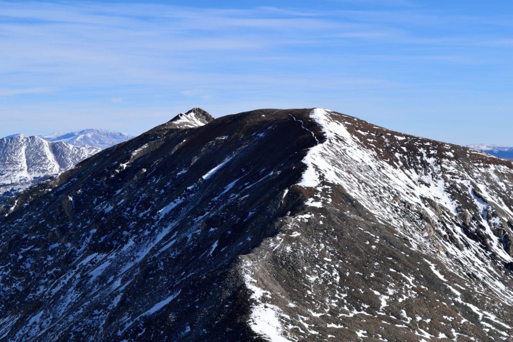
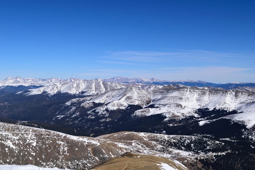
Best Views: This hike allows ample beautiful photo opportunities from the base of the TH all the way up to the summit of Mt. Lincoln and Mt. Democrat. If you do manage to snag the “golden hour” here, you will have your choice of beautiful landscapes to choose from. If summiting all four is in your plans, don’t get your hopes up for photos on Mt. Bross. Due to the large flat “summit,” I did not find many great opportunities for photos here.
Decalibron Hike Route
Gear Needed
- 14er Day Hike Packing List
- Men’s Trail Runners
- Women’s Trail Runners
- La Sportiva Trango Hiking Boots (Men’s)
- La Sportiva Trango Hiking Booths (Women’s)
- Backpack
- Food & Water
- Optional: Climbing Helmet – might be helpful for the descent down Bross
- Optional: Garmin inReach
- Optional: Hiking Poles
- Optional: Headlamp
- Optional: Garmin Fenix Watch
- Optional: Camera and Lens
- Optional: GoPro, Joby Tripod
- *Links included in this description might be affiliate links. If you purchase a product or service with the links that I provide I may receive a small commission. There is no additional charge to you.
My Trip to the Decalibron: October 2015
Mt Democrat, Mt Cameron, Mt Lincoln & Mt Bross was a hike I was looking forward to for the entire summer. The chance to climb four 14ers in a day was a novel concept for me and I loved the idea of getting my legs in shape for snowboard season all in one trip. My usual partner in crime Jackie, (wife) joined me on this trip and we arrived to the TH around 7AM on a Saturday. The drive in was not terrible, but my Subaru Legacy (ground clearance of an apple) had some difficulty towards the last ¼ mile of the road so we decided to park on the side and walk the rest of the way.
Mt Democrat
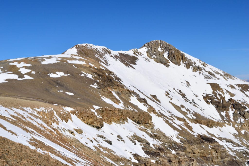
After paying our fee, we started the trip towards Kite Lake and up Mt. Democrat. There was a large amount of people there already, some who had camped out the night before and others who arrived shortly after we did. The trek up to Mt. Democrat kicks you in the gut right away with some pretty steep inclines for the majority of the trail until you reach the Democrat/Cameron Ridge. At this point the trail did level out somewhat, but was still fairly steep until reaching the false summit of Mt. Democrat. The last few hundred yards are quite flat and not terribly difficult to climb. We were lucky enough to have nice weather on the summit, but the entire Decalibron hike can get quite windy.
Mt Cameron
We enjoyed the summit views from Mt Democrat and snapped some photos before heading down to begin our ascent of Mt. Cameron. Fun Fact: Although Mt. Cameron is over 14,000 feet, it is not considered a true mountain because the eastern ridge does not drop 300’ before reaching Mt Lincoln which is apparently the “official mountain” requirement here in Colorado. Who made that rule up, I have no idea. Anyway, on our trip down to the Cameron/Democrat ridge Jackie informed me she would not be making the rest of the trip. Instead, she was going to head down to the car and wait for me while I completed the other two peaks. After minutes of pointless attempts to convince her to come along, I started up the trail towards “Mt. Cameron”.
This trail was very steep and a lot harder than I anticipated. I realized quickly as I began to pass many people heading the same direction that I needed to slow my pace down if my legs were going to make the whole day. However, my stubborn self hates to allow someone to pass me after I passed them so I continued pushing up towards the summit. Mt Cameron has several false summits which were a bit demoralizing to reach.
Mt Lincoln
Once I reached the true summit of Mt. Cameron, I could easily see Mt. Lincoln in the distance and loved the view from this spot. I snapped a few pictures, grabbed some water and eventually continued on. The trail to Mt Lincoln was so evident, it almost looked like a road. I started the hike down from Mt Cameron and after another 20 minutes of hiking, I was on Mt. Lincoln’s doorstep. Mt Lincoln has the most technical hiking of the entire Decalibron (Class 2), but really was nothing more than a few rock scrambles. I quickly hiked up the pile up rocks and reached the summit. This section of the hike Mt. Cameron to Mt. Lincoln was probably the easiest of the entire Decalibron loop due to the leveling off of the trail. Another few “Nikon moments” later, I began my descent of Mt. Lincoln to tackle the last true 14er of the day, Mt Bross.
Mt Bross
This section of the Decalibron loop hike was probably the most dull and my desire to keep hiking for the day took a sharp drop. I am not sure why, as the trail that connected Mt. Lincoln to Mt. Bross was not terribly hard. I think my eyes were starting to get sick of looking at the same boring rocky landscape that I had been hiking for the last several hours. Although the summit of Mt Bross is technically on private land, I decided to make a quick trip to the summit. The ascent to Mt. Bross was pretty steep and when I did reach the top, I was disappointed to find extremely windy conditions and poor views. Needless to say, my stay on Mt. Bross was extremely short lived and I quickly began my last descent of the day back to Kite Lake.
I may have mentioned this in other blogs, but going down a mountain is my favorite part of any hike. Obviously, it can be a lot easier (especially when hiking at high altitudes) but I just find that I get in a quick rhythm and can almost run down the trail. This was the case for about ½ of the trail down from Mt. Bross. However, once I reached the bottom half of the descent, I had to put on my brakes several times because the trail was in awful shape (bad footholds, loose rock or sand) and I ran into a large bottleneck of people. The gullies in this area of the trail are very steep and can be quite tricky to navigate. I quickly realized that the section of the trail everyone seemed to be stuck on was not the best way to descent. I peeled off the “main” trail and took a side route that avoided this traffic jam and was a far easier trail. My advice would be to look around and use common sense as to what route you should take. After another 30 minutes or so I arrived back to the car where Jackie was sleeping soundly and surprised to see me back so quickly.
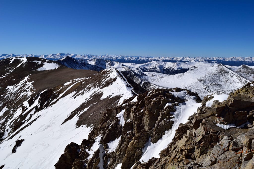
The Decalibron hike is nice intro to 14ers in Colorado but can get quite busy, especially during summer months. This loop hike is good for those looking to get into winter hiking as well. Outside of the summit of Mt Bross, the Decalibron provides great views in all directions. This route is not to be underestimated though, it is certainly on the hard side of most hikes and has many long periods of steady, steep climbing.
3 thoughts on “Decalibron 14ers: Democrat, Cameron, Lincoln & Bross Hike Guide”
Hey Mickey! Is the whole hike closed, or only the section including Mt. Bross? I saw your update, but when I read the paragraph after it, it sounds like as long as hikers follow the limits and stay off the summit, it should be fine.
Anywhere hikers can read and clarify hiking rules beforehand?
Hey Will – from what I understand its opening back up June 1st but there is currently NO access on any of the peaks from the Kite Lake side. Nowhere to check unfortunately as the land owners can change this at any time without any warning.
I’m visiting and I haven’t done a CO 14er yet. I’m considering doing this after a couple of others. Have you ever done it CCW? That seems like, at the expense of lots of effort at the beginning, it would be easier than descending a loose trail.