Grizzly Peak A Hike Guide
Grizzly Peak A, sometimes just known as Grizzly Peak, is the highest 13er in Colorado at 13,988ft. This mountain is located in the Sawatch Range near 14er La Plata Peak. This Class 2 hike does not see much hiker traffic and because of this, does not have an official trail for most of the hike. Commonly hiked from the east, it’s also common to pair with neighboring summit, Garfield Peak.
Grizzly Peak A Quick Facts
Grizzly Peak A Rating: ★★★ (3/5 Stars)
Virtual Trail Guide: Grizzly Peak A
Distance: 5.5 Miles RT
Elevation Start: 11,359ft
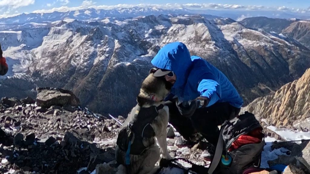
High Point: 13,988ft
Total Elevation Gain: 2,500ft
Estimated Time to Complete: 3-5 Hours Total
Difficulty: Moderate What does this mean?
Class: Class 2 – What does this mean?
Season: June – October (Expect road closures and snow outside of this window)
Crowds: Low
Directions to Grizzly Peak A
Trailhead: McNasser Gulch
Getting Here: First, navigate to the La Plata Peak trailhead, from there take FS391 for 3.2 miles and then bear left onto FS 394. This junction is considered the “lower TH.” The road does get a little more rough from here. Continue another mile or so until the road is gated off. There is a very small area to park about 50 yards before the gate.
Parking: There is a very small, unofficial, parking area about 50 yards before the road closure. This spot can fit 2-3 cars and has no official restroom.
Permits/Fee: No fee required.
Summary
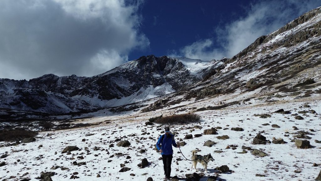
Dogs: Grizzly Peak A is a dog friendly hike.
Camping: There are good dispersed camping spots along CR391 on the way to McNasser Gulch. There is a 1.6 mile stretch of private land that you can’t camp on but besides that, use your best judgment. Once on the hike itself, camping is not really an option.
Make it a Loop: Although I did not do it on this trip, the most common way to make this hike a lollipop loop would be adding the easy Class ridge to Garfield Peak. I can’t speak to what this route is like though because as of posting, I have not yet completed it.
Trail X Factors: Loose & Steep Terrain
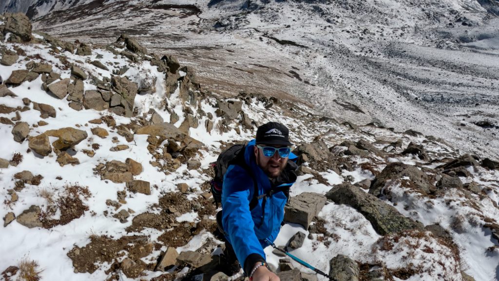
Like many 13ers, Grizzly Peak A does not have an official well maintained trail. Pair this with the steep terrain you must hike up and you have a perfect recipe for loose trail conditions. Once you leave the mine and start to climb the slopes and all the way up to the ridge, there is a lot of loose dirt, scree and talus.
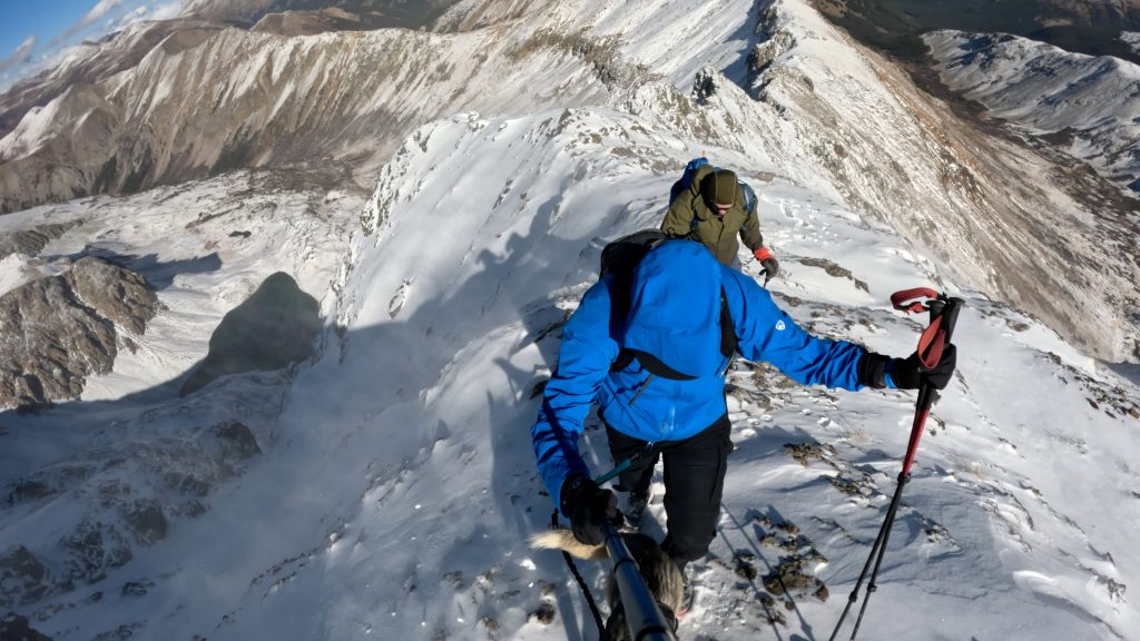
Hike Tip(s): When picking a line to hike up to the ridge, be patient. I am fairly confident that the line Aria and I took up to Grizzly Peak A is the “standard” route that many other websites describe. If you try to head up too soon, you can end up in a scree mess with an exit that is likely above Class 2. In addition, when you get to the saddle, be sure to not tag those first three towers unless you really want to spice things up for yourself.
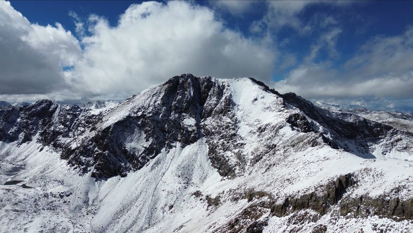
Best Views: Once you reach the saddle of Grizzly Peak A, to the east, the views from there to the summit are stunning. Be sure to look over the ridge at Grizzly Lake before heading over to the summit. Once on the summit, the views are honestly stunning in all 360 degrees. The Sawatch continues to amaze me.
Gear Needed
- 14er Day Hike Packing List
- Men’s Trail Runners
- La Sportiva Cyklon
- La Sportiva Trango Hiking Boots (Men’s)
- Backpack (Winter)
- Backpack (Summer)
- Base Layers
- T Shirt
- Mid Layer
- Rain Jacket / Shell
- Outer Layer
- Pants
- Shorts
- Socks
- Food & Water
- Optional: Water Filter
- Optional: Garmin inReach
- Optional: Hiking Poles – 120CM
- Optional: Headlamp
- Optional: Climbing Helmet
- Optional: Garmin Fenix Watch
- Optional: GoPro, Joby Tripod, Selfie Stick, GoPro Max 2, Drone, Insta360
- *Links included in this description might be affiliate links. If you purchase a product or service with the links that I provide I may receive a small commission. There is no additional charge to you.