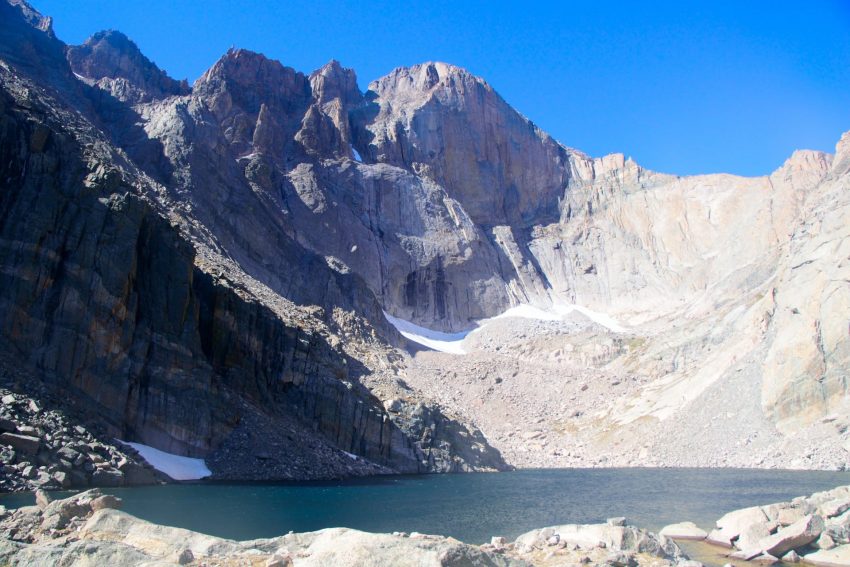
Longs Peak Loft Route Hike Guide
The Longs Peak Loft Route is a popular, more difficult, alternative to the standard Keyhole Route on the popular Colorado 14er. This hike starts at the same trailhead, works by Chasm Lake and climbs the south side of the mountain through The Loft, a couloir/gully. Longs Peak Loft Route is a class 4 trail, requires careful route finding and is easy to get into class 5 terrain in a few sections. It’s common for hikers that ascend this route to add on neighboring Colorado 13er centennial, Mt Meeker. The Loft route up Longs Peak is mostly without a trail and requires a lot more route finding than the standard Keyhole Route up the popular 14er.
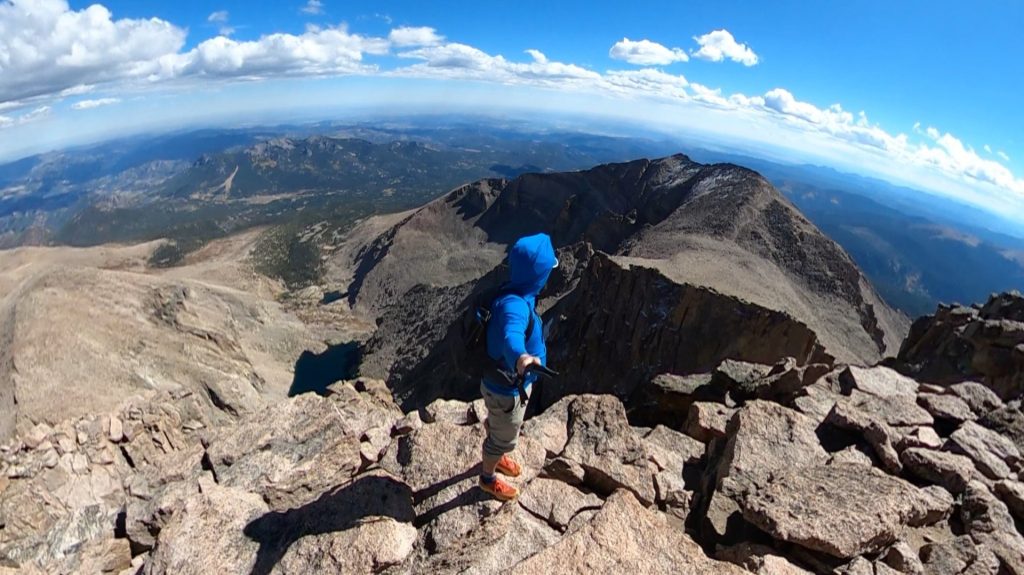
Longs Peak Loft Route Quick Facts
| Category | Details |
| Hike Rating | ★★★★★ (5/5) |
| Area | Front Range, Colorado |
| Trailhead | Longs Peak |
| Distance | 13 Miles Total |
| Route Type | Out & Back, Loop |
| Elevation Start | 9,250ft |
| Highest Elevation | 14,259ft |
| Total Elevation Gain | 5,300ft |
| Estimated Time to Complete | 10-12 Hours |
| Difficulty | Difficult – What does this mean? |
| YDS Class | Class 4 – What does this mean? |
| Exposure | High |
| Best Season | June – October |
| Activity Type | Hiking, Scrambling |
| Crowds | Moderate |
| Dogs Allowed | No |
| Permit/Fee | Yes |
| Last Hiked Date | 9.28.22 |
Alternative Routes Up Longs Peak:
Longs Peak Loft Route Virtual Trail Guide
In this virtual trail guide you’ll see the trailhead, route conditions, navigation tips, difficult sections, summit views, what to expect throughout the hike and of COURSE, my unique experience on this hike.
Longs Peak Loft Route Map & GPX
The map below shows the route that I followed for this hike. GPX files are available through a suggested donation of $3-$5. Creating and maintaining hiking guides, videos and GPX files takes a tremendous amount of time. Your support helps keep The Virtual sherpa running, covers website hosting costs and allows me to continue creating free hiking content.
After making a donation, click the button below to send me an email with the hike name in the subject line. I’ll send the GPX file as soon as possible.
Longs Peak Loft Route Directions & Parking
Protected Area Type: National Park
Protected Area Name: Rocky Mountain National Park
Trailhead: Longs Peak
Coordinates: 40.272065392962936, -105.55671070980704
Driving Directions: Longs Peak can be accessed by a number of different starting points but the road to the trailhead is paved and well signed.
Parking: The parking lot for Longs Peak can fit about 30-40 cars, but will 100% fill up on weekends from July – early October. Expect to arrive at the trailhead very early, especially on weekends, to have the best chance to secure a spot. On weekdays the lot is typically less hectic, but an early arrival time is still recommended.
Permits or Reservation/Fee Description: The park service makes the permit, timed entry and fees for Longs Peak clear as mud. However, from their official website, if entering the parking lot before 9am or after 2pm, a timed entry reservation is not required but a fee still is. If entering between 9am and 2pm, a timed entry reservation is required along with the fee. Read more about that entire process here and see the latest Rocky Mountain National Park fees here.
Longs Peak Loft Route Overview
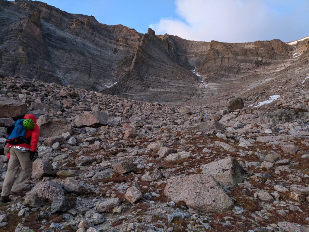
The Longs Peak Loft starts at the paved Longs Peak trailhead and a dirt trail works slowly up to the lower basin of the mountain gaining lots of elevation along the way. After emerging from the treeline about 2 miles in, hikers are greeted with fantastic views of Mt Lady Washington, the Diamond on Longs Peak and the foothills behind the trail. At 3.25 miles, the trail splits, right goes up the standard Keyhole Route trail and left leads to Chasm Lake, take a left. Continue towards Chasm Lake until eventually passing a boulder field just under the lake where the Loft comes into view.
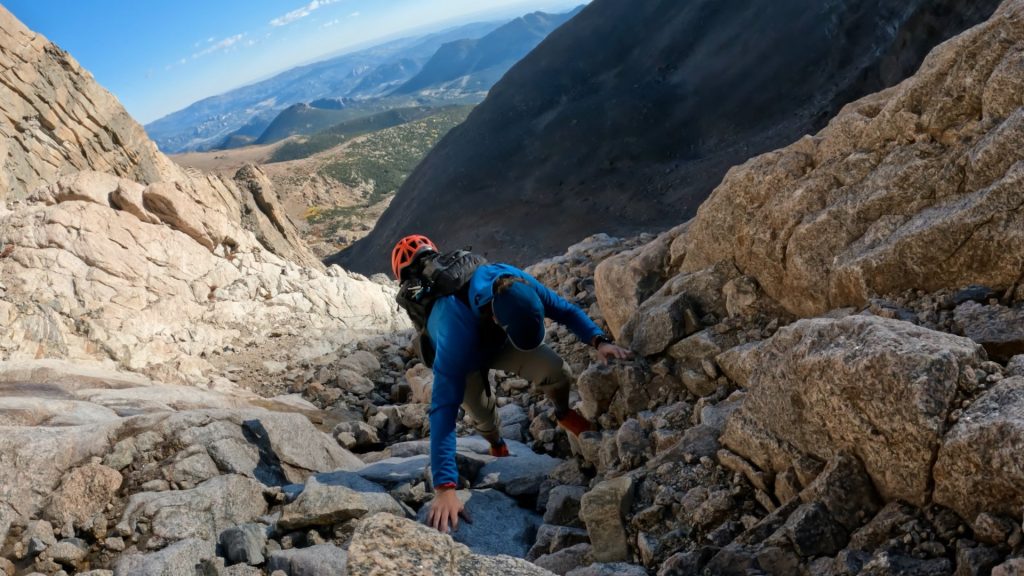
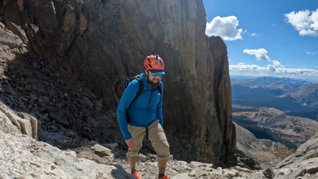
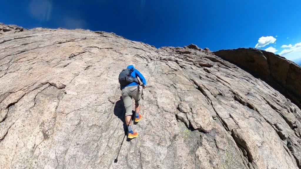
Start up the loose terrain and eventually into a rock field with some class 3 moves along solid slabs of granite. Towards the top, there are some exposed ledges and moves but nothing should be more difficult than class 3, bear left here to exit the Loft. Here there is a large boulder field, left goes to 13er centennial Mt Meeker, right goes towards the summit of Longs Peak. Head through the boulder field, heading left following cairns to a class 3 / class 4 downclimb. This crossover is extremely tricky but hikers are looking for Clark’s Arrow, an arrow painted into the rock by a RMNP ranger John Clark, decades ago.
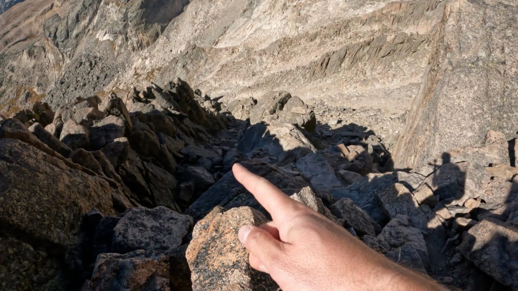
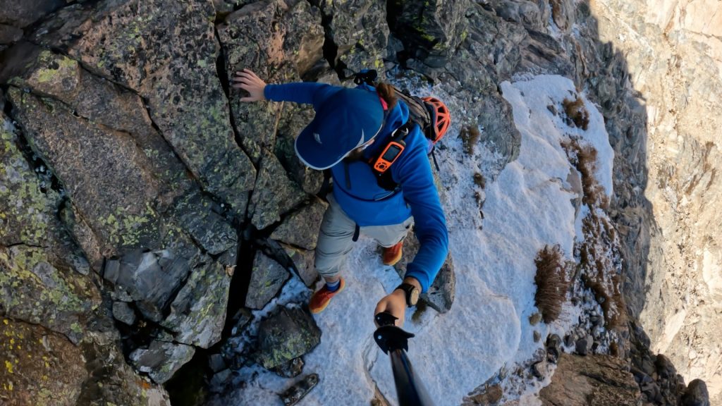
Continue crossing over the exposed ledges and enter Keplinger’s Couloir, a loose gully in summer months. Climb up until reaching the notch of Longs Peak and granite slabby ledges in front of you. Bear left here and continued traversing the ledges until reaching the homestretch of the Keyhole Route. From here, scramble up the exposed class 3 section to reach the summit of Longs Peak. From the summit, either retrace your steps down the Longs Peak loft route or take the standard Keyhole route down.
Plan Your Hike
Best Season: June through October. Expect snow outside this period.
Check Weather: Longs Peak Weather
Camping: Longs Peak Loft Route has one main area to camp: the Longs Peak Campground. This is seasonally open and first come, first served. In theory you could camp on the way down in the boulder field after the Keyhole, read more about that here.
Bathrooms: Longs Peak has several non-plumbing bathrooms at the parking area and a privy in the boulder field offering iconic views.
Hazards: Route Finding, Loose Rock, Exposure, Lightning, Rockfall, Weather Exposure
Dog Description: The Longs Peak Keyhole Route is not dog friendly because it is in Rocky Mountain National Park. Pets are not allowed in any US National Parks.
Water Sources: Longs Peak Loft Route does not offer great water sources. There are a few streams you pass by at the start of the hike and then some seasonal sources near the bottom of the Loft.
Drones: Drones are not allowed in any US National Park. Please always follow all drone regulations.
Hike Tip(s): The Longs Peak Loft Route is about 75% without an official trail, unlike the extremely well-marked Keyhole Route. Route finding, having reliable beta and a map are extremely important so if you are reading this, you are in the right place! The hiking up to the boulder field south of Longs and even over to Mt Meeker, is fairly straightforward. However, finding the route to Keplinger’s couloir can be very tricky. There are countless options to downclimb and crossover but many cliff out and others descend far too far down.
Clark’s Arrow is helpful if you can find it, but most do not. Contrary to what you may read on other sites, it’s very difficult to keep this route class 3 with the moves required on this downclimb. Take your time and ensure anything you do downclimb, you can climb back up.
Descending the standard Keyhole route on Longs Peak is recommended as it’s typically much faster to travel.
Best Views: The Longs Peak Loft route has stunning views. What makes this route is the ability to see Chasm Lake, the loft couloir, adding on Mt Meeker and a different view west into Rocky Mountain National Park.
Primary Attractions: Summit Views, Alpine Lake, Ridgeline, Solitude
Gear Needed
New to 14ers? This is What to pack for a 14er day hike.
Required Gear
- Hoka Mafate 5 – My go to hiking shoes and trail runners
- La Sportiva Cyklon – Great for scrambling
- Osprey Talon 22 Backpack
- Sunglasses
- Running Hat
- Base Layers
- T Shirt
- Mid Layer / Sun Hoodie
- Rain Jacket / Shell – Black Diamond
- Mountain Hardwear Puffy Jacket
- REI Sahara Pants
- North Face Wander Shorts
- Socks
- Hiking Poles – 120CM
Seasonal Gear
Optional Gear
- Helmet
- Water Filter
- Garmin inReach
- Headlamp
- Garmin Fenix Watch
- UD Running Vest
- Osprey Running Vest
- Film Gear: GoPro, Joby Tripod, Selfie Stick, GoPro Max 2 , Drone, Insta360
- *Links included in this description might be affiliate links. If you purchase a product or service with the links that I provide I may receive a small commission. There is no additional charge to you.
More Hikes in the Area
- Chasm Lake
- Mt Meeker
- Mt Lady Washington
- Longs Peak Keyhole Route
2 thoughts on “Longs Peak Loft Route Hike Guide”
“We did it, now let’s move on.”
This is exactly me, 100% of the time. I don’t think I’ve spent more than 5 – 10 minutes on any summit (or destination) in many years. My goal is to be in the wilderness and observe it. Moving through it helps me see more of it.
Or maybe I’m just antsy and can’t sit still.
Good to hear that there are other people like this, because (on the rare occasions that I’m not solo), my hiking/climbing partners don’t seem to understand why I’m ready to leave when we just got there.
Thanks for the comment Chris and appreciate you taking the time to watch the whole video. Agree with you for me its usually an anxiety to move on that keeps me going. I love the summits but I also find that (in most cases) the views up there are very similar to what you have seen for a lot of the hike. I always like to keep it moving from a time perspective too and to not let my body stiffen up too much.