Mt Bierstadt Colorado 14er Hike Guide
Mt Bierstadt is a extremely popular 14er located about 60 miles from Denver. Mt Bierstadt is extremely popular given its proximity to Denver and I70 and the relatively short amount of time it takes to summit. Although Mt Bierstadt is not extremely taxing compared to other 14ers, it is not a walk in the park (unless your parks are above 12,000 feet). Experience with high altitude hiking and plenty of time are recommended to tackle this peak.
Mt Bierstadt Quick Facts
Mt Bierstadt Rating: ★★ (2/5 Stars)
Virtual Trail Guide: Mt Bierstadt
Distance: 7.64 miles RT from Guenalla Pass Parking Area
Elevation Start: 11,669ft
Summit: 14,060ft
Total Elevation Gain: 2,400ft
Estimated Time to Complete: 3-5 Hours RT
Difficulty: Moderate What does this mean?
Class: Class 2 – What does this mean?
Season: July – October (Winter Climbing Trail Guide)
Directions to Mt Bierstadt
Trailhead: Guanella Pass
Getting Here: Mt Bierstadt is most commonly accessed via Guanella pass. Most people drive up to the pass from the town of Georgetown (north) but it can also be accessed from the small town of Grant in the south. If traveling from the north, take I70 until you reach Georgetown (exit 228) and follow signs to Guanella pass. In either direction, you can add Mt Bierstadt to your favorite navigational device.
Parking: Free parking is available at the base of the trailhead. The lot can arguably fit about 20 cars and there is additional parking in another lot about 100 yards up the road from the lower lot. If both lots are full, you can find ample parking along the road. The parking area does have a few public bathrooms but as of 2019, they do not lock or have door handles so I hope you do not need a lot of privacy!
Summary
Camping: Camping is available on Guanella Pass Road in a few different forms. There are a couple of official camp sites and even more car camping spots. Both areas fill up very quickly on the weekend (especially during the summer).
Dogs: Dogs are allowed on this hike, but they do need to be kept on a leash. Water is a good idea to bring because outside of the streams in the basin area, there are no other water sources along the way. Be sure your dog is good around other hikers and dogs since this hike is usually very crowded.
Make it a Loop: Mt Bierstadt is an out and back but there are several loops available including the popular Mt. Evans loop via Sawtooth ridge. Outside of Mt Blue Sky, there are several other hikes in the area (Square Top Mountain, Gray Wolf Mountain etc.)
Trail X Factors: Crowds/Altitude
Since Mt Bierstadt is only about an hour away from Denver, hundreds of people flock to this popular peak during the summer months. If you are looking for a quiet, secluded trip outside, this is probably not your hike. However, if hiking with other people motivates you to keep going, Mt Bierstadt is a great choice. When making your plans to tackle this peak, keep in mind that most of the hike is above 12,000 feet which can sometimes be a problem for those not used to high altitude. AMS (Altitude Sickness) is very common so be sure to watch out for these symptoms.
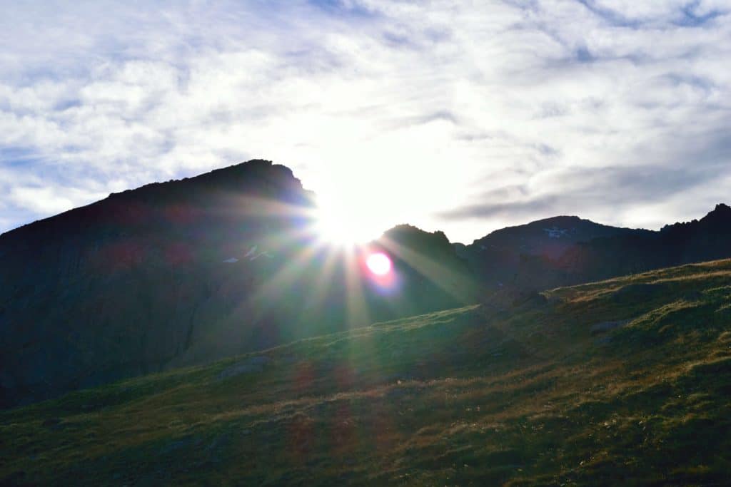
Hike Tip(s): When climbing any mountain in Colorado, especially during the summer months, an early start is always a solid choice. Not only do you avoid some of the crowds, it is also your best bet to avoid the pesky afternoon thunderstorms that can be deadly on an exposed peak. Mt Bierstadt is no exception to this rule. The earlier you get to the trailhead, the more time you allow yourself to climb the mountain, enjoy the views and get back to the parking lot so you can lay on the couch enjoy the rest of the day.
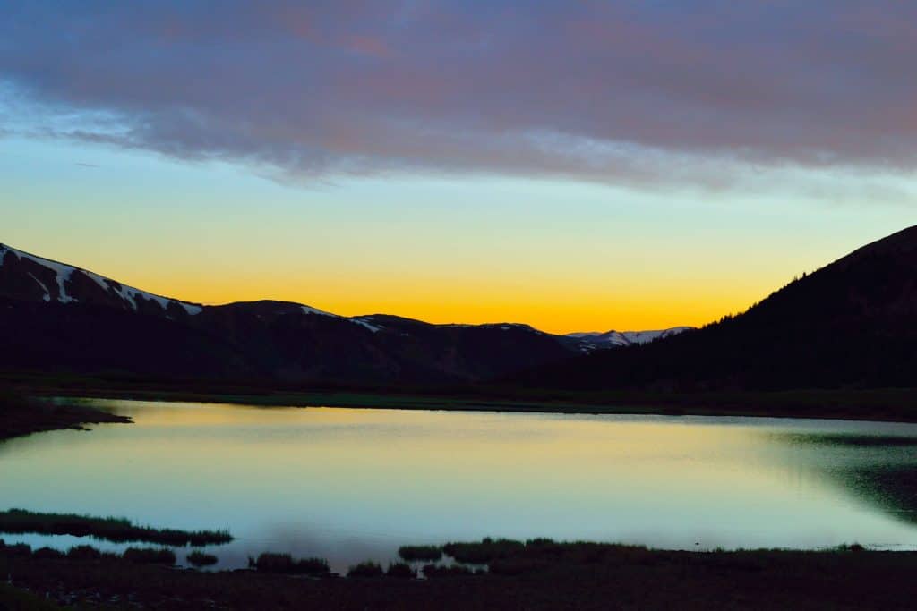
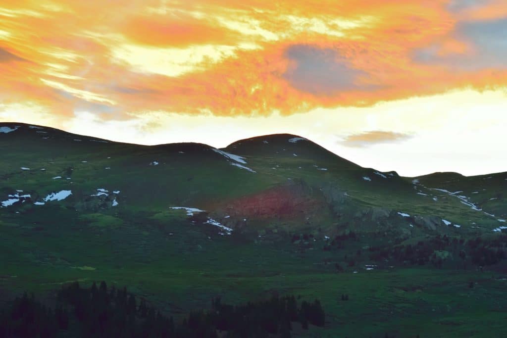
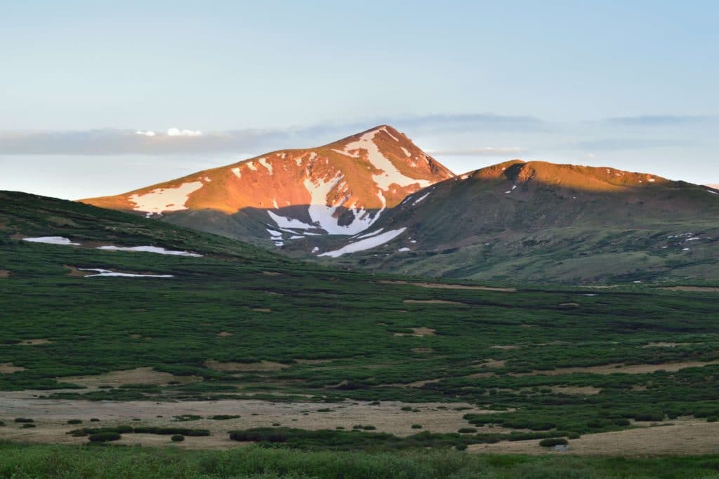
Best Views: If you are into photographing the sunrise and stars, Mt Bierstadt is a fantastic spot to do both. The wide open valleys that surround the peak offer great views of the stars and sun when it eventually does rise. Get to the trailhead early and bring a tripod to photograph the stars or sunrise before you start your trek up to the Mt Bierstadt summit. If you are not looking to shoot the stars, Mt Bierstadt provides great views of the Front Range and neighboring peaks. On a clear day, you can even see down into Denver.
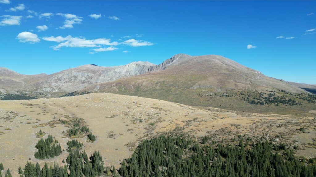
Mt Bierstadt Hike Route
*Note this Garmin route shows my trip all the way to Mt Blue Sky across the Sawtooth one way*
Gear Needed
- 14er Day Hike Packing List
- Men’s Trail Runners
- Women’s Trail Runners
- La Sportiva Trango Hiking Boots (Men’s)
- La Sportiva Trango Hiking Booths (Women’s)
- Backpack
- Food & Water
- Optional: Garmin inReach
- Optional: Hiking Poles
- Optional: Headlamp
- Optional: Garmin Fenix Watch
- Optional: Camera and Lens
- Optional: GoPro, Joby Tripod
- *Links included in this description might be affiliate links. If you purchase a product or service with the links that I provide I may receive a small commission. There is no additional charge to you.
My Trip to Mt Bierstadt: June 2016
Note: I have been up Mt Bierstadt 5-6 times as of 2023, this account is from one of my first trips up to the summit in 2016.
My last trip to Mt Bierstadt was earlier in February when I tackled the mountain in the winter. This visit to Mt Bierstadt, I had other goals in mind: complete the Mt Bierstadt – Mt Blue Sky loop via the Sawtooth ridge.
I arrived to the parking lot around 5:15AM and the lower lot was nearly full with fellow hikers looking to catch a glimpse of the sun rising over the peaks to the east. As I started my trek, all I could think was how different the area looked compared to just a few months ago when snow blanketed the entire valley. The trail started in the willows where it continued for about a mile until it reached the first stream crossing of the day. I saw other hikers taking off their boots and walking through the ice cold water which sort of blew my mind. The last thing on the planet I wanted at 5:30AM was wet, freezing feet. I headed about 50 yards downstream where I used a log to cross the small stream.
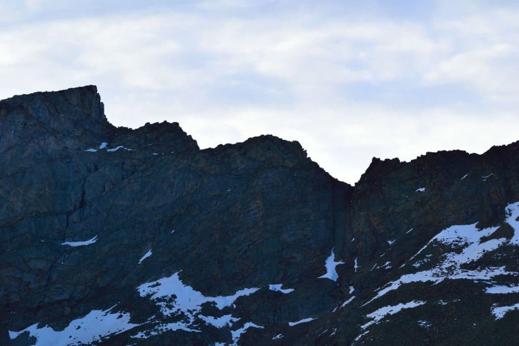
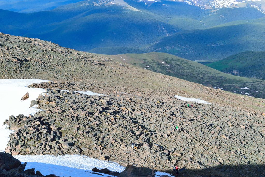
After the stream crossing, the hike began to pick up its incline for about a half mile. This stretch of the trail ranged from flat to fairly steep and I slowed my pace down a bit so that I did not waste any energy. I reached the first false summit of the day and Mt Bierstadt’s true summit was now visible in addition to the gnarly looking Sawtooth ridge. From this point, the trail gradually snaked its way up the west side of Mt Bierstadt until it reached some late spring snow that was hanging on to dear life.
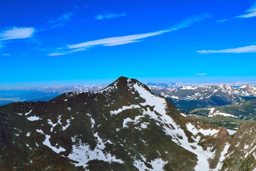
The snow was fairly easy to trek through, but I imagined it would be a major pain in the butt as the day went on and the snow warmed up in the summer sun. After a few snow fields, the summit of Mt Bierstadt was in site and all that separated me from the top was a large boulder field. This area of the hike involved minor scrambling for about a quarter of a mile until I reached the summit of Mt Bierstadt. Unlike some mountains in Colorado, Mt Bierstadt has a fairly small summit area and has a definite “peak” at the top of its 14,060 feet. I was happy to be at the summit, but knew that my day had just begun as I stared down the barrel of the Sawtooth Ridge.
9 thoughts on “Mt Bierstadt Colorado 14er Hike Guide”
I really like it when people come together and share opinions.
Great blog, stick with it!
Glad you enjoy the site, thanks Kristen. I would appreciate if you shared with anyone who might find it helpful! -Mickey
Hiya! Quickk question that’s totally off topic.
Do you know hhow to make your site moile friendly?
My weblog loolks weird when viewing from my iphone4. I’m trying
to find a template or pluggin that might be able to resolve this
issue. If you have any suggestions, please share.
Thanks!
Thanks for the comment and happy to answer as best I can. I am certainly not a web designer or coder, but I would look into web and mobile friendly templates for your site. WordPress offers hundreds of free ones and they all translate well to a mobile phone, ipad etc. If that does not work, it might be the compatibility of the template of your site with your phone, although I do not think that is the case. Hope this helps! – Mickey
Thank you for sharing with us, I think this website genuinely sstands
out :D.
Would like to hike mt bierstadt next summer’24.
Need a guide or someone to hike with me.
I will appreciate a response back.
Thx
Hi Satish,
Love that goal – check out my videos on the hike and you have obviously found the guide here which should also help. In all honesty, I would not recommend a guide as I think its a bit of an overkill but a hiking partner is a solid idea. Check out the forum on 14ers.com – there are often people posting about hiking partners so when the time comes for your trip, you may have luck finding someone there.