Mt Guyot Colorado 13er Hike & Snowboard Guide
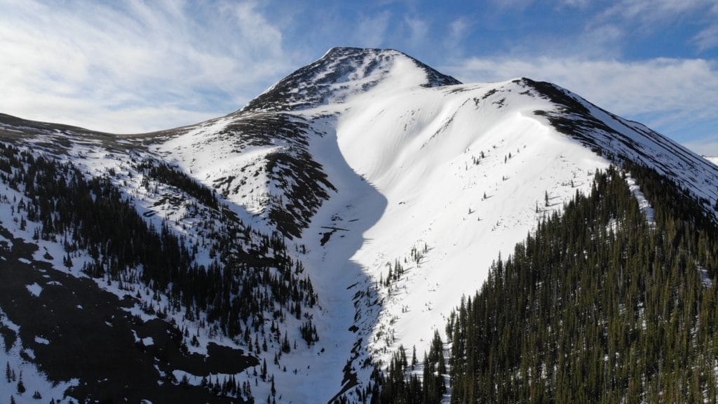
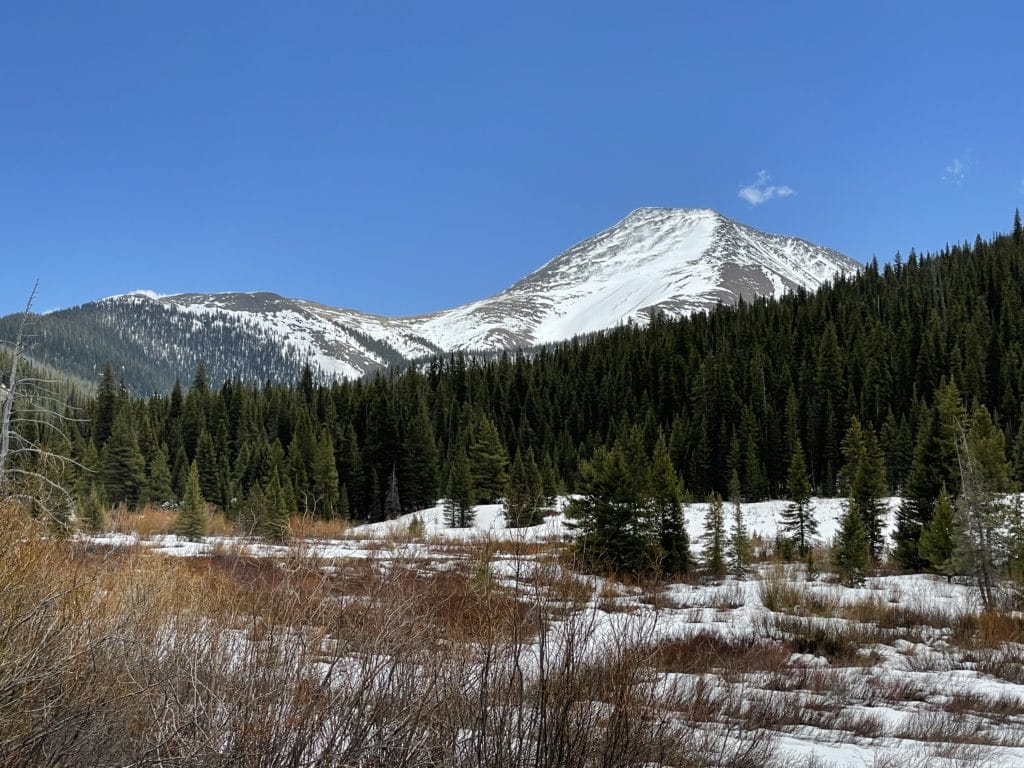
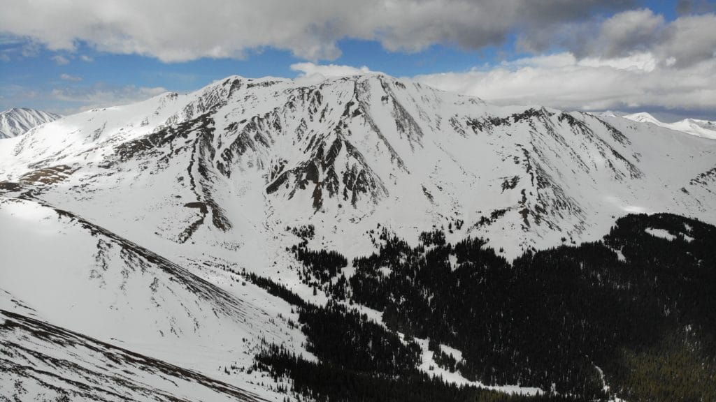
Mt Guyot is a 13,376ft mountain located in the Front Range of Colorado. This 13er is a relatively unpopular hike but is a great line to ski or snowboard during the winter, spring and early summer months because of its north facing aspects. Although there are a few routes to the summit, Mt Guyot’s Northwest Ridge is the most popular due to its relatively easy TH access via the French Gulch. When hiking Mt Guyot on this route, there are two lines to choose from: the northwest ridge or northwest slopes both offer their own challenges depending on conditions.
Mt Guyot Quick Facts
Virtual Trail Guide: Mt Guyot Northwest Slopes with Snowboard Descent
Mt Guyot Peak Rating: ★★★(3/5 Stars)
Distance: 7 Miles as long as you can get to French Gulch TH (you usually can)
Elevation Start: 10,328ft
Highest Point: 13,370ft
Total Elevation Gain: 3,250ft
Estimated Time to Complete: 4-6 Hours RT
Difficulty: Moderate – What does this mean?
Snow Climb Grade: Easy- 30-35 degrees max
Class: Class 2 What does this mean?
Season: Year Round – Skiing/Boarding Lines Usually last until early June
Avalanche Forecast: This route and area is avalanche prone, check conditions here.
Directions to Mt Guyot
Trailhead: Sallie Barber Mine/ French Gulch
Getting Here: From Breckenridge, Colorado there are a few variations to take to get to the French Gulch TH. However, the most straightforward would be to take Huron Road (next to the 7/11) which turns into Reiling Road. Continue until this road ends and take a left at the stop sign onto French Gulch Road. Follow this for about 1.3 miles until you see a marked TH on your right. This is the last place to park for Mt Guyot. In winter months getting this far may be an issue adding some distance to your hike/skin.
Fees: There is no fee for this hike.
Parking: The parking situation for this hike is going to entirely depend on the snow conditions and when you visit. In the best case scenario there are several spots to park 5-10 cars at the TH and in the worst case scenario you may have to find a spot on the side of the road to put your car. In either case, there are no restrooms at any of the parking areas.
Summary
Camping: Camping for Mt Guyot is tough because the surrounding land is scattered with private homes and land. However, if you hike far enough in you should be able to find a few spots to set-up a tent at the base of the gully/ridge. There is an old mining building here so be sure to stay away from that but otherwise it should be fairly open. In general though, this is not a great place to camp.
Dogs: Mt Guyot is dog friendly in the summer and for a dog who is good off leash and in the snow, dog friendly in the spring and winter as well. I didn’t bring Juno on this one because it would absolutely be too much to snowboard with her on the leash given the grade of these slopes.
Make it a Loop: Mt Guyot is an out and back hike.
X Factors: North Facing & Descent Method
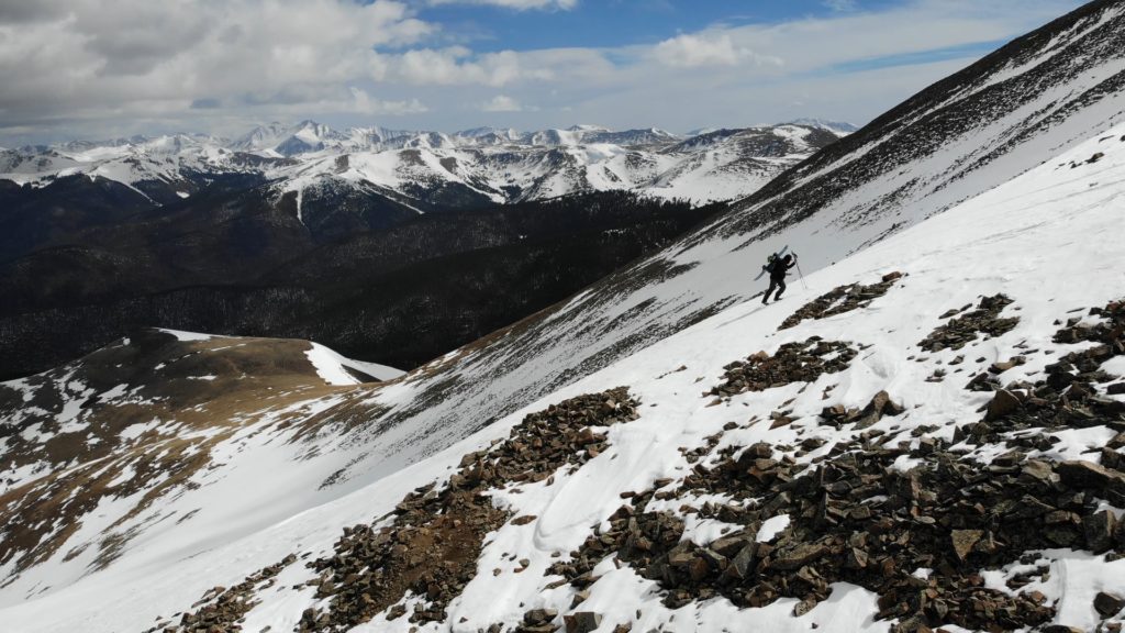
If you have a basic understanding of snow and aspects of mountains, you know that North Facing mountains and slopes keep snow for much longer than most other directions. Without getting too scientific, this is due to the lack of sun hitting the snow here and melting it down. This allows Mt Guyot’s Northwest Ridge/Slopes to hold snow later into the season but also means that the snow will take a much longer time to soften up. If you are into harvesting corn for your turns down, a later start or long summit wait might be in order.
If you are snowboarding down Mt Guyot you have the option to take either the same route you hiked up or descend via the Swan Dive line which essentially takes skiers right off the summit. This descent requires a slight traverse back to your approach line and also takes you past an old mining cabin. Swan Dive faces Northeast and may be softer and hold a bit less snow than the route you took up, both are great options for a descent though.
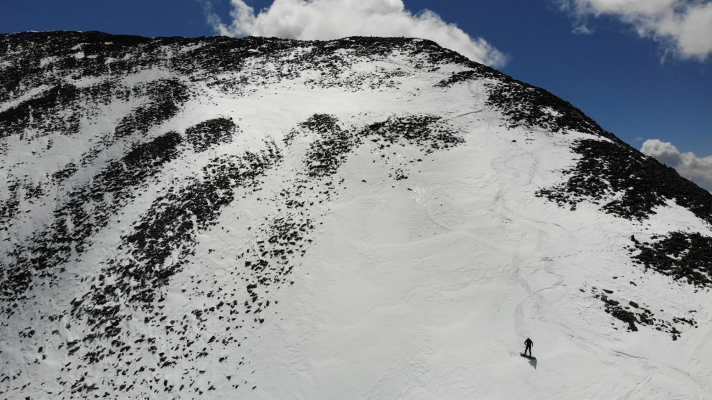
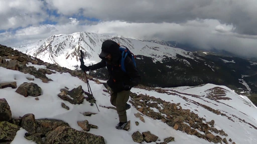
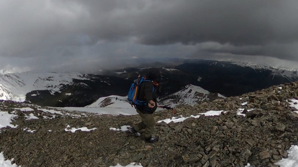
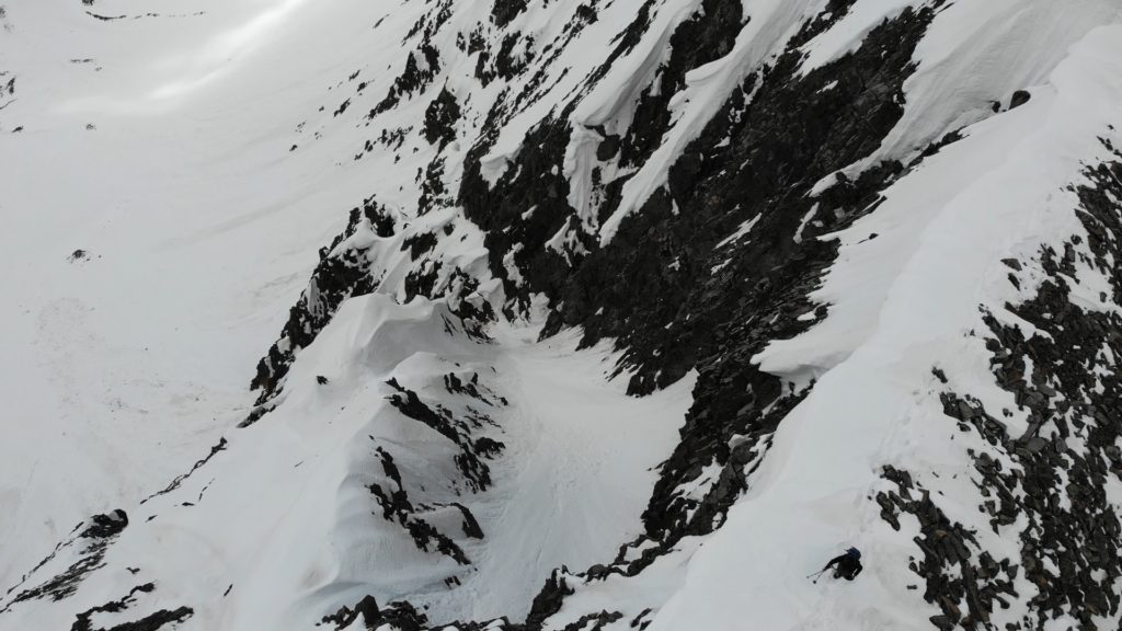
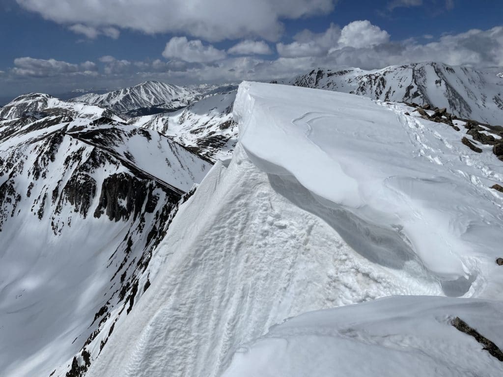
Hike Tip(s): As you approach the final summit ridge of Mt Guyot, be sure to know that the hikers right side is loaded with cornices usually. When I summited they were extra gnarly and hard to tell where they started. Be sure to stick to hiker’s left here to avoid them altogether as a fall here would be very nasty.
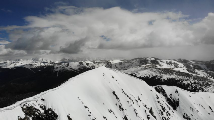
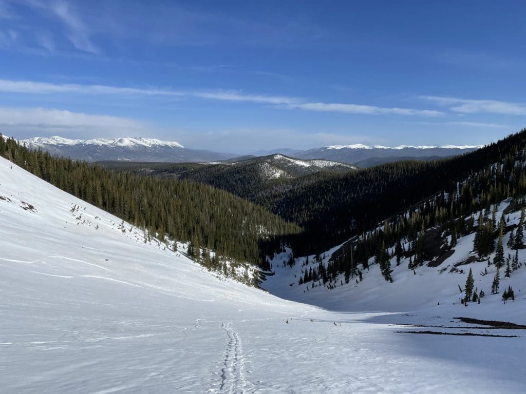
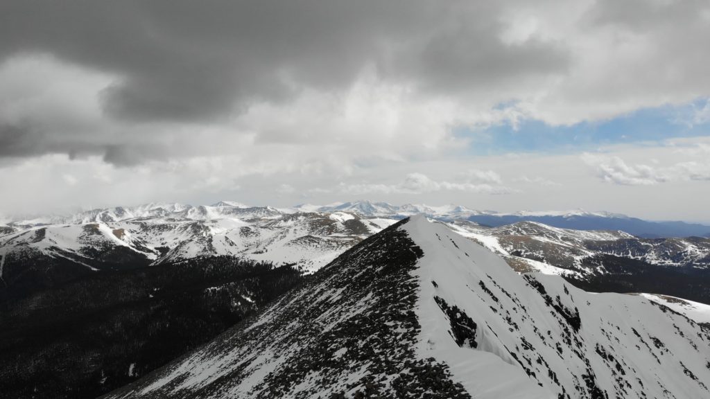
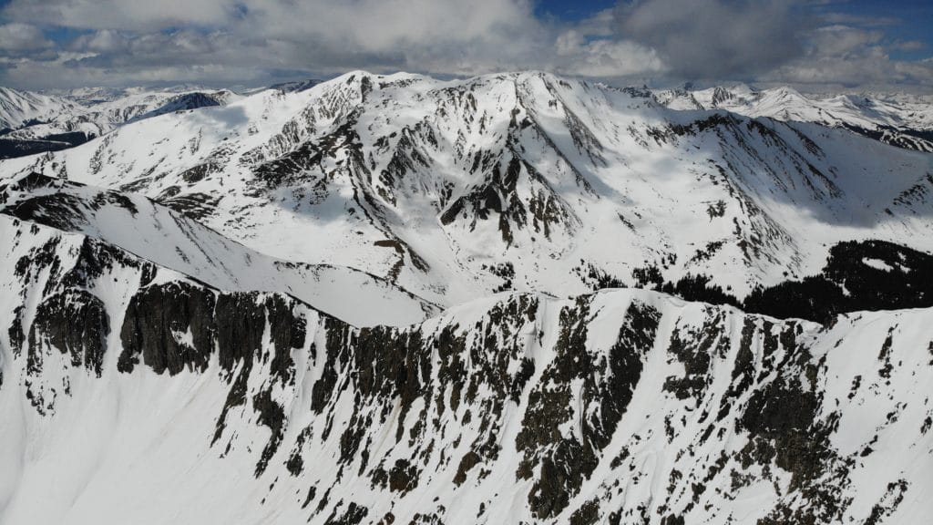
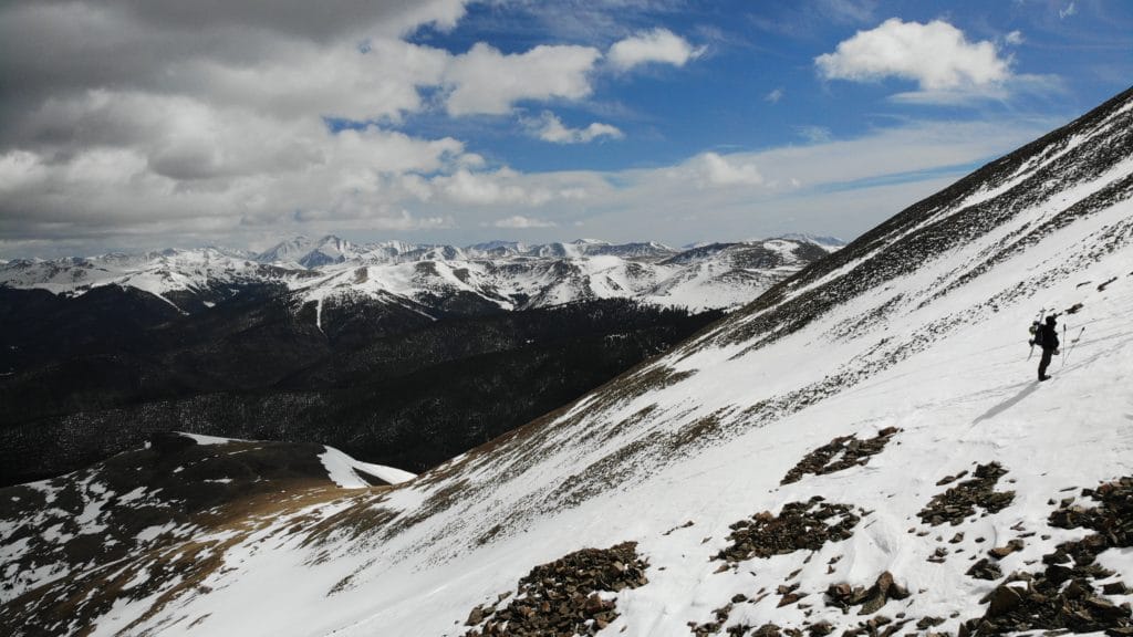
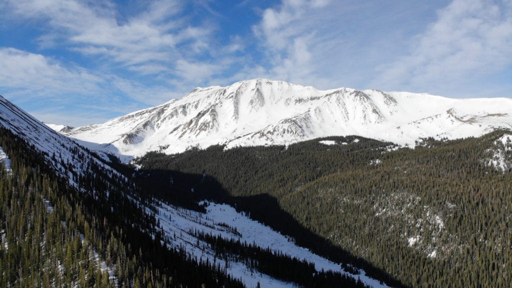
Best Views: Mt Guyot has great views once you gain the Northwest Ridge west and north. As you reach higher up the views are basically great in all directions but my favorites were looking south and west. Snow covered peaks always look good so it was really hard to go wrong with photo options on this one.
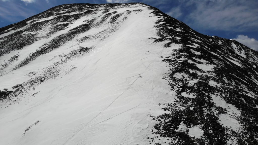
Mt Guyot Northwest Slopes Hike Route
Please ignore the distance and my route as I missed my turn at the start and had to track down my drone on the way down after it crashed.
Gear Needed
- Dakine Poacher Winter Backpack
- Hiking/SkiPoles
- Headlamp
- Climbing Helmet
- Mountain Axe
- Crampons
- Crampon Bag
- La Sportiva Mountaineering Boots
- Microspikes
- Gaiters
- Optional: Avalanche Gear: Beacon, Probe, Shovel
- Optional: Snowshoes
- Optional: Skis or Splitboard
- Optional: Goggles
- Optional: Garmin inReach
- Optional: Garmin Fenix Watch
- Optional: Camera and Lens
- Optional: GoPro, Joby Tripod
- *Links included in this description might be affiliate links. If you purchase a product or service with the links that I provide I may receive a small commission. There is no additional charge to you.
My Trip to Mt Guyot: May 2021
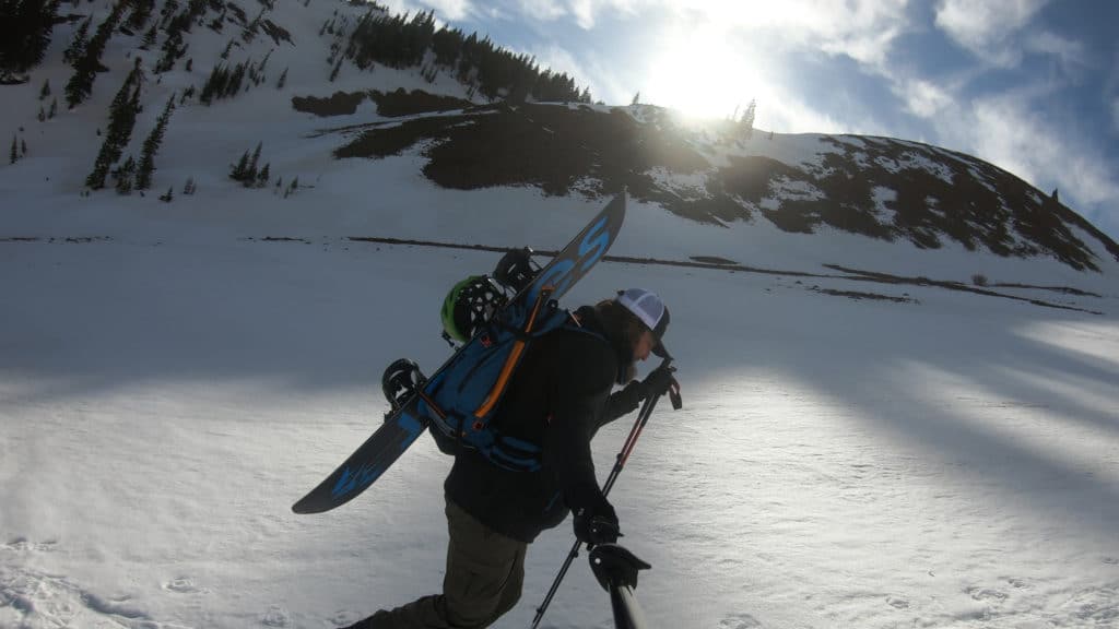
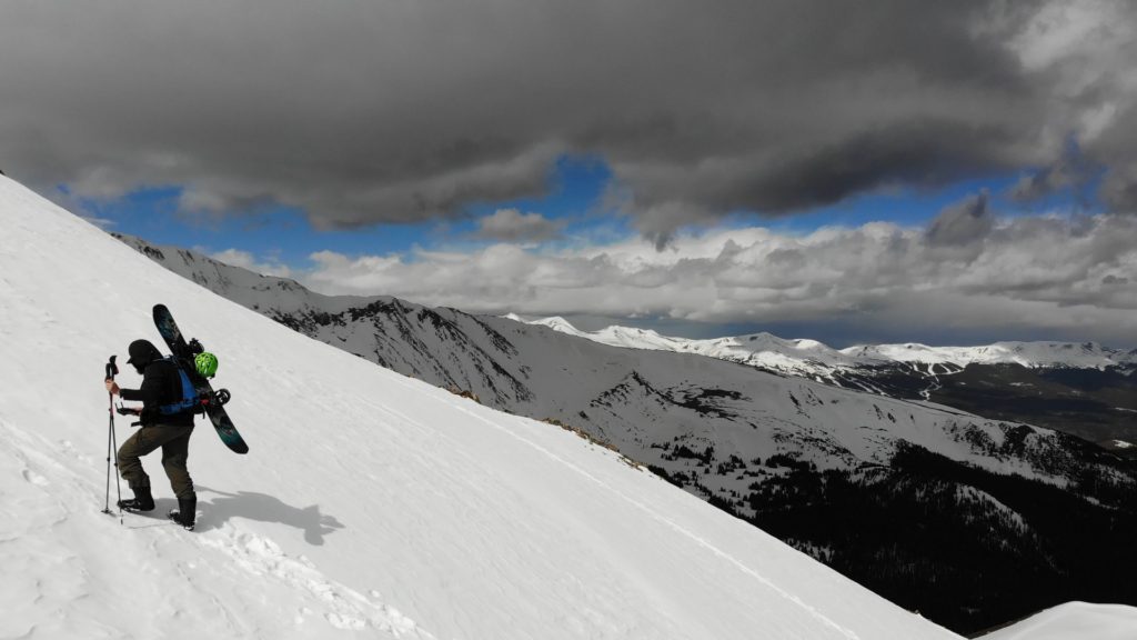
I had a weekend alone with Juno so I decided to split the weekend in two: a day for me and a day for her, more on that hike soon. For my day, I wanted a quick hike that I could also splitboard down. Given the weird weather, I needed something north facing so Mt Guyot fit the bill. A quick drive and a little detour later (I got lost) I was hiking up through the snow covered forest roads to the North slopes of Mt Guyot. The hiking was extremely straightforward and with a hard overnight freeze never had to transition to skinning which was nice.
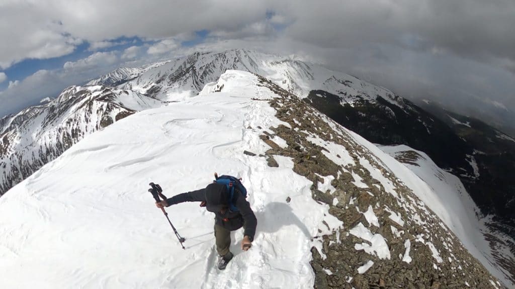
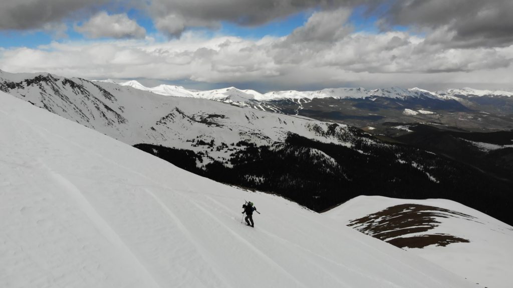
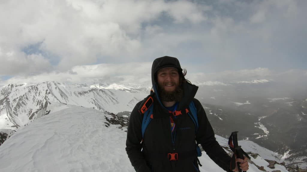
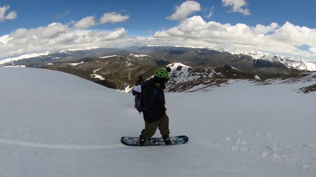
I worked up the steep northwest slopes keeping an eye on the weather and hoping for some warming to happen, it was very cold. As I reached the ridge, the clouds to the west looked nasty and I was not sure what kind of conditions I would have to board down. Avoiding some impressively large cornices I reached the summit just in time for the winds to pick up and snow to start falling. Neat! I filmed some quick video and retreated down the ridge towards a wind block. Suddenly, the sun came out again even though just miles to the north I could see it was snowing/raining hard. This seemed like the best opportunity I would have to snowboard with some good light so I transitioned to my boarding gear and started making my way down. The snow was surprisingly decent even with almost no warming from the sun.
Everything is for the gram so like an idiot I decided I could snowboard and fly the drone at the same time – not just fly it but also control it. Welp it crashed shortly after but luckily I was able to find it in good condition just minutes later. No more flying on this one. I popped the Mavic Air back into my bag and had an AWESOME time snowboarding the rest of the way down to the road closure. When I got back to the car it started snowing again with nasty dark clouds all around me, talk about good timing. I would easily repeat this hike up Mt Guyot if snowboarding down was the descent mode.
One thought on “Mt Guyot Colorado 13er Hike & Snowboard Guide”
Did this exact line yesterday on my splitboard, video was super helpful man! Appreciate you taking the time to give others the lay of the land.