Mt Ouray 13er Hike Trail Guide
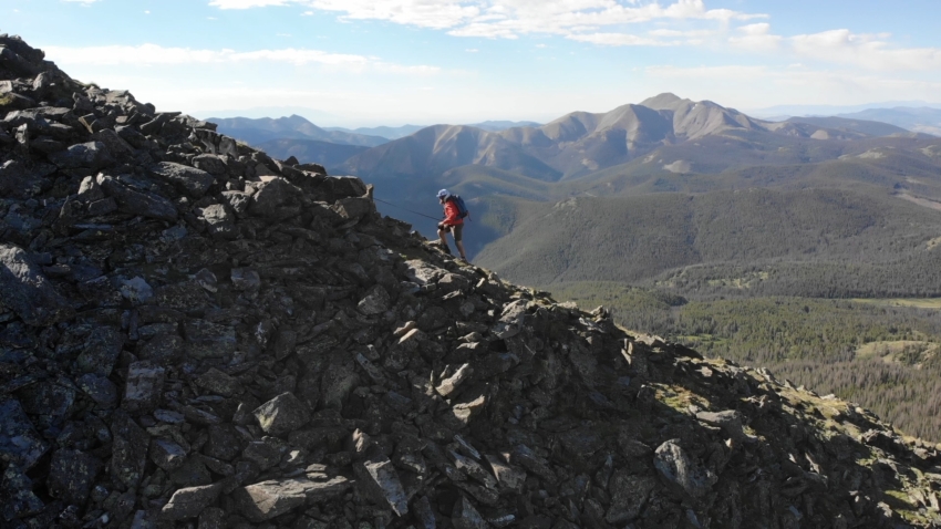
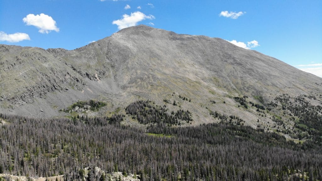
Mt Ouray is the 58th ranked Colorado peak at 13,971ft. Don’t let this short hike deceive you as the elevation gain is steady from the trailhead to the summit. Like many 13ers in Colorado, there is not an official trail for about 50% of the hike. Mt Ouray is dog friendly and a great hike for hikers of all skill levels.
General Hike Information: Mt Ouray
Virtual Trail Guide: Mt Ouray
Mt Ouray Rating: ★★★★ (4/5 Stars)
Distance: 6.5 Miles RT
Elevation Start: 10,856ft
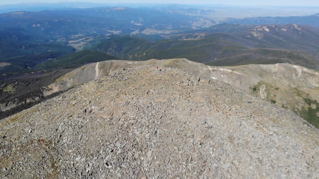
Highest Point: 13,971ft
Total Elevation Gain: 3,000ft
Estimated Time to Complete: 4-5 Hours RT
Difficulty: Moderate Difficulty System Explained
Class: Class 2 What does this mean?
Season: Late June- Early December (Expect snow outside of this period)
Weather: Check the Weather Forecast
Directions to Mt Ouray
Trailhead: Marshall Pass
Getting Here: From US 285, take Marshall Pass Rd and continue for about a 2.3 miles. Take a right at the road junction to stay on Marshall Pass Rd. Continue for another mile and take another right. Keep driving for about 10.5 miles until you reach the signed parking area on the left. If you want, you can take a right on 200CC road and drive for about .1 miles and park here instead. Both options are accessible by all vehicles.
Fees: There is no fee to hike Mt Ouray.
Parking: There are two main areas to park for the hike up Mt Ouray. You can park at the Marshall Pass trailhead which has room for about 10-20 cars or drive right to the start of the hike on 200CC road just before the trailhead parking on the right. This road has much more limited parking but can fit 5-10 vehicles. Both parking areas have non-plumbing bathrooms.
Summary
Camping: Marshall Pass Rd has plenty of spots to dispersed camp and there are also plenty of spots around the trailhead to park. On the hike itself, camping options are very limited.
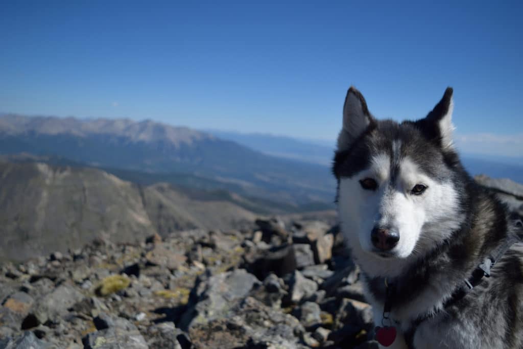
Dogs: Mt Ouray is a dog friendly hike for dogs that have experience in the mountains and can handle minor scrambling on talus and small boulder fields.
Make it a Loop: This is an out and back hike. This hike also joins both the Colorado and Continental Divide trails if you want to add more hiking.
Trail X Factors: Without a doubt, the biggest X factor on this hike is the weather. Nearly the entire hike is above treeline here with very little options for a quick descent if storms roll in.
Hike Tip(s): Unless you specifically want to park at Marshall Pass trailhead, I would recommend driving up 200CC road and parking at the start of the trail. Parking here saves you about .2 miles of hiking that is completely unnecessary.
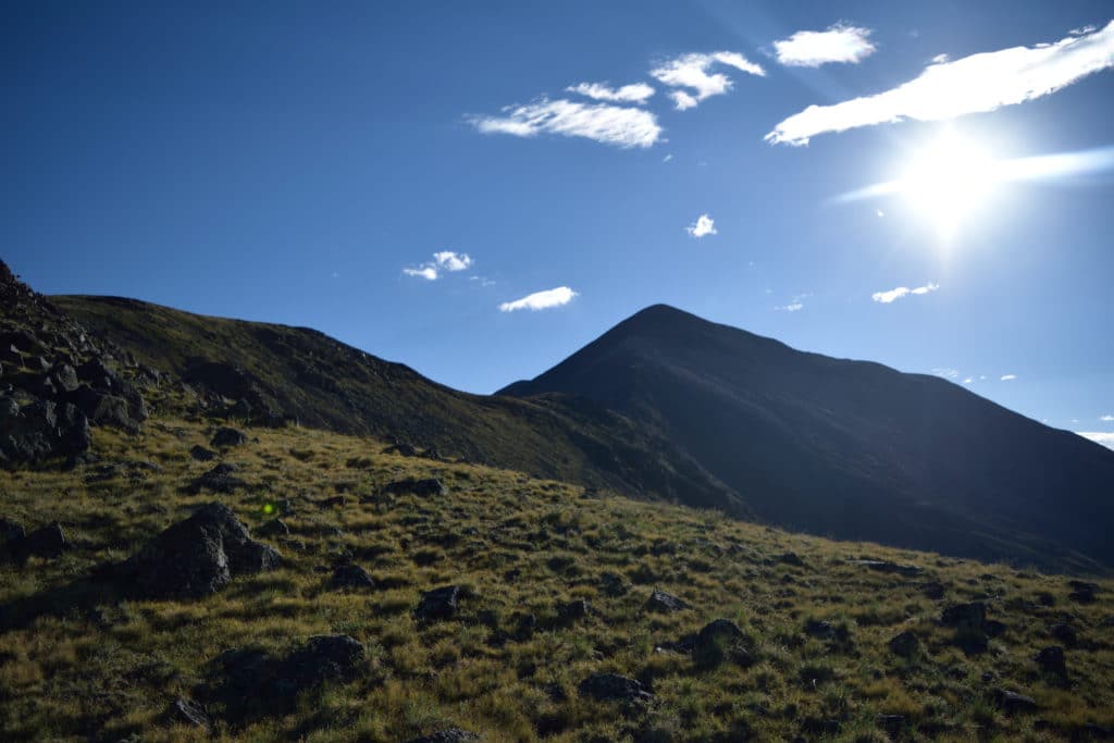
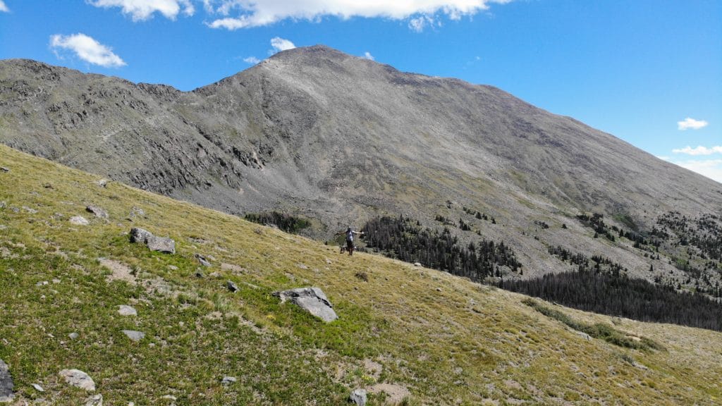
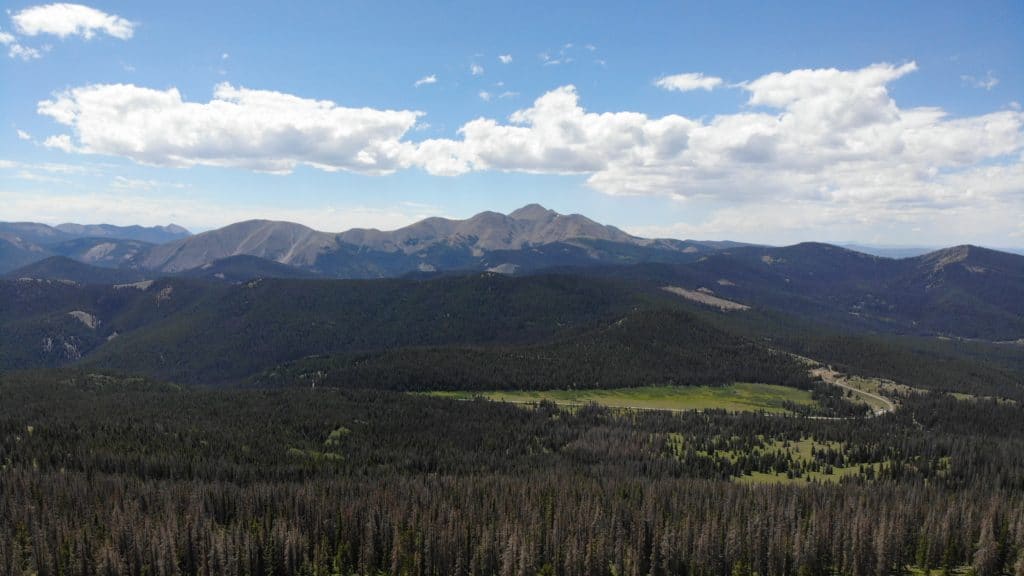
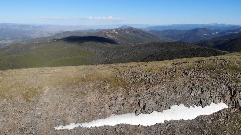
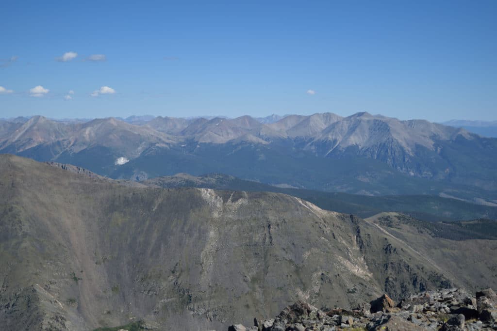
Best Views: This hike presents hikers with fantastic views for almost the entire trail once you leave the treeline behind. On a clear day you have fantastic views of the Sangre de Cristo Range to your south and east, the Collegiate Peaks to your north and to the San Juans to south and west. Summit views are great in all directions.
Mt Ouray Trail Route
Gear Needed
- Mickey’s Mountain Kit
- Backpack
- Hiking Shoes or Hiking Boots
- Map of area or GPS – I use the Garmin inReach
- Optional: Hiking Poles
- *Links included in this description might be affiliate links. If you purchase a product or service with the links that I provide I may receive a small commission. There is no additional charge to you.
My Trip to Mt Ouray: August 2020
After some time well spent on the East Coast, I was excited to get back to Colorado and tackle some more high elevation peaks. I wanted to give my lungs an acclimation hike and thought that Mt Ouray was a great choice. Best of all, Juno could come along with me! We left home very early and arrived at the somewhat crowded trailhead near Marshall Pass at 7AM.
The hike didn’t have an official trail but was very straightforward and easy to follow from car to summit. The hiking was fun, the views were beautiful and the trail surprisingly uncrowded. Overall, Mt Ouray was a great half day hike and one I would recommend for anyone in the area.
Mt Ouray Virtual Trail Guide
Questions or comments about the hike up Mt Ouray? Leave a comment below or follow me on Instagram!
2 thoughts on “Mt Ouray 13er Hike Trail Guide”
Thanks for the excellent trail guide to Ouray. I climbed it yesterday. A comment for you on the Grizzly description. In the X section you say “Traveling under or on top of any cornice is highly advised.” Some newby might takes this literally. Change to NOT advised.
Good catch, thanks Chuck!