Presidential Traverse New Hampshire Hike Guide
The Presidential Traverse is a 19+ mile hike that works through the White Mountains of New Hampshire. The hike name comes from the fact that hikers will summit 8+ mountains named after US Presidents in addition to several other peaks along the way. This gem of a hike has a few variations allowing hikers to end at Mt Pierce, Mt Jackson or Mt Webster and the ability to add-on sub peak of Mt Washington, Mt Clay. This is truly one of the most beautiful hikes in the United States but does require a full day of good weather or several days if you plan on camping to extend this to two days.
Presidential Traverse Quick Facts
Virtual Trail Guide: Presidential Traverse
Presidential Traverse Rating: ★★★★★ (5/5 Stars)
Distance: 21 Miles with Clay and Jackson, 18 Miles Without Jackson & Clay
Elevation Start: 1,300ft
Highest Point: 6,288ft
Total Elevation Gain: 9,100ft
Estimated Time to Complete: 15-24+ Hours
Difficulty: Difficult to Strenuous What does this mean?
Class: Class 3 (very low class 3 moves along the way, most is Class 2 or lower)- What does this mean? –
Season: May – November (expect snow outside of this period)
Directions to Presidential Traverse
Trailhead: The Presidential Traverse starts at the Appalachia Trailhead and ends at the Webster/Jackson trailhead. It’s most common to go North to South. It’s about an hour drive in between trailheads.
Getting Here: A north to south hike is the most common, although you could start at either trailhead below.
Appalachia Trailhead
Webster/Jackson Trailhead
Parking: Both of these trailheads are insanely popular, especially during the summer and fall. If you plan on hiking the Presidential Traverse, plan on a very early start to get a parking spot and give yourself ample time for the hike. The Appalachia Parking Lot is massive with parking along the road while the Webster/Jackson trailhead lot is much smaller with road parking available as well. Surprisingly, neither lot has any restrooms.
Fee: As of 2021, there is no fee to hike the Presidential Traverse if you get dropped off and picked up. However, if you do plan on parking – there is a $3 per day fee at the Appalachia Trailhead to start/end the hike.
Summary
Dogs: Although dogs are allowed, I would not recommend bringing them on this hike. Its a long enough day for humans, leave them at home.
Camping: Camping along the Presidential Traverse comes in two forms: camping at one of two designated campsites: Valleyway Campsite and Nauman Shelter Tentsite or through the many huts along the way. You can read more about the huts here.
Hike Variations: There are two bigger variations and one minor one for the Presidential Traverse. The two main variations are adding Mt Clay (Mt Reagan) and Mt Jackson. The first mountain, Clay, adds hardly any distance and short elevation while adding Jackson extends your hike by about three miles. If you want an even further variation, some hikers continue past Jackson and add Webster as well. However, for me, that defeats the purpose of this hike as Daniel Webster was not a president.
Hike Tip(s): When picking a day to hike the Presidential Traverse, you 100% need to have good weather. Rain/storms will ruin this hike and make it extremely dangerous. Why would you want to suffer through 20+ miles of hiking and not enjoy a beautiful day? Water and food are going to be crucial on this hike so take advantage of the huts to refill water and grab a snack. In addition, the top of Mt Washington might be the most commercial and annoying part of the hike, but it’s a fantastic spot to grab some hot food and take a quick break. If you plan on hiking the Presidential Traverse in one day, be sure to be prepared for a long day and have the appropriate things in your bag for all scenarios that might arise. Having a map or GPS for this one is also a great idea.
XFactor: Crowds & Views
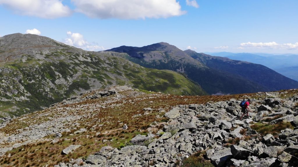
I am not sure if everyone was just “naturing” really hard in 2021 but when I hiked this route, I literally did not have my own space for 19 of the 21 miles. It was absolutely crazy. For the entire day I had no space to myself with the exception of 10-20 yards before and after me. Crowds were the worst around Mt Washington and Monroe. An early start MIGHT help avoid some people, but it’s inevitable you will run into hordes of people at some point during the day.
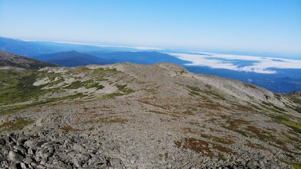
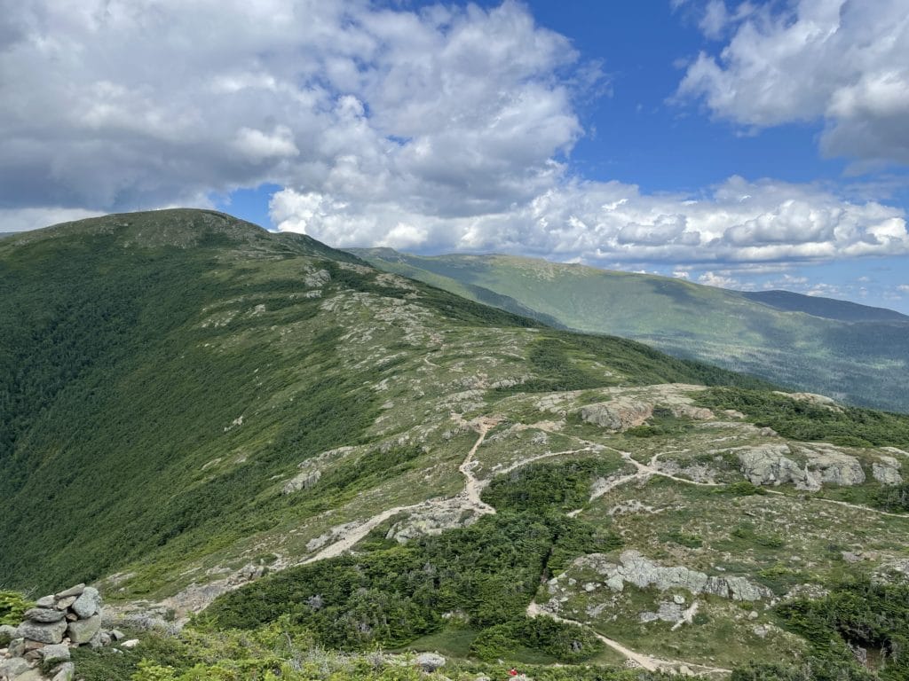
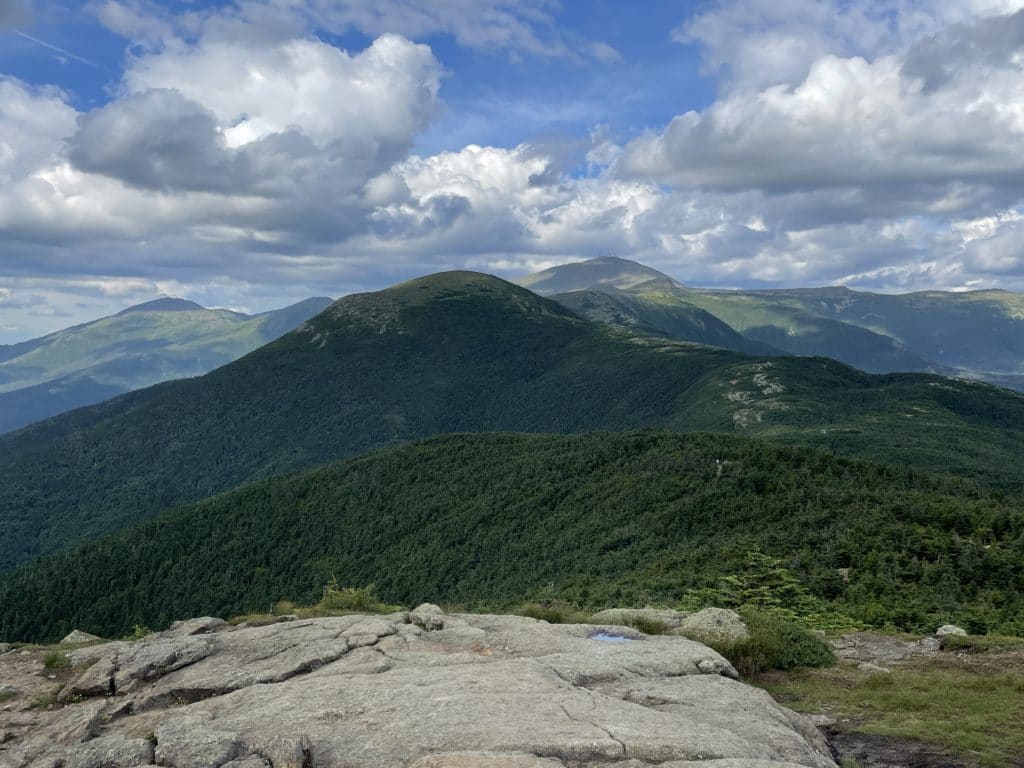
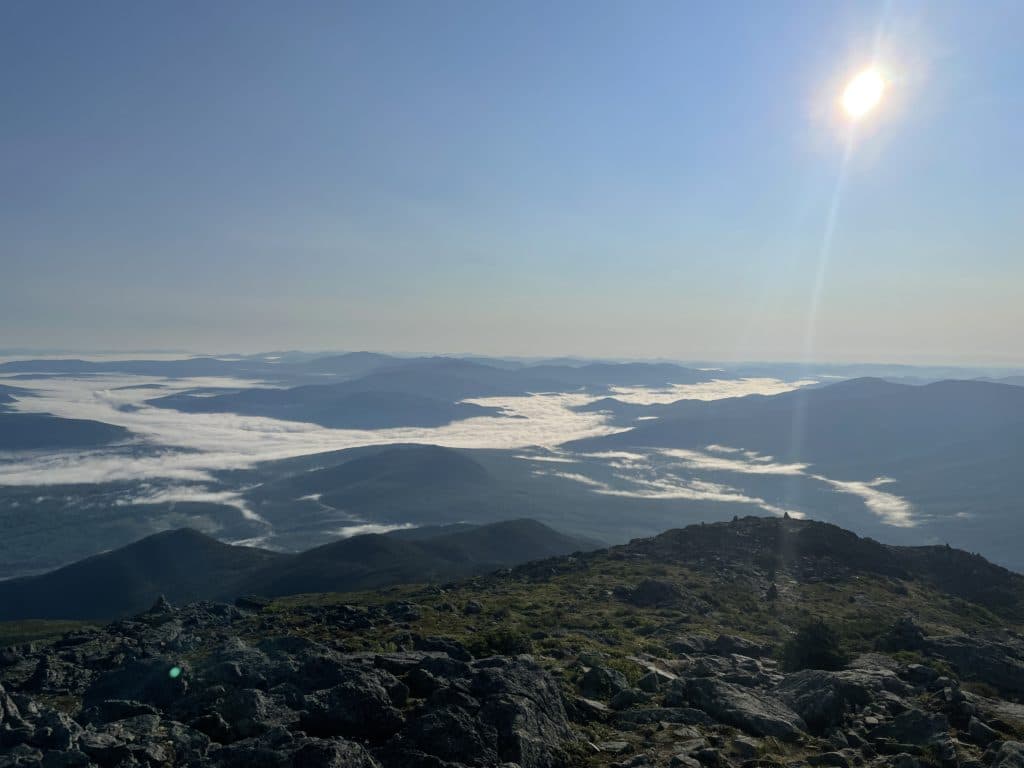
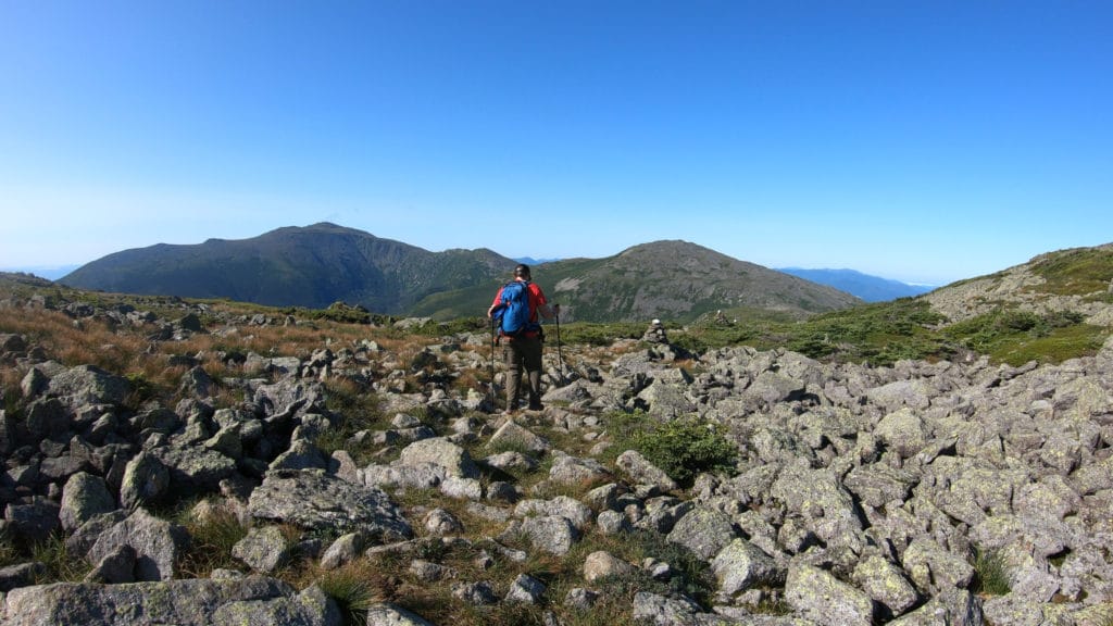
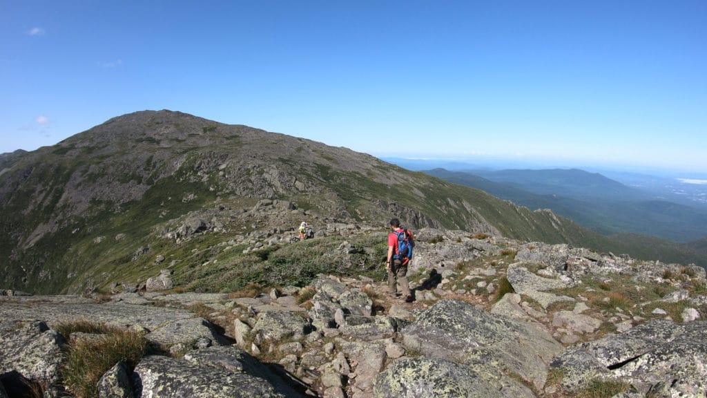
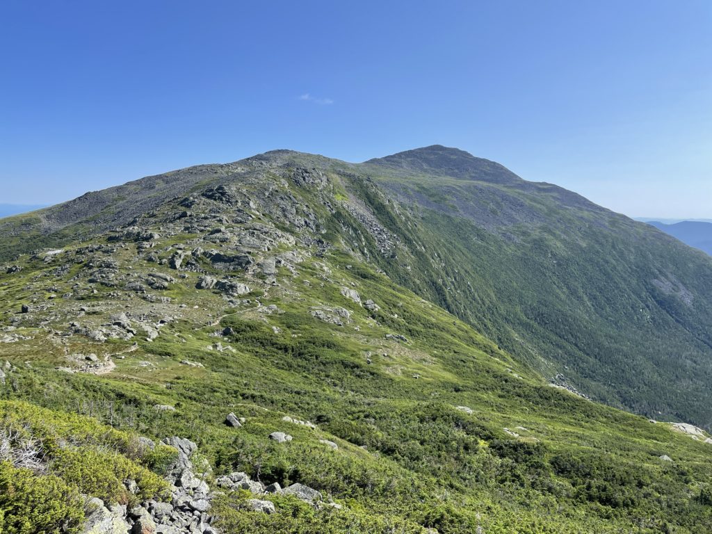
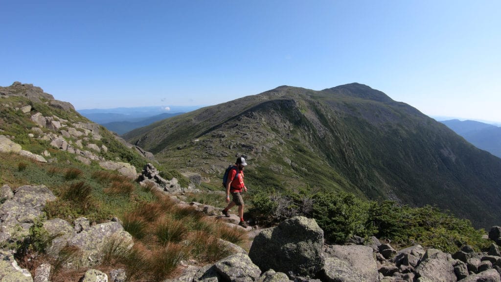
Crowds suck, but the views on this hike do not. On a clear day, the Presidential Traverse views rival any hike the US has to offer.
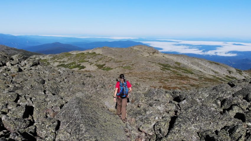
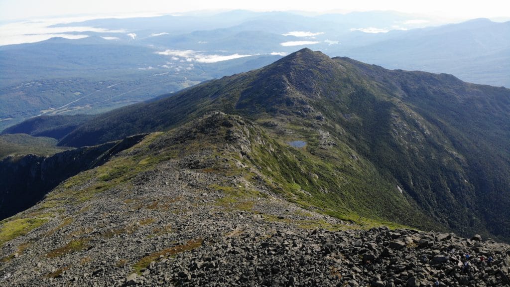
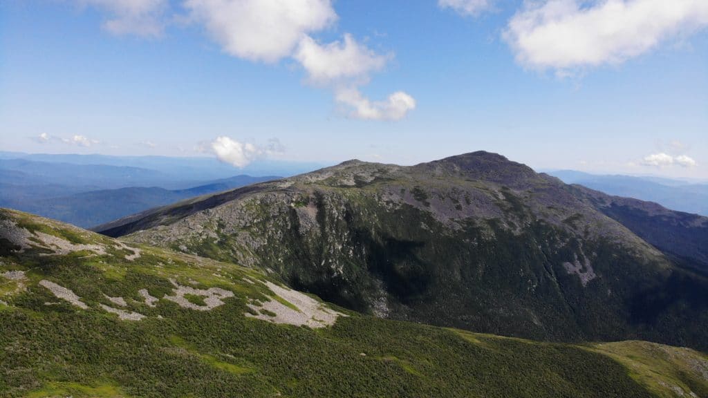
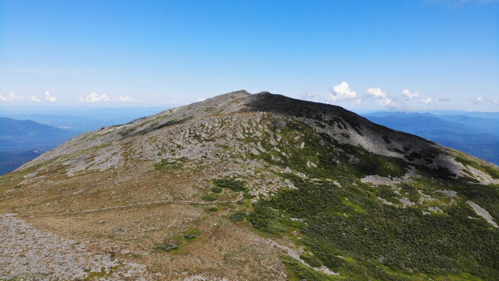
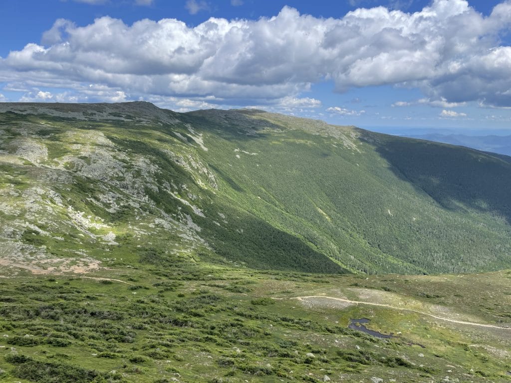
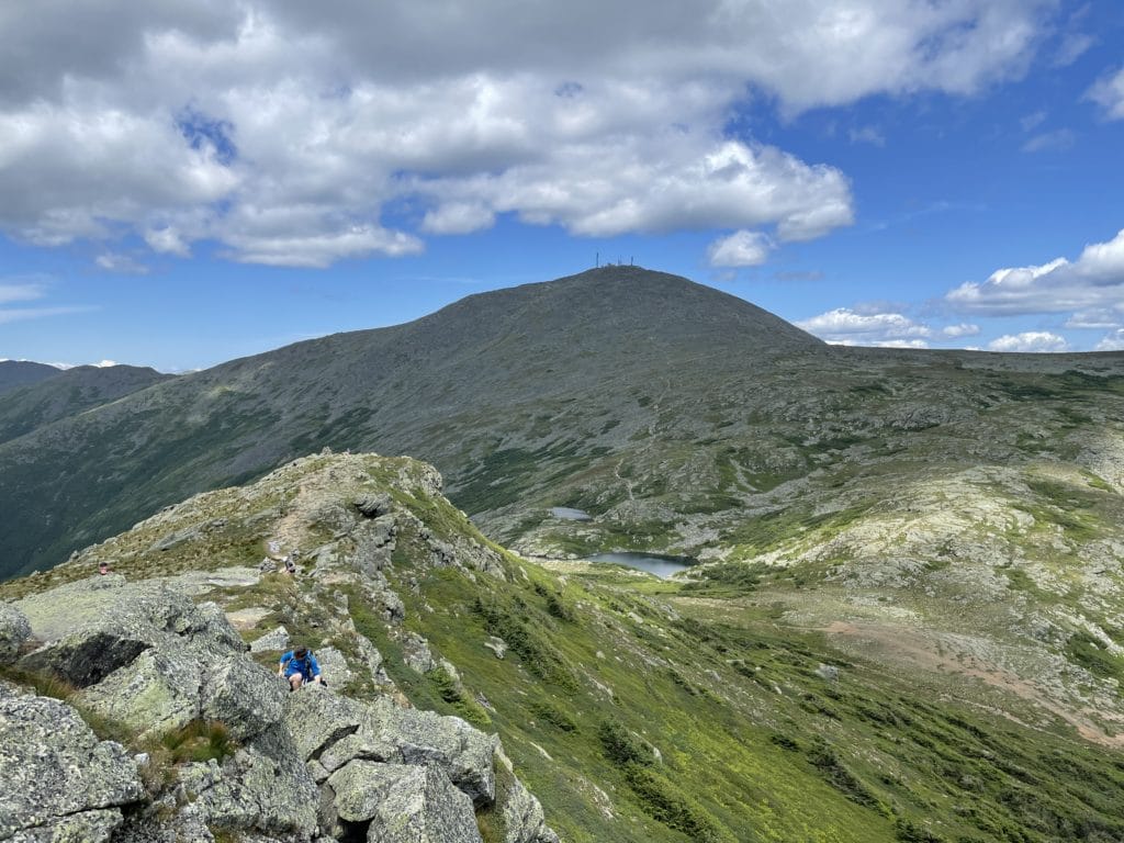
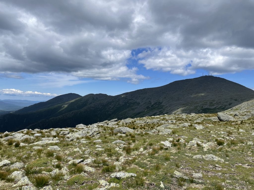
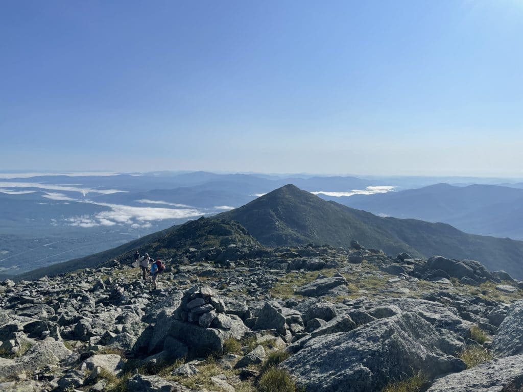
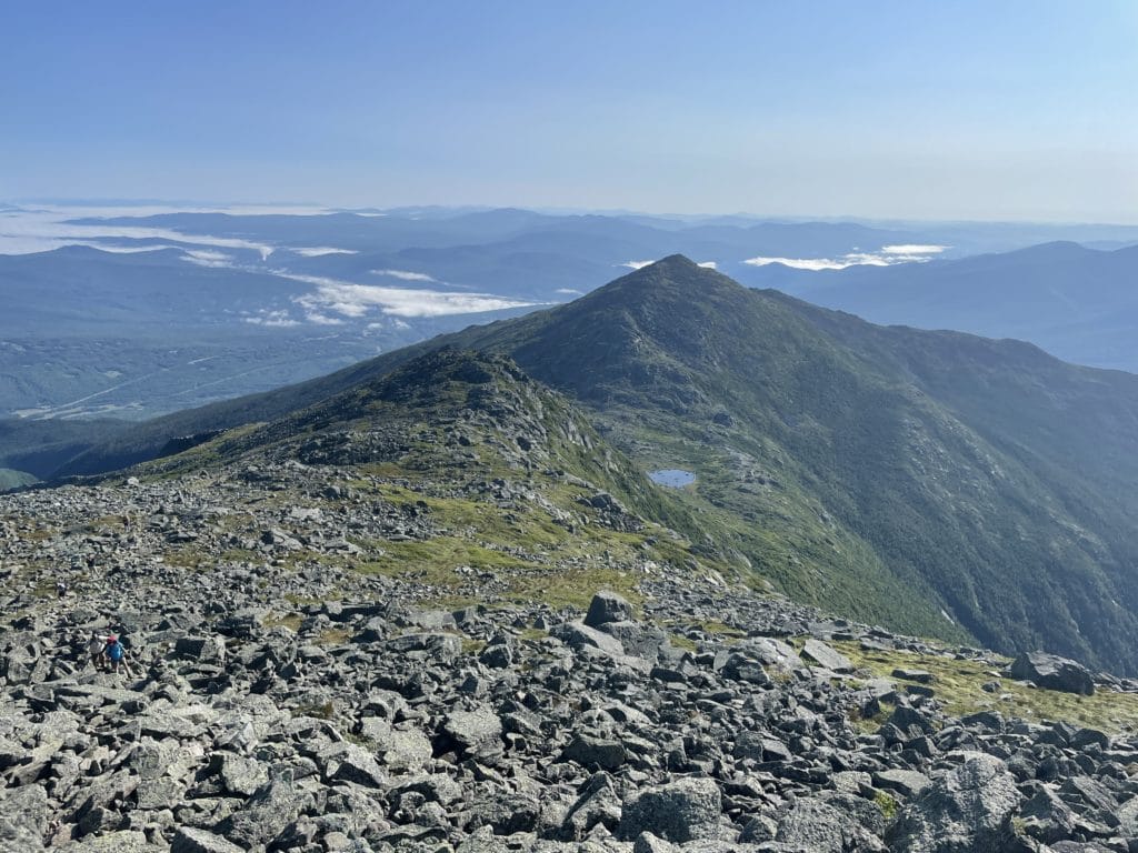
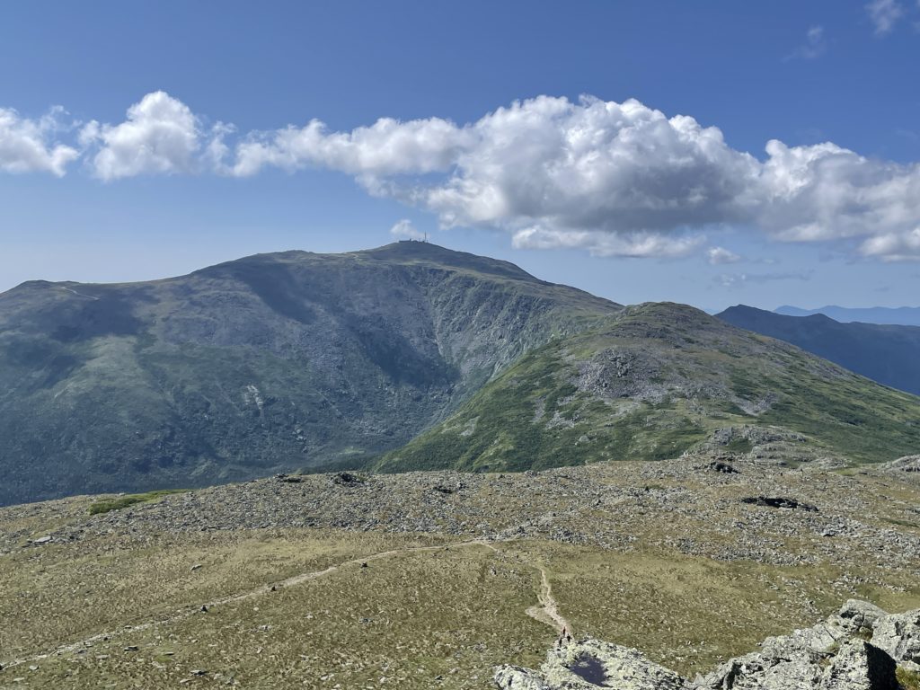
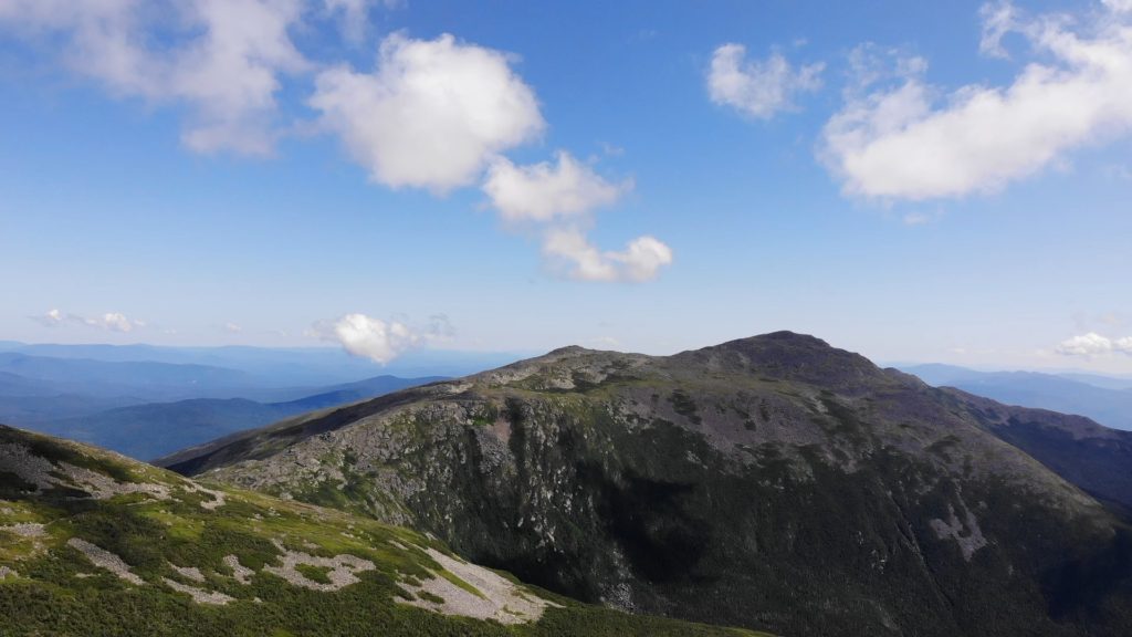
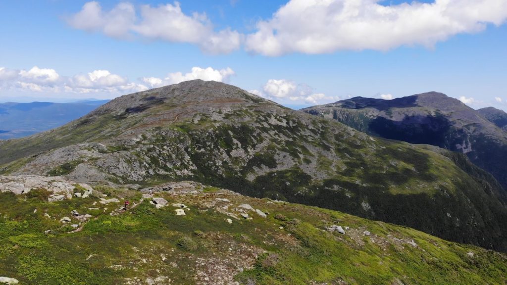
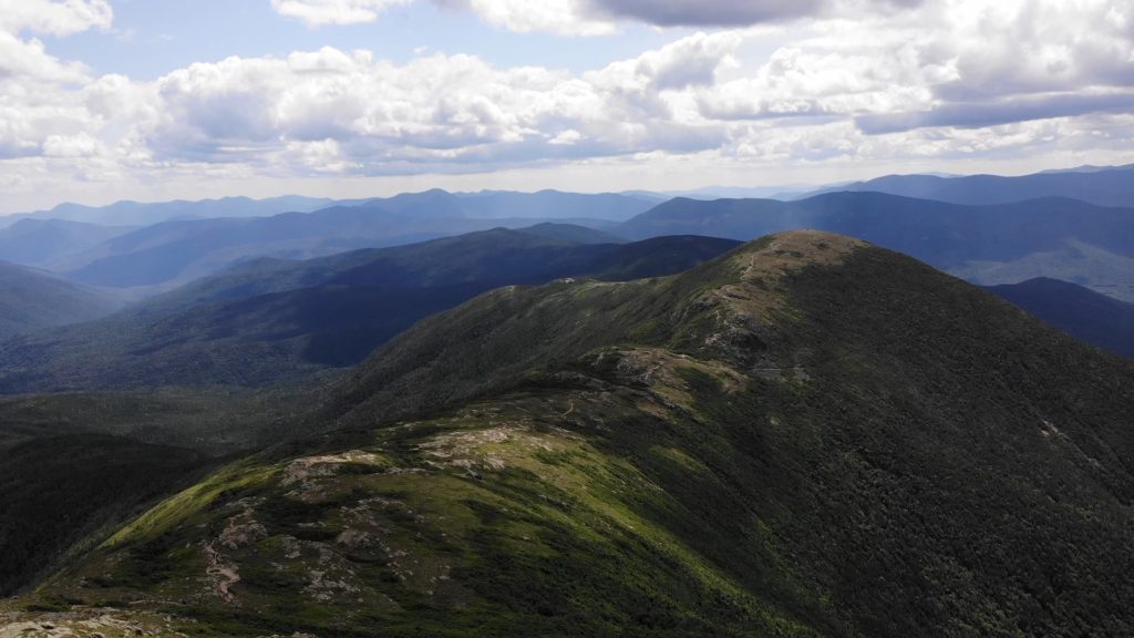
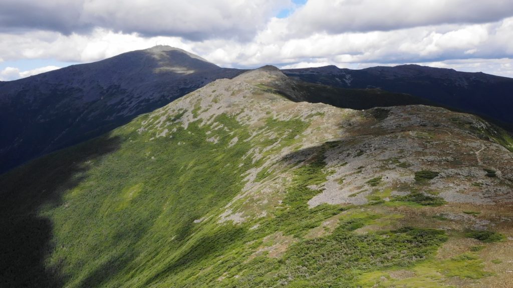
Best Views: In general, the best views are from Mt Madison to Mt Eisenhower since all of that hiking is above treeline. I really enjoyed the views from Mt Clay and Mt Monroe as they have excellent landscape views of the White Mountains and much of the Presidential Traverse. Mt Jackson also had sneaky good views since they provided a different perspective of the White Mountains vs what you had seen most of the day.
Presidential Traverse Hike Route
Includes Mt Clay & Mt Jackson
Gear Needed
- Men’s Trail Runners
- Women’s Trail Runners
- La Sportiva Trango Hiking Boots (Men’s)
- La Sportiva Trango Hiking Boots (Women’s)
- Backpack
- Food & Water
- Cash/Credit Card for Mt Washington Summit Refuel
- Garmin inReach or GPS – at the very least have a map of the route
- Optional: Hiking Poles
- Optional: Headlamp
- Optional: Water Filter OR UV Pen
- Optional: Garmin Fenix Watch
- Optional: Camera and Lens
- Optional: GoPro, Joby Tripod
- *Links included in this description might be affiliate links. If you purchase a product or service with the links that I provide I may receive a small commission. There is no additional charge to you.
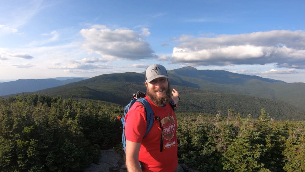
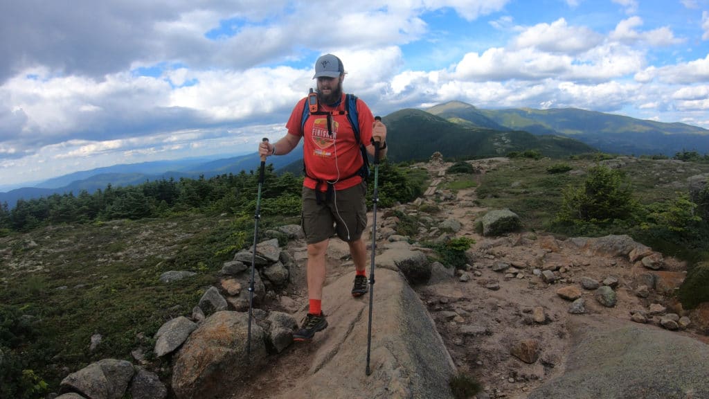
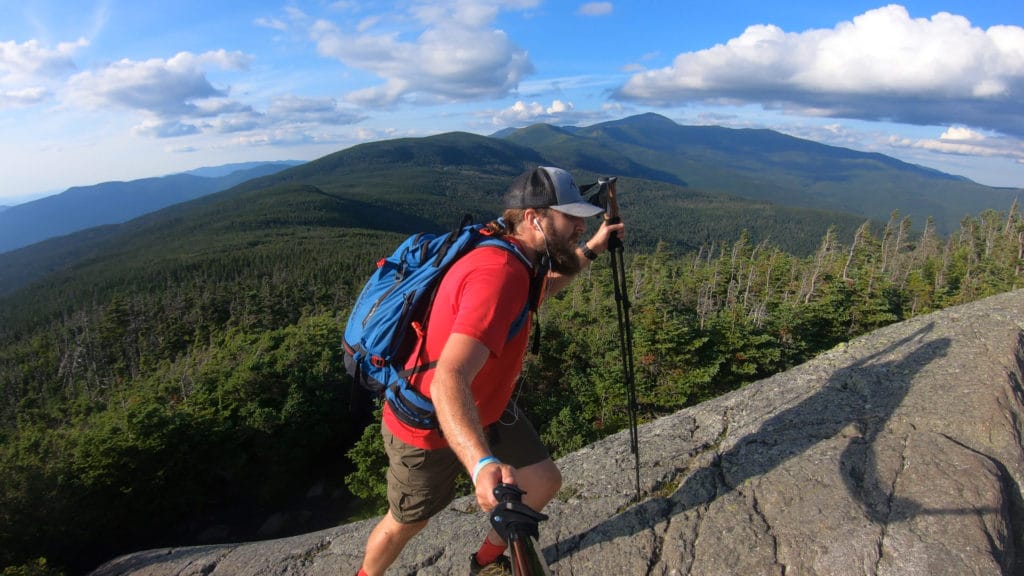
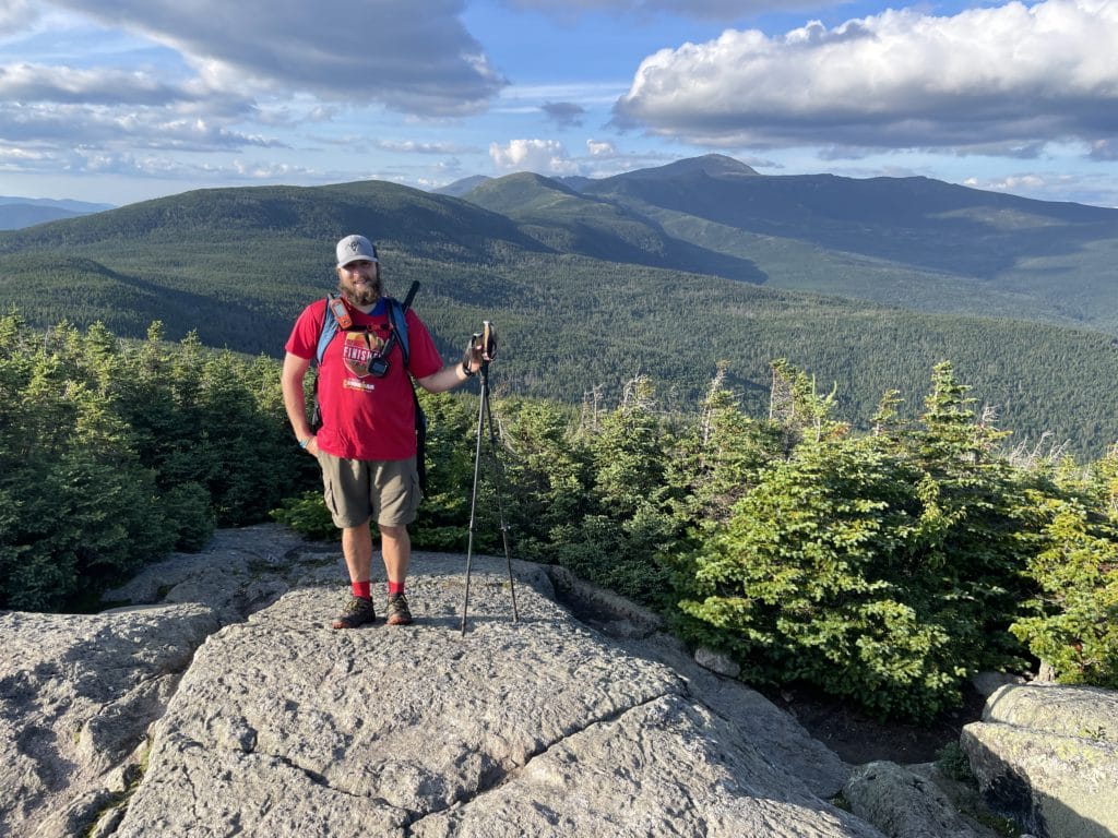
My Trip to the Presidential Traverse: July 2021
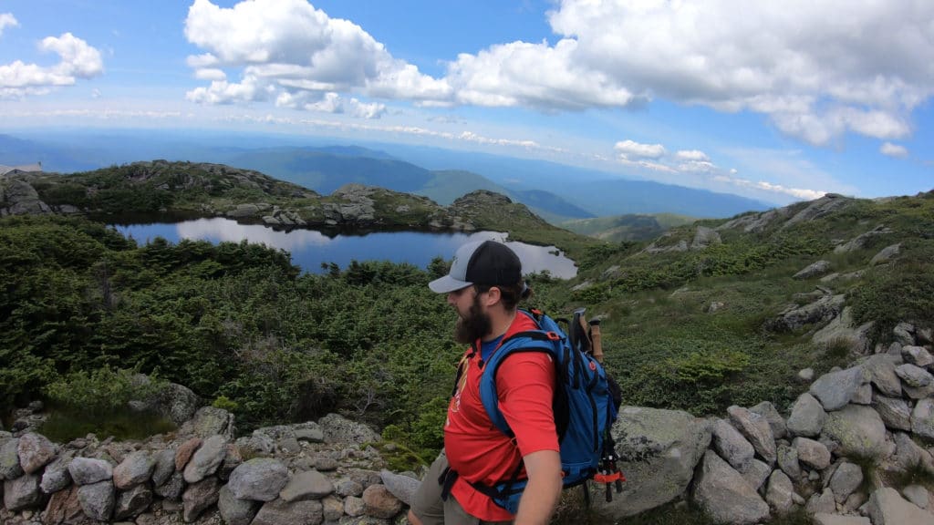
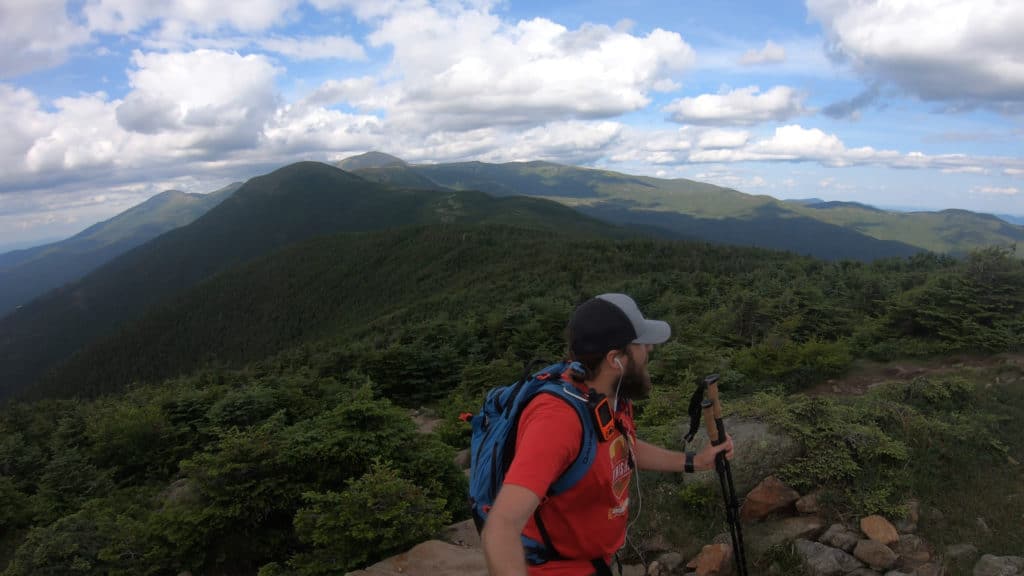
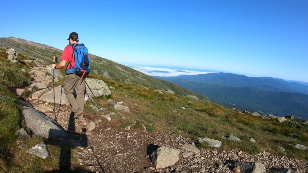
Ever since my friend Nick told me about the Presidential Traverse, I knew this one had to be tackled. I grew up in southern New Hampshire and had hiked many of these 4,000ft mountains, but never together in such an awesome link-up. When plans to hike this in the summer of 2020 fell through, I knew that a beautiful Saturday during the July of 2021 was my ticket. My step dad dropped me off at the Appalacia trailhead at 4:30AM. The lot was bonkers busy but I did not let that distract me from the goal at hand, gain Mt Madison.
Start to Mt Madison
The start of the presidential traverse was tough, there is no way around that. In the first 3 miles or so you gain about 3,000ft of elevation. Hiking through the dark is never fun, but when you add roots, mud and rocks to the mix – it was a losing combination. I took my time working up towards Madison knowing that I had many miles ahead of me. When I finally cracked treeline in front of the Madison Spring Hut, I was so relieved to see blue skies and feel almost no wind at all. After some small scrambling, I stood on top of my first peak of the day. I went to drink some water and realized that I had not filled up my two Nalgenes. My next stop, back to the hut to fill up.
Mt Madison to Mt Adams
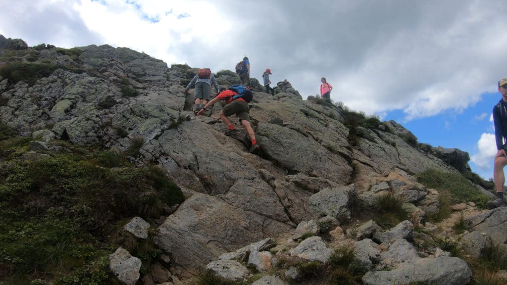
The hike up Mt Adams was more of the same terrain that Madison offered: rock scrambling, a bit of bushwhacking and a well established trail. To be honest, the trail really did not even matter because there were so many people hiking that I could have probably followed the trail with my eyes closed. On the summit of Adams, it was great to gain views of the hike so far and the low hanging clouds really were a nice touch to the scenery, thanks Ma’ Nature.
Mt Adams to Mt Jefferson
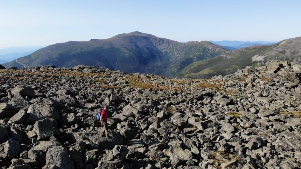
Mt Adams to Mt Jefferson offered some of the toughest trail conditions of the day. Lots of loose rock, elevation loss and pockets of water/mud. If I was looking to do some trail running, this was certainly not the spot. The good news is that the slopes of Jefferson offered some of the best scrambling on the entire Presidential Traverse. After hiking down the slopes of Mt Adams, it was about 750ft back up to gain the top of Mt Jefferson, the third summit of the day.
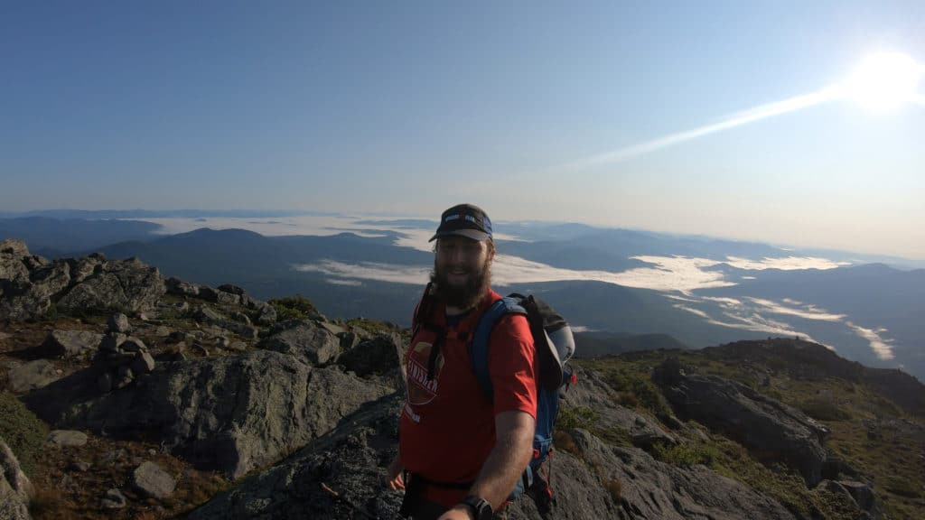
Mt Jefferson to Mt Washington
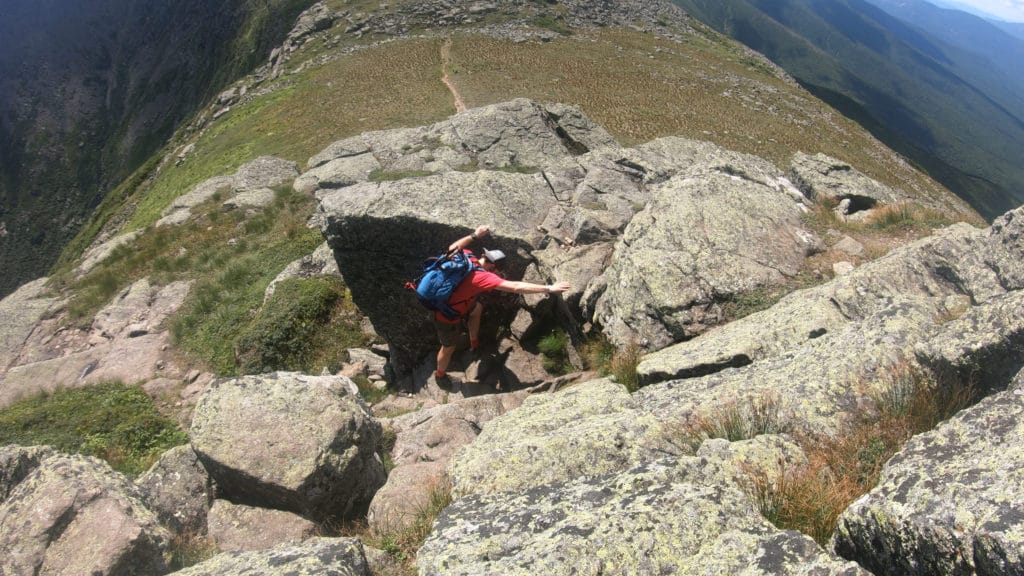
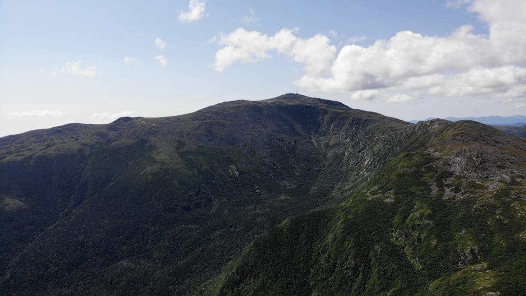
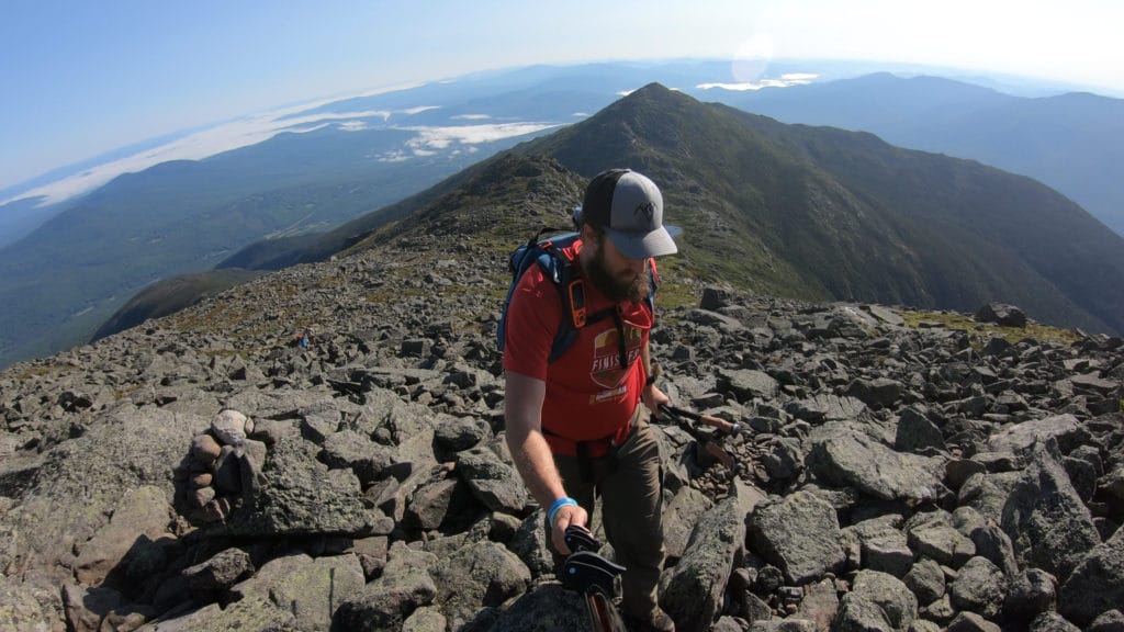
After leaving Mt Jefferson, I once again had some elevation loss before the trail leveled out for a while. Cruising along the trail, I came to my first option of the day: descend or bypass Mt Clay. I opted to climb the subpeak of Mt Washington since it hardly added any distance or elevation and I wouldn’t be able to live with myself if I left a summit behind. Mt Clay was by far the least crowded summit to this point on the Presidential Traverse and again offered amazing views. The trail up to the top had less rock hopping than the previous two mountains which was nice.
Mt Washington to Mt Monroe
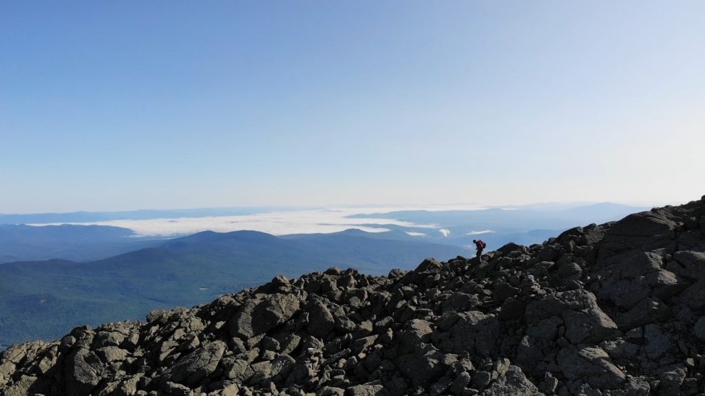
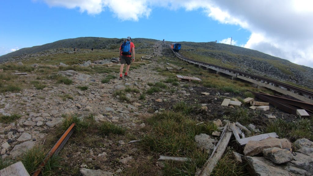
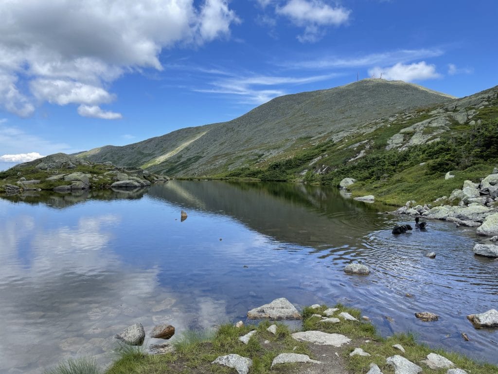
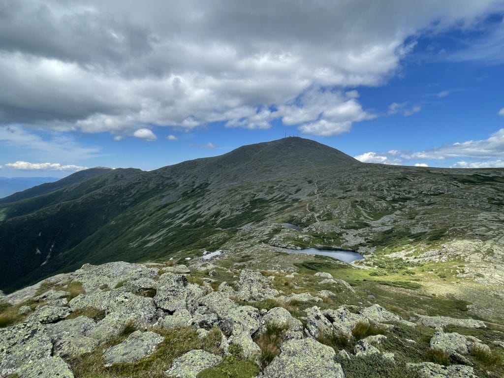
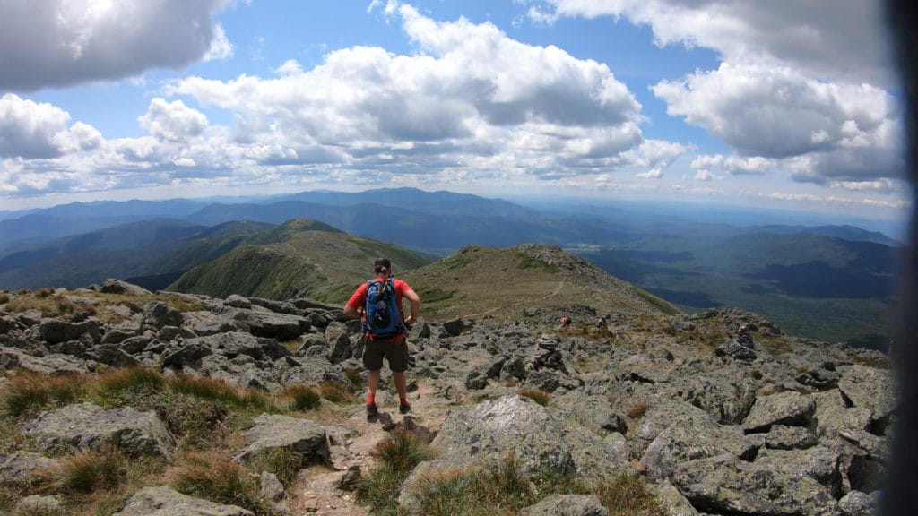
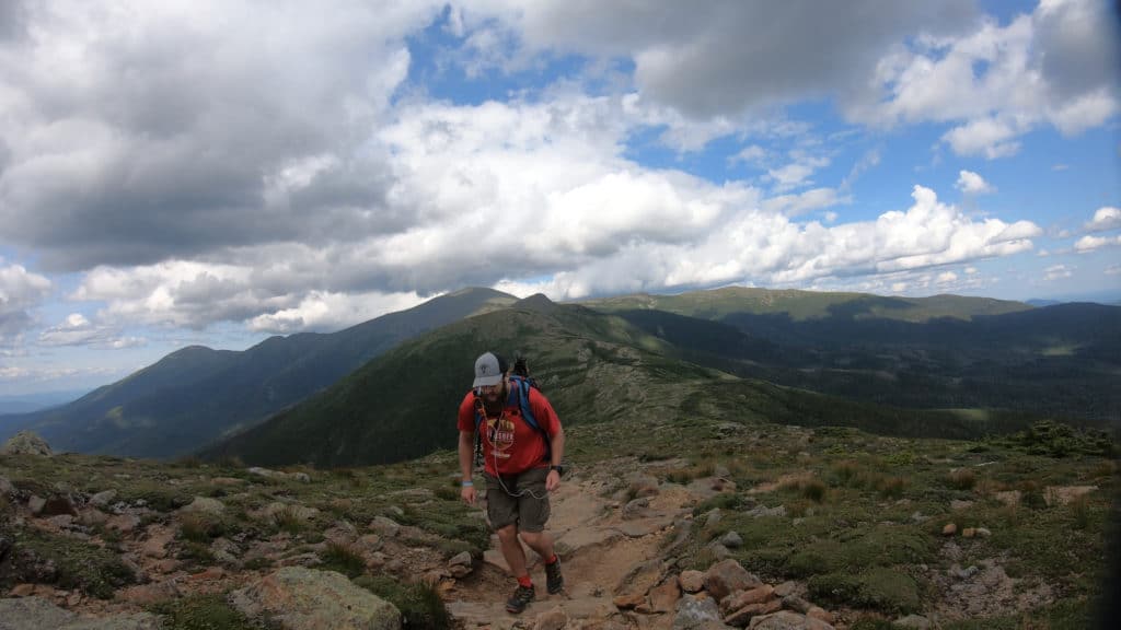
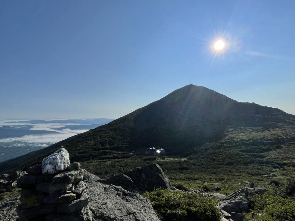
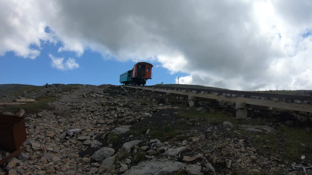
Mt Washington and I don’t really get along. The crowds, the smell of cigarette smoke from people who just put a sticker on their car congratulating it for driving up – it’s just not my jam. I do always love seeing the cog railroad so I made sure to get some pictures and footage of that on my way up to the summit. Hiking up Mt Washington, I think I got a little off trail for a bit, but there are so many trails that lead to the top of New Hampshire’s tallest mountains, it’s pretty hard not to find your way. On top, I stopped and ate the least healthy lunch of all time – but my legs were starting to feel it and I needed sodium, bad. I didn’t linger long here because I knew that I still had 10+ miles of hiking to go.
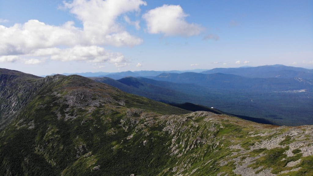
Leaving Mt Washington, the crowds were just insufferable. It was nearly impossible to not be hiking right behind randoms and finding your space on the trail? Forget about it. The worst part about this was not sharing the beautiful views with all of these fellow humans but not being able to hike at the pace I wanted. The Crawford Path, the trail that hikers on the Presidential Traverse follow for several miles, is a great spot to trail run. Unfortunately, I was not able to do this. I hiked past the Lakes of the Clouds Hut, joined by some random off leash dogs that were now part of my hiking party apparently and made my way up towards Mt Monroe. Right before gaining the summit was another fun class 3 section of hiking that I really enjoyed.
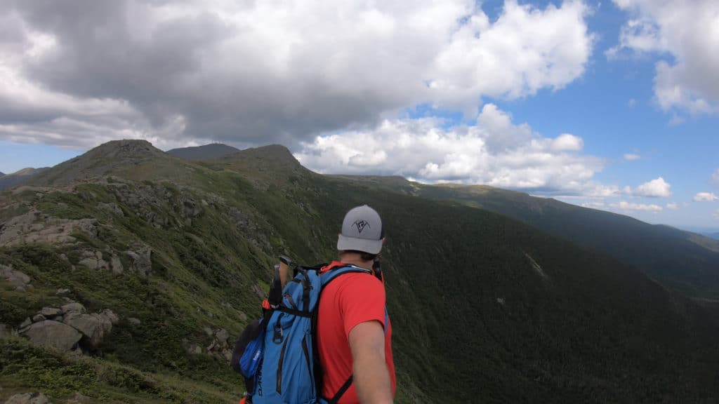
Mt Monroe to Mt Eisenhower
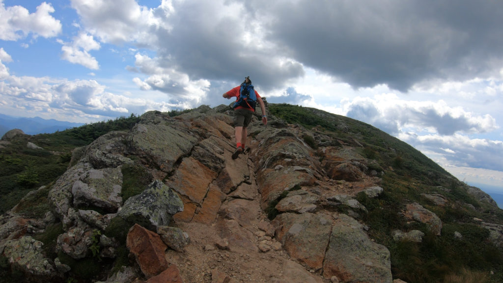
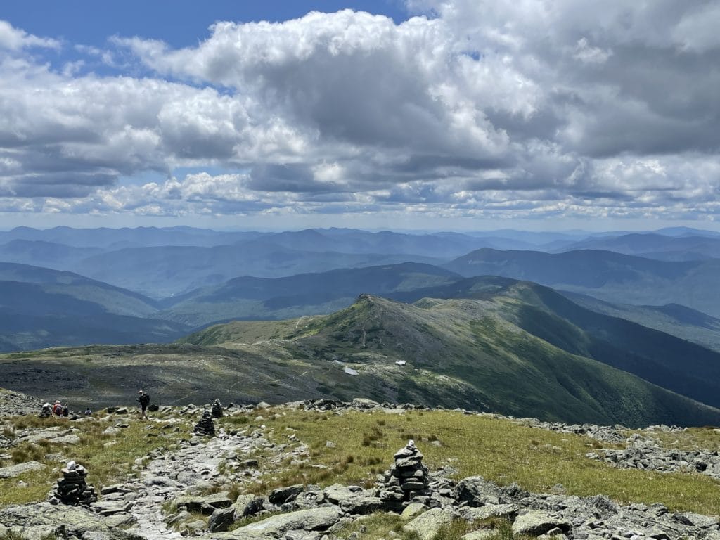
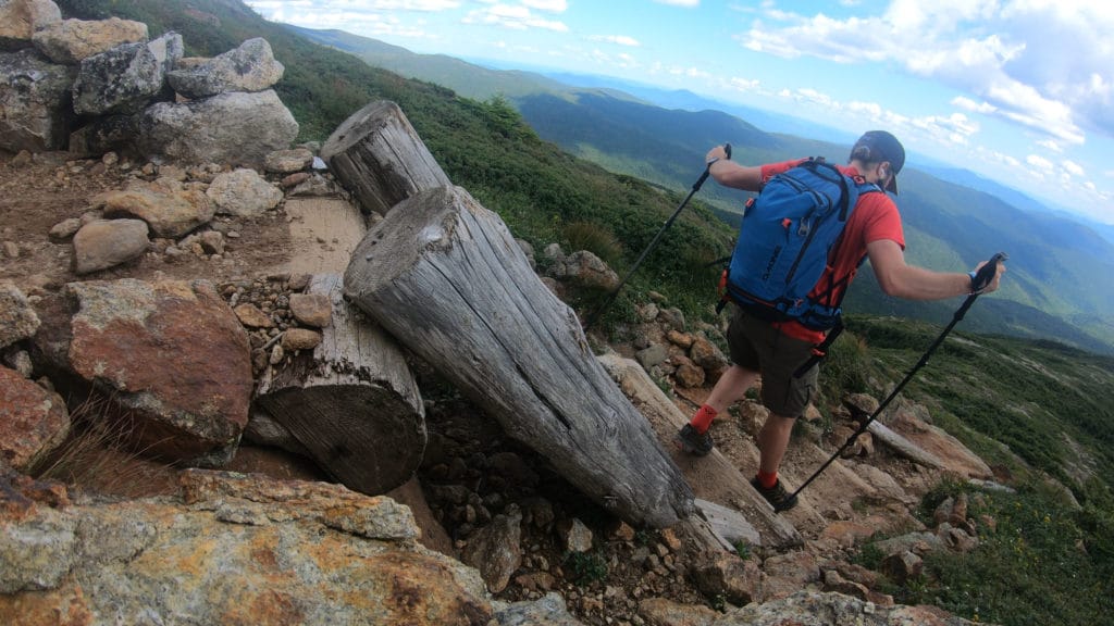
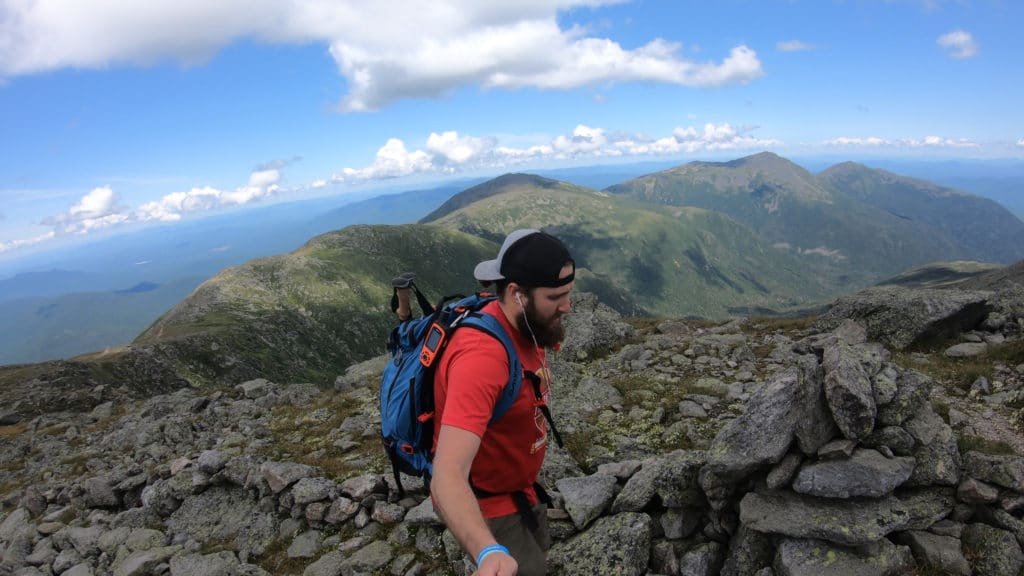
On the summit of Mt Monroe, I looked back towards Mt Washington and the clear windless day I had experienced less than an hour before seemed to be changing. Dark clouds were rolling in and the weather was turning. I wanted absolutely no part of that so I kept it moving adding on subpeaks Mt Monroe West and Mt Franklin on my over to Eisenhower. The trail conditions were nice and mostly flat with a minor downhill angle mixed in. The hiking here was some of my favorite of the day because I had a little more space on the trail and the views back towards Mt Washington were just awesome. Near the summit of Mt Eisenhower, the Presidential Traverse trail worked up some fun rock scrambles before topping out on the flat summit of this 4,000+ft peak.
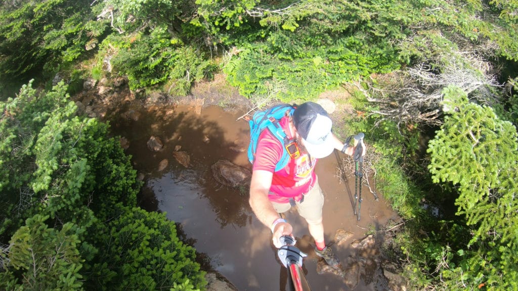
Mt Eisenhower to Mt Jackson
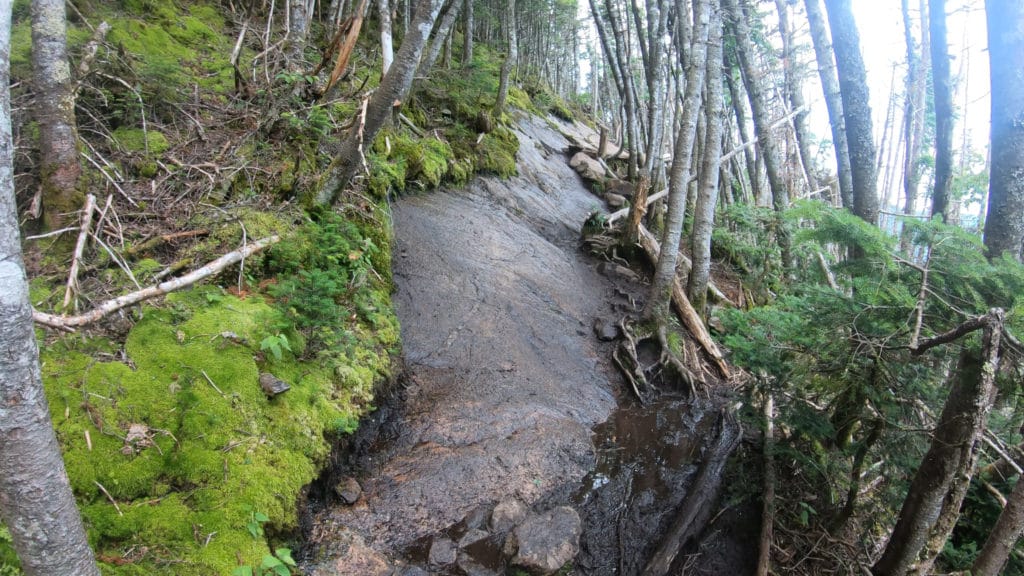
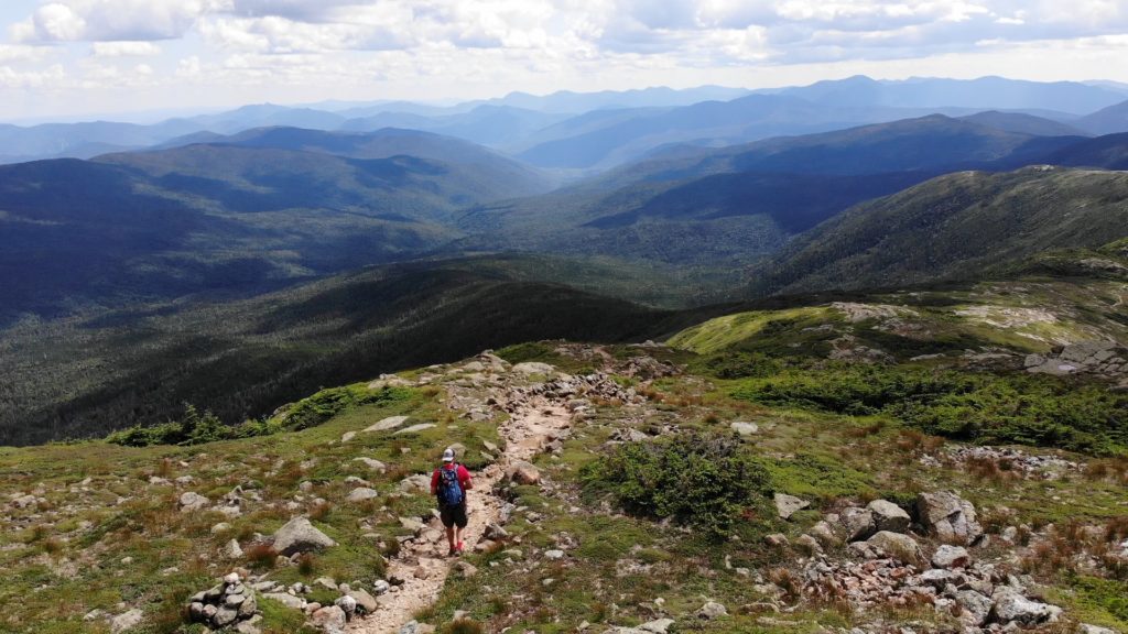
To this point, the Presidential Traverse had delivered with A+ views, great hiking conditions and a memorable day. Unfortunately, the stretch of trail from Eisenhower to Pierce changed that. The downhill hiking continued but with a lot more mud and water mixed in. All of that above treeline joy you had experienced for several hours prior was gone. Back into the thick pine trees I went. The summit of Mt Pierce, a place I was familiar with from a prior hike, was anticlimactic and the hiking from Mt Pierce to the Mizpah was honestly the worst stretch of trail from the entire day. Steep wet sections of granite paired with loads of mud and bugs made for a terrible time.
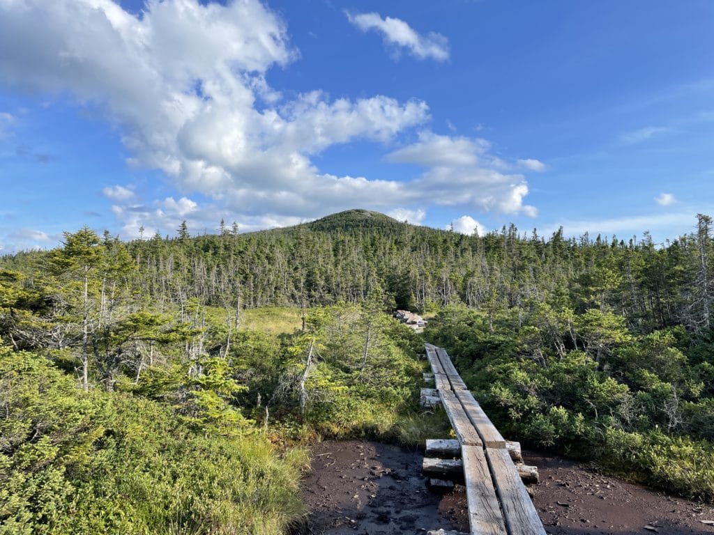
I reloaded on water for the final time of the day at Mizpah Hut and continued towards Mt Jackson. More hiking through the woods, more mud and my spirits were starting to dip. I was ready for this hike to be over. I scrambled up the granite slabs and gained the summit of Mt Jackson, my final peak of the day. I took some time to look back at what parts of the Presidential Traverse I could still see and admired my work. The hike back down to Crawford Notch was uneventful and each mile felt like it was 5. I arrived at highway 302 just as it was starting to get dark. Exhausted, hungry and dirty but mentally I would never forget this day.
Overall, the Presidential Traverse was a beast of a day but I can confidently say it is one of the best hikes that the United States has to offer. If you are a hiking enthusiast, a trip to New Hampshire should absolutely be in the cards so that you can take on this classic route.

7 thoughts on “Presidential Traverse New Hampshire Hike Guide”
HI
I have hiked all but one of the 4,000 footers in NH. However, I am old and slow. If I hike the traverse over a few days I assume i will be fine. My questions is: does one need a guide or is the route well marked?
Thanks for reply
Hi Dotty, the trail is super well marked so you will be fine in terms of following the directions to each summit. If you do plan on spending multiple days, check out the camping section of the post for reservations on huts and camping spots. Best of luck!
Awesome useful information. thx for this and the YT video. Very much appreciated.
Are any of the tent sites around the halfway mark of the presidential traverse?
Best bet is to stay in one of the huts that are close to the halfway point.
How did you manage getting your car at the end of the traverse to get back home at the end of the day if you were solo. Thanks. 🙂
Was dropped off at the start and picked up at the end. You could 100% shuttle two cars if need be though.