Silver Couloir Buffalo Mountain Guide
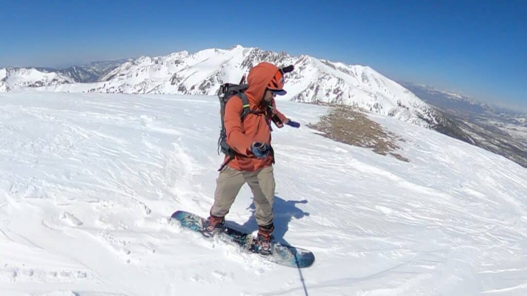
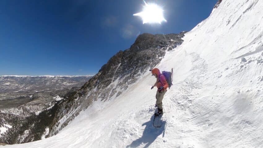
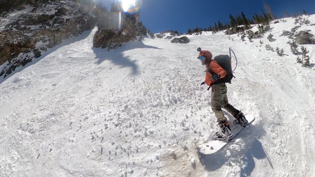
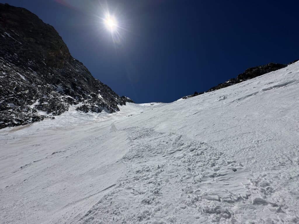
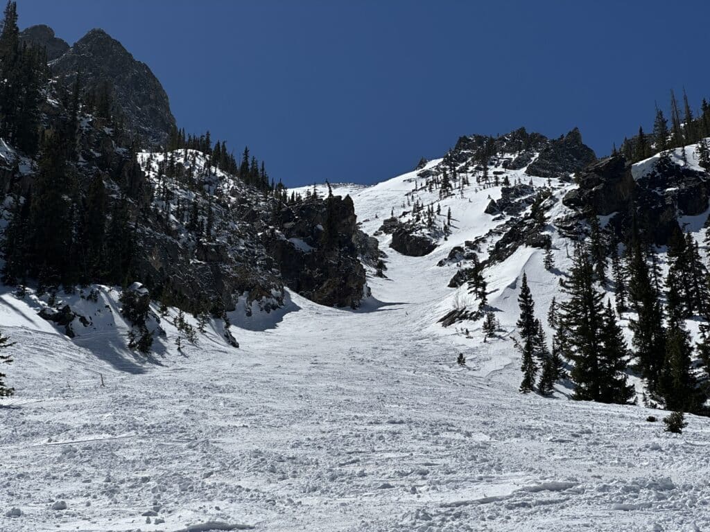
Silver Couloir on Buffalo Mountain is a classic ski line and snow climb located in Silverthorne, Colorado. Many consider this line one of the 50 classics in North America. This northeast facing couloir lasts for about 3,000ft and maxes out around 40-45°. Silver Couloir is typically ridden down with skis or a splitboard and the ascent line takes you up the eastern slopes of Buffalo Mountain.
Silver Couloir Quick Facts
Virtual Trail Guide: Silver Couloir Buffalo Mountain
Silver Couloir Rating: ★★★★★ (5/5 Stars)
Distance: 4.75 Miles (Up Eastern Slopes, Down Silver)
Elevation Start: 9,767ft
High Point: 12,777ft
Total Elevation Gain: 3,500ft
Estimated Time to Complete: 4-5 Hours RT
Difficulty: Moderate What does this mean?
Class: Class 1 – What does this mean?
Season: December – June
Snow Climb Grade: Moderate: 40-45 Degrees at its crux
Avalanche Risk: Silver Couloir in the Winter and Spring does present avalanche risk, so please understand the conditions and risks before heading out. There have been deaths on this line in recent history, so please be careful when recreating on Buffalo Mountain. Watch this video for basic avalanche information.
Directions to Silver Couloir
Trailhead: Buffalo Mountain / Lily Pad Lake
Getting Here: From I-70, exit #205 at Silverthorne and travel north on HWY 9 to the first traffic light, this is Wildernest Road. Take a left onto Wildernest Road, which turns into Ryan Gulch Road. Continue on Ryan Gulch Road up the winding hill past numerous condo complexes. At the top of the hill there is a parking area on the left. The trail starts at the far side of the parking area towards the houses.
Parking: Parking is extremely limited for this climb, room for about 10-12 cars with no overflow or nearby options if these spots are full. If this lot is full (it usually will fill up by 7AM throughout the spring on weekends, your best be is to take the Summit Stage bus. This free bus picks up and drops off at the TH with the closest option to ride down at the Lowes off I70. More information here, navigate to Wilderness Loop. There are no restrooms at this TH.
Fee: No fee is required
Summary
Dogs: I would not recommend bringing a dog up any couloir.
Camping: Camping in this area is extremely tricky, especially during winter or spring months. There is no camping at the TH or in the immediate area surrounding Buffalo Peak due to plots of private land that surround the TH.
Make it a Loop: The easiest way to make this one a loop is to climb Buffalo Mountain via the standard, east slopes and descend via Silver couloir. You will need to skin/hike a bit to rejoin the initial trail and there are several spots that require uphill hiking.
Trail X Factors: Parking & Hike Out
I discovered the hard way that this parking lot and line in general, is very popular. If you plan on tackling this line during the winter or spring, I would highly recommend an early arrival so that you can snag a spot. Otherwise, your options are very crappy.
In addition, after descending down Silver, be sure to look out for the exit of the line to the right back through the trees. There will typically be a line already established and its pretty key to find this so that you don’t have to suffer back up to the trail. Check out my GPX if you need to follow something. After rejoining the trail, there will be 2 or 3 sections that may require hiking unless you are really good at skinning.
Hike Tip: Before heading out to attempt ANY winter hike or couloir be sure to understand avalanche conditions. Silver Couloir faces north/northeast so the snow will typically be fairly firm and well tracked out unless you are hitting it with fresh powder. However, because you are ascending the east facing slopes, an early start is still recommended to avoid any wet slab/slide risk on that side of the mountain.
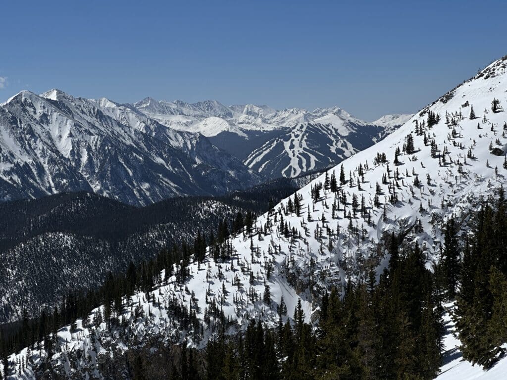
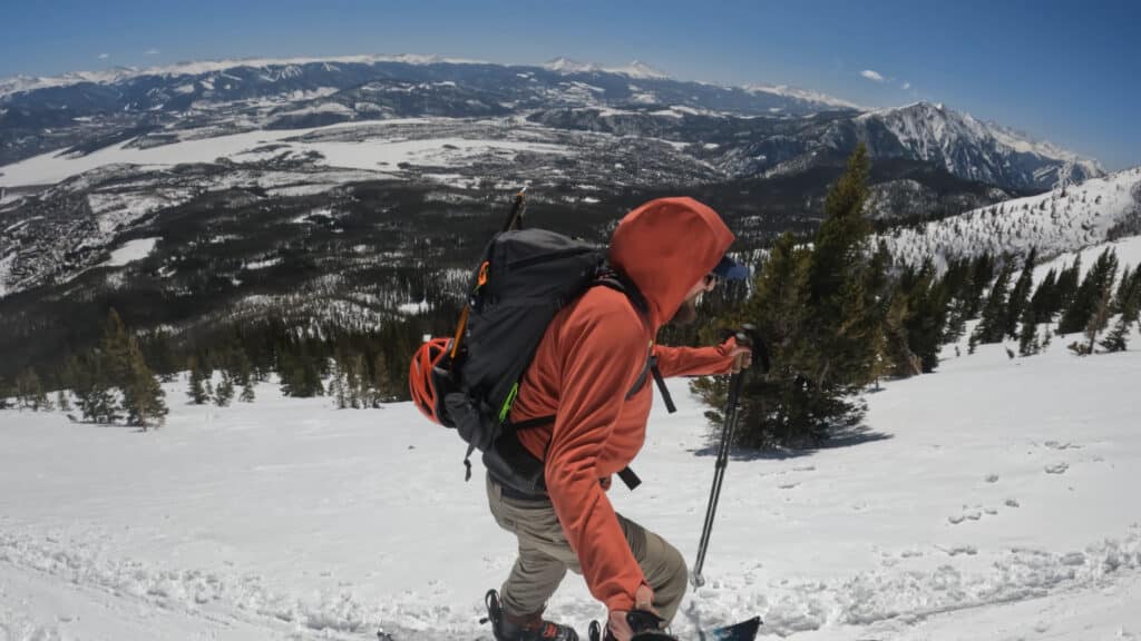
Best Views: Until you break the treeline, there are no views. However, once above, the views of Summit County and the Tenmile / Gore Ranges are fantastic. From the summit, the views West are A+.
Silver Couloir Buffalo Mountain Route
Gear Needed
- 14er Day Hike Packing List
- Winter Backpack
- Hiking/SkiPoles
- Headlamp
- Climbing Helmet
- Crampons
- Crampon Bag
- Snowboard Boot Crampons
- La Sportiva Mountaineering Boots
- Snowboard Boots
- Snowpants
- Gloves
- Microspikes
- Gaiters
- Avalanche Gear: Beacon, Probe, Shovel
- Optional: Mountain Axe – Petzl EVO
- Optional: Mountain Axe – Black Diamond Raven – Great for Beginners
- Optional: Snowshoes
- Optional: Skis or Splitboard
- Optional: Goggles
- Optional: Garmin inReach
- Optional: Garmin Fenix Watch
- Optional: GoPro, Joby Tripod, Selfie Stick, Drone
- *Links included in this description might be affiliate links. If you purchase a product or service with the links that I provide I may receive a small commission. There is no additional charge to you.
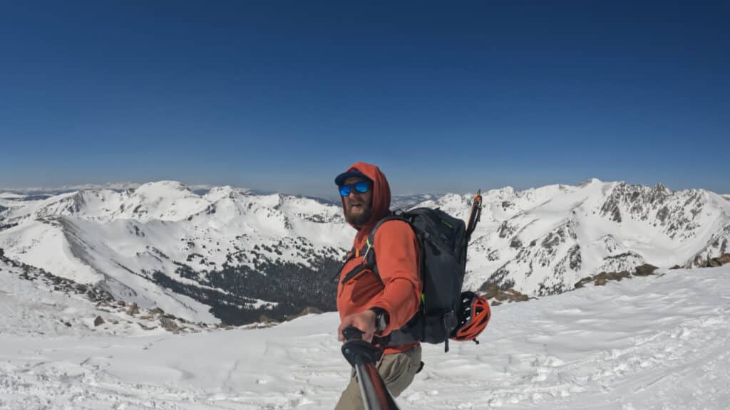
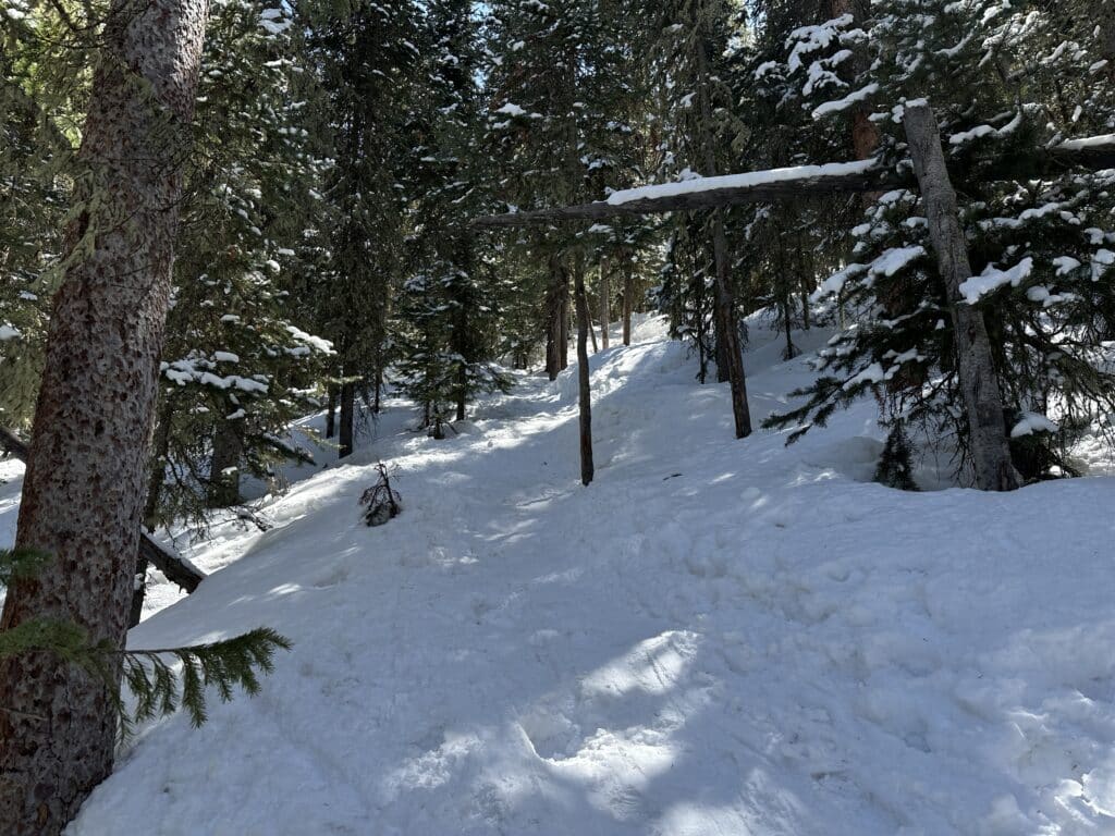
Silver Couloir Buffalo Mountain Pictures