
The Narrows Hike Trail Guide Zion National Park
The Narrows hike is one of the most popular in the United States and certainly Zion National Park. The hike starts on the paved Riverside Walk trail and then immediately enters the Virgin River where hikers will work their way up the winding canyon for miles to reach the famous Highway, Orderville Canyon and the eventual turnaround point of Big Spring. Big Spring is about 5 miles into the canyon and hikers going past this point must have a backcountry permit.
The Narrows Hike Quick Facts
Virtual Trail Guide: The Narrows & Orderville Canyon
The Narrows Rating: ★★★★★ (5/5 Stars)
Distance: 10 miles RT – View Park Map Here
Elevation Start: 4,419ft
Highest Point: 4,714ft
Total Elevation Gain: 300ft
Estimated Time to Complete: 4 Hours RT to Highway, 6-10 Hours RT to Big Spring
Difficulty: Moderate Difficulty System Explained
Class: Class 2 (minor rock scrambling) – What does this mean?
Season: Year Round – expect seasonal closures depending on hike
Weather: Check the Weather Forecast
Directions to The Narrows Hike
Trailhead: Zion Canyon Visitor Center
Getting Here: The Narrows hike is accessed by the southern entrance of Zion National Park. Zion Canyon requires a shuttle to get around the park or hikers can bike to the TH. Once in the park, get off or bike to “Temple of Sinawava” stop to start the Riverside walk to the start of the Narrows. This is the last stop within the southern portion of the park.
Fees: View this page for the most up to date information on Zion National Park fees.
Parking: Entering through the Zion Canyon Entrance point, you will need to park at the visitor center and take a shuttle into the park. There is a fee to park here ($25 as of 2020). If you don’t want to shell out for this, you can bike into the park or take a free Springdale town shuttle to the visitor’s center from most hotels.
Summary
Camping: Camping in Zion National Park comes in two forms: campgrounds and backcountry camping. Read more about both of them here.
Dogs: Zion National Park is not dog friendly for the most part. However, the one trail dogs are allowed on is the Pa’rus trail which is a pretty neat walk if you have the time.
Make it a Loop: The Narrows is an out and back hike with the option to extend your hiking in the Orderville Canyon. View the park map here to plan your trip today.
Hike X Factors: Time of Year
The Narrows is a very different hike depending on when you visit it. In the Spring, the hike will often be closed due to flash floods from melting snow water from the mountains above. During the summer, the water level is usually lower and much warmer. Hikers can enjoy the refreshing water as a reprieve from the insanely hot temperatures. In the fall and winter, the water is bone chillingly cold and usually requires neoprene socks, canyoneering boots and drypants. The Narrows will always be closed when water levels or the water pressure is high. Regardless of when you visit, this is an awesome hike.
Hike Tip(s): The Narrows will get crazy crowded during summer months. If you want to avoid crowds during the hotter months, be sure to get to the hike early. In the middle of the day, the highway to the parking area will have hundreds of people which can make for slow hiking and a less than ideal experience. Want to avoid some of the crowds? Head to this hike during cooler months (October, November, December) or bike into the park to arrive before the shuttle buses. The bike into the park is very mellow and should take most people between 30mins and an hour.
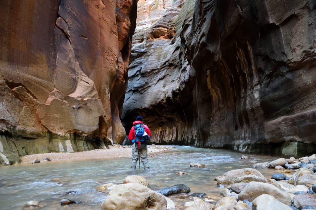
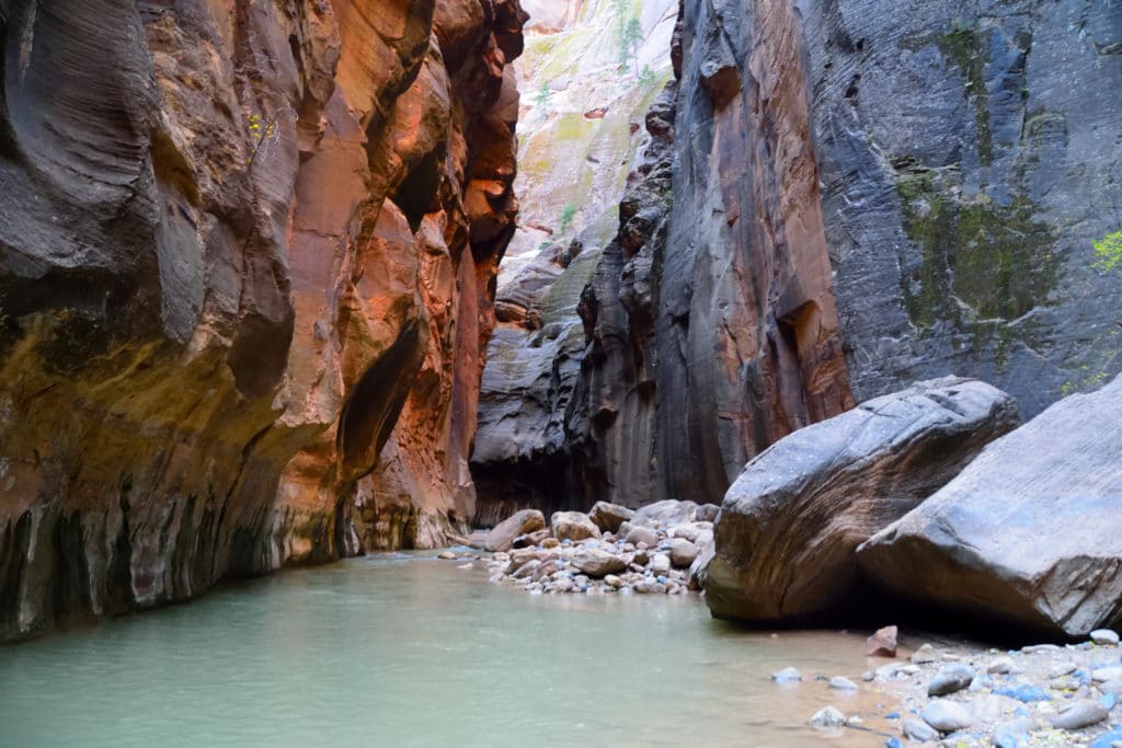
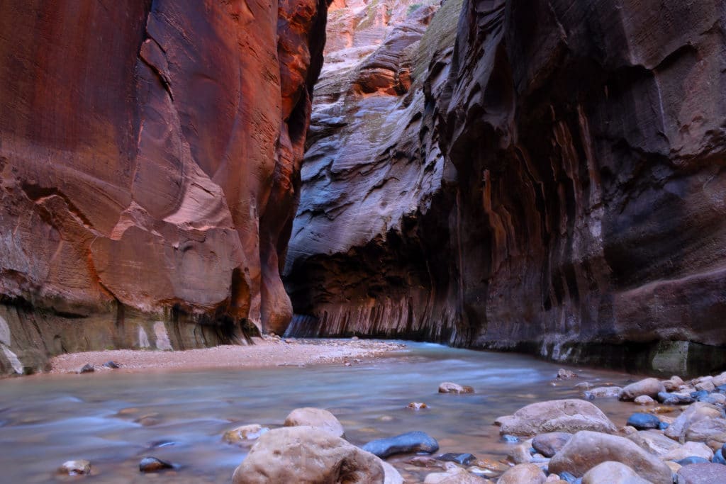
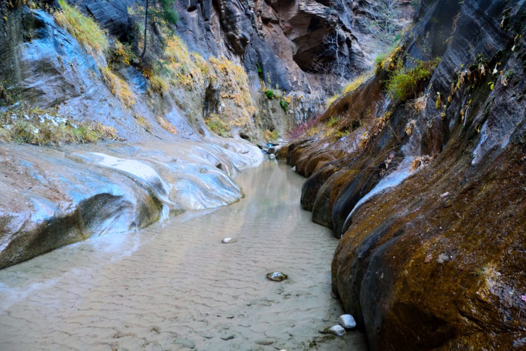
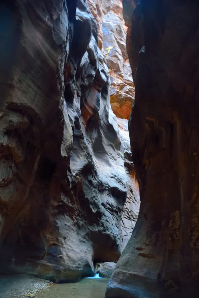
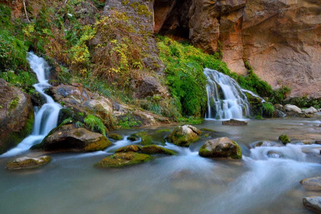
Best Views: From start to finish, The Narrows is a beautiful hike. The riverside walk provides great views of the high canyon walls above with the Virgin River snaking its way through the middle. Once in The Narrows itself, there are so many cool spots to take pictures you really have endless opportunities. Be sure to take your time and soak in the entire experience.
The Narrows Hike Trail Route
This includes hiking into Orderville Canyon and all the way down to Big Spring and back. Ignore the distance as the watch was bouncing off the walls.
Gear Needed
- Hiking Boots, Trail Runners or Canyoneering Boots
- Backpack
- Quick Drying Clothing aka NO Cotton
- Food & Water
- Hiking Poles or Walking Stick
- Waterproof Backpack or Stuff Sack
- Optional: Map of Park or GPS – I use the Garmin inReach
- Optional: Headlamp
- Optional: Canyoneering Gear (I recommend renting waterproof pants, Neoprene Socks and Boots if visiting during cold months – There are many spots in town who do this for about $40)
- Optional: Camera
- *Links included in this description might be affiliate links. If you purchase a product or service with the links that I provide I may receive a small commission. There is no additional charge to you.
My Trip to the Narrows: November 2020
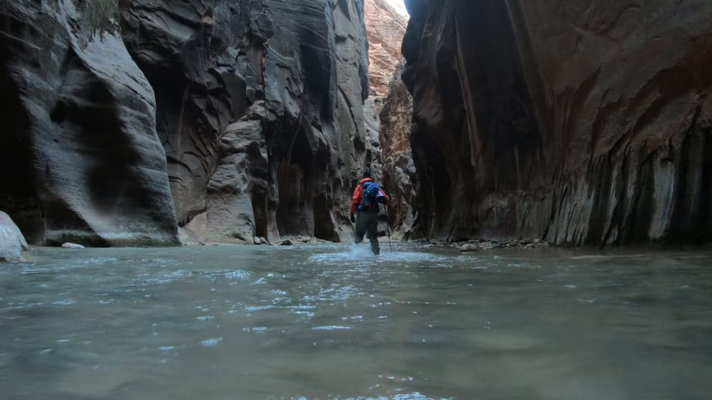
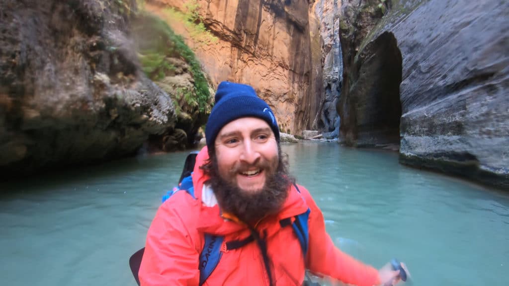
The Narrows was the “it” hike for me on my trip to Zion National Park so I decided to hit the TH early. I left my hotel around 5:30AM and biked into the park under the stars. Besides one worker cleaning the bathroom at the Temple of Sinawava TH and some deer, there was no one else in the park. I started my hike along the Riverside Walk and after a mile changed into my rented gear. I hate renting gear but I quickly found out that for this hike, it was worth every single cent. The hike immediately directed me into the 42 degree water and shocked my system. Eventually I got into a nice flow and made my way up to Orderville Canyon which I explored before hiking through the world famous “Highway” portion of the hike.
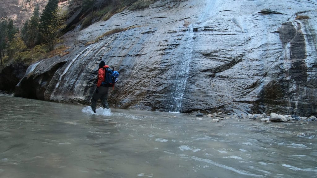
A few hours in and I had only seen one other hiker which was amazing. My early start was paying off. I eventually found two deep sections of the river which tested every single inch of my “walking on tiptoes” ability. The water in these sections was a little over waist high soaking my hiking pants inside the dry pants. Just when I thought I would not reach Big Spring, it seemed to appear out of nowhere. I enjoyed the spot by myself for a bit before heading through the heavy afternoon crowds to get back to my bike.
The Narrows was an unbelievable spot and I would easily go back to explore more canyons in the area.
Check out some pictures from my hike through The Narrows below and then watch the virtual trail guide.

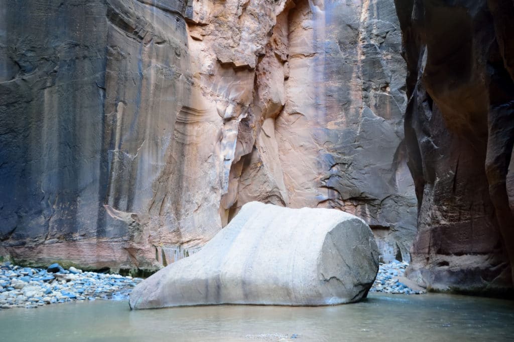
Floating Rock 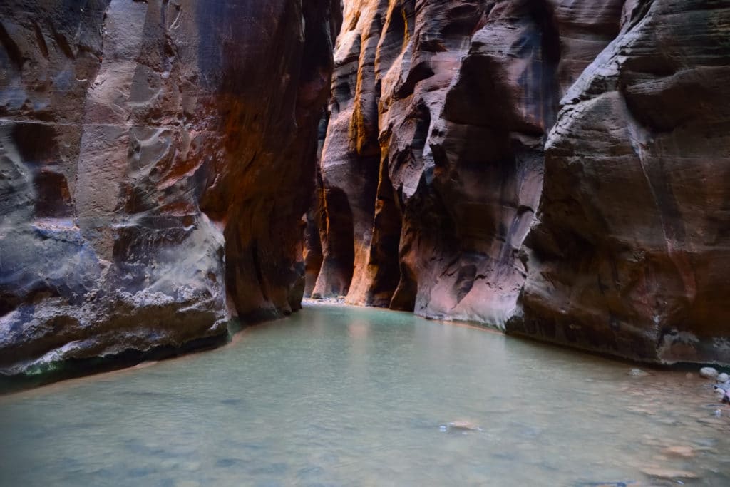
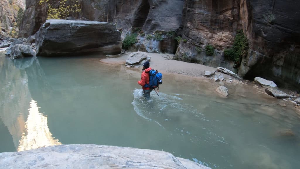
Approaching the deep sections 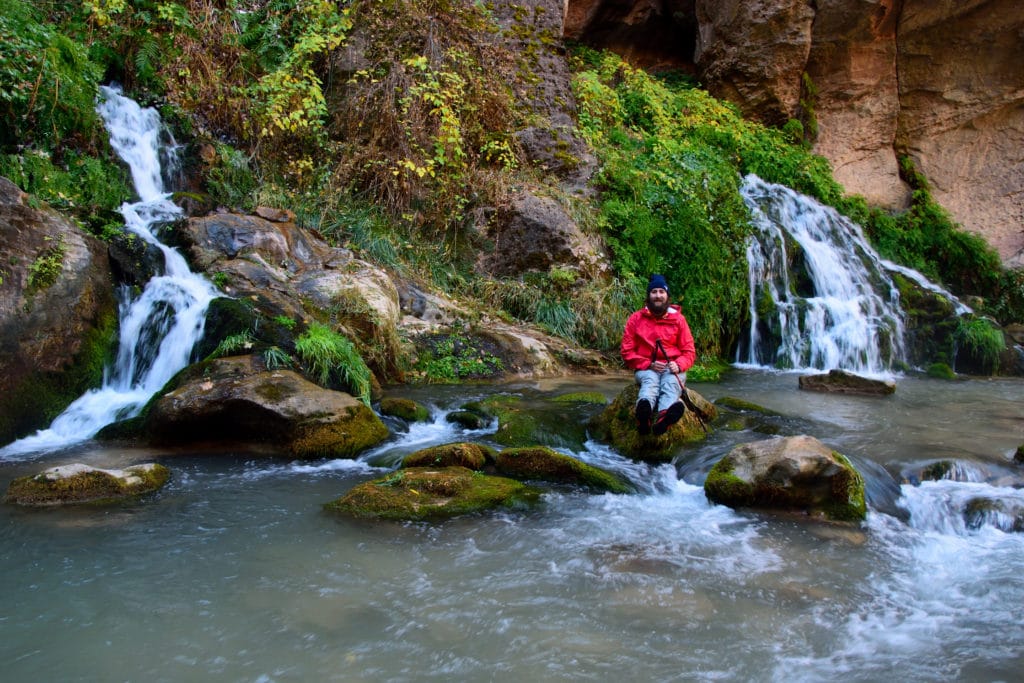
Big Spring
The Narrows Virtual Trail Guide
Questions or comments about this hike? Leave a comment below or follow me on Instagram!
2 thoughts on “The Narrows Hike Trail Guide Zion National Park”