Boundary Peak Nevada High Point Hike Guide
Boundary Peak is the highest mountain in Nevada at just over 13,000ft. The hike to the top of Nevada requires a lengthy drive to the base due to tough road conditions. Once you start hiking, trail conditions range from good to downright awful, with lots of loose rock and scree. This hike has two main starting points but the most popular is Queen’s Canyon Trailhead which this guide is based on. Hikers looking for an additional peak can easily summit Mt Montgomery, less than a mile away.
Boundary Peak Quick Facts
Virtual Trail Guide: Boundary Peak with Mt Montgomery
Boundary Peak Rating: ★★ (2/5 Stars)
Distance: 9 Miles RT or 10.5 Miles RT W/ Mt Montgomery. Distance will vary depending on starting point.
Elevation Start: 9,787ft (Upper TH)
High Point: 13,147ft / 13,447ft – Mt Montgomery
Total Elevation Gain: 4,900ft with Mt Montgomery, 4,600 Without
Estimated Time to Complete: 5-7 Hours RT
Difficulty: Moderate to Difficult What does this mean?
Class: Class 2 / Class 3 if Going to Mt Montgomery- What does this mean?
Season: June – October Expect Snow & Rough road conditions outside of this window
Directions to Boundary Peak
Trailhead: Queen’s Canyon
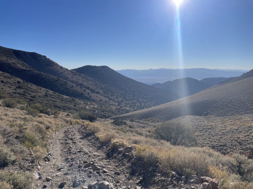
Getting Here: Woof. I usually don’t say this, but getting to Boundary Peak can be a challenge. The most direct way Google Maps will take you is likely not going to be the way I recommend. I took Highway 264 and then started on Trail Canyon Road. This map is a good resource to reference since you will not have service for much of this drive. Once you turn onto Trail Canyon road – it turns to dirt immediately and is quite sandy in areas. The next 15 miles range from a rough dirt road to a dirt road that without higher clearance you will not be able to travel. Although not 100% necessary, I wouldn’t recommend anything with lower clearance (most cars) trying to drive this road. Follow this road past Trail Canyon Reservoir and it will split to the right. This is where the rougher and narrow driving starts. Without a powerful engine, good driving and better tires – your car will not make it to the upper TH.
Parking: Parking for Boundary Peak can be tricky, especially with other hikers/cars in the area. If you are able to get to the upper TH, there is room for about 10-12 cars. However, a lot of you will likely not make it up there which leaves one off spots to pull off and park a single car or two. The road is so narrow and the dirt very loose. Be sure to leave your car in a spot that doesn’t destroy vegetation and also allows you to drive it out when you get back to it. There are no restrooms of any kind at the TH or along the way.
Fee: N/A

Summary
Dogs: I wouldn’t recommend bringing a dog up Boundary Peak, there is just too much loose crap all over the mountain. If you do bring your pup – bring lots of water and be sure to keep them leashed since this entire hike is in a Wilderness Area.
Camping: On the drive in and near the trailhead there are plenty of spots to dispersed camp. There are no established campgrounds anywhere near Boundary Peak.
Hike Xfactor(s): The Road to the TH / Trail Conditions
I am a very seasoned offroad driver. I have spent hundreds of miles on rough roads in the US and other countries. However, the approach to Boundary Peak is going to be your biggest X Factor on this hike. The roads are maintained but who knows at what rate and are susceptible to Spring Snowmelt and flooding – especially on the lower portions. This is by no means a VERY rough road so if you have a higher clearance SUV you will likely have no issues at all. Anything with lower clearance could have problems depending on the conditions that day.
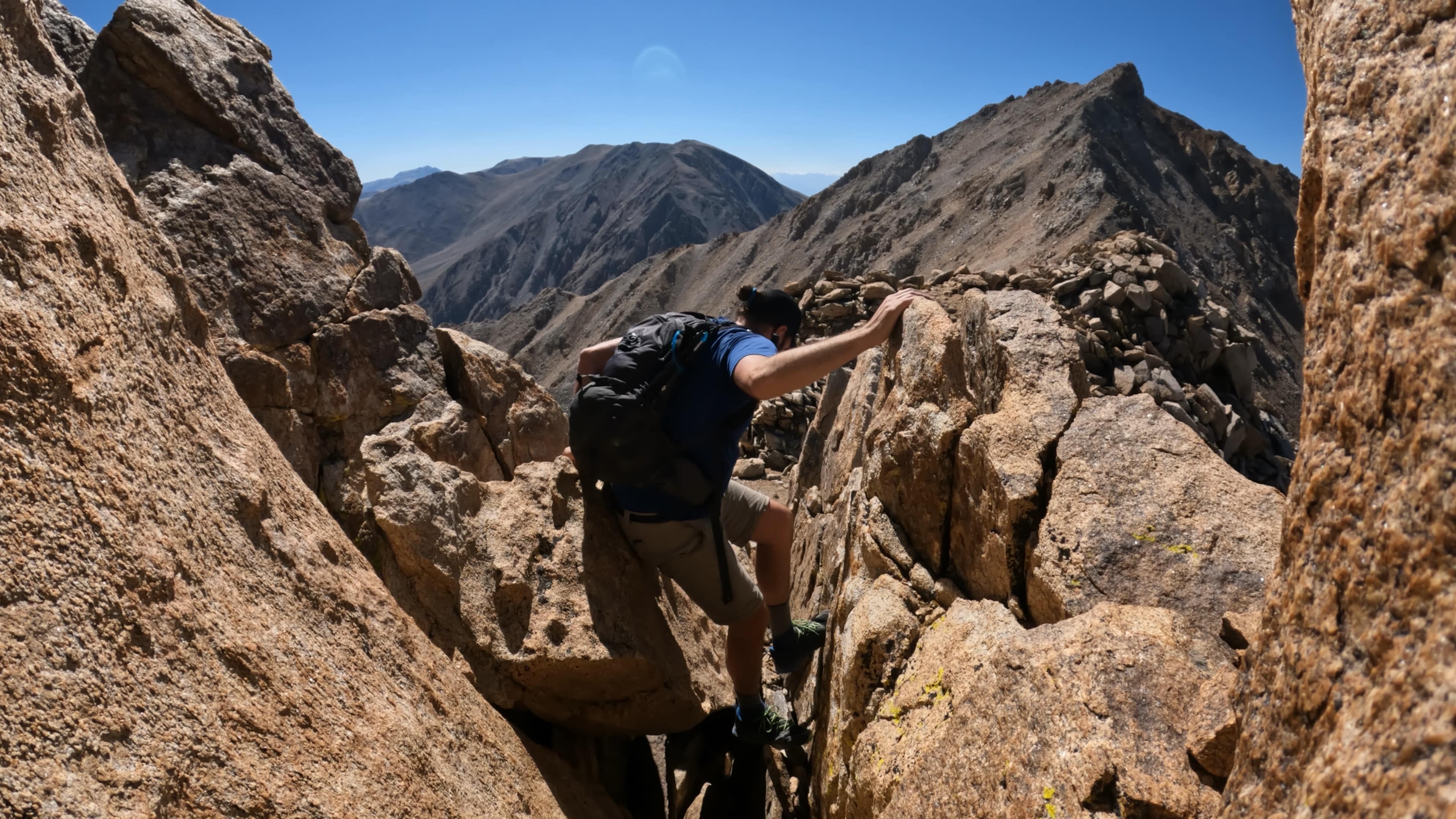
Outside of the drive to the TH – the trail itself is just downright nasty in spots. There are several sections that contain a number of different social trails that can make the hiking to the summit more difficult than it needs to be. When in doubt, use your best judgment to stay off loose terrain.
Hike Tip(s):
- Small steps with hiking poles are going to make this hike much more enjoyable on both the way up and down.
- Having gaiters to prevent rocks from getting inside of your shoes/boots could be nice.
- After gaining the Trail Canyon Saddle (the one where you can first see the top of Boundary) – stay right as much as possible. As you hike higher, stay directly on the ridge. Although this will likely involve a little more elevation gain/loss – its worth it to save time and horrible sliding.
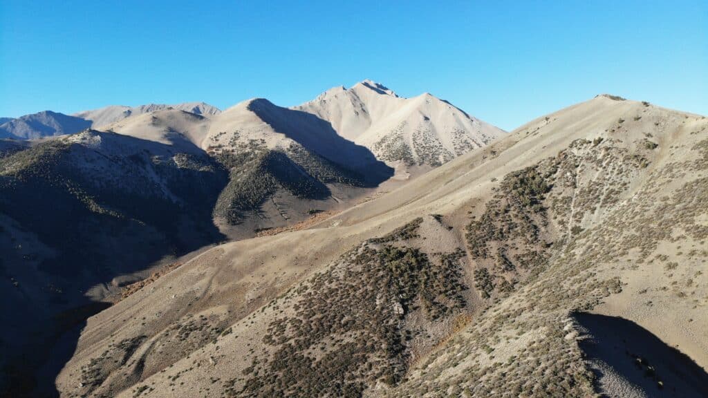
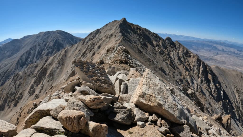
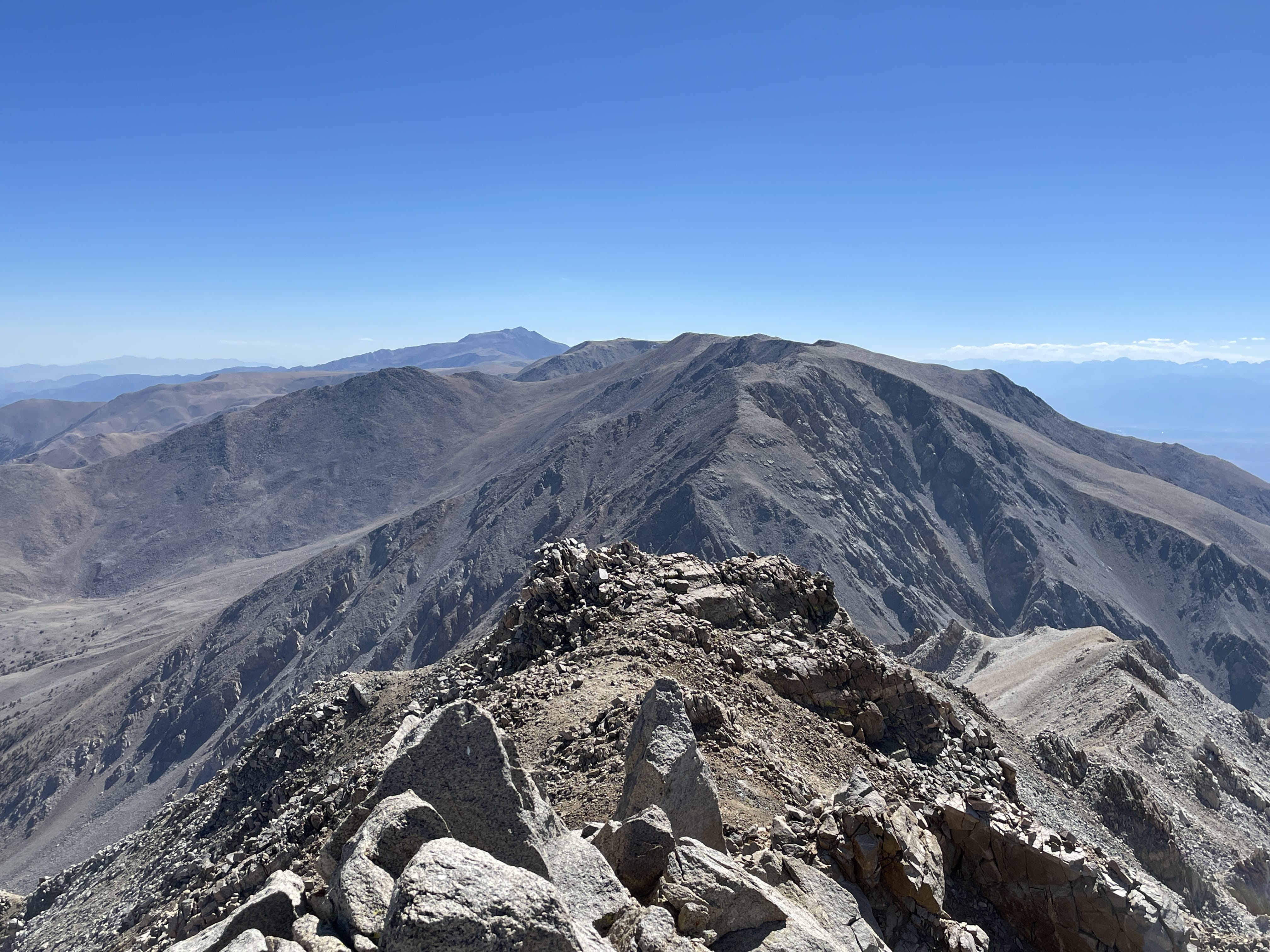
Make it a Loop: The most common way to extend this hike is by adding on Montgomery Peak. Fun Fact: some consider Boundary Peak a subpeak of Montgomery but since its neighbor is in California, Boundary holds onto the high point in Nevada. Adding Montgomery Peak adds about 1.5 miles of hiking and does involve scrambling on a loose ridge that is Class 3 in sections. Stay direct on the ridge outside of the few towers I point out in the virtual guide.
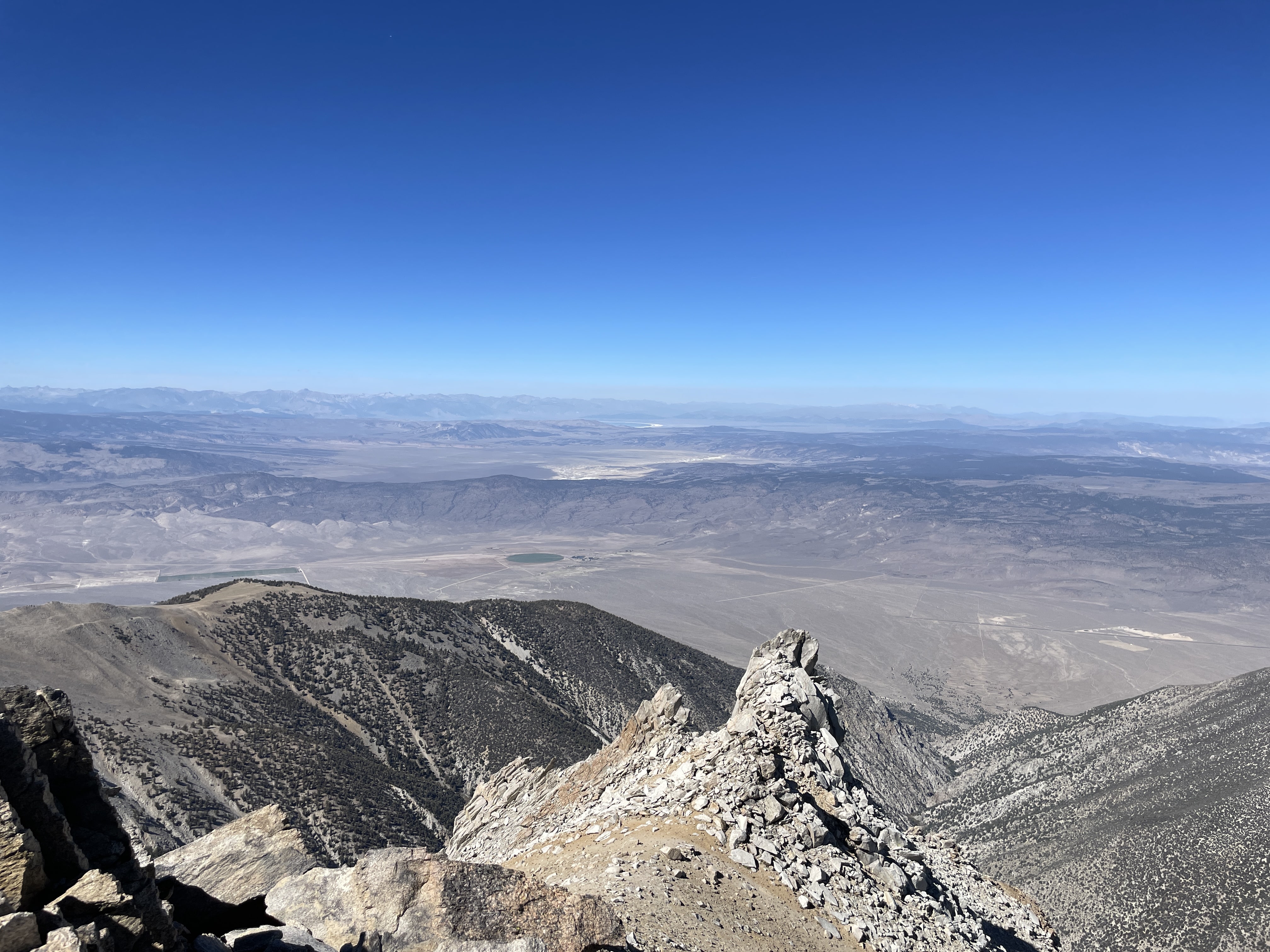
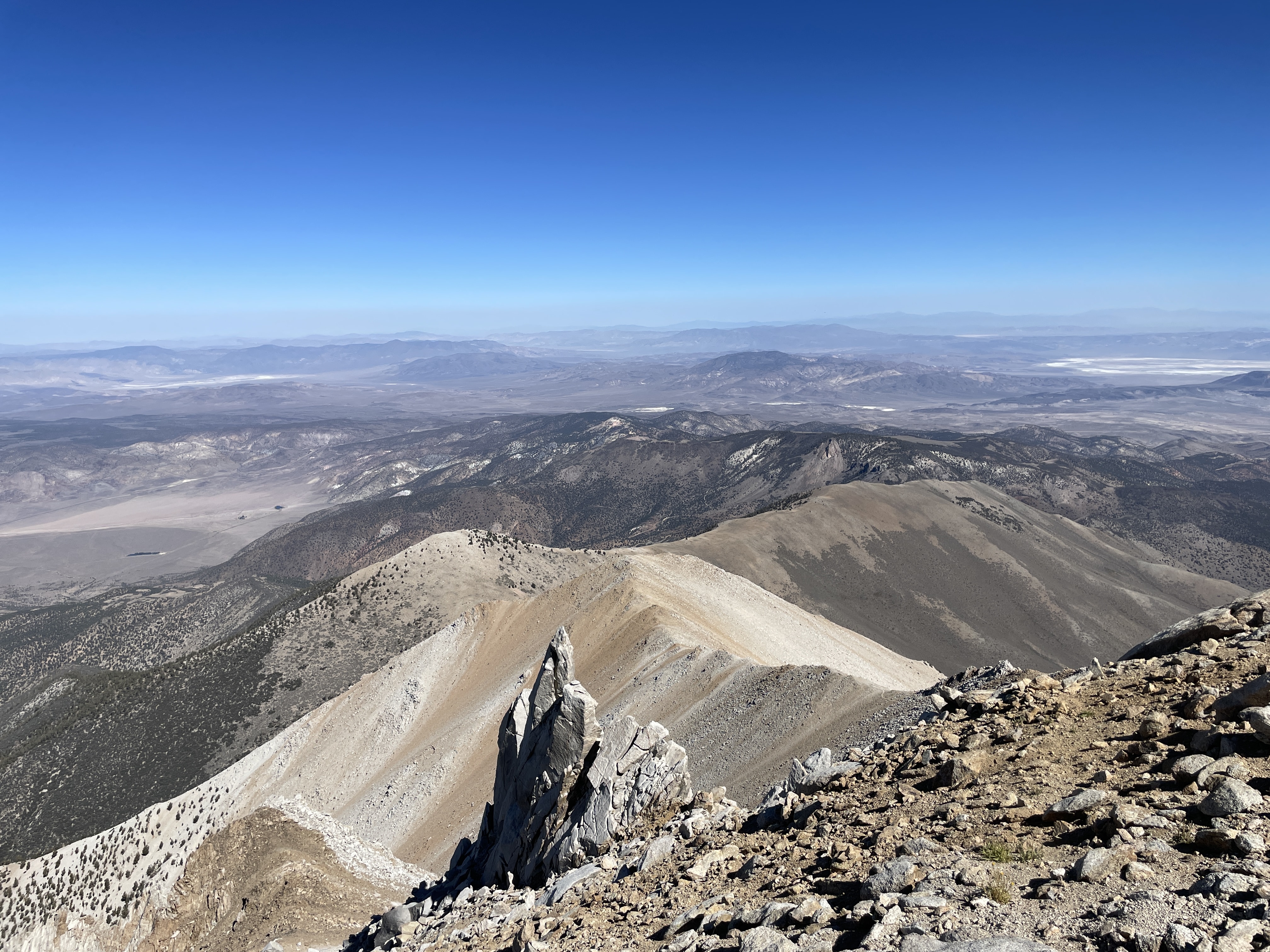
Best Views: My favorite views on Boundary Peak were from the Trail Ridge Saddle and on the summit looking North. The views from Montgomery are marginally better in my opinion but obviously very similar.
Boundary Peak Hike Route
Includes Montgomery Peak and about .5 miles of hiking to get to the upper TH.
Gear Needed
- 14er Day Hike Packing List
- Men’s Trail Runners
- Women’s Trail Runners
- La Sportiva Trango Hiking Boots (Men’s)
- La Sportiva Trango Hiking Boots (Women’s)
- Backpack (Winter)
- Backpack (Summer)
- Food & Water
- Helmet
- Optional: Garmin inReach
- Optional: Hiking Poles – 120CM
- Optional: Gaiters
- Optional: Headlamp
- Optional: Garmin Fenix Watch
- Optional: GoPro, Joby Tripod, GoPro 360
- Optional: Drone
- *Links included in this description might be affiliate links. If you purchase a product or service with the links that I provide I may receive a small commission. There is no additional charge to you.
Boundary Peak Trail Summary: October 2022
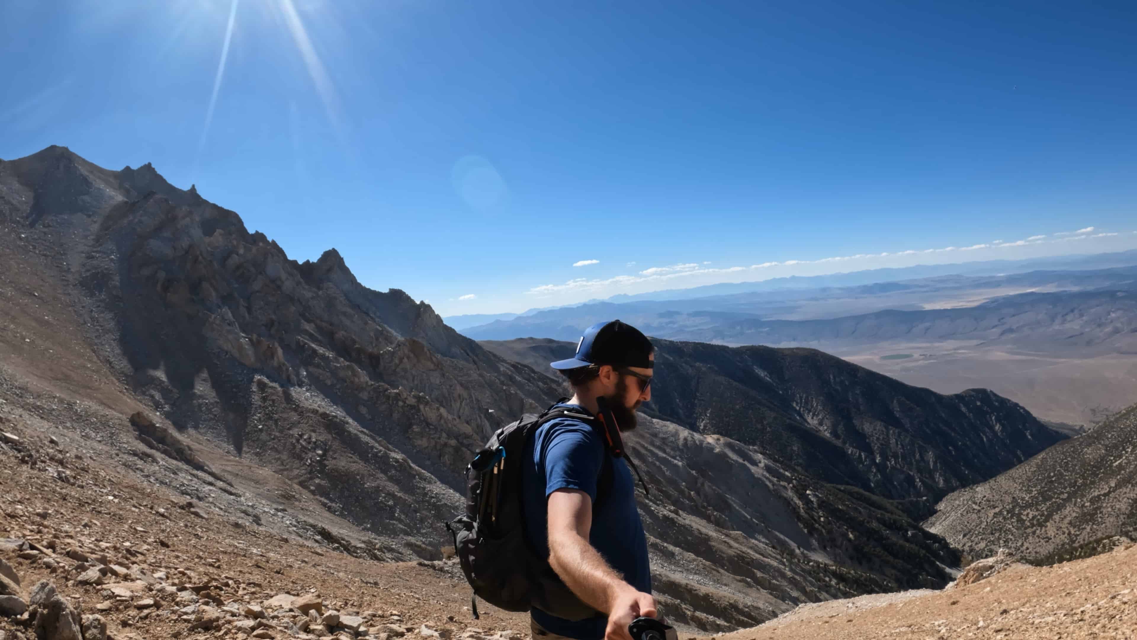
After a long and rough drive to the trailhead, my rental car just didn’t have enough power to make it to the upper TH. The tires started spinning on the steep grade so I found a spot to safely pull off and park the car. The hiking to the upper TH was STEEP and loose – a sign of what was to come.
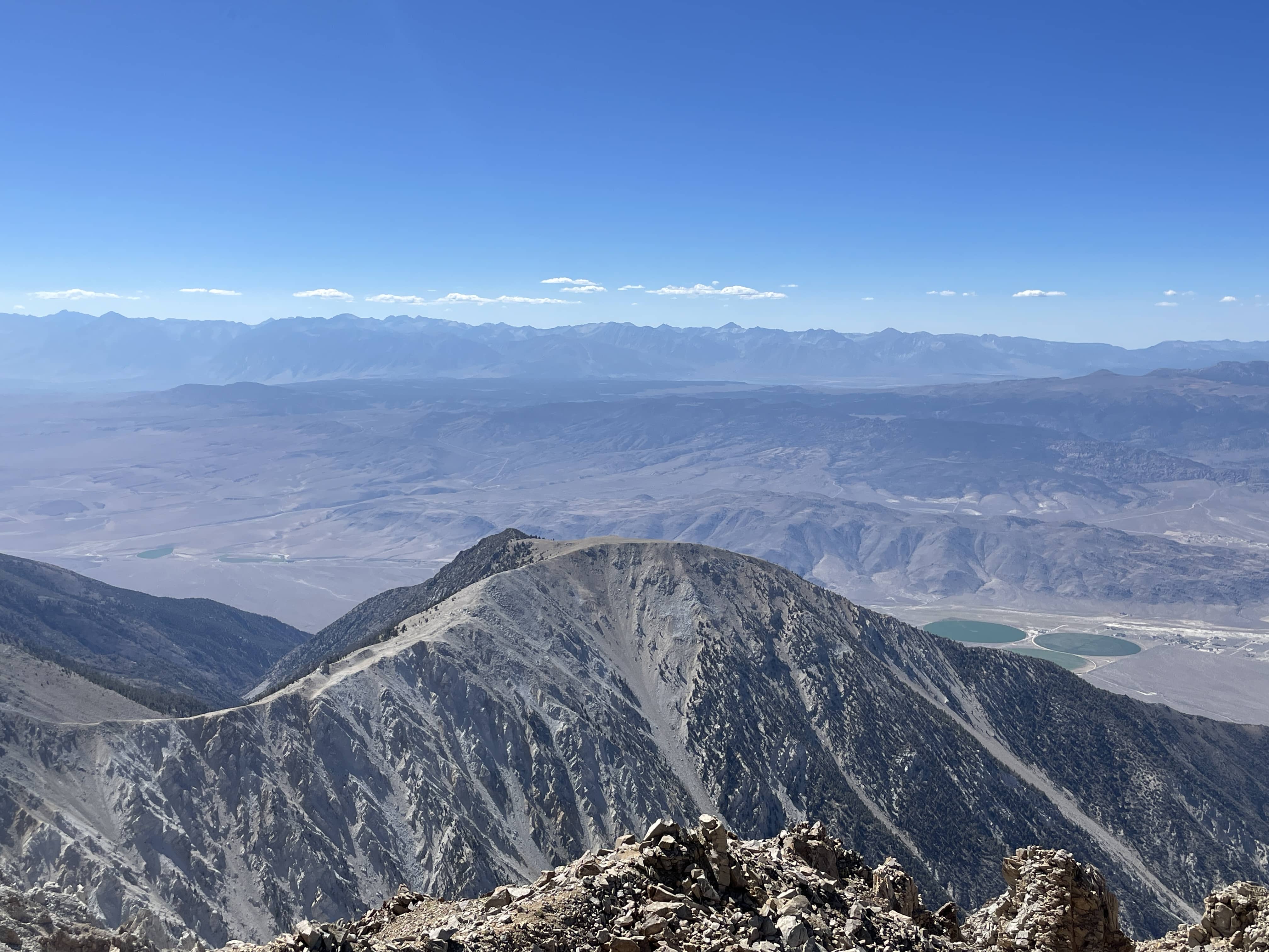
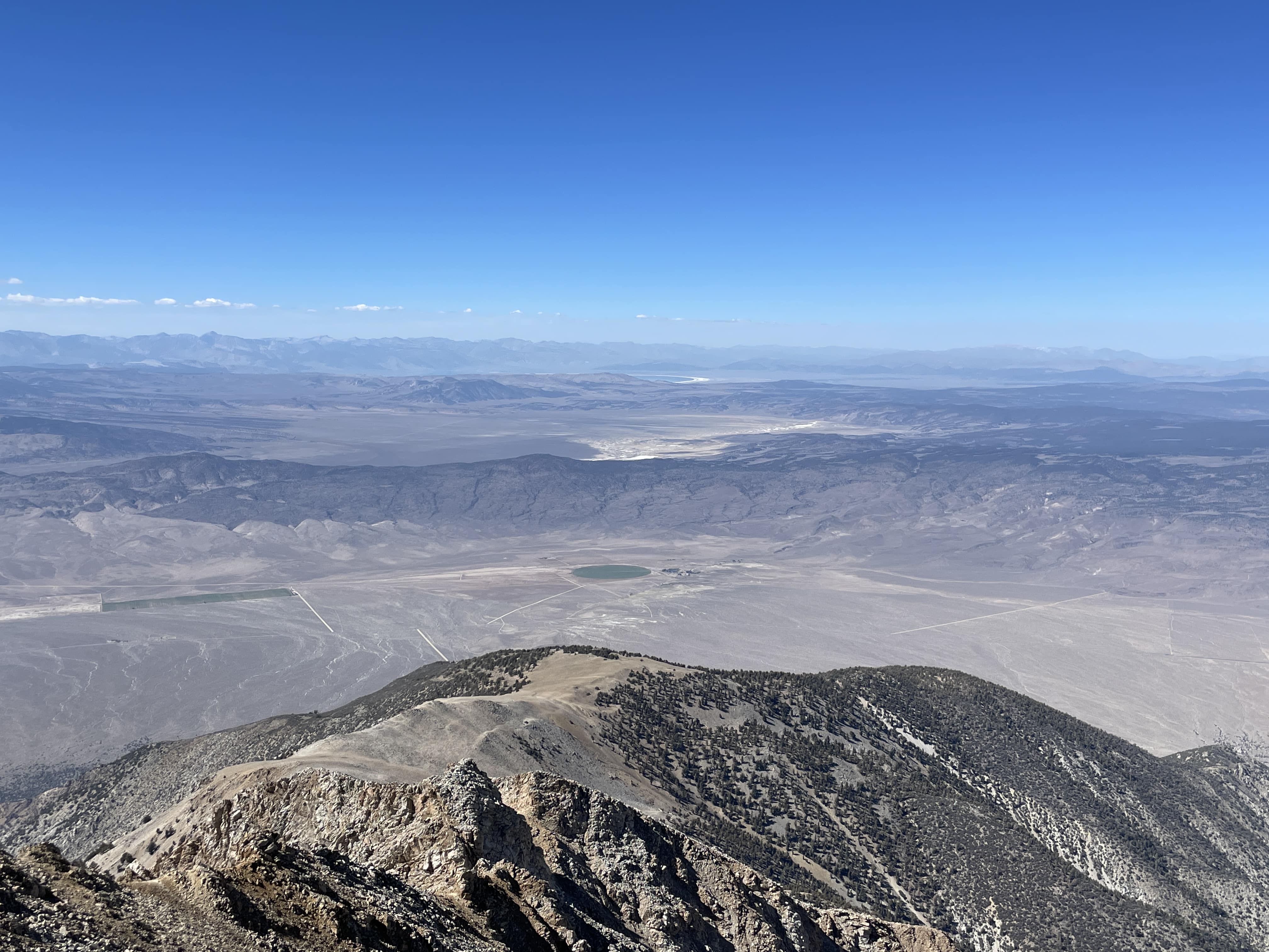
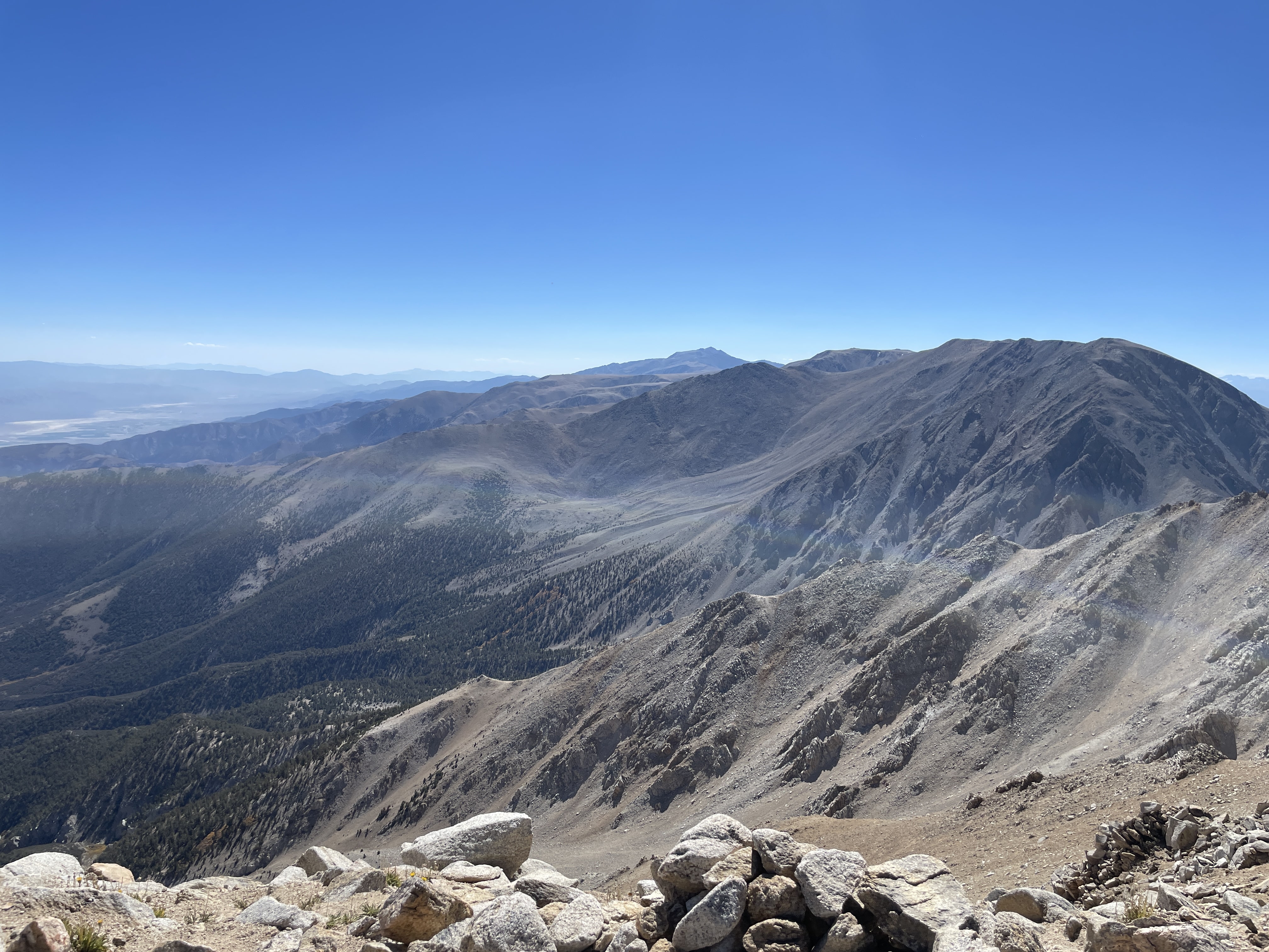
For the first few miles the elevation gain was steady but was very easy to follow. After gaining the first saddle of the day, I could see Boundary in front of me and while it seemed close it was still miles away. I hiked across the flat open field stopping to take some video and look at a small group of deer eating breakfast.
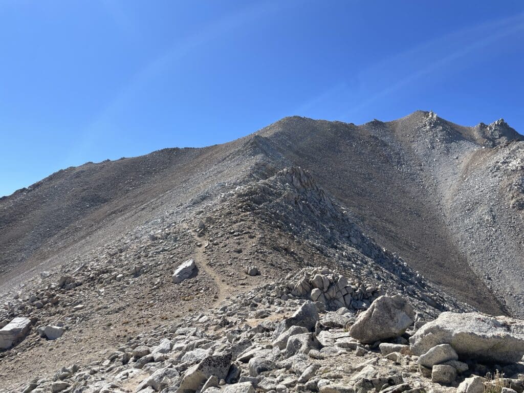
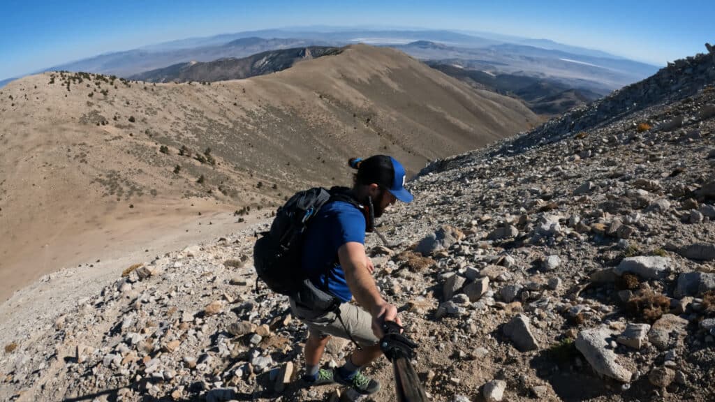
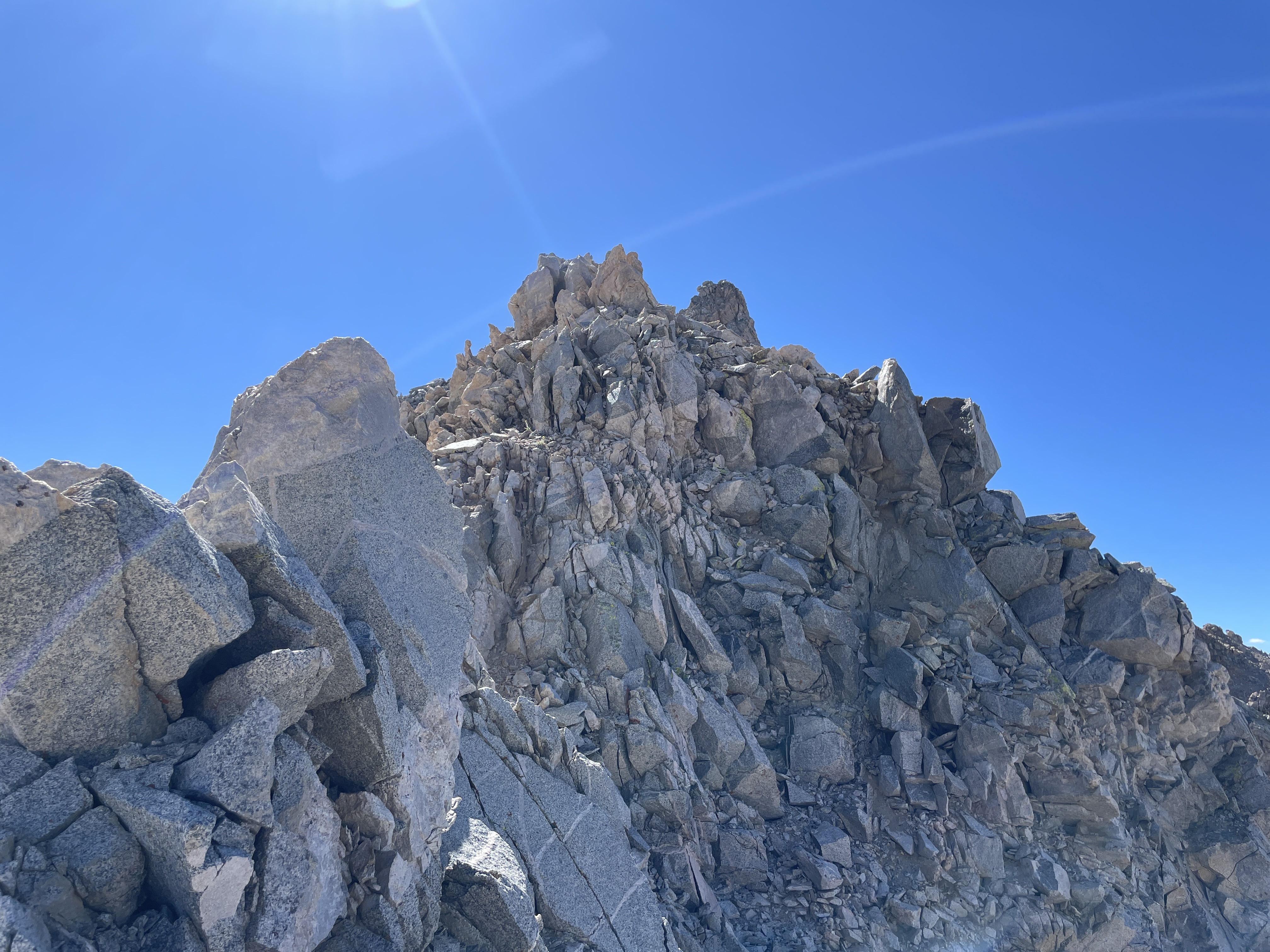
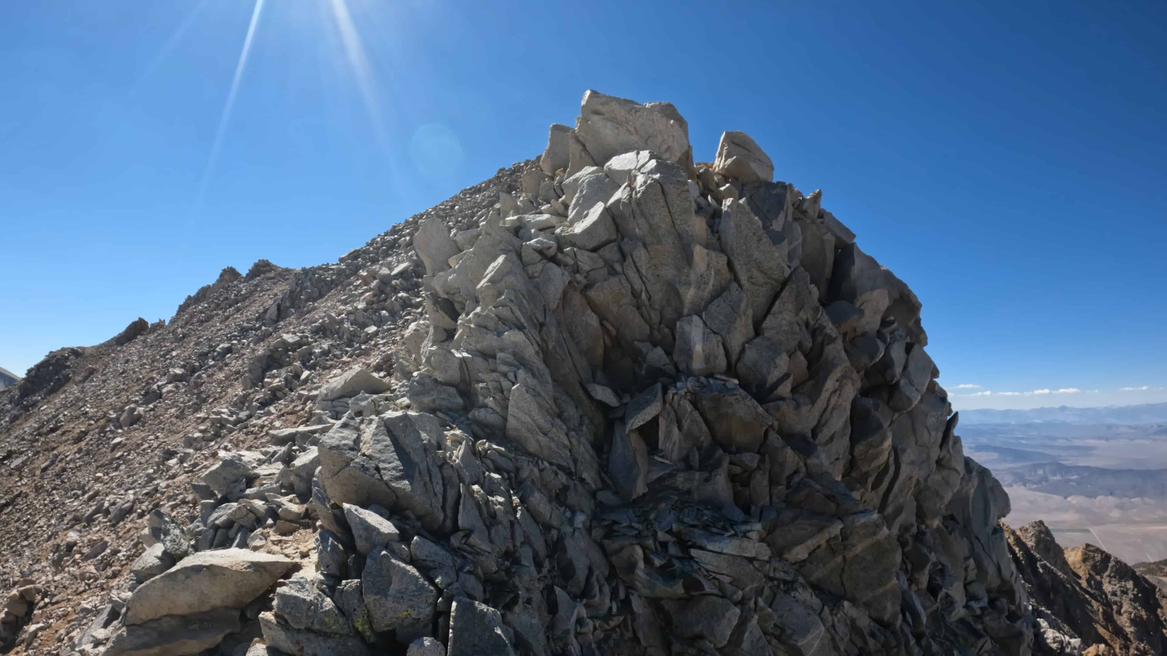
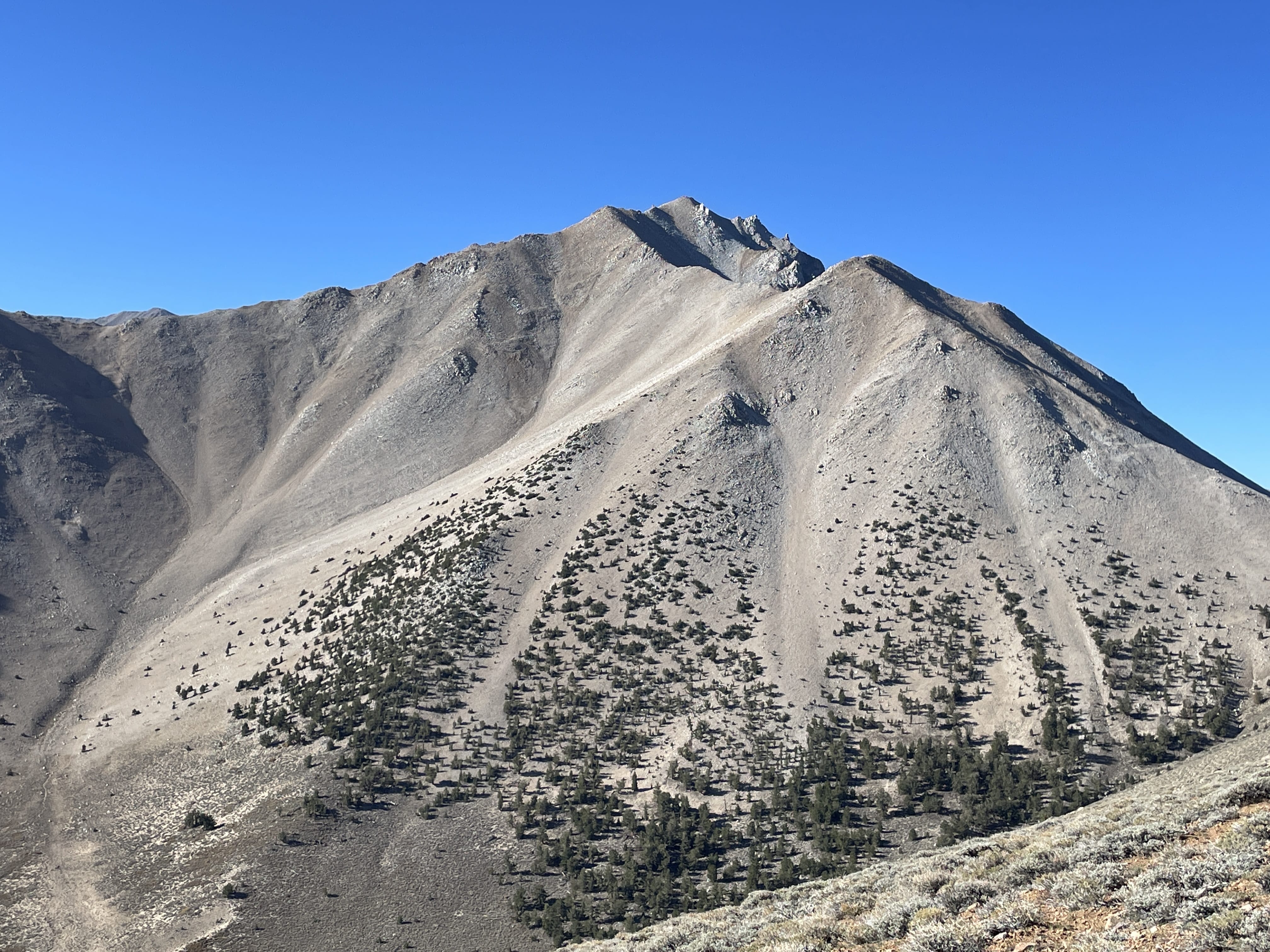
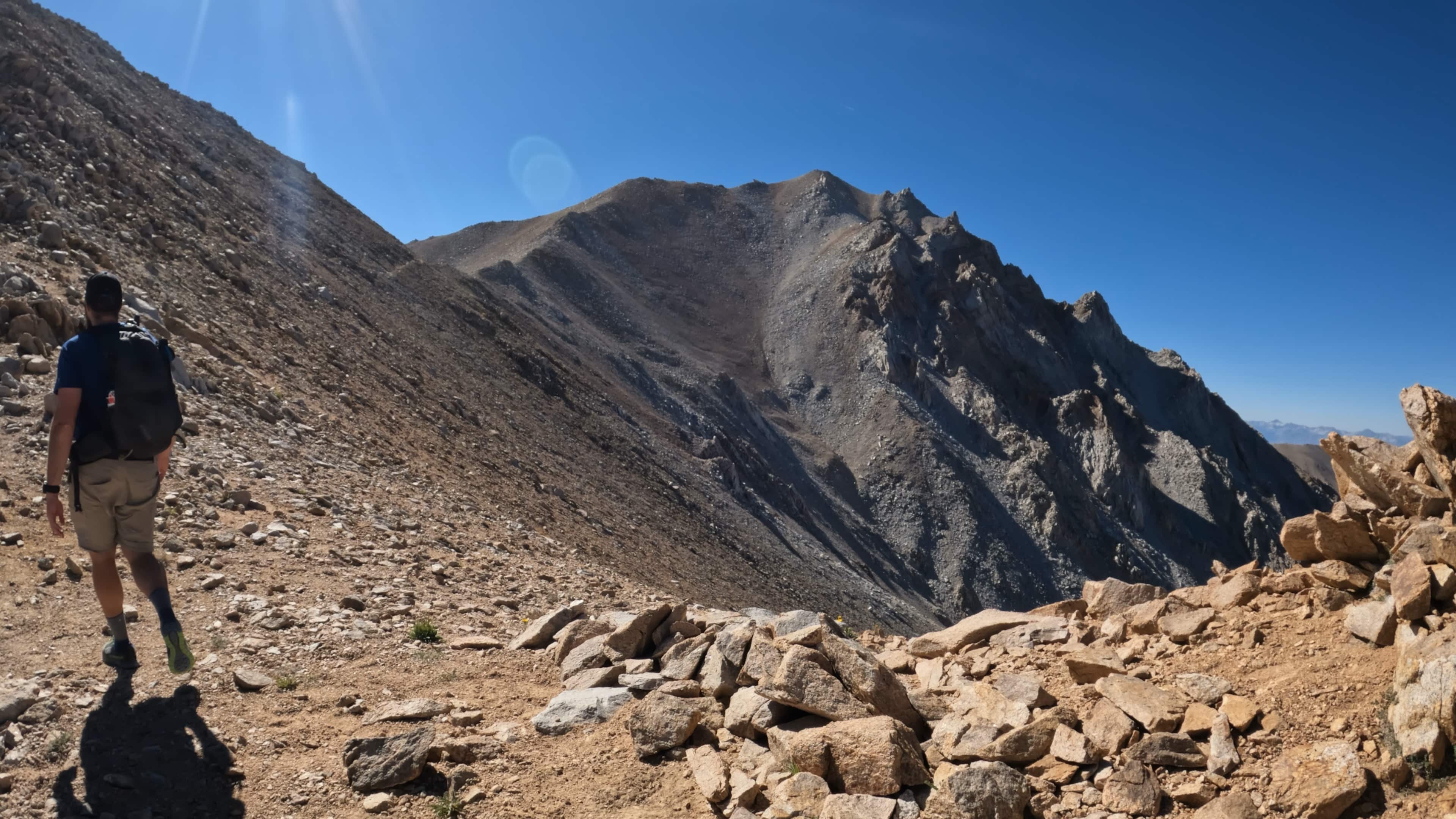
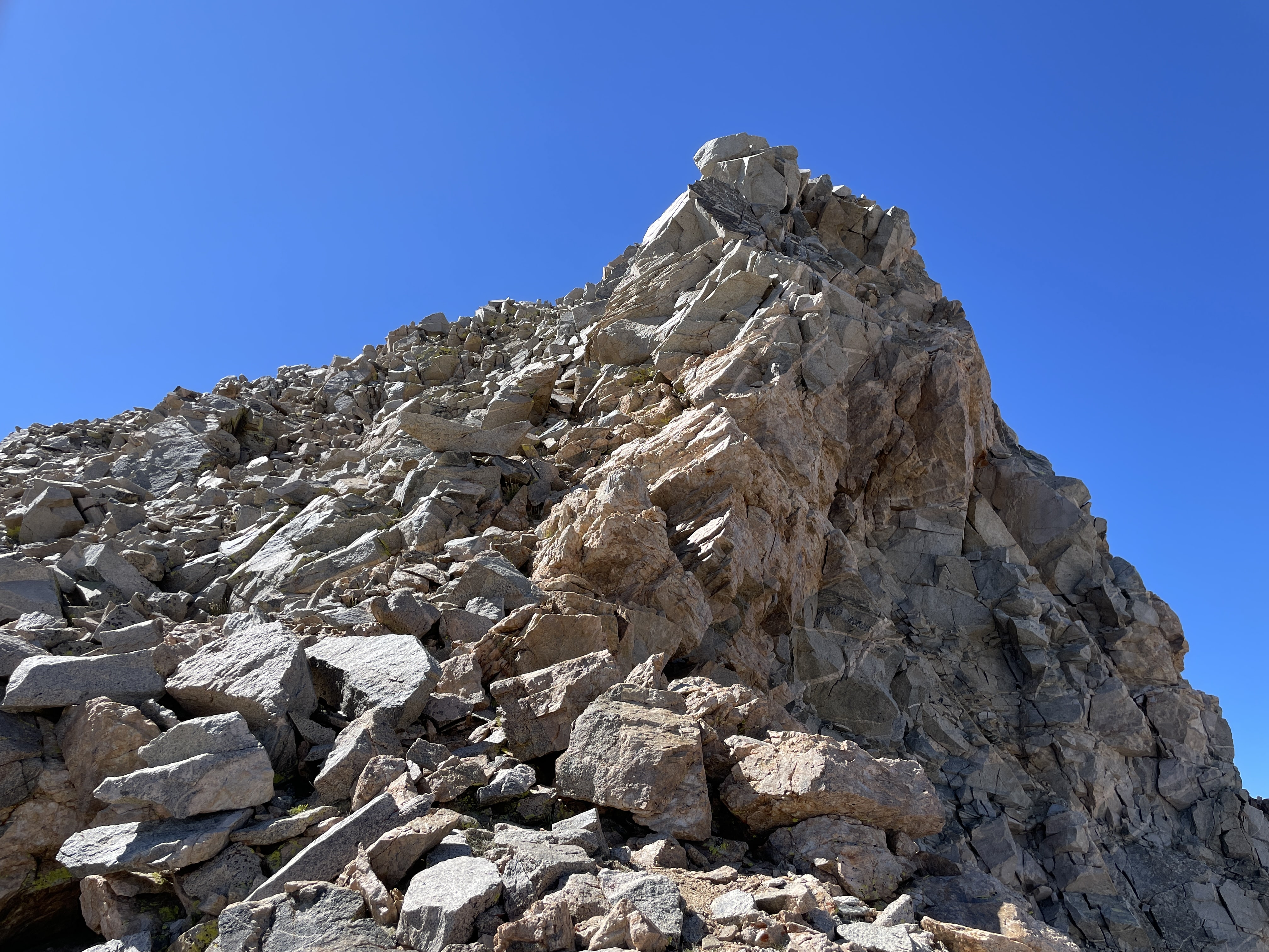
When I arrived at the base of the steep section, I knew right away it was not going to be fun. The trail was extremely loose and steep – each step sliding a bit before gaining the inches of elevation. With small groups of switchbacks, this section was steep, loose and not a lot of fun. I was so happy to gain the saddle and see Boundary Peak again – this time much closer in front of me. I continued to work up towards the summit and the trail was more of the same – loose and steep.
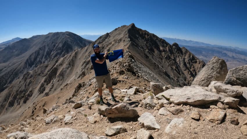
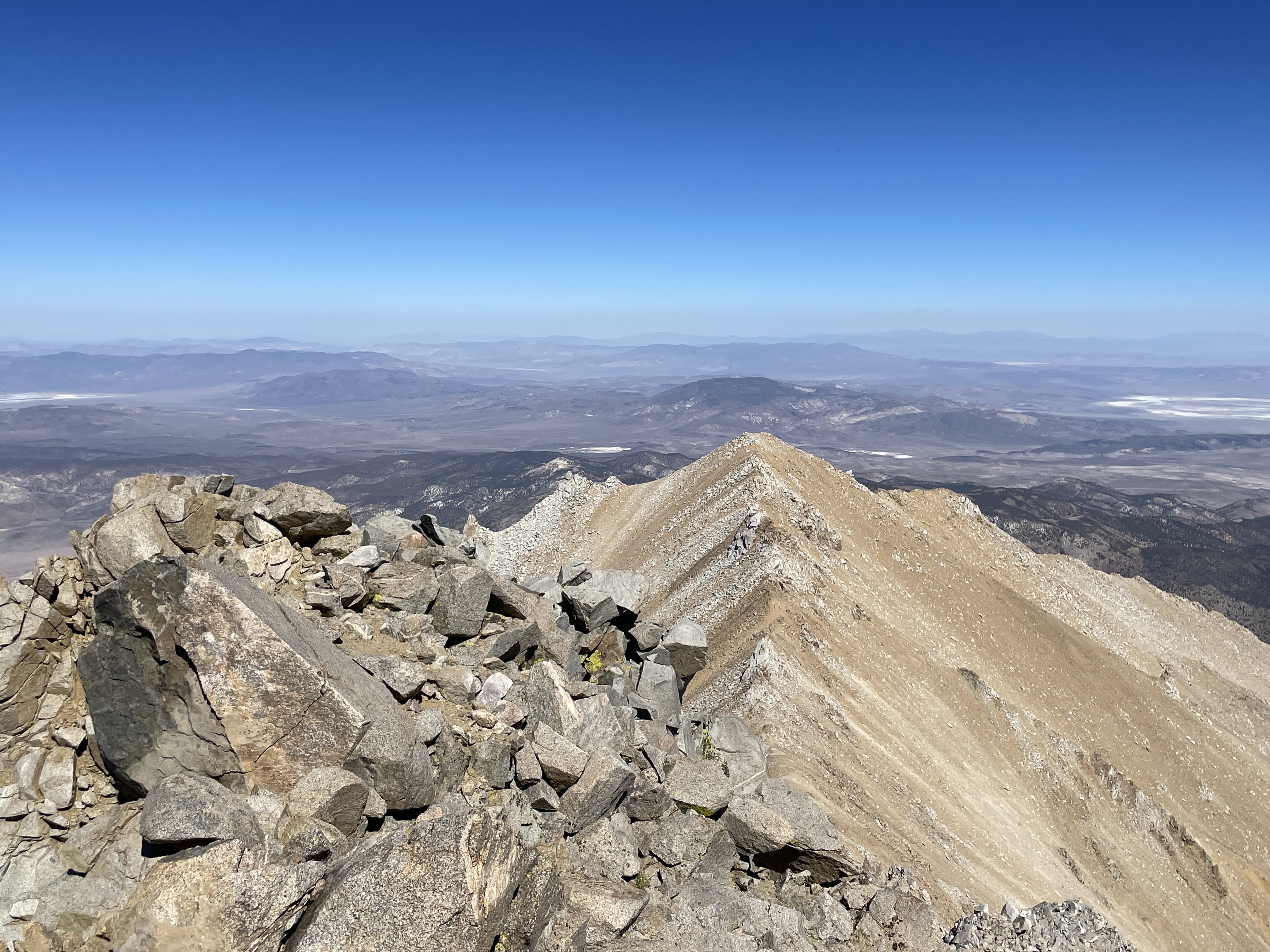
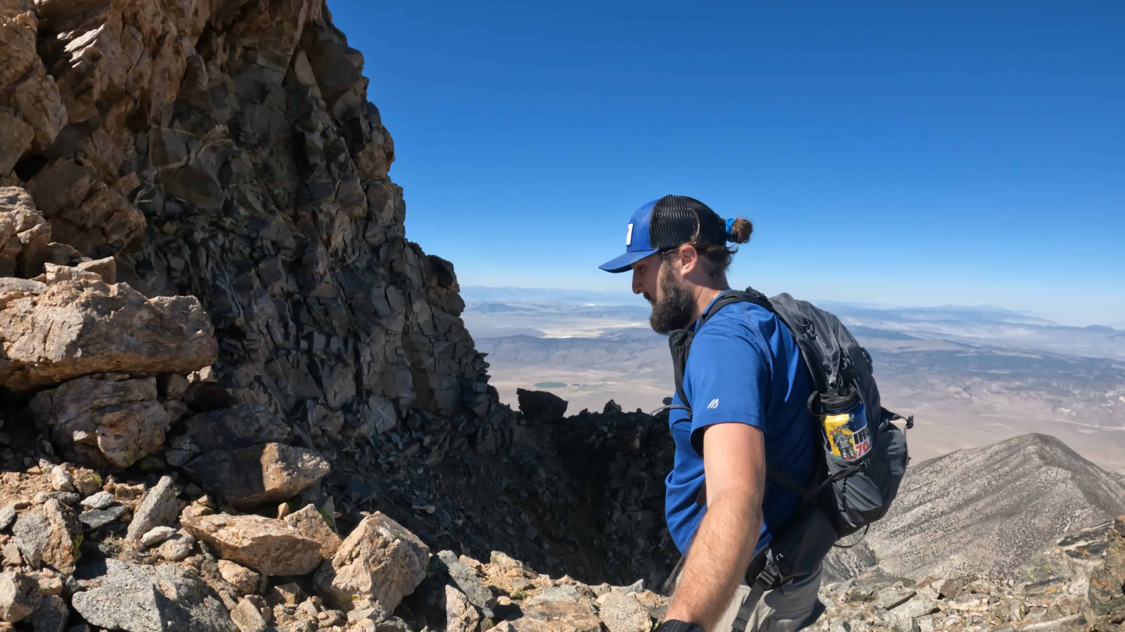
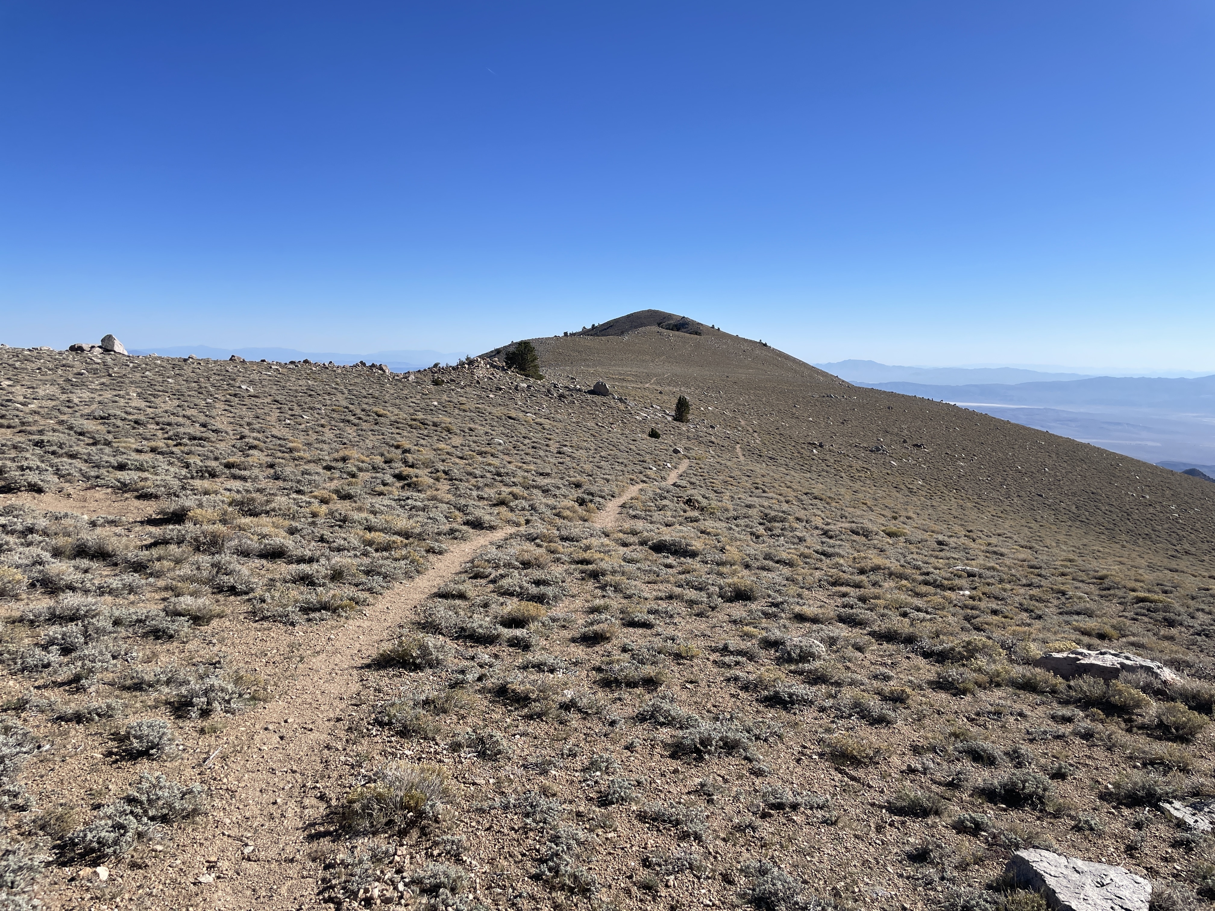
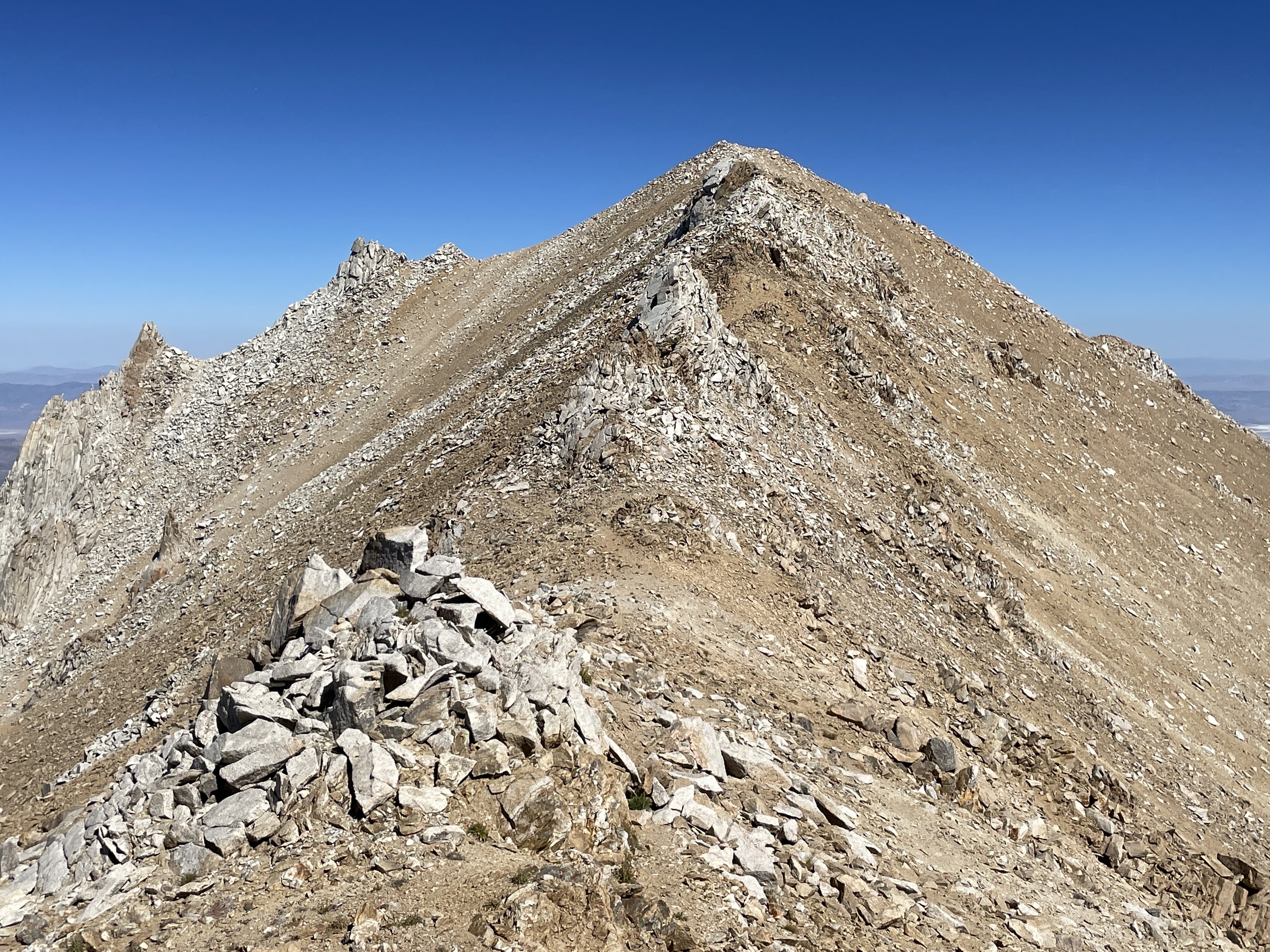
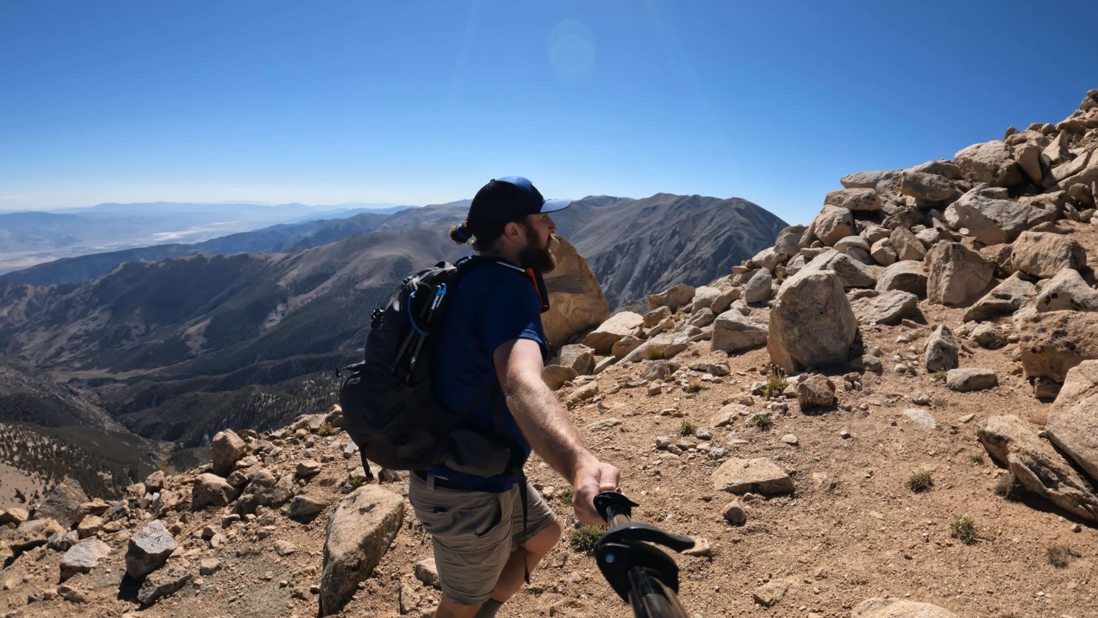
As I worked up the final saddle, I noticed a variety of smaller social trails that seemed to go in the wrong direction. I tried to ignore as many as I could and just stay directly to the left on the ridge. It was still loose here but much less sand and gravel then farther off to the right. After gaining the saddle, I headed right and made my way up the less steep section to the top of Nevada. The views here were great and the seclusion – amazing.
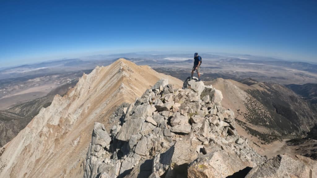
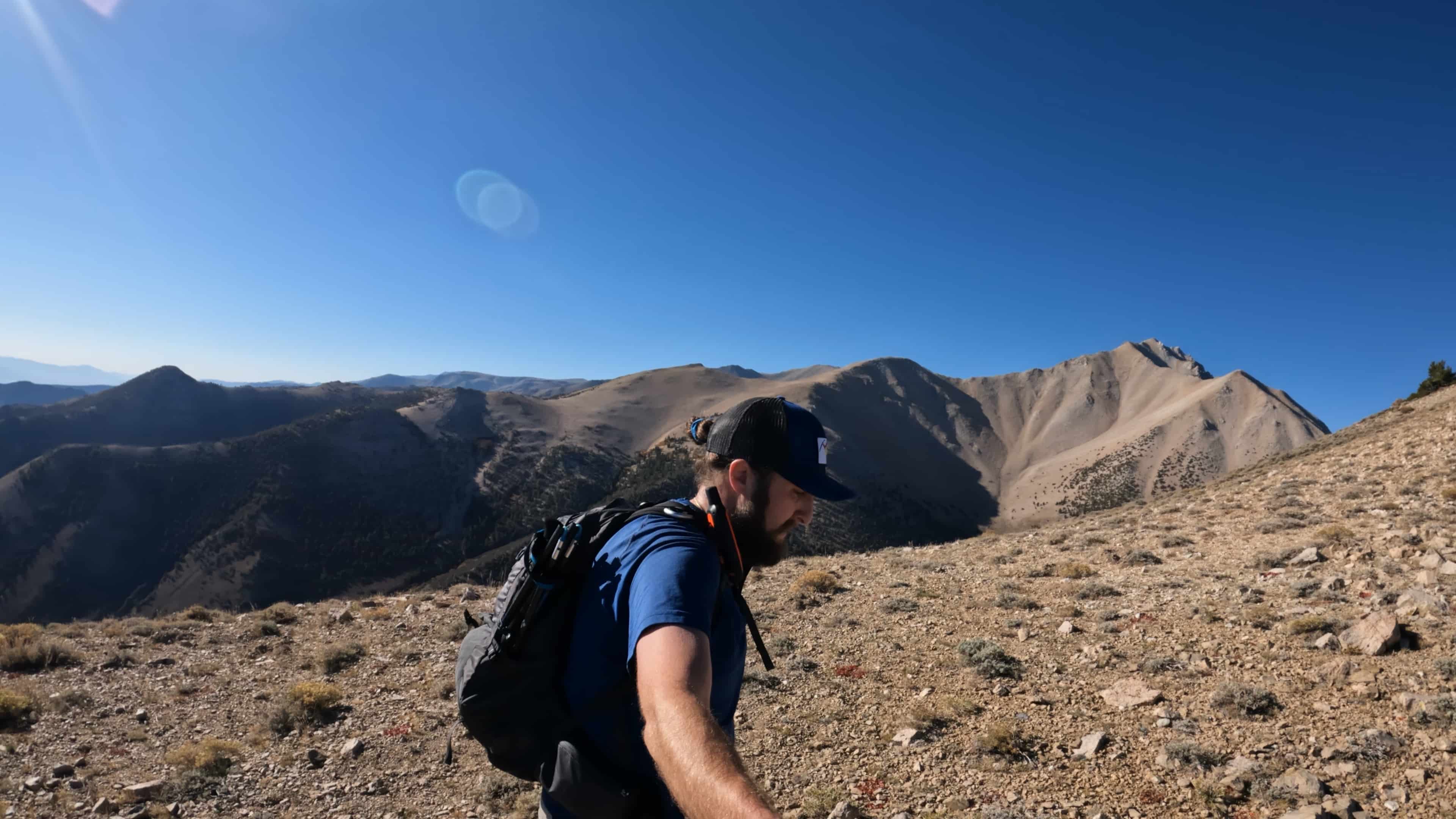
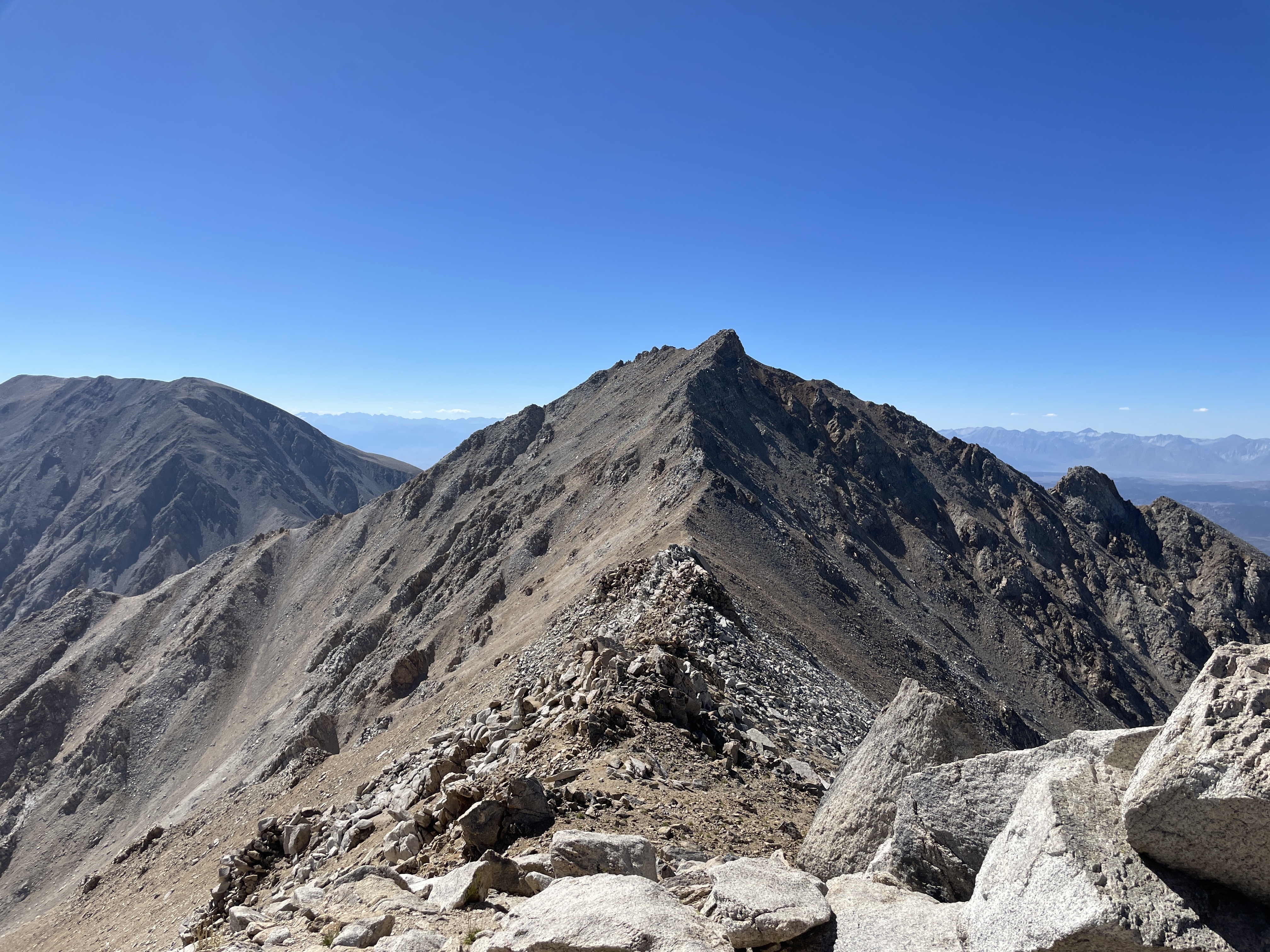
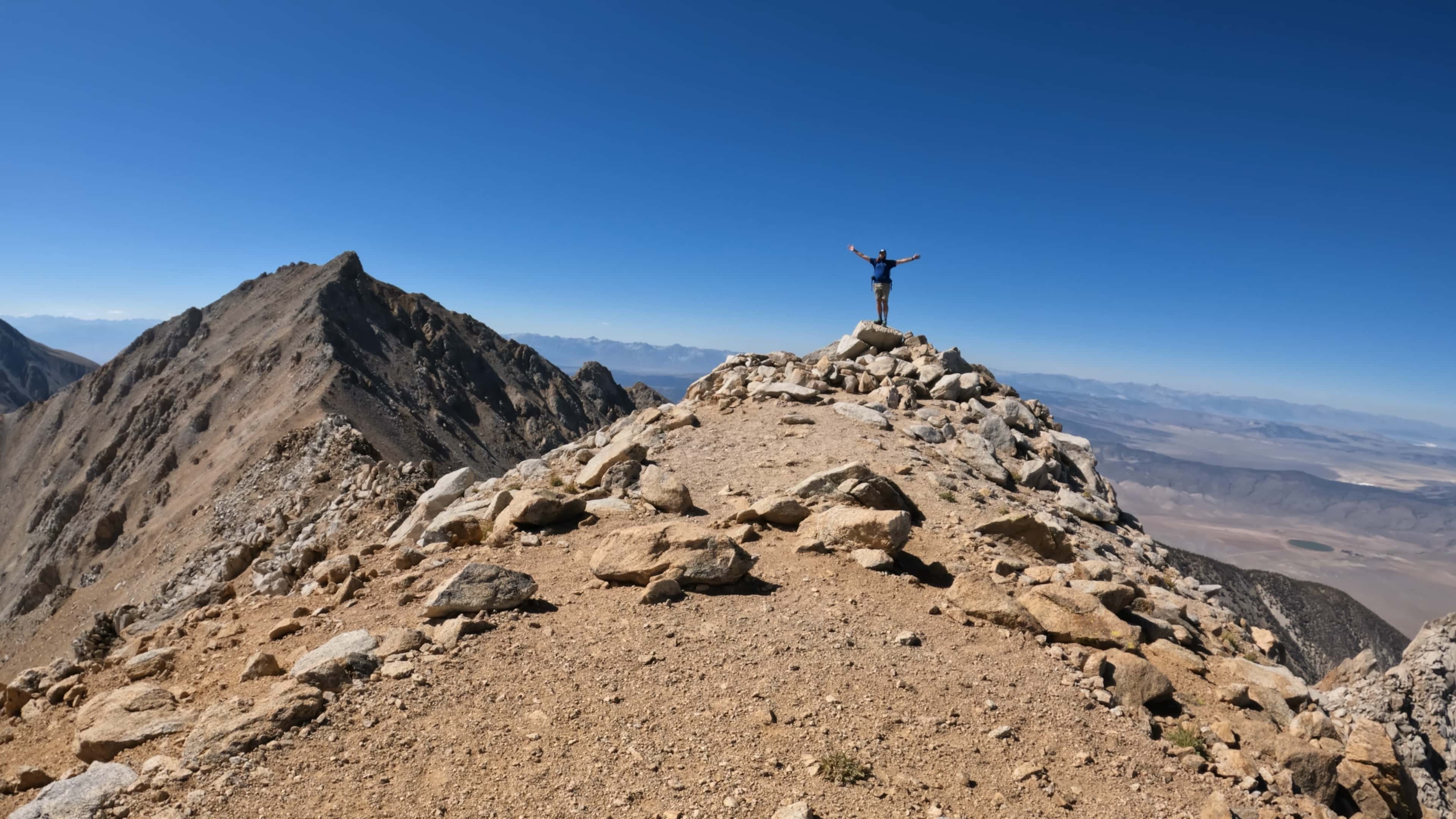
With a beautiful weather forecast called for – I headed over to Mt Montgomery. The ridge looked far worse than it actually was but there was, to a shock to nonone, lots of loose rock. I ended up avoiding a number of towers that I climbed on the way back. The difficulty was Class 3 but there were lots of moves higher than that difficulty if I was really looking for them. I arrived on Mt Montgomery and soaked in the beautiful views.
After signing the trail registry, I headed back to the car – with lessons learned from the hike over – I stayed directly on the ridge which was a bit more exposed but much faster moving. Just before I got back up to Boundary Peak, I slipped and fell cutting my wrist and pinky finger. Lucky for me, the cuts were not too deep and a quick patch up using my first aid kit had me on my way.
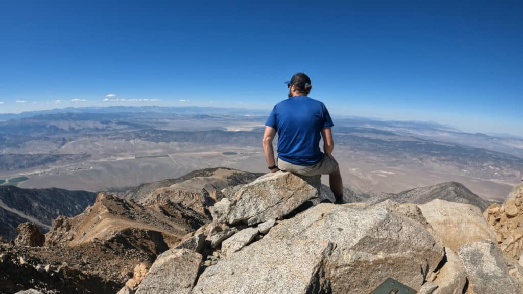
Overall, I have to be honest, I didn’t love the hike up Boundary Peak and would have no plans to revisit the area. However, if you are bagging state highpoints – this one was relatively easy compared to a lot of others in the West.
5 thoughts on “Boundary Peak Nevada High Point Hike Guide”
I always enjoy your reviews and yourube videos of various mountains. Thanks for all the details.
Francie from Oregon
Can you suggest a guide for boundary peak to accompany us on our hike?
I am not aware of any, but between my written & virtual guide + my GPX file, you should be able to summit it without a guide.
I’m planning this trip but have to rent a vehicle. FYI, when I describe the trip to a rental car agent, some consider the route to be “off-road” and violation of their policies. Others say that as long as it’s a mapped and maintained road, I’m in the clear. But a word to the wise for anyone not driving their own vehicle.
The reviews I’ve read say that Trail Canyon road is easier to drive vs. Queen Mine, do you know if there’s a significant difference? I’m renting a Jeep Compass or similar vehicle, so there will be some clearance, but not as much as a pickup truck. Do you think that is enough? And any thoughts on how risky it might be for sagebrush or overgrowth to scratch the rental car?
Hi Jeff, I appreciate the question but what I can say about the road is covered here and in the video. Respectfully, getting to the TH or close to it, will entirely depend on the driver + their experience + the conditions that year. From what you describe you should be fine with at least getting to where I did unless the road changed significantly (very possible).