Mt Democrat North Couloirs Guide
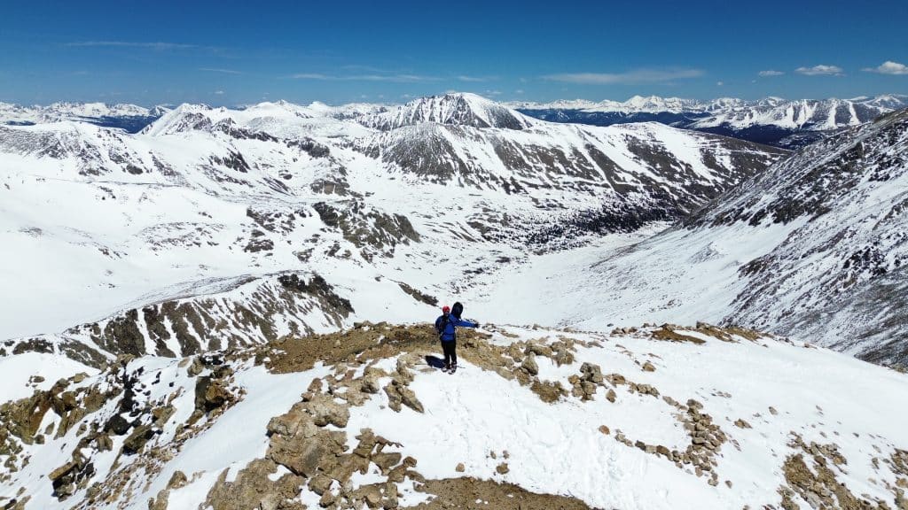
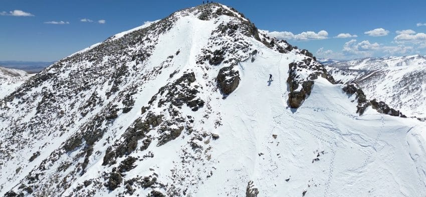
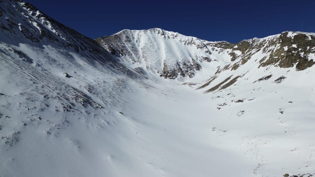
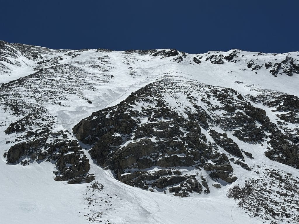
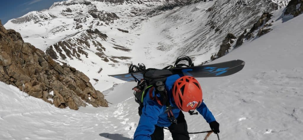
The Mt Democrat North Couloirs are a set of relatively untraveled snow lines on the immensely popular 14er. These lines have a longer approach and present several technical choices for route finding, especially on the descent. After climbing the 2,000 or so feet through the 40-45 degree slopes, you will find yourself on the high class 2 / low class 3 ridge just about 100 yards from the summit. Time this one right as coverage and the approach can be very painful without adequate snow.
Mt Democrat North Couloirs Quick Facts
Virtual Trail Guide: Mt Democrat North Couloirs
Mt Democrat North Couloirs Rating: ★★★★ (4/5 Stars)
Distance: 10 Miles RT
Elevation Start: 10,950ft
Summit: 14,154ft
Total Elevation Gain: 3,300ft
Estimated Time to Complete: 6-8 Hours (Depending on snow conditions)
Difficulty: Moderate to Difficult (depending on snow levels) What does this mean?
Class: Class 2 – What does this mean?
Season: February – May (This route generally melts out fairly quickly)
Avalanche Risk: Mt Democrat North Couloirs present a large avalanche risk, even in spring months. Due to the complicated nature of the terrain, please understand the conditions and risks before heading out.
Snow Climb Grade: Grade II, 40-45 degrees
Directions to Mt Democrat North Couloirs
Trailhead: Montgomery Reservoir
Getting Here: About a mile south of Hoosier Pass take the County Road (CR) 4 west. Stay straight on this road for about a mile then continue right on the higher road to reach the reservoir. In the winter and spring this will be the end of the road for you. In the summer, low clearance cars can continue another .3 miles or so where there is room to park a few cars before the Magnolia Mill. VERY high clearance 4×4 cars with a very experienced off-road driver can continue on this road. However, if the road is open, most likely the lines on Democrat are not going to be in anymore.
Parking: The parking situation for this hike is going to entirely depend on the snow conditions and when you visit. However, for the best snow conditions, you will be parking at the reservoir (room for 10-20 cars) and hiking in from there. There are no restrooms at this TH.
Fees: None
Summary
Camping: Camping near the trailhead or for the first few miles to the Mt Democrat North Couloirs route is not really an option. However, if you are into a winter camping trip – you could find a spot in the valley to post up and spend a night or two if you needed. Be advised that almost the entire area is exposed to the elements and weather.
Dogs: I never recommend bringing a dog up any couloir or snow climb.
Make it a Loop: There are countless lines back in this valley but the two most common would be:
- Summiting Democrat, skiing the south face, reclimbing to the top and then down the North side.
- Riding Wheeler Mountain or Clinton Peak which are both located in the same area.
Trail X Factor: Approach
I always keep it VERY real on this site, this approach could really suck. Mt Democrat North Couloirs have about a 4 mile skin into the valley where you start the climb. The first 2 miles of which can be hell on earth. Think: running water, melting snow bridges over puddles and streams, sections of gravel, big rocks and the temptation to transition but the inability to fully do so. The way out is no less pleasant since you will be postholing and walking through MANY sections that are not passable on skis or a board. Since these lines are North facing, you will likely want for the snow to warm up a bit, that makes sense. Just know what awaits you the longer in the day you wait to descend.
Hike Tip(s): Understand the Terrain
Mickey, this is the most obvious tip on the planet. Guys, I know – but unlike many couloirs that are fairly straight forward, especially with snow coverage, the Mt Democrat North couloirs are not. The middle of the North face of Democrat is full of rocks and small cliffs, neither of which you want to end up with in the case of a self arrest or while riding down the face of this 14er. Take some pictures, make mental notes, add waypoints to your GPS – do whatever you need to do in order to safely get DOWN this mountain. Generally speaking, the middle section (which I show several times in the video) is not going to be safe to descend. When in doubt, head very far left or right.
Best Views: Snow makes everything more beautiful. The summit is amazing. The approach is gorgeous. If I had to add a little tip, take a quick stop at the old mining buildings and waterfall near the reservoir.