Mt Princeton Winter 14er Hike Guide
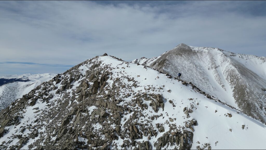
Mt Princeton winter route is an intermediate option for those looking to summit the 14ers during the snowy Colorado months. Unlike most of the year, this hike starts at the lower TH for all hikers adding extra mileage and elevation. However, unlike many other mountains in Colorado, the avalanche risk is fairly low on Mt Princeton during the winter which provides accessibility to this mountain year round for the right hiker. Hiking up Mt Princeton during the winter is very similar to the rest of the year until you get above treeline where it’s recommended to summit neighboring Tigger Peak first to avoid almost all avalanche risk.
Mt Princeton Quick Facts
Virtual Trail Guide: Mt Princeton Winter Hike
Mt Princeton Winter Rating: ★★ (⅖ Stars)
Distance: 12 Miles RT (exact mileage may change depending on boot track)
Elevation Start: 8,951ft
High Point: 14,197 ft
Total Elevation Gain: 5,750ft (Including Tigger Peak)
Estimated Time to Complete: 10-12 Hours RT
Difficulty: Difficult What does this mean?
Class: Class 2 – What does this mean?
Season: December – March (Winter Season)
Avalanche Risk: Mt Princeton in the Winter does present avalanche risk, so please understand the conditions and risks before heading out.
Directions to Mt Princeton
Trailhead: Mt Princeton Road
Getting Here: If you are coming from the north, there are a few alterations from the instructions below, but this is the easiest way to get to Mt Princeton from both the north and the south. From US 285, take county road 162 (Chalk Creek Rd) for 4.1 miles until you reach county road 321. Take this for about 1.5 miles to take a sharp left onto county road 322. Continue on 322 for about .8 miles until you reach a fork, bear right to reach the lower parking area.You can enter “Mt Princeton Trailhead” into your favorite navigational device.
Parking: For a Mt Princeton winter hike, the lower trailhead is your only option to park. Do not try to drive up the road, I have seen first hand how that doesn’t work out well for even very high clearance vehicles.
Summary
Dogs: A Mt Princeton winter hike is not the best for dogs. If your dog is great off leash and on tight voice command, I might consider it. In general though, I wouldn’t recommend bringing your pup on this one.
Camping: Mt Princeton has rather limited camping options since they do not allow camping at the lower TH. If you needed to sneak a night in your car, you might be able to make it work. Otherwise, your next best bet is near the radio towers (around 11,000 feet – 3.4 miles into the 4WD road) where there are a handful of camping options. If you continue past these, you will most likely be camping above treeline or on a sloped area.
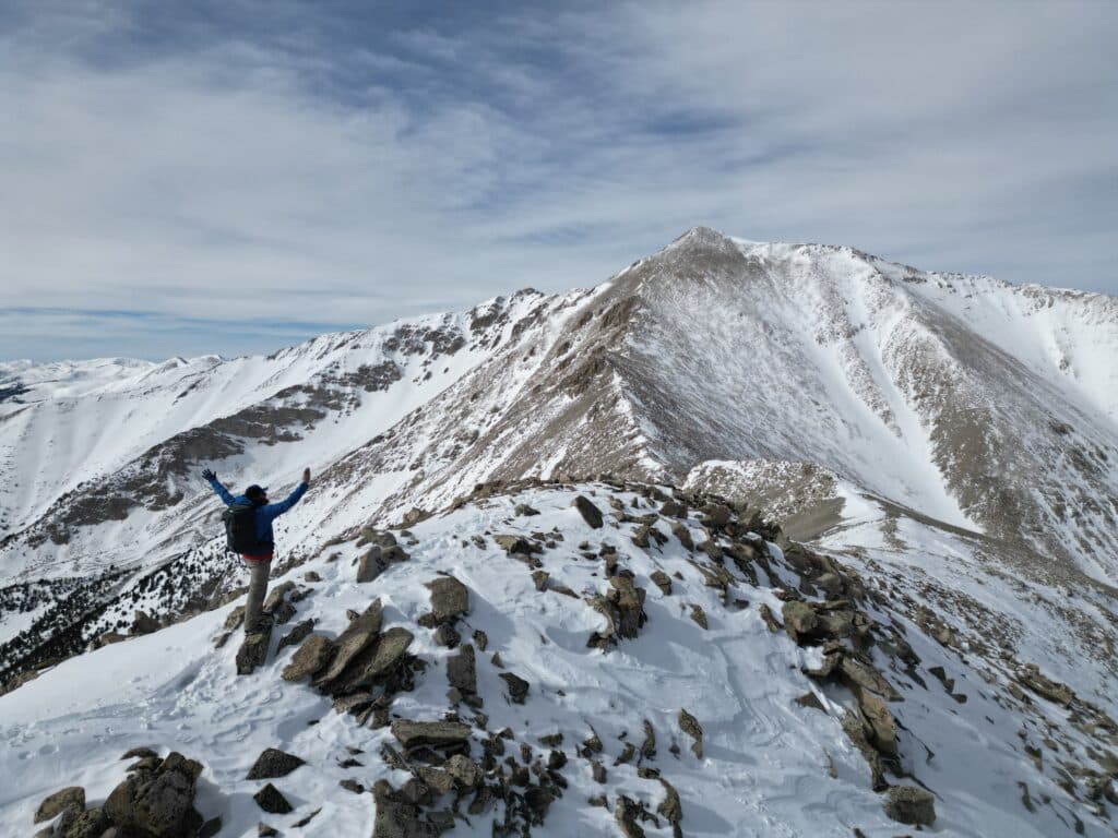
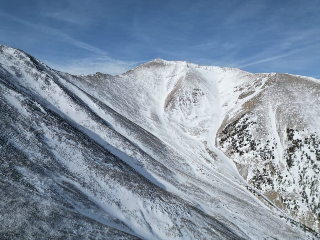
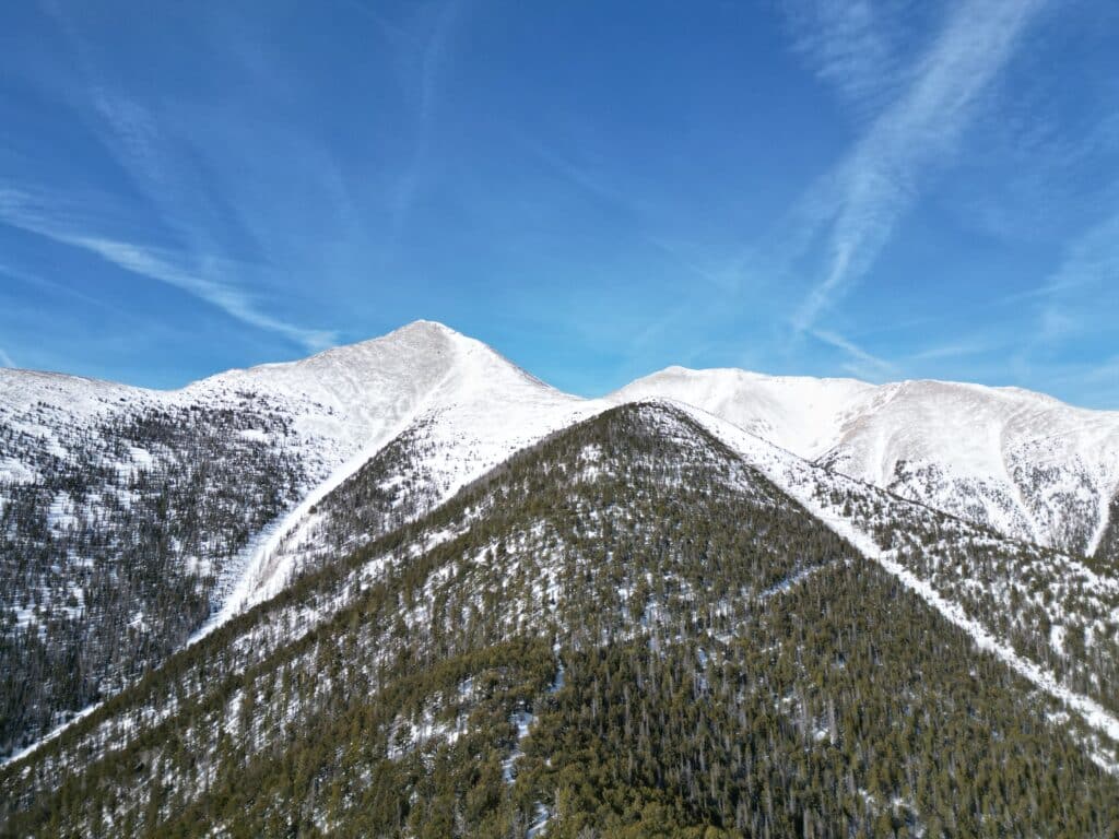
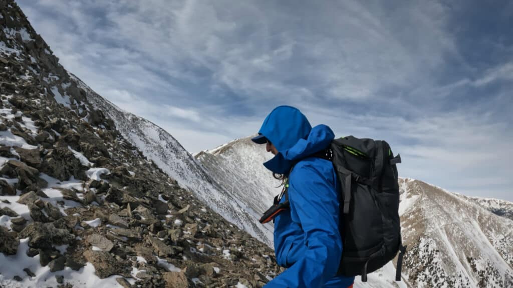
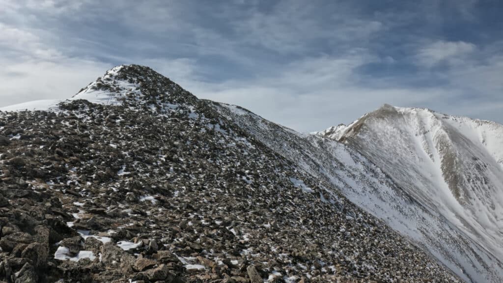
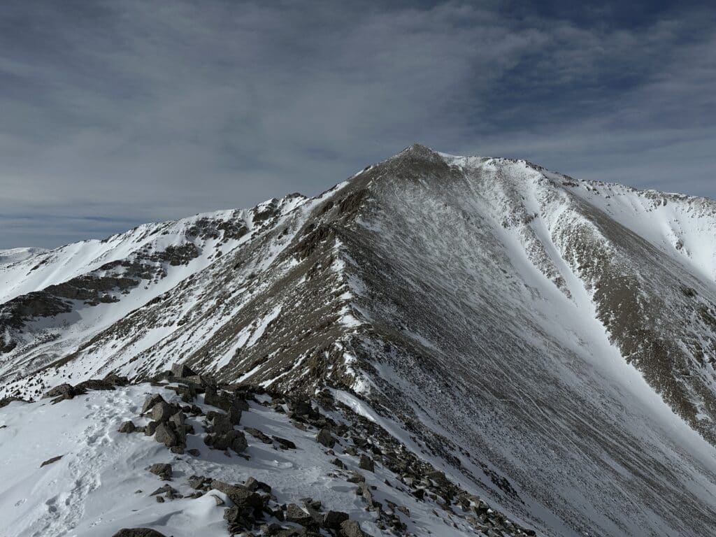
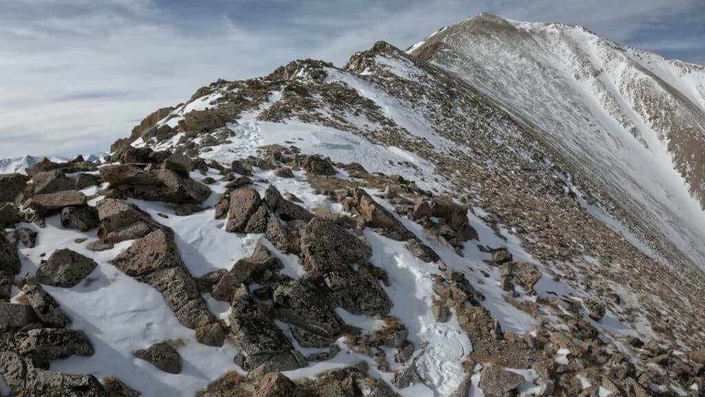
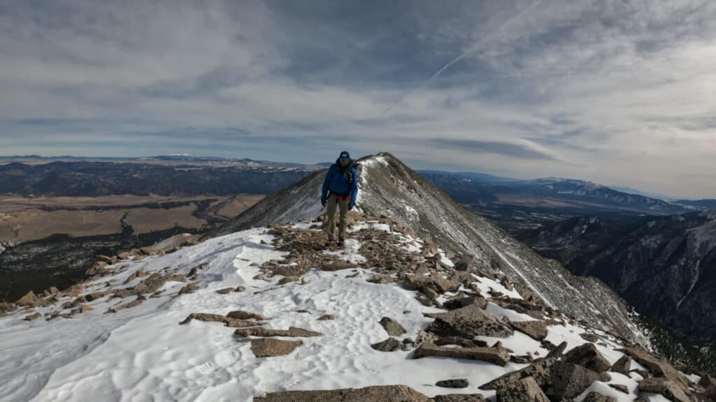
Make it a Loop: In the winter months, it’s best to take the East slopes of “Tigger Peak” which is an unranked 13er next to Princeton. From the standard trail before heading across the steep Northern slopes of Tigger, take the ridge straight up to the summit. This will add some elevation gain both ways but also avoid much of the avalanche risk. If conditions were stable, you could ascend Tigger and descend the standard route which would make this a lollipop loop. Looking to hike more 14ers in the winter? Check out my list of easiest winter 14ers here.
Trail X Factors: Mt Princeton Road & Snow Levels
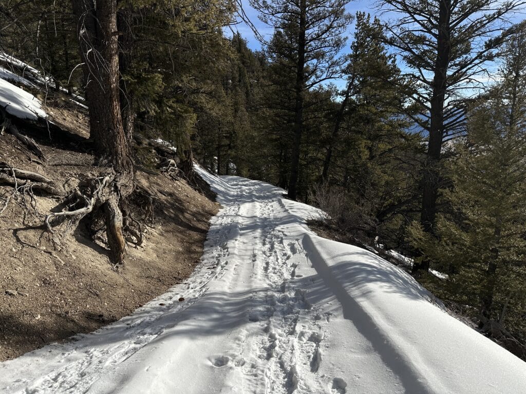
The road up to Mt Princeton is quite unpredictable, especially in the winter. As mentioned, I wouldn’t even attempt to drive up here. However even for hikers, the road can vary from melted out to tracked out from a snowcat to deep snow. If you are lucky to find it well traveled or melted out, these extra 3.5 miles can go fairly quick, if not…well, it might be a sufferfest.
Snow levels on any mountain in the winter vary by season and from month to month. Mt Princeton tends to be very windswept so you might get lucky to have mostly dry trail conditions once above treeline. Alternatively, you could have conditions like I had which ranged from bulletproof snow to sugar snow up to your thighs. Be prepared for both!
Hike Tip: Before heading out to attempt ANY winter hike, be sure to understand avalanche conditions. Even though a Mt Princeton Winter hike has lower avalanche risk, it’s still present. Check out my video to understand basic avalanche information but PLEASE do not consider this enough information to attempt this hike. Always know before you go.
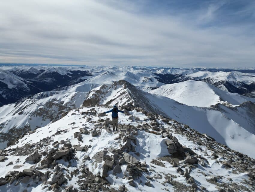
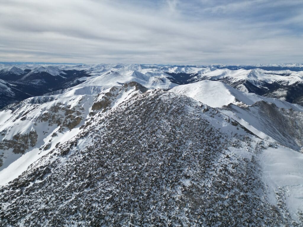
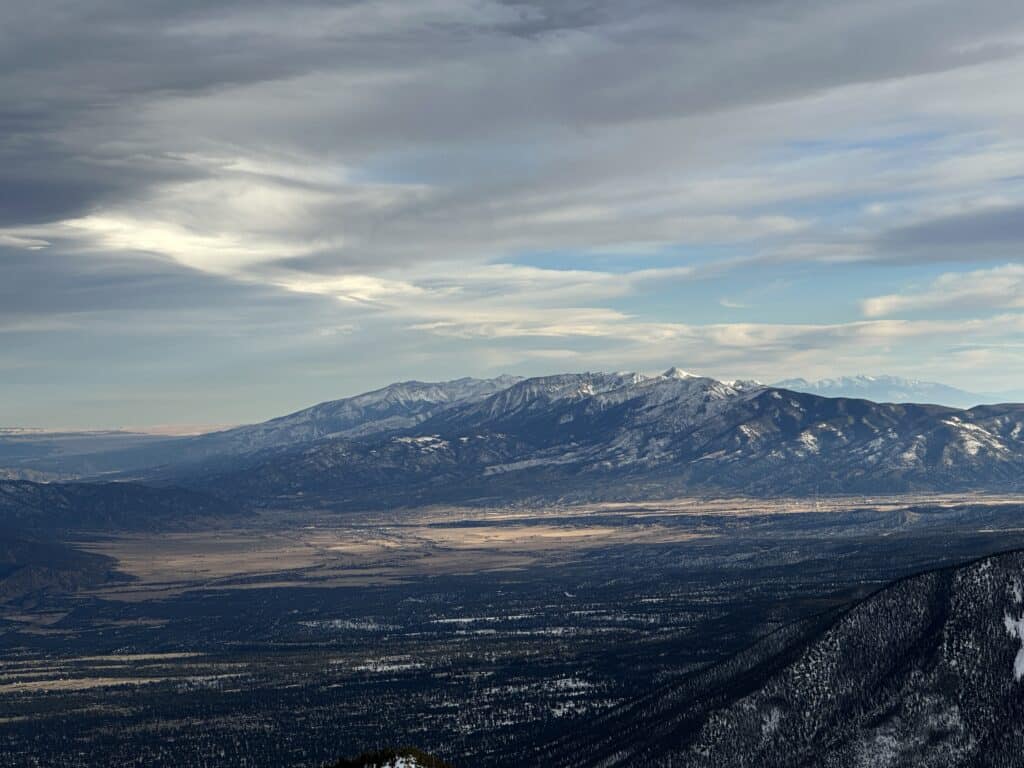
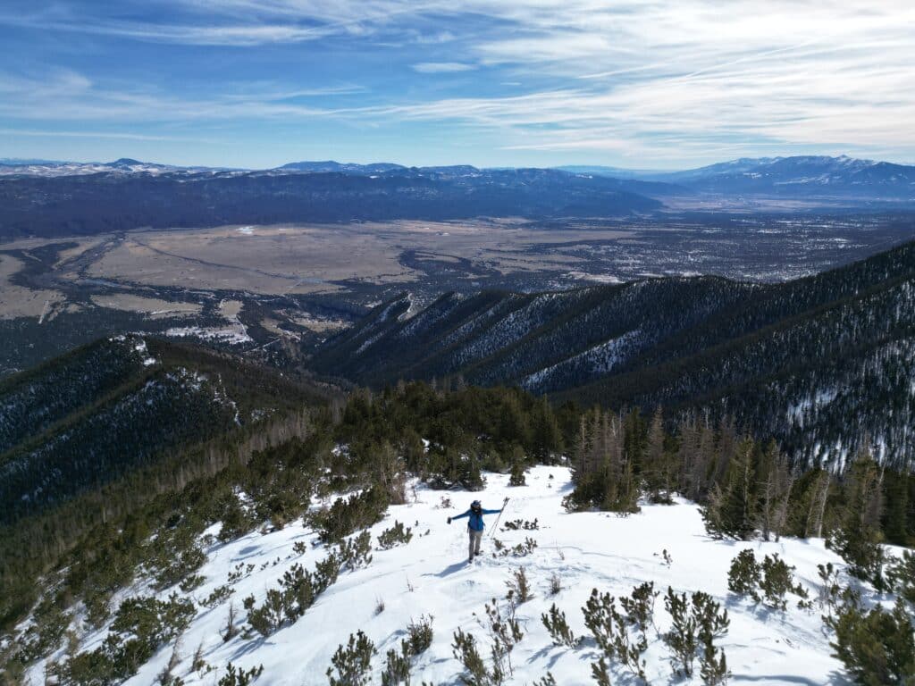
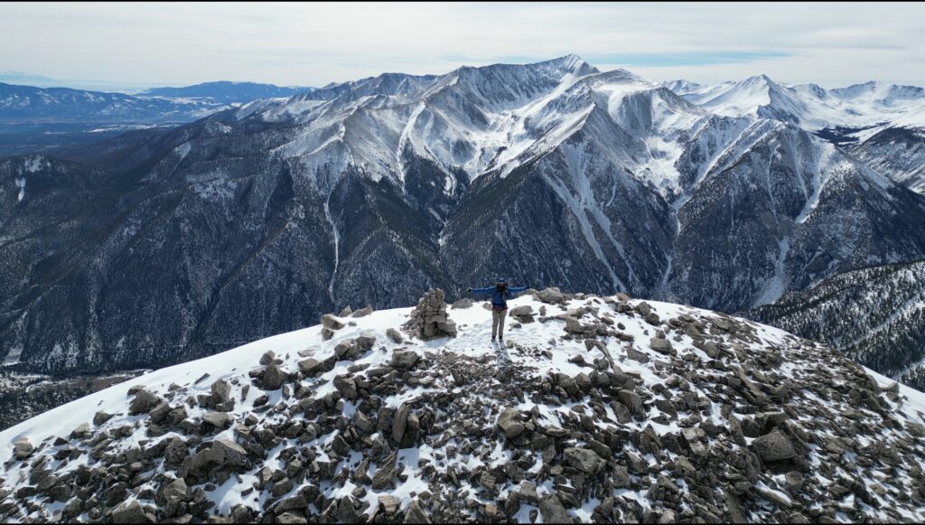
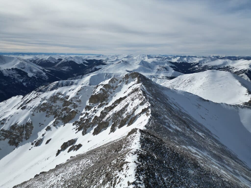
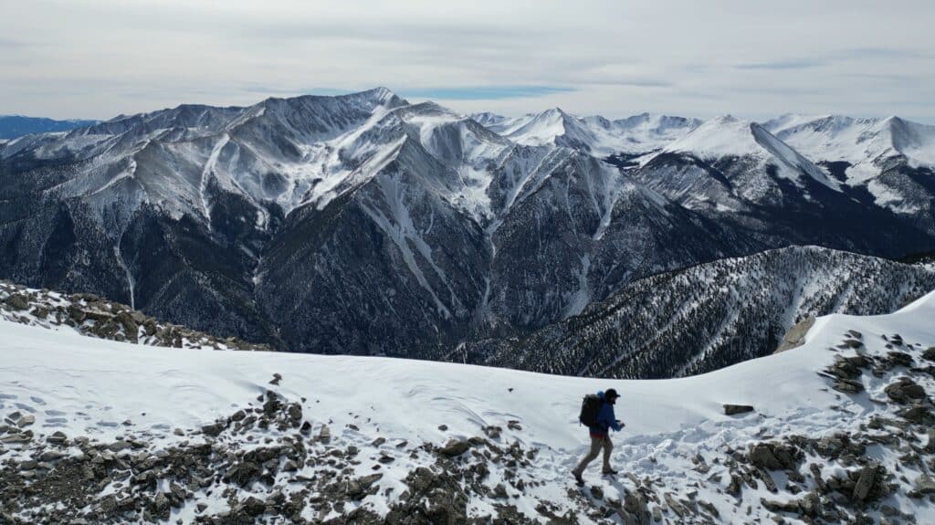
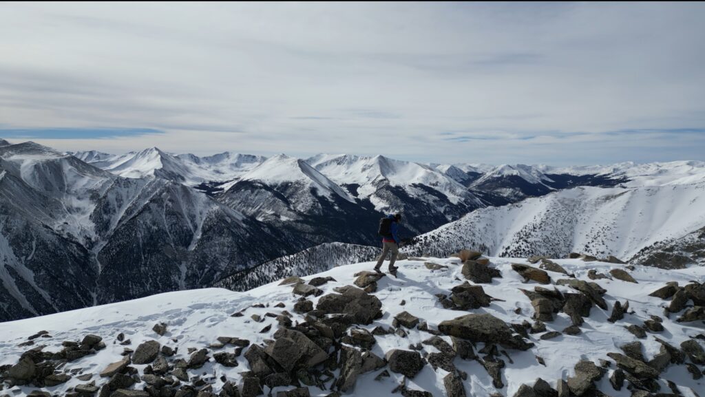
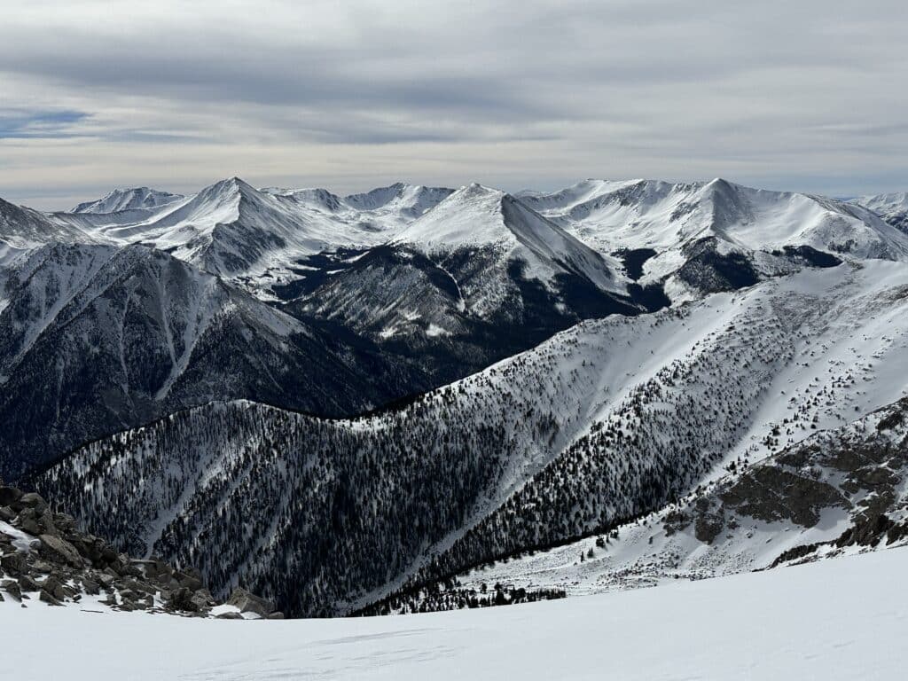
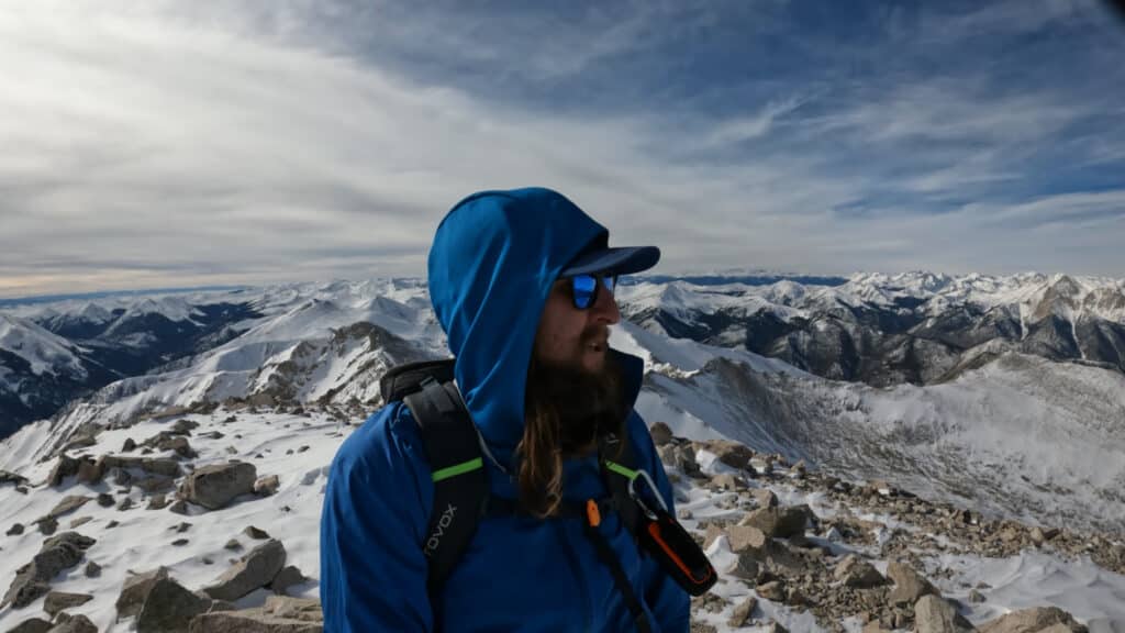
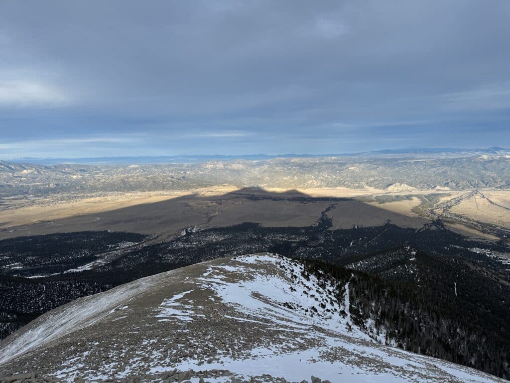
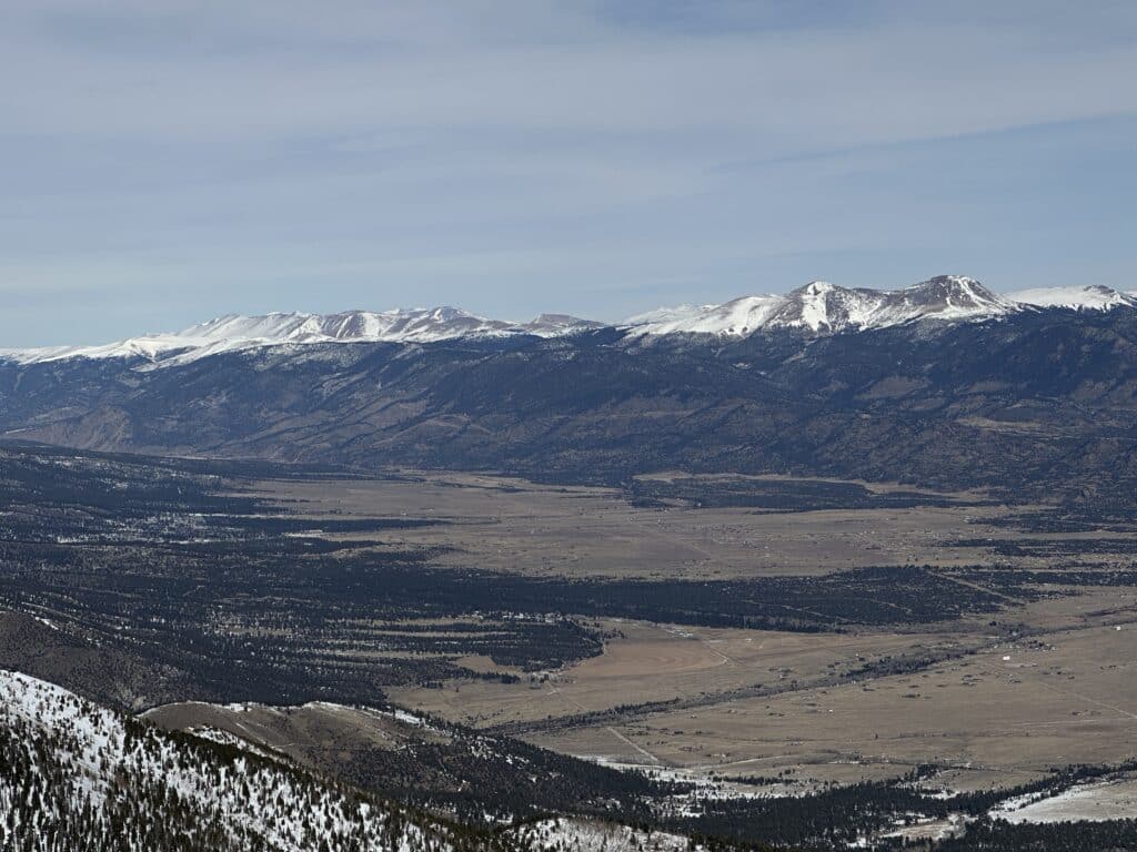
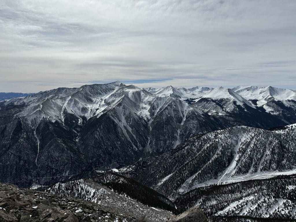
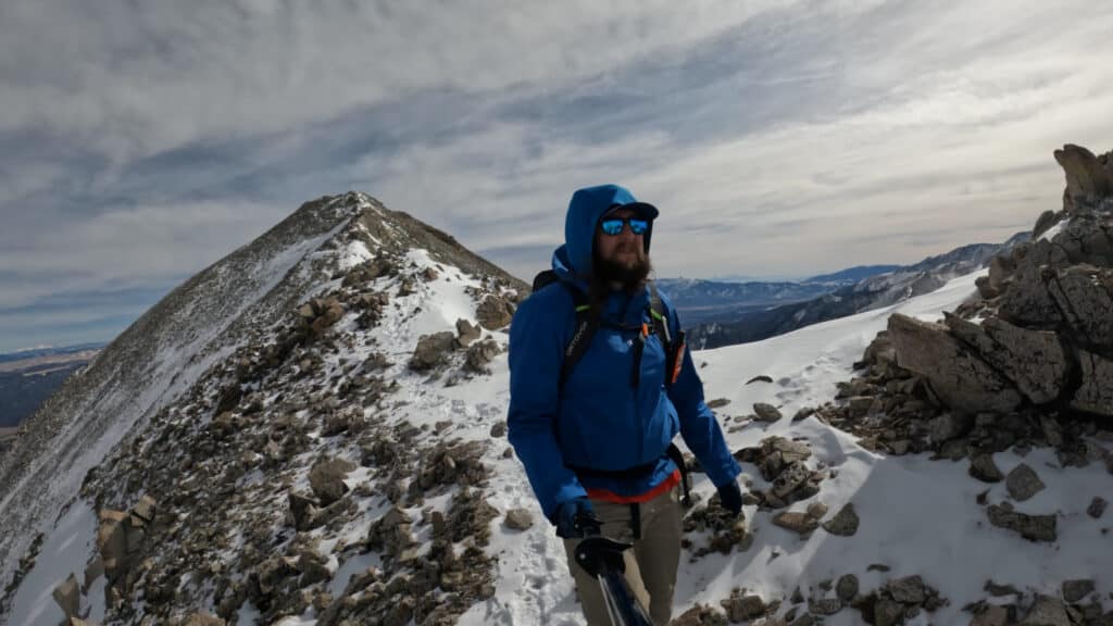
Best Views: Mt Princeton during the Winter is a beautiful sight. To the East and down into Buena Vista and Salida, most likely there will be very little snow. However, as you climb higher and get views into the Sawatch and Elk Ranges, the mountains are beautiful and caked with snow. If you are (un)lucky enough to descend as the sun is setting, you get some awesome shadows of the mountains to the East as well. Overall, Mt Princeton in the Winter or Spring is far more beautiful than the bleak summer or fall months.
Mt Princeton Winter Hike Route
Gear Needed
- 14er Day Hike Packing List
- Winter Backpack
- Hiking/SkiPoles
- Headlamp
- Climbing Helmet
- Mountain Axe – Petzl EVO
- Mountain Axe – Black Diamond Raven – Great for Beginners
- Crampons
- Crampon Bag
- Snowboard Boot Crampons
- La Sportiva Mountaineering Boots
- Snowboard Boots
- Snowpants
- Gloves
- Microspikes
- Gaiters
- Optional: Avalanche Gear: Beacon, Probe, Shovel
- Optional: Snowshoes
- Optional: Skis or Splitboard
- Optional: Goggles
- Optional: Garmin inReach
- Optional: Garmin Fenix Watch
- Optional: GoPro, Joby Tripod, Selfie Stick, Drone
- *Links included in this description might be affiliate links. If you purchase a product or service with the links that I provide I may receive a small commission. There is no additional charge to you.
Trip Report: Mt Princeton Winter 2023
One of my 2023 goals was to tackle a Mt Princeton Winter hike. Why? Honestly, I have no idea. It had been on my hiking to do list for a few years so I finally decided to give it a go. I arrived to the TH around 7:00AM, a later start for this time of year, but the weather was supposed to be A+ so I felt it was okay to start at this time.
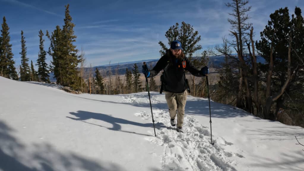
Gaining the miles and elevation to the radio towers were boring but fairly easy. However, I was coming off COVID just 2 weeks before and boy my heart and lungs were feeling it. HR through the roof and I couldn’t catch my breath to save my life. I felt like some of you all from the “flatlands”! After reaching the radio towers, I followed the booter/trench which cut some of the road switchbacks, saving some mileage but adding some postholing because OF COURSE, I left my snowshoes at home.
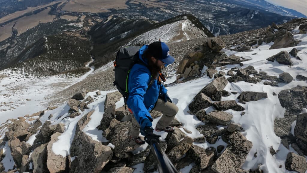
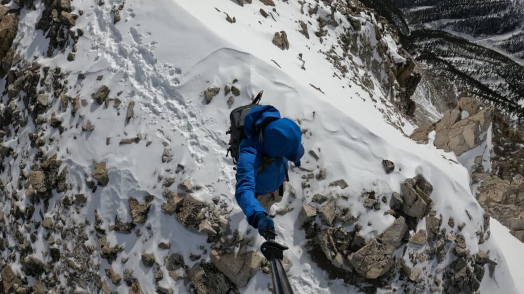
I eventually got above treeline and started my way up “Tigger Peak” via its East slopes. Naturally, I broke both of my hiking poles right as I actually needed them and resorted to using a mountain ax, less than ideal. The conditions up this ridge were challenging, ranging from rock hard snow to sugar snow that would suddenly plunge a leg up to my thigh. Deathly afraid of hyperextending my knee (or worse), I took my sweet time.
I made it to Tigger and started the trek over to Mt Princeton. Heart Rate still through the roof and sucking for wind like I was breathing through a straw, this was the most out of place I had ever felt at this altitude. I knew that I was going to run out of light eventually and as much as I love suffering in the mountains, I didn’t want to be in the dark for too long. I made a mental “cutoff” summit time of 2:30. I reached the summit at 2:37PM…
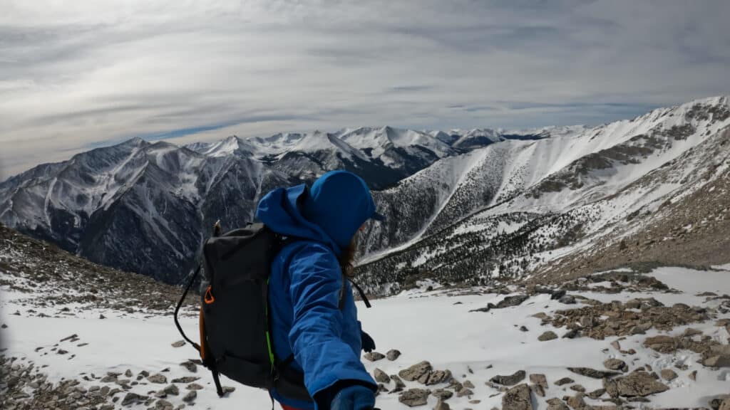
The views from the summit of Mt Princeton during the winter were A++. Snow covered mountains in all directions and the weather *chef’s kiss* perfect. I rewarded myself with some maple syrup from a plastic tube, drank some water, housed some expired beef jerky and started back down. Typically, a descent down a mountain is much faster than the way up. In the winter months, not so much. I was very tired and the snow conditions (especially without hiking poles for balance) were very tricky. The last thing I wanted to do was to get hurt so I took it very slow. Spoiler, I cut my hand open on a rock and was bleeding all over the place until I begrudgingly stopped to put some gauze and bandage on.
Walking down that Mt Princeton road in the dark was not ideal, but I had my headlamp and some great Podcasts to keep me company until I FINALLY reached the car past 7PM. It was a LONG day, but that’s honestly to be expected during the winter months and Mt Princeton Winter ascent was officially checked off my list.
3 thoughts on “Mt Princeton Winter 14er Hike Guide”
Hi Mickey! Love love love your content!! Amazing stuff always. Would you recommend Mt Princeton in Spring – mid-May?
Hey Ali – yeah, should be fairly dry by then with 99% of any avalanche danger gone.
Princeton was my longest and least favorite day, my wife called mountain rescue because she thought something was wrong besides me dragging myself out. Keep up the great work!