Beaver Brook Trail Colorado Hike Guide
The Beaver Brook trail in Colorado is a 9.7 mile one way trail located in the Front Range of Colorado. This trail is very popular for the first sections as it connects with the Chavez Trail off I70 on one end and the Windy Point overlook in Golden on the other. Although this trail can be hiked or run almost year round, it does tend to hold quite a bit of snow into early April and can be quite muddy for a few weeks after that. However, for the right athlete, the Beaver Brook trail does present a nice year round trail run or even Winter hike. Please note that since this hike is 9.5 miles one way, it does require a shuttle or ride for any hiker just looking to make this a one way trip.
Beaver Brook Trail Colorado Quick Facts
Beaver Brook Trail Rating: ★★★★ (4/5 Stars)
Distance: 9.7 miles One Way
Elevation Start: 7,570 (Beaver Brook TH) 6,914ft (Windy SaddleTH)
High Point: 7,733ft
Total Elevation Gain: 2,400ft (East to West) 2,900 (West to East)
Estimated Time to Complete: 2-4 Hours One Way
Difficulty: Moderate What does this mean?
Class: Class 1 – What does this mean?
Season: Year Round – expect snow: December – April
Directions to Beaver Brook Trail Colorado
Trailhead: Beaver Brook TH or Windy Saddle Park TH
Getting Here: Beaver Brook TH: From I-70, take exit 253 (Chief Hosa) and continue towards Stapleton Road (right off highway if traveling west, left off highway if traveling east). You can enter “Buffalo Overlook” into your favorite navigational device to get to the TH.
Windy Saddle Park TH: From Golden, Colorado, take Rt 6 to Lookout Mountain Rd and follow this for about 4 miles until you reach the small pull off and parking area for Windy Point Park.
Parking: The parking area off I70 for the Beaver Brook/Chavez Trail has room for about 20 cars with a non plumbing bathroom. The small parking area at Windy Point can fit about 10-15 cars with restrooms without electricity there as well. Both spots do not require a special car to get to and are accessible year round.
Summary
Dogs: This is a dog friendly trail.
Camping: Camping is not allowed in this area and in general, this is not a good spot to camp anyway. However, if you did want to camp – Chief Hosa offers camping from May 1 through the 4th week of September each year. Read more about that here.
Make it a Loop: The best way to make this hike a loop is to cut off the majority of the trail and link the Beaver Brook trail with the Chavez trail. Read a full guide about that hike here.
Trail X Factors: Snow Level During Winter
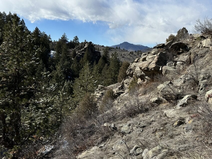
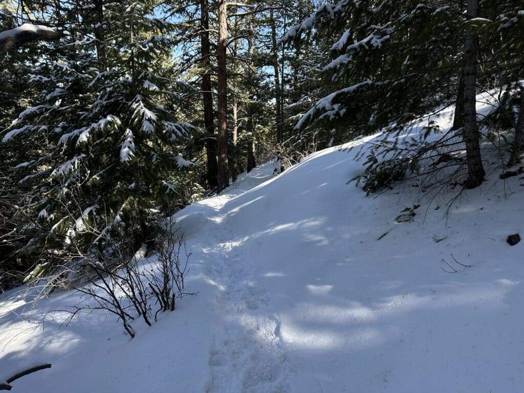
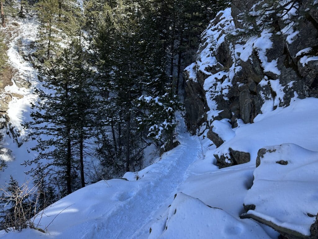
Chances are, if you have hiked this spot in the winter, you experienced several sections of deeper snow, trail breaking and even some sketchy ledges near the Windy Saddle or east end. Snow in the Front Range of Colorado, especially in this location, varies greatly month to month and year over year. If you are hitting this spot in the winter, be prepared with microspikes, hiking poles and even snowshoes depending on the exact month.
Hike Tip(s): Be prepared to climb a lot on this hike or run. Although the starting and finish elevation are very close, there are a number of large hills you climb up and down while on this hike. Overall, I would say this trail is probably 85% runnable depending on the conditions.
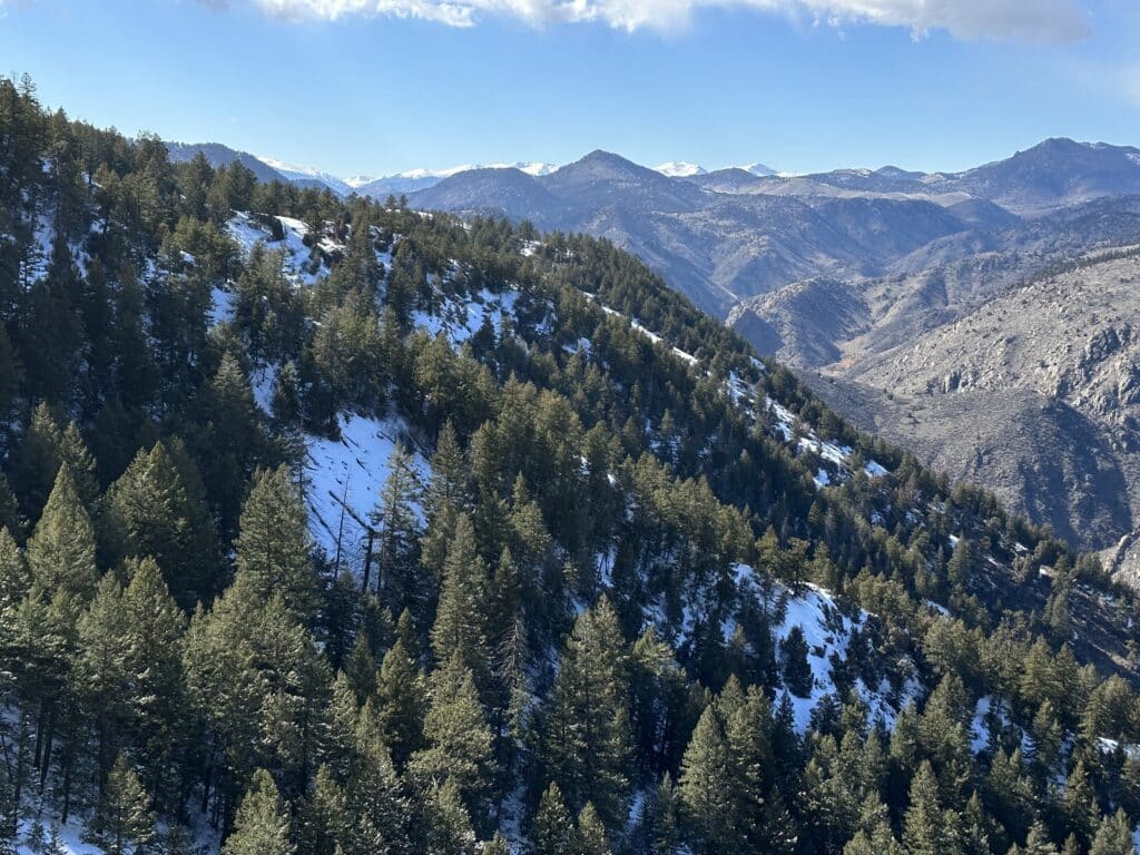
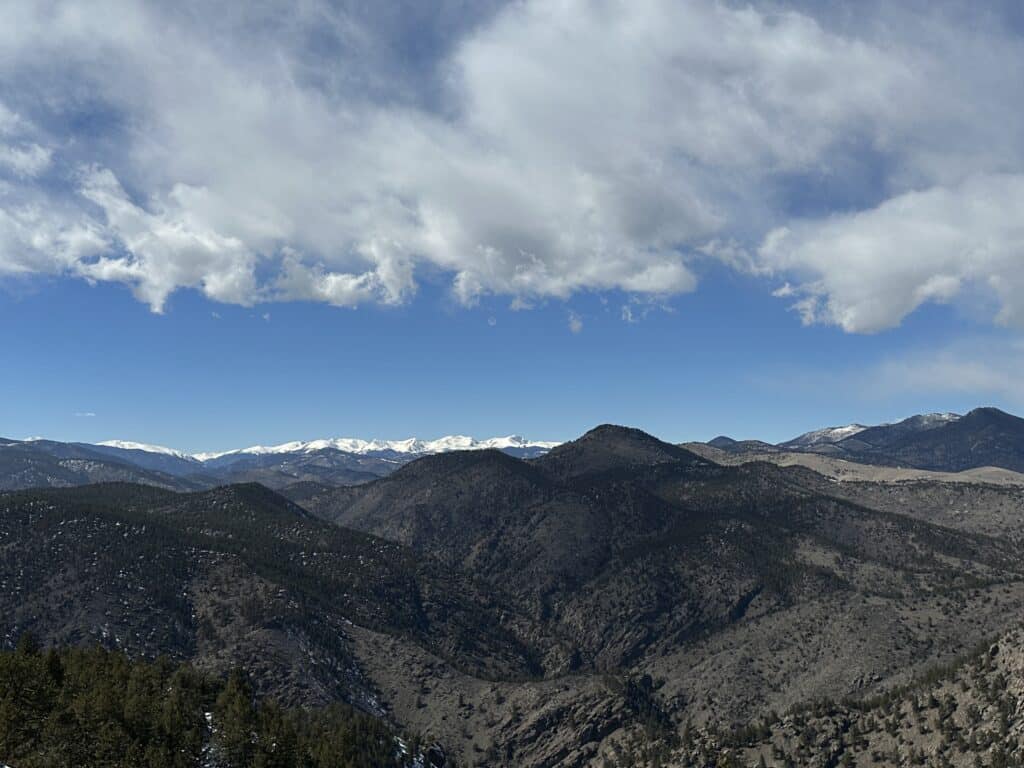
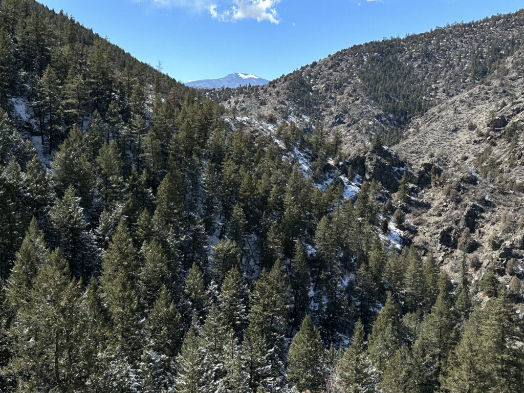
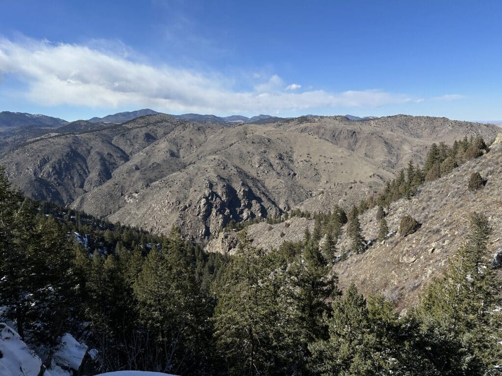
Best Views: My favorite views on this hike were about half way towards Windy Saddle when you could see Mt Evans and some of the Indian Peaks off to the West. In addition, as you get closer to Windy Saddle, some of the views of the foothills and down into Denver are also beautiful. For how close this hike is to Denver, you really can’t go wrong with how much seclusion and beauty it offers.
Beaver Brook Trail Colorado Hike Route
Gear Needed
- Winter Backpack: https://amzn.to/3whui7J
- Hiking/Ski Poles: https://amzn.to/2txU7mB
- Headlamp: https://amzn.to/2SmfroN
- Microspikes: https://amzn.to/31KwwM5
- Optional: Gaiters: https://amzn.to/3aPKpyk
- Optional: Snowshoes: https://amzn.to/2Hgx4jq
- Optional: Yaktraks: https://amzn.to/36SDC2r
- Optional: Garmin inReach:https://amzn.to/3ckhnFq
- Optional: Garmin Fenix Watch: https://amzn.to/38cSlIB
- *Links included in this description might be affiliate links. If you purchase a product or service with the links that I provide I may receive a small commission. There is no additional charge to you.
My Trip to Beaver Brook Trail: March 2023
The Winter of 2023 was a tough one across the state of Colorado. High winds, lots of snow and cold temperatures made venturing outside exceptionally difficult especially when I was looking for a trail run. With a free weekend day and a 10 mile run needed, I decided to stick closer to home and try out the full version of the Beaver Brook Trail. I had hiked the smaller and more popular loop previously but not the full version.
The trail was fairly runnable with lots of packed down snow and mud in sections at the start. However, as I started getting farther away from the popular trailhead off I70, the tracks decreased, snow deepened and running slowed down to a hike in several spots. It turned out, this spot probably needed a few more warm days to melt out. Nevertheless, I made the most of the beautiful day and continued on towards Windy Saddle stopping to soak in the views in several spots. As I reached the end of the trail, I started to come across a lot more day hikers who were hiking to one of the many outlooks near Windy Saddle.
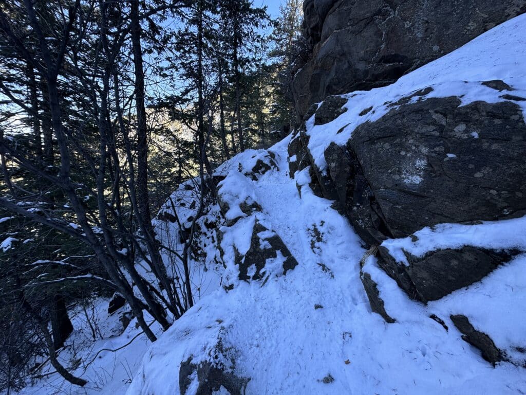
The most fun and most sketchy part of this trail during the winter were the ledges towards the very end of the 9/10 mile trail. In the summer, the trail was likely narrow but wide enough to pass over a handful of 20/30 ft cliffs with ease. In the winter, with snow and ice on the trail and trail runners on my feet, I had to cross very carefully. This added to the excitement though and I wrapped up the run shortly after.
Overall, I really enjoyed the Beaver Brook Trail and would certainly come back to hike or run it in the future. In addition, there are a few smaller trails that loop off the main trail that could also be fun to explore. This one is added to my best hikes near Denver list.
2 thoughts on “Beaver Brook Trail Colorado Hike Guide”
I just wanted to send you a message. You have helped me and my dad climb well over a dozen 14’ers in the past 2 years, including longs. I appreciate all that you do and thank you for your content; it truly makes a difference. Wishing you the best and safe travels.
Thank you very much, really appreciate the kind feedback and glad to have helped!