Bridge Point Hike Guide
Bridge Point is a 6,700ft mountain located on the West side of Red Rocks canyon outside of Las Vegas, Nevada. This summit is the smaller sibling of neighboring Bridge Mountain which sees more traffic than this summit. Both approaches use Fern Canyon before splitting off on the final sections of scrambling. In order to reach Bridge Point, hikers must navigate miles of a tedious canyon and then scramble up the sandstone that surrounds the mountain. While there is no trail up this mountain, once leaving the canyon, the way to the summit is marked heavily with cairns. I would recommend this hike to someone who is moderately experienced as there is lots of route finding and scrambling on the way to the beautiful summit.
Bridge Point Quick Facts
Bridge Point Rating: ★★★★ (4/5 Stars)
Virtual Trail Guide: Bridge Point
Distance: 8.5 Miles RT
Elevation Start: 3,932ft
High Point: 6,780ft
Total Elevation Gain: 3,500ft
Estimated Time to Complete: 6-8 Hours
Difficulty: Difficult What does this mean?
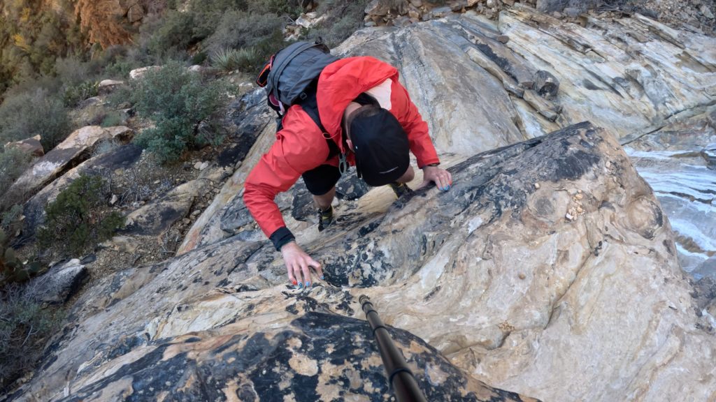
Class: Class 3* Generally, you should be able to keep this to Class 3 so long as you stay on route. What does this mean?
Season: Year Round – Most popular times to visit are during the Winter and Spring months when temperatures are cooler.
Crowds: Low
Directions to Bridge Point
Trailhead: Pine Creek
Getting Here: Enter Red Rocks Canyon National Recreation area and drive 10 miles on the one way road to reach the signed trailhead on the right. Red Rocks is about a 20 minute drive outside of Las Vegas.
Parking: There is a parking lot located at the trailhead that can fit about 50 vehicles. There is also a non plumbing bathroom here as well. From my experience, parking was easy to come by, but during the busiest times of the year or week, I imagine that this lot can get competitive to find spots.
Permits/Fee: $20 and timed entries are encouraged/sometimes required for October 1st to May 31st. Read more about fees for Red Rock Canyon here.
Summary
Dogs: Although dogs are allowed in Red Rock Canyon, I would not recommend Bridge Point for dogs. Having to navigate the initial drainage with a dog would be extremely annoying and tedious, especially with them on a leash. Add on the likely high temperatures; I would leave your pup at home for this one.
Camping: Red Rock canyon offers two forms of camping: through a campground or dispersed (backcountry) camping above 5,000ft in the park. Read more about that process and various options here. Along this hike itself, I truly did not see any suitable options for camping.
Make it a Loop: Bridge Point is an out and back hike with the ability to add on Bridge Mountain with a bit of back tracking. I was not successful in doing this but I believe you have to backtrack to basically the exit of Fern Canyon and then climb to the left vs following cairns to the right.
Trail X Factors: Navigation
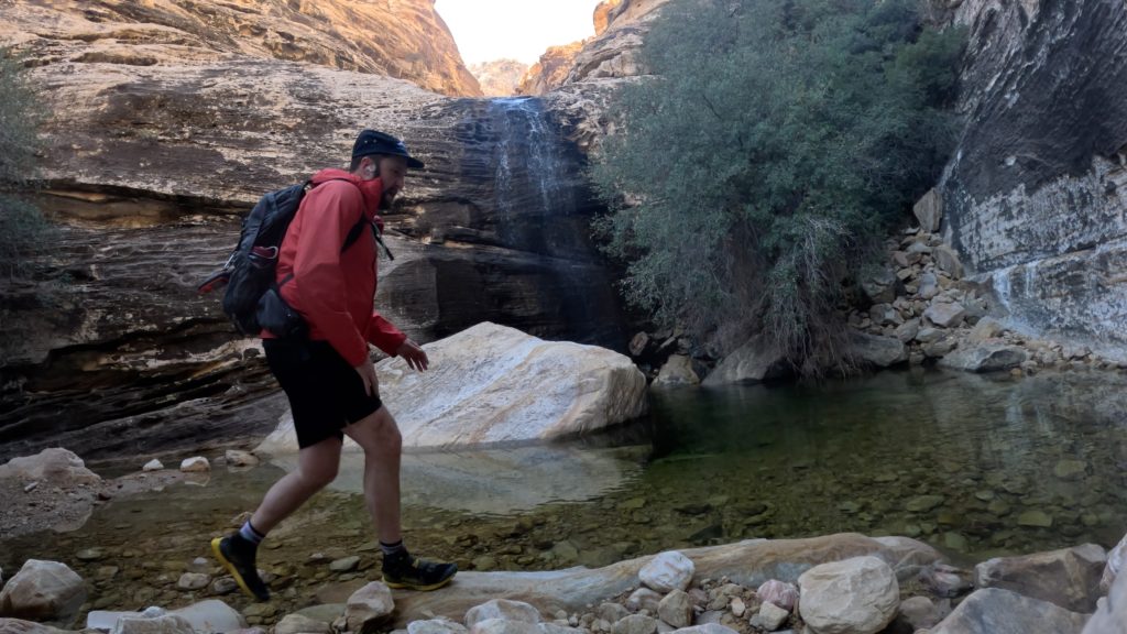
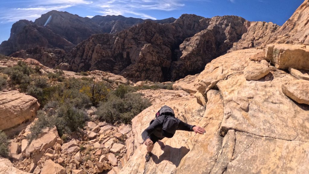
Almost the entire hike up to Bridge Point is not on an official trail and involves A LOT of route finding. Fern Canyon is dense, tedious and slow going and that is when water conditions are low. Although the general goal is to follow the creek until it ends, there are a handful of sections that require you to leave the creek as the difficulty of the climbing exceeds most hikers’ skill level.
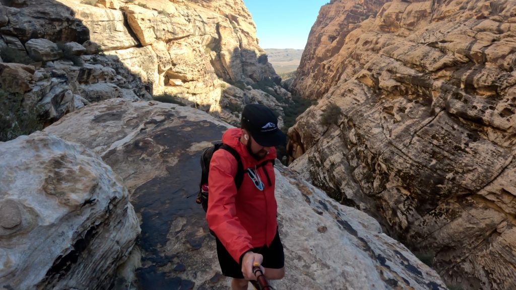
Once above the canyon, there are plenty of cairns to follow but there are also a handful of objectives along the way and it’s dangerous to always assume they are leading you the “right” way. My biggest advice is to have a .gpx track to follow AND know the general direction where you want to head. It can be very easy, even with all of the cairns, to get off route on this hike. Be sure to follow the same way down as you went up. There are PLENTY of spots where you could get cliffed out.
Hike Tip(s): Along Creek: Give yourself plenty of time to navigate the section of trail along the creek. When in doubt, stay low as it can be easy to get cliffed out above. After you climb up past the waterfall, you will have to leave the creek at least once but be sure to go back down as you will likely get cliffed out.
Above Creek: BE SURE to follow the correct start to this hike once you leave Fern Canyon. This starts by following the cairns that lead you out of the drainage to the right. If you find yourself going more towards the left, you are likely following the “trail” to Bridge Mountain and you will not be able to tag Bridge Point without backtracking. Additionally, since there is A LOT of trail finding this entire hike (near the creek and up on the slopes) I would highly recommend having a .gpx to follow.
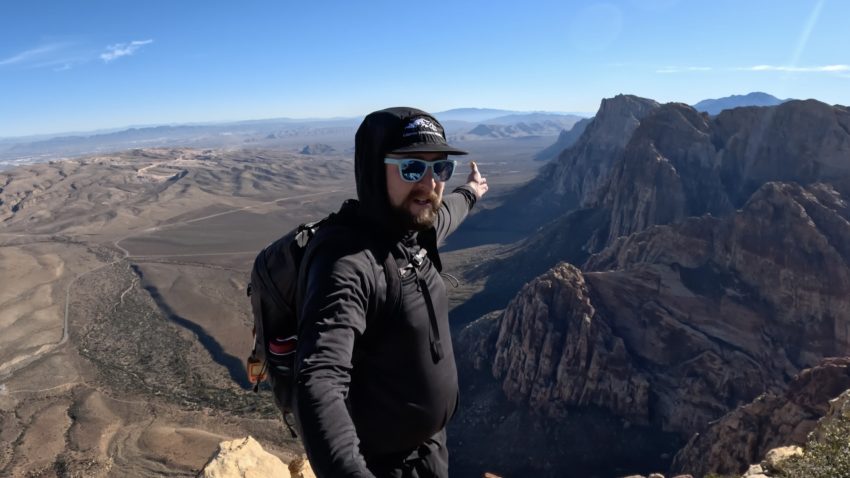
Best Views: I fully admit that the desert is still very foreign to me and things that some may find boring, I find beautiful. Having said that, I think that the views offered on the hike up to Bridge Point are objectively beautiful for almost the entire hike. The vast canyon behind you as you scramble of the red rock does not get old. From the summit of Bridge Point, you can see Las Vegas and most of Red Rocks Canyon Preservation area. Behind you the Spring Mountains (sometimes snow coated in the Winter months) are magnificent to look at.
Gear Needed
- Men’s Trail Runners
- La Sportiva Cyklon
- La Sportiva Trango Hiking Boots (Men’s)
- Backpack (Winter)
- Backpack (Summer)
- Sunglasses
- Base Layers
- T Shirt
- Mid Layer
- Rain Jacket / Shell
- Pants
- Shorts
- Socks
- Food & Water
- Optional: Water Filter
- Optional: Garmin inReach
- Optional: Hiking Poles – 120CM
- Optional: Headlamp
- Optional: Garmin Fenix Watch
- Optional: GoPro, Joby Tripod, Selfie Stick, GoPro Max 2 , Drone, Insta360
- *Links included in this description might be affiliate links. If you purchase a product or service with the links that I provide I may receive a small commission. There is no additional charge to you.
Bridge Point Hike Route
*As you can tell, I got lost a lot on this hike…however, my route up to Bridge Point was fairly direct and I feel confident sharing this with you. Ignore all of my indirect hiking after I tag the summit…