Guadalupe Peak Hike Guide
Guadalupe Peak is Texas’ highest peak at 8,751ft. The hike to the top of Texas is a moderately difficult hike with over 3,000ft of elevation gain over the course of its 8.5+ miles. Hikers will likely need a half or full day to summit this mountain, depending on experience levels and conditions. In terms of state high points, I would compare this one to Humphrey’s Peak in Arizona or maybe Wheeler Peak in New Mexico.
Guadalupe Peak Quick Facts
Virtual Trail Guide: Guadalupe Peak
Hike Rating: Guadalupe Peak (3/5 ★★★ Stars)
Distance: 8.5-10 Miles RT (depending on starting point)
Elevation Start: 5,822ft
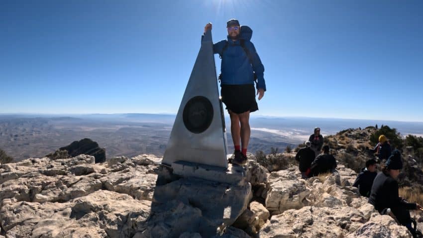
Highest Point: 8,751ft
Total Elevation Gain: 3,350ft
Estimated Time to Complete:4-6 Hours Total
Difficulty: Moderate Difficulty System Explained
Class: Class 2 – What does this mean?
Season: Year Round, expect snow December – February
Weather: Check the Weather Forecast
Directions to Guadalupe Peak
Trailhead: Pine Springs
Getting Here: Since Guadalupe Peak is fairly remote from the New Mexico side, I will assume a starting point of El Paso. Take US180 East for about 113 miles until you reach the Guadalupe Peak visitor’s center on your left. If the parking lot is not full, after checking into the visitor’s center, continue towards the Pine Springs trailhead. If the lot is full, park at either the visitor’s center or Butterfield Stage lot.
Parking: There are three parking lots for this hike: directly at the Pine Springs trailhead, at the park visitor center and the Butterfield Stage lot. During busy days and weekends, all three lots may fill up. All three lots are in walking distance of each other with about .5 miles separating Butterfield from Pine Springs. There are restrooms at the Pine Springs and Visitor Center.
Fees: $10 National Park Entrance Fee
Summary
Camping: The best spot to camp for Guadalupe Peak is in one of the National Park’s campgrounds. For more information or to make a reservation, visit the park’s website.
Dogs: Although Guadalupe Peak is dog friendly from a terrain perspective, dogs are not allowed to hike in US National Parks.
Make it a Loop: Guadalupe Peak is an out and back hike but there are other hikes in the park should you want to see more.
Trail X Factors: Parking Availability & Time zone
Although Guadalupe Peak is one of the country’s least visited National Parks, parking is limited and can fill up on busy weekends and holidays, especially during the Spring and Fall. I would recommend an early start or visiting on a weekday if possible during these periods of the year to ensure the best chance at snagging a parking spot. I will admit that I was very lackadaisical with my hike start and almost ended up striking out on a parking spot.
This hike is on the edge of two time zones and your phone or other devices may lie to you on what time it actually is. Note that Guadalupe Peak falls under the Mountain Standard Time Zone (MST).
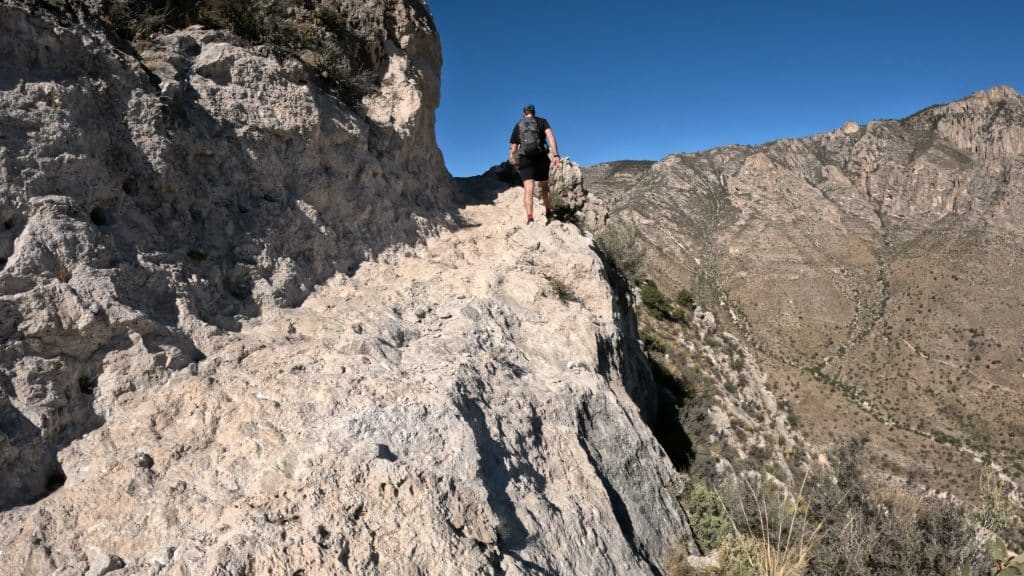
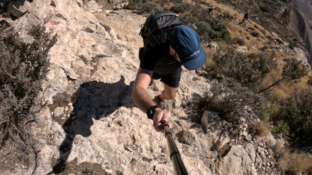
Hike Tip(s): Take it easy on this trail as it’s a fairly constant elevation gain. I am not sure if my legs were not feeling it on the day I summited but on the way down, my knees were killing me from the rocky and rough terrain. Right before the summit, there are some sections of trail that involve low Class 2 hiking but this may be tougher for more inexperienced hikers. However, if you take your time, it should not be a dealbreaker on getting to the top.
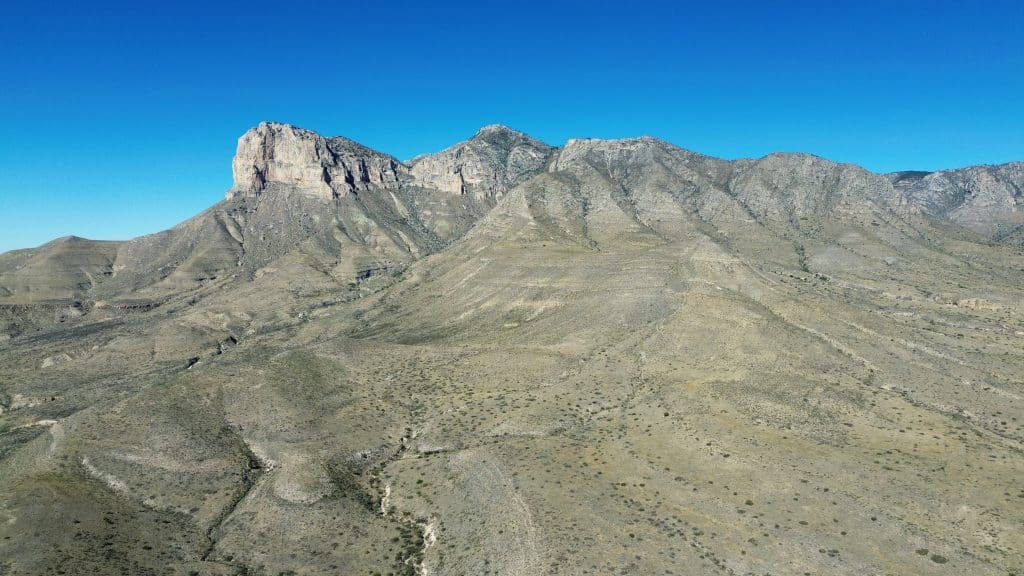
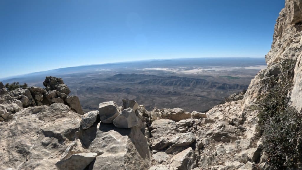
Best Views: This trail basically has great views from start to finish. There are a few sections towards the middle of the hike that are covered by trees but otherwise, the desert views are spanning. From the summit, my favorite photos were those that included nearby El Capitan.
Guadalupe Peak Hike Route
Recommended Gear
- Men’s Trail Runners
- La Sportiva Cyklon
- La Sportiva Trango Hiking Boots (Men’s)
- Backpack (Winter)
- Backpack (Summer)
- Sunglasses
- Base Layers
- T Shirt
- Mid Layer
- Rain Jacket / Shell
- Pants
- Shorts
- Socks
- Food & Water
- Optional: Water Filter
- Optional: Garmin inReach
- Optional: Hiking Poles – 120CM
- Optional: Headlamp
- Optional: Garmin Fenix Watch
- Optional: GoPro, Joby Tripod, Selfie Stick, GoPro 360, Drone, Insta360
- *Links included in this description might be affiliate links. If you purchase a product or service with the links that I provide I may receive a small commission. There is no additional charge to you.