Humphreys Peak Arizona Highpoint Hike Guide
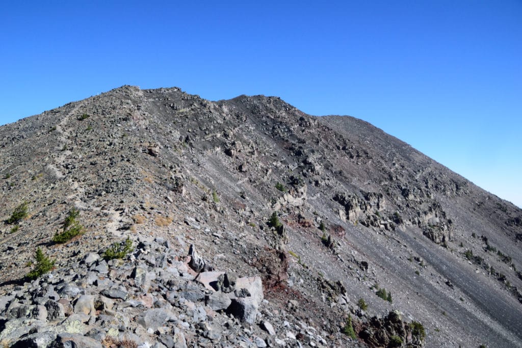
Humphreys Peak is the highest mountain in Arizona at 12,637ft. Chances are if you have been near Flagstaff, Arizona you have seen a portion or the summit of this mountain. Typically hiked during the spring, summer and fall but it can also be ascended in the winter months. Hiking consists of a dirt trail with some extremely minor class 2 as you get above treeline. This is a unique hike due to the area its located and offers great views from the summit.
Humphreys Peak Quick Facts
Virtual Trail Guide: Humphreys Peak
Humphreys Peak Rating: ★★★ (3/5 Stars)
Distance: 10 Miles RT
Elevation Start: 9,319ft
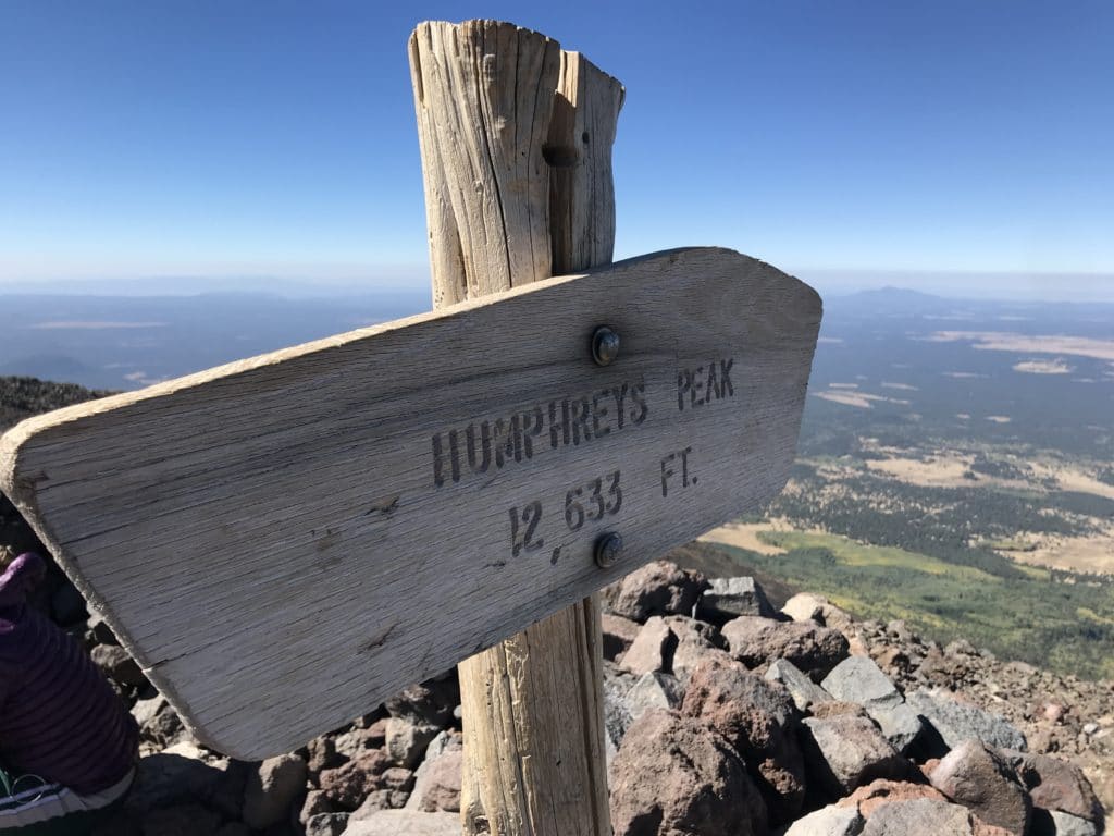
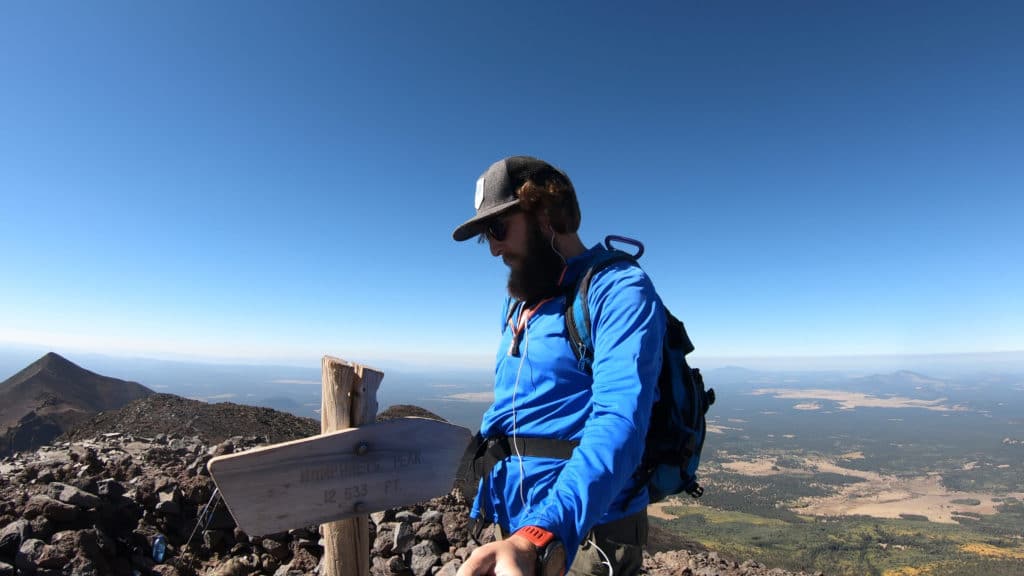
Highest Point: 12,637ft
Total Elevation Gain: 3,250ft
Estimated Time to Complete: 4-6 Hours RT
Difficulty: Moderate Difficulty System Explained
Class: Class 2 What does this mean?
Season: Late June – Late November – Expect snow & SEVERAL more miles outside of this period
Weather: Check the Weather Forecast
Directions to Humphreys Peak
Trailhead: Arizona Snow Bowl
Getting Here: From Flagstaff, take US-180 for 6.6 Miles to reach the entrance of Arizona Snow Bowl. Take a right here and continue to the end of the road (about 6.5 Miles). Once you get close to the TH, there will be signs for Humphreys Peak parking.
Fees: There is no fee to hike Humphreys Peak.
Parking: Humphreys Peak has a large parking lot that can fit 30+ cars. As of 2020 there are a handful of porta potties at the TH.
Summary
Camping: The best areas to camp are on the road along to the trailhead. NF-522 in addition to some limited roadside camping spots. In general though, this is not the GREATEST area to camp, but you can certainly make it work.
Dogs: Humphreys Peak is dog friendly however it does enter a wilderness area for the majority of the hike so please keep dogs leashed when you can. As always, please pick-up after your dog.
Make it a Loop: Humphreys Peak is an out and back hike. If you wanted to add more hiking there are some other trails at the start of the hike that could be added on.
Trail X Factors: Elevation
Chances are, if you are hiking Humphreys Peak, you might not be used to thin air at high elevation. The hike starts just north of 9,000ft and picks up consistent elevation until you arrive at the summit. Your lungs may be feeling it at the start, but once you get north of 10,000ft you will really be breathing heavy. If you are used to high elevation hiking, this one will not be a problem for you as it only tops out in the 12,000 range.
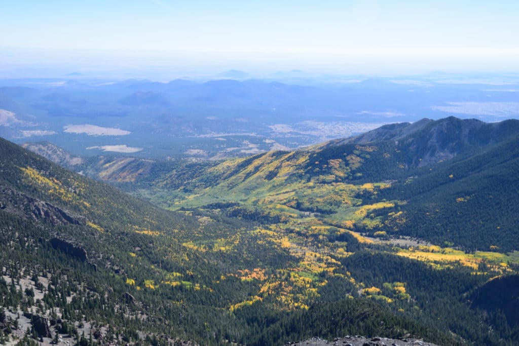
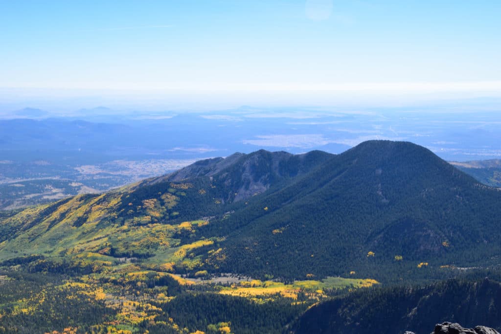
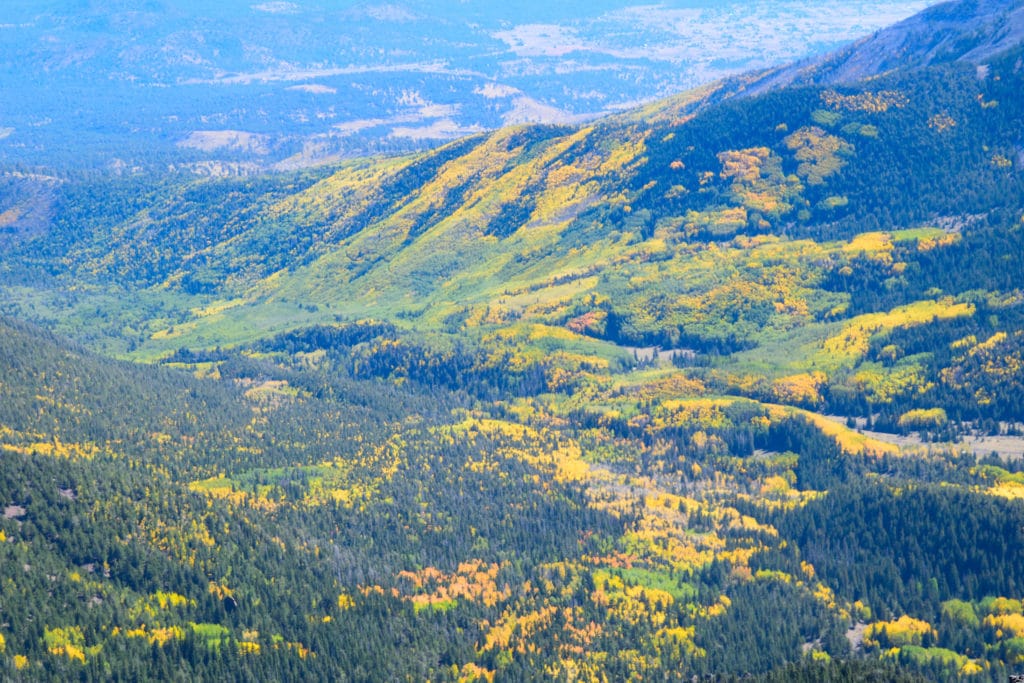
Hike Tip(s): I would highly recommend hiking Humphreys Peak in the fall. Not only are the temperatures cooler which will make for a much more enjoyable hike but you will also get to enjoy the beautiful aspen trees that cover all sides of the mountain. It’s quite the experience to be hiking next to yellow and orange aspen trees one hour and then next to cactuses the next.
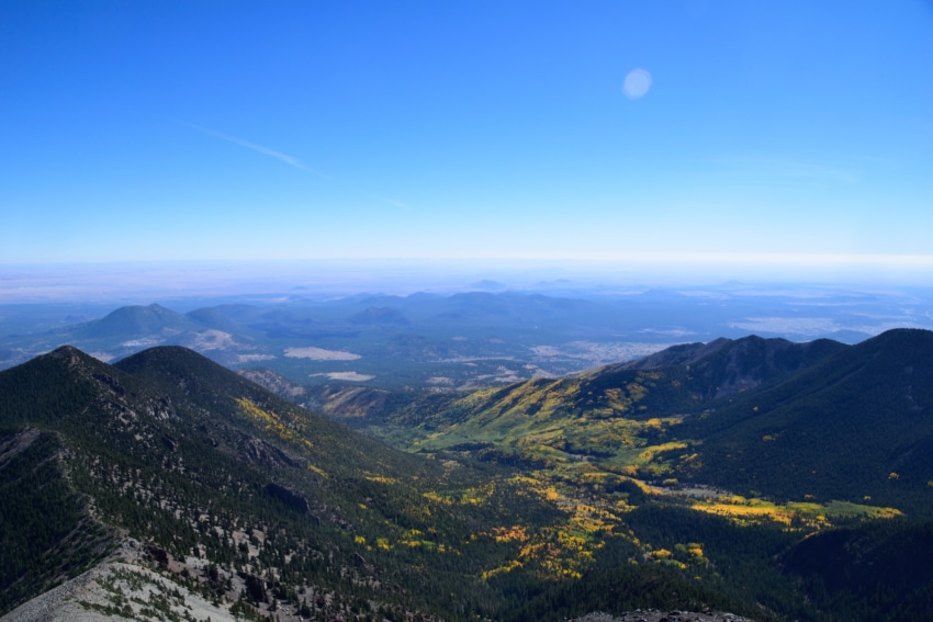
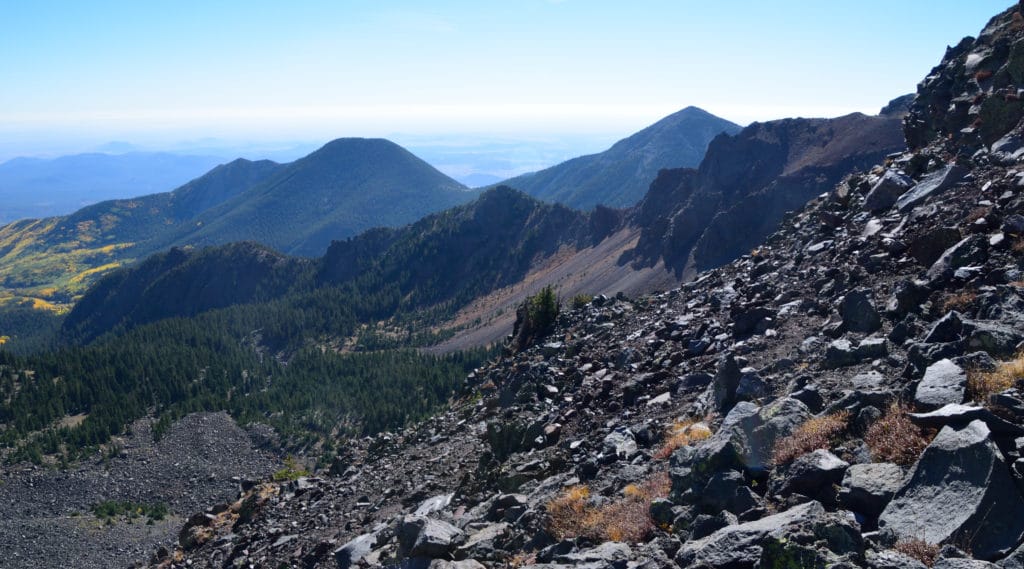
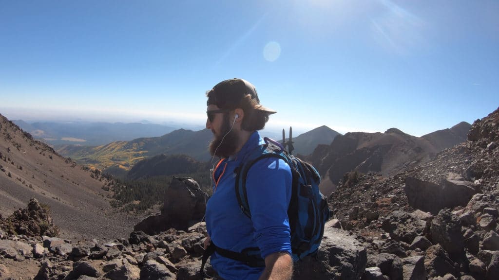
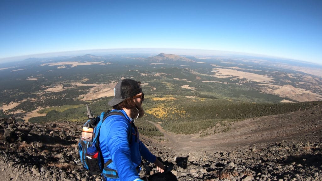
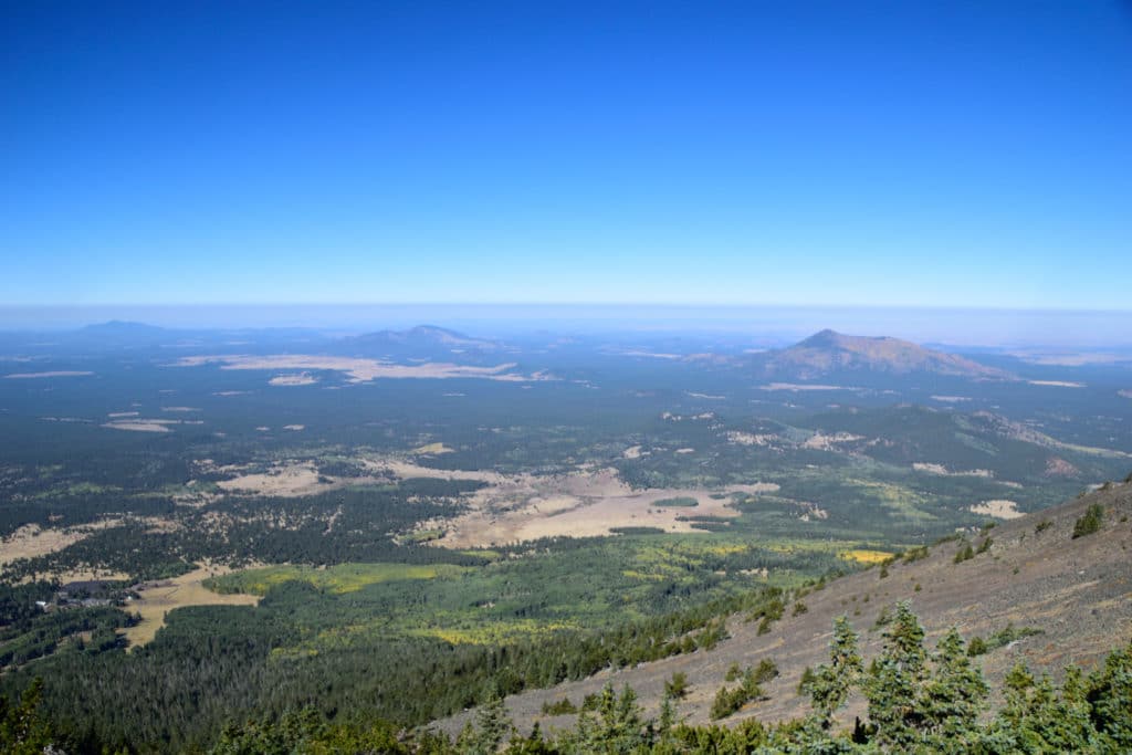
Best Views: Humphreys Peak has the best views once you crack treeline. On a super clear day from the summit you can even see the south rim of the Grand Canyon. On a typical hike you will get a great perspective of the other San Francisco Peaks. I would highly recommend this hike in the fall when the leaves are changing to add to your views.
Humphreys Peak Hike Route
Gear Needed
- 14er Packing List – 14ers are mountains that rise above 14,000ft but the packing list applies here.
- Hiking Boots or Trail Runners
- Backpack
- Protection from Sun – almost entire hike is above tree line
- Optional: Map of area or GPS – I use the Garmin inReach
- Optional: Hiking Poles
- Optional: Headlamp
- Optional: Camera
- *Links included in this description might be affiliate links. If you purchase a product or service with the links that I provide I may receive a small commission. There is no additional charge to you.
My Trip to Humphreys Peak: October 2020
After spending a beautiful day hiking at the Grand Canyon, I was ready to explore more of Arizona. I arrived to the trailhead on an early October weekday and was greeted with the cool desert temperatures. The hiking was quick and relatively boring until I cracked treeline where I was greeted with fantastic views of the neighboring mountains and foliage in almost all directions.
As I got closer to the summit I was intrigued by the cool geology as Humphreys Peak is a dormant volcano. You could certainly tell by the unique rocks that almost looked like lava. The summit had beautiful views of the fall colors to the east and west with the Grand Canyon’s south rim veiled in smoke. I decided to jog down and ended up car to car in just over 4 hours.
Check out some pictures from my hike up Humphreys Peak below and then watch the virtual trail guide.
Humphreys Peak Virtual Trail Guide
Questions or comments about this hike? Leave a comment below or follow me on Instagram!