Mt Yale East Ridge Hike Guide
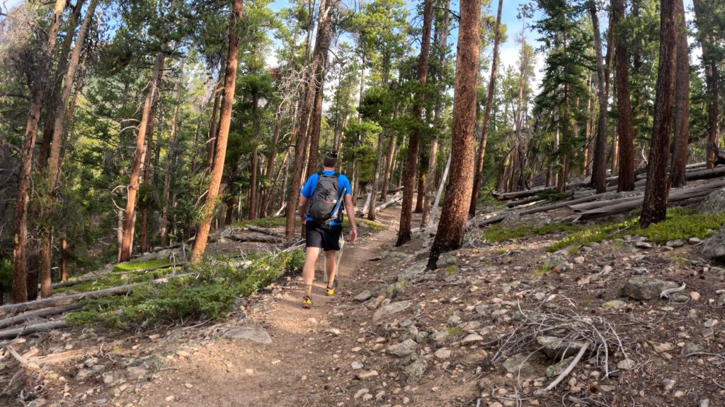
Mt Yale East Ridge route is an alternative to the standard Southwest ridge up this Sawatch 14er. This route is Class 2 and has over 5,000ft of elevation gain with a decent amount of loose rock and route finding to contend with. The Mt Yale East ridge is less popular than the standard route but still sees hikers as the Colorado Trail shares part of this mountain’s approach.
Mt Yale East Quick Facts
Mt Yale East Ridge Rating: ★★★★ (4/5 Stars)
Virtual Trail Guide: Mt Yale East Ridge
Distance: 10.25 Miles RT (from TH)
Elevation Start: 9,381ft
High Point: 14,199ft
Total Elevation Gain: 5,250ft
Estimated Time to Complete: 6-9 Hours Total
Difficulty: Moderate to Difficult- What does this mean?
Class: Class 2 – What does this mean?
Season: June – October: You could hike this in early November and December depending on snowfall. Hiking this route during Winter and Spring months is possible but this trail is heavily avalanche prone.
Crowds: Low
Directions to Mt Yale East Ridge
Trailhead: Avalanche
Getting Here: From Buena Vista, take Main Street (CO Highway 306) for 9.3 miles to reach the trailhead on your right.
Parking: The Mt Yale East ridge uses the Avalanche trailhead. This is a large parking area that is popular amongst other hikes, including the Colorado trail. It has plenty of parking and a non-plumbing restroom.
Permits/Fee: No fee required.
Summary
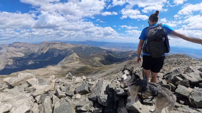
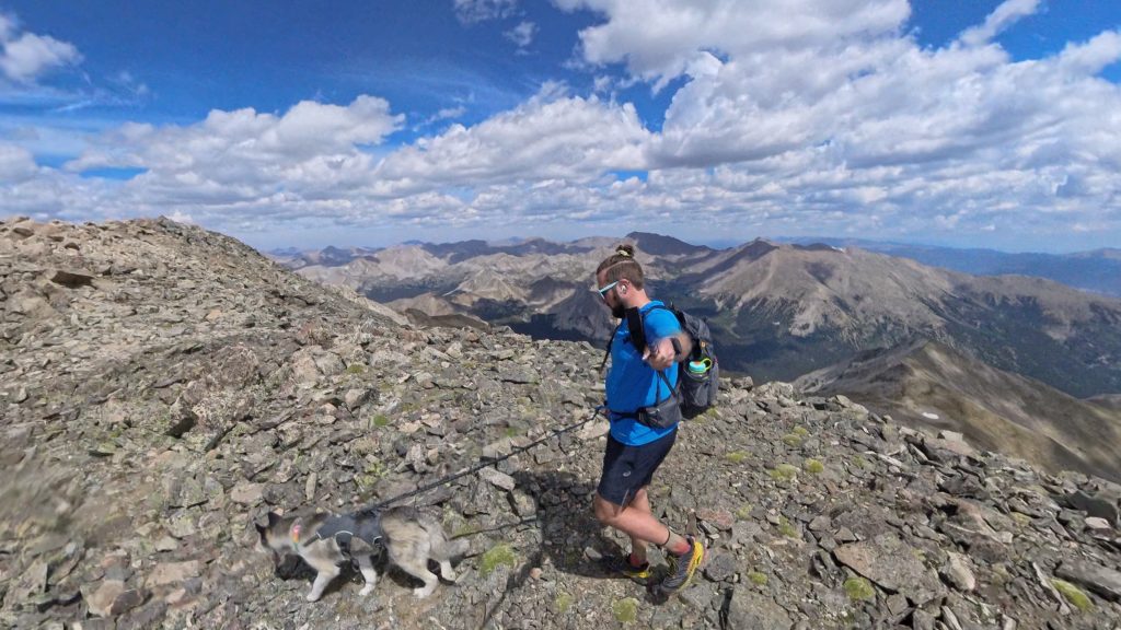
Dogs: The Mt Yale East Ridge is dog friendly for a dog with experience in the mountains. There is a fair amount of loose terrain but in terms of technical terrain, most dogs should be fine. This route is in a Wilderness area so please keep your dogs on a leash.
Camping: You could get away with camping at the TH for a night or maybe two as there are some dispersed spots. However, generally speaking you should always avoid camping at THs. Once on the hike itself, there are ample spots to camp as this route shares about half of the mileage with the Colorado Trail.
Make it a Loop: The best way to make this hike a loop would be to descend via the Southwest Ridge trail and take 3 miles on the road back to the Avalanche TH. Alternatively, this hike could be extended to the North or South by continuing on the Colorado Trail.
Trail X Factors: Loose Terrain + Lack of Trail
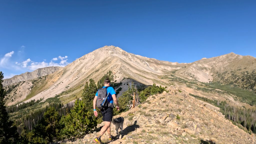
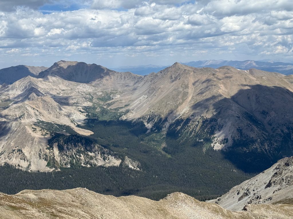
After leaving the treeline and once you start climbing the ridge, the Mt Yale East ridge contains a fair amount of loose terrain, especially when you leave the ridge itself. Although there is a social trail for most of this hike, you do have a fair amount of route finding along the way to gain the summit.
Hike Tip(s): Generally speaking, once you are on the ridge, you can take it directly all the way to the summit of Mt Yale. There are a handful of towers along the way but you really don’t need to climb any of them unless you want to.
Best Views: Once leaving treeline a little over a three miles in, the views are stunning to the North and South all the way until the summit. The Summit of Mt Yale provides 360 degree views of the Sawatch Range.
Gear Needed
- 14er Day Hike Packing List
- Men’s Trail Runners
- La Sportiva Cyklon
- La Sportiva Trango Hiking Boots (Men’s)
- Backpack (Winter)
- Backpack (Summer)
- Base Layers
- T Shirt
- Mid Layer
- Rain Jacket / Shell
- Outer Layer
- Pants
- Shorts
- Socks
- Food & Water
- Optional: Water Filter
- Optional: Garmin inReach
- Optional: Hiking Poles – 120CM
- Optional: Headlamp
- Optional: Garmin Fenix Watch
- Optional: GoPro, Joby Tripod, Selfie Stick, GoPro 360, Drone, Insta360
- *Links included in this description might be affiliate links. If you purchase a product or service with the links that I provide I may receive a small commission. There is no additional charge to you.
One thought on “Mt Yale East Ridge Hike Guide”
Thanks for the info Mickey!