Mt Elbert Black Cloud Trail
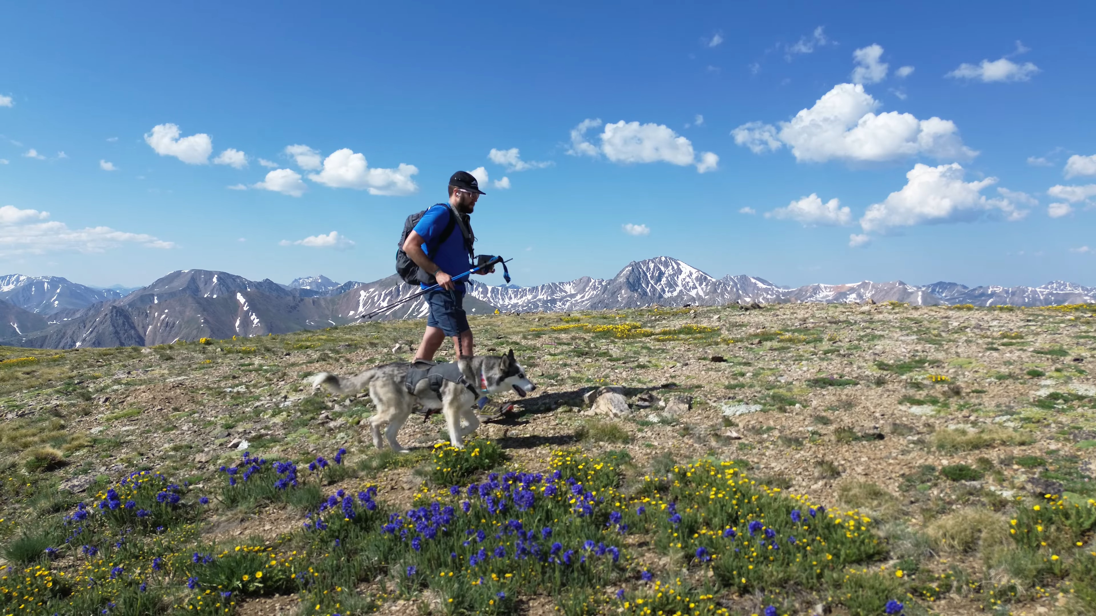
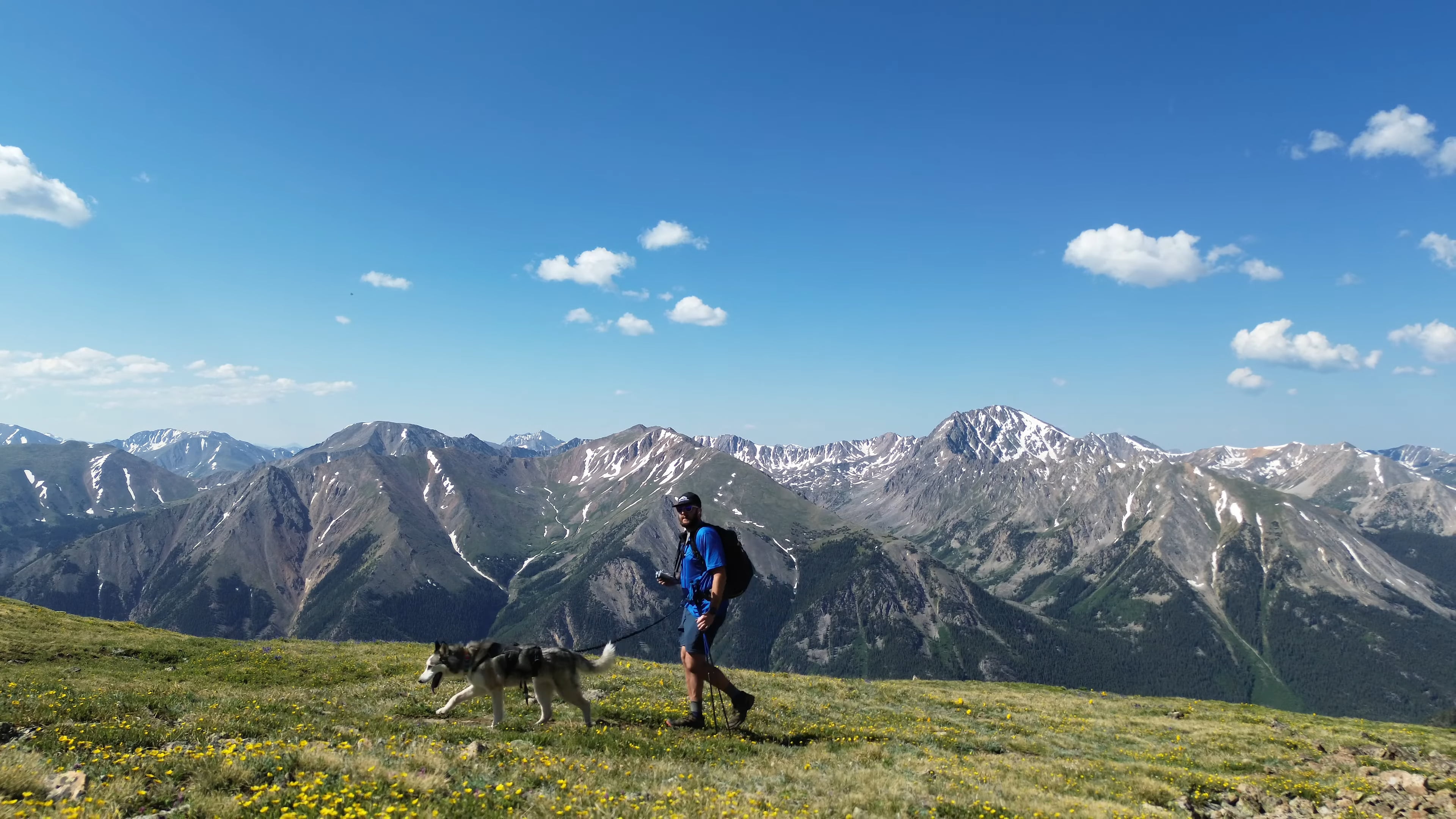
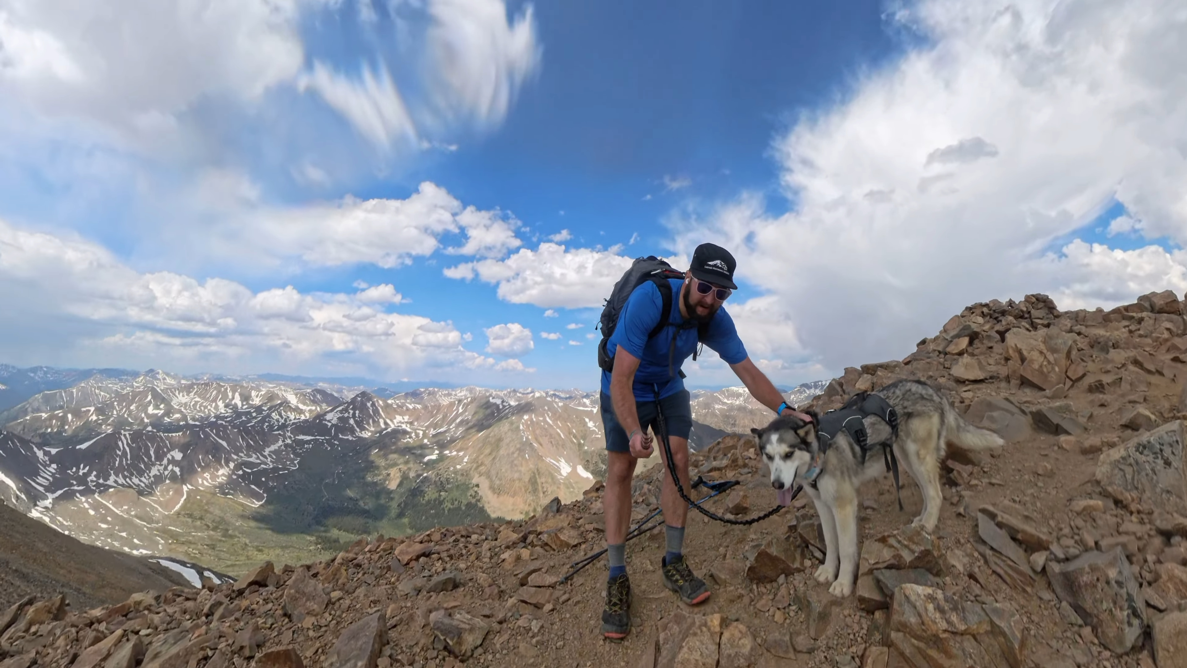
Mt Elbert Black Cloud trail is, in my opinion, the hardest way up Colorado’s highest peak. The hike starts off Independence Pass just outside of Twin Lakes, Colorado and gains thousands of feet of elevation in the first 3 miles. Once on the ridge, hikers are left exposed to the elements for another mile or so. On the way to the true summit, the trail also passes through unofficial 14er, South Elbert. Mt Elbert Black Cloud trail is by far the most beautiful and secluded way up the highest peak in the Lower 48.
Mt Elbert Black Cloud Quick Facts
Mt Elbert Black Cloud Rating: ★★★★★ (5/5 Stars)
Virtual Trail Guide: Mt Elbert Black Cloud
Distance: 11.3 Miles RT (from TH)
Elevation Start: 9,858ft
High Point: 14,443ft
Total Elevation Gain: 5,300ft
Estimated Time to Complete: 7-9 Hours Total
Difficulty: Difficult – What does this mean?
Class: Class 2 – What does this mean?
Season: June – October: You could hike this in early November and December depending on snowfall. Hiking this route during Winter and Spring months is possible but this trail is heavily avalanche prone.
Crowds: Low
Directions to Mt Elbert Black Cloud
Trailhead: Black Cloud
Getting Here: From Twin Lakes, head West on CO-82 (Independence Pass) for about 4 miles until you reach an easily missed turnoff for the trailhead.
Parking: The Mt Elbert Black Cloud parking lot is very small but not super popular (at least as of 2025). The lot has no restrooms but can fit about 10 vehicles. There are no restrooms at this TH.
Permits/Fee: No fee required.

Summary
Dogs: Basically all routes up Mt Elbert, including this one, are dog friendly or the right dog. There is A LOT of elevation gain and loose trail conditions along the way so be sure your dog is capable of what I try to show in the full guide.
Camping: You could get away with camping at the TH for a night or maybe two as there are some dispersed spots. However, generally speaking you should always avoid camping at THs. Once on the hike itself, there are some spots to camp after crossing the creek for the 1st and 2nd times. However, once you start up the steep switchbacks (you will see them) camping is not really possible.
Make it a Loop: The best way to extend this hike would be to decend via the other Mt Elbert trails (standard or East Slopes) and either shuttle or run/hike/wallk back to your car. This would make this a massive day though.
Trail X Factors: STEEP
There is no way around it, the hike up to Mt Elbert on the Black loud trail is extremely steep. It will test your legs on the way up and down with lots of elevation gain and loose trail conditions. There are also a lot of false summits on the way to Mt Elbert and the way back so be sure to mentally prepare yourself for that as well.
Hike Tip(s): This route is a great one to avoid crowds, soak in beautiful views and enjoy the beautiful Summer wildflowers. However, since this trail is so exposed to the weather, you are going to want a beautiful day to attempt this summit. Give yourself PLENTY of time to get both to the Summit and back as you will gain elevation in both directions.
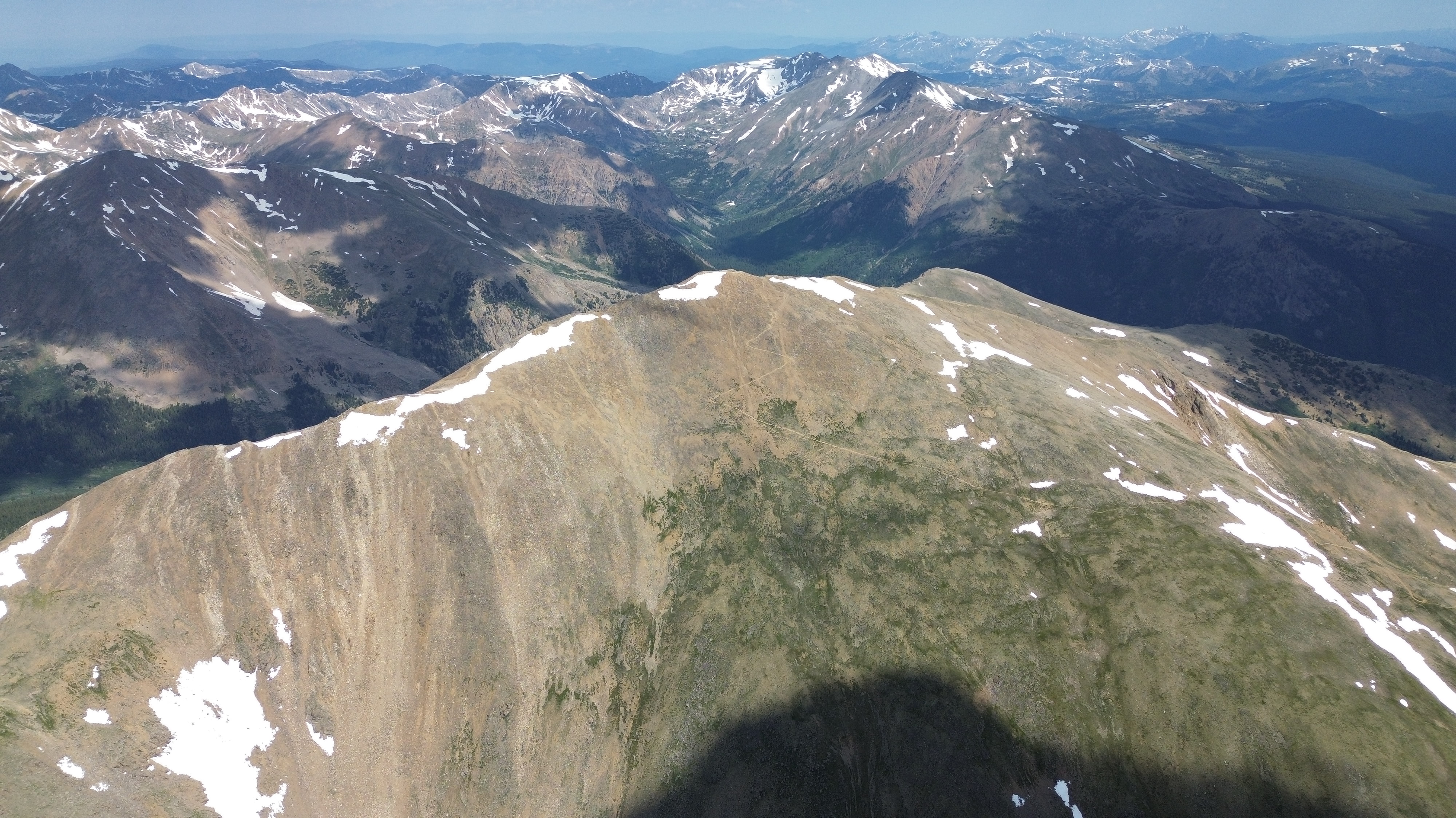
Best Views: Once leaving treeline a little over a mile in, the views are stunning to the South, West and North until reaching the ridge. On the South ride of Mt Elbert, the views in all directions are absolutely breathtaking. Although this route is hard, the views make up for it.
Gear Needed
- 14er Day Hike Packing List
- Men’s Trail Runners
- La Sportiva Cyklon
- La Sportiva Trango Hiking Boots (Men’s)
- Backpack (Winter)
- Backpack (Summer)
- Base Layers
- T Shirt
- Mid Layer
- Rain Jacket / Shell
- Outer Layer
- Pants
- Shorts
- Socks
- Food & Water
- Optional: Water Filter
- Optional: Garmin inReach
- Optional: Hiking Poles – 120CM
- Optional: Headlamp
- Optional: Garmin Fenix Watch
- Optional: GoPro, Joby Tripod, Selfie Stick, GoPro 360, Drone, Insta360
- *Links included in this description might be affiliate links. If you purchase a product or service with the links that I provide I may receive a small commission. There is no additional charge to you.