Tour De Abyss Colorado 14ers Hike Guide
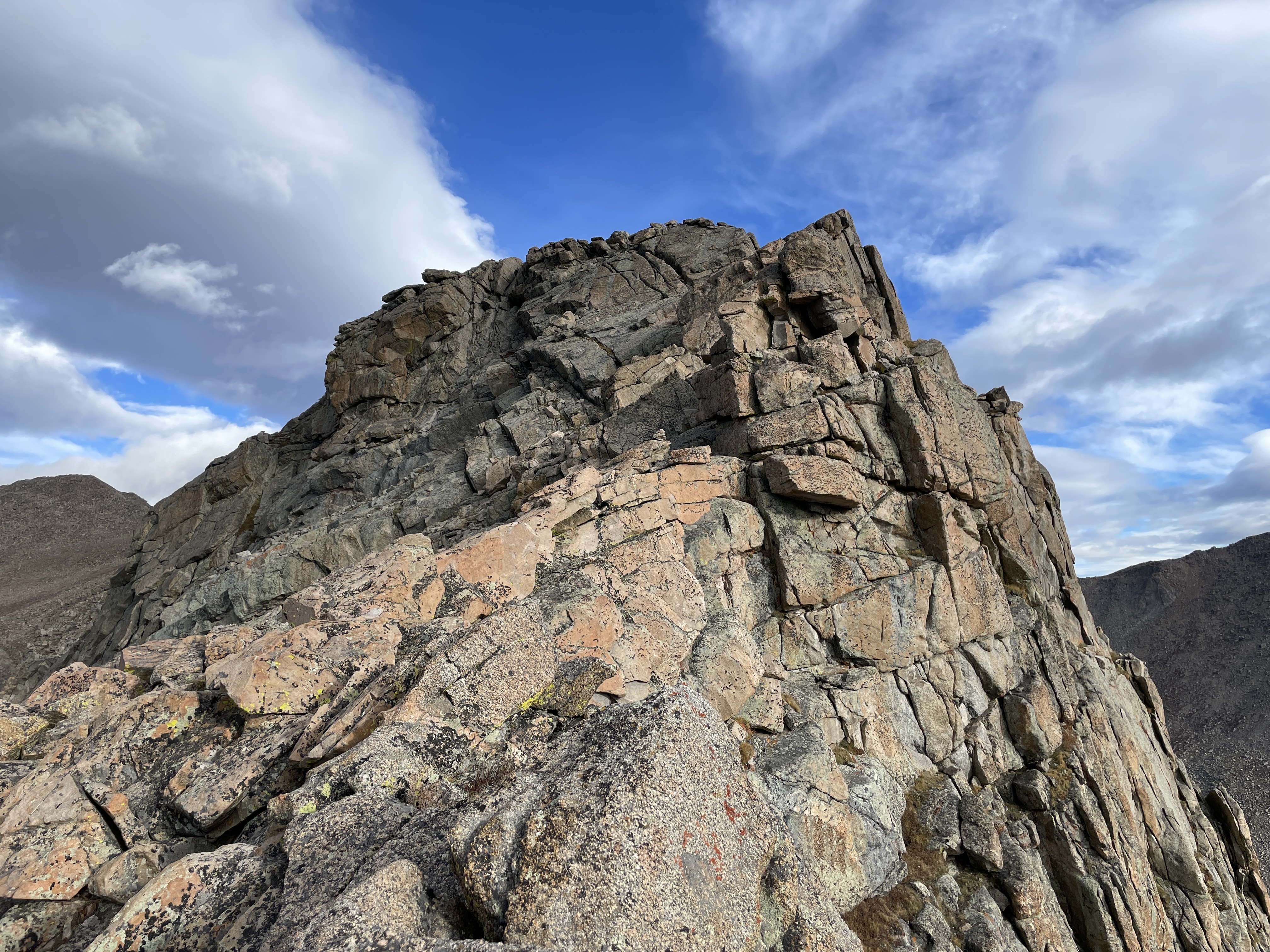
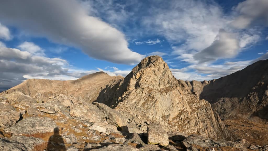
The Tour de Abyss is a popular ridge scramble that starts near Mt Blue Sky, works over to the south ridge of Mt Bierstadt then on to the Sawtooth Ridge and back to the summit of Mt Blue Sky. This is a unique way to hike these very popular two Colorado 14ers but is recommended for more experienced hikers. Both the South ridge of and Sawtooth ridge of Mt Bierstadt involve some Class 3 scrambling and route finding ability. There are a few variations on where to start this one, more on that below…
Tour De Abyss Quick Facts
Virtual Trail Guide: Tour De Abyss
Tour De Abyss Rating: ★★★★ (4/5 Stars)
Distance: 9 Miles RT
Elevation Start: 12,817ft (Summit Lake)
High Point: 14,066ft Mt Bierstadt, 14,264ft Mt Blue Sky
Total Elevation Gain: 3,440ft
Estimated Time to Complete: 5-7 Hours RT
Difficulty: Difficult What does this mean?
Class: Class 3 (Easy to find Class 4 in a few spots, but not necessary) – What does this mean?
Season: June – October (Mt Blue Sky road is typically closed outside of these months)
Directions to Tour De Abyss
Trailhead: Summit Lake
Getting Here: The best way to hike the Tour de Abyss is from Summit Lake or the summit of Mt Blue Sky. If you choose to park at the summit of Mt Blue Sky you will just walk down the road vs walking up it. If starting from Summit Lake you can follow the virtual guide. In either case, enter Mt Blue Sky road to your GPS.
Parking: Both Summit Lake and the Summit of Mt Blue Sky have sizeable parking lots that should not be an issue to park at since you have a reservation. Both have non-plumbing bathrooms.
Fee: $17 if parking on the summit, $10 if parking at Summit Lake.
Reservations: Mt Blue Sky does require reservations to enter at either location. They are only available seasonally with more information available here.
Summary
Dogs: Dogs should not be brought on the Tour De Abyss
Camping: You can find some dispersed camping options on Squaw Pass Rd but your best bet would be to snag a spot at Echo Lake Campground, more information here.
Hike Xfactor(s): Where You Start
Before heading out to hike the Tour De Abyss, it’s important to understand the logistics around your starting point. There are three options here:
- Park at Summit Lake – this would follow my virtual guide to a T
- Park at the Summit of Mt Blue Sky – for this option, just hike down the road to where the dropdown and cross over to the South Ridge of Mt Bierstadt is.
- Hike up Mt Bierstadt and then start the Tour. This option would add extra mileage and elevation gain but would not require a reservation and gives hikers more calendar months to attempt this loop.
Hike Tip(s): When dropping down from the Mt Blue Sky Road to the trail up to Abyss Lake, be sure to pick your line carefully. I ended up working down to the right a bit and found a third gully over from the initial one I was looking at to descend. This is a steep, loose, dropdown and having a safe path to travel is important.
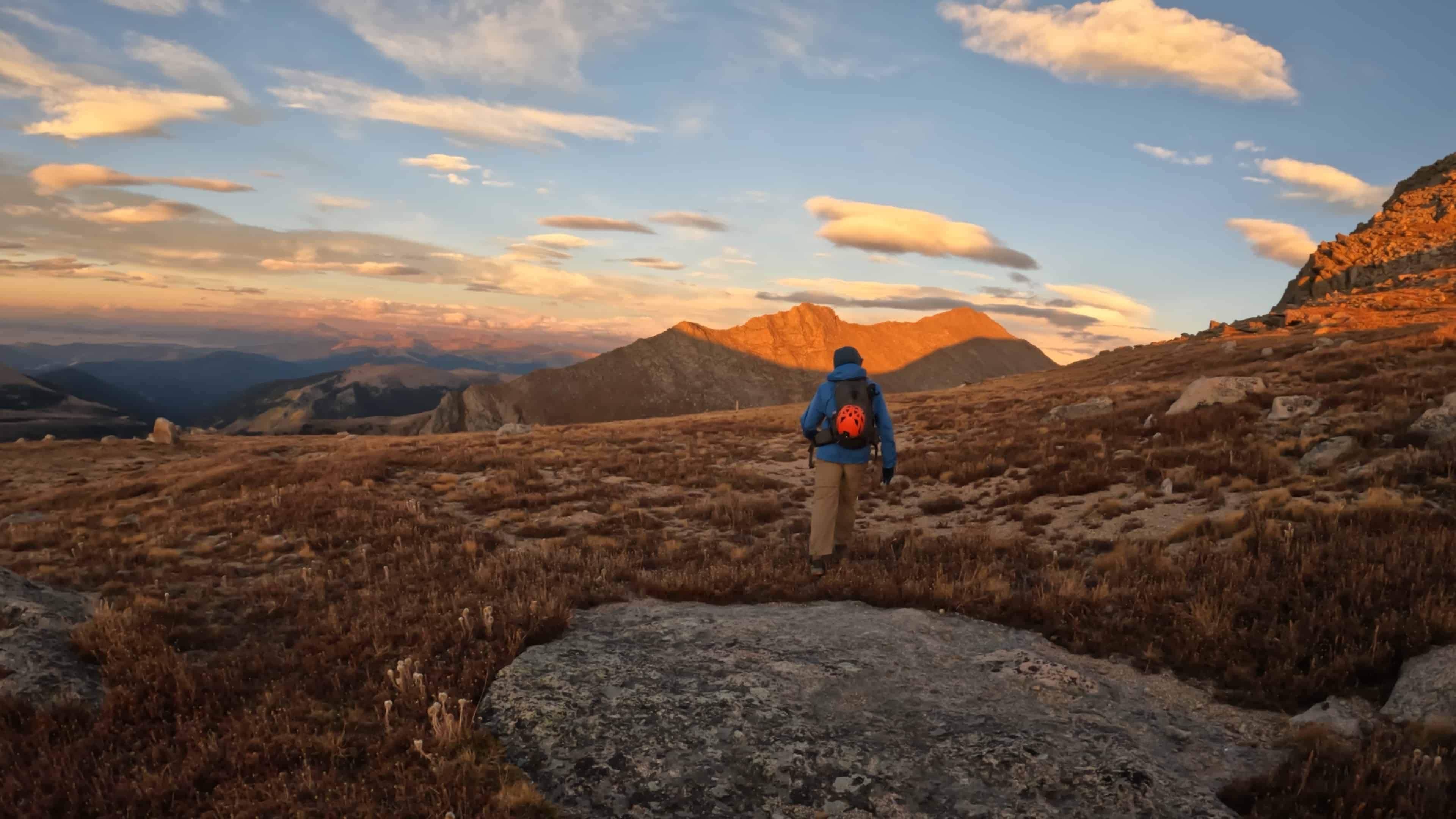
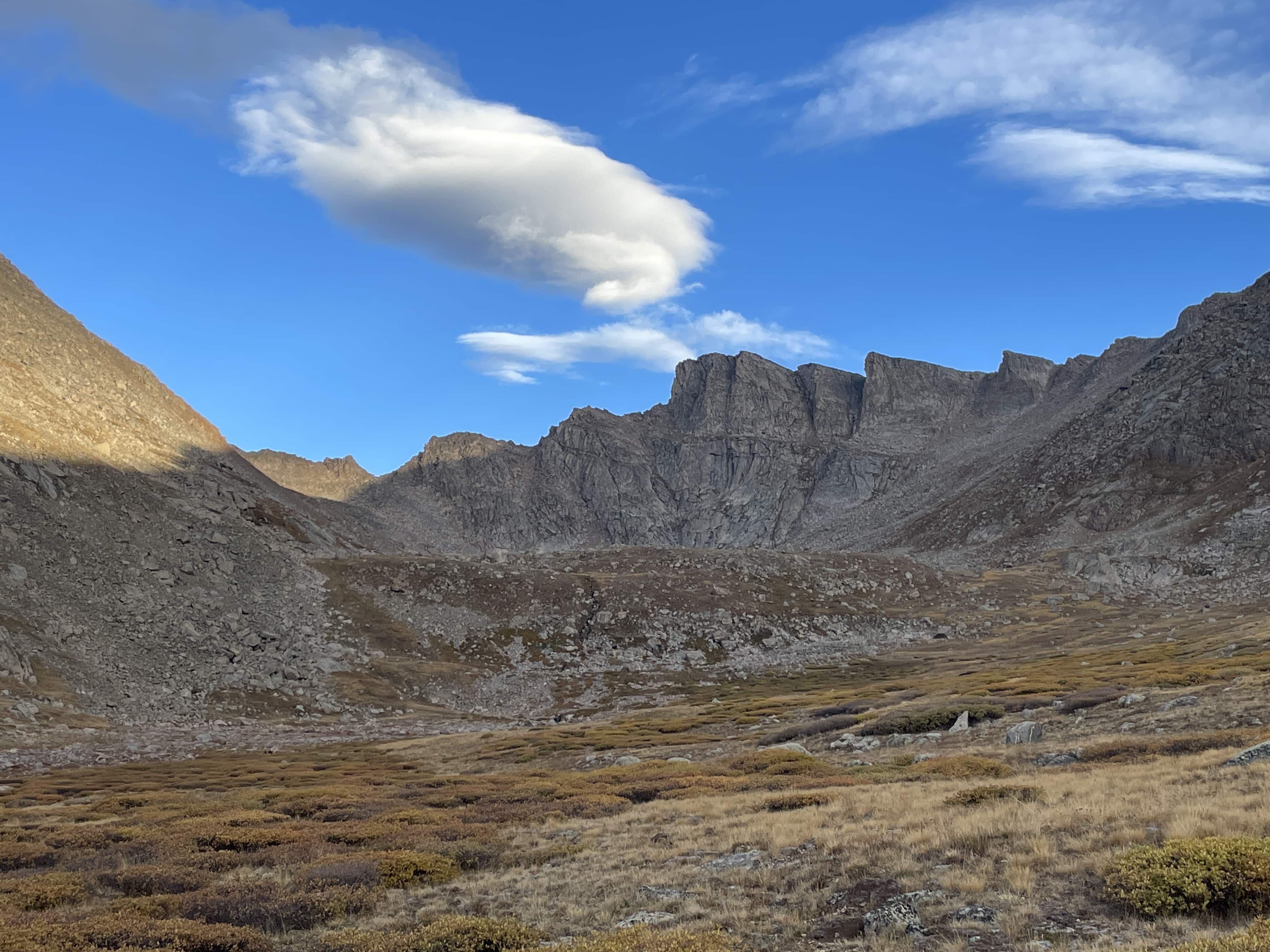
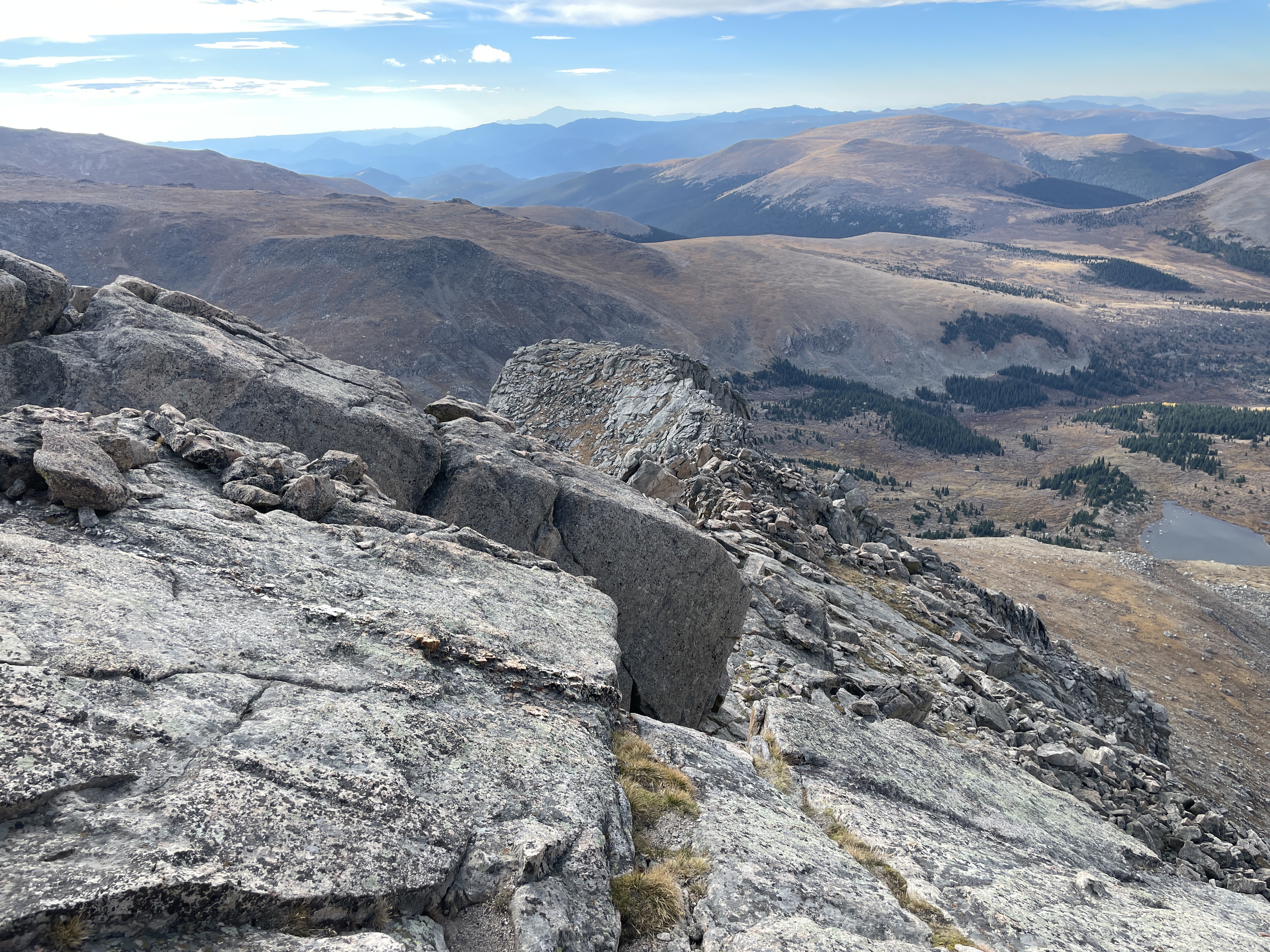
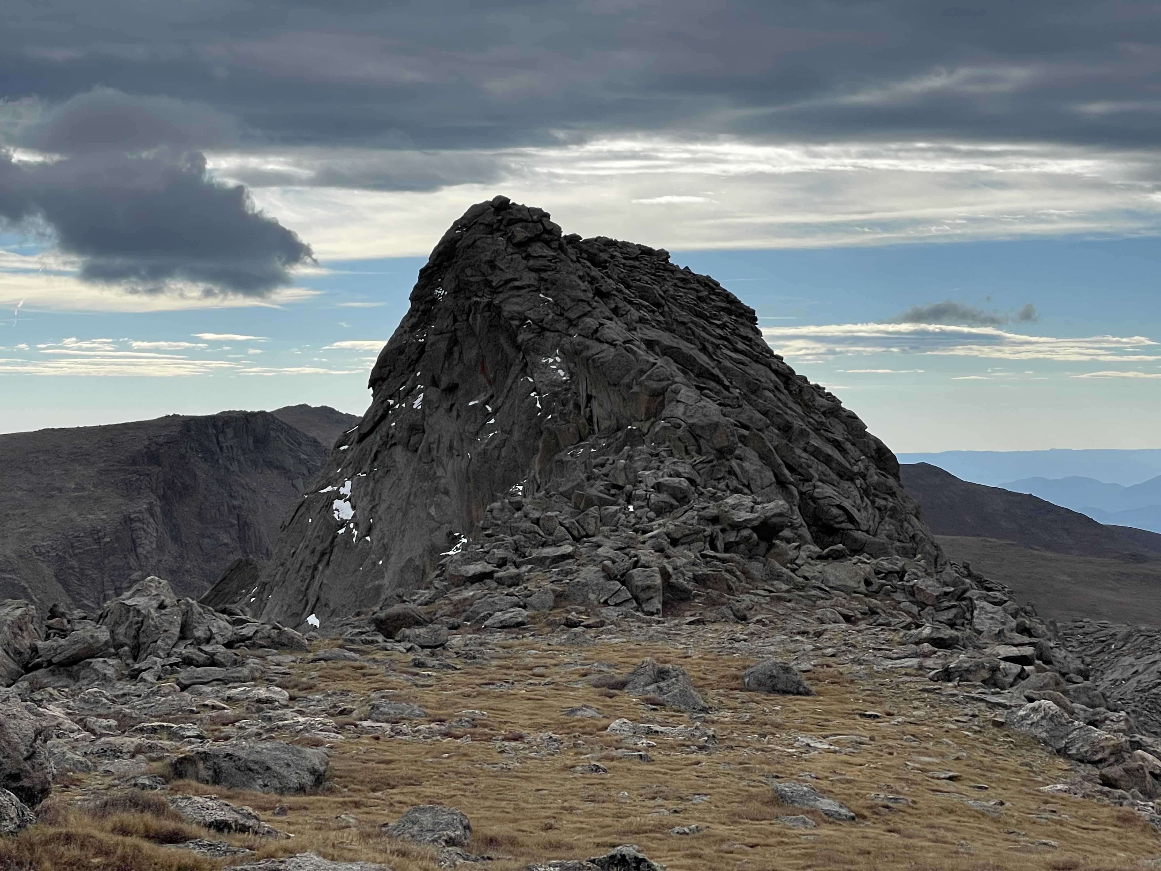
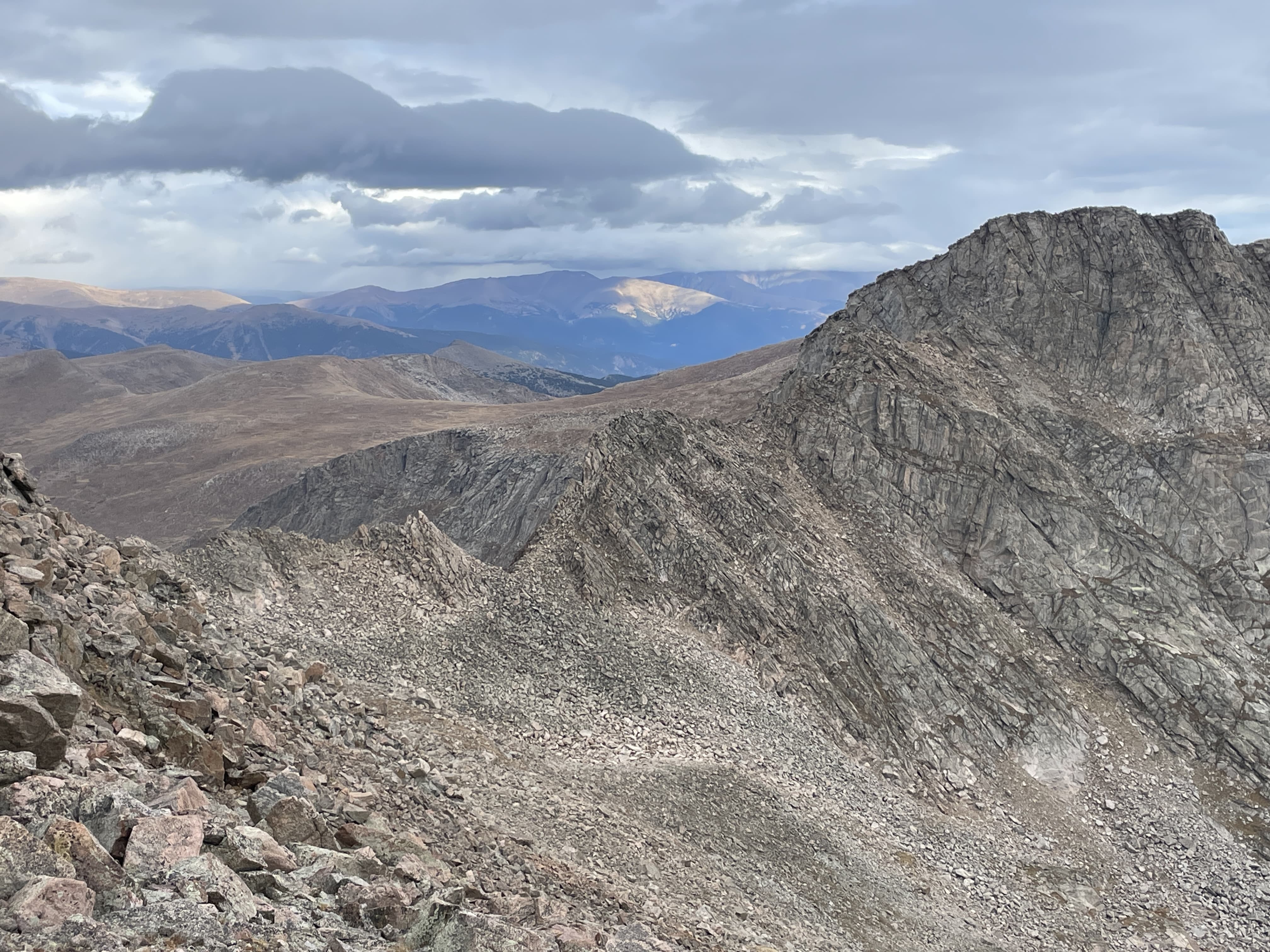
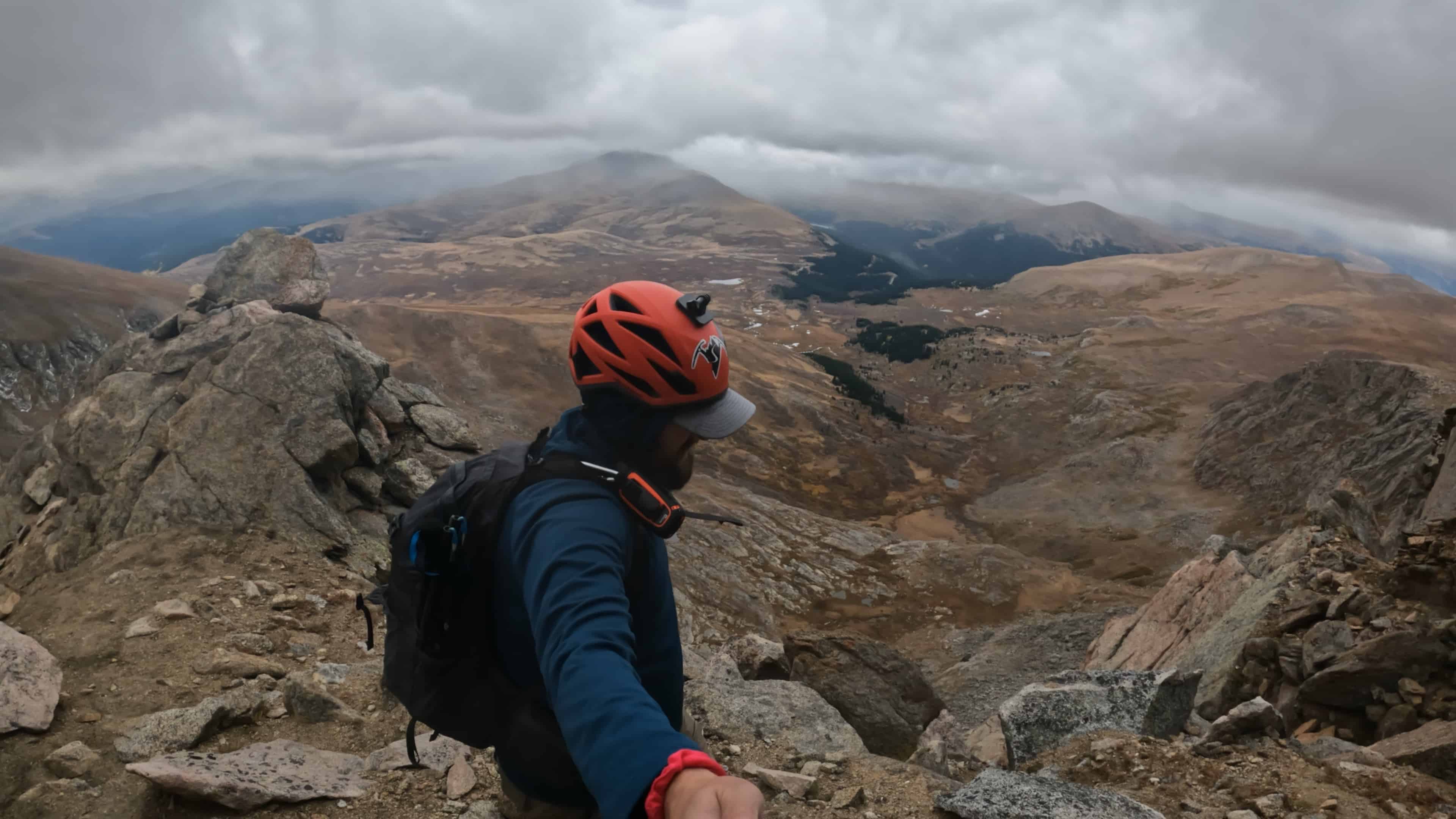
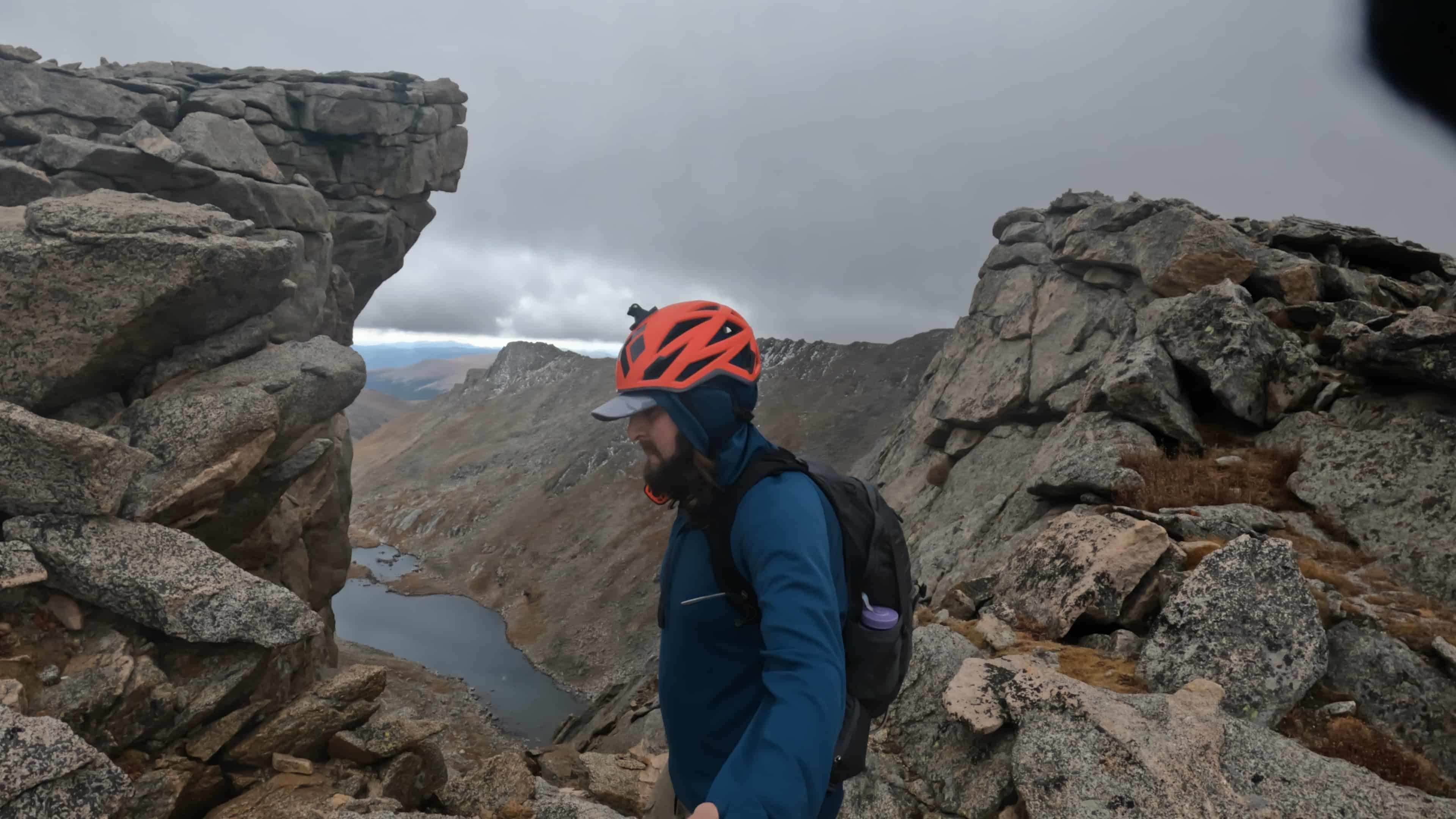
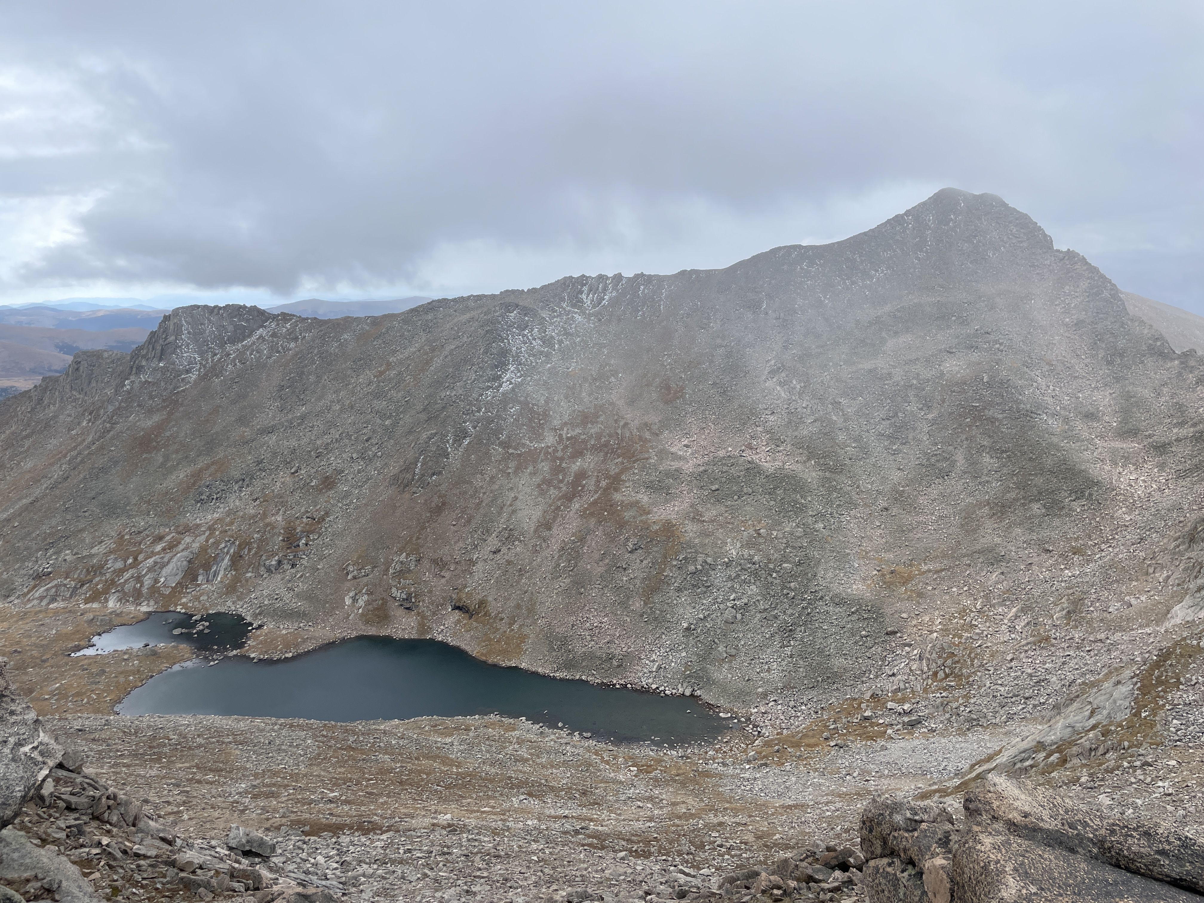
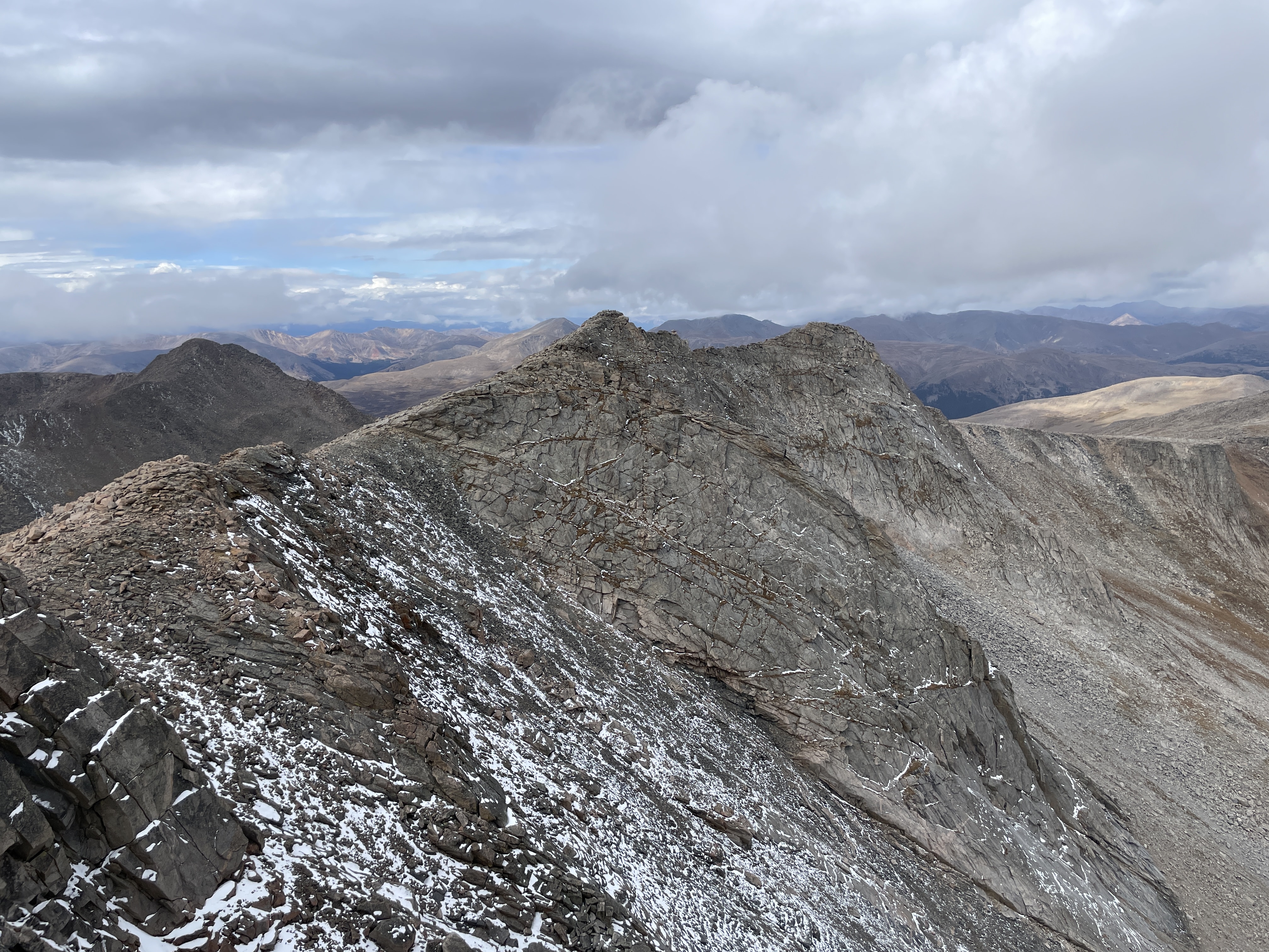
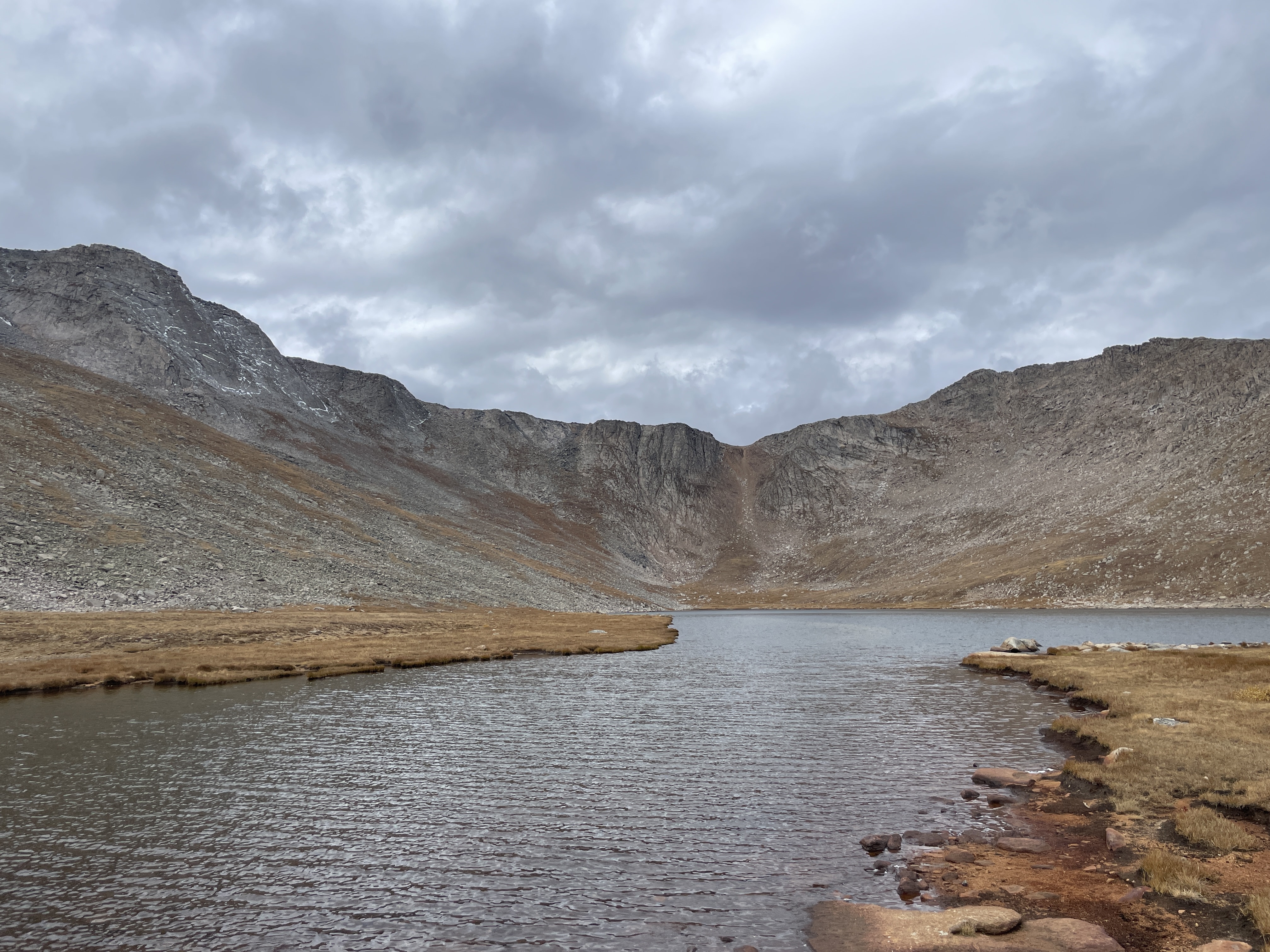
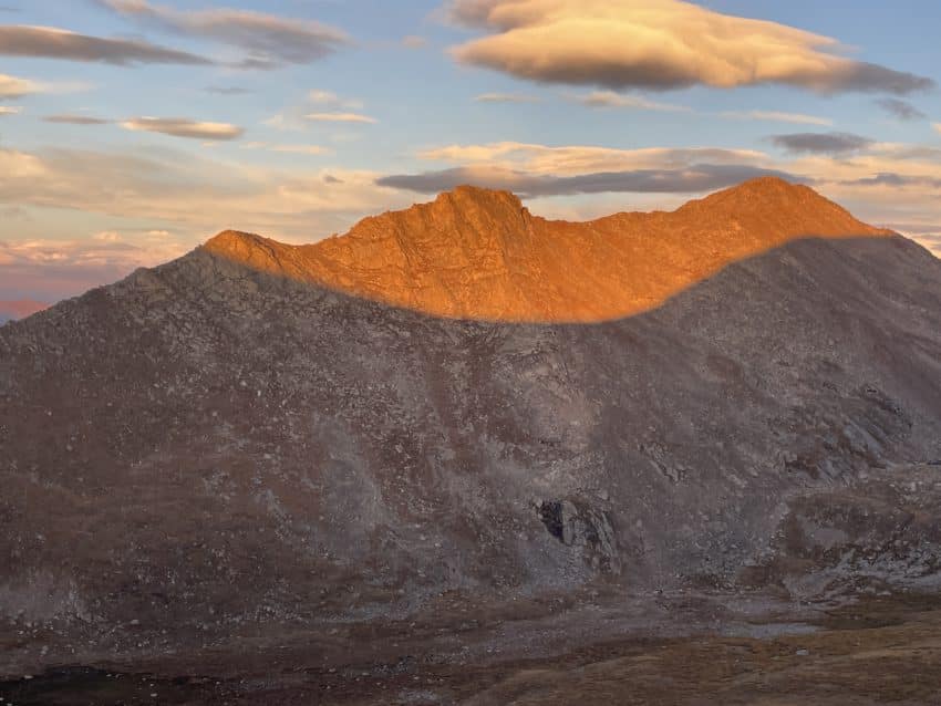
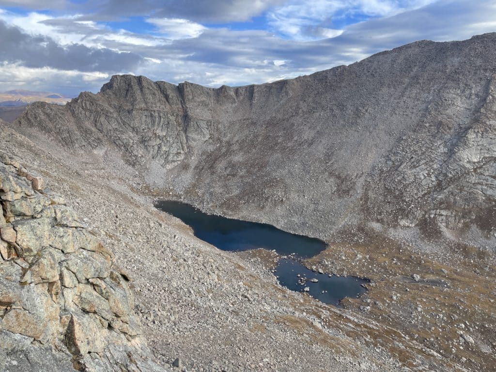
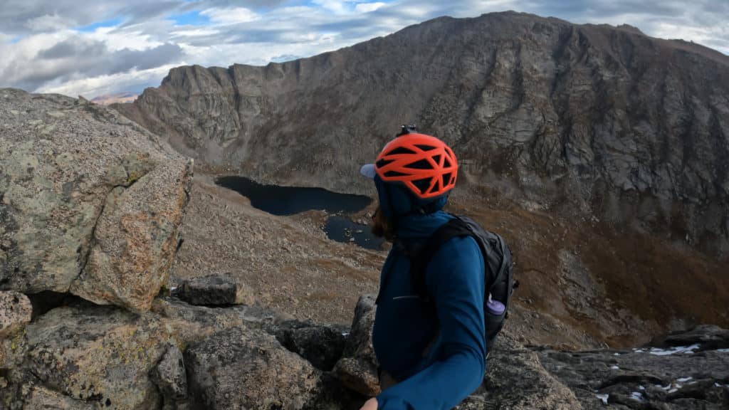
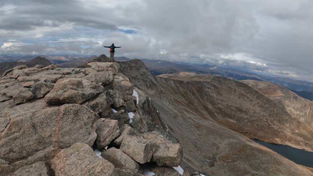
Best Views: This entire hike has beautiful views but my personal favorites are on the western slopes of Mt Blue Sky looking back to Mt Bierstadt, the Sawtooth and Abyss Lake from above.
Tour De Abyss Hike Route

Gear Needed
- 14er Day Hike Packing List
- Men’s Trail Runners
- Women’s Trail Runners
- La Sportiva Trango Hiking Boots (Men’s)
- La Sportiva Trango Hiking Boots (Women’s)
- Backpack (Winter)
- Backpack (Summer)
- Food & Water
- Helmet
- Optional: Garmin inReach
- Optional: Hiking Poles – 120CM
- Optional: Headlamp
- Optional: Garmin Fenix Watch
- Optional: GoPro, Joby Tripod, GoPro 360
- Optional: Drone
- *Links included in this description might be affiliate links. If you purchase a product or service with the links that I provide I may receive a small commission. There is no additional charge to you.
My Trip to the Tour De Abyss October 2022
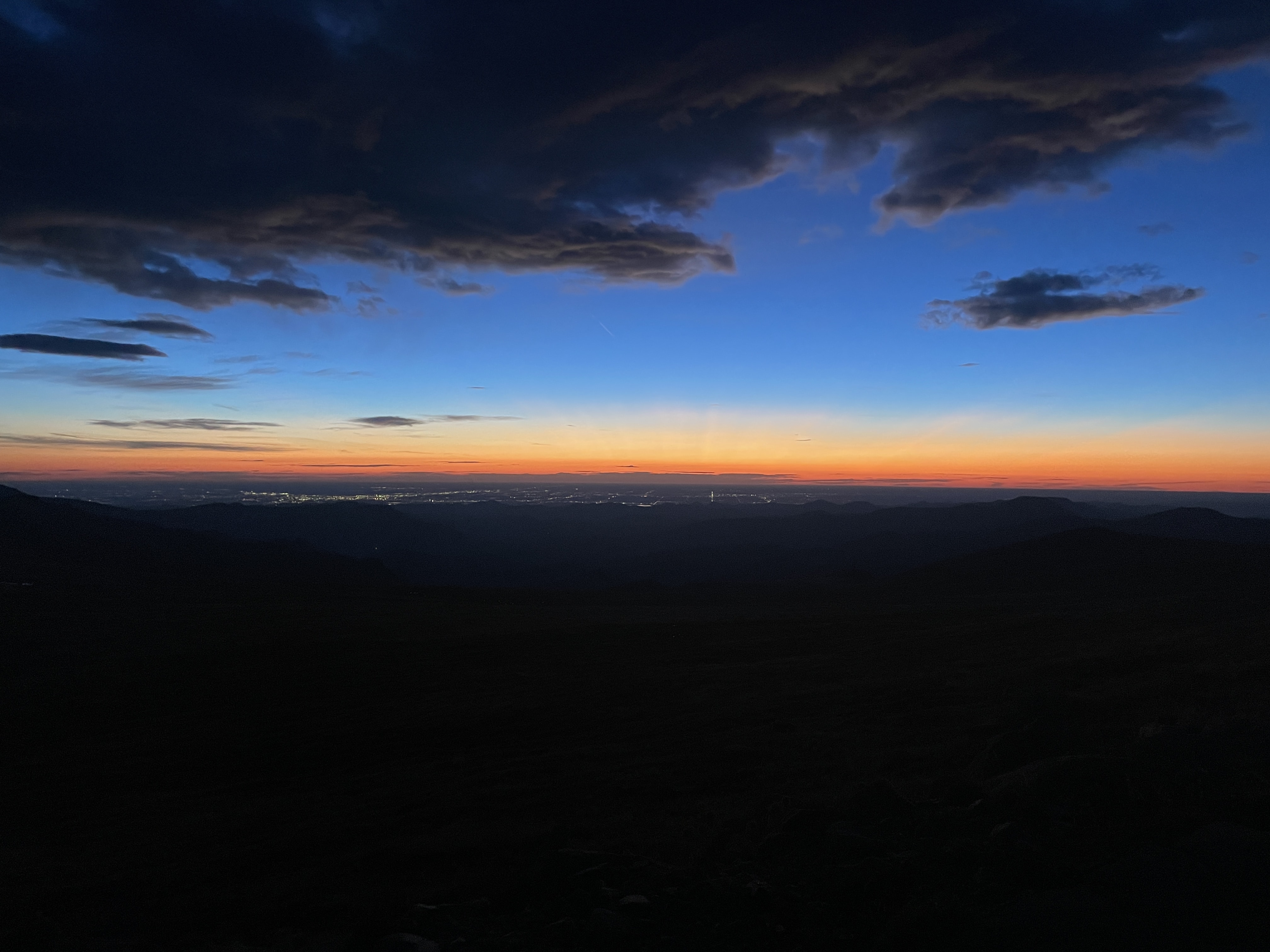
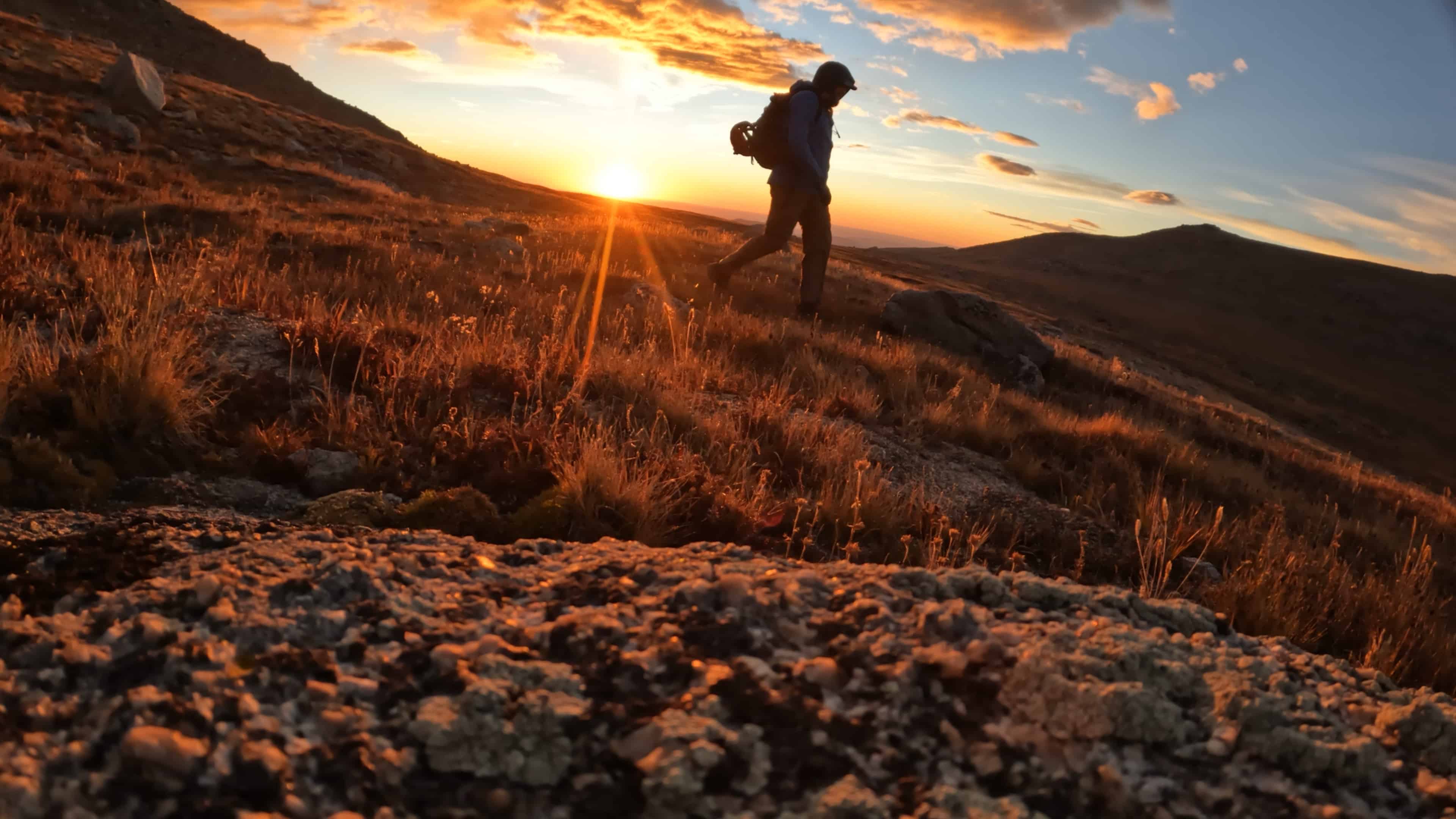
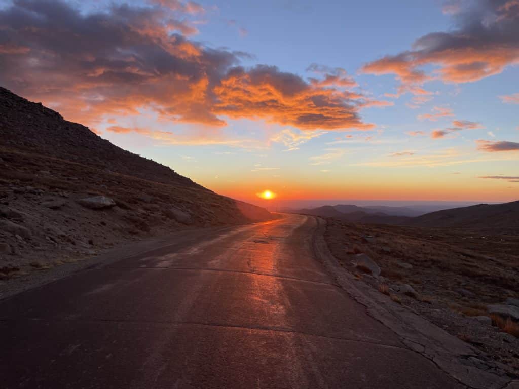
I had been eyeing the Tour De Abyss for a number of years since it was relatively close to home but also offered some good scrambling. Realizing that the window to drive on the Mt Blue Sky road was closing fast, I headed up to Summit Lake to give it a go. Predawn starts + winds left me with all the layers on and hiking up a poorly paved road to start the loop.
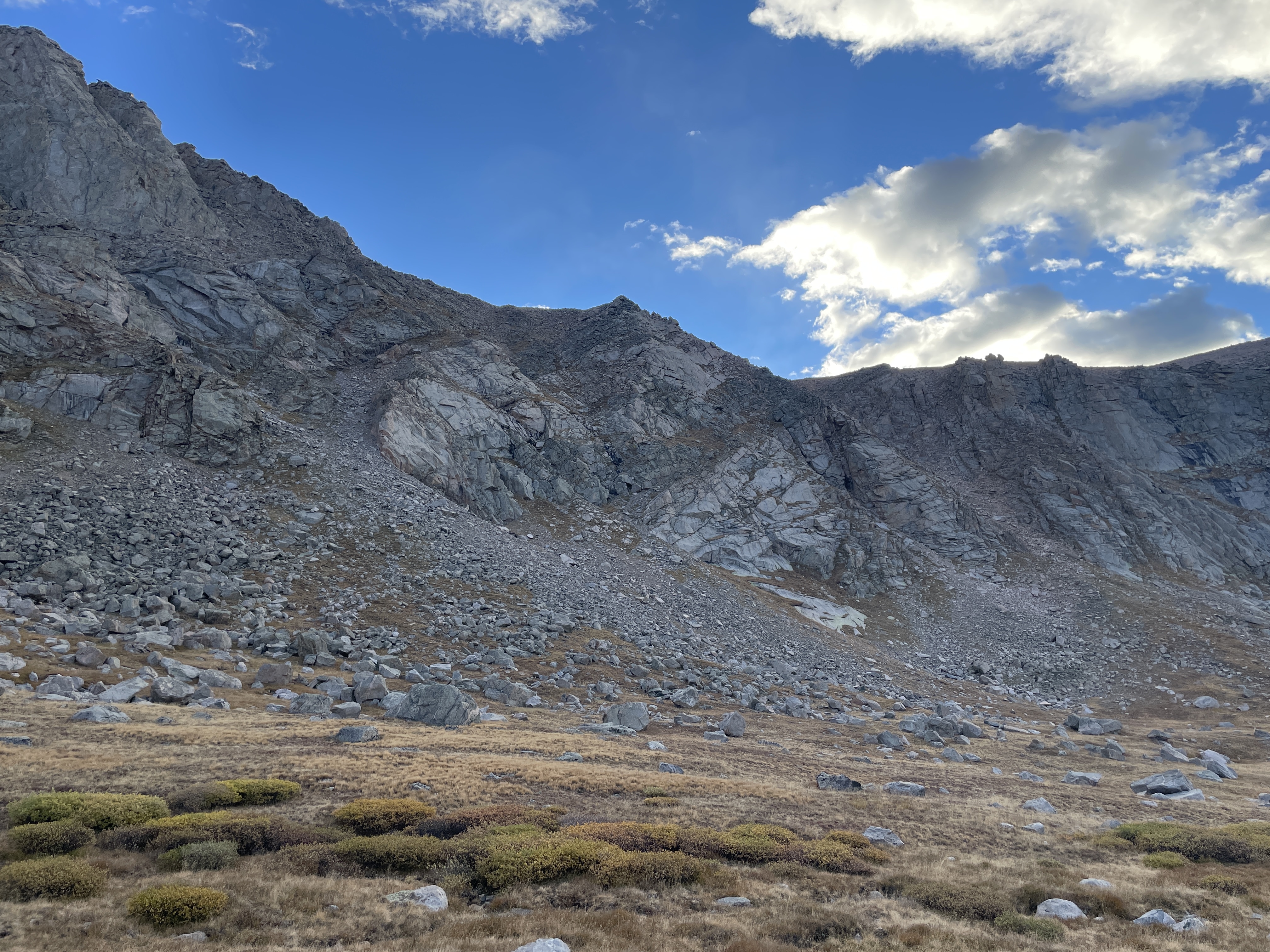
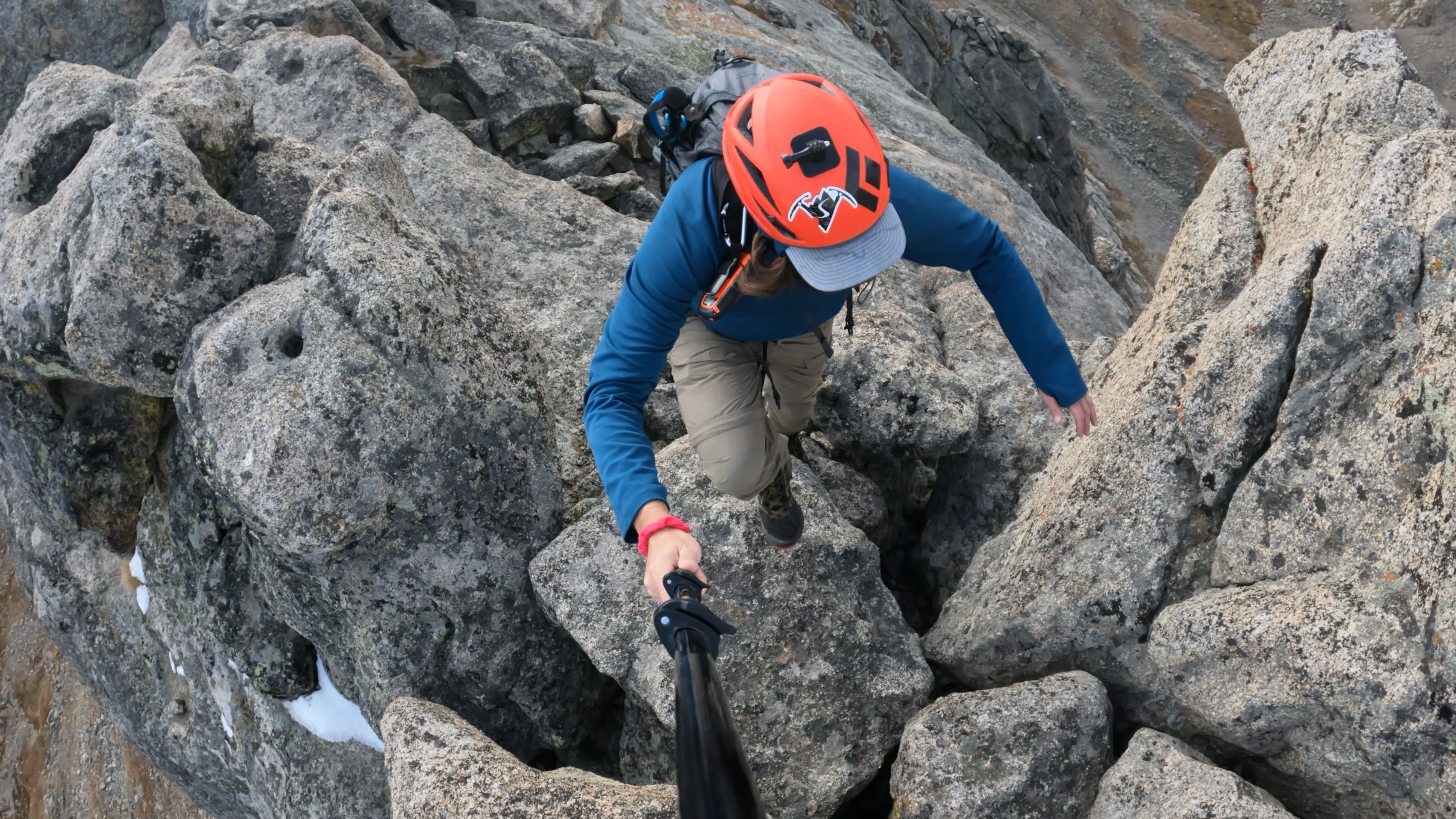
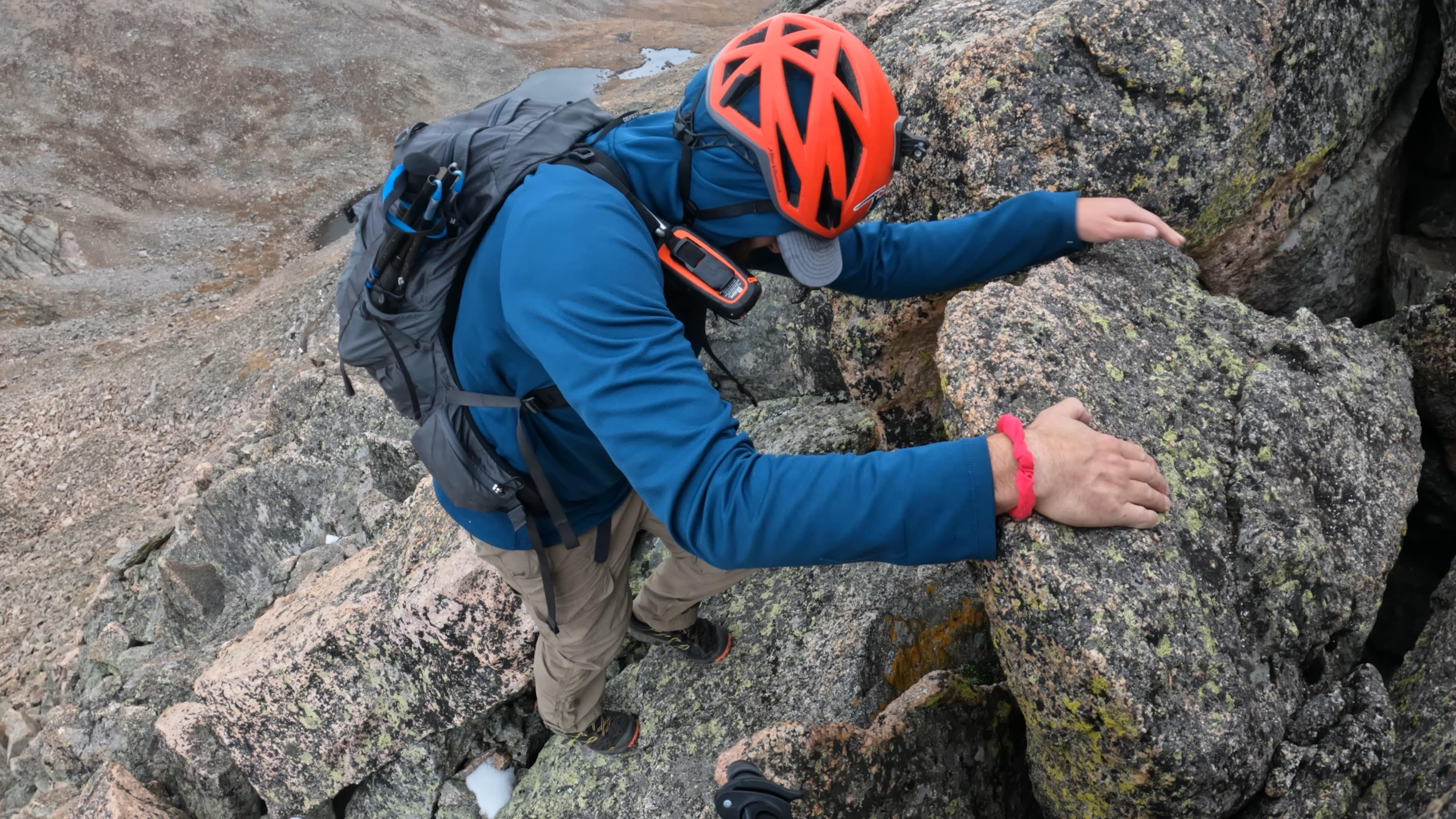
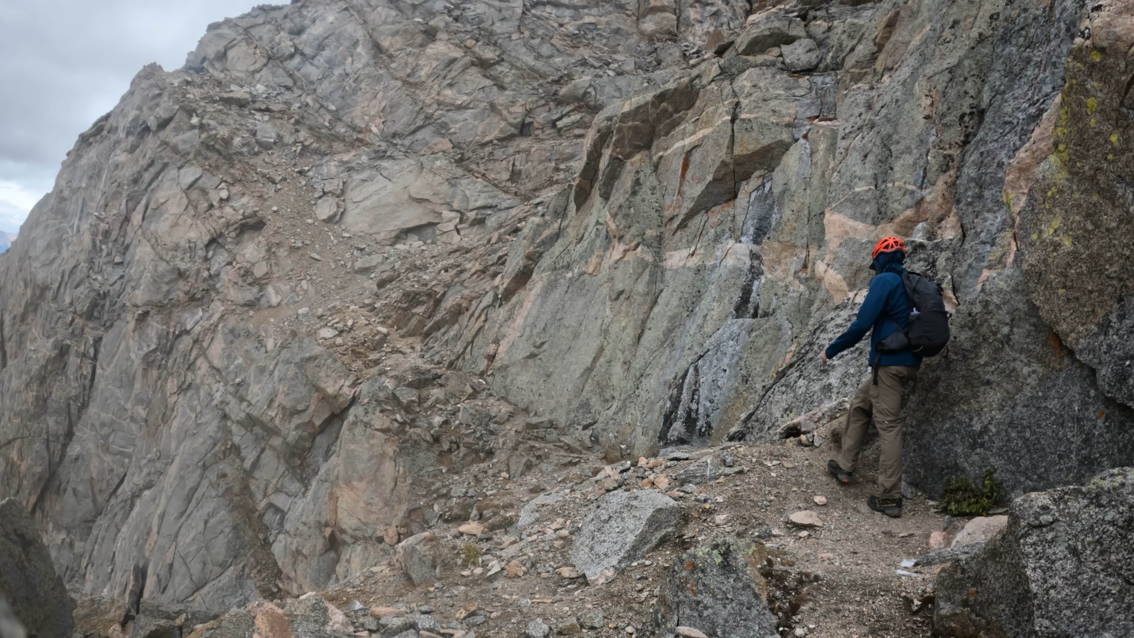
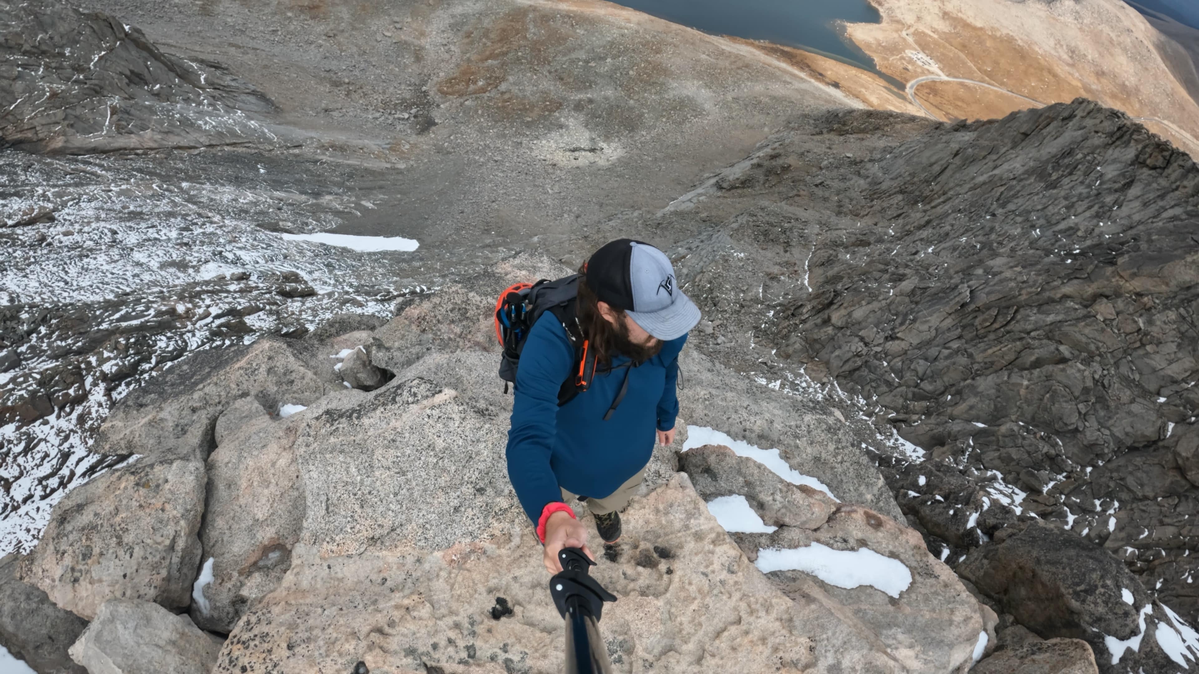
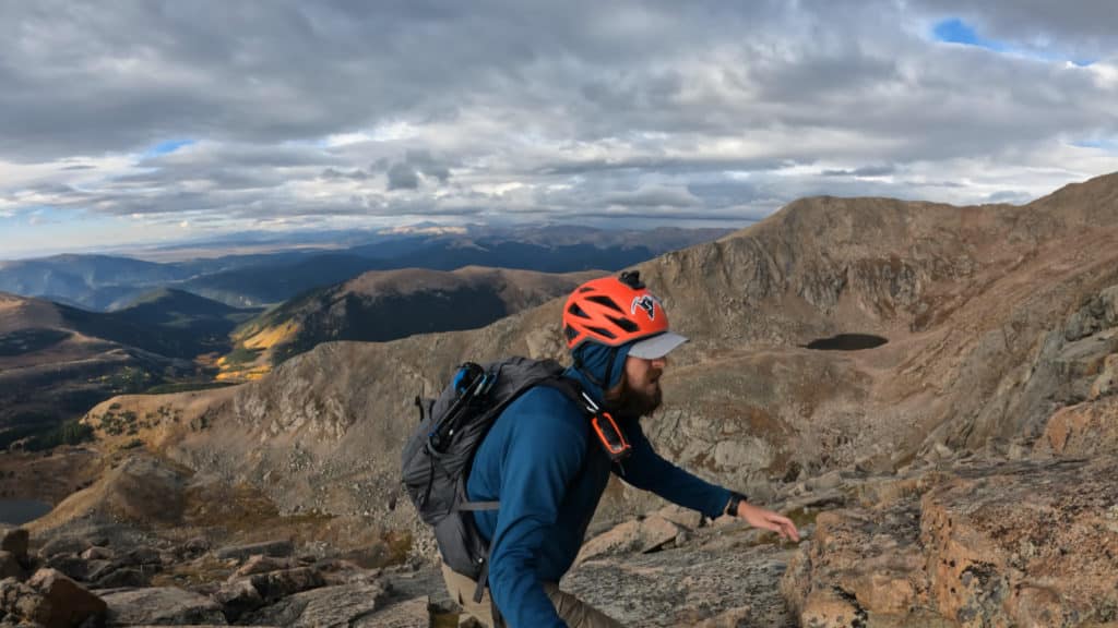
I found the dropdown fairly easily but had to ignore the GPX route which took me down a poor choice in my opinion. Instead I worked over to a gully that was much less steep and offered far less loose dirt. As I climbed up to the South Ridge of Mt Bierstadt, my eyes could not stop looking at the clouds moving in from the West. I started scrambling and the rock was solid, route finding not too difficult and difficulty around Class 3. However, the clouds kept pushing in and eventually snow showers started.
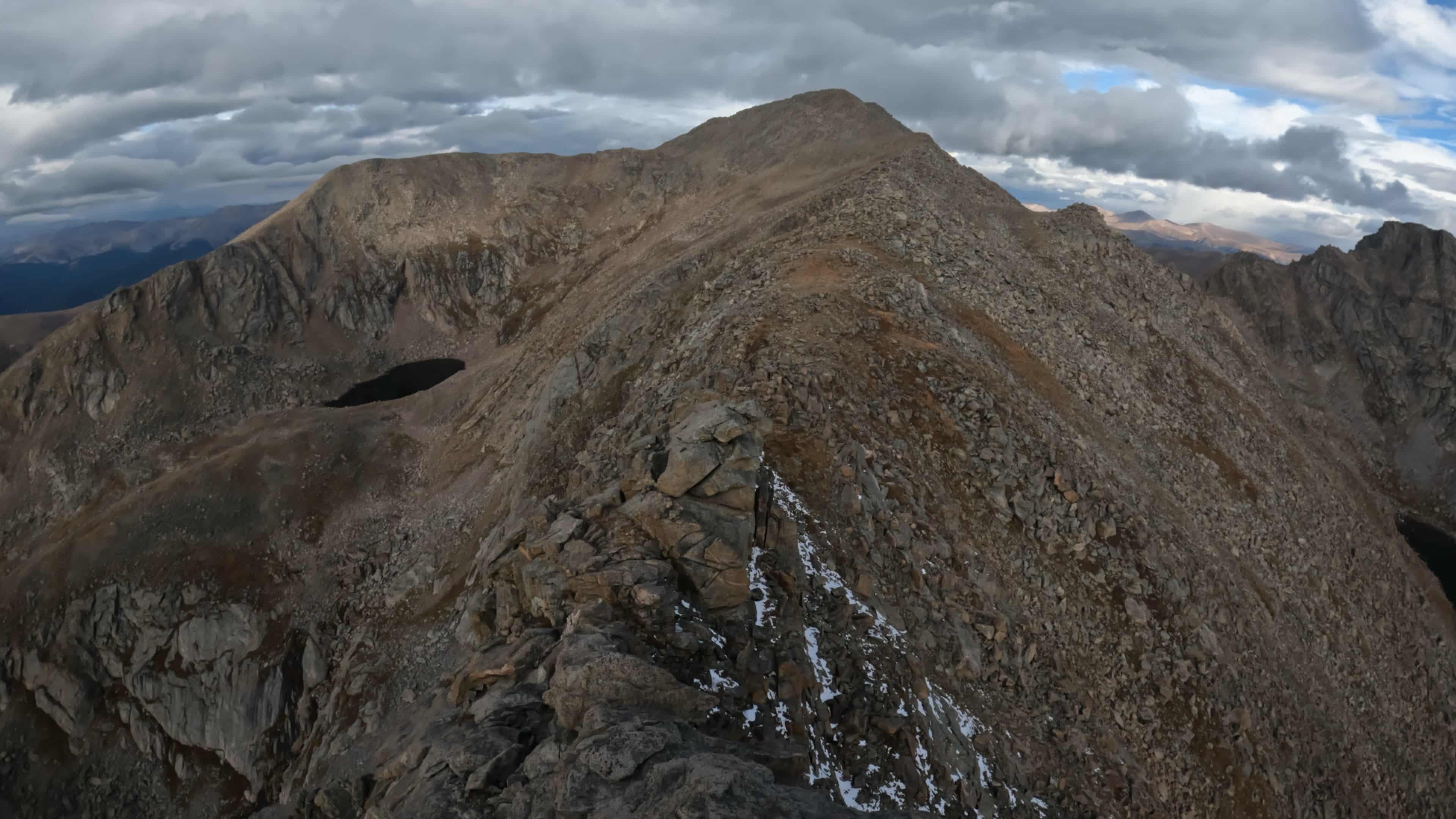
I finished the South ridge of Mt Bierstadt and arrived at the summit shortly after. The weather had not improved so I literally walked through the top of Bierstadt and started the Sawtooth Ridge. I worked down to the saddle and I forgot how technical it was in several sections. Luckily though, the weather held enough for me to finish the most technical part of the hike and I started working over to Mt Blue Sky. Snow showers persisted but nothing too crazy. Lucky for me, I had the summit of Mt Blue Sky to myself as well.
Working down from Mt Blue Sky to the car proved to be more difficult that I had anticipated. Instead of dropping down from the Observatory Tower which I had done previously, my beta lead me down the road a bit before dropping down. To be honest, the conditions here were really not that much better than the Observatory Tower gully but oh well, lesson learned.
Overall, I really enjoyed my day on the Tour De Abyss, even if the weather chased me off the mountain before I really wanted to. I would recommend this route for someone looking to tag these two 14ers in a more exciting way than the standard trail(s).