Wetterhorn Peak 14er Hike Guide
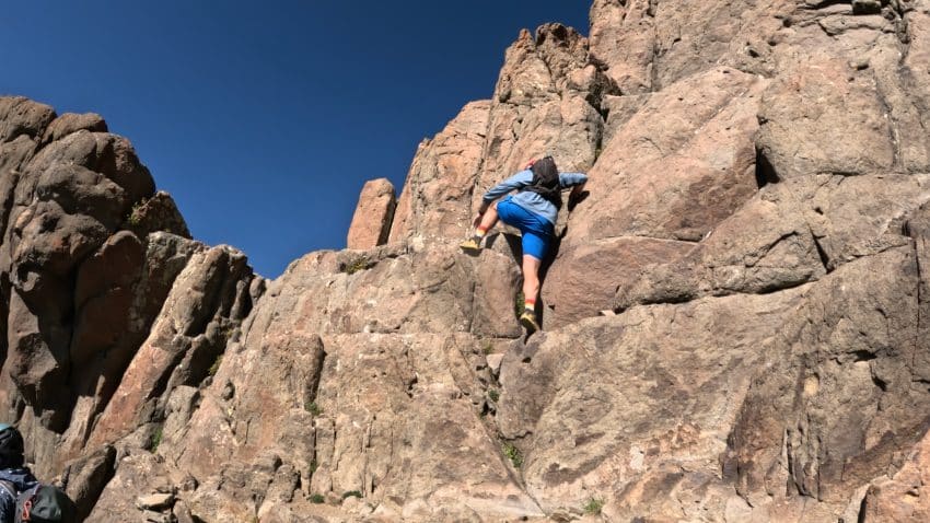
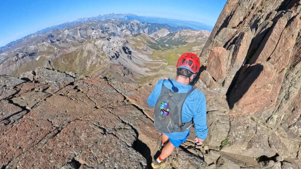
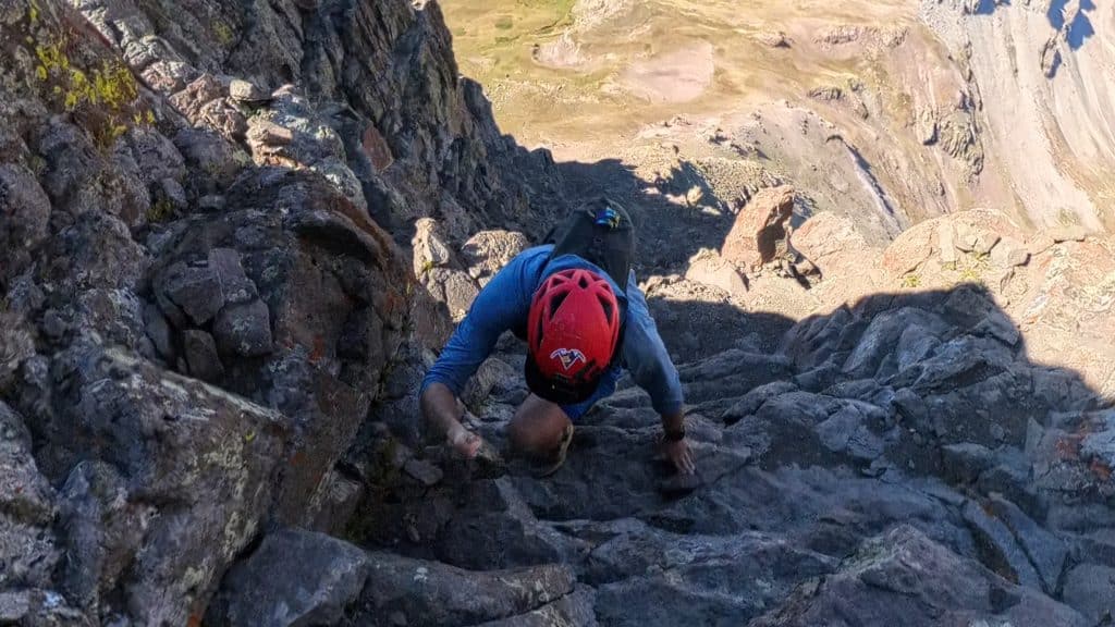
Wetterhorn Peak is a Class 3 14er located in the San Juan Mountains of Southern Colorado. While this peak looks gnarly from far away, most of the trail to the summit is Class 2 with only one smaller section of Class 3 scrambling. One of the toughest parts of hiking Wetterhorn Peak is the rough road that requires at least AWD and for the last bit, 4×4. Wetterhorn Peak is one of my favorite 14ers as it provides controlled bits of exposure and solid rock for its Class 3 headwall.
Wetterhorn Peak Quick Facts
Virtual Trail Guide: Wetterhorn Peak
Wetterhorn Peak Rating: ★★★★★ (5/5 Stars)
Distance: 7.3 Miles RT from Upper TH, 9.7 Miles RT from Middle TH
Elevation Start: 10,800ft from upper TH, 10,388ft from Middle TH
Wetterhorn Peak Elevation: 14,021 ft
Total Elevation Gain: 3,180ft, 3,500ft from Middle TH
Estimated Time to Complete: 4-6 Hours from Upper TH, 5-7 Hours from Middle TH
Difficulty: Moderate to Difficult What does this mean?
Class: Class 3 – What does this mean?
Season: July – September (expect snow outside of this period)
Directions to Wetterhorn Peak
Trailhead: Matterhorn Creek
Getting Here: From Lake City, its about 11 miles to the Matterhorn Creek trailhead. From the center of town, take turn onto 2nd avenue. Take a left at the end of the road (Bluff St/CO Rd 20). From here, the road turns into dirt but is passable for most vehicles. It can be rough in spots, but it does not turn into 4WD/AWD until about 9 miles into the road. As you drive, keep an eye on your odometer or the small green mile signs on the right side of the road. After 9 miles, the road does close seasonally (December – May). From here, take a right onto North Henson Creek Road. The road is more rough from here until the lower TH, as of 2024, it was in pretty rough shape but is still passable for most AWD vehicles with careful driving. Continue another 2.5 miles or so, where you will reach the Matterhorn Creek trailhead sign on your right. If you want to continue to the proper trailhead, take a right up the rough 4WD road for another .7 miles. PLEASE PUT YOUR VEICHLE INTO 4×4 before driving up this road. The upper section has gone to hell over the years and is not maintained by the county. My stock Tacoma had no problem getting to the upper TH, but it does require careful driving.
Fees: None
Parking: Wetterhorn Peak from the Wetterhorn Creek trailhead is free to park at but there are no bathrooms. If you park at the Middle TH, there is a small area to park and the upper parking area can fit about 5-10 cars.
Summary
Dogs: I would not consider Wetterhorn Peak dog friendly unless your dog is used to steep class 3 rock. I don’t think the issue would be getting up, but rather getting down the mountain. Generally speaking, please leave your pups at home.
Camping: Surprisingly, for how remote Wetterhorn Peak is camping can be somewhat tricky to find, especially on busy weekends. During your drive to the trailhead, there are scattered camping spots along the first 9 miles and a handful more once you turn onto North Henson Creek road. Near the trailhead (upper or lower) there are a few decent options to camp as well.
Make it a Loop: The hike to Wetterhorn Peak is an out and back hike but its very common to add on neighboring Matterhorn Peak or Uncompahgre Peak.
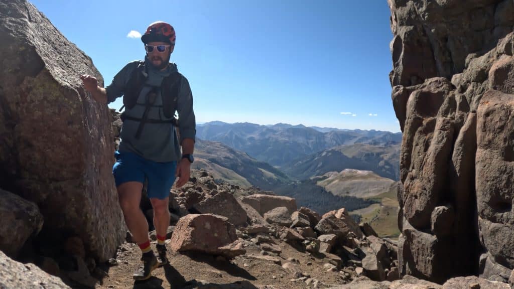
Trail X Factors: Trail Finding & Exposure
Although the trail on Wetterhorn Peak has been improved over the years (thanks CFI) once you reach the South Saddle, there is a bit of route finding to be had in order to get up on the ridge. Your best bet is to just pick a line and stay consistent in following it. Once you are on the ridge of Wetterhorn Peak, there are a million different cairns and trails to follow.
The exposure on the Class 3 headwall may be jarring for some who are not used to it. However, the rock quality is, generally speaking, solid. However, as always, please test all of your holds before committing.
Hike Tip(s): If you want to pair Uncompahgre Peak & Wetterhorn Peak together, I would recommend hiking Uncompahgre first. My reasoning for this is that the peak is farther away, so if the weather turns, you run out of energy etc. you have knocked out the farthest peak first. Wetterhorn is more technically challenging, so if you knock it out first and run out of energy heading over to Uncompahgre, you have a long slog back to your car. You could easily do them in either order, but I think mentally, it was nice to know that after I hiked Wetterhorn, I was a short 2ish miles away from the car.
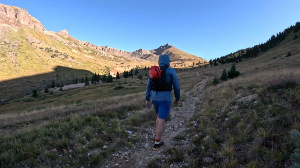
Best Views: The approach to Wetterhorn Peak is stunning. The surrounding mountains offers spanning views of Uncompahgre Peak & Matterhorn Peak and the basins/valleys that surround each of them. This is a great hike in the early fall/later summer when snow begins to fall or in the summer during wildflower season. Honestly though, the views anywhere in this part of the state are insanely beautiful.
Wetterhorn Peak Hike Route
Gear Needed
- 14er Day Hike Packing List
- Men’s Trail Runners
- Women’s Trail Runners
- La Sportiva Trango Hiking Boots (Men’s)
- La Sportiva Trango Hiking Boots (Women’s)
- La Sportiva Cyklone
- Backpack (Winter)
- Backpack (Summer)
- Running Vest Black
- Food & Water
- Optional: Garmin inReach
- Optional: Hiking Poles – 120CM
- Optional: Headlamp
- Optional: Helmet
- Optional: Garmin Fenix Watch
- Optional: GoPro, Joby Tripod, Selfie Stick, GoPro 360, Drone, Insta360
- *Links included in this description might be affiliate links. If you purchase a product or service with the links that I provide I may receive a small commission. There is no additional charge to you.