Colorado Trail Segment 24 Hike Guide
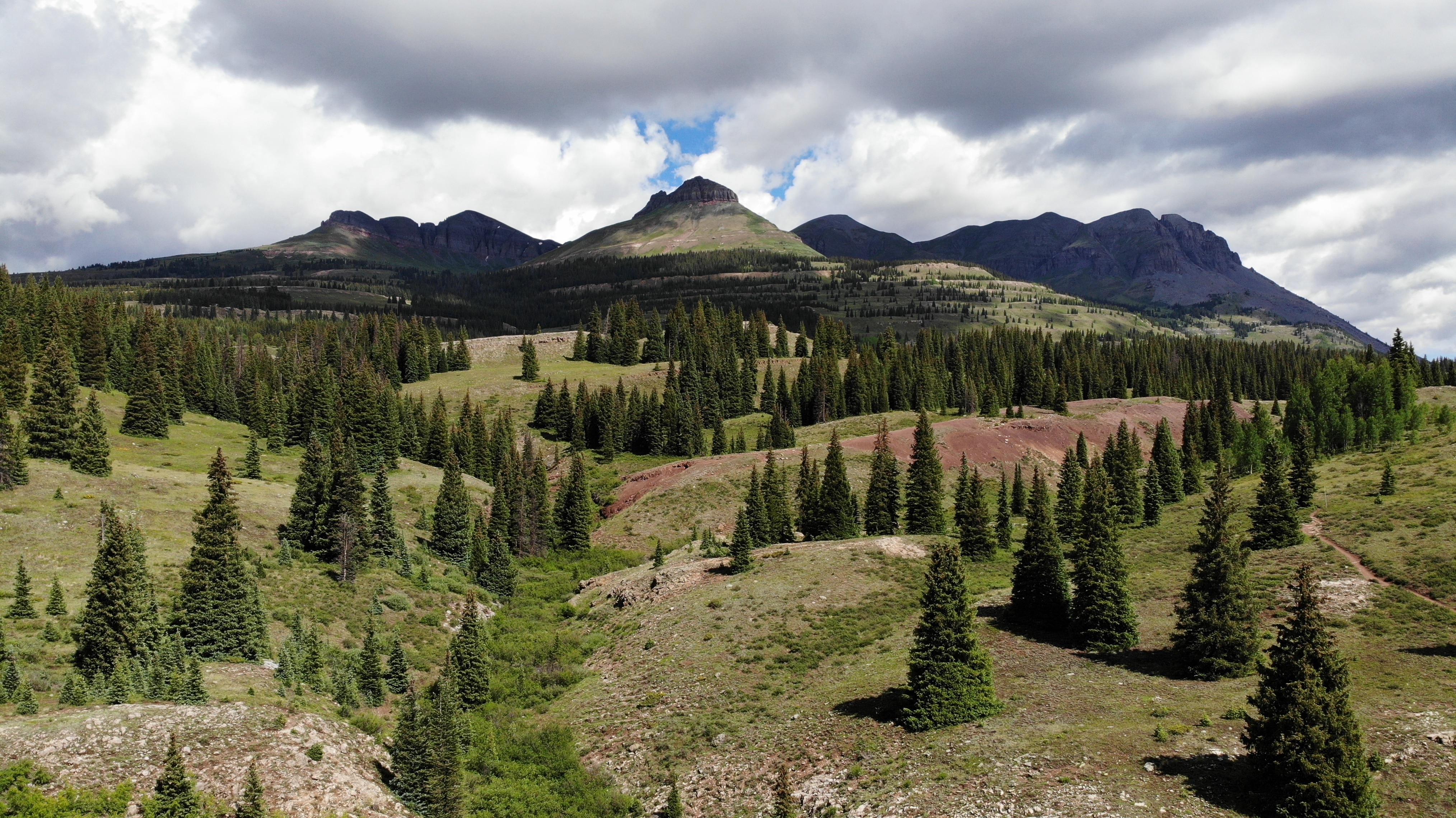
Colorado Trail Segment 24 starts at Stony Pass and ends at Molas Pass working through the most remote portions of the Colorado Trail. The 20 mile segment has a lot of elevation gain with 3,400ft but even more descending (5,100ft). With the tough hiking comes, in my opinion, the best views on the entire Colorado Trail. This segment is absolutely breathtaking with every turn. After spending most of the last 50 miles above 12,000ft – hikers will finally get down to 9,000ft before climbing back up to 10,800ft to end the segment. Molas Pass presents a fantastic opportunity to resupply for through hikers at the nearby campground.
Colorado Trail Segment 24 Quick Facts
Virtual Trail Guide: Colorado Trail Segment 24
Colorado Trail Segment 24 Rating: ★★★★★ (5/5 Stars)
Distance: 20.2 miles One Way
Elevation Start: 12,525ft
High Point: 12,690ft
Total Elevation Gain: 3,475ft
Estimated Time to Complete: 8-10 Hours One Way
Difficulty: Difficult What does this mean?
Class: Class 1- What does this mean?
Season: June- October – The earlier your plan on hiking this – the higher the chances you run into snow.
Directions to Colorado Trail Segment 24
Trailhead: San Luis Pass & Spring Creek Pass
Getting Here: Start Trailhead Stony Pass: Stony Pass is about a 10 mile/40 minute drive on a 4×4 road from the mountain town of Silverton, Colorado. I have no experience driving this road but based on what cars I could see parked here, a standard AWD/4×4 should do the trick.
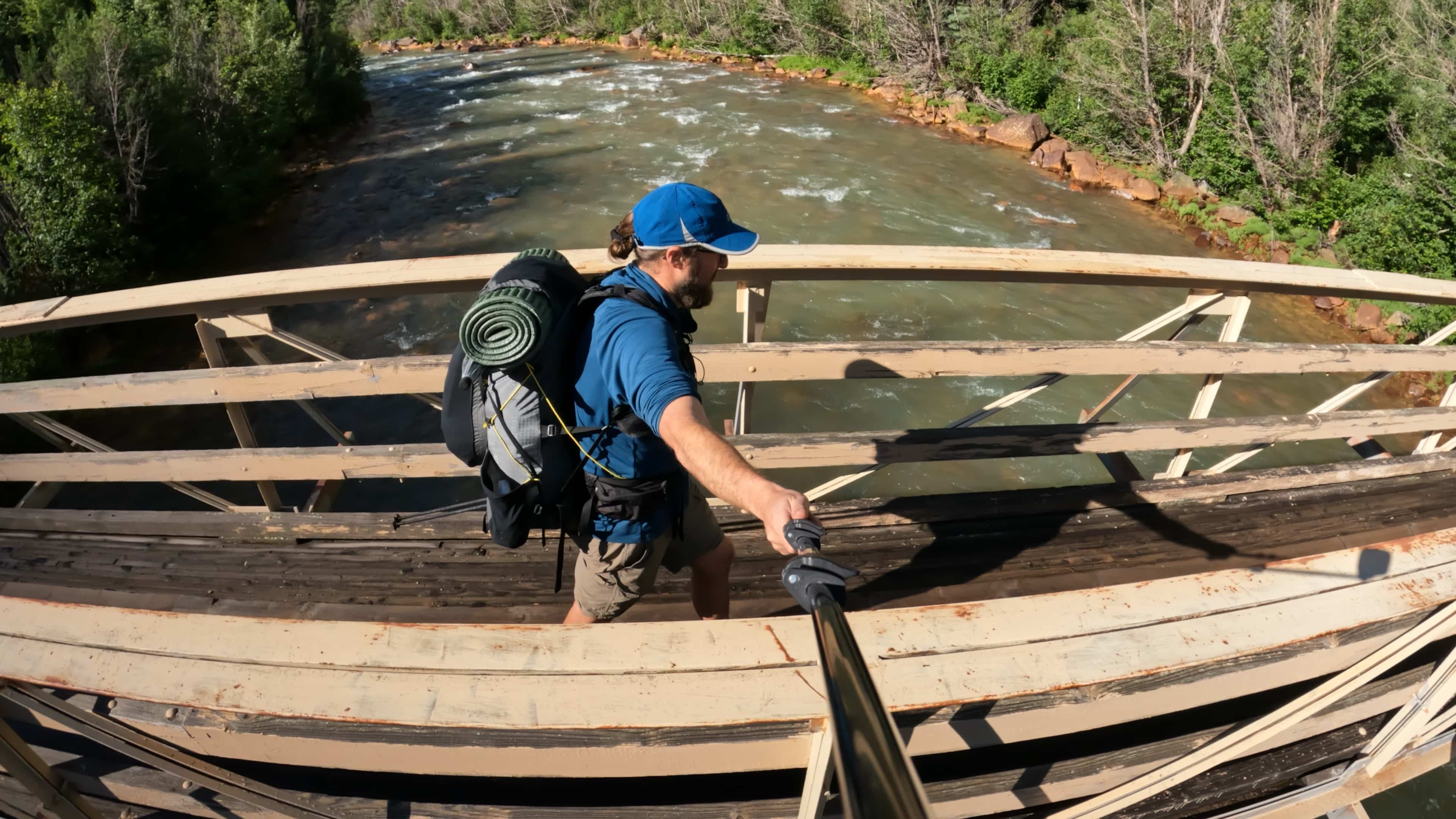
End Trailhead: Molas Pass. Although this segment ends at Molas Pass, if you want to park a car overnight, you will have to leave it at the Molas Trail TH just down the pass to the north. We left a car here for 4 days without any issues at all.
Parking: Parking at Stony Pass is not ideal – room for about 3 or 4 cars with no restroom or established parking area. Molas Pass on the other hand is a great spot to leave a car (so long as you leave it at the spot above and not the pass itself). If you need a bathroom, head to the top of the pass or check out Molas Lake Campground just down the road.
Fee: There is no fee to park at either TH.
Summary
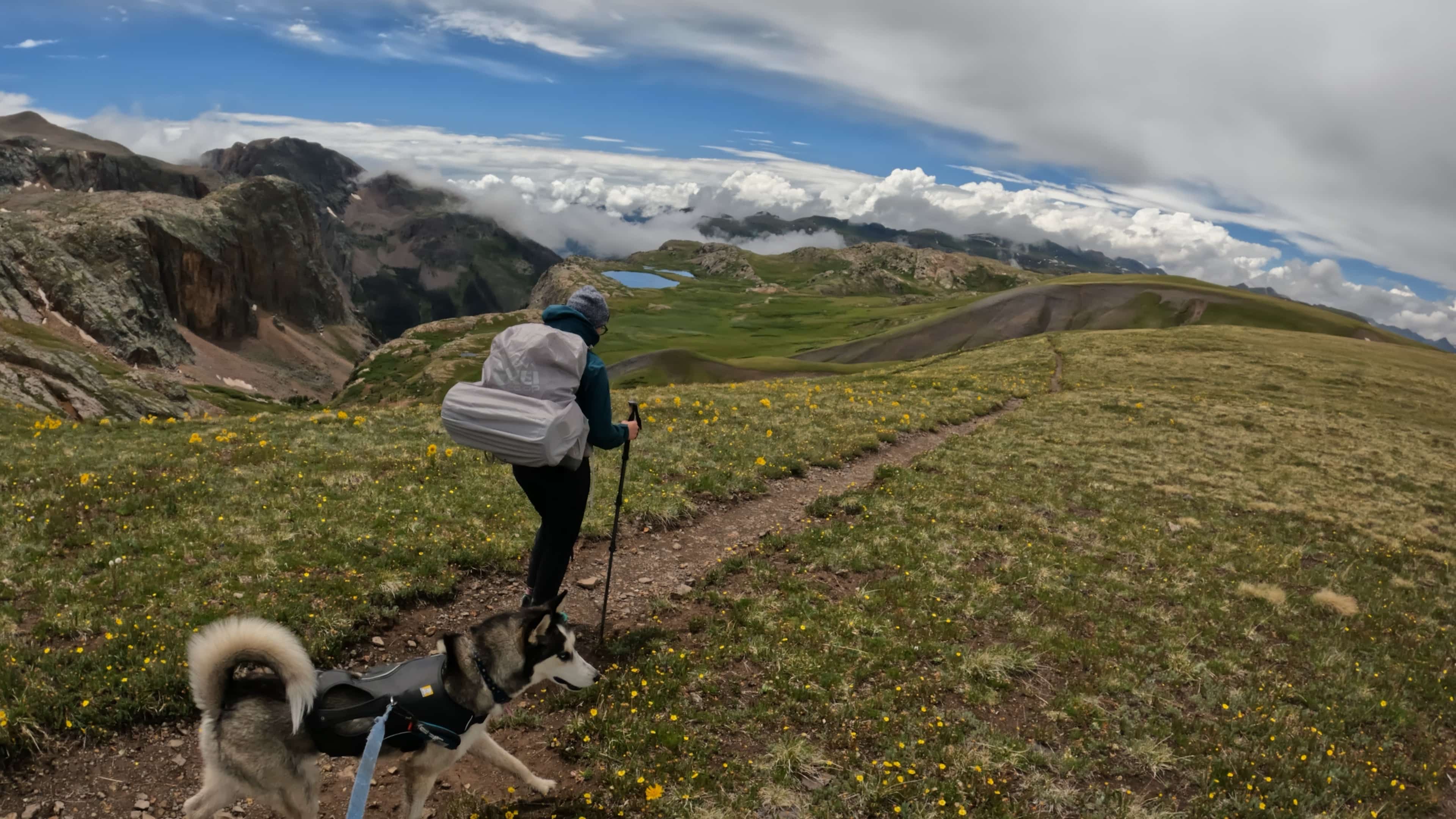
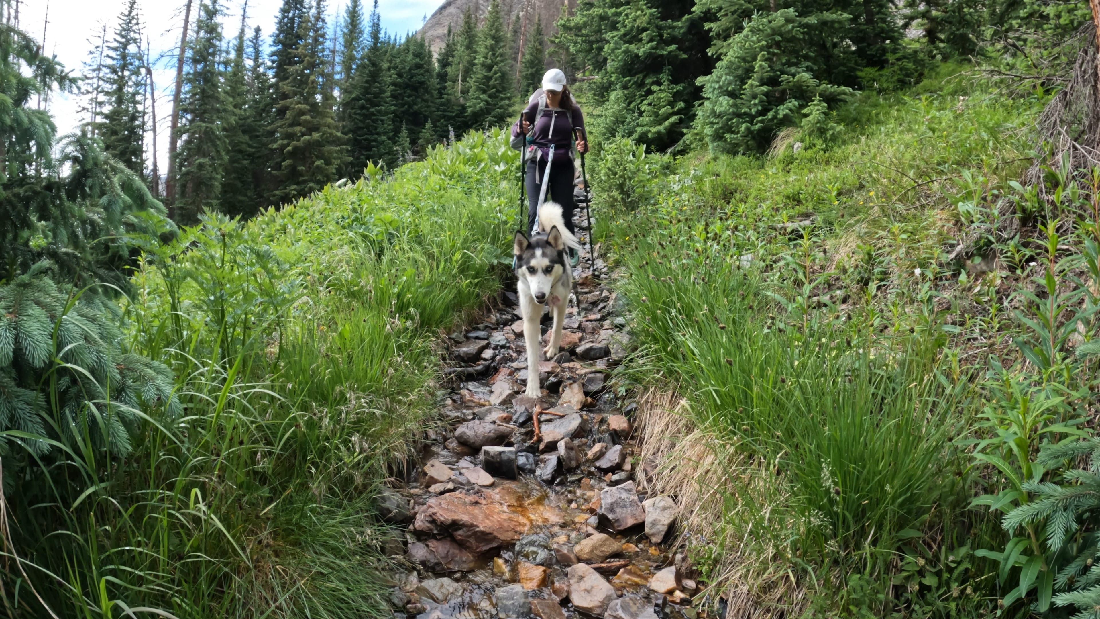
Dogs: Colorado Trail Segment 24 but does enter Wilderness so be sure to keep your dog leashed during these portions.
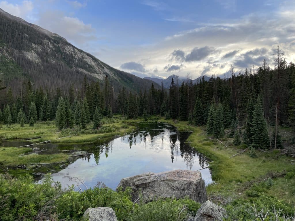
Camping: Once again, this segment can present some challenges with camping options. If the weather allows – there are a handful of spots around mile 5 near the ponds. After that, hikers must begin the descent to the Animas River to find decent spots around mile 7.2, 9-10 and the best spot on this segment in my opinion at mile 11.6 at the Beaver Ponds. If available this is not a spot to miss. After the ponds, there really are only a few options to spend the night on the remainder of the segment.
Access to Water: Colorado Trail Segment 24 has plenty of water sources after the first 5 miles which are basically dry. Just one note here – I would not recommend drinking out of the Animas River due to a mining accident a number of years back.
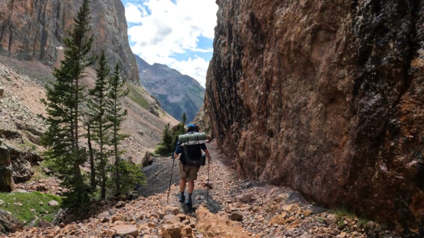
Trail X Factors: Descent to Animas River & Climb Back Up
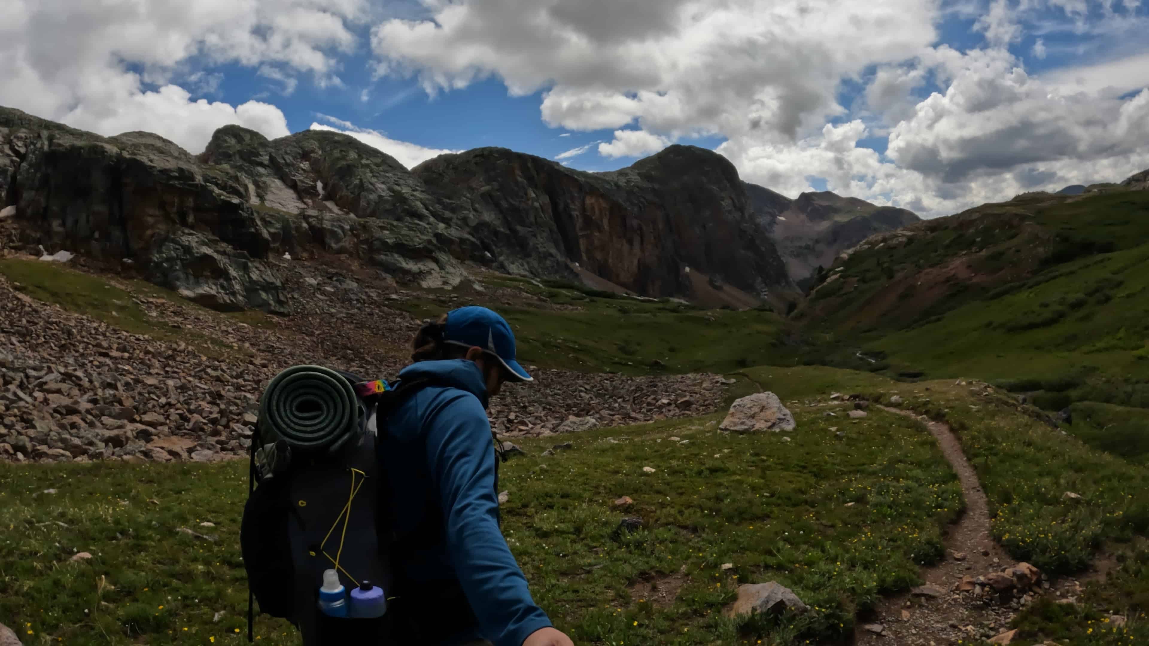
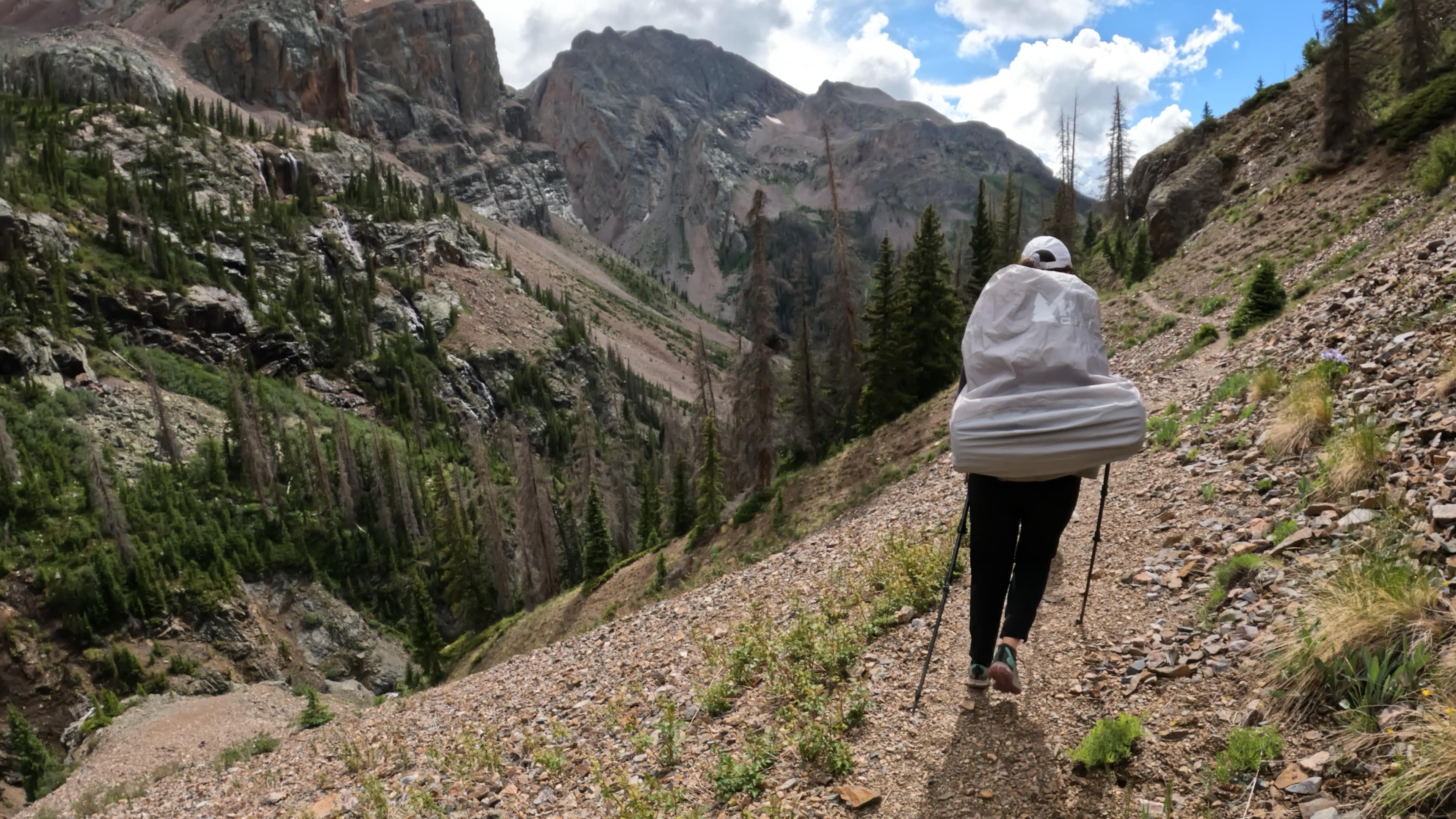
After spending most of the last 50 miles above 12,000ft – Colorado Trail Segment 24 finally brings hikers down to 9,000ft or so. This is a BIG descent over several miles but luckily no sections are super steep besides the initial bit. What goes down must come back up though so after you reach the Silverton/Durango railroad you must make a big climb back up to Molas Pass. This portion can be difficult on tired legs and is fairly exposed to the sun in the morning hours which means hotter temps.
Hike Tip(s): Looking for a resupply or shower? Check out Molas Lake Campground which has a small general store, hot showers for a few bucks ($8 as of 2022) and established campground. Its only about .3 miles off the trail and well worth it if through hiking. Like the previous 2 segments, CT 24 is VERY exposed for the first 7 miles or so. Getting stuck here in bad weather would not be ideal at all.
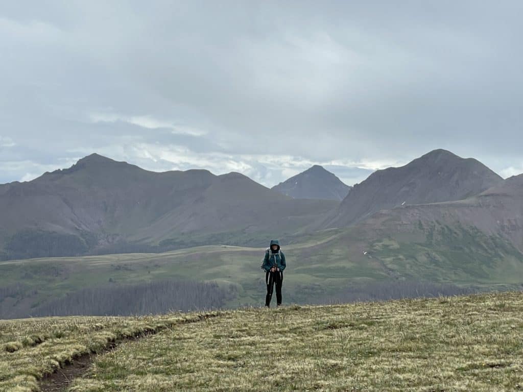
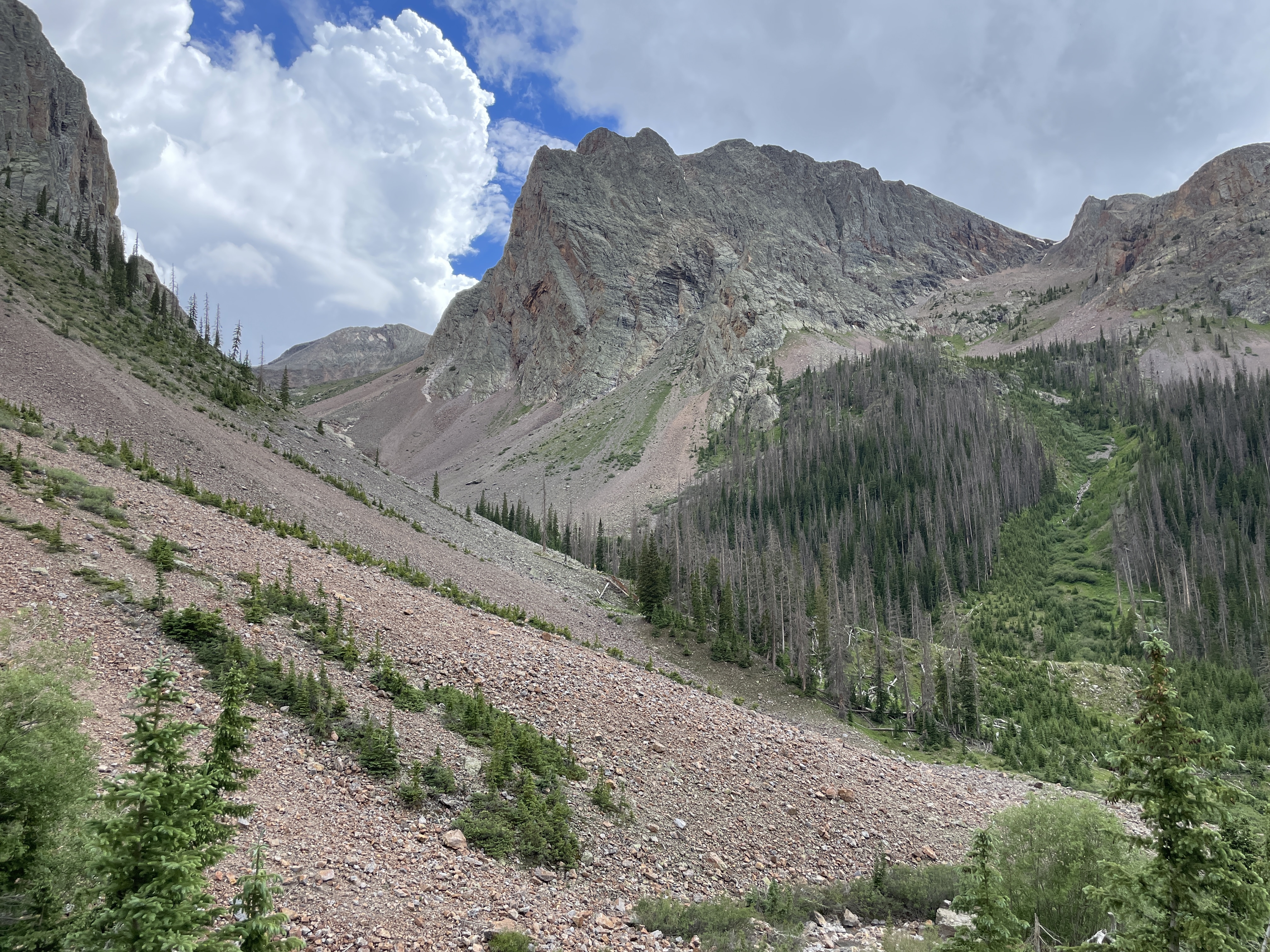
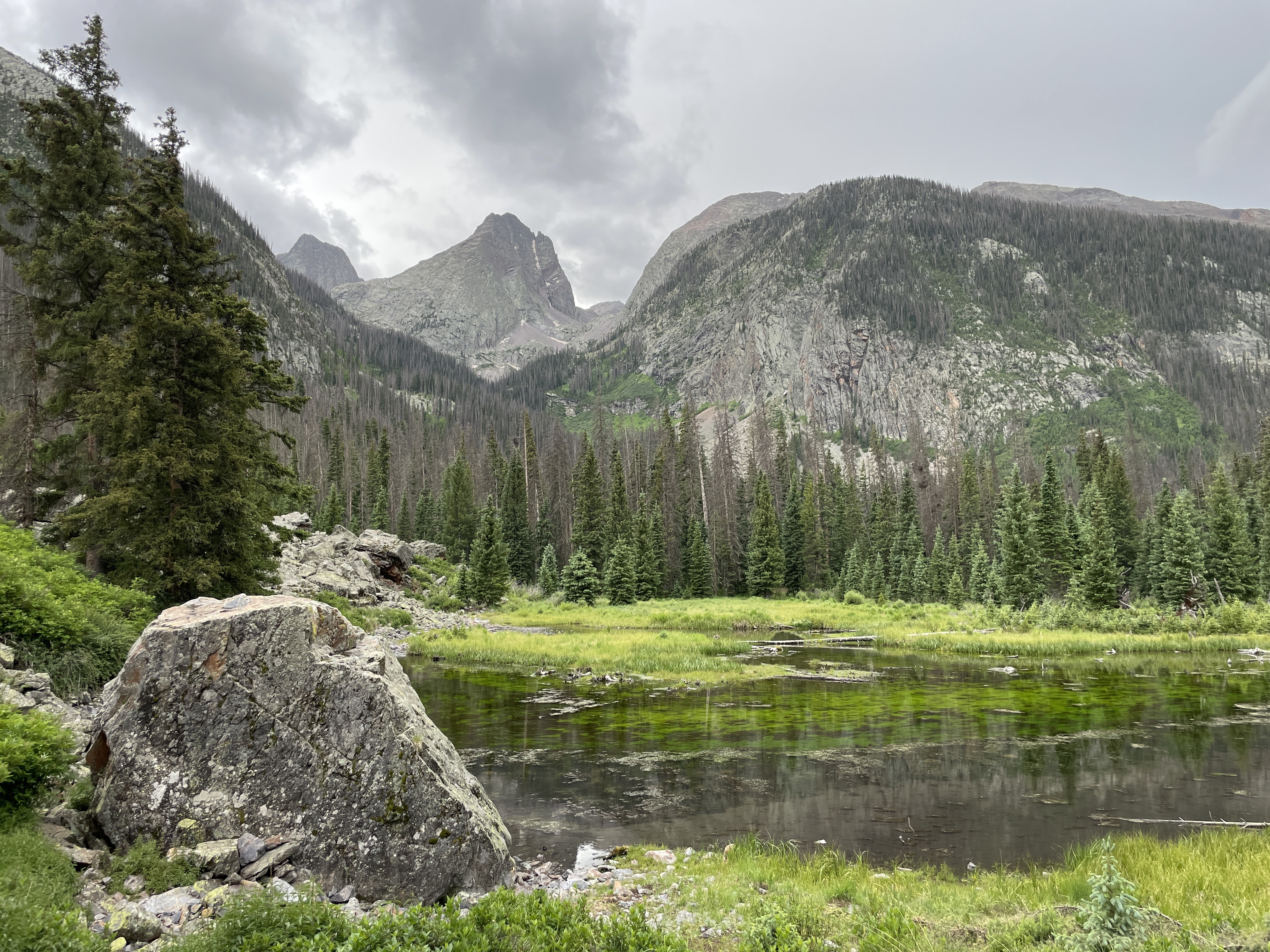
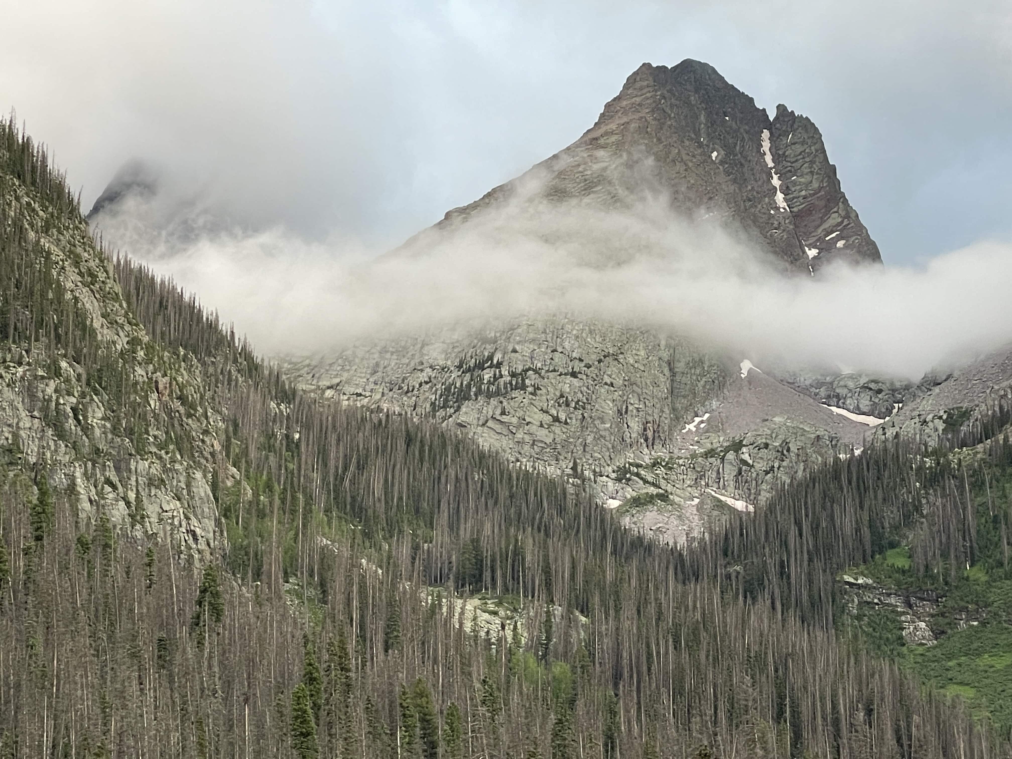
Best Views: The entire thing. A+ views from start to finish, really. Many consider Colorado Trail Segment 24 the most beautiful of the entire 480mile+ hike.
Colorado Trail Segment 24 Hike Route
*Includes Segments 22 and 23
Gear Needed
- SixMoon Designs Backpack
- Hiking Shoes
- Women’s Hiking Shoes
- Garmin inReach
- Water Filter OR UV Pen
- Headlamp
- Optional: Tent
- Optional: Sleeping Pad
- Optional: Sleeping Bag
- Optional: Cook Kit
- Optional: Stove
- Optional: Hiking Poles
Jackie’s Gear:
Aria’s Gear
Colorado Trail Books:
- Full Version
- Pocket Guide
- *Links included in this description might be affiliate links. If you purchase a product or service with the links that I provide I may receive a small commission. There is no additional charge to you.
Our Trip to Colorado Trail Segment 24: July 2022
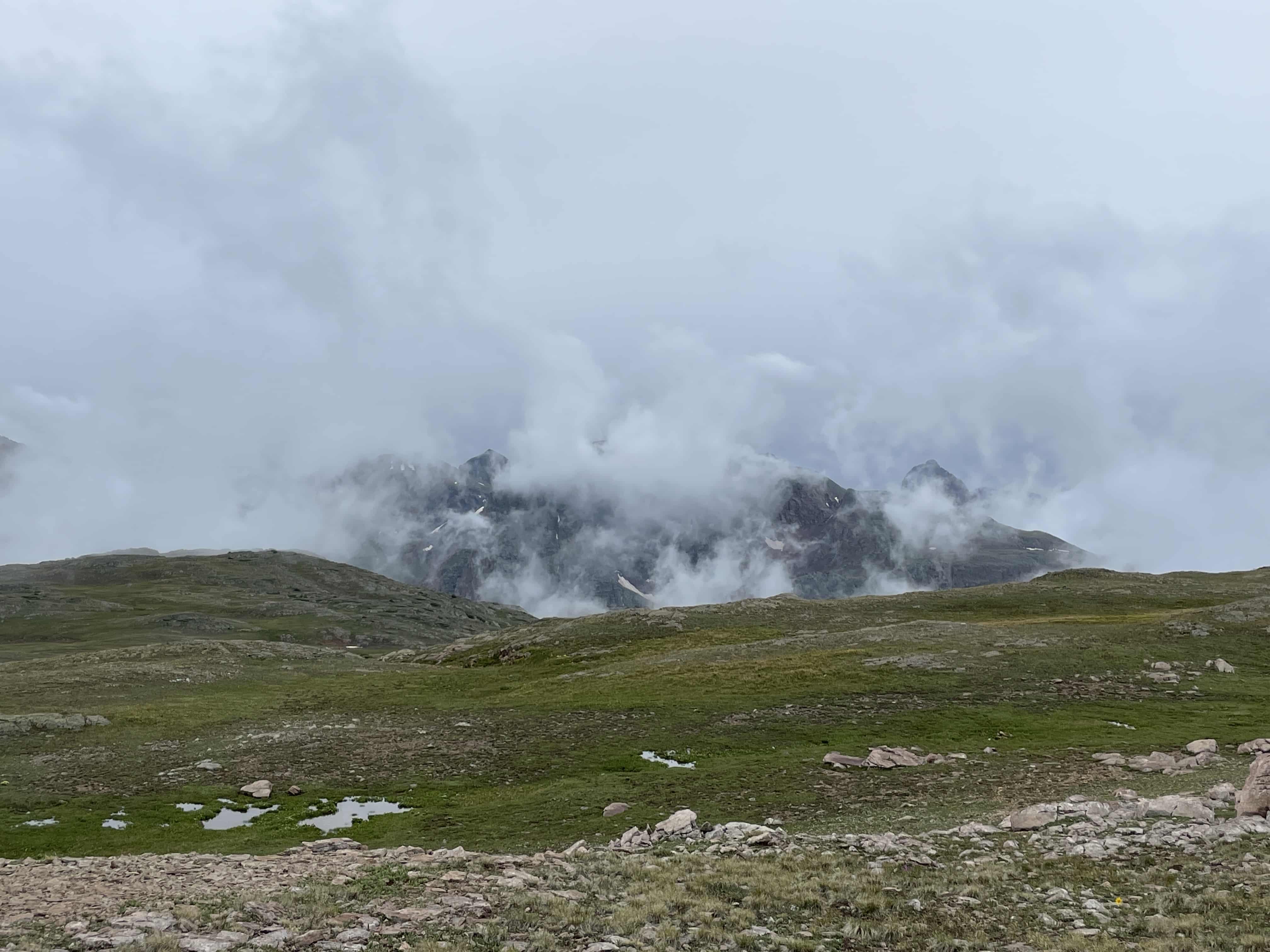
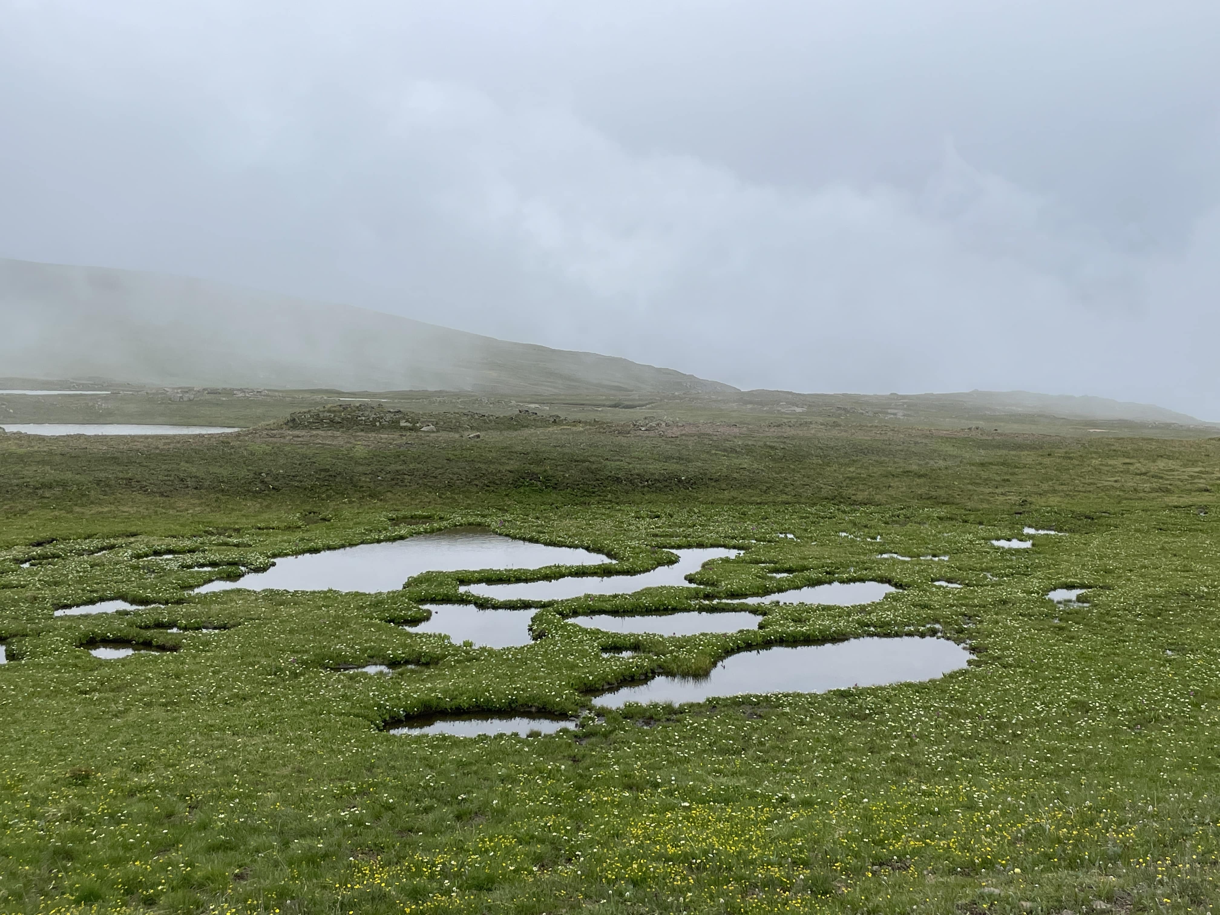
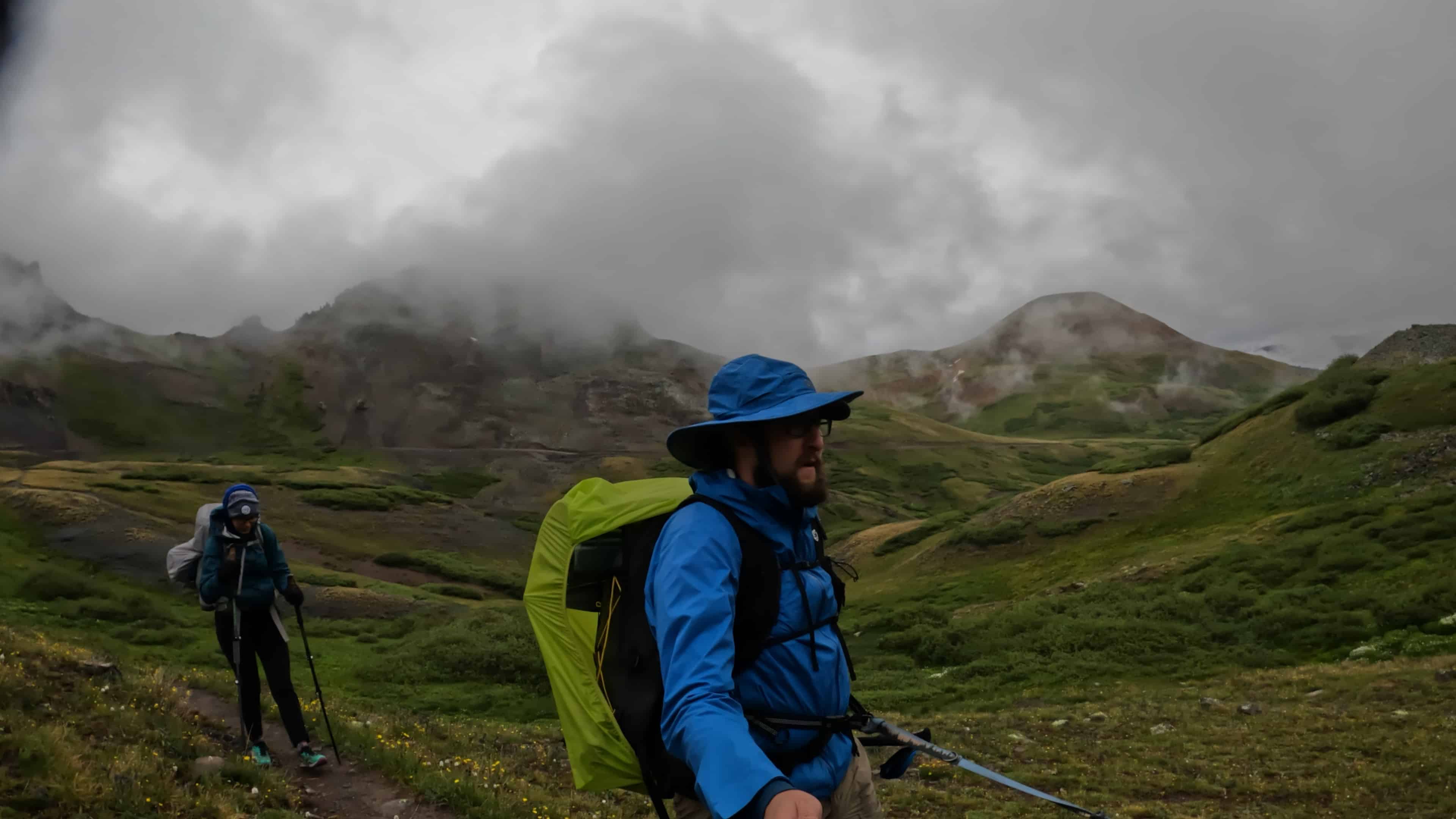
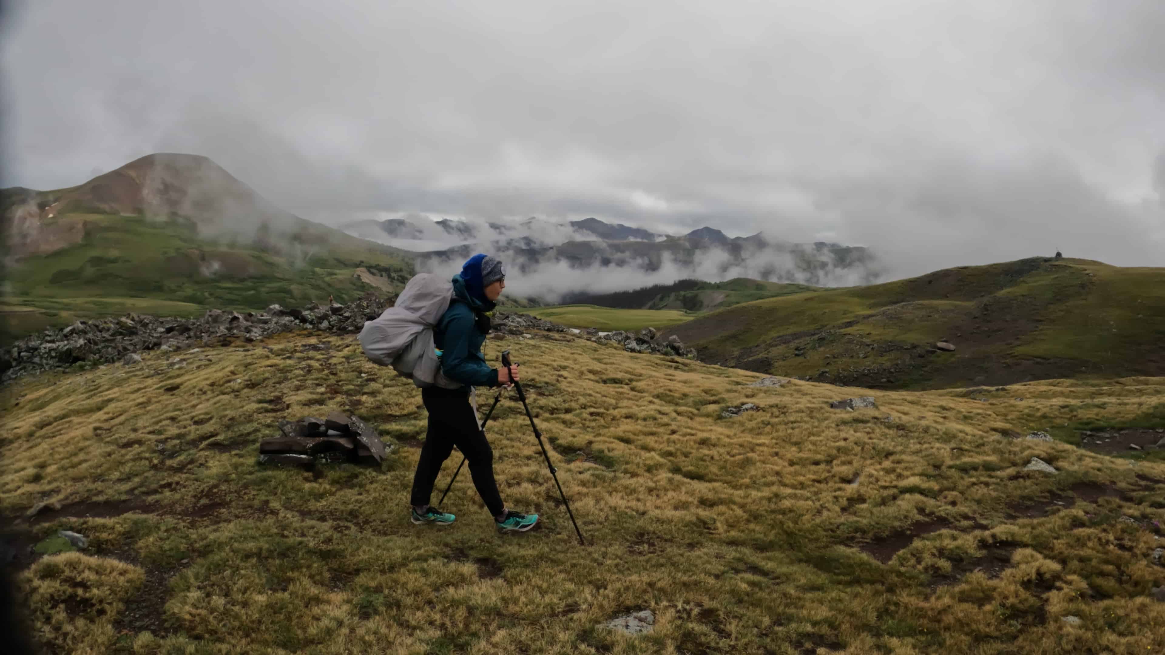
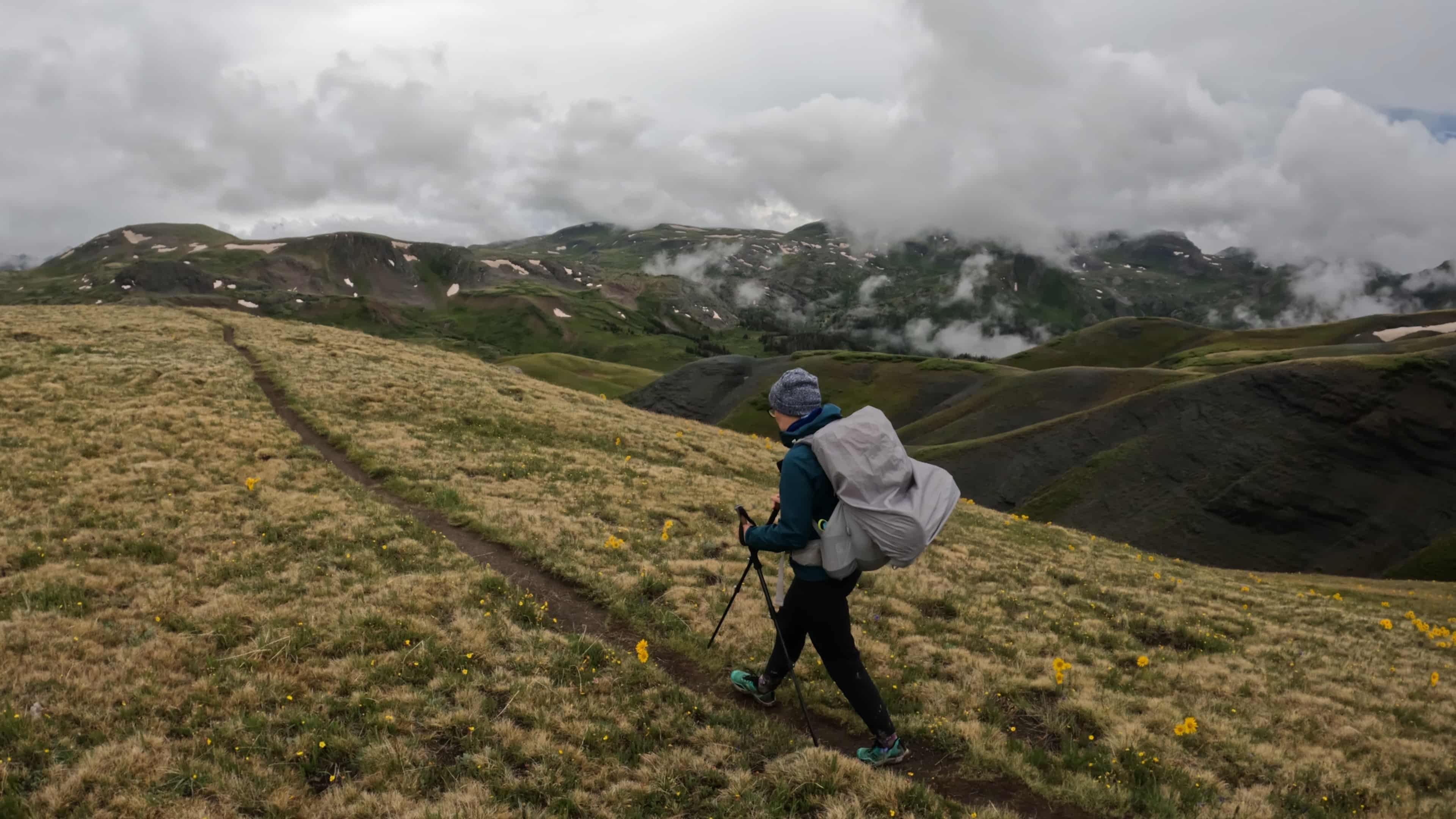
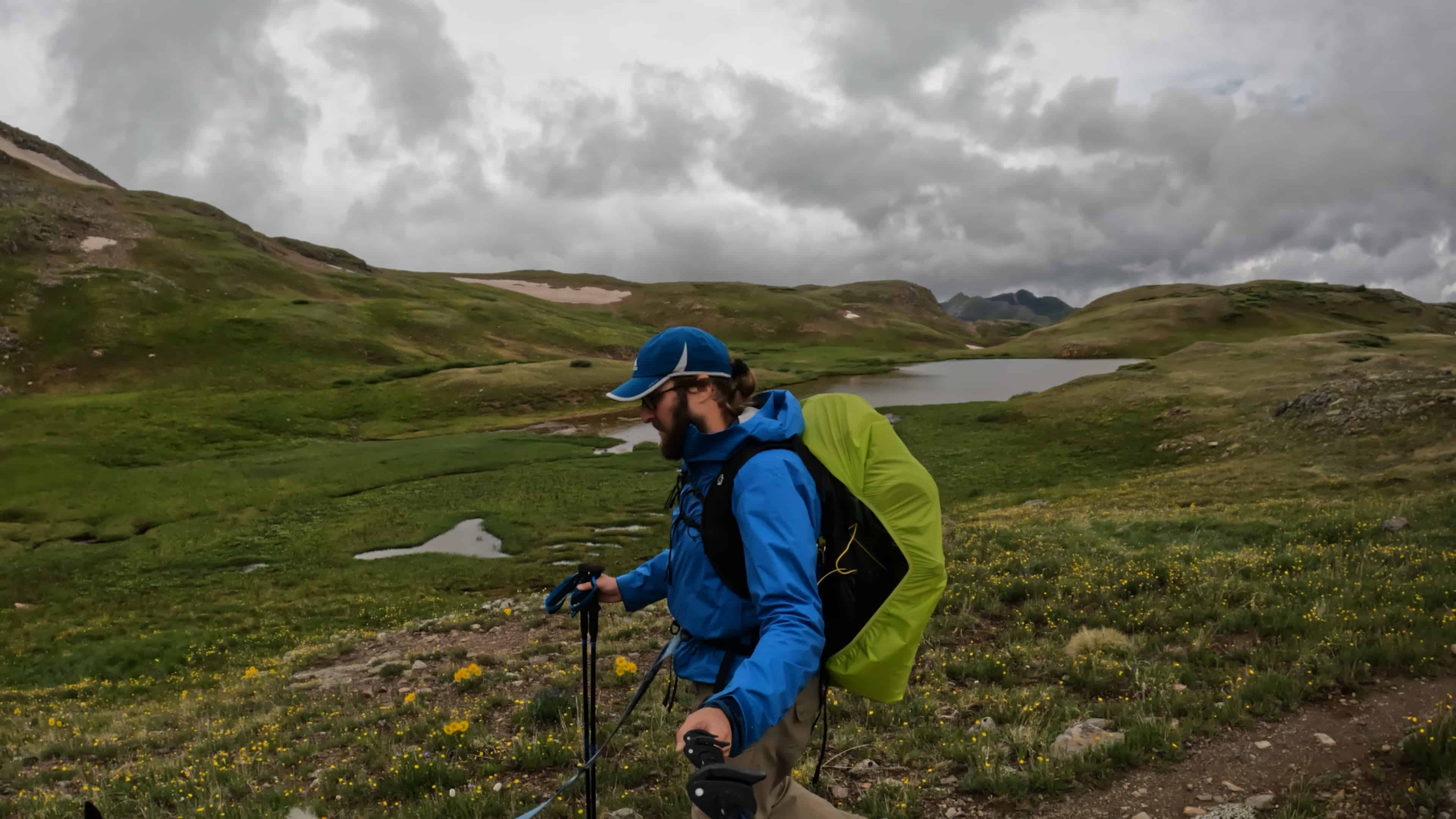
After finishing segments 22 and 23, we continued our weekend of hiking on Colorado Trail Segment 24. With a gloomy and rainy start at Stony Pass, spirits weren’t necessarily high. We knew that this segment was supposed to be insanely beautiful and it was – but much of what we were supposed to be seeing was covered in clouds. The first few miles rolled along some nice hills with bits of elevation loss and regain, but nothing very hard.
As we continued hiking – we reached a pretty significant moment of the Colorado Trail, we finally split from the Continental Divide Trail which we had been following for hundreds of miles. Then another odd moment, for the first time in nearly 400 miles – the Colorado Trail had…no trail. For some reason there is a few hundred yard stretch that has no singletrack path which felt very odd.
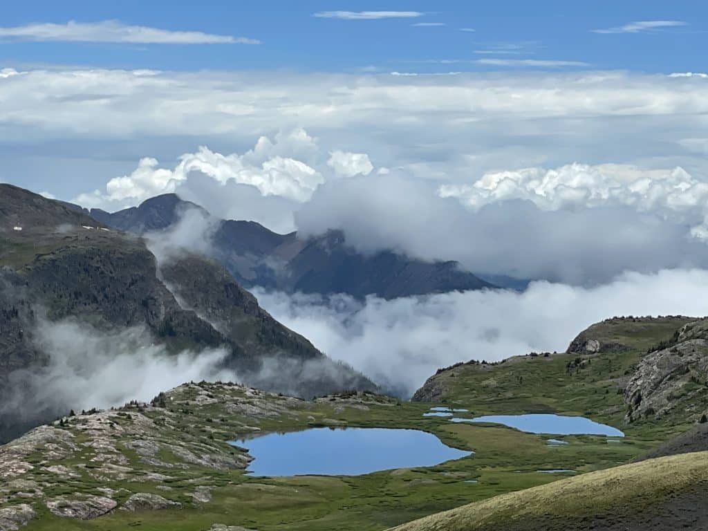
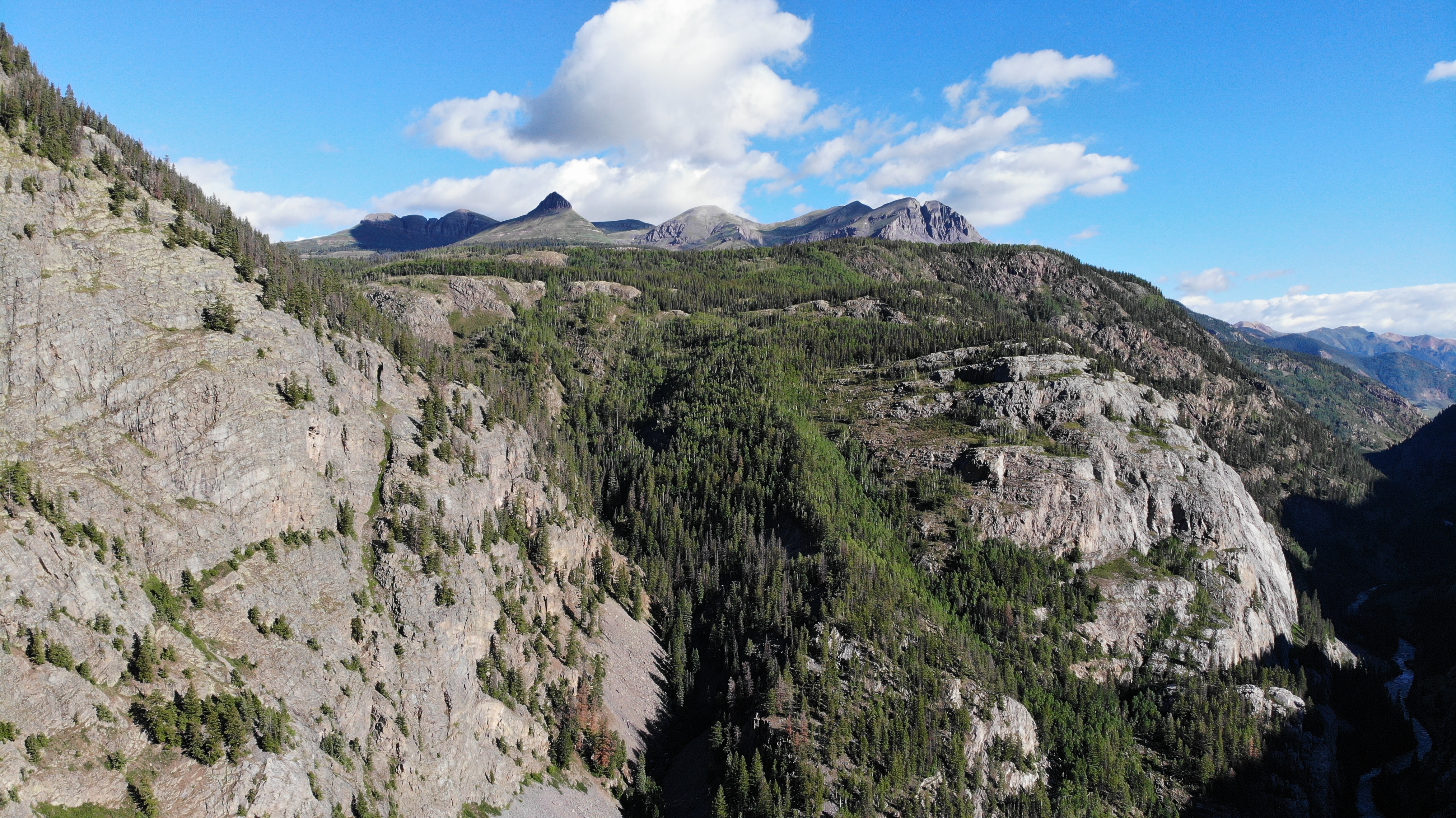
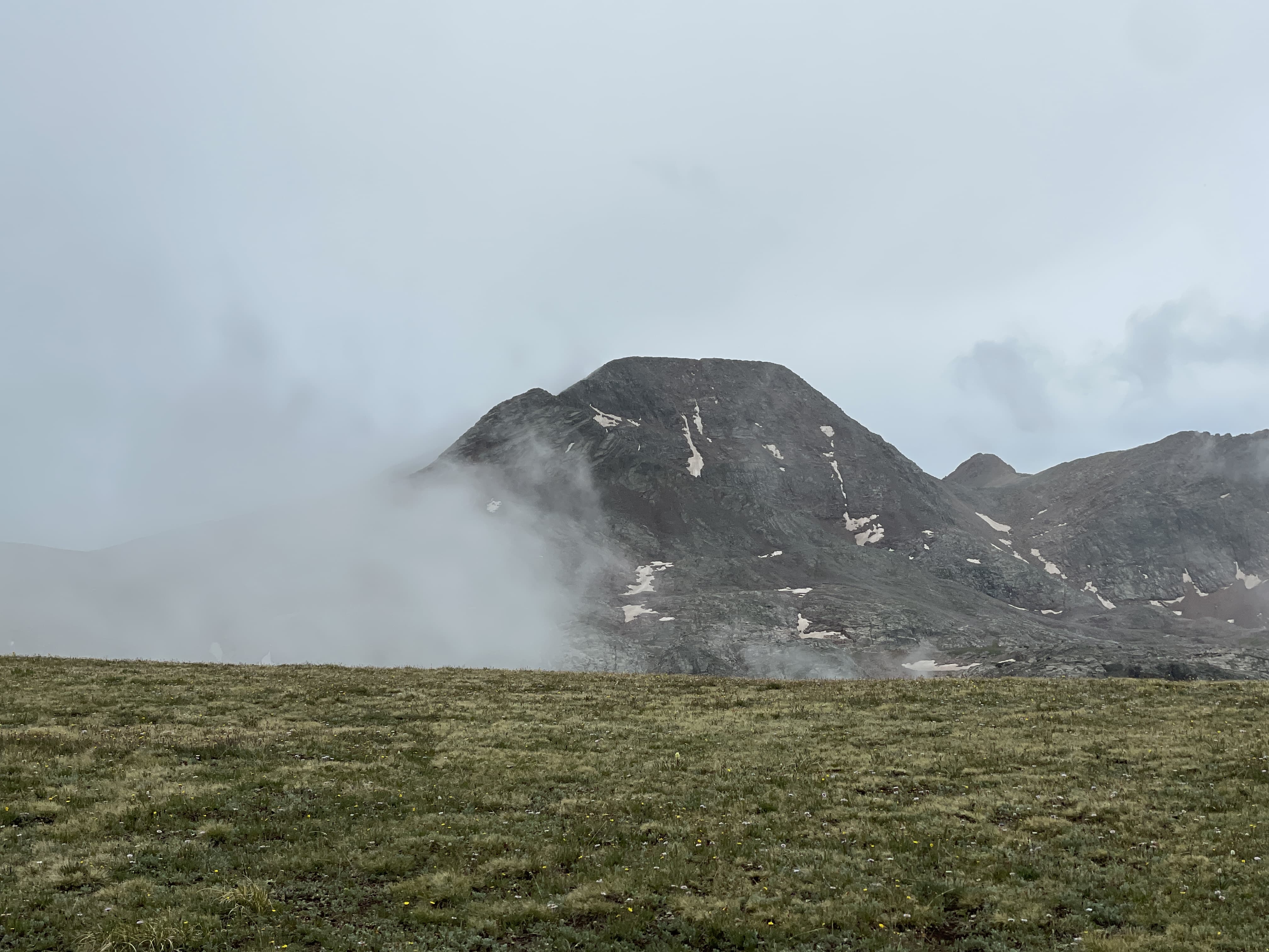
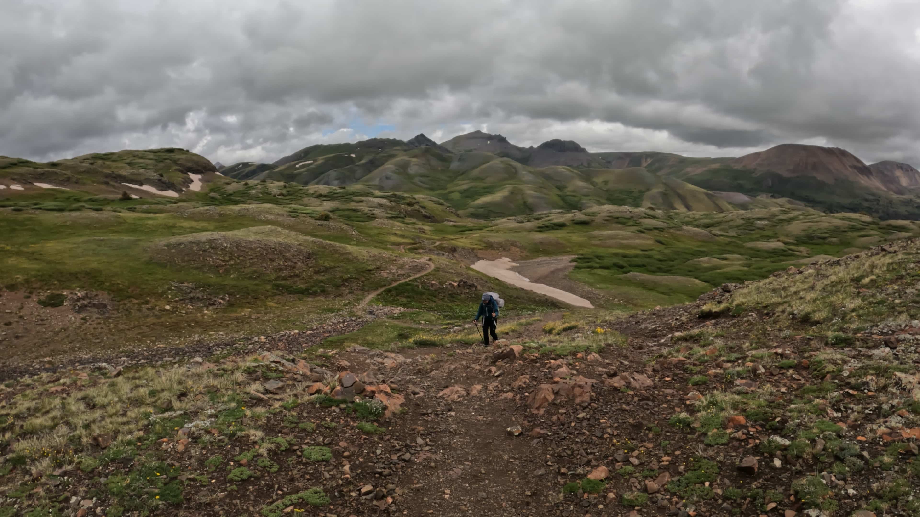
Our morale was still low because we knew that we were surrounded by mountains in all directions but just couldn’t see them. As we were about to start the massive descent to the Animas River, suddenly the clouds quite literally parted revealing jaw dropping views. Jackie and I thought it was a gift from Juno. She knew how hard we had all worked to get to this point of the CT and thought we deserved to see the segment’s true beauty.
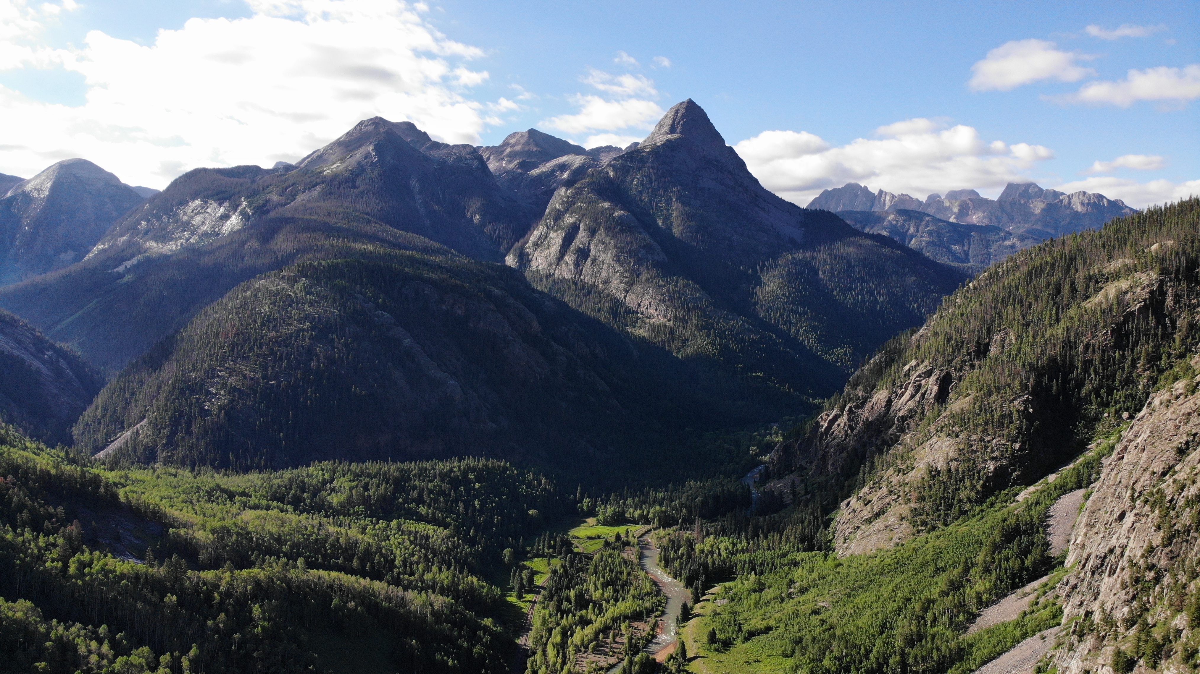
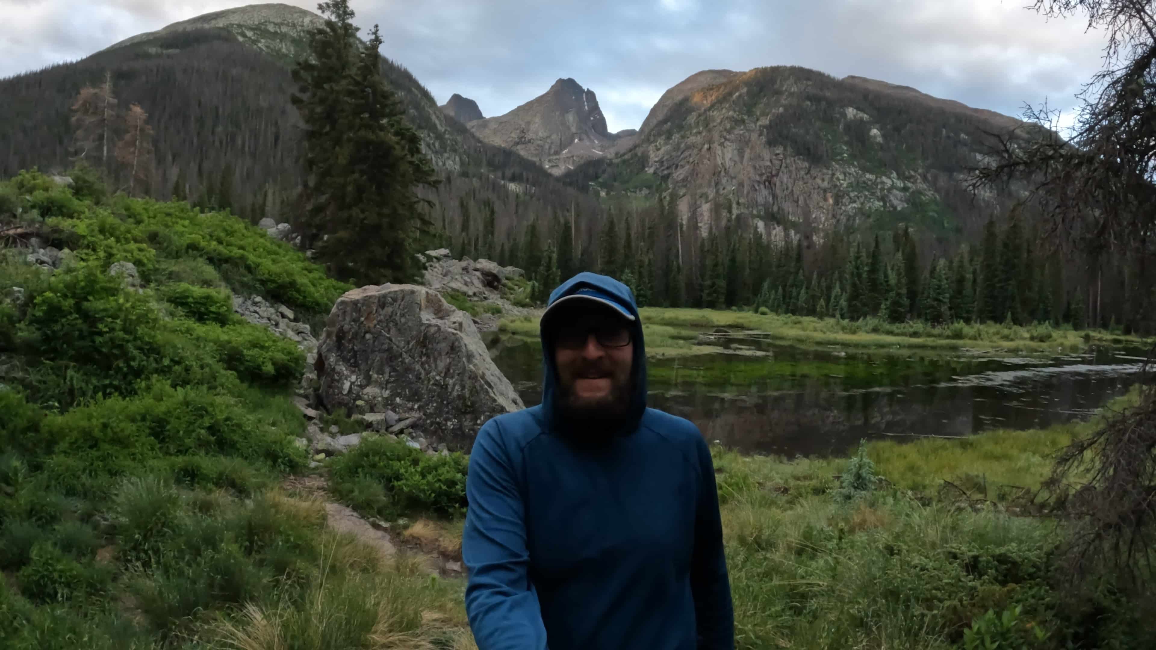
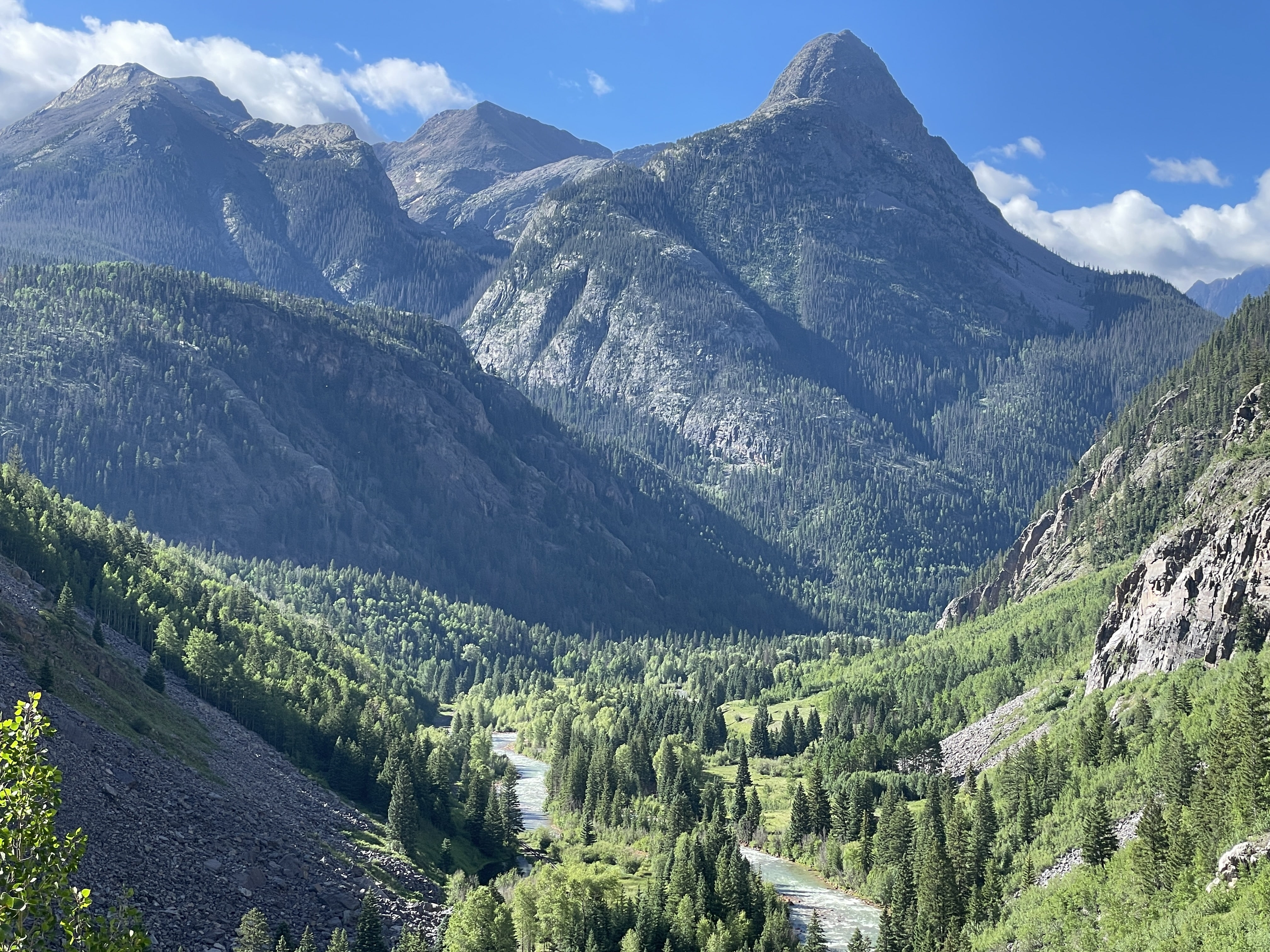
With the sun out for a bit – we stopped to eat a lunch and dry out the shelter. It was still soaking wet from the night before and the sun’s strong rays at 11,000ft made quick work of the water droplets coating the tent. We now had a dry place to sleep which was a massive pick me up. We worked our way down into the valley following Elk Creek and finally settling on camping at the Beaver Ponds around mile 12. The views of Arrow Peak and Vestal Peak were insane and I made a mental note to come back to climb both of the rugged looking peaks.
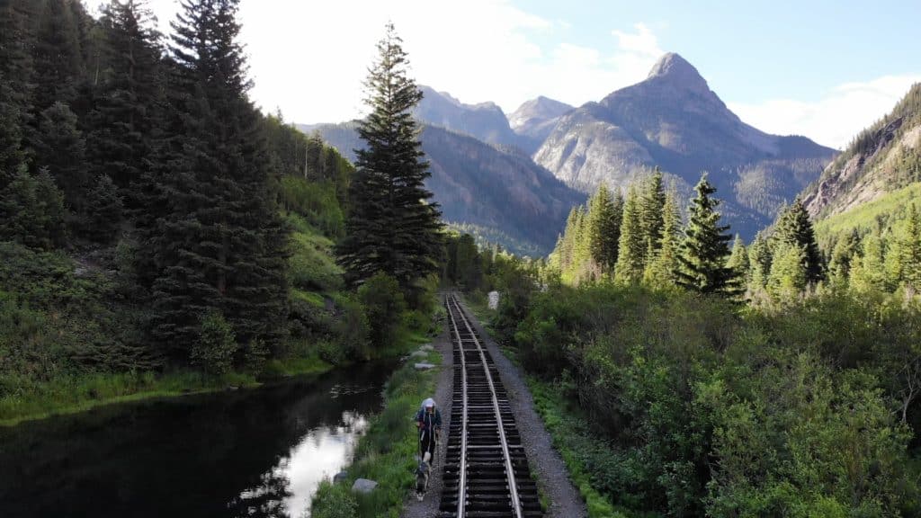
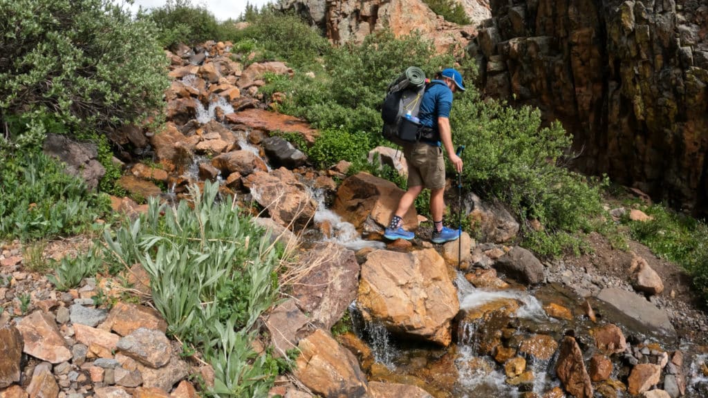
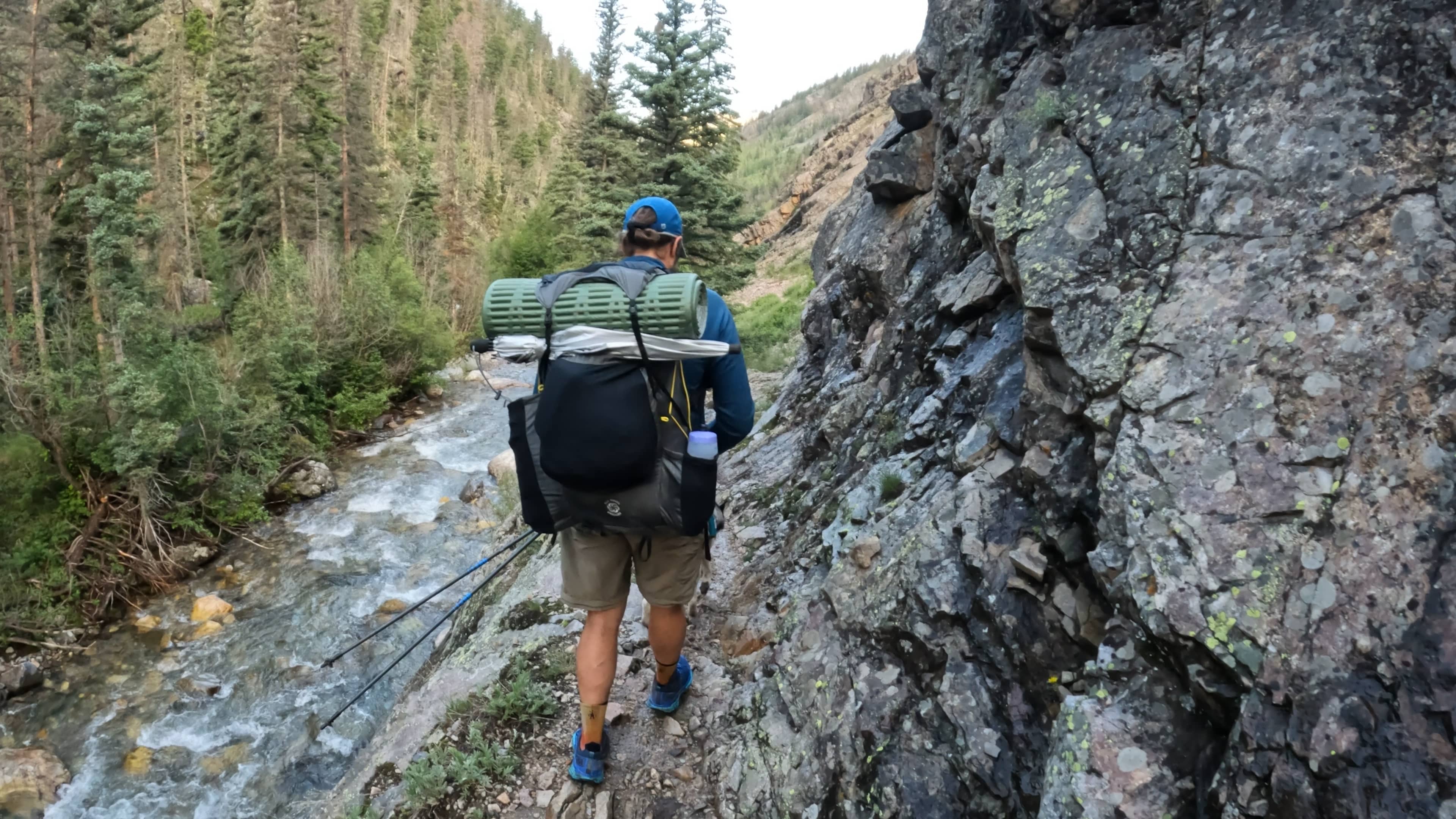
The next morning was a bit of a leisurely start hitting the trail around 7AM. We only had 6-7 miles left in Colorado Trail Segment 24 and after some really rough days/nights soaked in the extra few hours of sleep. The trail had a few interesting sections working around/through Elk Creek and the views were just stunning. It felt like we were in the Pacific Northwest, not Colorado. Everything was so alive and green which was great to see given the area’s struggle with wild fires each year. When we reached the Animas, I popped up the drone for some insane shots. Have I mentioned it was stunningly beautiful?
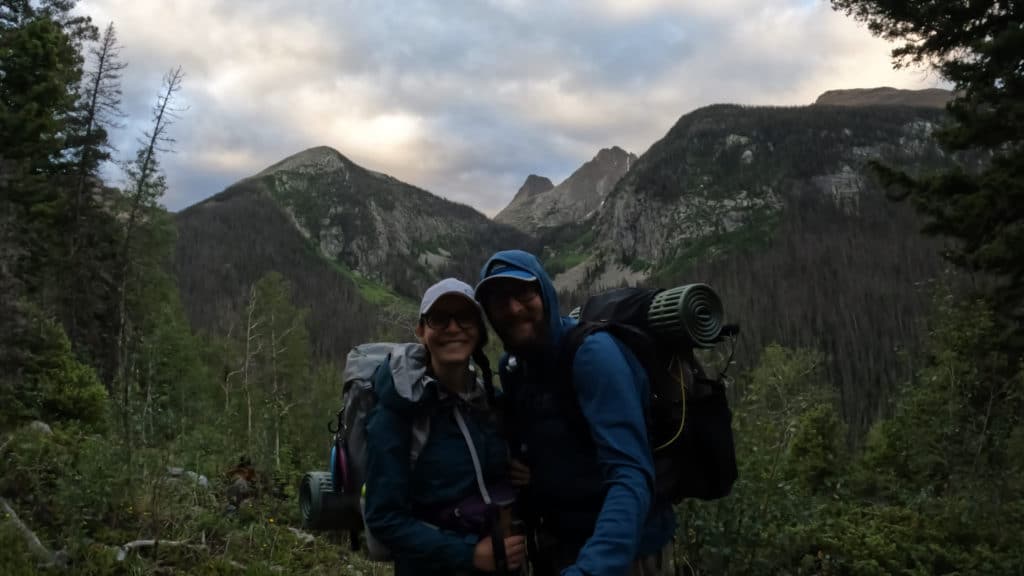
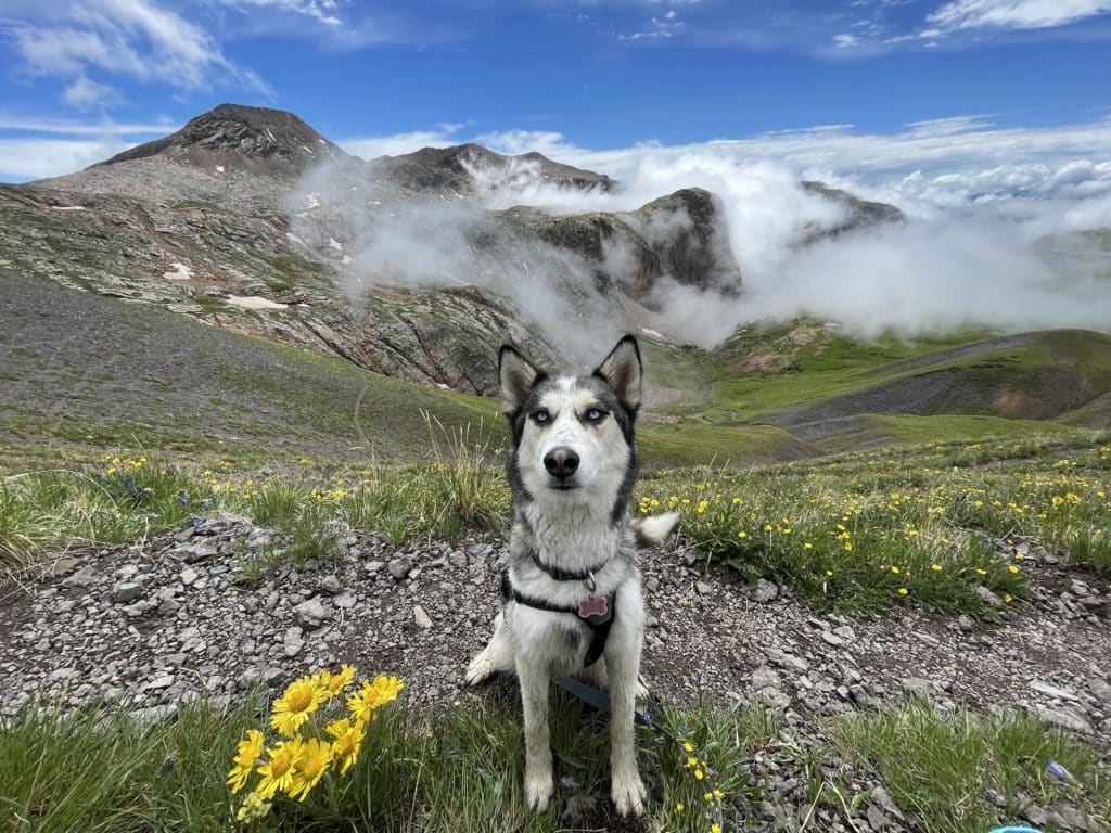
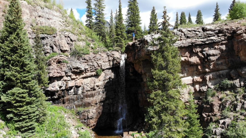
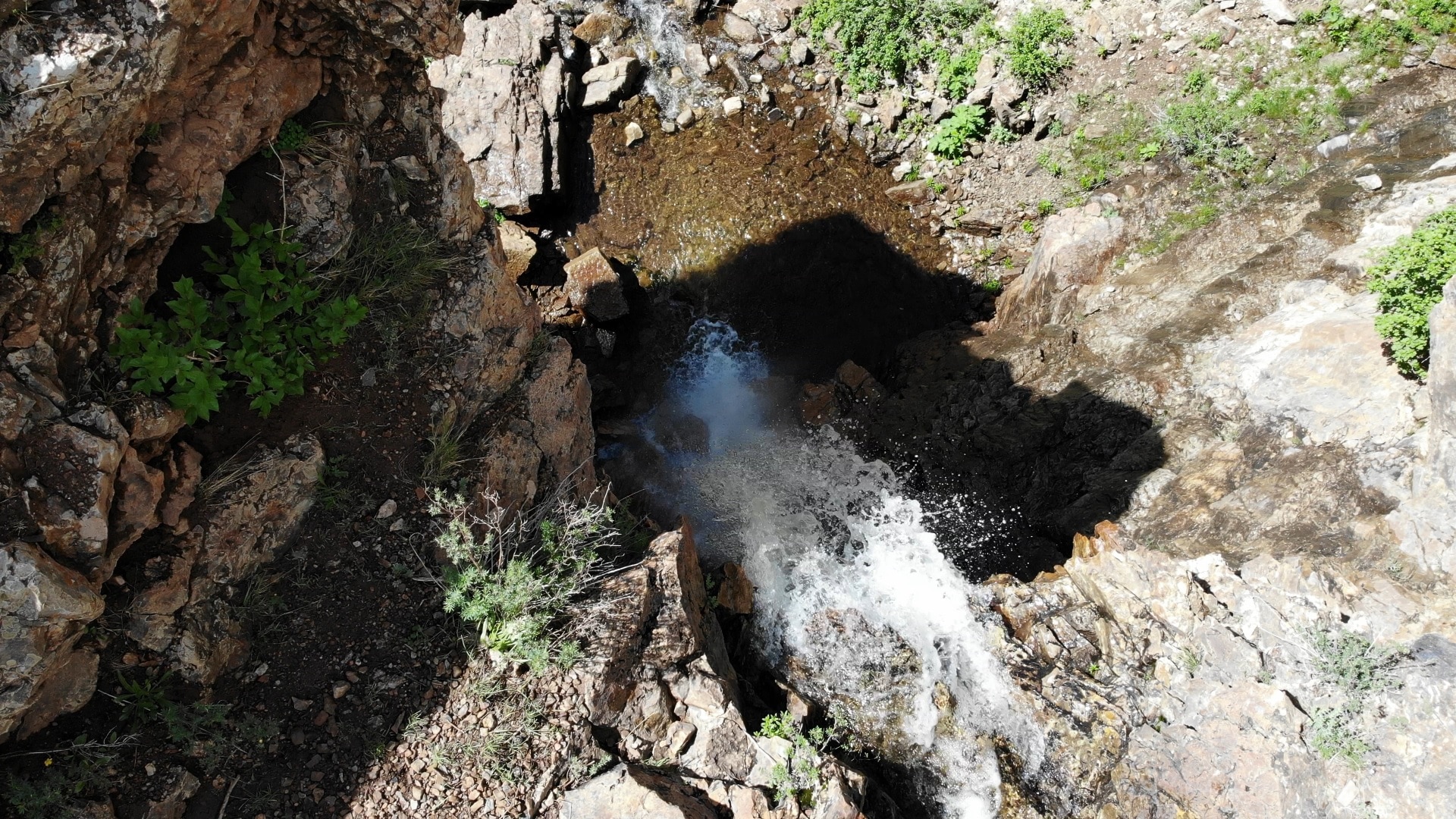
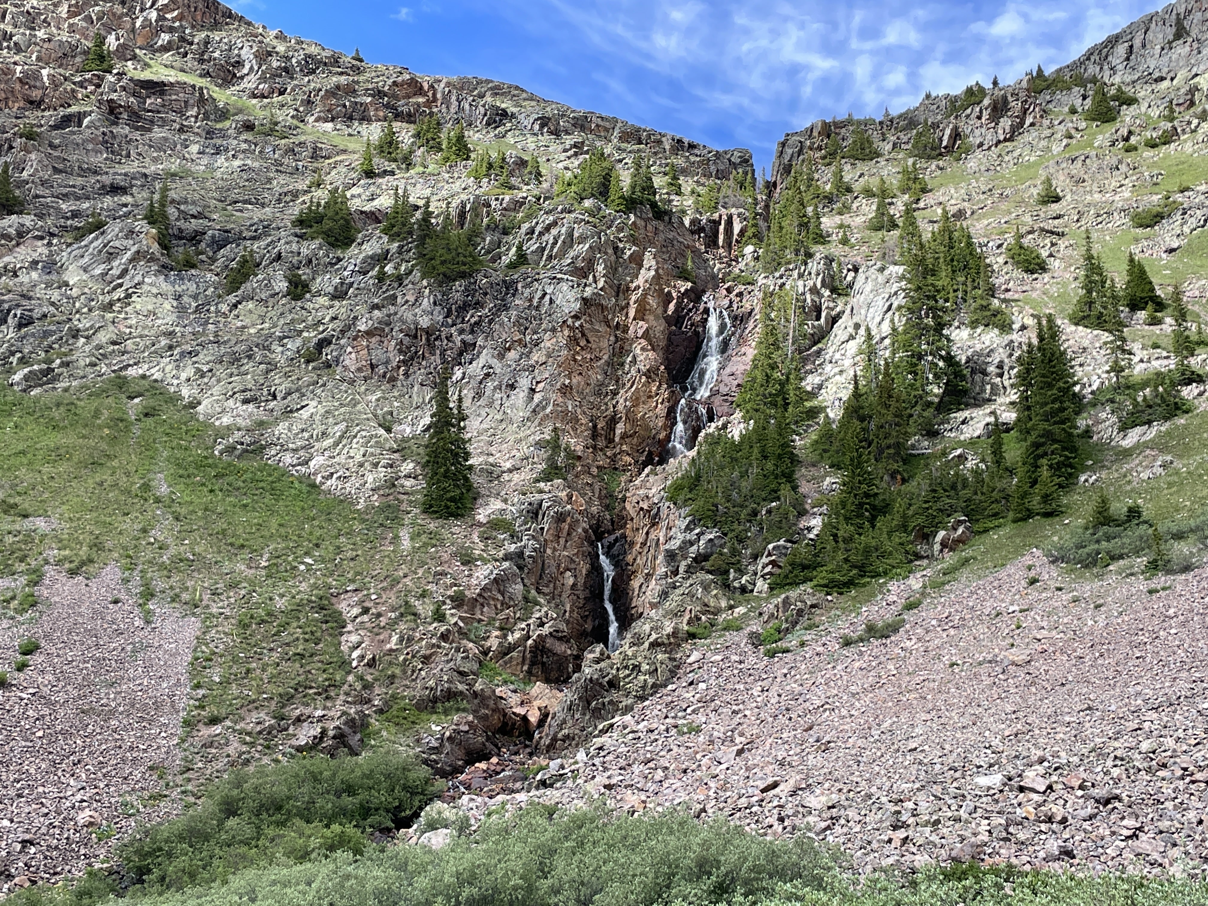
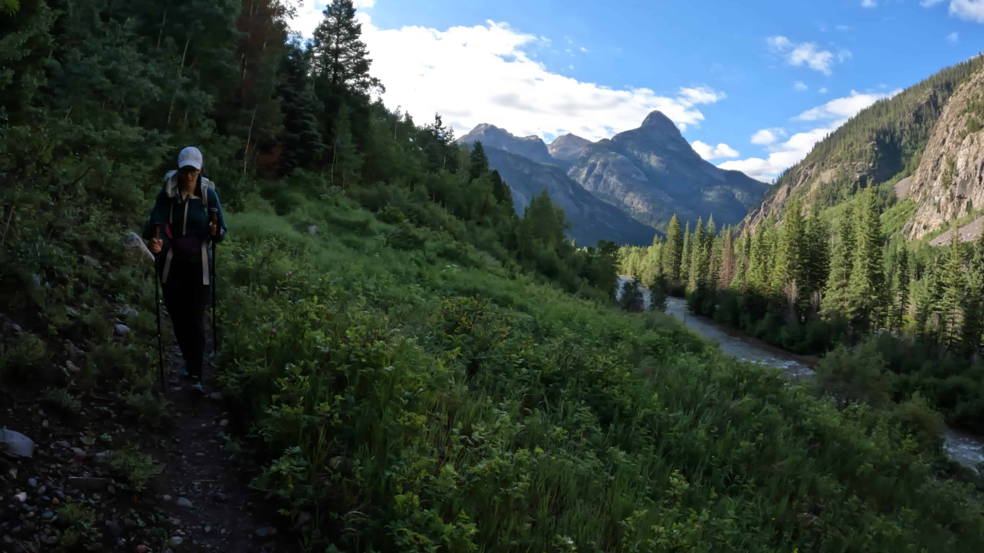
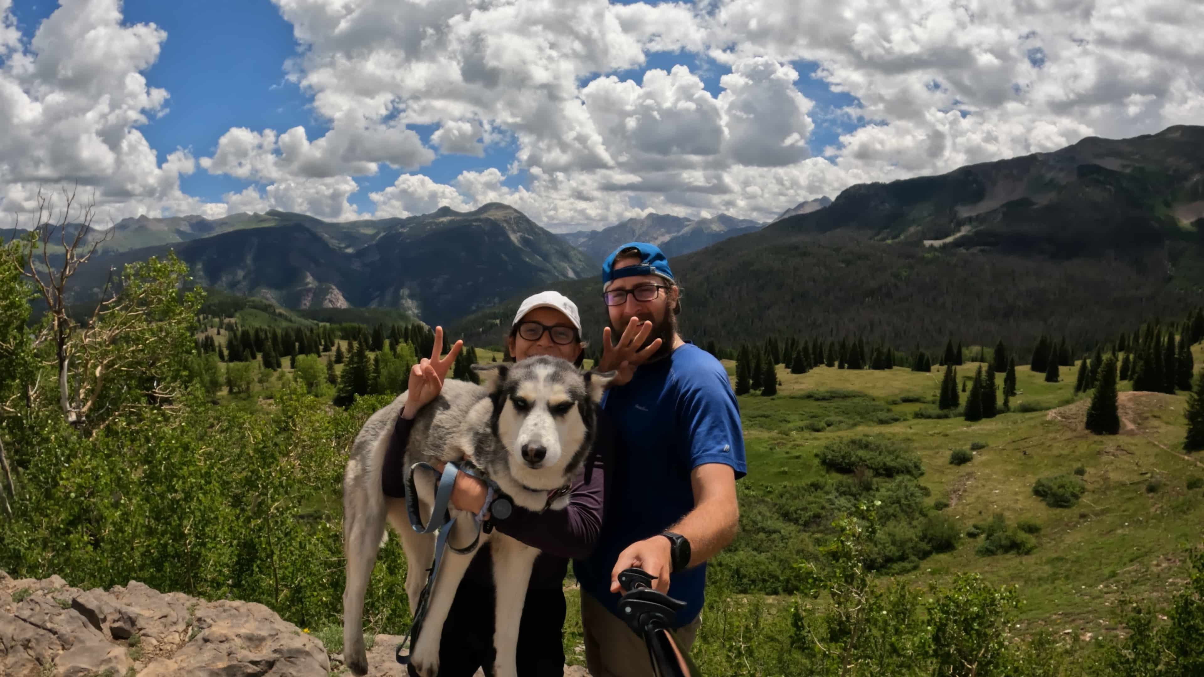
As we climbed back up to Molas Pass, we started encountering a lot of day hikers which was an odd sight after so much seclusion for the previous 3 days. The climb was tough but also rewarding with views of Mount Garfield and eventually a cool little waterfall located about 50 yards off the main trail. We reached our car around 10AM and cracked open a beer to reward our hard work over the past several days. Between CT Segments 22-24, we had hiked 54 miles and climbed 10,000ft. Aria was such a good girl and Jackie killed it for her first big backpacking trip in over a year. We drove up to the top of Molas Pass to take our usual end of the segment picture. Colorado Trail Segment 24 was in the books which left only 70 miles of hiking left and we would be done with the entire CT!

4 thoughts on “Colorado Trail Segment 24 Hike Guide”
I wanted to thank the two of you for putting together this amazing production of the CT, I’ve watched and re-watched most of it and it’s essential to my planning. I am planning to hike it solo in July. I worry about getting off trail, especially in this episode when the trail seems to disappear. Are you following cairns? Also, do you feel it’s safe to do the CT solo?
Hey Bob,
Glad the videos and posts have been helpful. Generally speaking, the trail is SUPER easy to follow and very well marked. Assuming you are carrying the mini guide with you produced by CTF and referenced in all of my posts, you will have no issues. In terms of safety, people are solo on the trail all the time so I would not be too concerned.
Hey I’m planning a Colorado trail trip with my buddies. We were planning on doing segment 22-24 but we don’t know where to park and also how to get back to our car once we finish the segments. Ik you’ve done this same portion and I was really hoping you could give me some insight. I’d greatly appreciate it!
Hey Andrew – I outline where we parked in both blog posts. Segment 22 is tough to do as a starting point so I would recommend starting at Segment 21 and ending at Segment 24.