Gladstone Peak Colorado 13er Hike Guide
Gladstone Peak is a Colorado 13er and centennial located in the San Juan Mountains. This Southern Colorado peak involves a long ridge scramble which requires careful route finding and lots of Class 3 and Class 4 climbing on loose rock. This Centennial is commonly approached by the Rock of Ages Saddle like neighboring 14er Wilson Peak.
Gladstone Peak Quick Facts
Virtual Trail Guide: Gladstone Peak
Hike Rating: Gladstone Peak ( 3/5 ★★★ Stars)
Distance: 10.75 Miles RT
Elevation Start: 10,350ft
Highest Point: 13,923ft
Total Elevation Gain: 3,650ft
Estimated Time to Complete: 8-10 Hours Total
Difficulty: Difficult Difficulty System Explained
Class: Class 4 (Easy to find more difficult scrambling) What does this mean?
Season: June – October (expect snow outside of this period)
Weather: Check the Weather Forecast
Directions to Gladstone Peak
Trailhead: Rock of Ages
Getting Here: From CO Highway 145 just outside of Telluride, CO take 60m/Silver Pick Rd. Continue on this road for 4.1 miles until you reach 622 Road which will turn right after 1.6 miles. Around this point, the road will turn rougher but should still be passable for most AWD and even some passenger vehicles. Turn right to stay on 622 Road after .7 miles. The road will split one more time and this is where the roughest driving occurs. For most AWD vehicles with okay clearance, you should be fine getting to the TH. The road ends at the Rock of Ages TH. Generally speaking, the start of this hike does not require 4×4 unless you are traveling after a big rain or in the early season when it can get very muddy.
Parking: The parking lot for Gladstone peak is large and can fit between 20-30 cars. As of 2024 there is a porta-potty at the trailhead as well.
Fees: None as of 2024
Summary
Camping: The approach to Rock of Ages trailhead is littered with private land but there are a handful of spots (both signed and not signed) that are suitable for a few nights of car camping. Although camping is not technically allowed at the TH itself, it would be quite easy to spend a night in your car here since the lot is fairly flat. Once on the trail, camping becomes much more limited as there is private land almost all the way up to the Rock of Ages saddle. If you want to backpack in, I would recommend the Navajo Lakes approach instead.
Dogs: There is no planet where I would recommend bringing a dog up Gladstone Peak.
Make it a Loop: If you want more hiking in the same area you can consider the El Diente to Mt Wilson traverse or, more straightforward, adding on Wilson Peak.
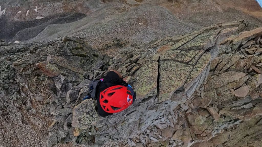
Trail X Factors: Loose Trail and Loose Rocks
For most of the approach up to the Rock of Ages trailhead, the actual trail is solid and easy to follow. However, after leaving the mining road behind, there are several social trails to follow up to the saddle and some are not correct. I would recommend having a .gpx to follow to just make your life a little easier.
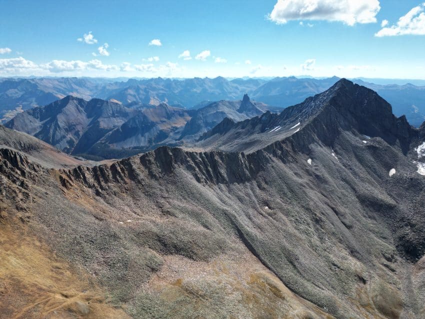
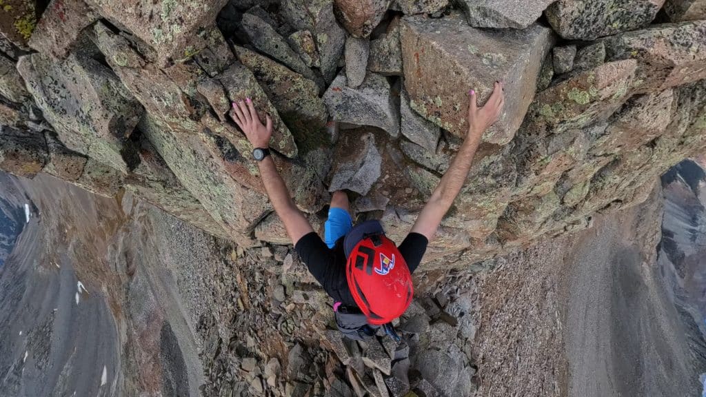
Once on the saddle, the real challenge of the day begins: every.single.thing. Is loose. Do NOT trust any rock, even the larger ones. The ridge itself has a variety of trash rock and slightly okay rock. Give yourself plenty of time to get up to Gladstone and back.
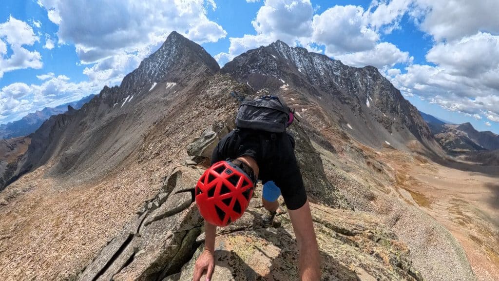
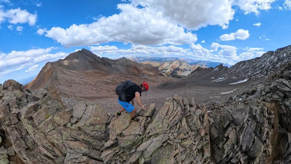
Hike Tip(s): I touch on this in the video guide a lot but once you get on the ridge of Gladstone Peak, I HIGHLY recommend staying as direct to the ridge as possible. With the exception of the first tower(s), after that you should try to stay on top of the ridge the entire time. This is for a few reasons: 1. The rock quality is much better. 2. You are far less likely to have rocks fall on you and 3. It requires a lot less route finding. This entire route goes with the exception of a few very obvious spots. I did not follow my own advice for some of the way up and I highly regret it.
Best Views: The route up Rock of Ages is a mixed bag of great views and monotonous mining claims. However, once on the ridge of Gladstone Peak, the scenery is stunning and only gets better with each step. You likely won’t be looking up too much as you will be focused on the loose rock all over the ridge.
Gladstone Peak Hike Route
*Watch died a little bit from the end
Gear Needed
- 14er Day Hike Packing List
- Men’s Trail Runners
- Women’s Trail Runners
- La Sportiva Trango Hiking Boots (Men’s)
- La Sportiva Trango Hiking Boots (Women’s)
- La Sportiva Cyklone
- Backpack (Winter)
- Backpack (Summer)
- Running Vest Black
- Helmet
- Food & Water
- Optional: Garmin inReach
- Optional: Hiking Poles – 120CM
- Optional: Headlamp
- Optional: Garmin Fenix Watch
- Optional: GoPro, Joby Tripod, Selfie Stick, GoPro 360, Drone, Insta360
- *Links included in this description might be affiliate links. If you purchase a product or service with the links that I provide I may receive a small commission. There is no additional charge to you.