Wilson Peak 14er Hike Trail Guide
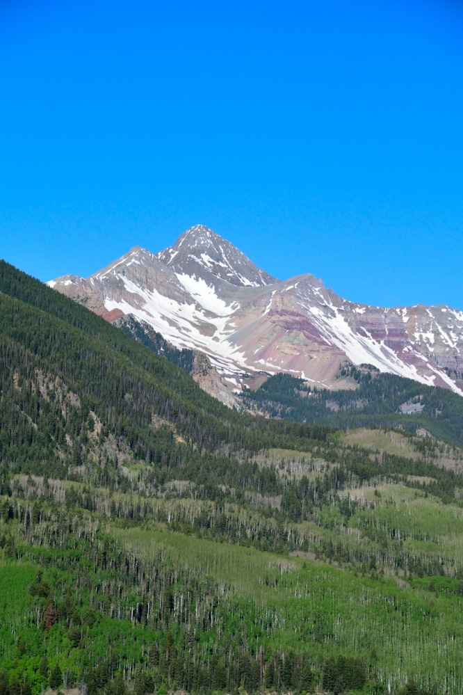
Wilson Peak is a 14er located in the San Juan mountains of southern Colorado. Most people will recognize the northern side of the mountain from the famous Coors Light can. The hike is long and consists of variable Class 3 conditions with the crux being a short and steep Class 3 scramble to the summit. Wilson Peak is a beautiful hike, but one that doesn’t have the best trail conditions as the trail consists of loose gravel, rocks and boulders.
Wilson Peak Quick Facts
Virtual Trail Guide: Wilson Peak
Wilson Peak Rating: ★★★★ (4/5 Stars)
Distance: 16 Miles RT (9 Miles RT to Navajo Lake, 7 Miles RT to Summit)
Elevation Start: 9,500 ft
Highest Point: 14,017 ft
Total Elevation Gain: 5,200 ft
Estimated Time to Complete: 14-16 Hours RT
Difficulty: Strenuous What does this mean?
Class: Class 3
Season: June – September (Expect snow outside of this period)
Directions to Wilson Peak
Trailhead: Navajo Basin
Getting Here: From Telluride, drive south on Colorado 145 to Lizard Head Pass. Continue south for 5.2 miles and turn right onto Forest Road (FR) 535. Drive 4.1 miles on the 2WD dirt road to a large meadow and junction. Stay straight on 535, pass the Kilpacker trailhead at 5 miles and continue another 2 miles (7 total from CO 145) to reach the Navajo Lake trailhead entrance on the right. You can enter Navajo Lake trailhead into your favorite navigational device, but don’t expect much service once you get onto FR 535.
Fees: None
Parking: There is a small lot at the trailhead that can fit about 10-20 cars. There are no bathrooms at any point along the hike to Wilson Peak.
Summary
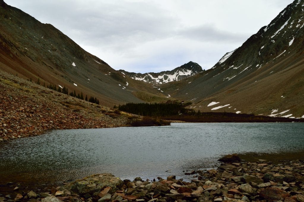
Camping: By far the most popular area to camp at Wilson Peak is along Navajo Lake. There are numerous camping spots, most of which are across the creek on the south side of the lake. If you do not want to hike in, there are dispersed camping areas near the trailhead and along FR 535.
Dogs: From a hiking perspective, Wilson Peak is dog friendly, but I don’t recommend bringing your furry friend along. The terrain along the saddle and ridgeline consists of lots of loose gravel and rock. To protect your dog and other hikers, I would leave your pet at home for this one.
Make it a Loop: Although there are numerous ways to approach Wilson Peak (Navajo Lake, Woods Lake, Kilpacker and Rock of Ages), they are all out and back hikes. It is common to extend your trip to Wilson Peak by adding El Diente and Mt Wilson. If you want to do some additional hiking around Wilson Peak, Navajo Lake is a great basecamp for your adventures.
Trail X Factors: Trail Conditions
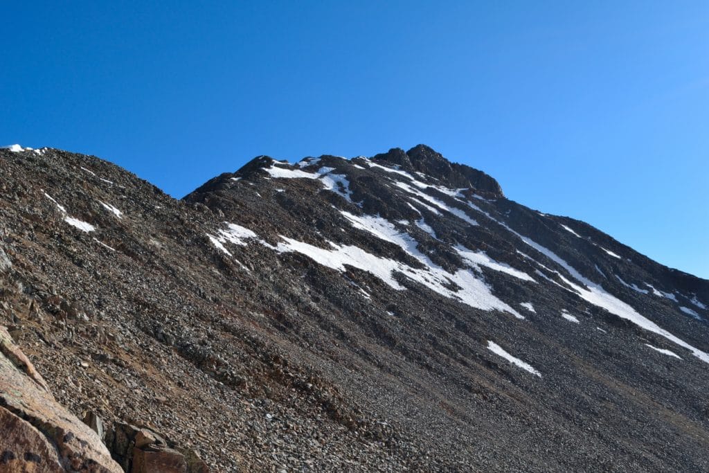
The hike to Wilson Peak is fairly miserable once you gain the Rock of Ages Saddle. Trail conditions include gravel, sand and loose rocks of all sizes. Be sure to test every single hand and foot hold as rocks of all sizes can come loose. If you are hiking around others, be sure to have your helmet on and pay attention to rock fall from above.
Hike Tip(s): Once you have gained the Rock of Ages Saddle, you will see a number of false trails to gain the final ridge of Wilson Peak. In reality, you want to work to the south side of the ridge and not straight up like some trails would let you believe. If you hike straight up the ridge, you will run into lots of loose rocks and dangerous trail conditions. You have a high change of “cliffing out” aka running into a cliff that can’t be hiked around. I would advise you to stay high for a bit, then head east (right) to gain the little dirt spot before the final ridge line push.
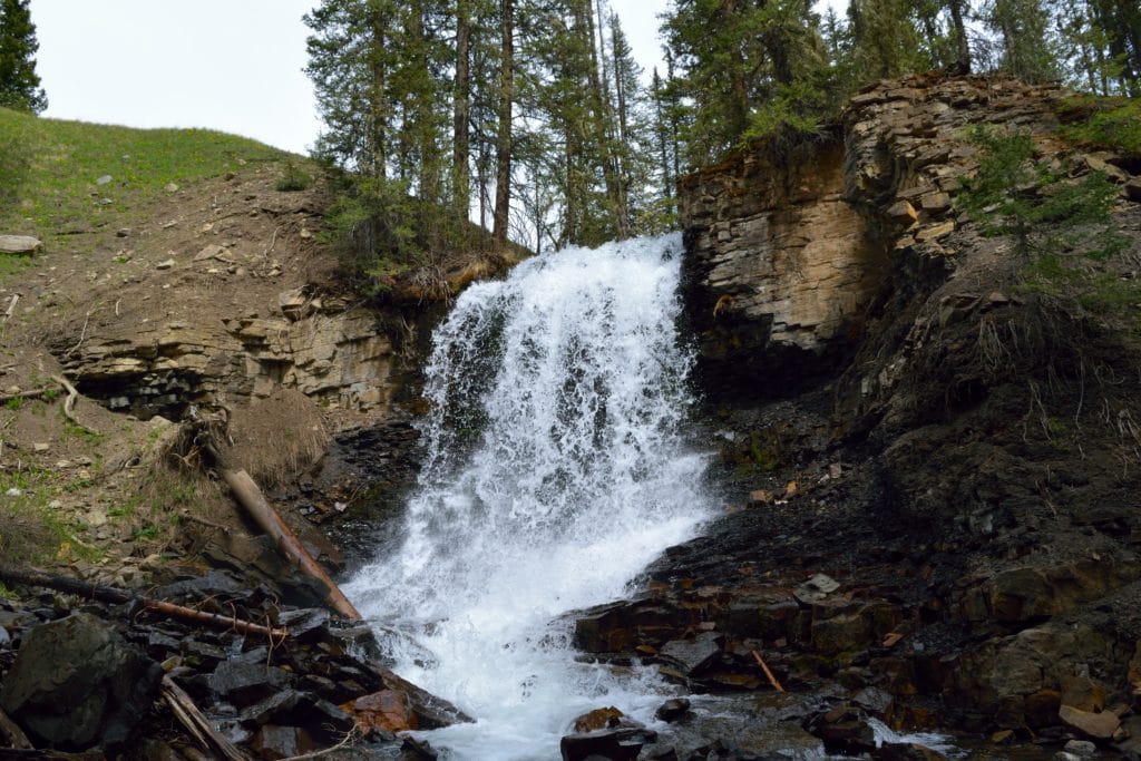
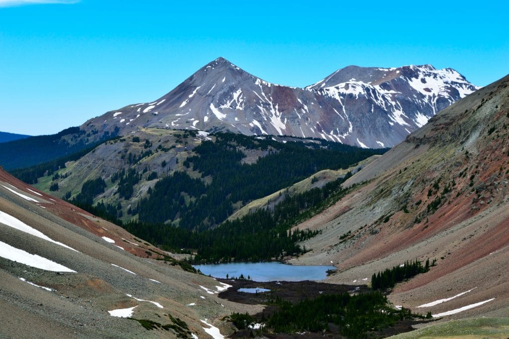
Best Views: The best views of Wilson Peak are on the summit and hiking back to Navajo Lake. Although summit views on Wilson Peak aren’t as secluded as other mountains in the San Juans, they are still beautiful. On the way down, it is awesome to see how the snow melt in the basin have kept plant life around the lake alive. In addition to the lake, be sure to stop at the massive waterfall (in the spring) which is accessed by a quick side trail about 1 mile into the hike up Wilson Peak.
Wilson Peak Trail Route
Shows the Navajo Lake approach and does not track the hike out as my watch died.
Gear Needed
- 14er Day Hike Packing List
- Men’s Trail Runners
- Women’s Trail Runners
- La Sportiva Trango Hiking Boots (Men’s)
- La Sportiva Trango Hiking Booths (Women’s)
- Backpack
- Food & Water
- Optional: Garmin inReach
- Optional: Hiking Poles
- Optional: Headlamp
- Optional: Garmin Fenix Watch
- Optional: Camera and Lens
- Optional: GoPro, Joby Tripod
- *Links included in this description might be affiliate links. If you purchase a product or service with the links that I provide I may receive a small commission. There is no additional charge to you.
My Trip to Wilson Peak: May 2018
Day 1
Sometimes, things don’t go as planned, especially when your plans involve mother nature. Memorial Day weekend 2018 seemed like the perfect time to make the 6.5 hour drive down to the Wilson Group to try and hike Wilson Peak, El Diente and Mt Wilson. The San Juans had an extremely low snow year, which left the mountains bare of snow at the end of May; something extremely rare for Colorado.
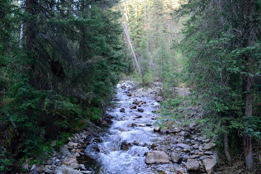
I arrived to the Navajo Lake trailhead around 7PM and had plans to hike up to Navajo Lake that night, where I would make a base camp for a couple of days. Day 1 plan was to hike Wilson Peak and on the second day I would hike the El Diente traverse. Light was fading and I knew I only had a couple of hours to hike before nightfall would arrive. I strapped on my bag and hit the dirt trail. For the first couple of miles, I hiked through patches of lush forest and into a variety of fields. I encountered several animals eating dinner who didn’t appreciate my presence in their peaceful wilderness.
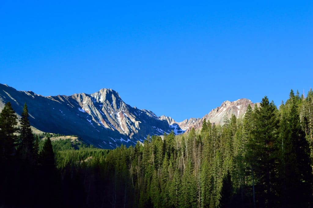
After about 2 miles of hiking, I got my first views of El Diente Peak. The south side was bone dry with only a few patches of snow. I grew hopeful that condition reports from previous weeks had changed, making the traverse much more doable. After re-entering the forest, I exited yet again facing a series of steep switchbacks. It was 8:30 and the sun was fading and quickly. The switchbacks were extremely steep and a real nuisance on my sore legs. I trudged up the slopes, gaining the final switchback around 9PM. Light was almost entirely gone in the sky, so I popped on my headlamp and descended the small hill towards Navajo Lake. I arrived to the lake about 15-20 minutes later.
I knew that campsites were mostly on the south side of the lake, but the raging stream made crossing the cold water impossible to do. I noticed another tent on a small overlook across the stream, so knew there had to be a suitable way across. After a couple minutes of searching, I found a large downed tree which allowed me to cross the creek and located a suitable campsite minutes later. I quickly set-up my tent, hung my food in a tree to avoid animals being attracted to my tent and got into my sleeping bag. After a long day of triathlon training, driving and hiking, my body was physically and mentally exhausted. I set my alarm for 3:30AM, did one last round of research on the trail to Wilson Peak and passed out.
Day 2
I awoke to the chirping of my watch and wanted nothing to do with getting out of my warm sleeping bag. I snoozed the alarm by 30 minutes and went back to “sleep”. When I got up the second time, I somehow felt more rested and was ready to tackle Wilson Peak, my 46th 14er. It was windy and cold outside, so I layered up like it was winter even though the calendar read May 26th. I hit the trail around 4:30AM and started my around Navajo Lake and up to Navajo Basin, which sits on the east side of Wilson Peak. I was hoping for better stars, but they were just okay, nothing like what I had seen on Snowmass Mountain a few weeks before.
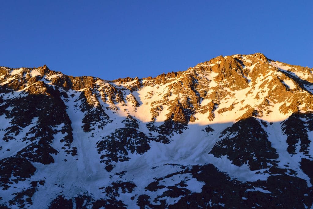
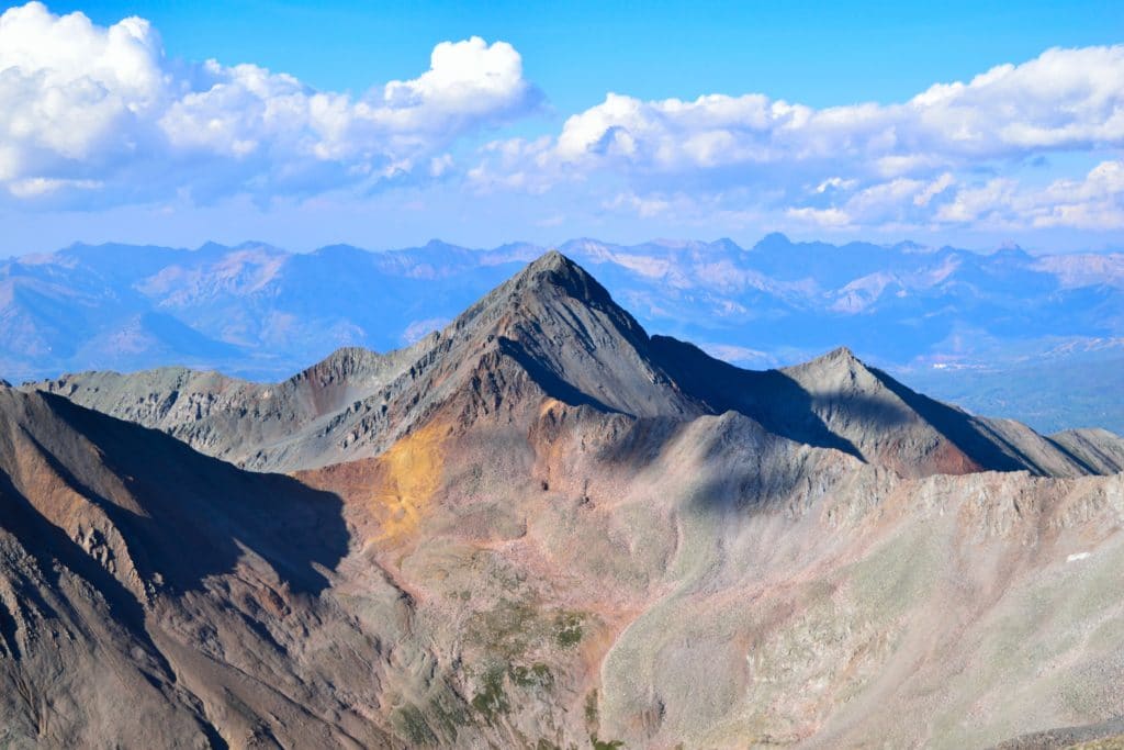
The trail slowly wound out of the valley and up towards the massive Navajo Basin. When I arrived to the basin, the sun was just starting to kiss the tops of El Diente and Mt Wilson to the east. It was at this time, I got my first views of my day 2 plans. The snow looked great for hiking, but I noticed a snowy area towards the summit of El Diente, I knew that I had to cross a shelf that was not wider than 20 feet and it was covered, in what looked like, fresh snow. I immediately began to worry about my chances of crossing the shelf with just microspikes (instead of crampons). I continued my way up out of Navajo Basin and towards the Rock of Ages Saddle (west side of Wilson Peak). I encountered several patches of snow which I easily grazed over since the snow had firmed up over night.
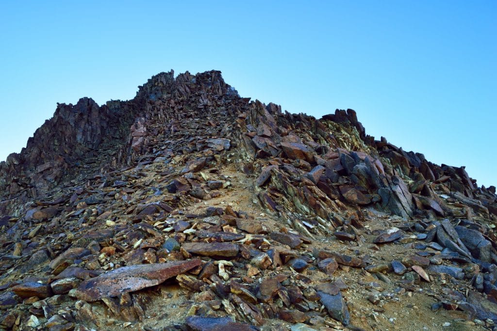
As I worked up towards the saddle of Wilson Peak, my thoughts could not stray away from El Diente Peak. If that section was still covered in snow, how would the class 4 move on Mt Wilson be? Was I going to be able to do this? I was so concentrated on my future plans, that I started to take my current hike for granted. It’s as if mother nature heard my thoughts because when I finally did gain the saddle, the winds slapped me right in the face, causing me to lose my balance several times. I continued up the ridge, following what I thought was the “trail”. After about 10 minutes of hiking, I knew that something was wrong, I was already above 13,000 feet, but on the wrong side of the ridge. I tried to work towards the south side but ran into several steep cliffs. Neat. Looked like I had followed the wrong path and was now off trail. I eventually found the spot I needed to go and slowly worked down and across the steep, loose rock to regain the trail.
Near the south side of Wilson Peak, I encountered a fox who had no idea I was there for a few seconds. When it did finally see me, it reacted like “what the hell are you doing here?!” and ran into cover. I could now see the first views of the true summit of Wilson Peak, only about a ½ mile away but I still had several tough sections of hiking to go. I worked across some steep class 3 sections, snow fields and loose gravel to finally gain the true ridge of Wilson Peak. I could see the false summit and knew that I was getting close.
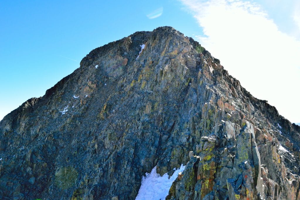
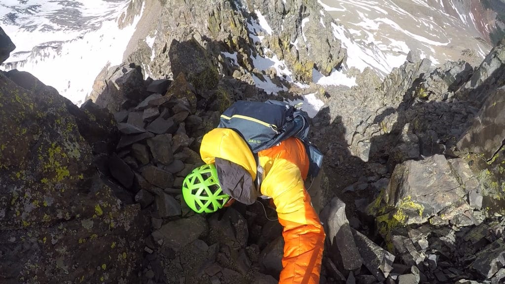
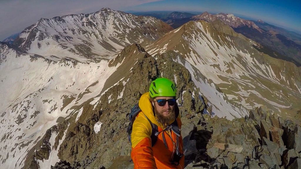
A few minutes of hiking later, I could see the final stretch towards the summit: a steep descent followed by a steep ascent of Class 3 conditions to reach the top of Wilson Peak. The problem was that the colouirs near the summit still held snow. This made for some hair raising traverses across steep sections of variable conditions. I didn’t trust my microspikes along to hold me and the handholds were still covered with snow. I tried to stay on the ridge, which was a horrible idea. Eventually, I made my way across the steep sections to the final section of Class 3 rock. A couple of minutes of scrambling later, I was on the summit of Wilson Peak!
I called Jackie to let her know I was safe and that Wilson Peak, a hike I had drastically underrated, was actually fairly difficult, especially due to conditions. I had already made a decision about my original day 2 plans, but telling them to her, out loud, made them so much more real. I decided to bail on the El Diente traverse, I just didn’t want to put my life in the hands of some tiny steel microspikes when crampons were needed. I was so bummed out, frustrated and disappointed, but knew that battling mother nature was not a smart fight. The old saying “the mountains aren’t going anywhere” is my least favorite to hear, but is in fact accurate.
My time on the summit was limited because I knew the snow was going to warm-up fast and postholing was going to be in my immediate future if I didn’t descend quickly. The hike back to the lake was slow, tedious and annoying but I eventually did reach the lake around 2PM that afternoon. I packed up my tent and hiked out, stopping at a large waterfall I had passed the day before, but didn’t have time to check out. Plan B for the weekend involved several smaller hikes in the area and a trip to Telluride Brewing (spoiler: not that great).
Overall, my trip to Wilson Peak was disappointing, but still had some memorable moments. It was not my favorite hike due to poor trail conditions and extremely variable terrain. If you plan on hiking Wilson Peak, hiking in the late spring or early summer may be a good idea to avoid some of the steep gravel and loose rocks that plague the trail to the summit.