Keller Mountain Colorado Hike Guide
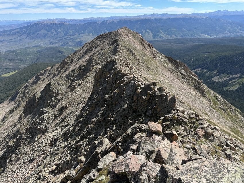
Keller Mountain is a 13er located in the Gore Range of Central Colorado. This relatively unpopular summit has a few ways to get to the top but the most enjoyable is the East Ridge. This Class 3 scramble mixes in a bit of everything: bushwhacking, ridge scrambling, ascending through scree fields and even some runnable singletrack trail.
Keller Mountain Quick Facts
Hike Rating: Keller Mountain Falls ( ⅗ ★★★ Stars)
Distance: 9.75 Miles RT
Elevation Start: 9,500ft
Highest Point: 13,080ft
Total Elevation Gain: 4,100ft
Estimated Time to Complete: 6-8 Hours Total
Difficulty: Moderate to Difficult Difficulty System Explained
Class: Class 3+ (Easy to find more difficult scrambling) What does this mean?
Season: June – October (expect snow outside of this period)
Weather: Check the Weather Forecast
Directions to Keller Mountain
Trailhead: Rock Creek
Getting Here: From Silverthorne, CO take CO9 North for 7.5 miles until you reach County Road 1350. Continue on this road for 1.3 miles until you reach CO 1350 again on your right. From here the road gets a little more rough but should be passable with most AWD vehicles and passenger cars with decent clearance. The road ends at the trailhead after another 1.6 miles. This drive SHOULD be passable without 4×4 but may require high clearance depending on the condition of the road. There are several spots to park lower along the road if you need to.
Parking: There is a large parking lot at the Rock Creek trailhead that can fit 20-25 cars. Although this lot does serve as the starting point to several other hikes, you should not typically run into a problem with a parking spot. There are no restrooms at this TH.
Fees: None as of 2024
Summary
Camping: Blue River Campground is an official spot to camp near Keller Mountain. However, there are also several options to disperse camp along the County road before the start of the hike.
Dogs: I would not recommend bringing a dog up Keller Mountain. The terrain is too rough and loose in my opinion.
Make it a Loop: This is an out and back hike but once you are on the summit of Keller, there are endless options to get deeper into the Gore Range.
Trail X Factors: Lack of Trail
Ascending the East ridge of Keller Mountain gives you two equally crapping options to get onto the ridge itself:
- Bushwack up steep slopes above Boss Mine
- Take a trail that is littered with downed trees
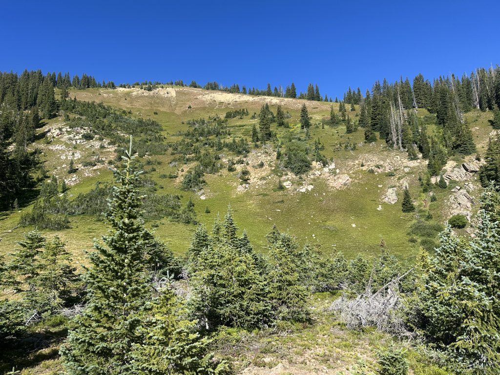
If you look at my GPX track below, you can see I tried both varieties of getting up and down this mountain. If I HAD to do it again, I would 100% choose the bushwhack up the steep slopes. This is a much shorter and direct route on very loose terrain in areas. However, it’s much better than the hundreds of downed trees on the other trail. In either case, be sure to have a route to follow or it could be very very easy to get lost.
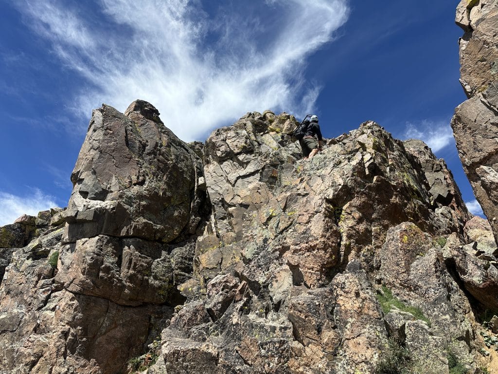
Hike Tip(s): Once on the East ridge of Keller Mountain, almost the entire ridge goes by staying directly on top of it. However, there is one section of scrambling, almost near the end of the ridge itself, that requires most hikers to get off the ridge to hikers left (South side) to avoid high Class 4 or even low Class 5 moves. There are several other sections of the ridge where it’s easy to avoid some of the Class 3 scrambles and reduce exposure but it’s not required to do so.
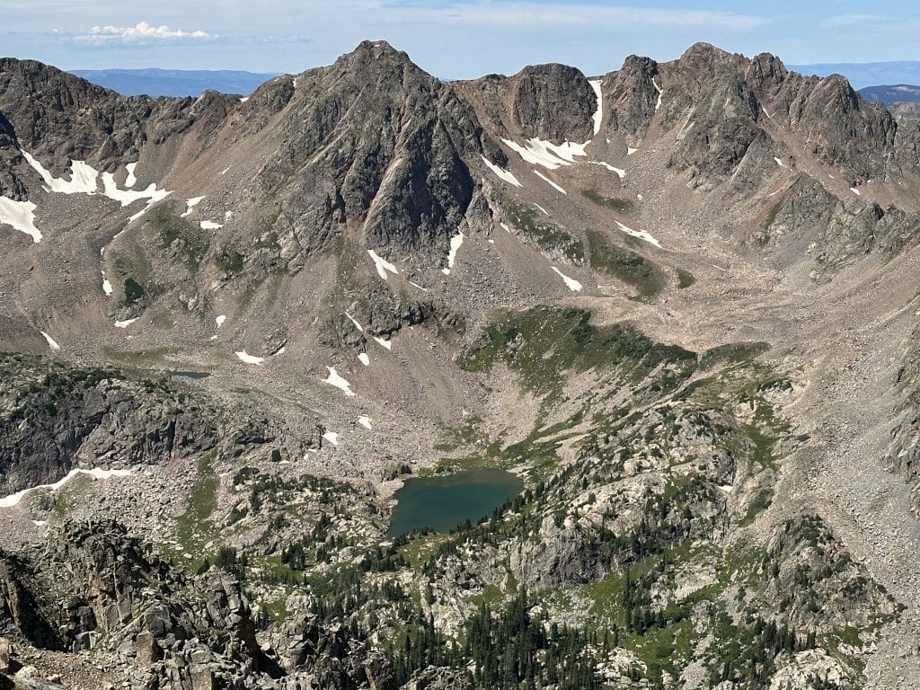
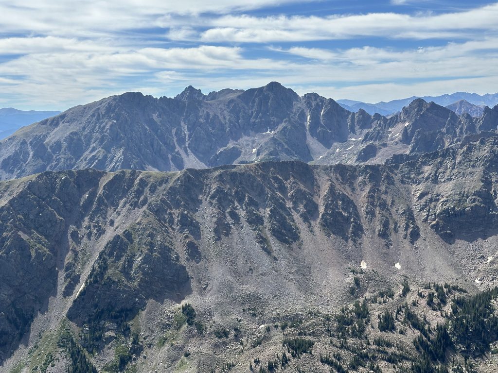
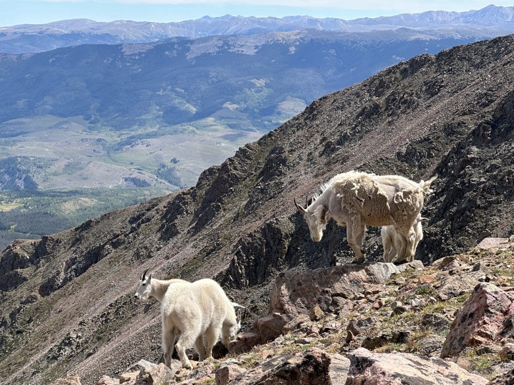
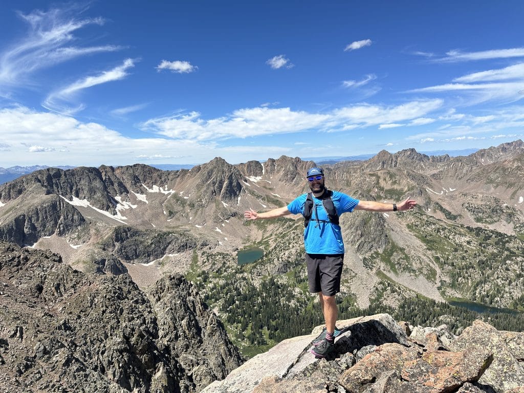
Best Views: Keller Mountain and the Gore Range in general has absolutely stunning views once you get above treeline. As you hike higher, the views open up in all directions and somehow, get even better. From the summit the views West are the best in my opinion.
Keller Mountain Hike Route
Up Boss Mine slopes, down old ATV trail
Gear Needed
- Men’s Trail Runners
- Women’s Trail Runners
- La Sportiva Trango Hiking Boots (Men’s)
- La Sportiva Trango Hiking Boots (Women’s)
- Backpack (Summer)
- Food & Water (Lots of water since there are very limited options to pump)
- Optional: Helmet
- Optional: Water Filter
- Optional: Garmin inReach
- Optional: Hiking Poles – 120CM
- Optional: Headlamp
- Optional: Garmin Fenix Watch
- Optional: GoPro, Joby Tripod, Selfie Stick, GoPro 360, Drone, Insta360
- *Links included in this description might be affiliate links. If you purchase a product or service with the links that I provide I may receive a small commission. There is no additional charge to you.