Kings Peak Utah Highest Peak Hike Trail Guide
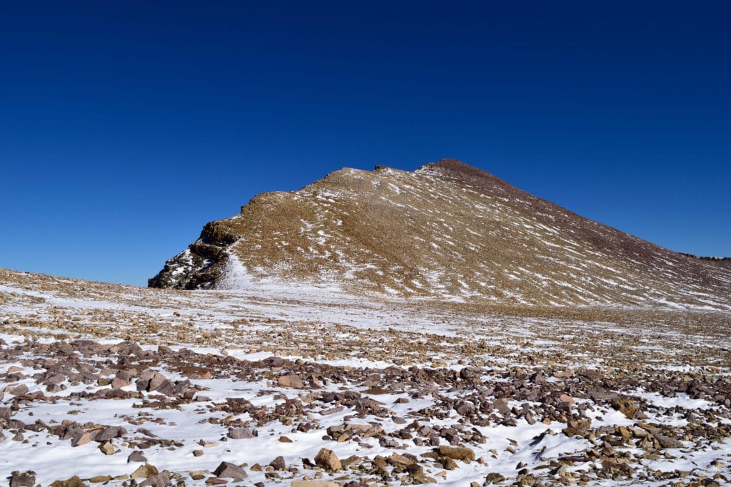
Kings Peak is the highest point in Utah at 13,528ft and is located in the remote Uintas Wilderness of Northeast Utah. The hike to the summit consists of a well established dirt trail with many variations to extend or shorten your trip along the way. The technical grade of this hike tops off at Class 2 with the option to go minor Class 3 in a few sections. Most people will extend this hike to 2 or 3 days but it is 100% doable in a long day hike or trail run.
Kings Peak Quick Facts
Virtual Trail Guide: Kings Peak
Kings Peak Canyon Rating: ★★★★★ (5/5 Stars)
Distance: 26 Miles via Shortcut (Variations to Hike Up to 30 Miles)
Elevation Start: 9,423ft
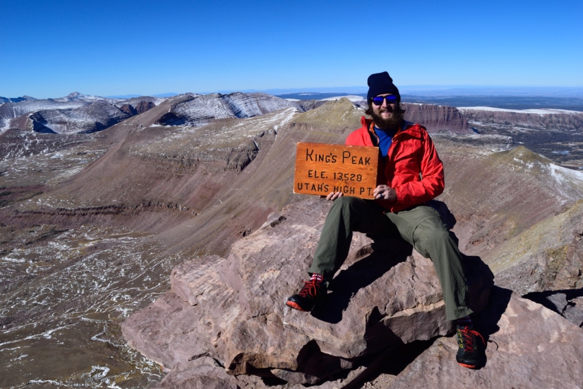
Highest Point: 13,528ft
Total Elevation Gain: 4,500 – 5000ft depending on hike
Estimated Time to Complete: Various – 12Hours to 3 Days
Difficulty: Difficult to Strenuous Difficulty System Explained
Class: Class 2+ What does this mean?
Season: Late June – Late October (expect snow outside of this period)
Weather: Check the Weather Forecast
Directions to Kings Peak
Trailhead: Henrys Fork
Getting Here: There are so many variations to get to the TH depending on where you are coming from. It’s easiest to just put Henry’s Fork into a GPS and follow it from your starting point. Note that all roads to the TH get a little bumpy but are typically fine in passenger cars. You will loose service once you get closer to the TH.
Fees: There is no fee to hike Kings Peak.
Parking: The main TH has plenty of parking, with the capacity to fit 20+ cars easily. Since this hike is so remote, you will typically not be battling those types of crowds unless you get unlucky. There is a non-plumbing restroom at the TH.
Summary
Camping: There are a ton of options to dispersed or car camp along the forest roads leading up to the TH. In addition, there is a campground (Henrys Fork) right at the TH that is a great option as well. Reservations are not required and camping is free. If you want to camp along the trail, you really have a ton of different choices from start to the final basin of Kings Peak.
Dogs: Kings Peak is a dog friendly hike for the most part. I am assuming that if you are considering bringing your dog on this hike, it has a lot of experience hiking and is in good shape. The final ridgeline has lots of loose rocks so be sure to tread carefully on this part. Bring lots of water as this is a VERY long day hike.
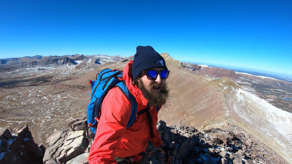
Make it a Loop: Most people will make this an out and back hike. However, you can add variations to make it more of a loop. Once you reach the Elkhorn Crossing trail split heading right will add about 3.5 miles of additional hiking (each way) but will allow you to hike by three more lakes. In addition, once you reach Gunsight Pass you can head straight for a more roundabout and less technical trail. This will add another couple miles (each way) to your hike. If you head right the hiking is more direct but involves more scrambling on loose terrain and without a trail.
Trail X Factors: Distance of Trail & Wind
When setting out to hike Kings Peak, you are presented with a difficult choice: take a VERY long day hike or carry extra weight/gear to make it a backpacking trip. Both have unique challenges along with their pros and cons. I love to push my body and for me, a day trip was the only logical option, even with snow. However, a 26+ mile day for some is unheard of or impossible, in which case you will need to stretch Kings Peak to 2 or 3 days.
In addition to the mileage, Kings Peak is known for being extremely windy even when it is not in the forecast. The trail works up several spots that are wind tunnels and since the mountain is so prominent, heavy winds are to be expected on this hike. There is nothing more demoralizing than hiking 13+ miles to have an insanely windy summit, but that is the nature of the mountains.
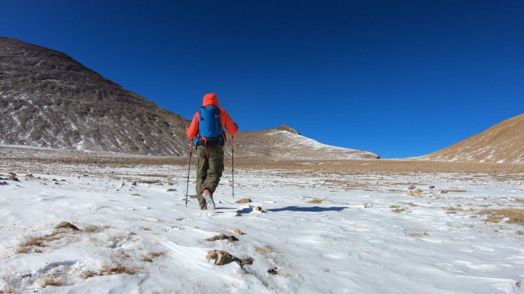
Hike Tip(s): Regardless of your plan to hike Kings Peak in a day or two+, bringing a water filter or UV pen is a great decision. I hiked Kings Peak in late October and there were still plenty of water sources along the way to top off my liquids. Carrying less water and a filter can save you some weight and allow you to hike more efficiently. In addition to fluids, I would HIGHLY recommend taking the “shortcut” option that I did for this hike. If you are okay in somewhat loose terrain and used to trail finding this is the only way to attempt Kings IMO.
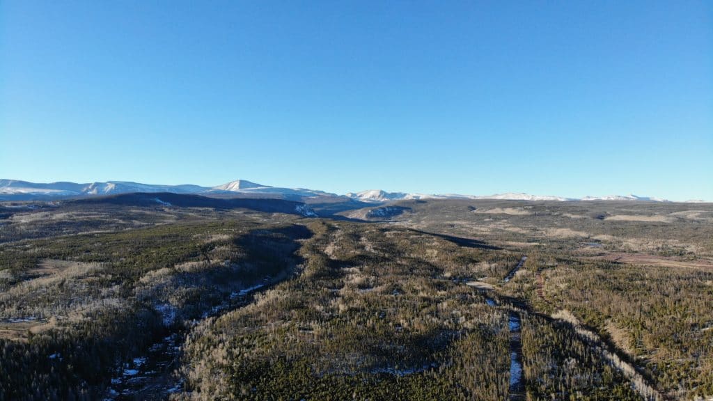
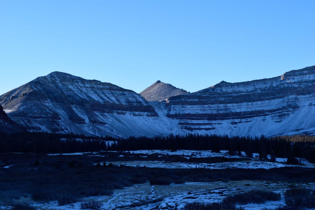
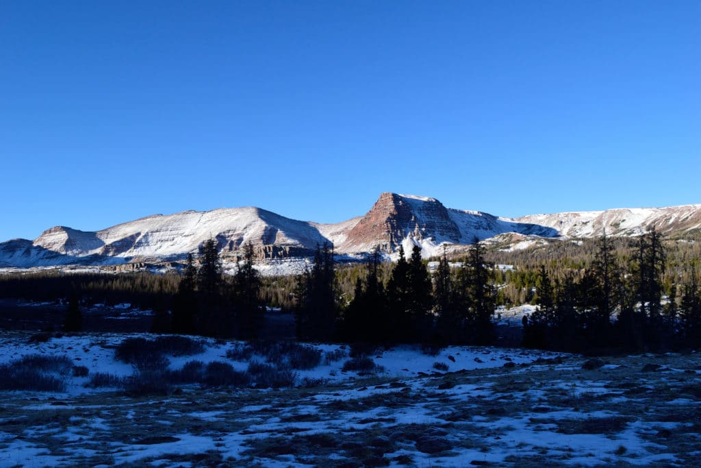
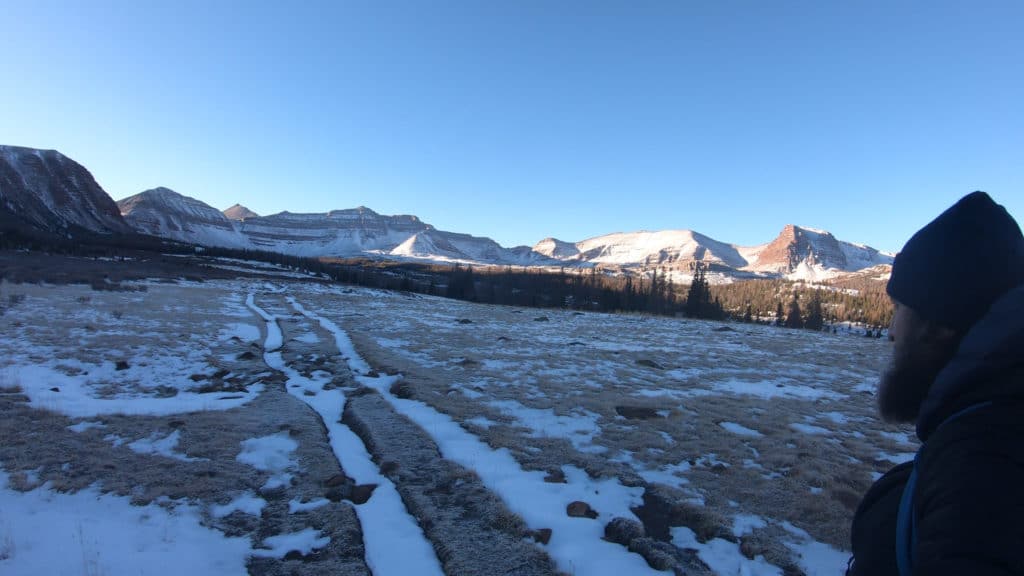
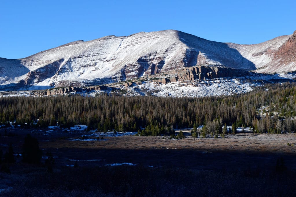
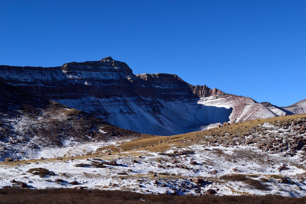
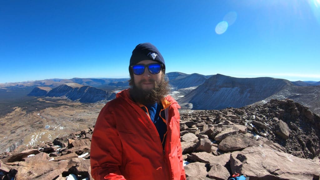
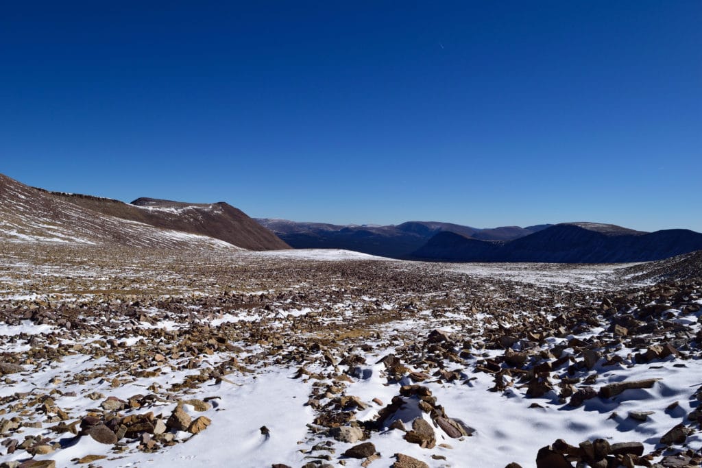
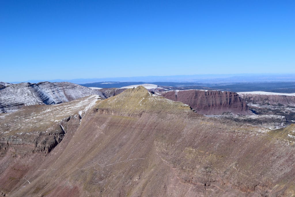
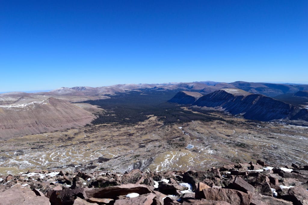
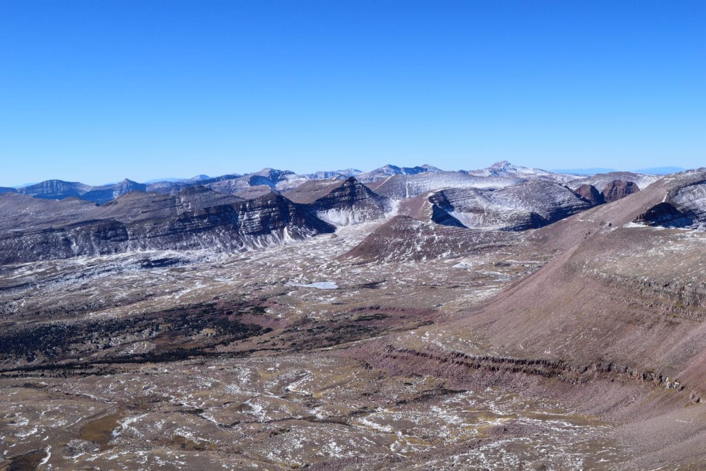
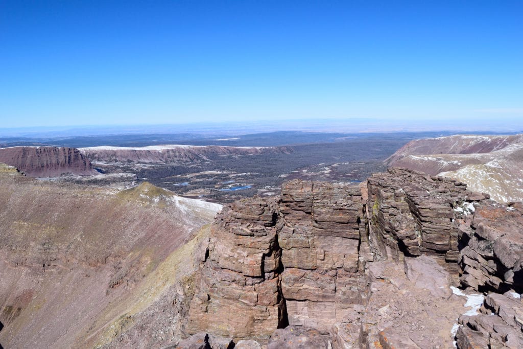
Best Views: Outside of the first 4-5 miles or so, Kings Peak is an absolutely gorgeous hike from start to finish. I was the only person for miles and miles (*in fact, no one had hiked the mountain in 5 days according to the trail registry) when I hiked Kings and it felt like I was in untouched land. The amount of wildlife was so abundant, I felt severely out of place the entire day. The beauty of the basin and wilderness area is hard to get jaded to after hours and hours of hiking. Even on my way out and 10+ hours hiking, I still stopped to soak it all in and appreciate the hike’s beauty.
Kings Peak Hike Route
Started at Henrys Fork, took direct route and “shortcut” to the right once above Gunsight Pass. Watched died before reaching back to TH.
Gear Needed
- Hiking Boots or Trail Runners
- Backpack
- Protection from Sun – almost entire hike is without shade
- LOTS of water – At least 2+ liters
- Optional: Map of area or GPS – I use the Garmin inReach
- Optional: Hiking Poles
- Optional: Headlamp
- Optional: Water Filter or UV Pen
- Optional: Camera
- *Links included in this description might be affiliate links. If you purchase a product or service with the links that I provide I may receive a small commission. There is no additional charge to you.
My Trip to Kings Peak: October 2020
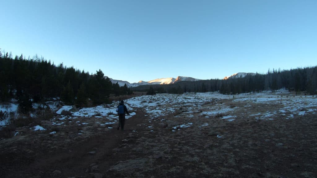
When your day starts and then ends in darkness, you know it’s going to be pretty epic. Kings Peak had been on my list for a while and the weather window finally presented me with an almost perfect day to make a long day hike out of it. After a night in Rock Springs, I arrived at the TH at 5:30AM. Alone, in pitch black darkness under a blanket of stars in the frigid fall air; that was how my hike started. It had snowed two days before and besides the scores of animals who had used the Henrys Fork trail, I was the only human to have step foot in this place for days.
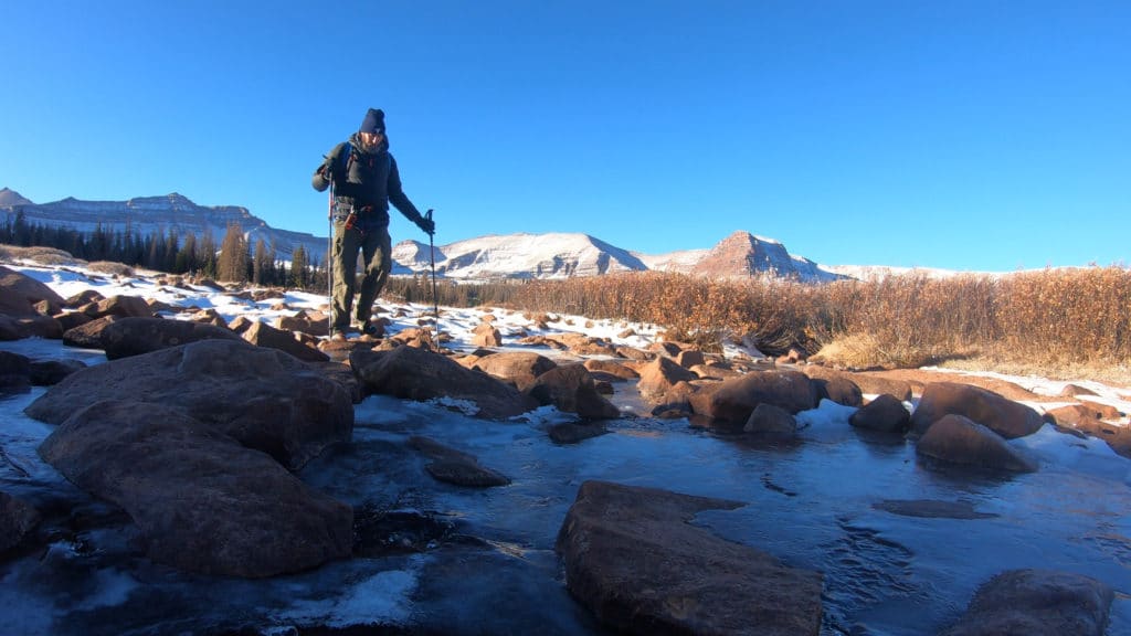
Hiking in the dark in an unknown place by yourself is never thrilling, especially when its mating season for elk, deer, moose and “bulking up” season for bears. Needless to say, I was thrilled to have the sun rise about 5 miles into my hike. I made quick work of the miles in the woods and emerged in the MASSIVE basin to the north of Kings Peak as the sun started its journey across the sky. I spotted two bull moose hundreds of yards away. “Good,” I thought “stay over there.”
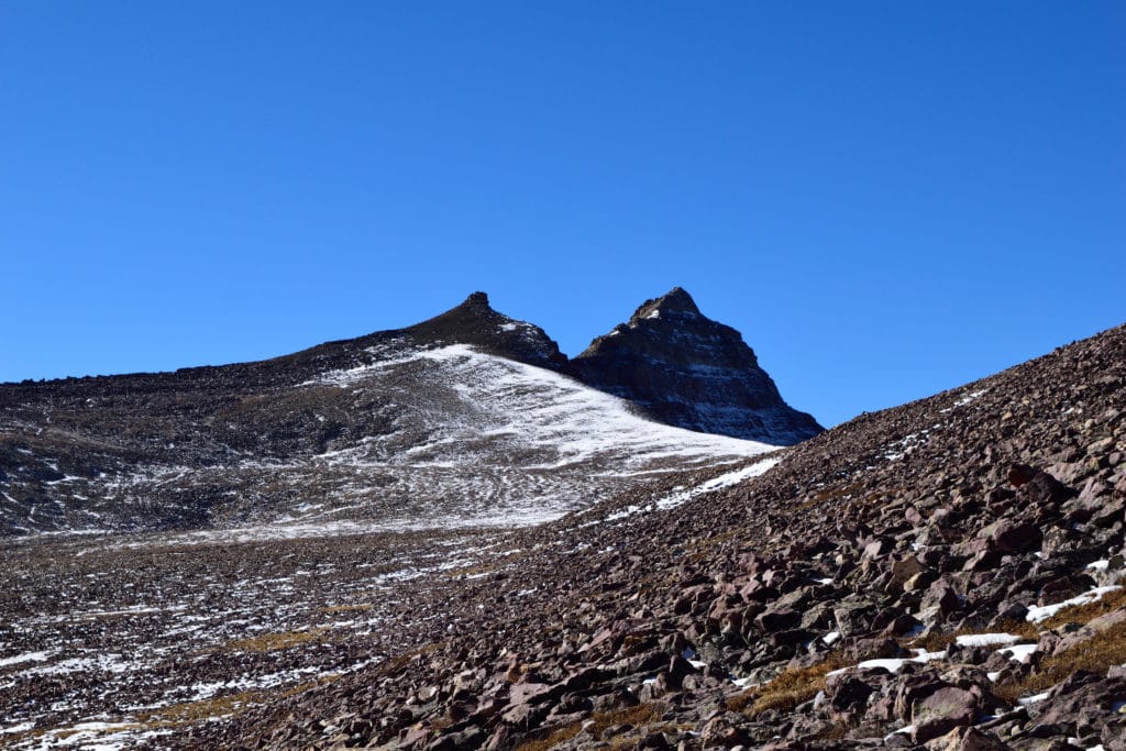
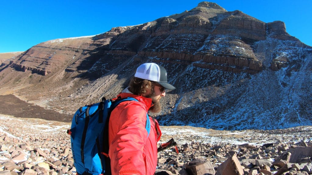
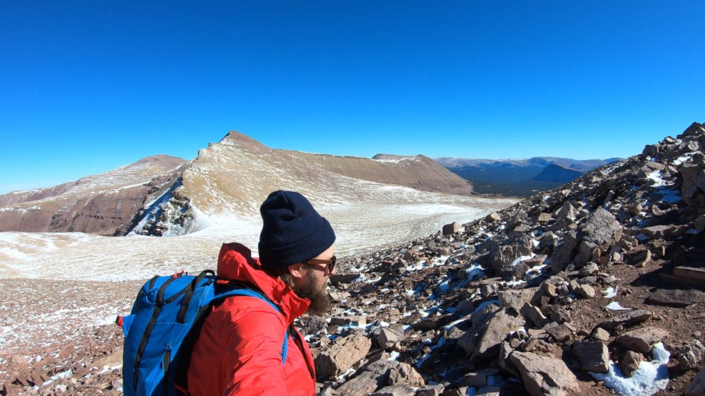
The hike up to Anderson Pass was when the snow I had been hiking through for the first 7 miles started to become problematic. Before this point I was able to avoid almost all the snow and it remained crispy in the frigid overnight temperatures. As I summited Anderson Pass, I thought that trail runners without gaiters were probably a terrible choice. My feet soaked, I continued on.
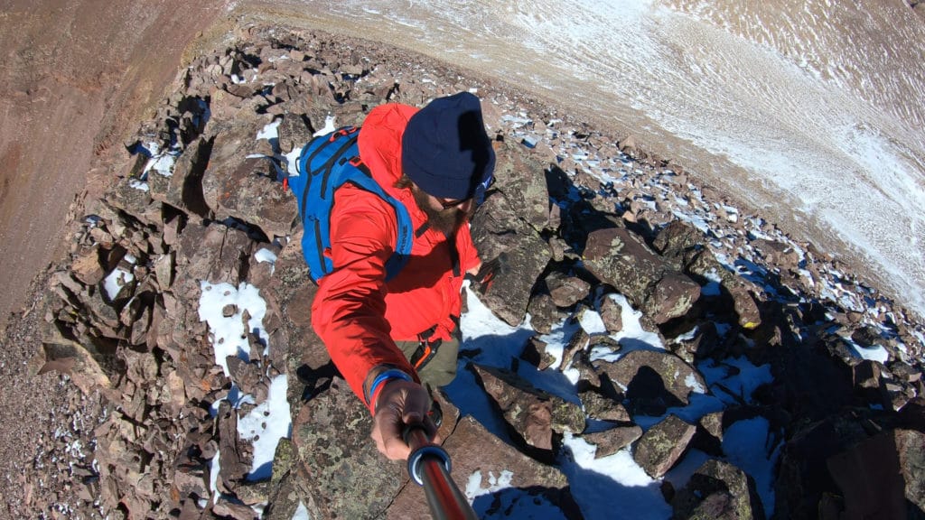
I decided to take the “shortcut” route and headed directly over to Kings instead of taking the roundabout trail. This was the best choice I made all day. I reconnected with the standard trail and headed up to Anderson Pass. My arrival here scared the crap out of 4 mountain goats who were having their lunch. The remaining hike to the summit was full of loose, frost and snow covered rock that had been protected by the sun’s strong rays.
The summit was beautiful, peaceful and windless. A perfect combination. My hike back to the car was LONG and each step in my waterlogged shoes reminded me that I was indeed an idiot for thinking that snow + trail runners was a good combination. Demoralized after realizing I still had a mile to go, I yelled out a big “FUCK!!!” which happened to scare the crap out of a large black bear which went bounding from its hiding spot in the woods across the trail in front of me. I was so tired that I didn’t even care if the bear ended my life but made my presence very vocal for the rest of the hike.
I reached the car after 14 hours and back in the dark again. I popped up my tent in the nearby campground, shoveled down some leftover “food” and passed out. What an amazing day.

Kings Peak Virtual Trail Guide
Questions or comments about this hike? Leave a comment below or follow me on Instagram!
8 thoughts on “Kings Peak Utah Highest Peak Hike Trail Guide”
Congrats on the baller marathon mile day! For any old school hikers trying to find King’s on the map, it’s in Northeast Utah (not northwest).
Enjoyed pretty much your vlog and appreciated your great effort sharing with us. will take the trail next week and plan to run down and make it a day hike. hopefully there is no BEAR…hahaha.
Awesome, best of luck!
Thinking about adventuring out and tackling this 26 mile hike the first week of October. Do you think weather will hold out around that time or should I plan on bringing some cold weather gear?
Don’t think anyone has the answer to that besides Ma Nature. However, early October should be typical fall and basically when I hiked this. Cold weather/layers is always a safe bet during this time of year.
Is there a way to make this a 5 day backpack? I’m very new to this.
Sure – plenty of spots to camp along the way and at the TH. You would just need to stretch the miles over 4-5 days.