Mt Belford & Mt Oxford 14er Hike Guide
Mt Belford & Mt Oxford are a pair of class 2 14ers located in the Sawatch Range of Central Colorado. The trail up these two peaks is very steep and involves lots of elevation gain. Since the two mountains are only 1.5 miles apart, they are commonly hiked together. While these 14ers do not have any technical hiking involved with them, I only recommend them for hikers who are in relatively good shape because of the steep terrain for almost the entire hike.
Mt Belford & Mt Oxford Quick Facts
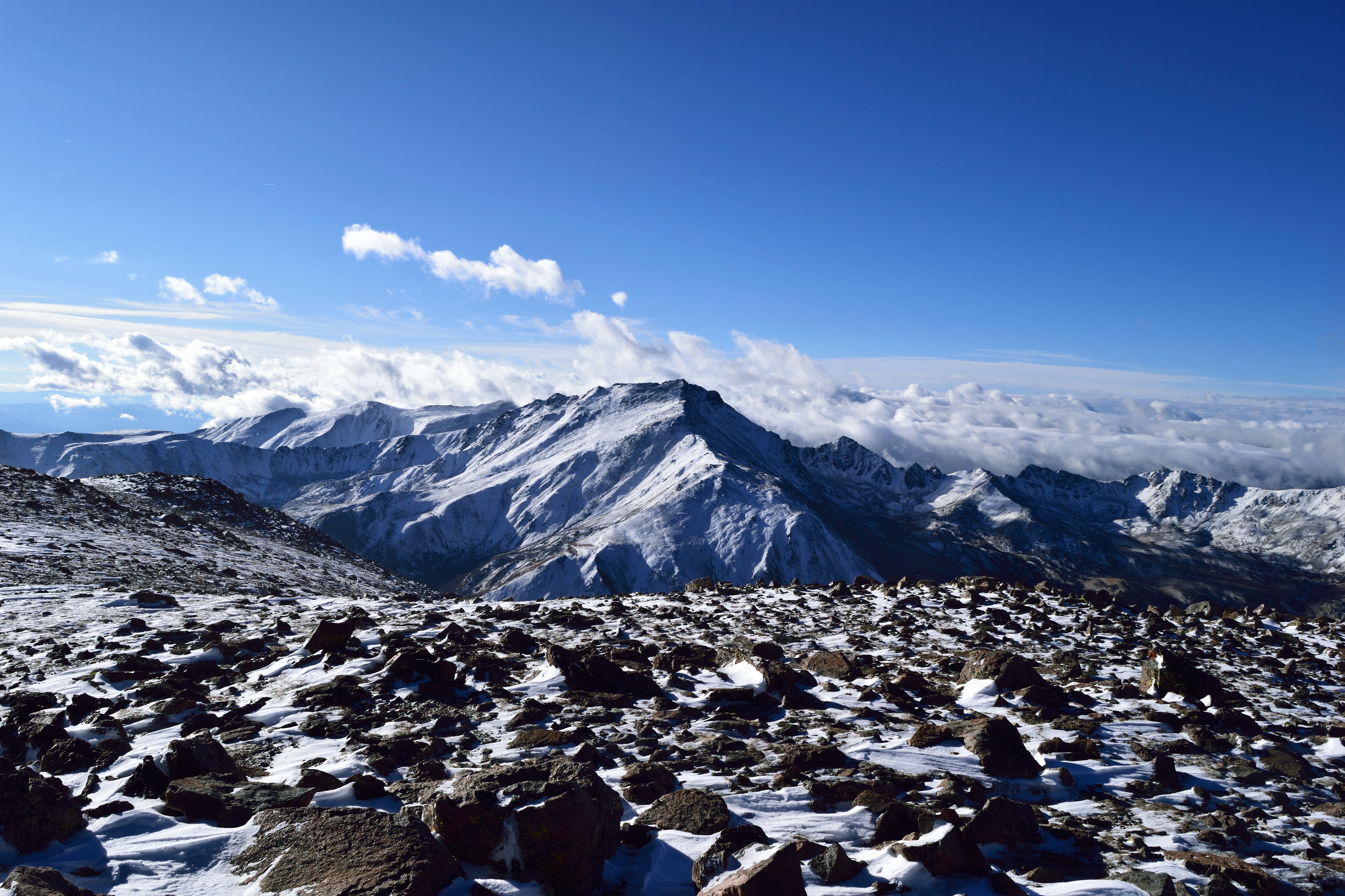
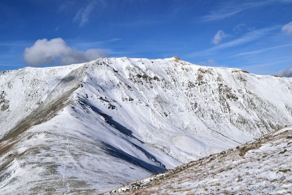
Virtual Trail Guide: Mt Belford & Mt Oxford with snow & Without Snow
Mt Belford Rating: ★★ (⅖ Stars)
Mt Oxford Rating: ★★ (⅖ Stars)
Distance: 11 miles RT (8 Miles RT to Mt Belford, 3 miles RT Mt Belford to Mt Oxford)
Elevation Start: 9,690 ft
Mt Belford Elevation: 14,200ft
Mt Oxford Elevation: 14,156ft
Total Elevation Gain: 5,900ft
Estimated Time to Complete: 8-9 hours RT (4-5 up Mt Belford, 30-45 minutes to Mt Oxford, 3-4 hours back to trailhead)
Difficulty: Hard What does this mean?
Class: Mt Belford- Class 2, Mt Oxford- Class 2 – What does this mean?
Season: July – September (expect snow outside of this period)
Directions to Mt Belford & Mt Oxford
Trailhead: Missouri Gulch
Getting Here: The hike For Mt Belford & Mt Oxford starts at the Missouri Gulch Trailhead which is smack in between Leadville and Buena Vista. If you are coming from Buena Vista, head north on US24 and head south if you are coming from Leadville. Continue on 24 from either direction until you reach County Road 390. This is a fairly well maintained dirt road but can get pretty bumpy in spots. Take the road for about 7.5 miles until you reach the trailhead on your left. If you hit a “museum” on the right side of the road, you have gone too far. You can enter “Missouri Gulch Trailhead” into your favorite navigation app but will most likely lose cell service before you reach the trailhead. The trail starts on the south west side of the parking lot near Clear Creek. Where the hell is the southwest? Well, walk towards the loud running water and you will find the trail.
Parking: The parking lot at Missouri Gulch Trailhead is fairly large, but will 100% fill up on most summer weekends. Parking is free and there is 1 non-plumbing bathroom there. Bring toilet paper, because it will often run out due to the number of people using it.
Summary
Dogs: Mt Belford & Mt Oxford are both dog friendly hikes in most seasons. If you are visiting in the early spring or winter, it is probably best to leave your dog at home. The trail is composed mostly of packed dirt with some rock scrambling towards the top of Mt Belford, so realistically you could bring dogs on Mt Belford & Mt Oxford all year round if your dog has enough experience. This entire hike is in a wilderness area so please keep your dog leashed.
Camping: If you want to camp in the backcountry while hiking Mt Belford & Mt Oxford, that is an option, but you will have to hike about 2 – 3 miles in to find flat ground. If you want to car camp, there are camping spots along County Road 390, but they will fill up quickly. In the past, I have arrived around 5-6PM with rain incoming and forced to set-up the tent in a less than ideal location.
Make it a Loop: Mt Belford & Mt Oxford is an out and back hike. If you want to add another 14er in the area, you could hike Missouri Mountain or centennial Emerald Peak.
Trail X Factors: Elevation Gain & Exposed to Weather
Anytime you have a trail that averages 1,000 feet of elevation gain per mile, you are in for a long day. Mt Belford & Mt Oxford gain over 5,900 feet in just under 11 miles to both summits. From Missouri Creek TH to the summit of Mt Belford is basically straight up the entire time. Once you reach Belford, you have a brief descent to a flat ridge where you will need to gain lost elevation to summit Mt Oxford. This is a STEEP descent (and climb back up).
The other X Factor for Mt Belford & Mt Oxford is the exposure to weather. Once you leave treeline around 11,000 feet, (about 1.5 miles into the hike) you have about 3-4 miles of exposed ridge hiking to reach both summits. Mt Belford & Mt Oxford are surrounded by a variety of steep cliffs and drop-offs, so getting out of harm’s way is not easy. When you are planning your hike, make sure the weather window is good for 8-9 hours or so.
Hike Tip(s): Whether you had a bender the night before or you are planning Mt Belford & Mt Oxford as part of a bigger hiking trip, I would strongly recommend hiking these on an energy level of (insert 100 emoji). This is a steep hike with LOTS of elevation gain that will test your leg strength early and often.
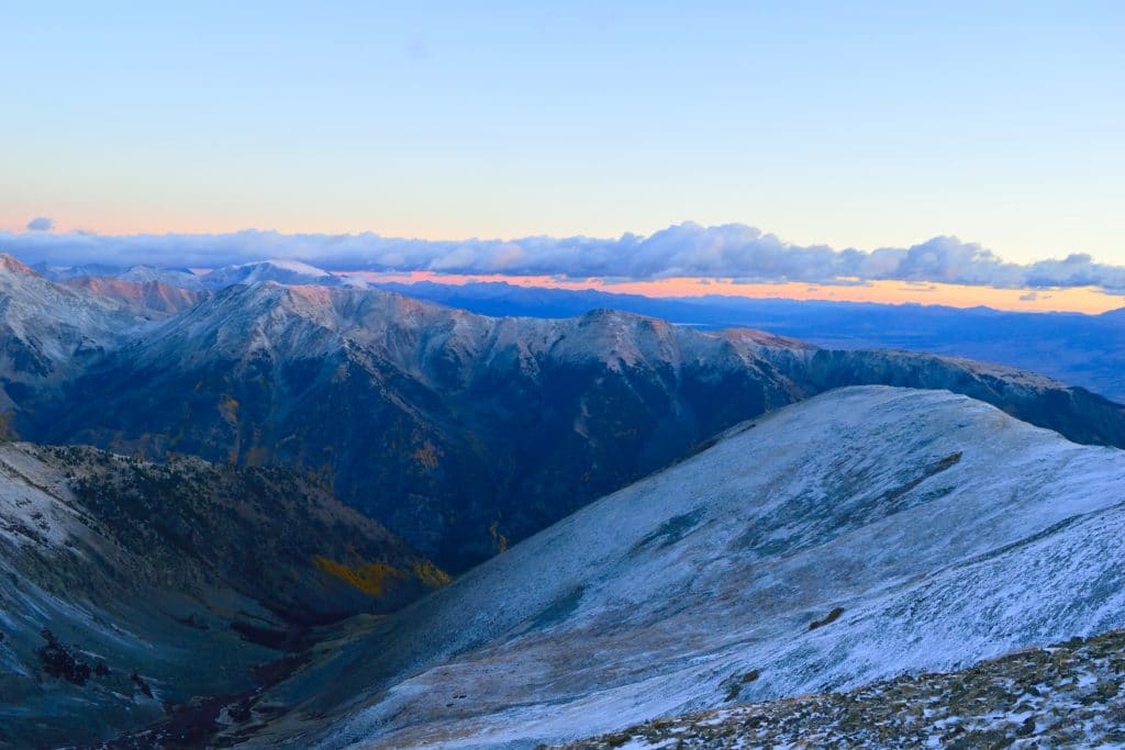
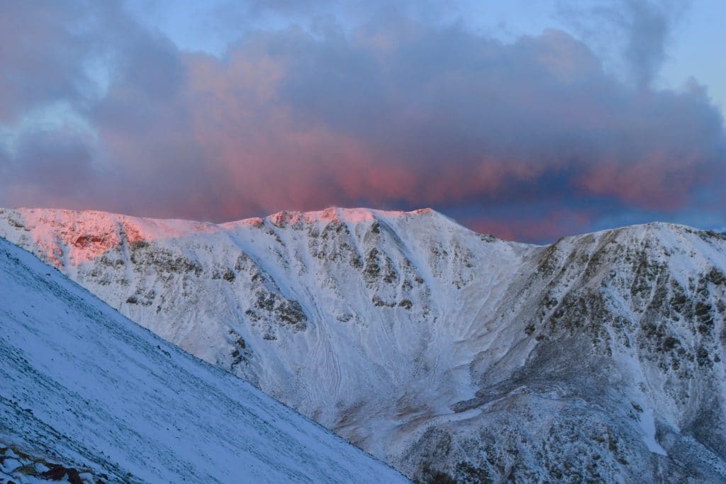
Best Views: In my opinion, the best time to hike Mt Belford & Mt Oxford would be early fall or early Summer. You can see the foliage from up high and if your timing is good, see the neighboring peaks with some snow on them making for some awesome photos. The wildflowers in this area can be quite good as well. Once on the summit, the views are best west and south where you can see a variety of other mountains in the area. I would keep photo equipment somewhat light on this trip.
Mt Belford & Mt Oxford Hike Route
Gear Needed
- 14er Day Hike Packing List
- Men’s Trail Runners
- La Sportiva Cyklon
- La Sportiva Trango Hiking Boots (Men’s)
- Backpack (Winter)
- Backpack (Summer)
- Base Layers
- T Shirt
- Mid Layer
- Rain Jacket / Shell
- Outer Layer
- Pants
- Shorts
- Socks
- Food & Water
- Optional: Water Filter
- Optional: Garmin inReach
- Optional: Hiking Poles – 120CM
- Optional: Headlamp
- Optional: Garmin Fenix Watch
- Optional: GoPro, Joby Tripod, Selfie Stick, GoPro 360, Drone, Insta360
- *Links included in this description might be affiliate links. If you purchase a product or service with the links that I provide I may receive a small commission. There is no additional charge to you.
My Trip to Mt Belford & Mt Oxford: September 2017
Trailhead to Mt Belford
I love nature. Respect it. Admire it. It never ceases to amaze me. But, just like anything you can love, there are some days where you just want to punch it right in the face. My trip up Mt Belford & Mt Oxford in the fall of 2017 involved a lot of figurative face punching.
I was down in the San Juans the night before, so I arrived to Missouri Creek area around 8PM on a Friday night. I was tired from a long day of driving and hiking. I pitched the tent, made my dinner and went to bed. I woke up early the next morning. The weather forecast for the day was a bit iffy, so I decided to get an early jump on the hike up Mt Belford & Mt Oxford. I pulled into Missouri Creek trailhead around 3:45AM and there were already a number of cars and hikers there. I wanted nothing to do with any of them, so I quickly strapped on my bag and hit the trail before anyone else in the lot.
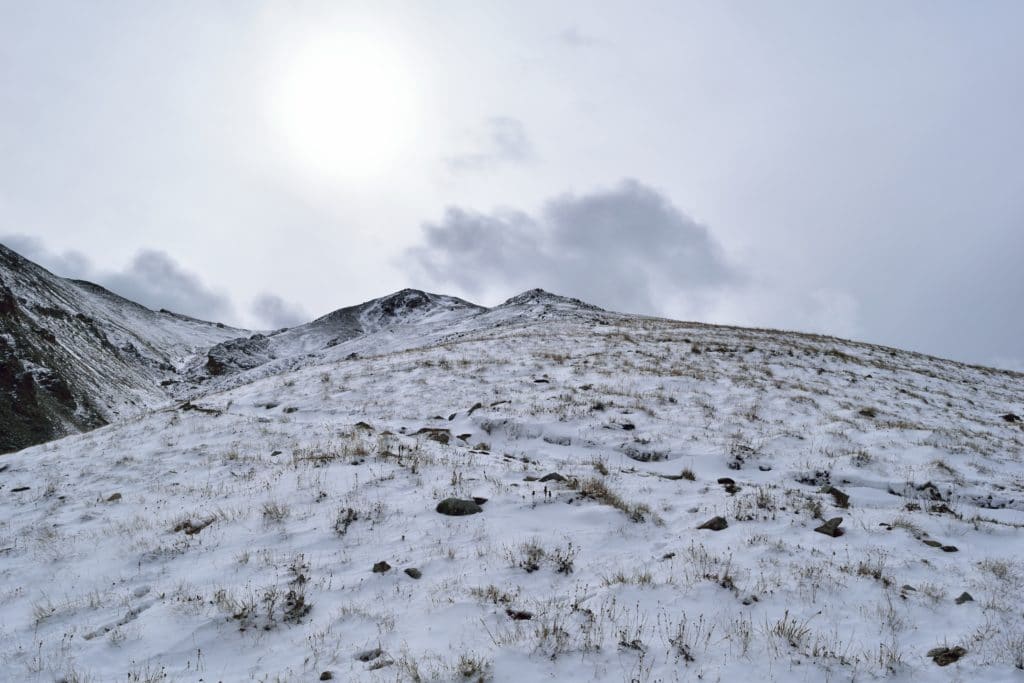
The night was full of crisp fall air and had a slight aroma of rotting leaves, the seasons were changing in Colorado. I had hiked this same approach trail previously and knew that the first couple of miles were steep and boring, my favorite! I slowly ascended the handful of switchbacks and made the first and only stream crossing of the day. 1,000 feet of elevation gain down, so far, so good. When I reached treeline around 5AM, I was greeted with my first views of the large basin that surrounded Mt Belford & Mt Oxford. When I was looking at the weather forecast, the biggest threat for the day was lightning which had a medium chance of happening after 9AM. My pace was good but I quickly realized that I was going to have to deal with snow all day. Even though it was dark, I could see that the slopes around me were all coated with about 2-4 inches of snow. No problem though, I had microspikes and plenty of experience in fresh snow.
After I reached the trail split at 2 miles, I was now in new territory and this is where the fun began. The wind had been present all morning, but the higher I hiked up Mt Belford, the stronger it got. To make matters worse, the elevation gain was steadily increasing as well. Want me to bitch some more? Okay, sweet. Since I was the first person on the mountain this morning, I was also breaking trail in the snow which was wind blown to 6-7 inches in several spots along the steep ridge. As I dragged my legs up the steep ridge of Mt Belford, I spotted several headlamps behind me. So much for making it up to the summit first, there was no way that some of these hikers would not pass me. I thought about it for a minute and decided that it made much more sense to let someone else break trail up to the top.
About a mile from the summit of Mt Belford, two younger hikers passed me and I was grateful to be following someone else’s footprints for once. The wind was now downright annoying. Its stronger gusts blowing so hard that I lost balance at times in the slippery snow. Want to know what the weather forecast had call for this day? 10-15 mph winds, 20 mph gusts MAXIMUM. I am still laughing thinking about how incorrect that was. With every step up the steep ridge, I grew closer to the summit of Mt Belford & Mt Oxford, but mother nature seemed to want to have nothing to do with me stepping foot on her precious mountains.
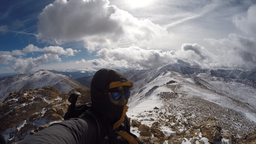
The sun started to rise and I thought to myself, “maybe the winds will die down a bit once the sun comes up”. Thats a thing, right? Not this day. When I finally reached the summit of Mt Belford, the wind was so loud against my coat, I could barely think. The two hikers who had passed me were now heading down from Belford and yelled something like “too windy, not going for Oxford”. Looked like a solo adventure from here on out.
Mt Oxford
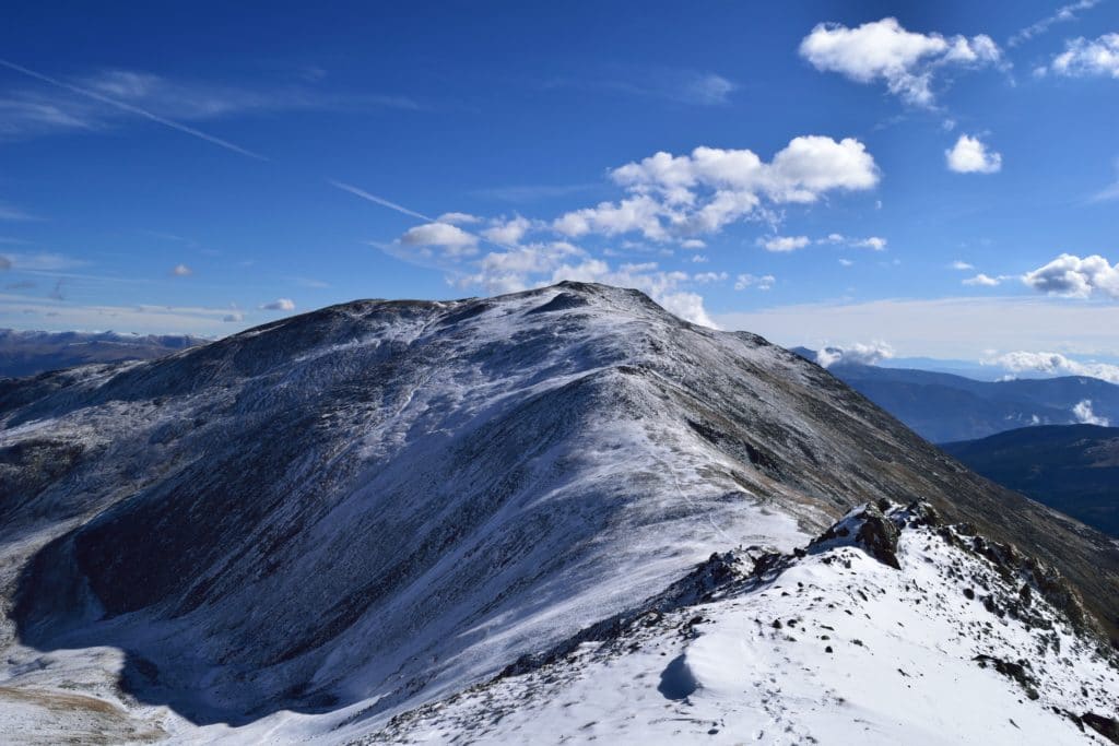
My time on the summit of Mt Belford was short. Essentially, I texted Jackie to let her know I was okay, checked the weather for lightning, snapped a picture or two and moved on. There was a snowball’s chance in hell that I was going to get any usable video footage. I surveyed the ridge to Mt Oxford. It looked more of the same of what I had been dealing with, snow and wind. Neat.
The trail down Mt Belford was a bit steep in sections and I decided to stick to the higher class sections to avoid some of the minor elevation loss. Even with snow, it was a breeze to deal with and I was down on the saddle of the two mountains in about 15 minutes. The wind here was insane. I swore several times out loud at the mountain as if it would make any difference. The positive, the sun was now up so the temperature was warming now, slightly. I continued to break trail over to Mt Oxford and was on the summit about 15 minutes later.
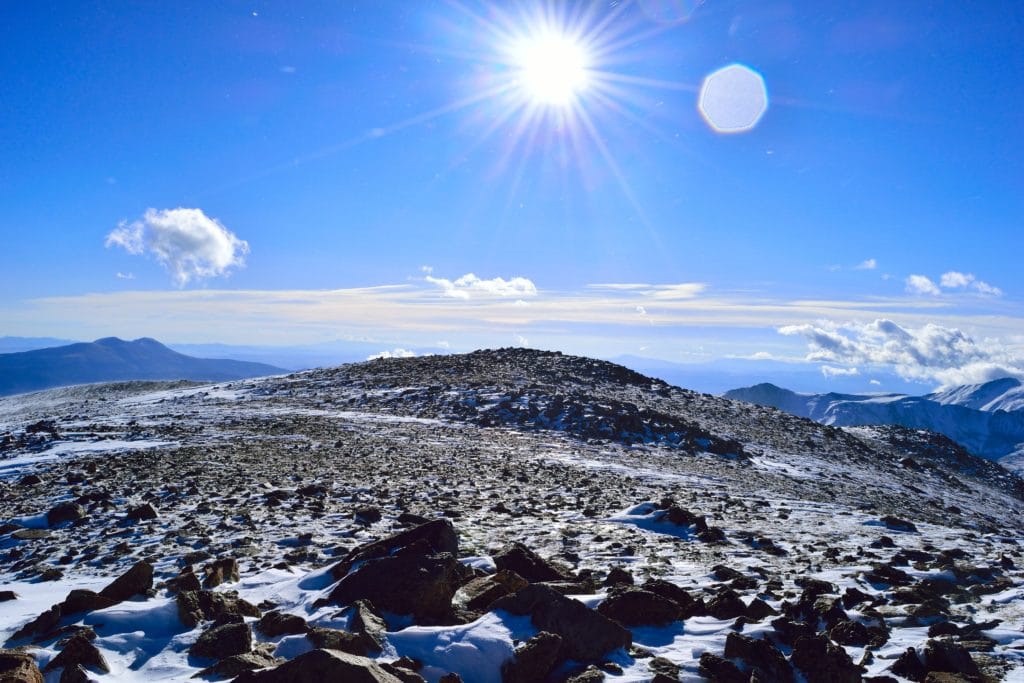
From the top of Mt Oxford, I could see the rest of the Sawatch Range peaks in the area, all covered in snow. The views down into the lower valleys were also awesome, I could see the snow line and the yellow leaves of the aspens that still remained. For such a bad morning on the mountains, these views easily made up for it, it was beautiful. It was very cold and windy (crazy right?) on top of Mt Oxford, so again my summit time was short. Even though I had hiked both Mt Belford & Mt Oxford, I still had a ton of ground to cover until I was back at my car.
Mt Oxford to Car
The hike from Mt Oxford back to Mt Belford was a bit more taxing than the hike over. My legs were slowly turning into jello after back to back days of hiking with 6,000+ feet of elevation gain on each day. I wanted to be back at my car and needed a hot meal like “whoa.” The temperatures were rising under the clear skies which was causing a slow melt to occur on the mountain. I ran into several groups of hikers heading over to Mt Oxford from Mt Belford, all asking how it was. My one word answer to all of them, “windy”. Eventually I regained Mt Belford’s summit and was back down on the steep north slopes. The snowy trail was now much more packed in which was nice so that I didn’t have to think about trail finding, but awful because traction (even with microspikes on) was hard to come by. I tried to think of the positives of the day as I trampled down Mt Belford: I had knocked off 2 more peaks, picked up some more high wind and snow experience while also avoiding any inclement weather.
When I reached the bottom of Mt Belford’s steep north ridge, I was so happy. I knew the remaining 2 miles back to the car would fly by. I nearly jogged most of the way back to the car, so ready to rest my tired feet and legs. I was surprised about how difficult of a hike Mt Belford & Mt Oxford was. No 14er in Colorado is an “easy hike,” but I didn’t expect these two to be as tiring as they ended up being. Overall, even with all of the wind, I had an okay time on Mt Belford & Mt Oxford. I do not plan on returning to either peak, but I also don’t enjoy class 2 hiking. When you are planning your hike, be prepared for a long, steep day on the mountain.