Uncompahgre Peak 14er Hike Guide
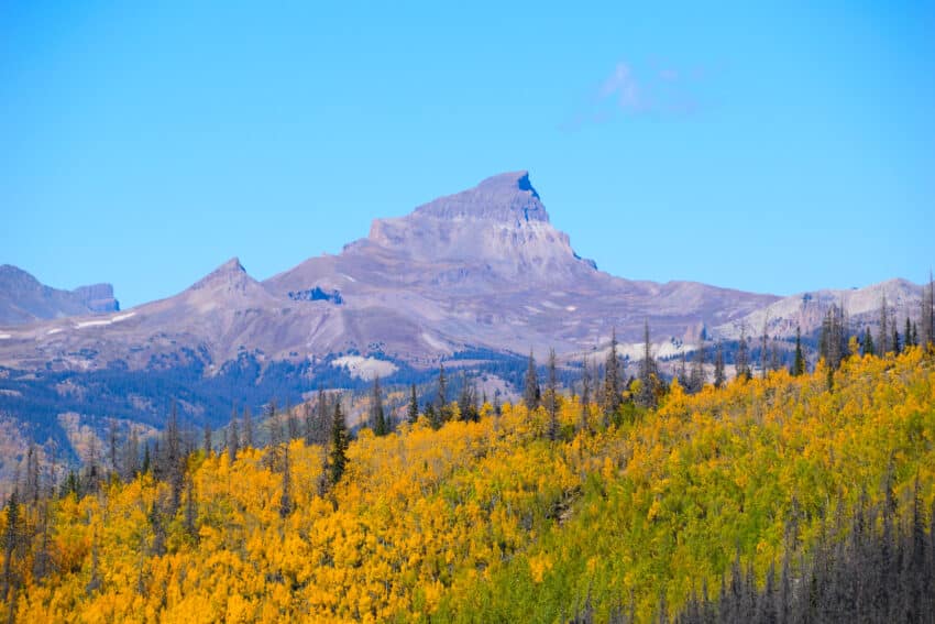
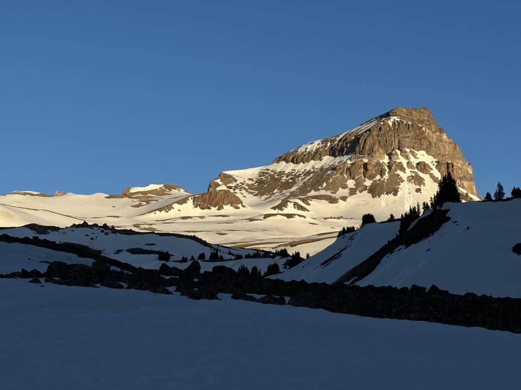
Uncompahgre Peak is a Colorado 14er located in the Eastern San Juan mountains of Colorado. This peak can be seen from Slumgullion Pass from the south and is one of the more gnarly looking mountains in the area. However, what looks like a difficult hike is actually mostly a Class 1 trail with a bit of Class 2 scrambling near the summit. What makes Uncompahgre Peak more difficult to access is the road that leads up to the trailhead which requires a high clearance AWD or 4×4 vehicle.
Uncompahgre Peak Quick Facts
Virtual Trail Guide: Uncompahgre Peak
Uncompahgre Peak Rating: ★★★★ (4/5 Stars)
Distance: 15.5 Miles RT Lower TH / 7.5 Miles RT Upper TH
Elevation Start: 9,310ft (Lower TH), 11,456ft (Upper TH)
High Point: 14,318ft
Total Elevation Gain: 5,500ft (Lower TH), 3,000ft (Upper TH)
Estimated Time to Complete: 4-10 Hours RT – depending on starting point
Difficulty: Moderate What does this mean?
Class: Class 2 – What does this mean?
Season: June – October: Expect road closures and snow outside of this period. Even in June this mountain will hold snow on some portions.
Directions to Uncompahgre Peak
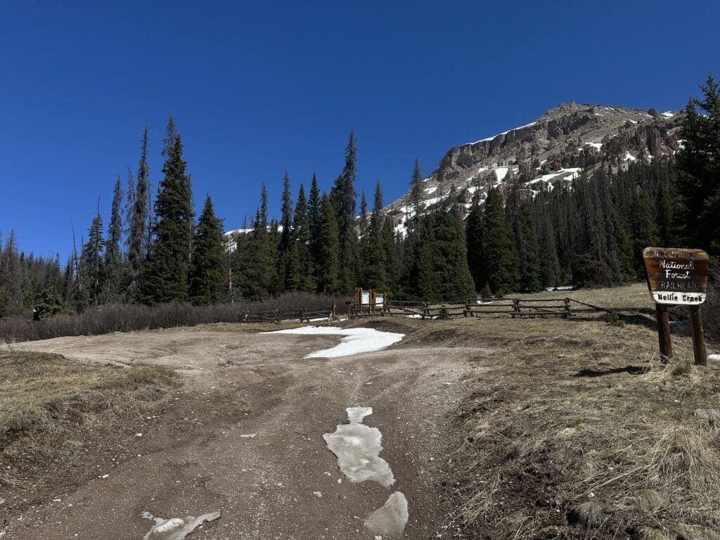
Trailhead: Nellie Creek
Getting Here: From Lake City, take 2nd street and turn left onto Bluff Street which turns into Henson Creek Road/Alpine Loop Scenic Byway. Drive 5 miles on the rough, but passable but most vehicles, dirt road to reach the lower TH on your right. Park here if you do not have a 4×4 vehicle with high clearance AND an experienced driver. The road will get very rough after this point. From the lower TH, it’s 4 miles to the Upper TH and the road starts off rough and gets worse after the 1st stream crossing about 1.8 miles in. Continue up the road, bearing left at the only junction you come across. After crossing the stream a 2nd time, this is where the most variables occur in terms of downed trees, rock and mudslides + remaining snow in early summer months.
Nellie Creek Road is a rough one that is very narrow with relatively few spots to turn around if you need to. As you get near the upper TH (after the 2nd creek crossing), the road will mellow out a bit and open up for more opportunities to pull over should you not be able to continue on.
Parking: The best spot to park for Uncompahgre Peak is at the lower TH or at the Upper TH. There is plenty of room in both areas to park. Both the lower TH (about 50 yards to the west) and upper TH have non-plumbing bathrooms. In between these two spots, parking is very limited and availability will depend on when you are hiking.
Fee: No fee is required.
Summary
Dogs: Uncompahgre is a great option for dogs with a little bit of mountain experience (due to the final Class 2 scramble). Since this hike is in a Wilderness area, please keep your dogs leashed.
Camping: In general, there are quite a few spots to camp along the Alpine Scenic Road (generally after the TH) and along Nellie Creek road itself. At the base of the road there are spots for several campsites and as you drive up the road more options randomly appear. Getting a campsite here will depend on when you visit, but if you have a 4×4 vehicle, you should not have a problem finding one. Please follow all guidelines for no camping and day use only spots to keep this area accessible in the future.
Make it a Loop: The most popular way to extend this hike is to add on neighboring Matterhorn Peak or Wetterhorn Peak. If you plan on extending your day on either of these peaks, leave PLENTY of time and be sure to have a good weather window.
Trail X Factors: Road to TH
With any remote forest road, it’s always a gamble to know what conditions will be like and since the difference between the upper and lower THs are over 8 miles RT, getting information beforehand will be pretty important. 14ers.com has a section on the site where you can read about road conditions which I highly recommend doing before you visit Uncompahgre Peak.
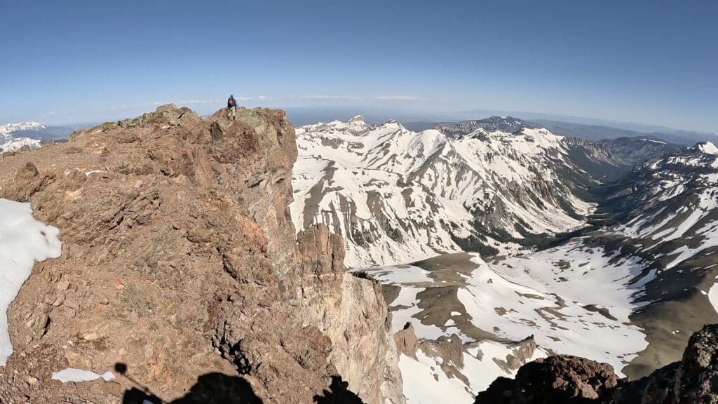
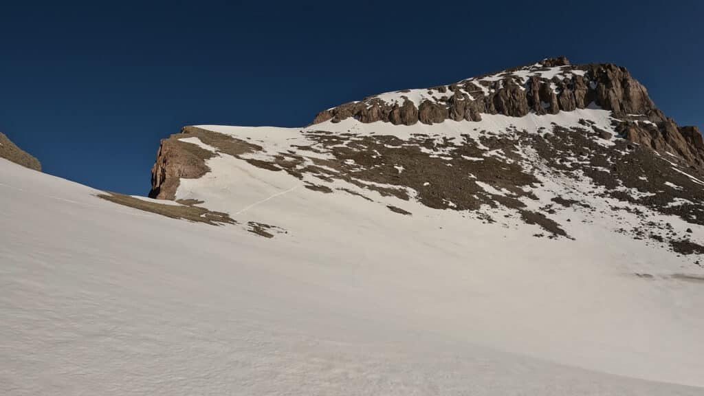
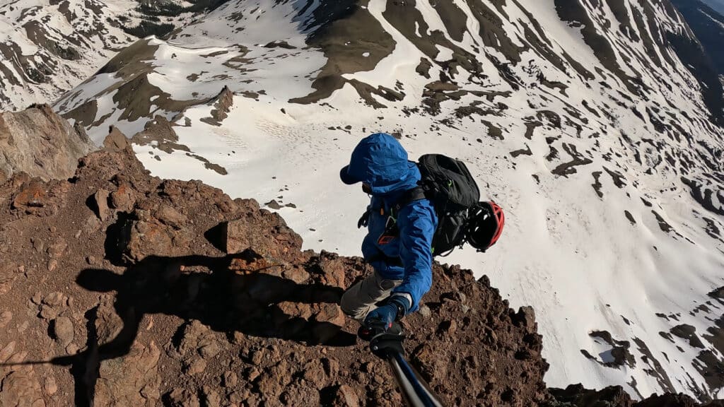
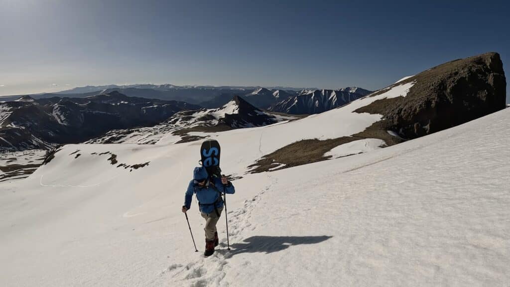
Hike Tip: When heading out to hike this 14er, you will want a good weather window to allow for a safe hike. Once you leave the upper TH, there is about ¾ mile of tree coverage and then you are basically in an open field from the second you leave there until the time you top out on the summit. Once you are on the summit, be very careful when exploring the north side of that area as the cliffs below drop several hundred feet to the valley below.
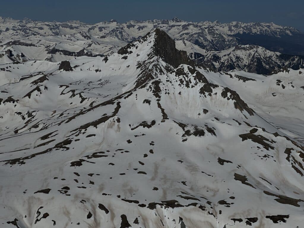
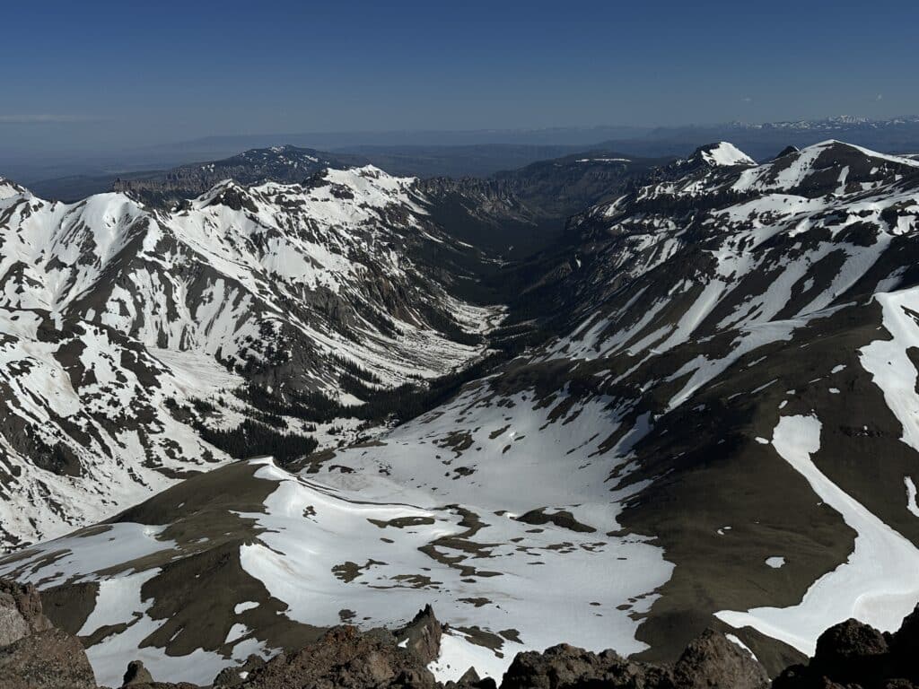
Best Views: Uncompahgre Peak offers A+ views for essentially the entire hike. Once you get to the summit, be sure to explore the area and soak in the views, they are some of the best Colorado has to offer!
Uncompahgre Peak Hike Route
Note that I started right before the 2nd stream crossing on Nellie Creek road due to some issues with the road. In addition, I was on a splitboard so my line to the summit does not follow the summer trail which is very obvious once the snow has melted out.
Gear Needed
- 14er Day Hike Packing List
- Men’s Trail Runners
- Women’s Trail Runners
- La Sportiva Trango Hiking Boots (Men’s)
- La Sportiva Trango Hiking Boots (Women’s)
- Backpack (Winter)
- Backpack (Summer)
- Food & Water
- Optional: Garmin inReach
- Optional: Hiking Poles – 120CM
- Optional: Headlamp
- Optional: Helmet
- Optional: Garmin Fenix Watch
- Optional: GoPro, Joby Tripod, GoPro 360
- Optional: Drone
- *Links included in this description might be affiliate links. If you purchase a product or service with the links that I provide I may receive a small commission. There is no additional charge to you.
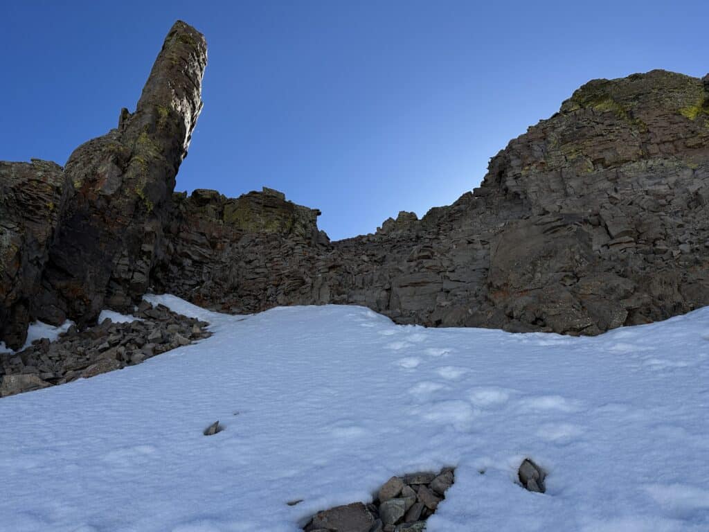
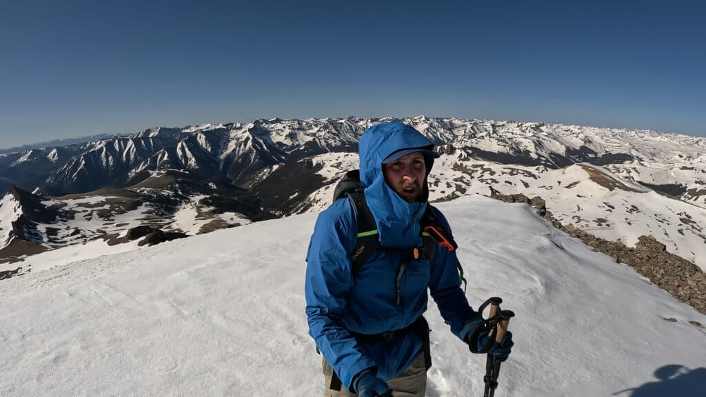
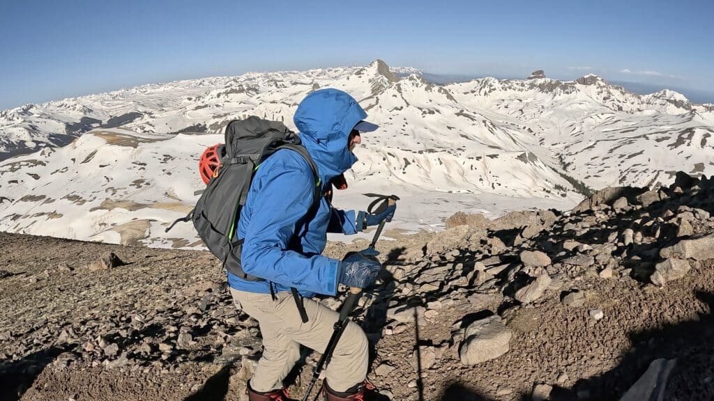
Uncompahgre Peak Pictures

2 thoughts on “Uncompahgre Peak 14er Hike Guide”
How is this during winter?
A very long approach since roads are closed even allowing you to access lower TH. Plan on adding miles and miles of additional travel.